All posts by James Lancel Mcelhinney

HEMINGWAY AT THE MORGAN LIBRARY

Hemmingway-1_0

The Morgan’s mission of paying homage to literature and the book arts as it celebrates drawing and the graphic arts is well served by the current exhibition focused on the writings of Ernest Hemingway at the Morgan Library. Among the revelations to be experienced is the character of Hemingway’s writing process. He was known to have written on a typewriter while standing up, which proclaimed his self-image as a man of action, ready at any moment to walk to his next adventure. Lady Frances Trollope and de Tocqueville were struck by how Americans ate and drink on their feet. More than Hemingway’s broad-shouldered midwestern roots, his typed manuscripts marked up in graphite reveal a person showing, not telling, overtaken by a flood of revisions before word one is on the page. During his lifetime these documents would not have been readable in the way they are today. We might have criticized his adolescent penmanship, or how in haste he seldom wrote in horizontals. His sentences curve downward to the right, his mind fighting his body to put words on the page. Sloping scrawl speaks to his faith in savage intuition, and how haste is part of his method as much as the endless changes that follow. A few generations ago before the rise of keyboarding and the decline of penmanship these manuscripts would not have been seen as drawings. But now they can, as clear as Kid Balzac’s prose.

http://www.themorgan.org/exhibitions/ernest-hemingway

Advance copies of the new painting book are now in hand and available for pre-order

asl_cover

This modern painting guide is a sourcebook for study, teaching, professional practice, and personal enrichment written and edited by league instructor and artist James L. McElhinney in cooperation with the Art Students League of New York, America’s signature art school, run by artists for artists. Founded in 1875, the Art Students League of New York has nurtured students like Jackson Pollack and Georgia O’Keefe. Today, more than 2,500 students of all ages, backgrounds, and skill levels study at the League each month. This book invites the reader into the studio classrooms of some the League’s most acclaimed and beloved instructors–including Sharon Sprung, Mary Beth McKenzie, and Henry Finkelstein–for lessons on a variety of fundamental topics and approaches in painting. Richly illustrated with artwork from the League’s considerable archives, its instructors, and its students, the book will be a source of inspiration and enrichment for painters of all levels.

amazon_sm

bn_sm

indiebound_sm

google-books_sm

apple-ibooks_sm

Journal Painting video featured in exhibition at Wailoa Center in Hilo, and at the Donkey Mill Art Center in Holualoa, will be displayed at the Art Students League of New York Instructors’ 2015 Annual Exhibition. Animation designed by Graham White:http: //gwhite.us

Hawaii Day Four Part Three: Back to Hilo.

Hawai’i Day Four part three: Back to Hilo

href=”https://www.mcelhinneyart.com/jlmcelhinney/wp-content/uploads/2015/07/P1010791-e1438184534201.jpg”>Hana Hou Restauant,

Facing a choice of routes, we decided to not retrace our steps but instead return to Hilo via the Saddle Road crossing the northern end of the island between the peaks of Mauna Loa and Mauna Kea. Driving up to the ridge above Punalu’u, we turned left onto Route 19 and proceeded to Na’ālehu, population 866. The name of the settlement in Hawaiian means “volcano ashes”. Trees line the street passing by a cluster of civic buildings and shops on the left side of which we found a brightly painted single-story building advertising itself as the southernmost restaurant in the United States. The Samoans might have something to say about that if they were inclined to split hairs. The open plan of Hana Hou restaurant was similar to many local eateries on the Big Island; lunch counter and table seating, no air conditioning, fans whirring overhead.

IMG_4375

The diner fusion cuisine included fish tacos, pulled pork and salad all served as part of the dish I selected. The management and wait-staff were predominantly native. Sensitive to the resentment that can sometimes be expressed by people of color towards European-Americans, based on the many abuses suffered by their ancestors at the hands of whites, I found indigenous Hawaiians to be outwardly friendly and meticulously polite. An older generation might have remembered, or heard from their elders the story of how mainlanders arrived first to spread Christianity and were followed by sugar planters who at a time when White Supremacy was at its peak overthrew the Kingdom of Hawai’i. The Hawaiian term Ha’ole literally means “without breath” and is said to be derived from the first contact with mariners sailing with Captain Cook, who were ignorant of the practice of exhaling while pressing the nose and brow against that of another as the common form of greeting. Bows and handshakes delivered by Brits were interpreted by the locals as mistrust or hauteur. The last day of school leading into summer vacation is known in some places as “Kill Haole Day”, some native kids allegedly heckle and assault their light-skinned classmates. The majority population on the Big Island is Hawaiian, and my sense is that the majority of those harboring hostility toward whites regard them as inconvenient outsiders or necessary evils. Continuing our journey the road led west, across the landward end of South Point. We were disappointed to no have visited the green sand beach at Papakolea but our vehicle would not have stood up to the rough condition of the road leading to the water’s edge. The slope of Mauna Loa climbed into the clouds on our right. Black lava flows punctuated sunburnt grasslands while out to our left spread the wide blue Pacific.

P1010794

Moving northward toward Kona, the vegetation quickly changed from mountainous savannah to forests and fields as we entered coffee country. Kona coffee is highly renowned and the prices reflect it. A pound of roasted ground or whole beans can set you back sixty dollars. The highway climbed to a thousand feet above the ocean as we moved from the slopes of Mauna Loa onto those of a smaller active volcano named Hualālai. By all reports this is the most worrisome of the five major Big Island volcanoes, and the one most likely to erupt one day. Of course it looms above an enclave of pricey resorts while million-dollar homes pepper its flanks.
A precipitous drop from the shelf of land traversed by the road descended to a shoreline of white breakers crashing against the black rim of a green coastal plain a mile or two in width. We stopped for coffee at a roadside café a few miles below the town of Captain Cook that overlooked the site where the explorer had been killed in a needless dust-up with irate locals. Kathie is maniacal about her coffee and was enchanted beyond words by the heady brew she was served alfresco. The establishment appeared to have once been a service station. The white block building backed up onto a modest lanai with a concrete floor and corrugated steel roof. We debated making a detour down to the coastline where the Kailua-Kona resorts are located, but ditched the plan when we encountered the same bumper-to-bumper beach traffic one finds everywhere else. Instead we veered off the main road on to Route 180 and headed for Holualoa village, where I was to deliver a talk one week hence. The winding two-lane road followed torturous curves bereft of guard-rails. Driveways seemed to plunge and soar up from the roadway’s negligible wooded shoulders at impossible grades, possible only in such a climate but undoubtedly vexing for any car with a standard transmission. The village was a concatenation of shops and galleries, a B&B and an inn priced at opposite ends of the market. Unsure of our ETA in Hilo, we elected to carry on. 180 ended at a t-intersection where we turned right (north) onto 190—the main road between Kailua-Kona and Waimea in the heart of Hawaii’s cattle country. Within a few miles forest and vegetation gave was to arid conditions. We passed to the left almost two thousand feel below the Kona airport and then Kekaha Kai Beach, the coastline stretching off toward North Point and the green Kohala Highlands. Rolling grassy hills punctuated by dark lava flows and extinct spatter cones flanked the highway as off to the right a gathering of clouds shrouded the peak of Mauna Kea. The exit for Hilo arrived suddenly. A right turn from the road to Waimea put us on Highway 200, locally known as Saddle Road. The right of way varied from road cuts through deep lava beds to crossing grassy hilltops. Passing a cluster of tan Quonset huts to our right we approached the massive form of Mauna Kea, coming to the entrance of an eponymous state park located at its southern base.

IMG_4378

Gullied slopes soared into the clouds. The buildings resembled a KMC type configuration—a quasi-military facility. New parking lots and recreational facilities were under construction, or at least construction had begun. No one was at work on them. The park headquarters were closed, but we made us of the restrooms that were located in a separate building.
A couple of Hawaiian men took a coffee break in a cable company van. A family of mainland tourists relaxed at a picnic table.
As we proceeded east we passed a monument erected next to an extinct spatter-cone; a stone altar festooned with ceremonial offerings, leaves and bundles, and presumed it to have been erected by native activists objecting to the construction of a massive new telescope on the summit of Mauna Kea. Crossing through more lava fields we skirted the northwestern margins of Mauna Loa and were suddenly met with a tangle of vegetation, then forest, then rain. The joke is that on the Big Island one can pass from one climate zone to another simply by crossing the road. Returning to Hilo Route 200 descends dramatically to become Wainuenue Avenue, along which are located many of the K12 public schools and the athletic fields. We returned to the Pakalana, unpacked the car and went to Pineapples for dinner.


The open-air bistro on the first floor of a low-rise flatiron building on the corner of Mamo, Keawe and Kilauea serves a young, lively crowd. I suspect few tourists were among them, the cruise ship having left port the day before. Our waiter was a friendly twenty-something effeminite man who vaguely resembled The Artist Formerly Known as Prince.
So are we having a drink, yaah? He asked in a creaky voice.
We ordered a couple of cocktails
Ditcha look at the specials, yaah?
They were on a blackboard. We hadn’t. So he told us what they were. We ordered.
Menu and service were above par. It was nice to find a place with an urban vibe.
We paid our check and walked around downtown Hilo before heading back to our quarters. Bums were asleep in the doorway of nearly every shop. Like so many homeless people we had seen in Berlin, many of them possessed a musical instrument and a dog. Two shirtless men had staked out opposite sides of the step of the Tsunami Museum. One of them had a backpack. The other one had a blanket.
At nine o’clock Cronie’s sports bar was getting ready to shut down for the night. Some New Yorkers might have bristled at the midwestern timetable followed by Hilo restaurateurs, or by the strong undercurrent of churchgoing culture. In a stroke of genius our landlord had decided that the best place for the television was on top of the microwave oven. We never turned on it, or the microwave.
In the course of one day we had stood at the smoldering rim of an active volcano, completed a circuit of an island slightly larger than the state of Connecticut, passed through three or four climate zones and had been served dinner by an AFKAP lookalike. Nothing on television could top that.

Big Island: Day Four, Part Two: The Color Black, July 2, 2015

The volcanic steam vent which according to legend proved to be a deadly sauna to a reckless ranger

Moses and Michael brought a group of students to the steam vents. We delayed our departure to join them for a few minutes in looking at these natural terrors. Signs cautioned visitors against breathing the vapors. Plume of steam rose at random intervals among the scrub and grasses that grew across the meadows.
Moses headed off on a crater hike with his detachment of art students. Kathie and I got back in the blue Nissan, exited the park and turned left onto the Mamalahoa Highway (Route 11) and headed south through the dense, tangled, steaming cloud forest that covers with higher elevations of Kilauea (4,092 feet above sea level). As the road descended we debouched from the forested area into vertiginous grasslands punctuated by clusters of trees and vegetation, traversed by wide lava fields. Kilauea is a subordinate peak to the southeast of Mauna Loa (13, 679 feet above sea level). Descending to 2,000 feet we then found ourselves on the southern slopes of Mauna Loa, passing ranches and small farms. Grazing cattle, horses and goats populated the fields. Traffic was light. Descending further the rain tapered off sharply and the grasses were transformed from lush green to golden sunburn. We would encounter the reverse effect later in the day, crossing the Saddle Road from Kona to Hilo, passing the northern extremity of Mauna Loa. At 1,000 feet we could see the highlands of South Point rising ahead of us. We had wanted to drive down to the headland, but were advised that it would be folly to do so without a rugged four-wheeler. Our feeble front-wheel drive Nissan ruled that out. Approaching an intersection near the bottom of a long hill, I intuitively turned left onto Ninole Loop Road, which took us down to the county park. Driving past the beach we parked near a series of pavilions full of family cookouts. The majority of people on site were Hawaiian or Asian, with a handful of Haole visitors stopping to take pictures. The indigenous people are physically attractive, according to conventional standards. Being fit in youth, by middle age many seem to become very large—both men and women. Tattooage is very common among all segments of the population on the Big Island. Some of the more elaborate tattoos might cover a person’s chest or arms. On a number of occasions I saw indigenous people wearing tattoos of traditional native design. Many of the first early modern Europeans to decorate their bodies with tattoos were mariners returning from the Pacific.
The black sand beach of Puna’lu’u is a common tourist destination, as is the green sand beach at Papakōlea, closer to South Point. Embracing an inclined crescent of granular gunmetal pounded by light surf and shaded by palm trees, two rugged quays of Pahoehoe lava reach out to the sea, then bend back along the coastline.

Dr. Kathie Manthorne delivers an art historical assessment of black sand

Neglecting to pack swimming attire, we walked along the southern margins of the site, in the barbecue-scented air. A latticework of bleached grass had been trampled flat as it pushed its way up between cracks in the black stone. I unpacked my journal and colors at a concrete picnic table near the rest rooms. Kathie wandered off closer to the water. The Big Island landscape challenges many of the clichés of Pacific island imagery and European conventions of landscape painting. The Marquesas from whence the ancestors of the indigenous people had come nearly two thousand years ago, and where Gauguin ended his days, are far to the south of the Hawaiian archipelago. The active volcanism, combined with several distinct climate zones has created an environment quite different than what I had expected to find. Unifying leitmotifs are the ubiquitous coconut palm trees and Haole tourists.

Punalu'u Beach. Watercolor in Moleskine journal, 3.5 x 10 inches. July 2, 2015
Punalu’u Beach. Watercolor in Moleskine journal, 3.5 x 10 inches. July 2, 2015

During my French-easel summer at Skowhegan forty-two years ago, one of the resident artists was a painter who affected the appearance of a Monet, dressed in white, wearing a dark beard and wide-brimmed hat. His was accompanied on his daily excursions to the motif by a coterie of acolytes.
Blue! He declared. Only Claude could paint the distance, and it is blue.
I have always cherished a bemused contempt for cults of personality—especially if they are presided over by American Francophiles. One of the visiting artists was a landscape painter who lived in the Camden Hills. He commented that only a fool would tackle the Maine landscape with a French esthetic. The place has a spirit all its own. Capturing the effect of the cold, hard light and deep shadows cannot be achieved without using the color black—which was anathema to self-described colorists admiring of Corot, Impressionism, the Nabis and Marquet.

"After the Storm, Vinalhaven," 1938-1939, oil on Academy board, by Marsden Hartley. Bowdoin College Museum of Art. Gift of Mrs. Charles Phillip Kuntz
“After the Storm, Vinalhaven,” 1938-1939, oil on Academy board, by Marsden Hartley. Bowdoin College Museum of Art. Gift of Mrs. Charles Phillip Kuntz

Marsden Hartley got it. Wyeth gets it. In the Maine woods and along its rocky shores black is a color.
Halfway around the globe, in very different terrain, the same holds true.
(To be continued)

Dawn over Kilauea. Big Island, Day Four, part one. July 2, 2015

P1010768 copy

Returning to our barracks, we agreed to rise around 4:30 and resume our toils at the crater.
Taking a glass from the kitchen I tossed a few ice cubes in it, covered them with an ounce or two of Jameson’s, drained it and fell into bed. In a minute I was unconscious. Then Kathie woke me. I looked at the clock. It read 4:45.
Someone’s moving around, she said. Don’t you have to go back out there?
As I pulled on my clothes I suggested that she come along to watch the dawn break over the caldera. Within minutes we were outside by the van. Mike drove us and a few others back to the Jaggar, from whence we made our way back to the summit.

IMG_4340 IMG_4344 P1010764 copy

It was still dark but a rosy grey band divided the land from the hovering clouds off to the south. I unpacked my kit and set to work, while Kathie photographed the proceedings. The previous night had been enough of a rehearsal for me to go off book, as they say in the theatre. I worked rapidly, producing three page spreads of Halema’uma’u as the new day arrived, until sunlight extinguished the pit’s glow.

Kilauea Dawn

Kilauea 3 copy

kilauea 5

I find that landscape painting in watercolor allows for less literal interpretations than working in oils. Quick washes and pairings of complementary colors establish an armature of light. Notes are struck and answered until a pattern emerges, at which point one might judge a work complete, or proceed to elaborate it. I seldom attempt refinements in the field because conditions are in constant flux. Better to let the work rest for a few hours or a few days before trusting memory and sound design to guide the process.
During the late 19th century, a younger generation of artists inspired by expeditionary artists like William Hodges, T.R. Peale, Albert Bierstadt and Thomas Moran, produced bodies of work around the theme of the Hawaiian volcanoes.
Known today as the Volcano School, notably Jules Tavernier and his protege David Howard Hitchcock. They attempted to do for what were then known as the Sandwich Islands what Thomas Cole and Asher B. Durand had done for the Hudson Valley. In many ways they pioneered a picturesque esthetic later embraced by shutterbug tourism.

Kilauea, Jules Tavernier 1887
D. Howard Hitchcock, Halema'uma'u, 1888
D. Howard Hitchcock, Halema’uma’u, 1888

There was some resonance for us being at Kilauea together because Kathie and I had first met at a conference on scientific exploration at the American Philosophical Society, where she was a one of the speakers. Her Columbia doctoral dissertation and late her first book was on 19th century American artists-travelers in Latin America. Some of Peale’s expeditionary watercolors are in the APS collection. At the time we first met I had been painting Civil War battlefields that were threatened with desecration or obliteration. I had rejected the notion of landscape painting based on formal motifs when I discovered that landscape is a narrative constructed by human beings repurposing the natural conditions of terrain to suit their convenience. This was an oversight I attributed to the deficiencies of a studio education. Expeditionary art had been created not only to document the process of exploration, but also to provide military leaders and scientists with a sales pitch for the next adventure. Surveys of the American West mapped railroad rights of way and searched for mineral resources. While places like the Yosemite, Yellowstone and the Grand Canyon yielded nothing of material value, they became gold mines for the growing tourism industry. The same was true of Kilauea. The first hotel was built near the rim in the 1840s. A more permanent structure went up in 1866, which now houses the Volcano Art Center. Mark Twain had been one of its guests. The latest incarnation of Volcano House was built in the 20th century. Offering quality accommodations, fine dining, an array of galleries and gift shops at a substantial nightly rate, the rear seating area of the lobby opens onto a broad belvedere of the crater.

IMG_4352

Mike was seated on the opposite side of the monument, working on a drawing. Moses stood at his easel, visible in this photograph a hundred yards to the rear, close to the museum. A few of the students still lingered at the site. Rosella and all but one of her posse had stumbled back to KMC around 3am. The straggler had returned but at such a late hour gave no notice. Lacking hot coffee with stomachs grumbling, our merry band descended to the parking lot, returned to the barracks and prepared a hot breakfast. The charismatic Moses was already recruiting doughty souls for a crater hike, an invitation we politely declined.
Instead, Kathie and I decided to explore the South Point area and Puna’lu’u Beach.
(To be continued)

Hilo Day Three: Midnight on the Summit of Kilauea: July 1-2, 2015

As a university-sponsored event, dinner was officially dry—no wine, beer or liquor.
Going for ice, Kathie and I could not resist dropping into the KMC bar and restaurant—formerly the officer’s club and mess hall. The service was indifferent, but the prices were very friendly. More people had arrived, and more introductions were made. The fare ranged from char-grilled meats to makizushi. As the kitchen was cleared and the food put away the group gathered in the living room where I asked everyone to introduce themselves one by one. Moses was leading tonight’s foray and gave the group pointers about how to achieve in their paintings and drawings certain effects they would witness in the field. I chimed in with a few suggestions, advising them to look for narratives in whatever they beheld, and to approach the process not with the goal of producing an image, but improving their knowledge of the terrain and the condition in which they find it. Seeing is visual cognition. If you can see it, I told them, you know it. If you know it you can draw it.
As we prepared to embark on the adventure, the mercury dropped to the fifties. I changed into a cotton sweater, cargo vest and lightweight waxed cotton Barbour raincoat. Through the evening there had been light precipitation. We returned to the Jaggar around 11:00. The parking lot was empty, the riot of tourists having progressed to feeding and sleeping.
Moses and his posse peeled away beyond the barrier, setting up their easels just east of the museum, closer to the rim. Mike Marshall and I accompanied one of the adult students—a sweet, older Hawaiian woman named Ululuwei along the lighted path. The younger students seemed to regard her in a maternal light. She shook her head and said that if the park service put up a barrier, they did it for a reason. The barrier at this point consisted of a series of vertical rods that suspended a colored rope that offered no impediment to anyone wishing to pass it. About two hundred yards beyond the museum this cordon veered off toward the rim. I followed it to a peculiar monument that consisted of a two-sided stone box with a concrete cap, transfixed by a vertical steel pipe perhaps four inches in diameter. About ten feet from the ground the pipe was festooned with four immobile right-angle blades, reminiscent of the tail fins of aerial bombs. Each bore a series of circular perforations comparable to the diameter of the pipe. A button-shaped bronze U.S. Geodetic Survey marker confirmed the site was the summit of Mt. Kilaeua.
The cap of the monument’s base stood roughly forty inches, which made it the perfect height for working while standing. A massive glowing plume rose from the pit of Halema’uma’u below, a mile to the southwest. The rain had tapered off and breaks in the clouds revealed a full moon that cast sufficient light to see the pages of my sketchbook. Off to my right Moses and his band were already busy. One of them, a Hawaiian man named Kamuela saw me and came over to investigate.
I had unpacked the contents of my small shoulder bag and begun mapping out a composition across a two-page spread with an orange Micron pen. Out of the corner of my eye I watched Kamuela work in graphite on an 18 x 24 inch drawing pad on a series of vignettes.
The problems facing me were interesting. Standing at the summit of an active volcano at night, in the dark on the edge of a precipice, my visibility relied on available moonlight that came and went like a strobe light on a very slow setting. Ten seconds here, thirty seconds there.

Kilauea Midnight

The fiery pit emitted occasional cracking sounds as rocks from its wall fell into the lava pit within. My sense of color depended more on having memorized the location of various pigments in the Schmeinke enameled steel twelve-pan watercolor box mit flasche I was using.
The additive-subtractive process resulted in soaking the page, wetting, picking up color and applying more. This went on for perhaps two hours.
Moses came up behind me.
I can’t believe I’m painting in the dark, I uttered. He laughed.
I can’t believe I’m painting in the dark, I repeated.
Placing a paper towel between the pages I clipped the wet pages shut and went to work on the next page spread, using a fountain pen and a grisaille wash. It was easier to judge the results under the intermittent moonlight.

Kilauea 2 copy

I took a break, drank half a bottle of spring water and found Mike Marshall. It was around 1:30 in the morning. He told me that Rosella—a student from Germany—and a few other students had headed up the trail back toward KMC, looking for other vantage points from which to draw. Moses was back at his easel, silhouetted against the glowing vapor plume. One of the other instructors sat on a bench in the parking area, suffering a headache and complaining about the vog.
We agreed to head back to KMC at 2am, catch a few winks and then return to the motif before dawn. I went back to the first painting and made a few final adjustments based on my exercise en grisaille. As we drove back to the hotel, our esprit de l’escalier moment was realizing that in all the excitement, we had completely forgotten about our headlamps.

Hilo Day Three, part two

IMG_4325

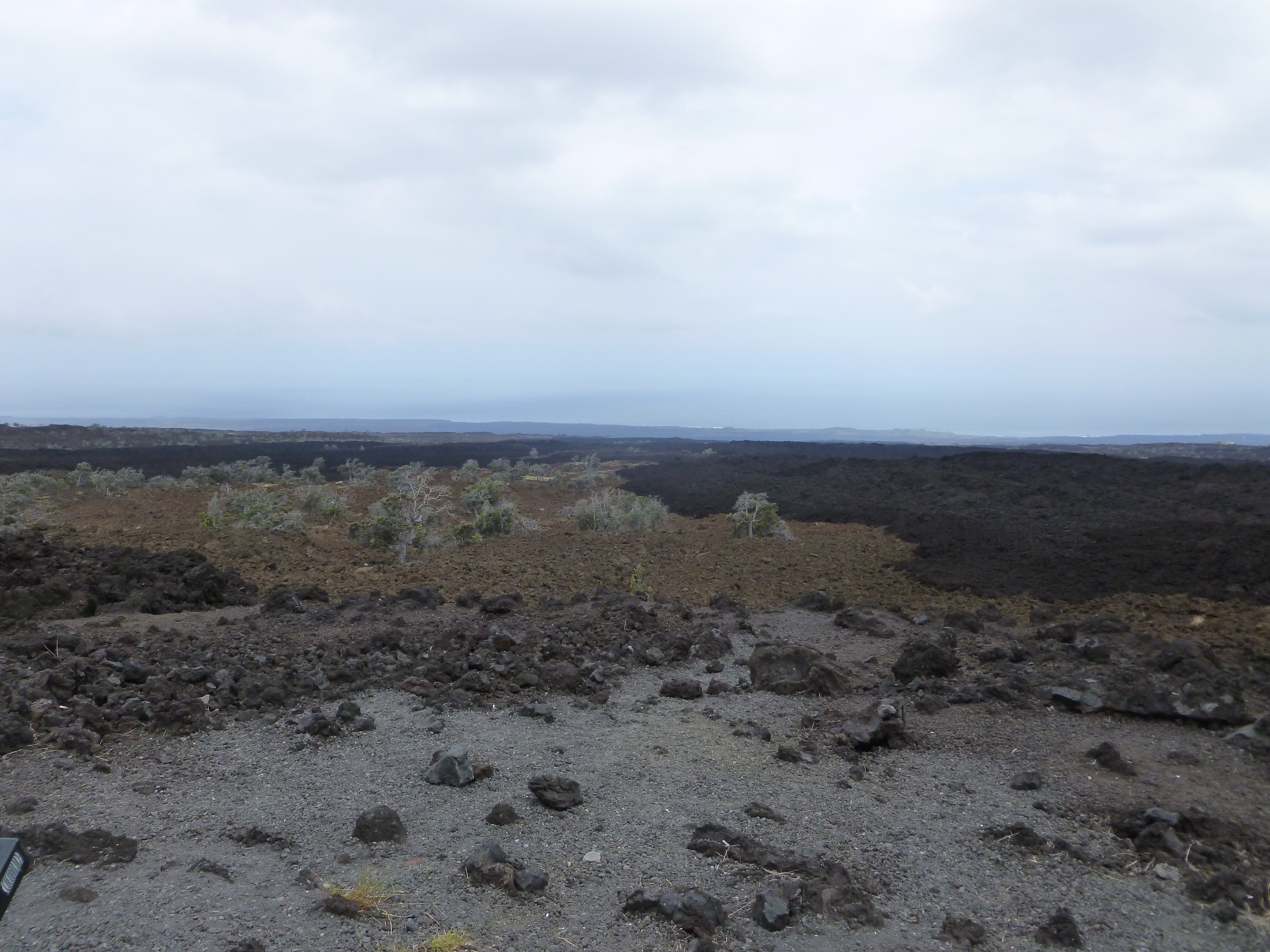
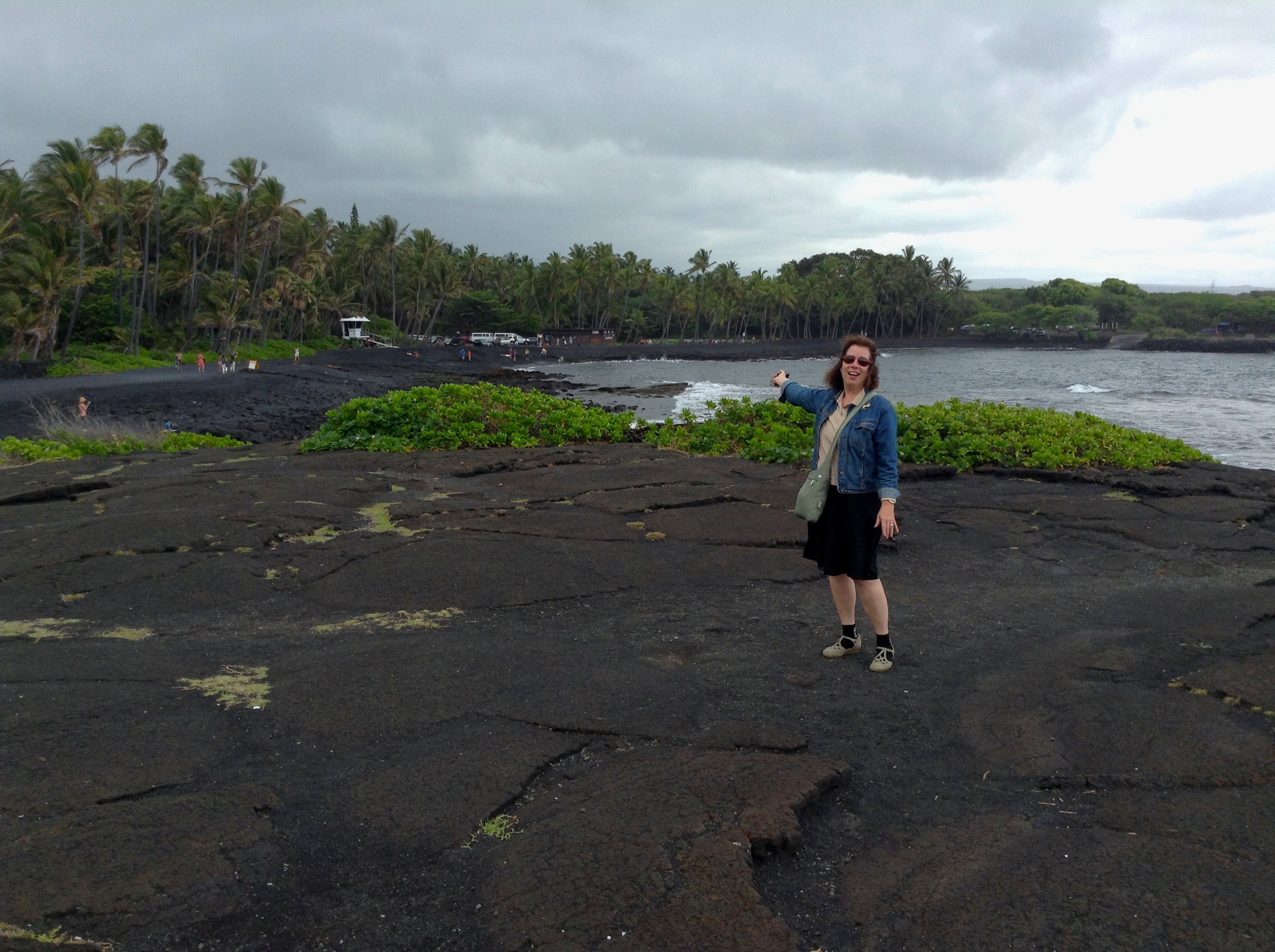
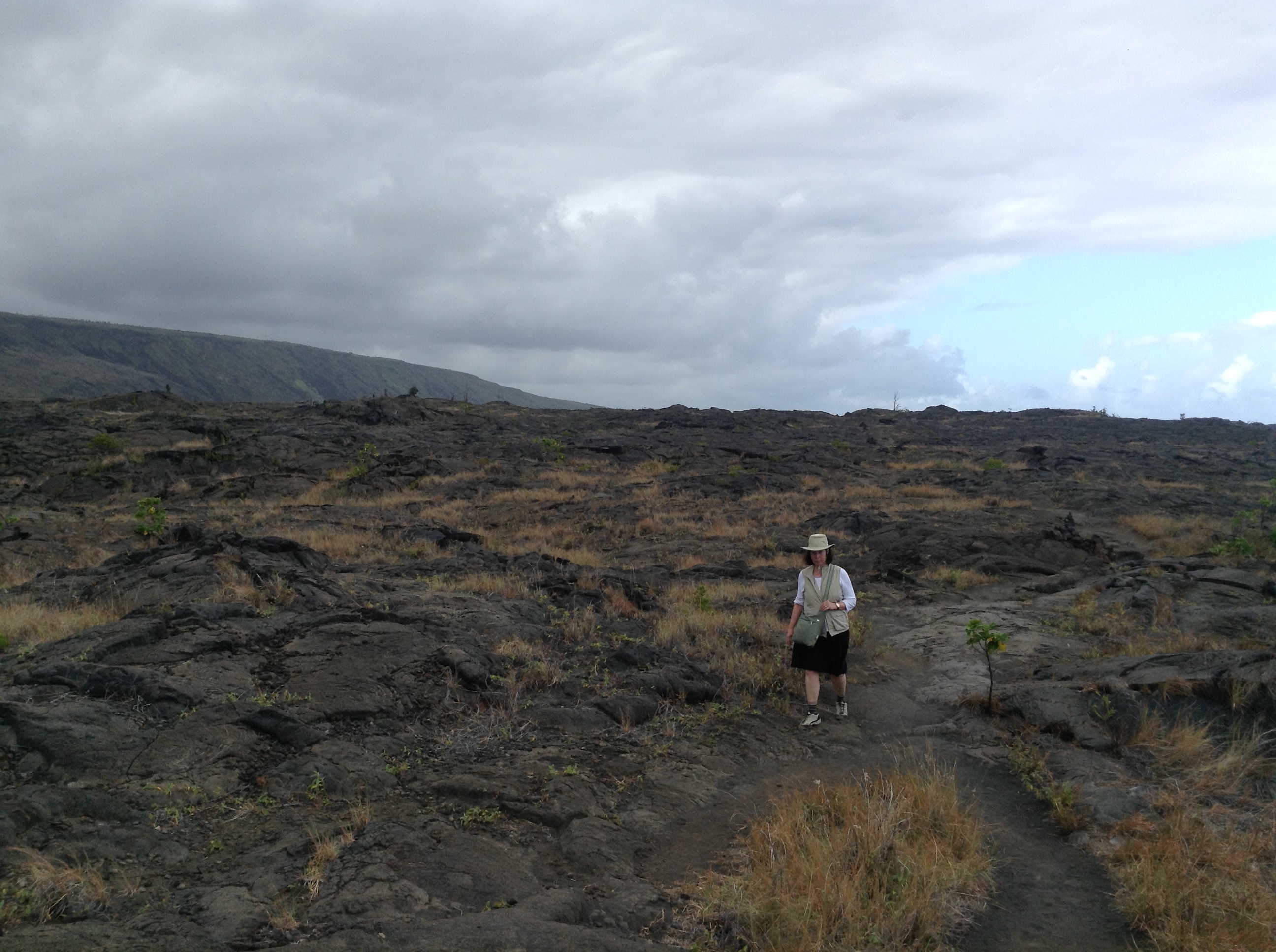
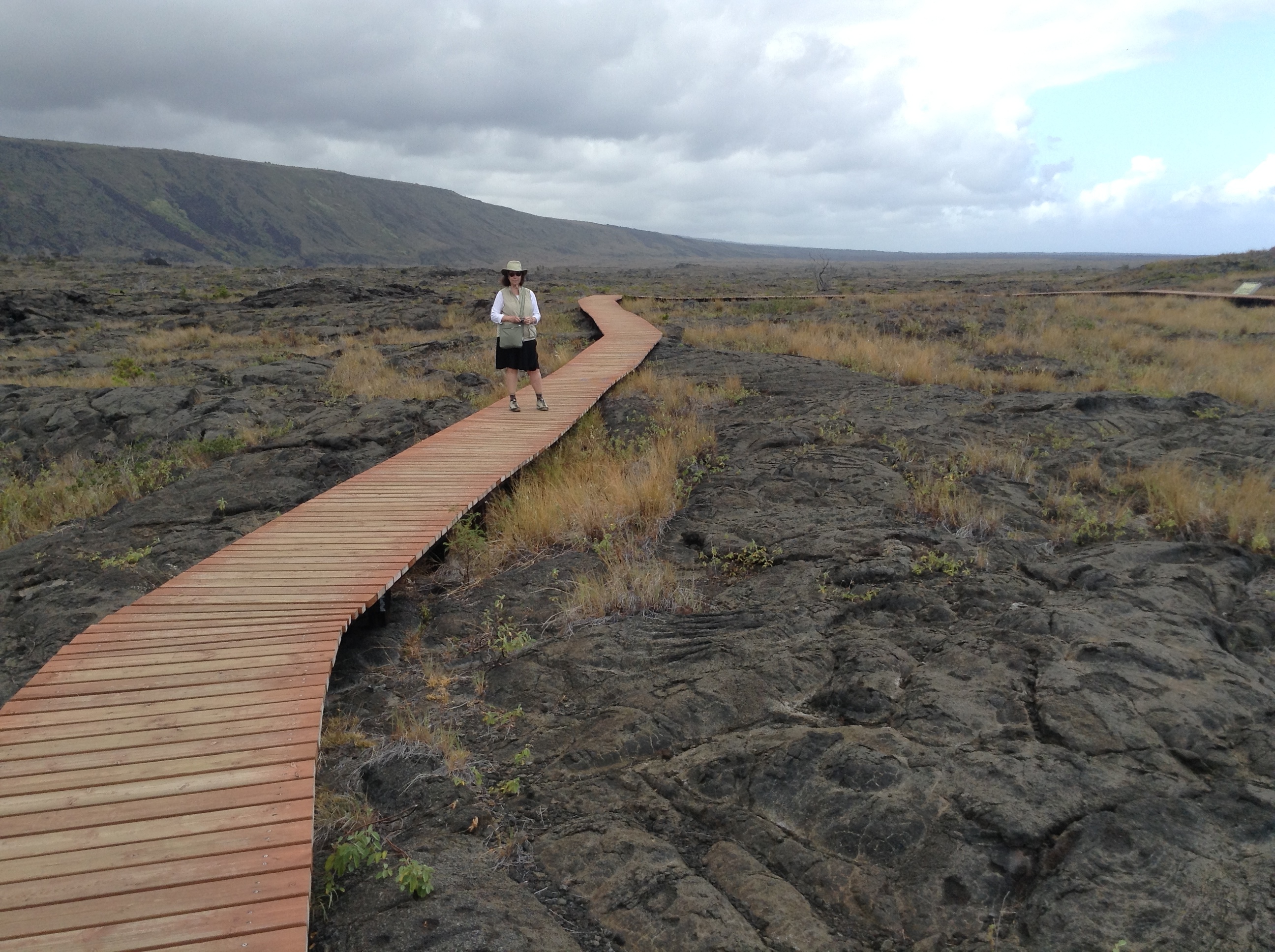
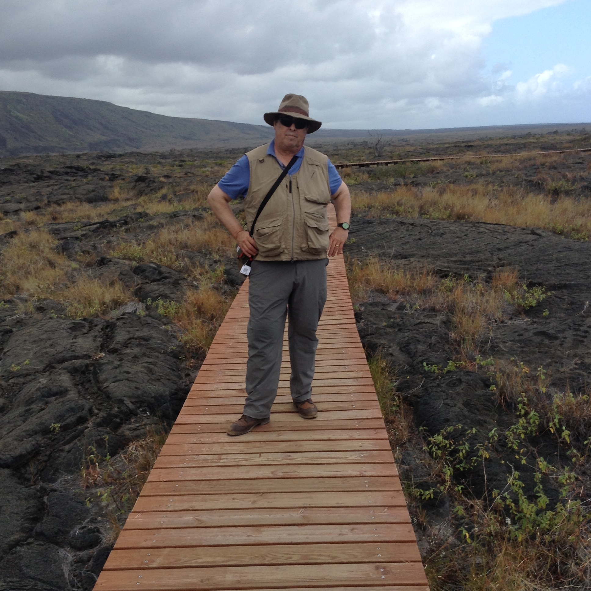
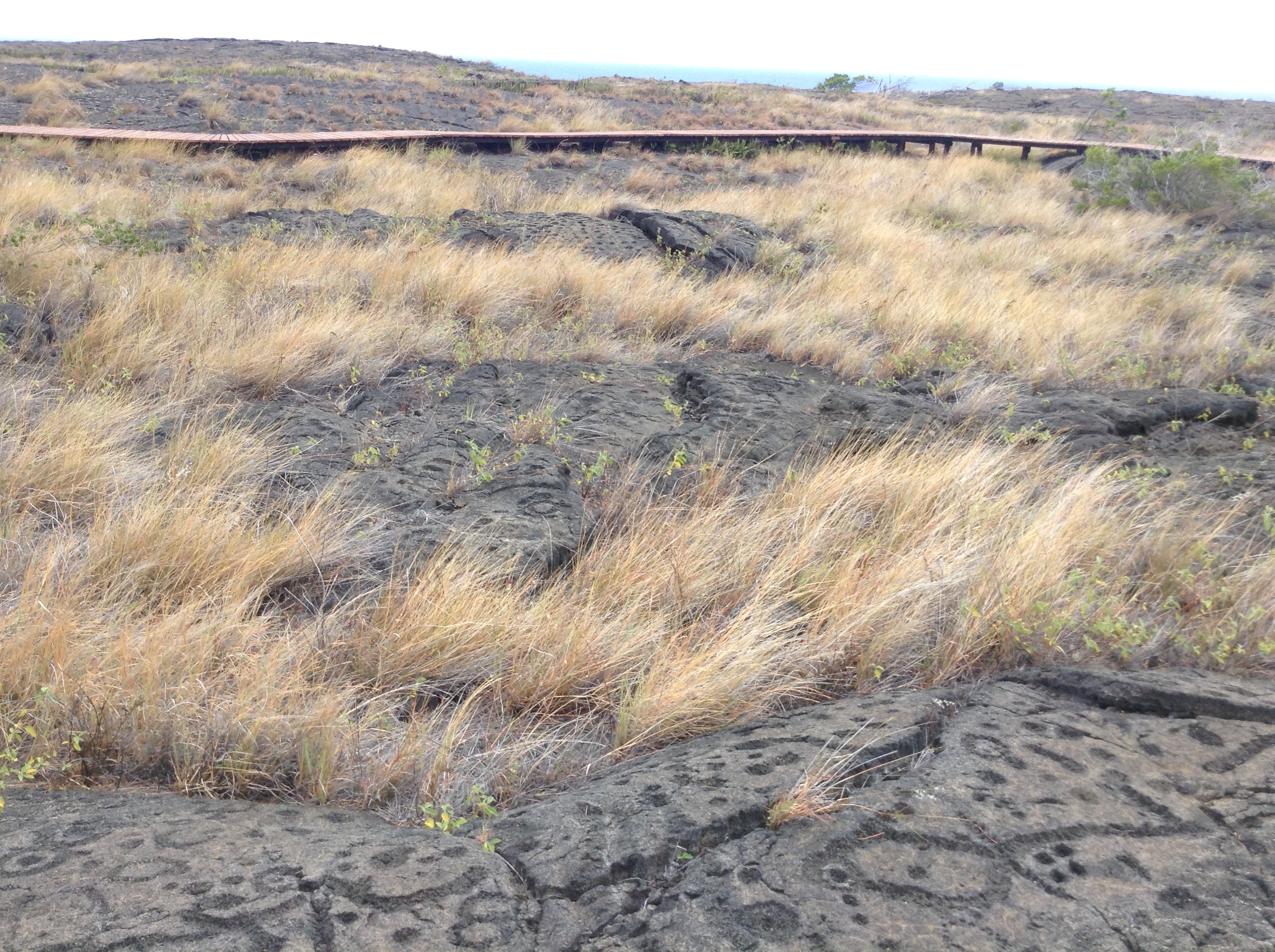
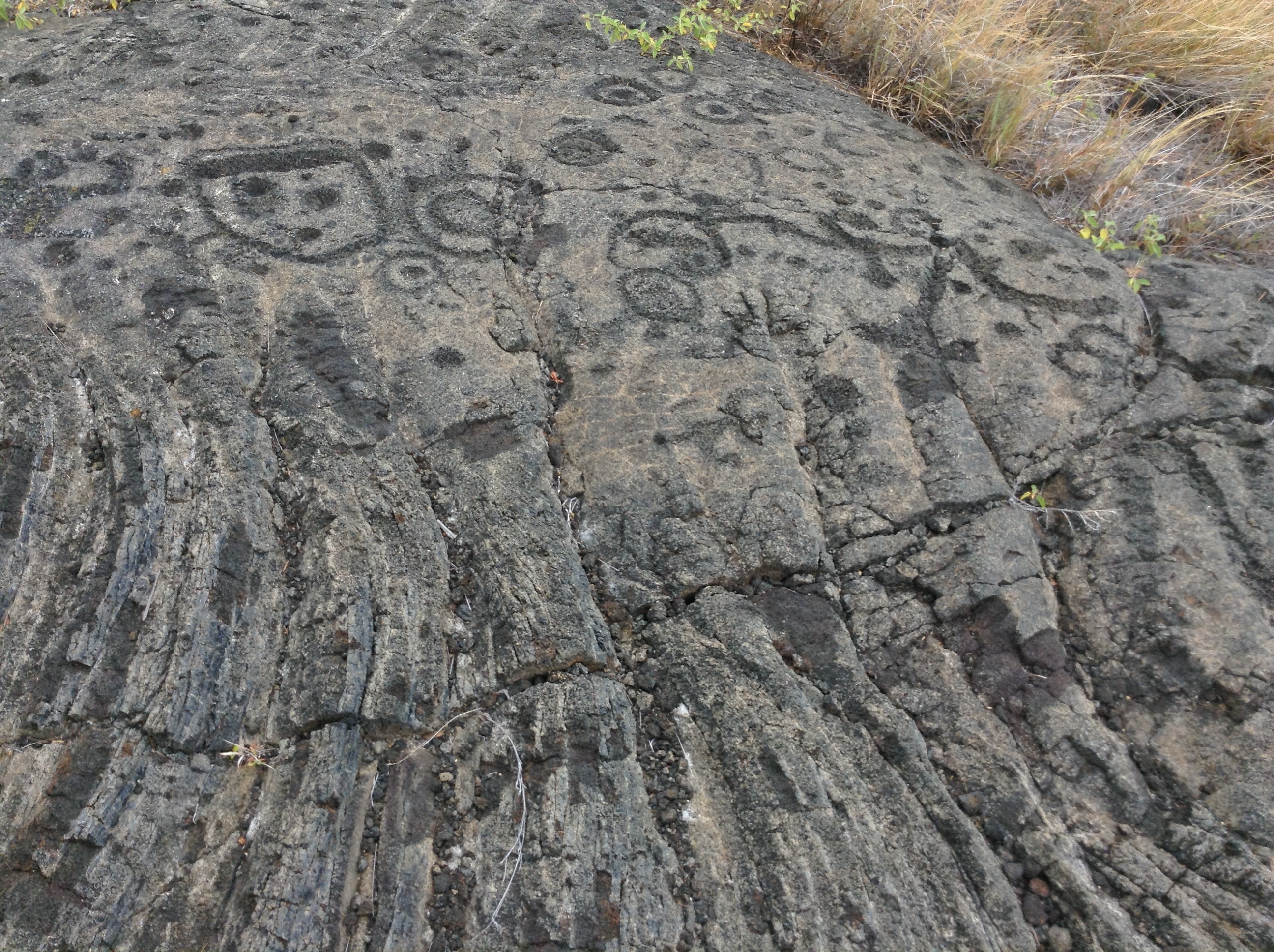
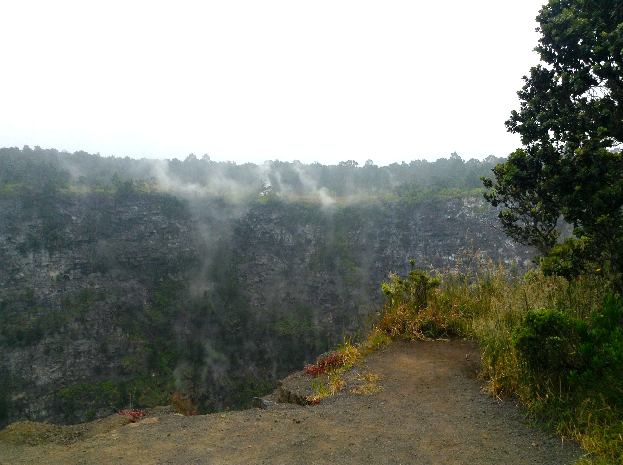
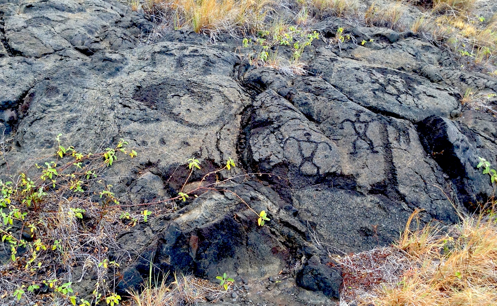
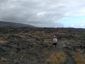
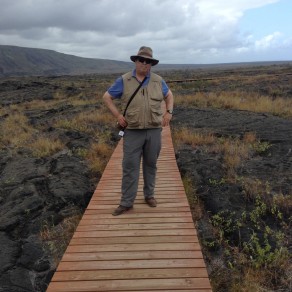
Pu’u Loa petroglyphs seem to be a modest collection of twenty thousand or so rock drawings. We later learned that these drawings are scattered up, down and across the fields of lava that had cascaded like fiery Niagaras from the escarpment rising up fifteen hundred feet to the north, onto the broad coastal shelf. Departing the dusty shoulder of the road, we followed a rough trail running seven tenths of a mile to east-northeast that terminated in a narrow, redwood viewing-platform elevated above the drawings, like temporary walkways that appear in Venice during Aqua Alta. I am always amazed at humanity’s undying faith in flip-flop footwear. Signs along the way warned of airborne dangers.

IMG_4306

IMG_4307

IMG_4300

The petroglyphs consist of concentric circles, stylized figures along with rows and clusters of dots. One conventional theory is that the drawings were made as prayer rituals, although I would like to believe that some of them might have been made for fun—indigenous graffiti like Pacific War Kilroys. Differing from indigenous rock art found on the mainland in their intimacy, they seemed to present a collection of individual images rather than the pictorial narratives one find in Anasazi rock-art.

IMG_4299

The precise meaning is lost. Perhaps they were measuring time or invoking the gods. Since the abolition of the old religion in 1819, the ability to interpret such images has been lost. On a more positive note, the Hawaiian language is alive and well, taught in many schools not only to natives but also to blue-eyed Haoles.
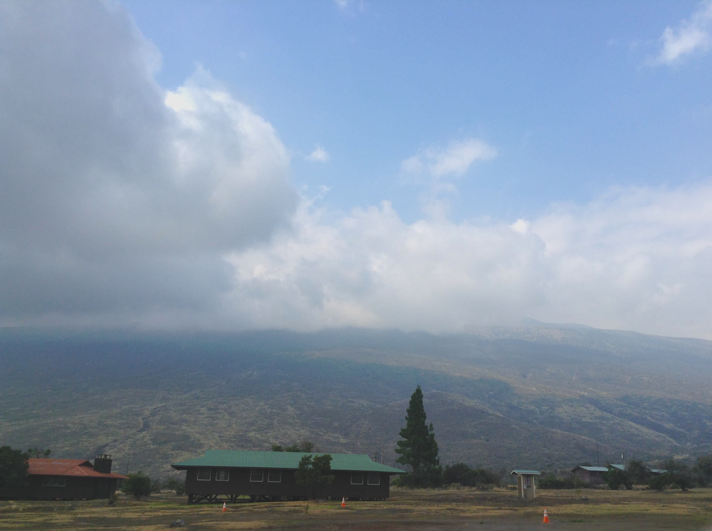
As we made our way back to the road a uniformed park ranger marched in the direction from whence we had come, shadowed by videographer and a soundman. As we crossed Chain of Craters Road to get to our car a stout lady with a southern accent descended from a large SUV. Oh no, she said. I’m not walking out there in these shoes. We ascended by the same road we had arrived, climbing quickly from the jagged barrenness of the plain behind us, the road traversing the ridgeline, winding its was upward into the dense cloud forest.
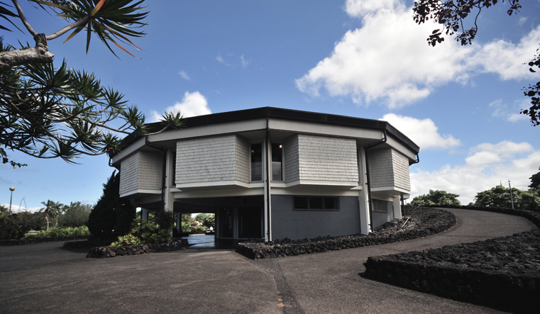
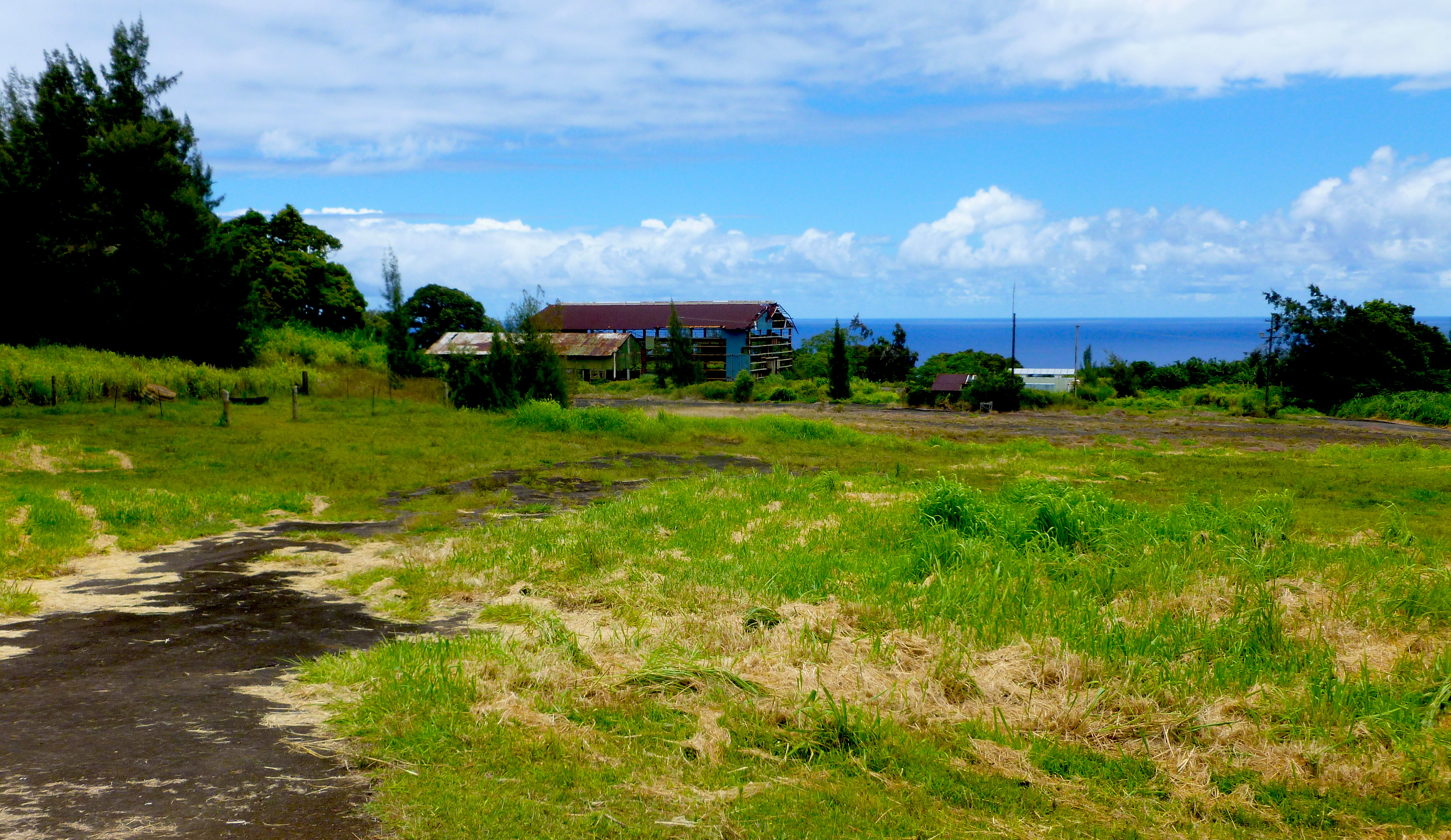
We arrived at Kilauea Military Camp (KMC), which I believe had been built for use by the Civilian Conservation Corps before being handed over to the army during the Second World War. Since it decommissioning as an active post, it has served as a modest resort for veterans, military personnel and their families. How the university had managed to billet us there is a mystery to me.

General KMC Store

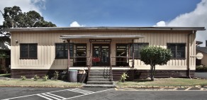
Michael and the crowd from the summer institute had yet to arrive. I marched up to reception and in my best military-speak informed the person manning the front desk that we had arrived and hoped to occupy our quarters. Papers were signed, keys were surrendered and I was given a map that directed us to a single story clapboard building located on the margins of the camp, with a canopied outdoor cooking area with picnic tables twenty yards from the building. Like all other buildings in the compound, the exterior was painted a kind of desert tan.
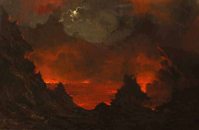
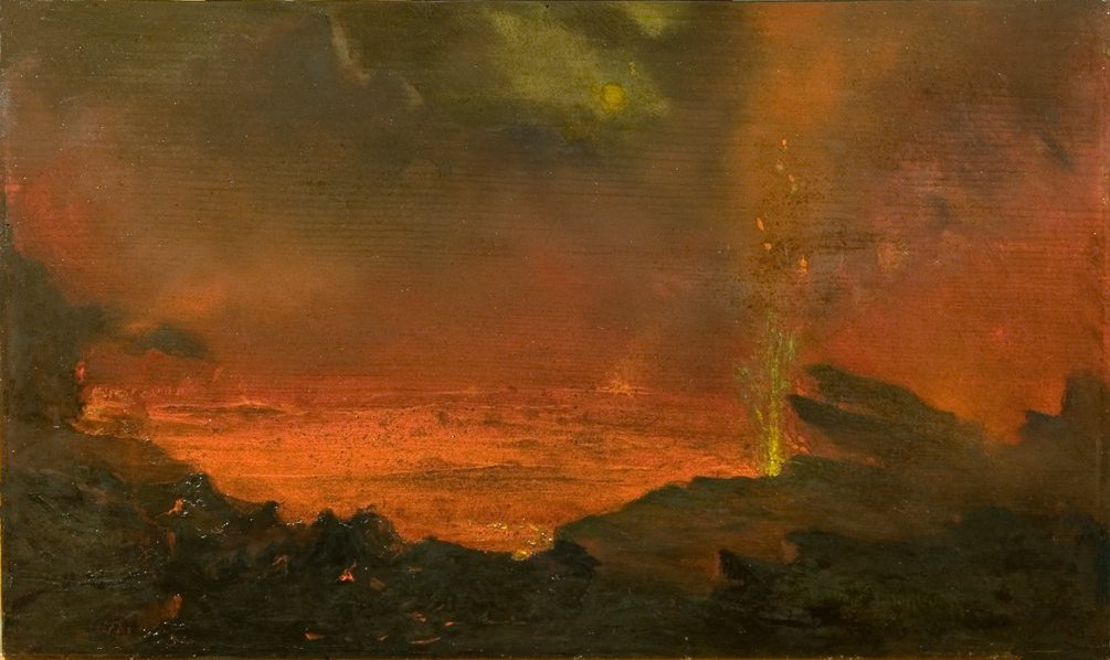
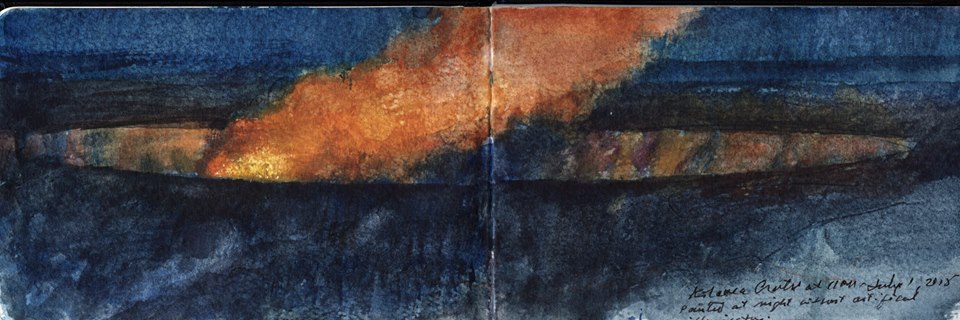
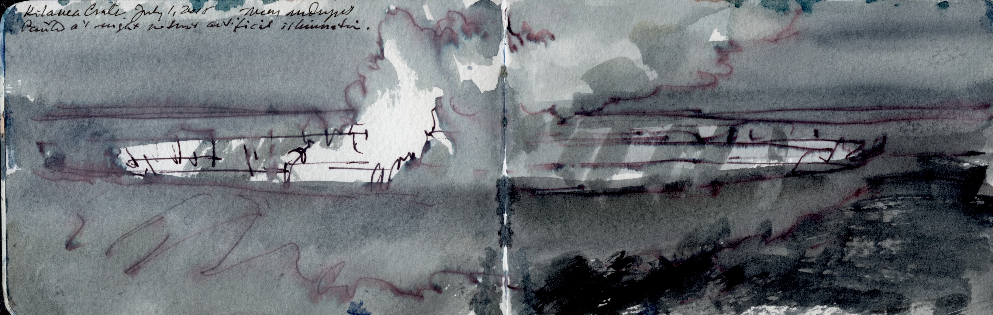
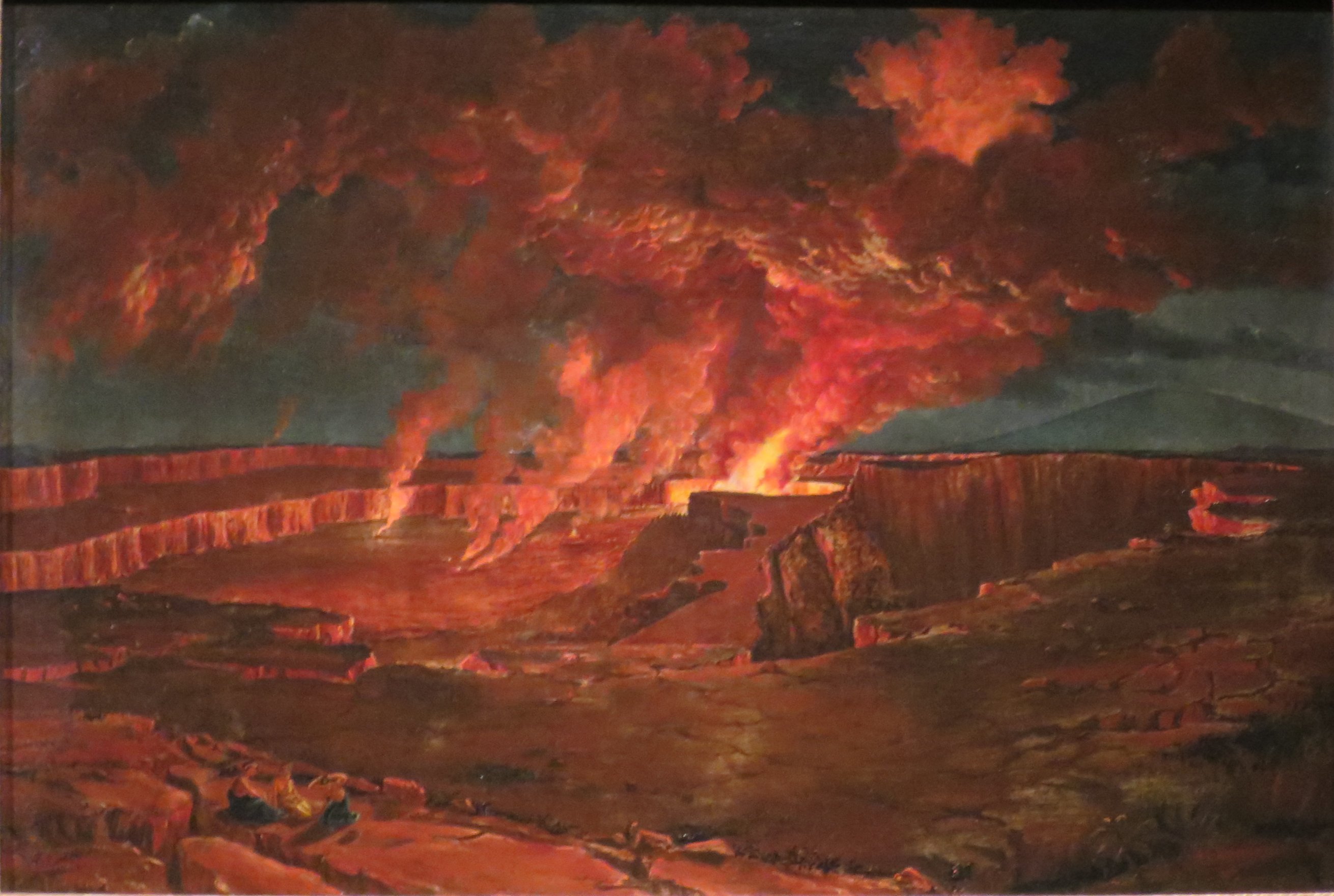
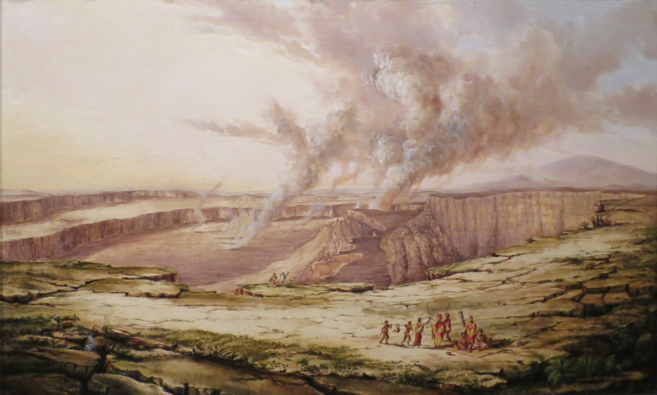
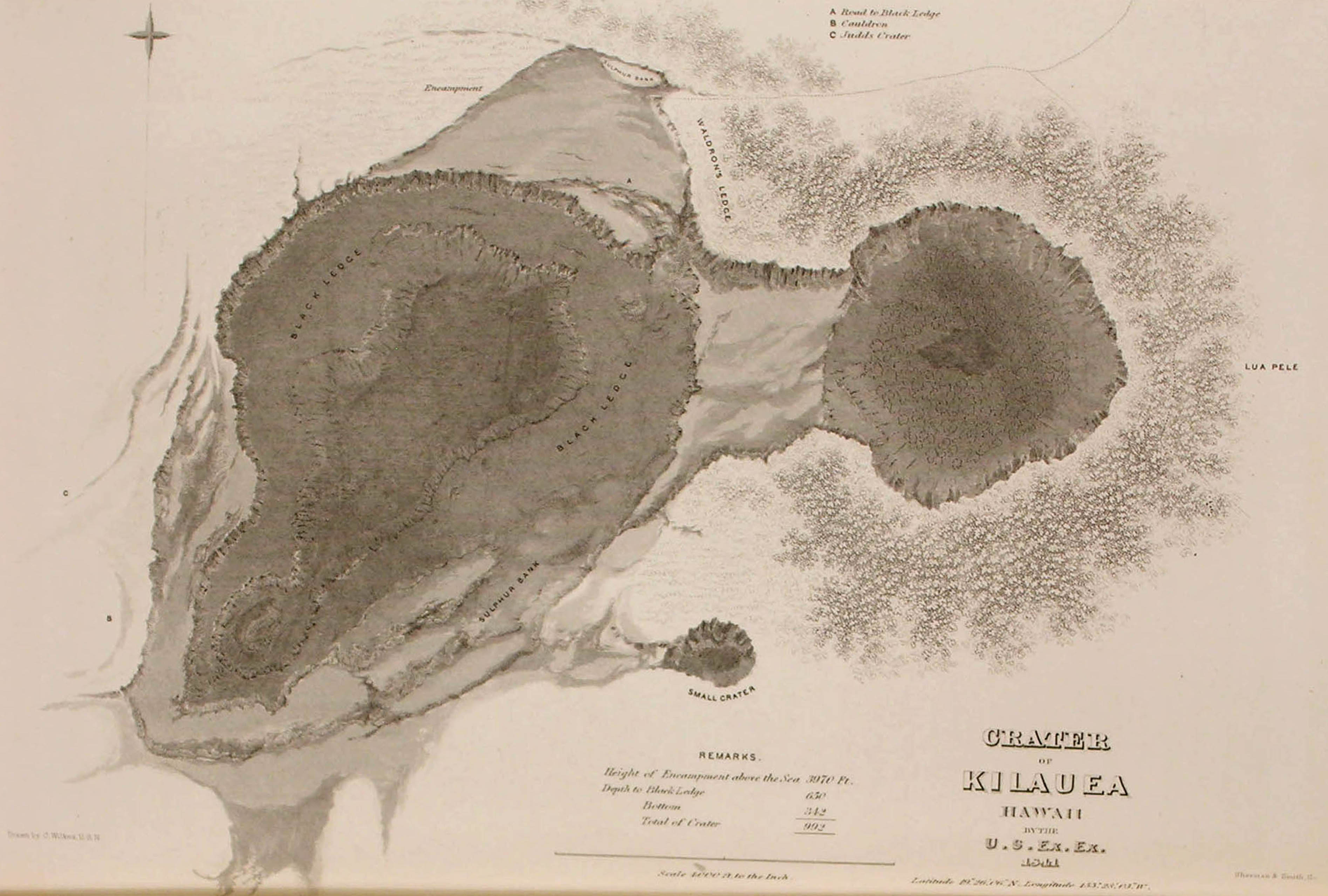
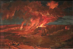
Our room was the only room with a private bath en suite. The other rooms had either twin or queen sized beds with shared bathrooms intervening. A large kitchen and contiguous living room divided our quarters from the rest. Kathie took a nap while I perused the chapter on Hawaiian Volcanoes National Park in our waggish Big Island guidebook. Of greater interest to me was an account of the United States Exploring Expedition of 1838-42, under Lieutenant Charles Wilkes, which conducted a survey of the crater at Kilaeua in the winter of 1840, during which a member of the party was surprised and nearly killed by a sudden rise in the lava pool of Halema’uma’u, the smaller and most active crater within the caldera. Several artists accompanied the expedition, including Titian Ramsay Peale II, whose paintings of the crater have become canonical images.

'Kilauea_by_Night',_oil_on_canvas_painting_by_Titian_Ramsay_Peale,_1842

'Kilauea_by_Day',_oil_on_canvas_painting_by_Titian_Ramsay_Peale,_1842

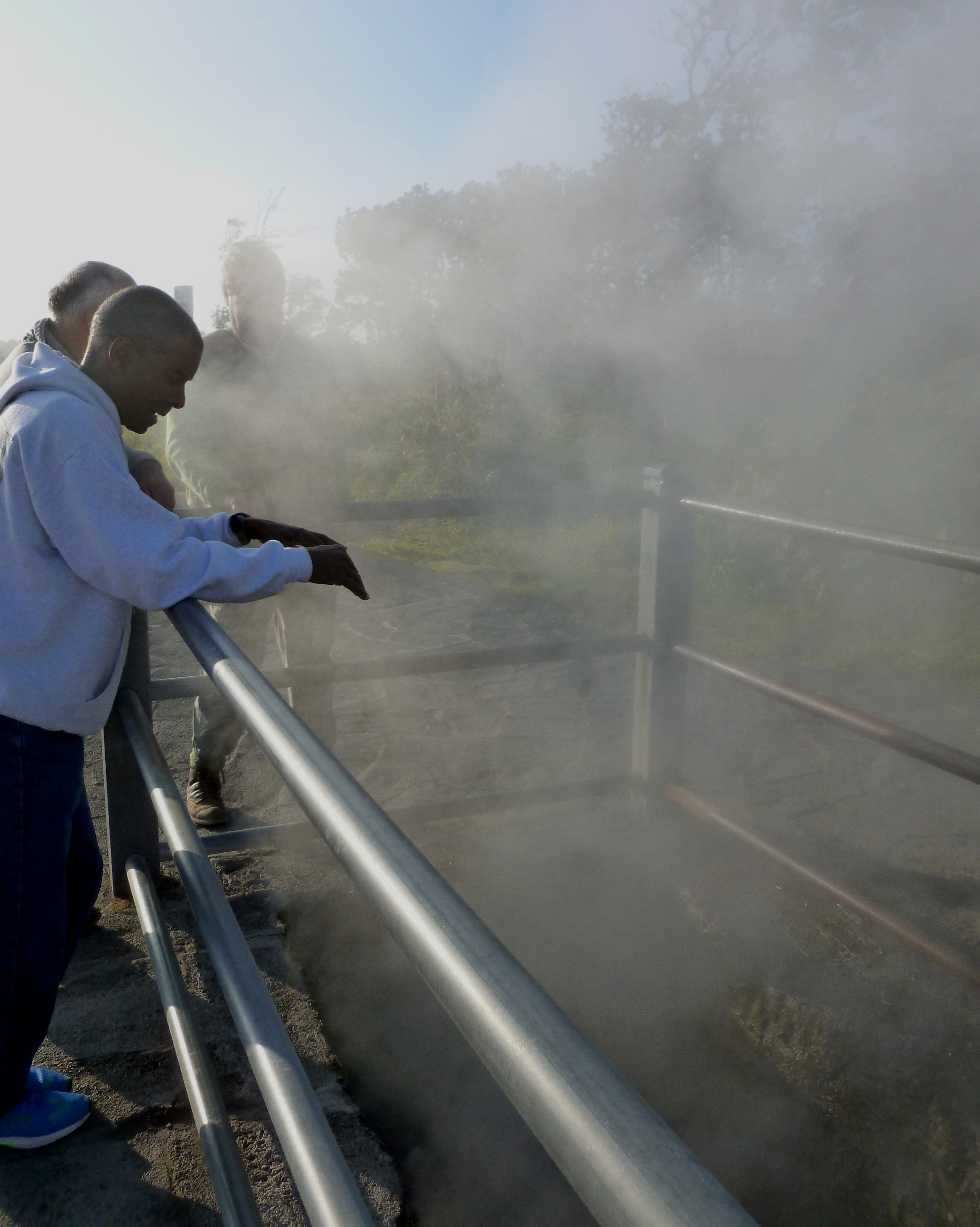
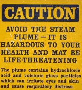
Stories abound of hikers defying posted warnings against going off trail and breaking through a thin crust into lava flowing beneath it, or into plunging into deep, steaming crevasses. One tale alleges that a young female ranger, new to the park, had descended one of the steam vents with a male friend, to use it as a kind of sauna. She quickly succumbed to the heat. When her companion returned with help, she had been poached to a turn. We were told that this mishap occurred in one of the steaming pits in the meadows between the park entrance and KMC. Trails that visit these vents are well marked with cautionary signage.

1ded1f3a1f54d2034a466a617bd933d9

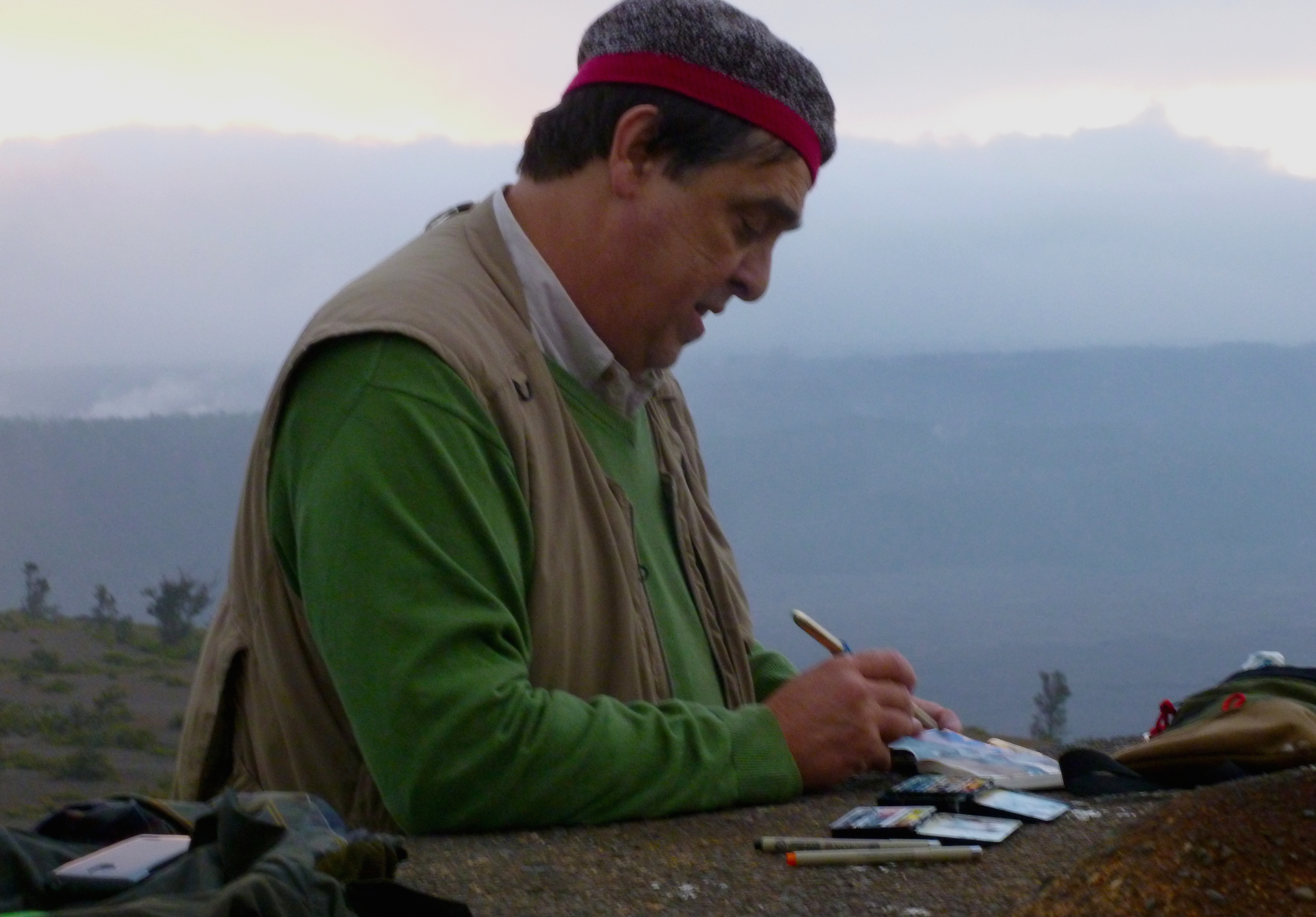
One by one, members of the summer institute arrived, which included several instructors and about a dozen students; some from the university, two women from Canada and a few more from other parts of the Big Island. An unofficial member of the party was Denver artist Judy Gardner, who was renting a rustic cabin down the mountain in Puna for a few weeks.
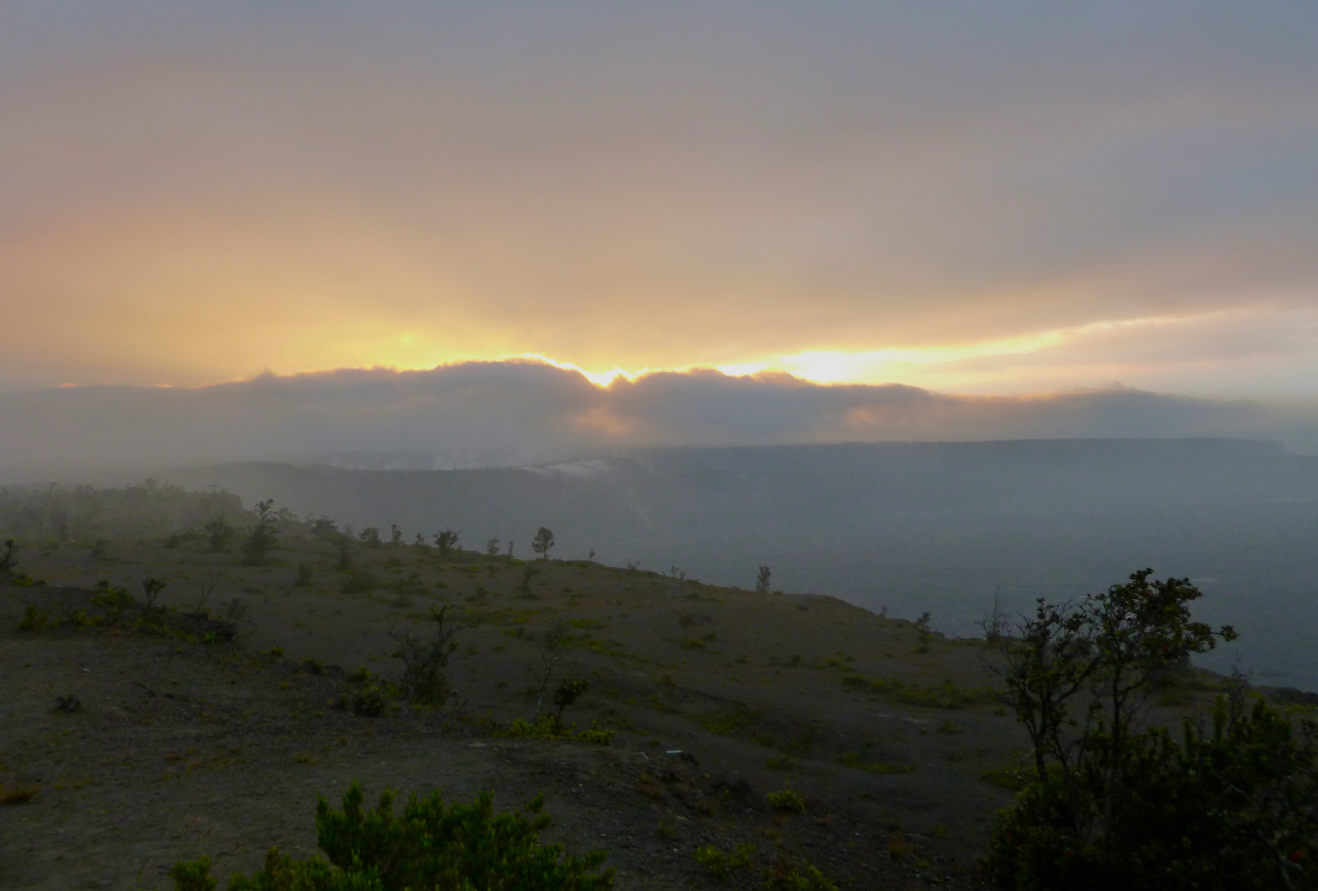
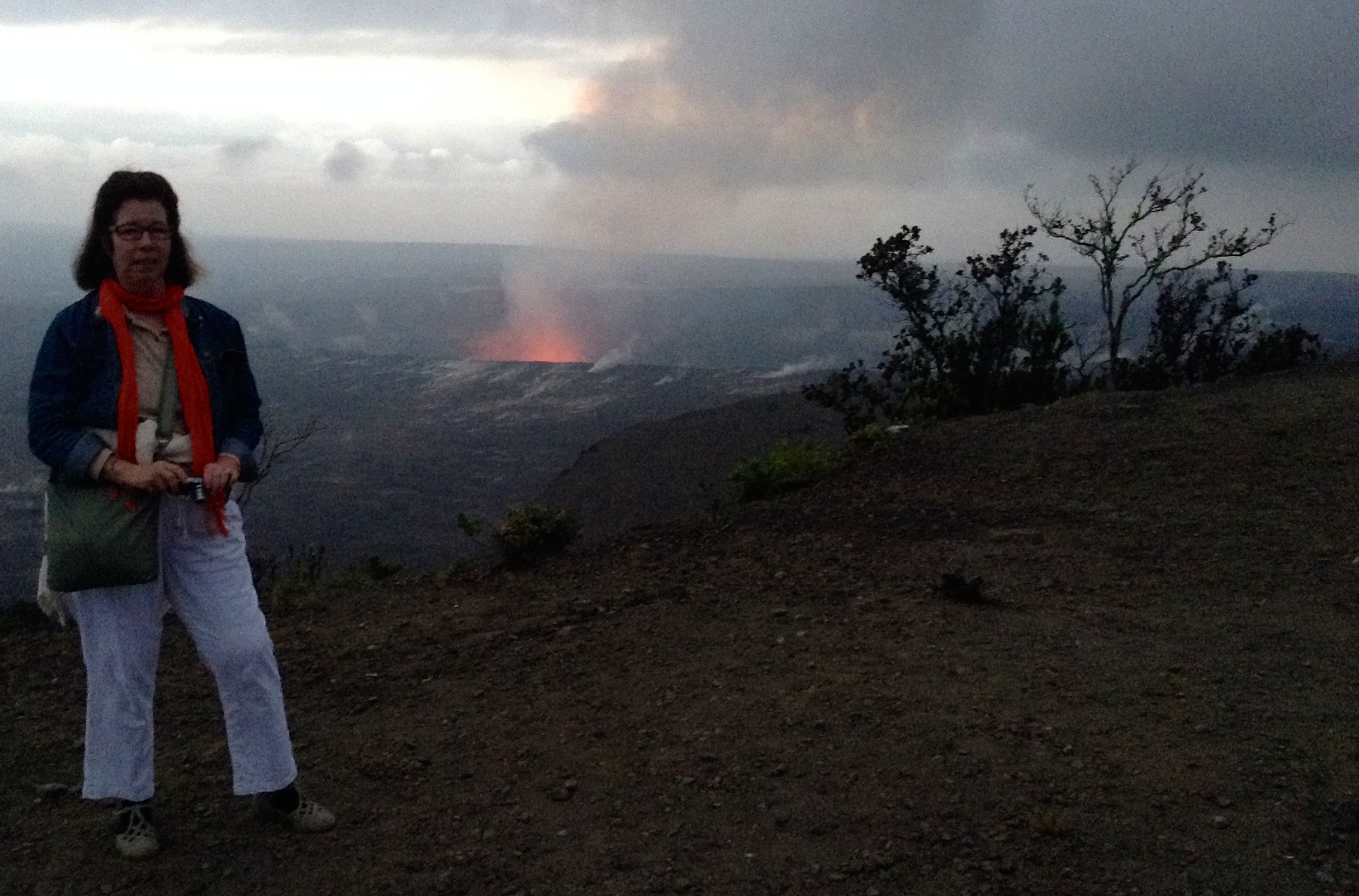
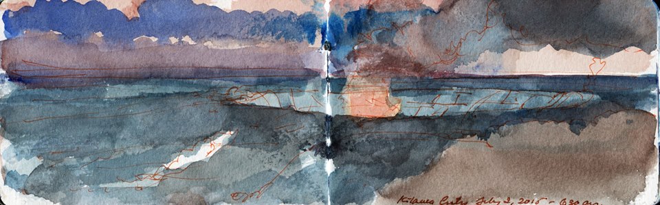
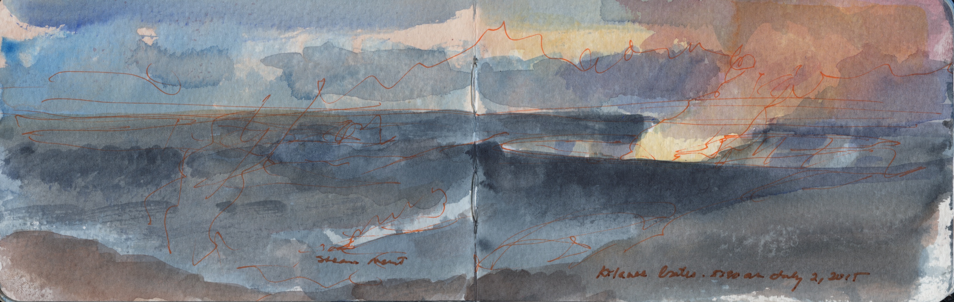
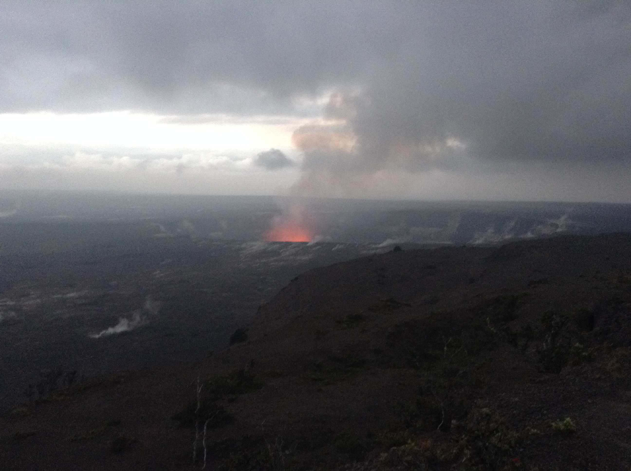
Night fell. As dinner was being prepared a number of us boarded a ten-passenger van and were driven to the Jaggar Museum by Mike Marshall, who struggled in vain to extinguish the dome light. All that was missing from the ride to the rim of the caldera were commuters playing with their smartphones or reading the newspaper.
Crowding the railing along the paved observation deck, sightseers looked at the glowing cloud rising about the fiery ellipse of Halema’uma’u. Arriving with a video crew and floodlights, an Asian family pushed their way through the crowd to the barrier and then demonstrated no talent or dignity as stars in their own reality television show. Selfie-sticks were ubiquitous vexations, like umbrellas on a rainy day in Manhattan. People shouted nonsense at one another. A few bold souls had jumped the barrier to get a downward look into the vast pit. I was disappointed to find ogling the volcano the same collection of humanity one finds daily, herded into Times Square, Place Saint-Michel, Piazza San Marco, Machu Picchu and Disneyland.
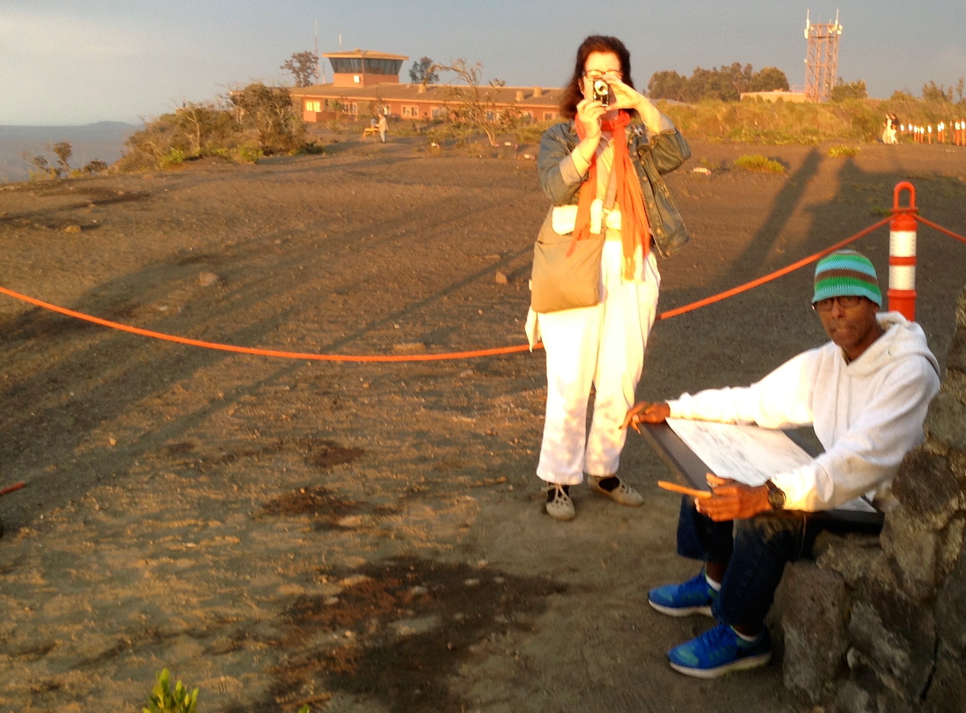
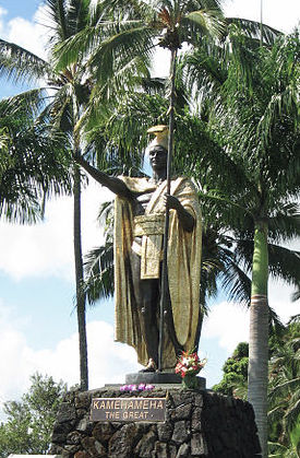
One of the institute instructors, landscape painter Moses Kealamakia Jr. explained that locally Hawaiian describe the opening with the colloquial name of Lua’Pele, or Pele’s Hole. Pele, a maternal deity, is the indigenous goddess of fire who embodies volcanic activity that created the island, and continues to increase it. The name appears on the right side of a map produced by the Wilkes Expedition.

1845-Wilkes-Expedition-IV-0164-fig

In the Hawaiian language lua can also just be a pit, such as the pit-roast or Lua’u.
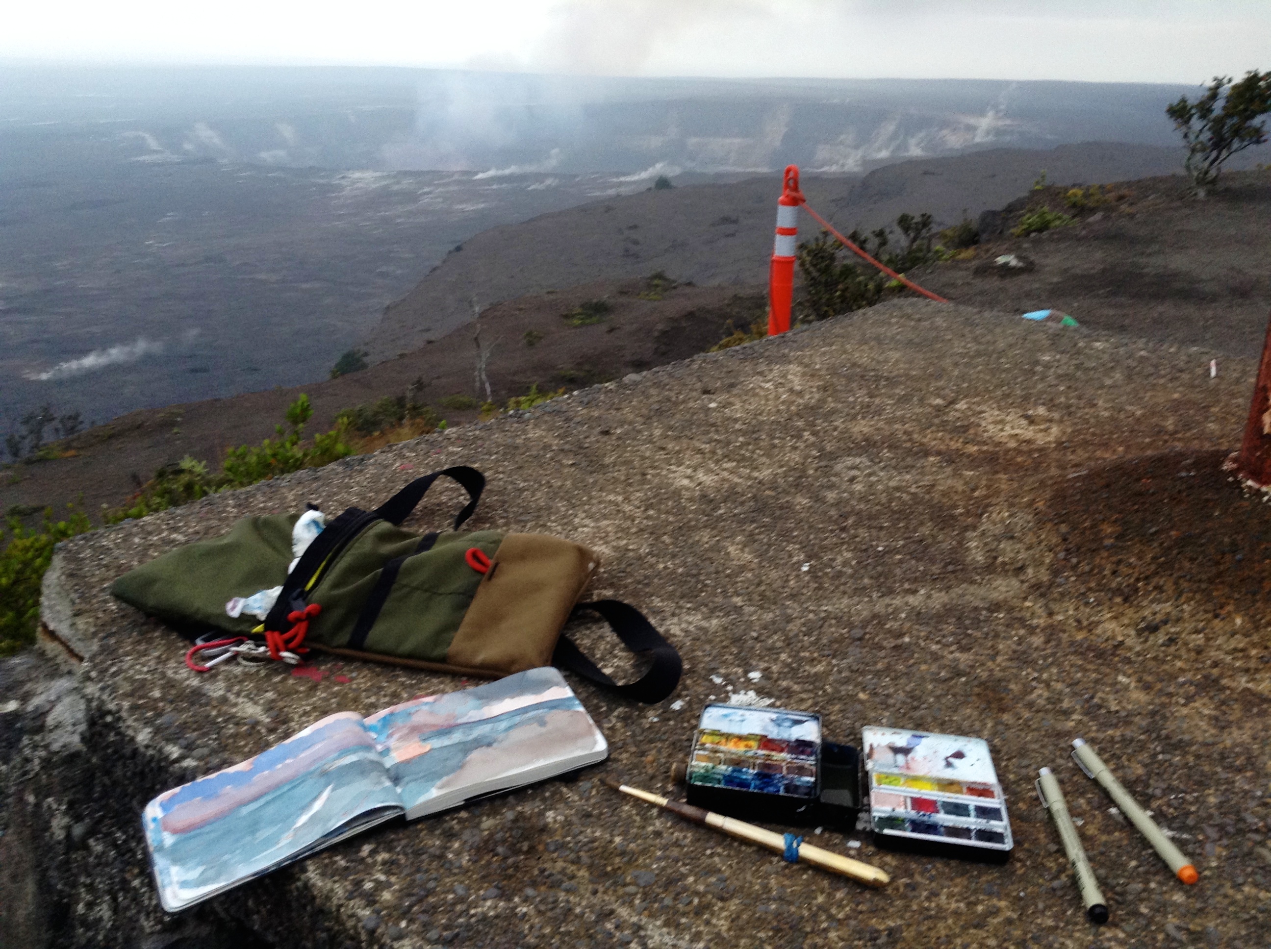
Moses explained that among its multiple meanings, lua also translates as feces, which is why public toilets around the island are known as lua—a usage that combined two different meanings in one. I wondered aloud if the word was perhaps the root of loo—British slang for rest room. Moses cautioned me against assigning the word too much scatological meaning. Kuae’Pele, he explained, is the literal word for Pele’s feces, specifically the sulfurous deposits (brimstone) around the rim of Halema’uma’u and the odor arising from them. He marched off with a small coterie of students to explore if the trail circling the rim was open, presumably to scout motifs for a post-prandial plein-air painting session. The rest of use piled back into the rented van and returned to KMC.

Hilo Day Three, part one: July 1, 2015

Vog (volcanic fog) is a mixture of humid air with sulfurous gasses that is formed when warm and hot air mingle near areas of volcanic activity. Exposure to vog can result in severe problems for people with pulmonary problems, while those with normal respiration can experience a burning sensation in the lungs, headaches and fatigue. The fragrance bears a faint resemblance to diesel exhaust combined with gunsmoke and is frequently present near the 4,091-foot summit of Kilauea, the Big Island’s lowest but most active caldera. This would be our destination for tonight.

Kilauea dawn

Having determined that preparing anything more than coffee or cocktails in our Pakalana room held little appeal, we arose and went in search of breakfast. Downtown Hilo is divided from the bay by a broad swath of Banyan-shaded parklands and a series of parallel roadways. The season for canoe regattas was underway. Competing crews gathered to practice for the upcoming trials. The town is not the typical beach resort one imagines. Those are all clustered around Kona-Kailua on the other side of the Big Island. Old Hilo is a relic of the last century, where it would not be a stretch to find Humphrey Bogart on a bar stool swapping lies with Sidney Greenstreet. Apart from the weekly infusion of cruise-ship shoppers there seem to be relatively few tourists, who prefer the drier climes and five star amenities of the Kona Coast. Hilo received more annual rainfall than Seattle while the western side of the island is semi-arid. We found no mainland-style diners or lunch counters, per se. Instead there is an abundance of eat-and-run coffee-shops or places like Paul’s and the Surf Break Café.
Along the northern stretch of Kilauea Street we ducked into Le Magic Pan, which occupied an oversized street-front space in a building from the nineteen-twenties of thirties. Strong coffee washed down ham and cheese Crepes Parisien. The server was a pretty young Eastern European woman (we did not inquire from where) who had recently arrived on the island and seemed delighted with Hilo. Fortified, we paid the check, returned to our quarters, packed and set off for an overnight near the summit of Kilauea. En route we stopped at S. Tokunaga hunting and fishing supply on the south end of town to purchase a headlamp. Mike had advised it as the plan was for us to be drawing and painting volcanic activity in the dark. I naively expected to be able to dash in, choose between one or two options, make a purchase and keep moving. Instead the salesman showed us a dizzying array of contraptions, from which I selected a Fenix HP05 350 lumen. Kathie was disappointed they did not have one in red.
We proceeded to Volcano village, less than an hour’s drive to the south. The outskirts of Hilo are undistinguishable from highway strips all over the United States—same brand-name tire stores, lube shops and burger joints that suddenly petered off into semi-rural terrain and as we ascended, into a dense cloud forest.
Arriving at the gate to Hawaiian Volcanoes National Park we paid fifteen dollars for a week’s access. Passing broad meadows billowing steam vents, we proceeded to reconnoiter the Kilauea Military Camp, where we would be spending the night. It was barely noon. Mike and the crew from the university were not due to arrive before five o’clock. Kathie (a colonel’s daughter) attempted to establish an early beachhead and failed. We had lunch in a Thai restaurant at a strip mall outside of Volcano Village, purchased a few more provisions—sunscreen and bug spray—and returned to the park. Passing the barrier we made a sharp left turn, which would have been easy to miss had I not noticed it when we exited an hour before. Descending Chain of Craters Road, we passed the promised concatenation of dormant craters many of which were overgrown with dense vegetation.

Steaming crater

Steam seeped from cracks in their rocky walls. The cloud forest gave way to grassy meadows and lava fields, punctuated with shrubby trees. The narrow roadway ran along a ridge that shadowed the brink of a great precipice rising perhaps fifteen hundred feet above the coastal plain below. Suddenly the road plunged to a hairpin turn on the face of the escarpment and then looped its way down to a vast expanse of hardened lava, giving us the sensation of being like field mice crossing a freshly plowed field. Two kinds of lava—Pahoehoe, which is created by slow-moving flows and A’a’, which is created by sudden eruptions, may range in color from black to reddish-brown. Pahoehoe resembles caramel slurry or the surface of a brownie while A’a’ is recognizable as large, jagged clumps like soil cut by a plow. A cluster of parked cars along a bend in the road at the bottom of the hill marked our destination—the Pu’u Loa petroglyphs.

petroglyphs

To be continued

Hilo Day Two: Part Two

Wailoa Arts & Culture Center, Wailoa River State Park, Hilo

Mike Marshall and I arrived at Wailoa Center, which is located in the center of Hilo’s largest city park, which is traverse by a freshwater lagoon. The parkland had been cleared by a tsunami in May 1960. Instead of rebuilding, the area was set aside for public recreation as a memorial to the more than sixty people who lost their lives to the disaster. At the north end of Wailoa River State Park is a fourteen-foot statue of King Kamehameha I, who is credited with Hawaiian unification. One guidebook claims that the statue had been lost at sea and recovered many years later; while other sources report that it was commissioned to greet guests arriving at a resort on Kauai, where the locals objected on the grounds that the first Kamehameha never took control of their island.

320px-Kamehameha_statue_Wailoa_River,_Hilo

Wailoa Center itself is an octagonal two-story pavilion embraced on five sides by an inclined base of volcanic rock one-story high around which ascends a ramp to provide access to people with disabilities. Mike and I carried the three drawings into the building, which like many buildings on the island is open to the elements. As we entered her office, Mike introduced me to Codie, the center’s director. A lively woman with a mane of white hair wearing a blue-and-white Hawaiian shirt, she sat in an office chair with one foot propped on a pile of towels atop her desk, nursing a recent injury. Pardon me for not getting up, she said, I’m just waiting for this thing to stop bleeding. I reached across the desk and shook her hand.
We all commiserated about the censorship of the exhibition and Mike promised to organize a Banned show at the university as a rebuttal to the nude exclusion by the Codie’s bosses. Popular images of Hawai’i have been shaped by Elvis movies, Hula girls, surfers as a swinging tropical backdrop to television crime shows. The reality is far from the myth. Hilo had been a village that grew into a government center under the rule of Kamehameha I. Soon after, missionaries and Yankee whalers arrived to save souls and hunt the waters off the Kohala and Hamakua coasts.
The second Kamehameha abolished the traditional Hawaiian religion and its system of Kapu (taboos) in favor of Christianity. The community today is full of deeply religious people whose view of nudity no doubt is based on Congregationalist fire and brimstone values, at odds with the rich artistic heritage of Catholicism. The irony of course is that prior to Western contact, indigenous people preferred light raiment. Zealous missionaries had taught them to regard the body as sinful.
I asked to see the vitrines in which my sketchbooks would be exhibited and was shown two bulky wooden fixtures that might have seen use in the S.H. Kress store, or one of the other former Hilo retailers. Both were accessible by sliding back-panels, but not secured by locks. How would these be secured, I asked.
Jeff—the installer and preparator whose sartorial appearance was similar to my Pakalana landlord—explained that the pieces could be placed back-to-back, which would hinder anyone trying to get into them. This did not bode well. When Codie told me that I would have to sign a waiver in order for the books to be included in the exhibition I decided to hang onto them. Instead I gave her a copy of Mapping and Mobility—the book published by New Arts Projects in Connecticut. Painter and web designer Graham White had already sent her an animation of several dozen of my sketchbook page spreads, which was running on a large-format television screen in the gallery upstairs. I apologized, explaining that if no one was willing to take responsibility for my work, that I would be forced to do so myself.
I drove Mike back to Building 395 and then collected Kathie, heading off to Banyan Drive for lunch at the Hilo Bay Café. Reputed as one of the finer bistros in town, it stands atop a central mechanicals column like any New York skyscraper, the edges supported by a concrete Sonotube colonnade, presumably in case of tsunami. A lanai faces the bay, looking across the green margins of Liliukalani Park. The building was an open-air structure like many on the island. The wait-staff was young and attractive. Salads and fish tacos were presented with spare artistry, garnished with small blossoms and sprigs of herbs, on large white plates. Dinner would have required a more significant investment. Following our repast we drove along Banyan Drive, past the Hilo Hawaiian hotel—a 1960s modern high-rise with balconies for every room. Some of the other hotels looked as if they had seen better days. Debouching from the lush foliage we drove into the seaport zone full of low-rise industrial buildings, many thirsting for a new coat of paint. Lashed to the pier was a massive ship of the Norwegian Cruise Line. Every Tuesday one of these leviathans calls at Hilo, disgorging its passengers who spend the day in the stores, restaurants and open-air markets in downtown Hilo, roughly a mile away.
South of the port along the bay we passed a few buildings probably purpose built as hotels but now serving as lower-income condos and apartments. Farther on we drove into a forested area. Bathers frolicked in tidal pools. The road surface changed from tarmac to gravel and then to dirt before it disappeared into a tangle of rutted swaths that approached Richardson Beach. A wall of volcanic rock divided the thoroughfare from the rugged beach. On it sat a Hawaiian couple; a youngish man covered in tattoos and a heavy-set woman a few years younger than he. A middle-aged Asian woman marched across the parking area from her car toward the water. Here and there a few rough characters seemed to be minding their own business.
We drove back to the print shop, where I received from Jonathan Goebel a copper plate equipped with a hard ground, a scribe, burin and burnisher.Worried about leaving the plate in the car during the heat of the day, we made a pit stop at Pakalana before conducting a reconnaissance along the Hamakua Coast as far north as Laupehoehoe.

P1010934

Returning to our accommodations we showered, changed and went to dinner at Café Pesto—Hilo’s other fine dining establishment. The menu was eclectic, vaguely Italian. The wait-staff was much like that at the Hilo Bay Café. Perhaps many of them were university students. I was stunned at some of the wine prices but jumped at a glass of Lagavullin 16-year old for ten-dollars. Thus came to an end the month of June.