All posts by James L. Mcelhinney

April 23, 2020. QT Dispatch # 23. The Summit of Eyjafjallajokull Volcano, Iceland

Waiting for the crisis to pass, our thoughts go out to friends and loved-ones who also shelter in place. Old friends pass away, people we loved and admired. Immobilized for the time being, we can revisit destinations, near and far. join me in celebrating the joys of Quaranteam travel, the hope that these diversions might inspire us to value things we had taken for granted, to draw strength, wisdom and compassion from deeper engagements with nature.
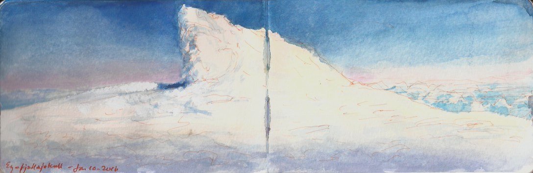

Atop Eyjafjallajokull. January 10, 2016. Watercolor on paper. 3.5 x 10.5 inches.

January 10, 2016. Sunday. Hotel Natura, Reykjavik. Kathie had booked a waterfall tour. Things did not go as planned. Instead they went far better than expected. Read the journal-extract below discover what happened.

Three Super Jeeps make up our caravan. Leaving Reykjavik, we head east on Highway 1, the southern coast road. Passing route 38 on our right, the land drops away. A broad inlet off to our right is fed by an estuary that snakes across the plain below. Passing the foot of table-lands rising steeply to our left, we drive past the town of Selfoss. Our driver Arne informs us that Chess-champion Bobby Fischer is buried at a Church not far from here.
“I thought Fischer was Jewish,” I reply. “How is it that he is buried in a churchyard?”
Arne can’t say for sure, but explains that most Icelanders are Lutheran, and not by choice. When the island was under Danish rule Lutheranism was compulsory, the official denomination for all Baptisms.
“The story we were told in school,” I tell Arne, “was that Leif Ericsson had converted to Christianity a thousand years ago.”
“That may be true,” Arne replies, “but many continued to worship the old gods. Some still do.”
I tell him how indigenous Pueblo communities in the American Southwest celebrate both Catholicism and traditional Kiva mysteries, not in defiance of Christianity, but in a blending of spiritual practices. Early Christian Europe I remind him, converted pagan gods into Christian saints. Medieval cathedrals were often built on the site of Roman temples that had replaced indigenous places of worship.
“That’s interesting,” Arne replies, “but I don’ think the Lutheran church would go for it.”
One of his favorite sagas is about Odin visiting Iceland, walking from one farmstead to another, to see who still worships him.
In outlying areas along the eastern and northern coast, there was some resistance to Christianity.
“What got them to go along with it?” I ask.
“We finally agreed to accept Christianity, but only if the church let us keep our slaves and eat our horses.”

Beyond Selfoss we cross a coastal plain covered by small farms. The road traverses a broad arroyo of black volcanic gravel through which dozens of frozen streams thread pathways to the sea. At Hvolvöllur we stop for fuel, use the restroom and buy sandwiches. The drivers gather for a powwow around the gas-pumps. The lead driver is the owner of the tour company Superjeep Island (pronounced Ice-land).
Arne informs us that his boss just had a call from base. Radar is showing no inclement weather as far west as Davis Strait, on the other side of Greenland. The other drivers are talking about driving to the summit of Eyjafjallajokülll–the unpronounceable volcano that brought air-travel to a halt in 2010 when it dumped thousands of tons of ash on Europe. Like Gaelic, Icelandic orthography to non-speakers is non-phonetic. Eyjafjallayoküll sounds like Aee-yah-fee-yacht-la-yo-cook to an Angophone.

All being game, we proceeded east on highway 1 to route 249. Turning left (north) we pass Seljalandfoss waterfall, turning right onto another road that bends back to the southeast, crossing the stream that feeds the falls. The unpaved road rises, reaching at last a desolate area that seems to have been mined for gravel.
The road-surface ahead almost resembles a stream-bed. Reaching a level area after half a kilometer, the Jeeps halt. Arne gets out. He and the other drivers deflate their tires to improve traction. A short distance ahead we drive onto the snow-pack.
Arne guides the Jeep around unseen pitfalls and obstacles, at times yawing twenty degrees to one side or the other, we crawl upward.
Carefully Arne crawls along a huge snow embankment, piled up against a rocky outcropping curving upward like an amphitheater. The flat, open space below is more likely to conceal dangerous fissures and crevasses.

The third Jeep in our caravan speeds past us.“He’s young,” Arne explains. “His dad owns the company.”

Reaching a broad shelf, we stop at the edge of the glacier. Arne gets out and deflates the tires to further enhance traction. He explains that a tank of compressed air in the rear of the vehicle will be used to re-inflate them when we return to a hard surface. Jumping back into in the car, he takes off his sunglasses, replacing them with a more expensive pair hidden in the side-pocket of his door.
I asked him why change eye-wear.
“Crossing this glacier (pronounced gloss-ear). It’s full of crevasses. The snow-pack should be deep enough to keep us from falling through, but you never know. This is the first clear day we’ve had like this for nine months. It’s up to you. Shall we go for it?”
“You know,” I said. “If we do get killed, I’ll be sure to tell Saint Peter that in spite of everything, you were an excellent driver.”
Looking sharply me, he furrows his brow. Pointing upward, he asks, “What makes you think I want to go THERE?”
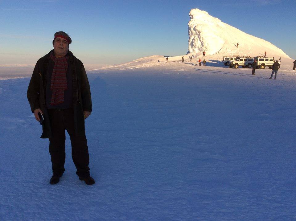

Atop Eyjafjallajoküll volcano, Iceland. January 10, 2016. Sunday. Note the sketchbook in hand.

Proceeding slowly at a steady pace Arne drives us up onto a snowy plateau at the crater’s edge. Another Jeep-tour caravan was already on site. On the northern edge of the shelf is a lopsided pyramid of snow, leaning away from the crater’s edge. I suppose this was created by a combination of the winds, and perhaps heat rising from the crater. People climb the giant snow-pile. I see a red parka at its summit, a child in spirit of Edward Whymper or Edmund Hillary.
Kathie and I walk south, a hundred meters from the tailgater now underway. I make two sketches with color accents, to be elaborated back at Hotel Natura, over a glass of Brennevin, Icelandic schnapps known locally as Black Death.
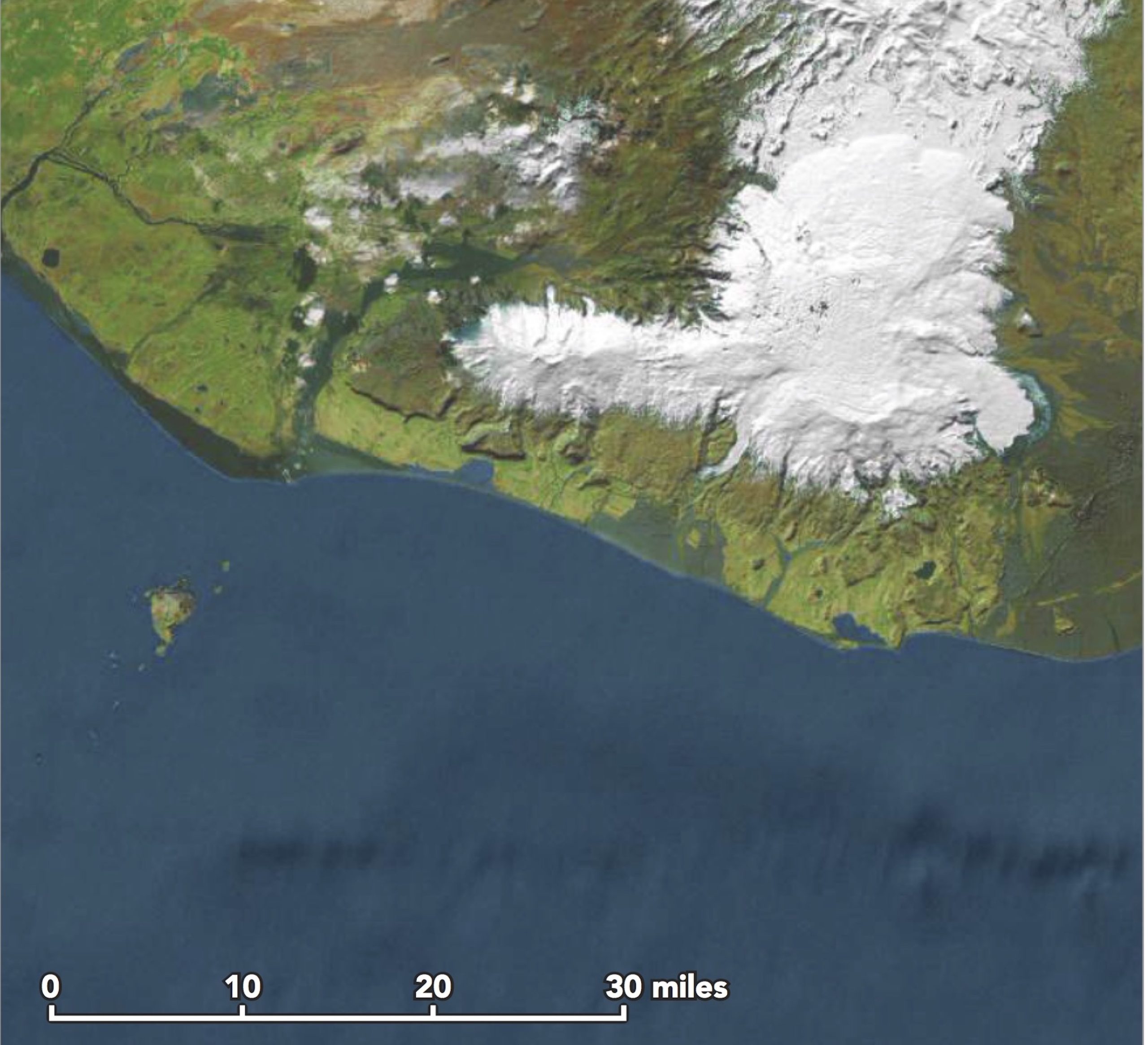
Silence envelopes us. Looking out toward the south we see the Vestmannaeyjar Islands, lying just offshore. The islands are named for a group of Irish slaves massacred by friends of their captor, whom they had murdered during a mutiny.
Reveling in the snowy hush of our wild isolation. Just as we feel the mountain about to whisper deep truths, a roaring blizzard almost knocks us over. Rising up from the crater is a sleek, black helicopter. Landing, the downwash of its rotors blows powdery snow is every direction. Suddenly we are in a James Bond moment. A tall thin woman in a long fur coat and thousand-dollar sunglasses steps out of the chopper, followed by an older, well-groomed man in a knee-length parka. Another man climbs down beside them, perhaps a handler, or their cicerone. Kathie and I walk back to the Superjeep cluster. A woman at the pinnacle of the tipsy pyramid calls down to friends, her words inaudible to us.
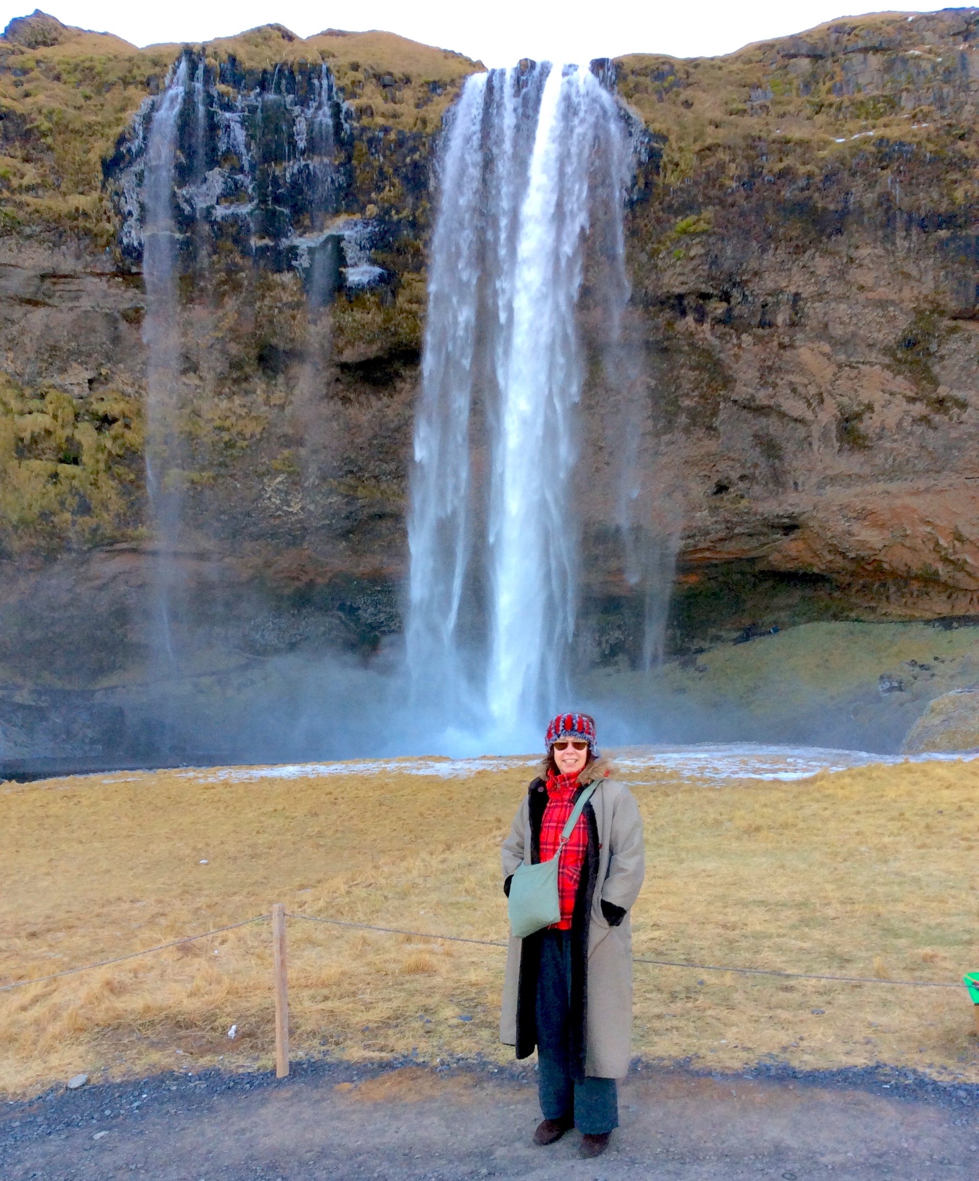

Boots-on-the-ground art-historian Kathie Manthorne at Seljalandfoss. June 10, 2016.

Down the mountain and back on blacktop, we stop at Seljalandfoss for photo ops. Again, I make a sketch, adding some color notes for later reference when I unzip the file. Skogafoss, a spectacular waterfall created by runoff from another glacier, on the southeastern slope of Eyafjallajoküll. Located next to the village of Skogár thirty kilometers further east. Today’s excursion will go no farther before returning to the city. (to be continued)

Below: Satellite view of the souther coast showing Eyjafjallaokull and Vestmannaeyjar Islands
© James Lancel McElhinney. 2016
Enquiries:

ja***@mc***********.com


Disclaimer: The above is a work of fiction based on real events. Any resemblance to fact is coincidental. “Print the Legend”

(A preview of SKETCHBOOK TRAVELER by James L. McElhinney (c) 2020. Schiffer Publishing).
Copyright James Lancel McElhinney (c) 2020 Texts and images may be reproduced (with proper citation) by permission of the author. To enquire, send a request to

ed******@ne***********.com


April 22, 2020. Earth Day x Fifty. Quaranteam Traveler Dispatch # 22

Three weeks ago, I published the first in a series of daily website blog-posts, of writings and artworks that celebrate personal mobility, in pursuit of mindful engagements with history, nature and the environment.
In relation to a finished painting, or essay, this process is no less a work of art than is the tree to the fruit it bears.
Shared as messages of hope and solidarity, these posts will appear every day, until these dark days are behind us.

Exploring the banks of the Schuylkill River in 2018, between the mouth of Wissahickon Creek and Fairmount Water-Works I filled a sketchbook with paintings.
Later that year, a limited-edition suite of prints drawn from this journal would become the centerpiece of an installation at Independence Seaport Museum in Philadelphia.


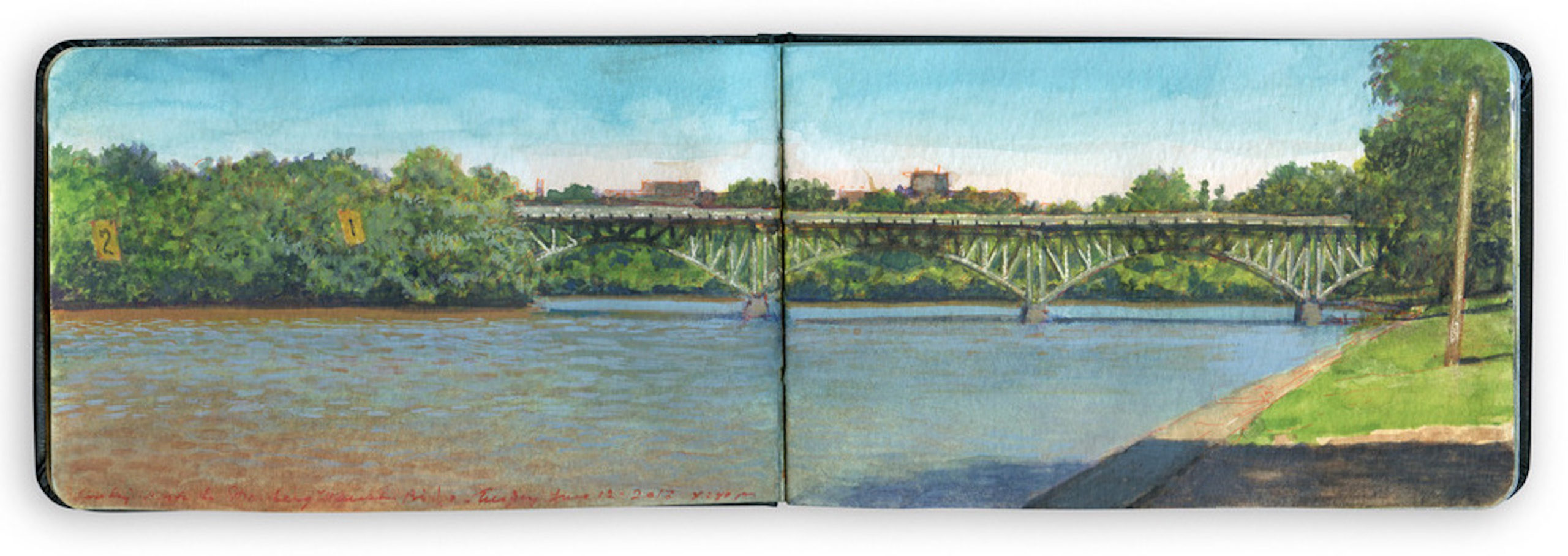
Looking North toward Strawberry Mansion Bridge. June 12, 2018. O.T.W. (On the Water) Schuylkill River Sketchbook

Stretching southward along the west bank of the Schuylkill, between Saint Joseph’s University Gillin Boathouse and the grandstand beside Columbia Railroad Bridge is a broad, grassy embankment sloping gently down from Kelly Drive to a stone bulkhead on the riverbank. Traversed by pedestrian and bike trails, the strand is sheltered beneath a canopy of trees. At its northern extremity is Strawberry Mansion Bridge. Taking its name from an eighteenth-century estate originally known as Summerville, the span was hailed as a marvel of modern engineering. Privately funded, the entire structure was prefabricated twenty-five miles upstream by Phoenix Iron Company and assembled at its present location in 1897. Its filigree steel arches soared above the river, conveying trolley-cars, pedestrians, and vehicular traffic between the eastern and western sections of Fairmount Park. Trolleys stopped running in 1946. After decades of hard use and disrepair, the bridge underwent a major restoration. Work began in 1991 and was completed four years later, just two years shy of the bridge’s centennial.
Just behind my point of view is a parking-lot. Beyond that is the grandstand used for viewing rowing competitions organized by the Schuylkill Navy. Fishermen cast their lines in the river. Sunbathers and picnickers pick their spots along the esplanade. To the left, across the channel is Peters Island. By mid-twentieth century, the wooded sandbar had been married to the right bank of the river by silt, mixed with crushed coal. Before the right-bank channel was reopened in the nineteen-fifties, Peters Island was notorious for clandestine trysts. Stretched between the eastern shore of the island and the left bank of the river is a steel cable, from which are suspended numbered lane-markers to help rowing-crews maintain their positions.
Southeastern Pennsylvania had been deluged overnight by a series of massive thunderstorms. Whenever this happens, effluvia from sewage-treatment facilities upstream sometimes enters the river, tinting it a muddy orange. Under a clear blue sky, the effect has a certain visual appeal. For fishermen, it’s definitely a catch-and-release kind of day.

(A preview of SKETCHBOOK TRAVELER by James L. McElhinney (c) 2020. Schiffer Publishing).

Copyright James Lancel McElhinney (c) 2020 Texts and images may be reproduced (with proper citation) by permission of the author. To enquire, send a request to

ed******@ne***********.com
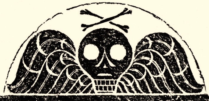


A Modest Proposal for Getting Past Doomsday

A sage once said that anyone can see the future, provided they don’t care how it will affect them. Most people are terrified by the prospect of death, but there are things far worse—most of them cruel and unnatural. Sensible people are doing what they can to dodge the reaper, but none have a playbook for managing what awaits them in the aftermath. Consider this:

Imagine one morning you wake up, make coffee, switch on your computer and look at the news. In one of the side-banners is an obituary. Oddly the deceased has the same name as you, the same birthday, same date, same year. They have the same address as you, same partner, same everything. Rest in Peace.

A week later, you learn that your late lamented doppelganger has in their will left you all their assets, goods, chattels, and property, real and personal. What do you do?

Answer that question and there is your game-plan. Good luck!

April 21, 2020. Quaranteam Traveler. Bonus Dispatch

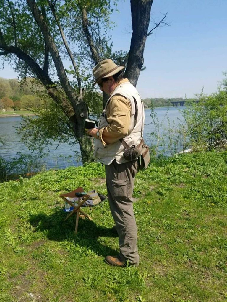
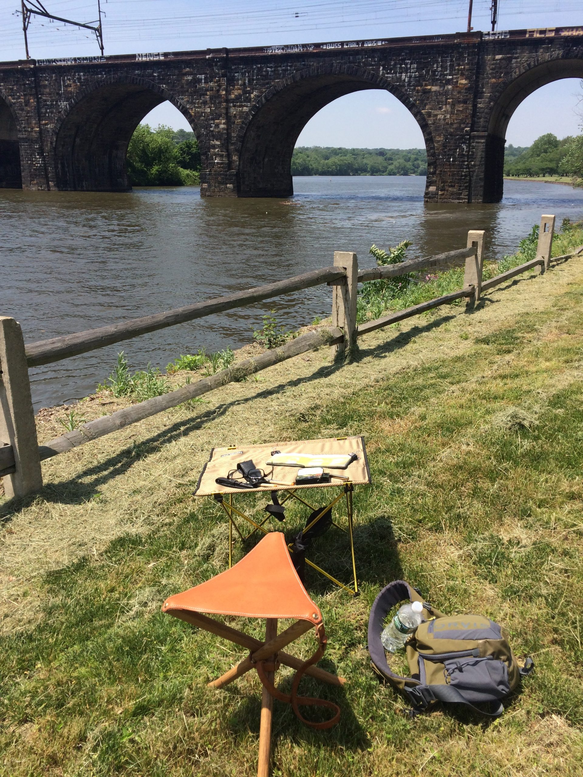
Having received request for information about my field practice, today let’s take a break from looking at art, to look at what you bring to the field, should you wish to pursue mindful travel through drawing and writing


Field setup along the Schuylkill River in Philadelphia. 2018

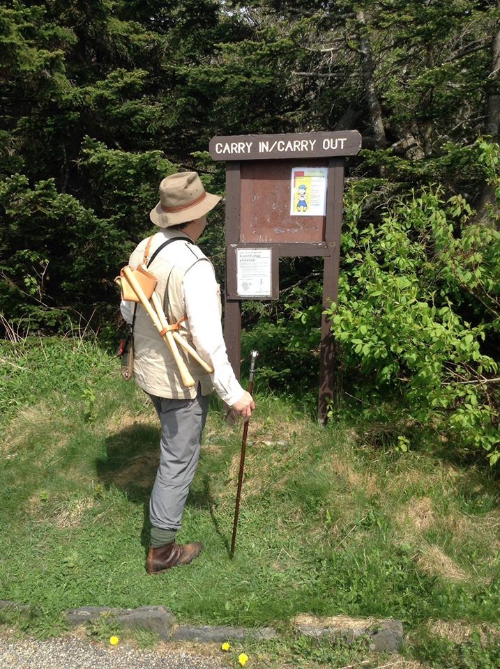
Note to self. Field kit for day-trips to wild places.Orvis bush shirt, Outback Trading Co. or Filson crushable waxed cotton wide-brimmed round-hat. Drake’s (London) neck-scarf/cravat. Duluth Trading company travel-vest. Season-appropriate cargo pants. Filson belt. Woolen socks (all seasons). All-season yellow deerskin gloves, Danner hiking boots, Wolverine oiled leather 1000-Mile boots, or knee-length Chippewa snake-boots (for protection against briars and venomous reptiles). Orvis snake-proof knee-gaiters are an option. Handmade belt-knife. Compass. Brass-tipped Yew walking-stick with wrought-iron rams-head Branscombe Forge, Devon, England. Telescoping REI walking-stick is also recommended. Wood & Faulk folding tripod stool with leather seat & carry-strap. Filson field-bag, or Frost River field-satchel, or Orvis Safe Passage fishermen’s bag. Kaweco (Austrian) brass pencil (port-crayon) and fountain pen. Sakura Sakura Micron colored pens (orange and brown) Watercolor travel-kit (Golden Paints QoR watercolors; Schmincke, Kremer, Maimeri, Sennelier-brand enameled steel travel-sets, with integral water-flask. Escoda or DaVinci travel-brushes, Paper towels, folded, carried in a reusable zip-lock bag. Safety razor. Moleskine watercolor journal. Pocket notebook. Maps. Mobile phone. Backup charger with cord. A quart-canteen of drinking water. Food: sandwiches, bag of almonds. Sunglasses. Sunscreen. Insect repellent. Travel protocols. When venturing out alone, know where you are heading. Let someone else know your travel/hiking plans. Stick to your schedule. Keep a log. Note date, time, location (map coordinates) with line-of-sight vectors (compass headings), temperature, weather conditions; nature of terrain, flora and fauna. Pay attention. The greatest show on earth is the earth itself.


Leaving no Trace at Mount Greylock, Williamstown, Massachusetts


Atop Eyjafjallajokull, Iceland. Note the sketchbook in hand. Crossing the glacier in out ascent, Arne stopped his SuperJeep, got out and deflated the tires 20% to increase traction. He had a tank of compressed air in the rear of the vehicle to reinflate them when we returned to a hard surface. He jumps in the car, takes off his sunglasses and puts on a more expensive pair that was in the side-pocket of his door. I asked him what he needed to change eye-wear.
“We’re crossing this glacier (pronounced gloss-ear). It’s full of crevasses. I think the snow-pack is deep enough that we can’t fall through, but you never know. This is the first clear day we’ve had like this for nine months. It’s up to you. Shall we go for it?”
As he guided the Jeep around unseen pitfalls and obstacles, at times yawing twenty degrees to one side or the other, we crawled upward.
“You know,” I said. “If we do die, I’ll be sure to tell Saint Peter that in spite of everything, you were an excellent driver.”
Looking sharply me, he furrows his brow. Pointing upward, he asks, “What makes you think I want to go THERE?”

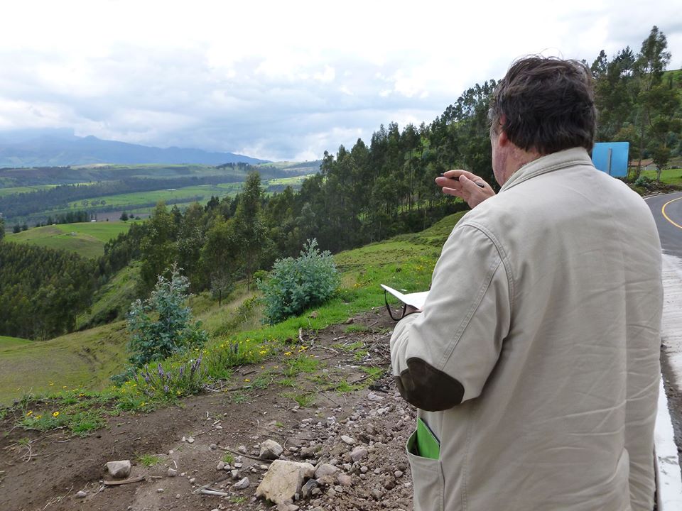
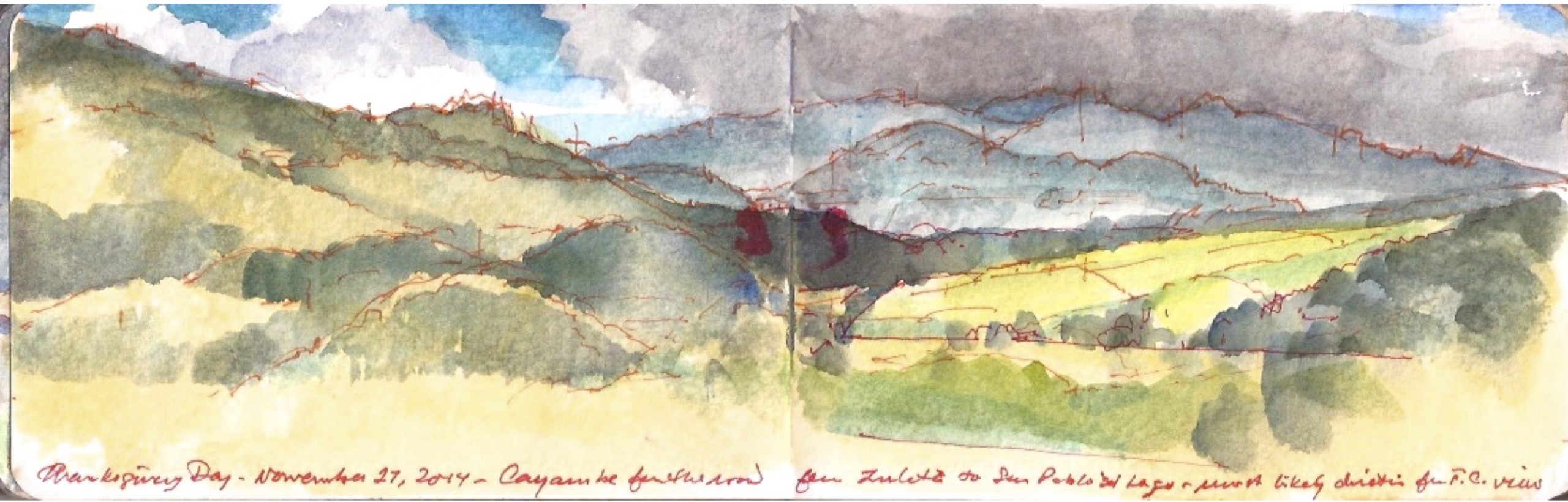
Below: Making a sketch of Cayambe, on the high road between Zuleta and San Pablo, Pichincha Province Ecuador. November 27, 2014.

Cayambe. November 27, 2104

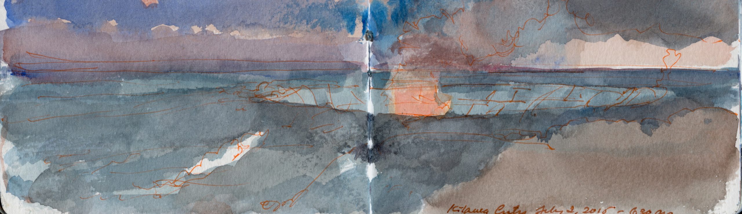
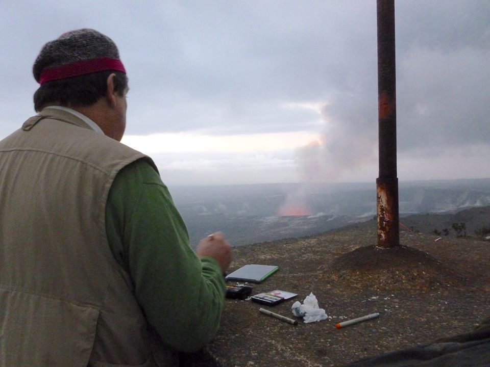
BELOW: Painting at the summit of Kilauea, Hawai’i. Dawn. July 1, 2015

Dawn at Kilauea. July 1, 2015

OUTDOOR JOURNAL-PAINTING GEAR AND SUPPLIES
The mission of expeditionary journaling is to devote as much time to engaging with your surroundings, carrying no more gear than a small messenger bag, or multi-pocket travel vest. Here are the essentials: (Scroll down to the link)

Download (PDF, 600KB)

(A preview of SKETCHBOOK TRAVELER by James L. McElhinney (c) 2020. Schiffer Publishing).

Copyright James Lancel McElhinney (c) 2020 Texts and images may be reproduced (with proper citation) by permission of the author. To enquire, send a request to

ed******@ne***********.com


April 21, 2020. Quaranteam Traveler Dispatch #21.

The world we have known can never be the same. We can beguile ourselves with the vain hope that things will return to normal, forgetting that the world has always been in flux. Human evolution has been driven by geological upheaval, climate change and plagues. Mortal crises test us. For the first time in the history of the planet, a unique intelligent life-form has been focused on a single natural disaster, in real time, at the same moment in time.
Trying to make lemonade out of bitter fruit, these quotidian posts are offered as messages of hope, not just for our own survival, but as motivation to redirect our attention to the world around us, to treasure what we had previously taken for granted, drawing strength, wisdom and compassion from deeper engagements with nature.


POET’S WALK. Hudson Valley Sketchbook. July 7, 2011

(Image and text were featured in the exhibition James McElhinney. Discover the Hudson Anew, curated by Laura Vookles. Hudson River Museum. Yonkers, New York. September 13, 2019 to February 16, 2020.

Poets’ Walk, Annandale-on-Hudson, New York

Located on the left bank of the Hudson a few miles upstream from Kingston-Rhinecliff Bridge is a rolling tract of land that was developed as a private pleasure-park in 1849. Wealthy families having built estates atop the bluffs set aside a tract of uncultivated land for the enjoyment of nature and the improvement of health. They hired German landscape architect Hans Jacob Ehler to divide the land between clearings and woodlands, laying out trails, view-sheds and pavilions. Washington Irving, William Cullen Bryant and other notable recipients of Delano and Astor hospitality are said to have drawn inspiration from their rambles at Poets’ Walk. In recent years the park has come under the control of Scenic Hudson Land Trust, which maintains the trails and other amenities for year-round public use. Having visited the park on numerous occasions, I have never failed to meet other hikers on the trails without the exchange of pleasant greetings. Setting up to work from one of the wooden benches set out along the trails, or on the portable stool strapped to my back, I never suffered any kind of interruption or distraction. Perhaps visitors might slow their pace as they pass me, or steal a glance over my shoulder as they stride by. It seems that such places might promote civility, as much as they inspire bards.

(A preview of SKETCHBOOK TRAVELER by James L. McElhinney (c) 2020. Schiffer Publishing).

Copyright James Lancel McElhinney (c) 2020 Texts and images may be reproduced (with proper citation) by permission of the author. To enquire, send a request to

ed******@ne***********.com


April 20, 2020. Quaranteam Traveler Dispatch #20

Despite our temporary confinement, we can still celebrate travel. These quotidian posts are shared as messages of hope, that when this crisis ends, we will discover outdoors, wonders we had taken for granted, drawing strength, wisdom and compassion from deeper engagements with nature.


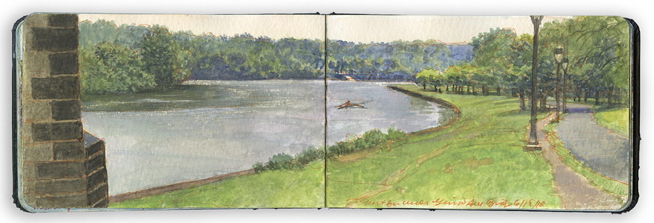
Looking North from Below the Connecting Railway Bridge.Schuylkill River Sketchbook.

Exploring the banks of the Schuylkill River in 2018, between the mouth of Wissahickon Creek and Fairmount Water-Works, I filled a sketchbook with journal-paintings. Later that year these would become a limited-edition suite of prints, and the centerpiece of the installation O.T.W. On the River, at Independence Seaport Museum in Philadelphia. The installation also included works by living artists Patrick Connors, Tom Judd, Stacy Levy, Deirdre Murphy, Jacob Rivkin and Joseph Sweeney and historic artists Edmund Darch Lewis, Johann Georg Martini and Granville Perkins.

LOOKING NORTH FROM BELOW THE CONNECTING RAILWAY BRIDGE
Surrounding this pastoral setting is a twenty-first-century city and a palimpsest of human mobility. For thousands of years prior to the arrival of Europeans, the Schuylkill River was a major thoroughfare for Native Americans. From 1815 to 1931 a series of locks and canals linked Pennsylvania coal regions with Allentown, Reading, Phoenixville, and Philadelphia. Footpaths, motorways, and railroads border both banks of the river. The Schuylkill is crossed by ten bridges between Fairmount and East Falls.
I began this painting on a rainy day, facing northwest, sheltered by one of the eastern arches of the Pennsylvania Railroad Connecting Bridge. Kelly Drive is at the right. A paved bike trail runs beside it, separated from traffic by grassy margins. Next to it, a worn dirt track follows the crest of a bank that descends to the river. Hidden behind the wooded western bank at the left is Martin Luther King Jr. Drive. Just beyond that, the roaring din of the Schuylkill Expressway restrains us from pastoral reverie. On the far shore, ahead is the wide metal ramp and dock operated by the Philadelphia Dragon Boat Association. On the water in the middle distance, a single scull sits where Eakins painted himself, pulling away from Max Schmitt.

April 19, 2020. Quaranteam Traveler. Dispatch #19.

These writings and artworks celebrate personal mobility, in pursuit of mindful engagements with history, nature and the environment. Beholding the world around us with care and attention is an act of reverence. Offered as messages of hope and solidarity, these quotidian posts will continue until the present emergency is behind us.

Traveling to New Mexico early in 2019, I explored the Rio Grande between John Dunn Bridge and Cochiti Reservoir. Sites were selected for narrative reasons, as well as for their visual allure. Many of the works I produced, including my painting-journal, were exhibited at Gerald Peters Gallery in Santa Fe, in the exhibitions Reimagining New Mexico, from June 28 to August 3, and Speaking to the Imagination / The Contemporary Artist’s Book, from June 21 to October 24.


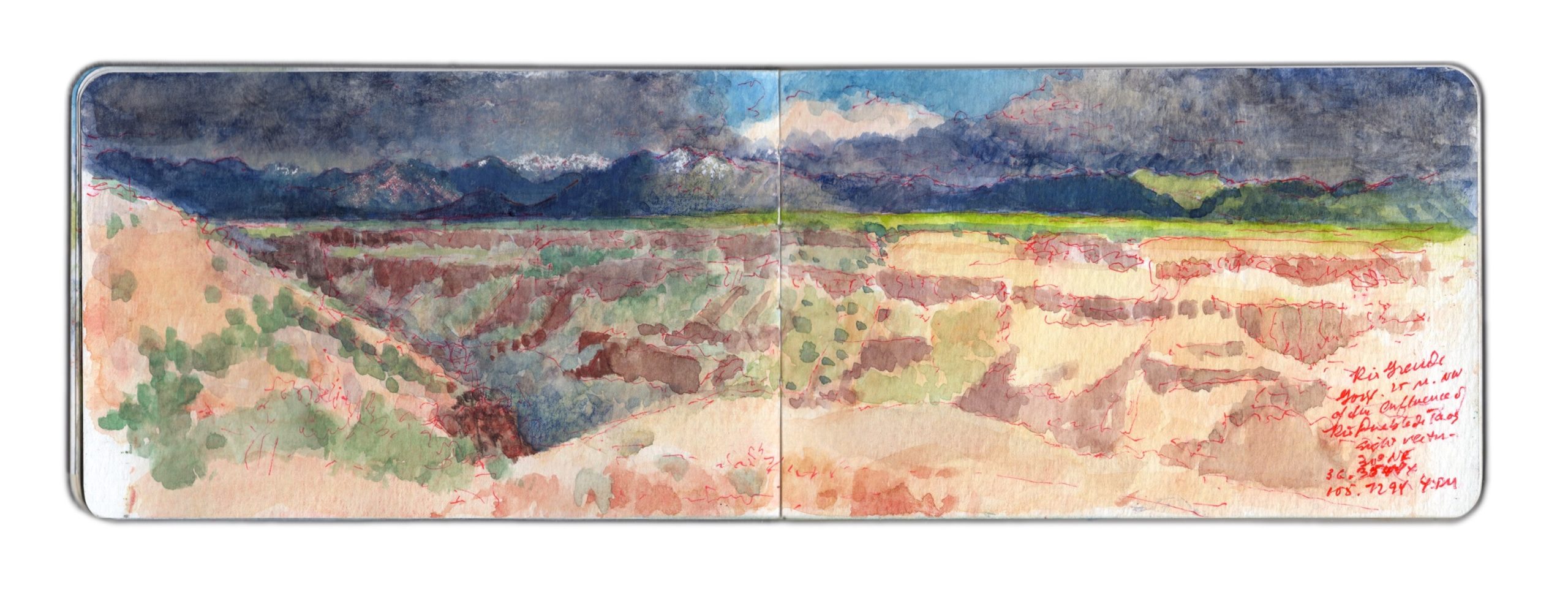
May 8, 2019. Near the Trail-head above Taos Junction. 30 degrees NE. 36.3544 x 105.7294

Wake early, make journal entries, posting them on social media. Simple breakfast. Work in the studio. Decide to try to produce a concertina book. Call Artisan, ordering cut foam-core to serve as (2 each) supports of the books (10 x 48”), and large works on paper (22 x 30”). Set out to work at White Rock Canyon, but dark clouds over the Jemez Caldera cause me to rethink my plan. Instead I drive pas Black Mesa, taking photos for reference. From there I follow the river to Ohkay Owingeh (San Juan Pueblo), crisscrossing the river. Chary of setting up in Indian land, I follow the Chama River for a distance before heading toward Ojo Caliente.
The area is agricultural. The village appears to survive off the revenue from guests staying at the eponymous spa and resort, surrounded by a modest number of satellite B&Bs and restaurants. I do not tarry A long mesa rises more than a thousand feet to my right (east). Continuing north on US285 toward Antonito, the land rises gradually, until the roadbed is level with the plain atop the mesa. I turn right onto NM567, passing a number of US Forest Service roads. I pull into one reddish dirt road, check my location and take a few photos looking south, toward the mouth of Rio Grande Gorge. Mental note. Rent a 4WD off-road vehicle. Ten miles to Canada de Embudo. Check the map later. Returning to NM567, I guide my Subaru eastward. The road seems to have been laid down onto the terrain with a straight-edge, running from west to east.
The land falls away to the south. Red soil gives way to sharp gravel and dark rocks. All is covered by the familiar scattering of sage and pinyon, a bushy sea of celadon and jade. Gullies widen into arroyos, revealing rocky layers like icing on a cake, breaking through the soil.
Suddenly, the drawing-board that plotted my course sends the two-lane blacktop into a ninety-degree turn to the left. Black and yellow zebra signs proclaim the event. I pause, look at the map. Country Road C-115 carries on to the north, toward US64 and the gorge high bridge.
State road 567 turns right, to the southeast, winding its way down to Taos Junction Bridge.
I follow the road, as it slowly descends along a gentle grade. Ahead can be seen the rocky walls of the Rio Grande Gorge. A few hundred yards to the left I see a group of parked cars, most with rooftop carriers. Just before the main road plunges down a series of OMG switchbacks, I turn left onto a dirt road, which leads to one of the western rim trailheads. I park alongside an SUV and walk toward the rim. Following a brief reconnaissance, I set up to paint. Selecting a sight-vector of 30 degrees northeast, I open the book and get to work. Measuring distances, gauging relative spatial depth, and mapping different features and landmarks, I find myself drawn to the simplicity of the composition—a dark leftward arrow, underlining the upper band of snow-capped mountains. Below the horizontal, abstract patterns of rock-layers and vegetation remind me why this very terrain had so enchanted Stuart Davis, Marsden Hartley and Georgia O’Keeffe. A thunderclap sounds behind me. Towering off to the west, black clouds seem to stride on graphite slabs—diaphanous curtains of promiscuous downpours. Scattered drops strike the dusty soil, like the shotgun pellets and .22 bullet-holes that pepper an interpretive sign at the parking-area. The storm moves eastward, four or five miles to the north. Native artists set up in the parking-lot next to the bridge on US64 must be scrambling to cover their tables, or put away their wares before the deluge arrives. Suddenly, bright sunshine warms my back. Shadows darken. Edges sharpen. The northern stretch of the canyon is thrown into darkness. Across the chasm, the vertiginous layer-cake effect of volcanic rock and alluvial sediment pales in the sunlight. Umbrageous clouds shroud the mountains beyond. Too much to absorb in one sitting, or to commit to paper with pigment, water and weasel hair.
One speaks of the Sublime, but talk is cheap. One cannot comprehend it, without knowing fear and awe. Speaking at a conference in New York in the nineteen-nineties, I shared that going into the wild, I sometimes wore a revolver on my hip—as an argument against feral dogs, rabid mammals and venomous snakes. Sitting in the audience, another presenter—the late Martha Mayer Erlebacher—raised her hand and commented. “I love it. Art as a life or death experience!”

(A preview of SKETCHBOOK TRAVELER by James L. McElhinney (c) 2020. Schiffer Publishing).

Copyright James Lancel McElhinney (c) 2020 Texts and images may be reproduced (with proper citation) by permission of the author. To enquire, send a request to

ed******@ne***********.com


April 18. 2020. QT Dispatch # 18

Despite our temporary confinement, we can still celebrate travel. These quotidian posts are shared as messages of hope, that when this crisis ends, we will discover outdoors, wonders we had taken for granted, drawing strength, wisdom and compassion from deeper engagements with nature.


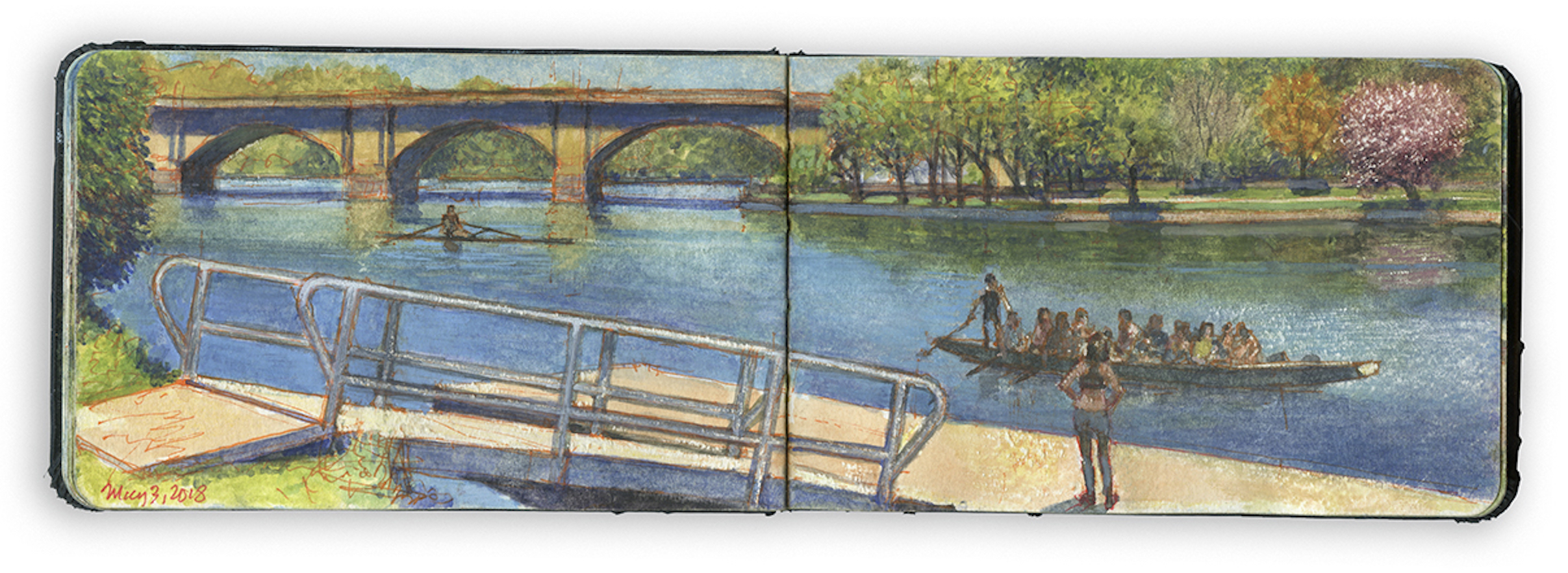
Dragon-Boat Dock. May 3, 2018. Schuylkill River Sketchbook.

Exploring the banks of the Schuylkill River in 2018, between the mouth of Wissahickon Creek and Fairmount Water-Works, I filled a sketchbook with journal-paintings. Later that year these would become a limited-edition suite of prints, and the centerpiece of the installation O.T.W. On the River, at Independence Seaport Museum in Philadelphia. The installation also included works by living artists Patrick Connors, Tom Judd, Stacy Levy, Deirdre Murphy, Jacob Rivkin and Joseph Sweeney and historic artists Edmund Darch Lewis, Johann Georg Martini and Granville Perkins.

Note on the image:

The Philadelphia Dragon Boat Association celebrates an ancient paddling tradition that began in South China, more than 2500 years ago. The sport was revived in Hong Kong in 1976. Within a few years, dragon-boats appeared on the Schuylkill River. The Philadelphia club has since won numerous international competition. Long, sleek and colorful, dragon-boats are unmistakable. With a crew of twenty-two, paddlers chant with every stroke. The sport has Asian roots, but crews are ethnically diverse. The dock used by the PDBA is located on the west bank, downriver from Columbia Railroad Bridge, near the intersection of Black Road and Martin Luther King Jr. Drive.
Below the bluffs, the floodplain behind the shoreline was once a series of marshes and wetlands, a breeding-grounds for mosquitoes. Deadly outbreaks of Yellow Fever led civic leaders to transform pestilential swamps into broad embankments. The eastern banks were girded with masonry revetments, while the western shore was treated with tender loving neglect. The Outrigger Canoe Club and P.D.B.A. have breathed new life into the wooded and less accessible right bank. Thomas Eakins chose this stretch of shoreline for his painting Max Schmidt in a Single Scull from this stretch of shoreline in 1871, the same year a monument to explorer Alexander von Humboldt by sculptor Frederick Johann Heinrich Drake was installed at the foot of the Pennsylvania Railroad Connecting Railway Bridge, a quarter-mile downstream. Moved from across river to its present location when the bridge was widened in 1912, Humboldt now stands in a grovw of trees behind the Dragon-Boat dock. A prominent member of the rowing community now wants to move the Humboldt monument from its sylvan abode to the campus of Drexel University. One suspects that Humboldt might not rather stay put.


On site near Dragon-Boat Dock.
Photograph by Virginia Baltzell.

(A preview of SKETCHBOOK TRAVELER by James L. McElhinney (c) 2020. Schiffer Publishing).

Copyright James Lancel McElhinney (c) 2020 Texts and images may be reproduced (with proper citation) by permission of the author. To enquire, send a request to

ed******@ne***********.com


April 17, 2020. Q.T. Dispatch #17

The world we have known can never be the same. We can beguile ourselves with the vain hope that things will return to normal, forgetting that the world has always been in flux. Human evolution has been driven by geological upheaval, climate change and plagues. Mortal crises test us, like running a marathon. In the last week, four people whom we loved and admired have passed away. Calamities like COVID-19 remind us of the fragility of life and the durability of the human spirit. For the first time in the history of the planet, a unique intelligent life-form has been focused on a single natural disaster, in real time, at the same moment in time.
Making lemonade out of bitter fruit, these quotidian posts are offered as messages of hope, not just for our own survival, but as motivation to turn our attention to the world around us, to treasure what we had previously taken for granted, to draw strength, wisdom and compassion from deeper engagements with nature.

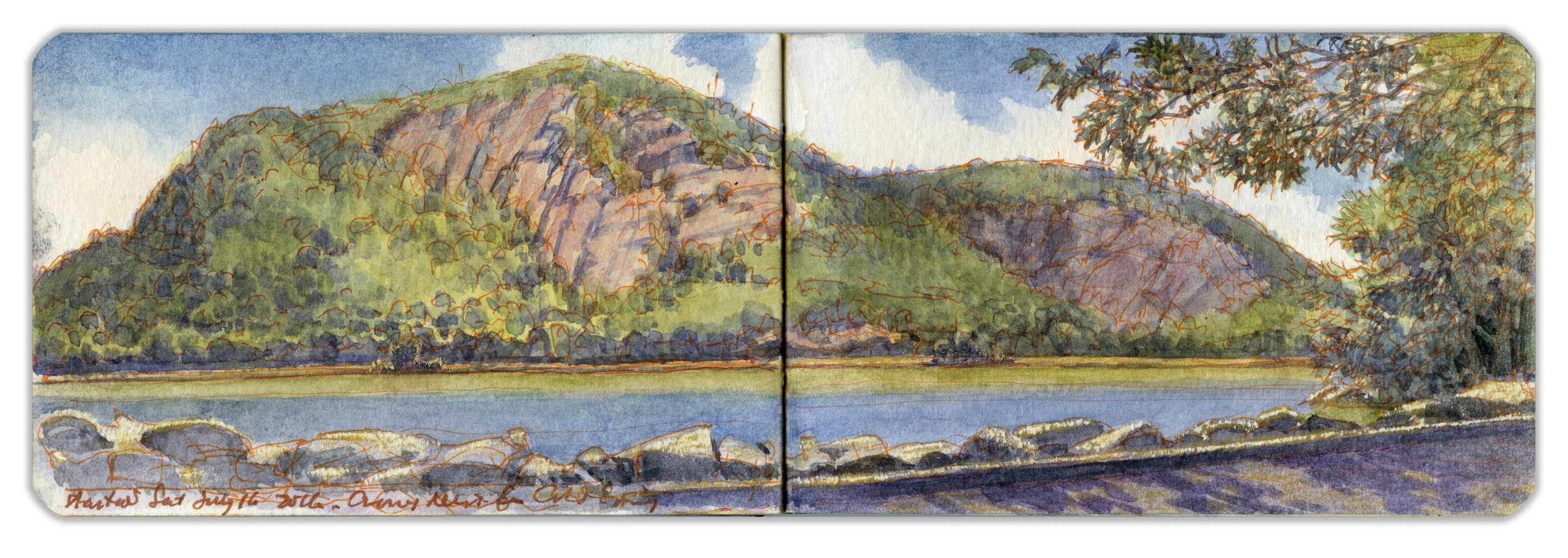
CROW’S NEST MOUNTAIN FROM COLD SPRING LANDING. Saturday July 16, 2016.

Located in the Hudson Highlands, an hour’s drive north of Manhattan, the village of Cold Spring was given its name by George Washington after refreshing himself at a nearby spring. In colonial times, the village was nothing more than a cluster of buildings by a river landing on the estate of Adolphus Philipse. In 1817, Gouvernor Kemble established the West Point Foundry just south of the village. For nearly a century, as the facility produced artillery-pieces and ammunition for the United States Army, the village grew into a town. Cannon tubes were finished, inspected, and tested by firing live rounds at Crow’s Nest Mountain, across the river. The rocky slopes are said to be littered with thousands of cannonballs and unknown quantities of unexploded ordnance. The infamous pirate William Kidd is said to have buried his loot at Kidd’s Plug, the rocky outcropping at the base of the distant cliffs. Putnam County poet George Pope Morris praised the mountain in verse:

“Where Hudson’s waves o’er silvery sands
Winds through the hills afar,
And Cro’ Nest like a monarch stands
Crowned with a single star.”

(Image and text were featured in the exhibition James McElhinney. Discover the Hudson Anew, curated by Laura Vookles. Hudson River Museum. Yonkers, New York. September 13, 2019 to February 16, 2020. Published also as a limited-edition in Hudson Highlands. North River Suite Volume One. Needlewatcher Editions. New York. 2018)

(A preview of SKETCHBOOK TRAVELER by James L. McElhinney (c) 2020. Schiffer Publishing).

Copyright James Lancel McElhinney (c) 2020 Texts and images may be reproduced (with proper citation) by permission of the author. To enquire, send a request to

ed******@ne***********.com


April 16. Q.T. Dispatch # 16.

.

Two weeks ago, I published the first in a series of daily website blog-posts. These writings and artworks that celebrate personal mobility, in pursuit of mindful engagements with history, nature and the environment. In relation to a finished painting, book, or an essay, this process is by itself as much a work of art as is the tree is to the fruit it bears. This practice might be seen as ceremonial. Beholding the world around us with care is an act of reverence. Offered as messages of hope and solidarity, these quotidian posts will continue, until the emergency is behind us.


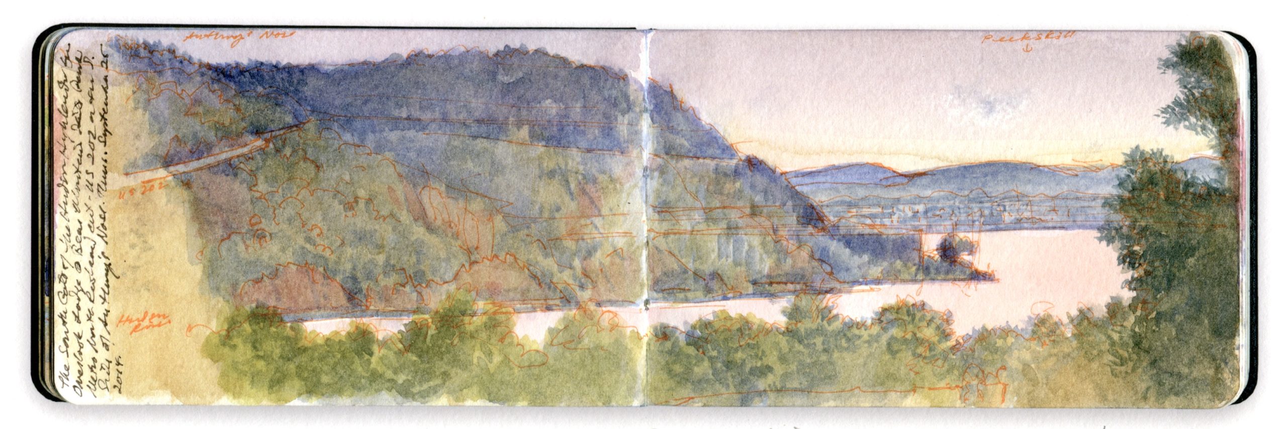
SOUTH GATE FROM BEAR MOUNTAIN. Watercolor and pen on Moleskine watercolor sketchbook. 3.5 x 10 inches. 2016

Bending around Trophy Point, the river follows a straight course for several miles, passing Buttermilk Falls and a small island known as Con Hook below the guns of Fort Montgomery on a bluff just north of where Popolopen Creek spills into the Hudson. It was here that American patriot forces stretched a heavy iron chain floating on a series of rafts across the river, below the mountain known as Anthony’s Nose. Connecting its vertiginous western face to Fort Clinton—Montgomery’s twin—on the bluff south of Popolopen Creek is Bear Mountain Bridge. Here the banks of the river widen again. A railway runs along a levee, enclosing an arm of the river that has become marshland over the years. The tracks cross Iona Island, which served as a naval weapons depot during the twentieth century. Parts of the rocky islet remain off-limits to the public. To the south, reaching eastward, is Dunderberg Mountain, or Thunder Hill, the downriver side of the south gate to the Hudson Highlands. Forming the northern gatepost is Roa Hook, below the southern declivity of Anthony’s Nose. Cast in shadow, a small concrete structure marks the location in this painting. The view is from the deck of Bear Mountain Inn’s Overlook Lodge, looking southeast toward the city of Peekskill, across the bay that bears its name.

Image and text were featured in the exhibition James McElhinney. Discover the Hudson Anew, curated by Laura Vookles. Hudson River Museum. Yonkers, New York. September 13, 2019 to February 16, 2020. Published also as a limited-edition in Hudson Highlands. North River Suite Volume One. Needlewatcher Editions. New York. 2018

(A preview of SKETCHBOOK TRAVELER by James L. McElhinney (c) 2020. Schiffer Publishing).

Copyright James Lancel McElhinney (c) 2020 Texts and images may be reproduced (with proper citation) by permission of the author. To enquire, send a request to

ed******@ne***********.com