In 2019, I made four trips to Santa Fe. Exploring the Rio Grande between John Dunn Bridge at the confluence of Arroyo Hondo, and Cochiti Reservoir to the south, key sites were celebrated in journal-painting. Today’s post is dedicated to dear friends and loved-ones weathering the storm in New Mexico and Colorado.

Roadside Vista. Below Pilar, Route NM68. 30 degrees NE from 36.2515102 x 105.801947. Cinco de Mayo, 2019
Driving north on NM68, through Embudo and a cluster of homes known as Rinconada, motorists are greeted by a distinctive geological formation. A Spanish settlement grew up at the base of the hill, on the site of an Apache village destroyed by Diego de Vargas during the Reconquista of 1684. Twenty-Five Spanish families in 1795 had taken possession of a Royal land-grant known as Cieneguilla, which in English might be translated as “little swamp”.
The southeastern face of the hill sheltering the village is sheer rock-face, crowned by a slight overhang. From certain angles, it bears a pareidolic resemblance to familiar images of the Virgin Mary.
Seven years after the crucifixion of Jesus, Saint James the Apostle preached the Gospel in Iberia. According to belief, the Blessed Virgin appeared to him in a vision, from which he received a pillar of Jasper, and instructions to sanctify a house of prayer in her honor. The following year, Saint James established a small church in Zaragoza. Growing over the centuries, the Basilica de la Nuestra Senora de Pilar has become one of two sites most sacred to Hispanic peoples. The other is Santiago de Compostela, which enshrines the relics of Great Saint James.
Scraping a living out of the fertile margins of the great river, Catholic Spaniards may have regarded the hill towering above them as their protectress and salvation. Pilar today is home to the Rio Grande Gorge visitor center, café, and a rafting-tour company.
Today, Taos County Road C-115 runs through the village, then upriver through Orilla Verde to Taos Junction Bridge. Clinging to the vertiginous walls of the gorge, the road climbs to the rim via a series of hair-raising switchbacks. Turning northward, it crosses the plain, intersecting US64 just west of the Rio Grande Gorge Bridge. Continuing north past Pilar on NM68, the road climbs for several miles before reaching the southern edge and wide expanse of the San Luis Basin of the Rio Grande rift
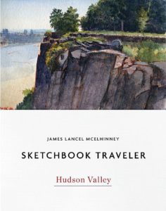
(A preview of SKETCHBOOK TRAVELER by James L. McElhinney (c) 2020. Schiffer Publishing).
Copyright James Lancel McElhinney (c) 2020 Texts and images may be reproduced (with proper citation) by permission of the author. To enquire, send a request to editions@needlewatcher.com