Waiting for the crisis to pass, our thoughts go out to friends and loved-ones who also shelter in place. Old friends pass away, people we loved and admired. Immobilized for the time being, we can revisit destinations, near and far. join me in celebrating the joys of Quaranteam travel, the hope that these diversions might inspire us to value things we had taken for granted, to draw strength, wisdom and compassion from deeper engagements with nature.
(Image and text were featured in the exhibition James McElhinney. Discover the Hudson Anew, curated by Laura Vookles. Hudson River Museum. Yonkers, New York. September 13, 2019 to February 16, 2020. Published also as a limited-edition in Hudson Highlands. North River Suite Volume One. Needlewatcher Editions. New York. 2018)

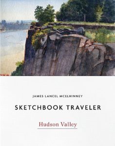
Looking South from Lamont Weather Station at Piermont. Wednesday. September 7, 2016
“About four miles below Nyack is Piermont, at which is the terminus of the New York and Erie Railway. The village is a child of that road, and its life depends mainly upon the sustenance it receives from it. The (railroad) company has an iron foundry and extensive repairing shops there; and it is the chief freight depot of the road. Its name is derived from a pier that juts a mile into the river. From it, freight is transferred to cars and barges. Tappantown, where Major Andre was executed, is about two miles from Piermont.”
–Benson J. Lossing. The Hudson from the Wilderness to the Sea. H.B. Nims & Co. Troy, N.Y. 1866

Piermont jetty juts into the stream by the marsh at Sparkill. Below Tallman Mountain, the western shore becomes a wall of tall basalt. At its foot, thickly wooded margins shade heaps of giant rock fall. Slipping past the eastern shore, past stately homes of patriots, poets, and robber barons, past Manhattan, the harbor islands, and the Narrows, past Brooklyn’s sandy beaches, through Raritan Bay, and beyond Sandy Hook, the Hudson disappears into the Atlantic Ocean. The river is 507 miles long. At a rate of flow averaging three miles per hour, a specific volume of water takes one week to move from the source to the sea. It is intermittently navigable above the tidewater stretch of the river but famously is fraught with treacherous tides and currents. Its indigenous name, Mahicannituck, is translated as “waters that are never still,” or “the river that flows both ways.” A weather-station operated by the Lamont-Doherty Earth Observatory stands at the end of a four-thousand-foot-long pier reaching into the Hudson from the village of Piermont. According to its mission statement, Lamont-Doherty is,
“…a core component of the Earth Institute, Columbia University. Nearly 200 Ph.D. level researchers work and teach there, and 80-90 graduate students are involved in research. Lamont also operates a federally funded research ship, the Marcus G. Langseth, which uses seismic data to map the sub-seafloor, highlighting hidden faults and other earthquake hazards.”
The pier was built in 1838 to accommodate the transfer of cargo and passengers from steamboats and ferries to the Erie Lackawanna Railway. During the Second World War it was a point of embarkation for a million troops. Today the narrow finger of land is maintained as a recreational resource by the village of Piermont. Reaching halfway across the river, he pier is a popular destination for anglers. When the pier was completed, low-patterns created a backwater downstream, around the mouth of Sparkill Creek. A tidal marsh was formed, which is preserved as a classroom for environmental studies and general recreation by the New York State Department of Environmental Conservation. Just downstream of the marsh is Tallman State Park, the northern terminus of the Palisades that extend southward past Weehawken.
The local police diligently patrol the pier, ticketing anyone reckless enough to leave a vehicle unattended. Having established a dialogue with team-members at Lamont, they were kind enough to let me park in one of their spaces. Falling into conversation with one of the locals, I got an earful about how the pier was state land, and thus outside the jurisdiction of village police. The argument made sense. Having never fought a ticket, I never had an opportunity to try it on the judge.
Looking south from the easternmost edge of the pier, the bluffs of Tallman State Mountain Park stand to the right. Punctuating a wooded shoreline, the villages of Dobbs Ferry and Hastings-on-Hudson are followed by the jagged blue profile of Yonkers. Casting shadows broken by golden light, long bands of heavy grey clouds float eastward across the river. At four in the afternoon, the temperature is in the low seventies, with light breezes coming from the west. Barges and pleasure-craft pass by. There is no way to encapsulate for others my awareness of this place in a singular vista. Being mindful of its history and present utility helps sharpen my focus on what I behold, empowered by that knowledge. To paraphrase J.B. Jackson, landscape is human desire, projected upon the terrain. Even if the viewer is unable to extract so much data from my painting, perhaps they will sense it is there and go find it for themselves.
Check out April 2020 Quaranteam Traveler Dispatches
(A preview of SKETCHBOOK TRAVELER by James L. McElhinney (c) 2020. Schiffer Publishing).
Copyright James Lancel McElhinney (c) 2020 Texts and images may be reproduced (with proper citation) by permission of the author. To enquire, send a request to editions@needlewatcher.com