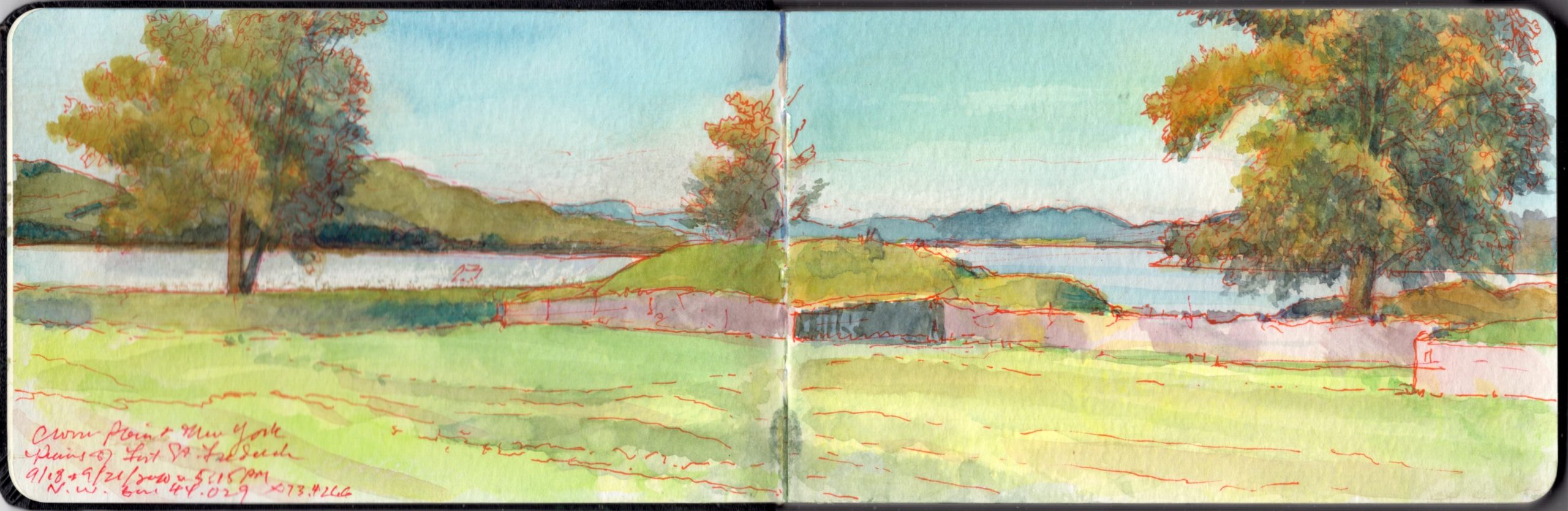
The Ruins of Fort St-Frederic, Crown Point on Lake Champlain. Journal-painting begun during a field-trial of new live, online outdoor workshop format, of Friday September 18, 2020.
The peninsula north of Riviere de la Chute, which carries water from Lake George into Lake Champlain was militarily strategic because it commands the portages between the Saint Lawrence watershed, Lake Champlain (Pitawbagok) Lake George (Horicon) and the Hudson Valley. The eastern corner of Crown Point reaches toward Chimney Point, on the western shoreline of Vermont. The vehicular bridge that first spanned the narrows in 1929 was replaced in 2011.
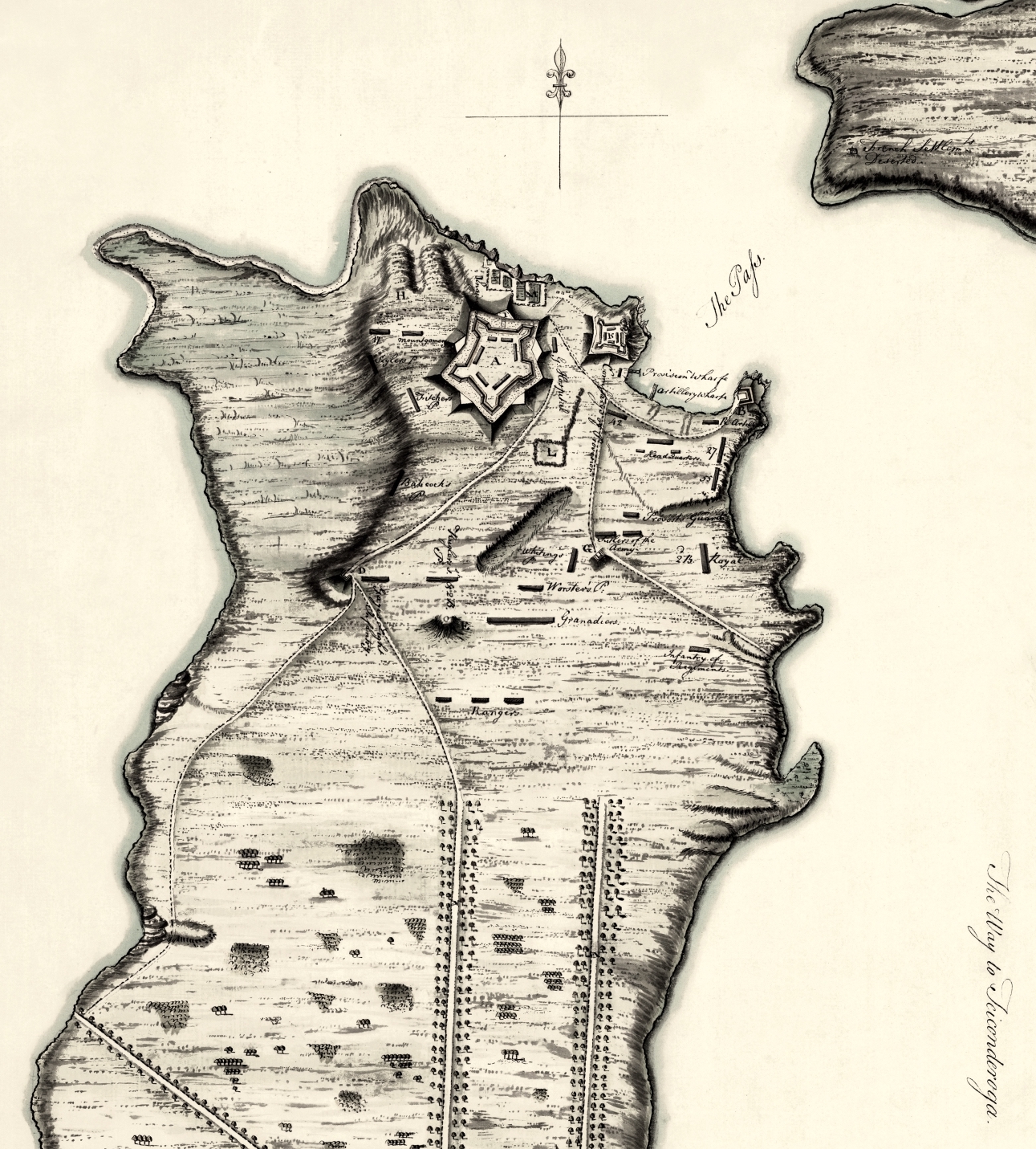
Crown Point, New York. 1759. showing the Grand Fort, the ruins of the French citadel, the disposition of British army camps. Chimney Point, Vermont is seen at top right.
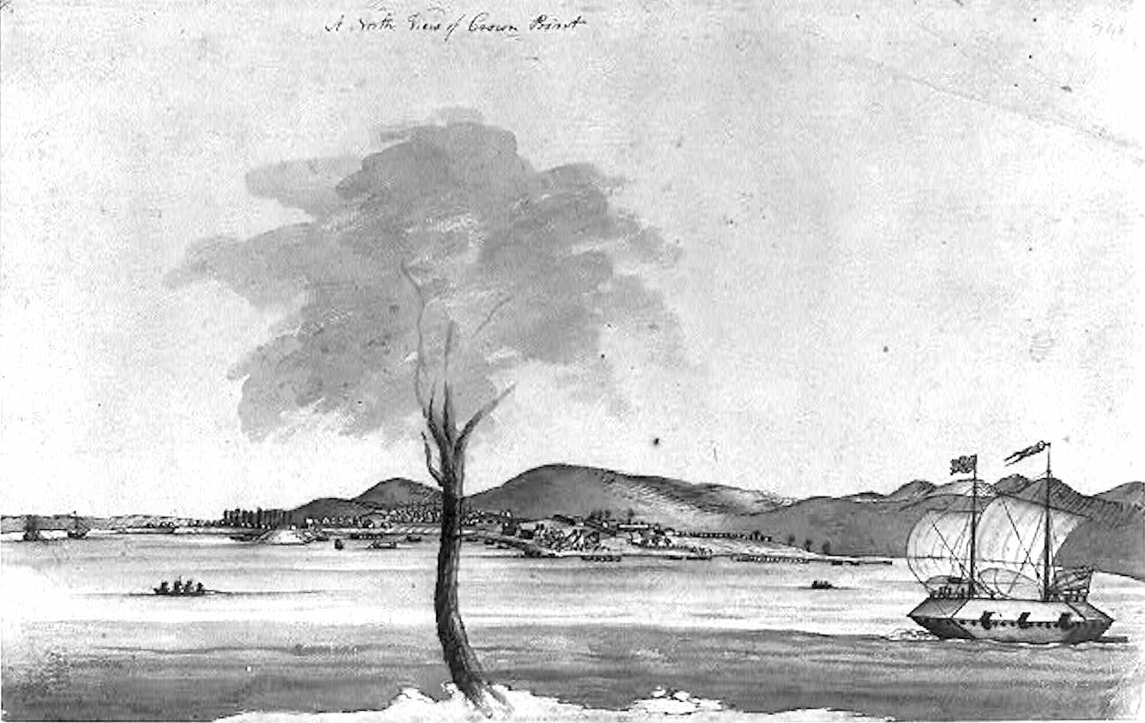
Thomas Davies. Captain, Royal Artillery. 1737-1812. South View of Crown Point. 1759. Davies went on to become a Lieutenant-General and noted naturalist artist. The curious craft is a timber-clad gunboat.
Reaching fifty miles northward from South Bay, Lake Champlain seems no wider than a river in some places. Beyond Crown Point the waters broaden into a series of expansive bays. In pre-colonial days the area between the La Chute and Crown Point was no-man’s-land between territories controlled by the Mohawk nation (Kanienkehake) to the south, and the Abenaki to the north and east. In peacetime it served as a meeting-place and trading hub. During periods of hostility, it became a battleground. Having allied themselves with these traditional enemies, the colonial powers of France and Britain found themselves at odds on the same contested ground. Crown Point served a military function again, during the American War of independence when it changed hands several times. Since 1910 the site has been maintained as a park by the State of New York, with picnic areas, a small museum and hiking trails. Champlain Memorial Lighthouse stands on the easternmost tip of the peninsula.
Crown Point and much of the Champlain region is undergirded with fossilized Ordovician limestone also known as the Chazy Fossil Reef that stretches from Tennessee to Newfoundland. Formed half a billion years ago, its most recognizable characteristic is a layer-cake of strata. The brittle dark grey rock shatters easily under a hammer-stroke, to reveal one of the most diverse arrays of fossils on Earth. This stone was quarried by the French for material to construct Fort Carillon, later Ticonderoga. It was also quarried at Crown Point (Pointe de Chevelure) to build Fort St-Frederique. After 1759 the British built Fort Crown Point with masonry salvaged from the French fortress, augmented with freshly cut stones. Unfinished blocks can still be seen lying near borrow-pits along the shoreline. During the nineteenth century masonry from the historic forts was cannibalized to feed new construction in nearby towns and dwellings. New pits carved out of the ground fed the production of lime.

Graffitti on the rocky ledges, Parade-ground at Ft. Crown Point. Photo: September 2020
Looking at the ruins of eighteenth-century Fort Crown Point, one finds the surrounding moat filled with haps of broken spoil from outcroppings dressed to serve as part of the fort’s outer wall. These surfaces were then covered in masonry, some of which is visible today. Rising up from the parade ground within the fort are several large uptilted rafts of grey limestone. One supposes that General Amherst’s fort had covered these with soil. Perhaps they emerged after the centuries or exposure to the elements. Carved into them are the names of visitors dating back to the nineteenth century. It is hard to imagine red-coated regulars drilling in close formations on such broken ground. These limestone uplifts appear all over the peninsula—some stretching down to the water in broad layered sheets.
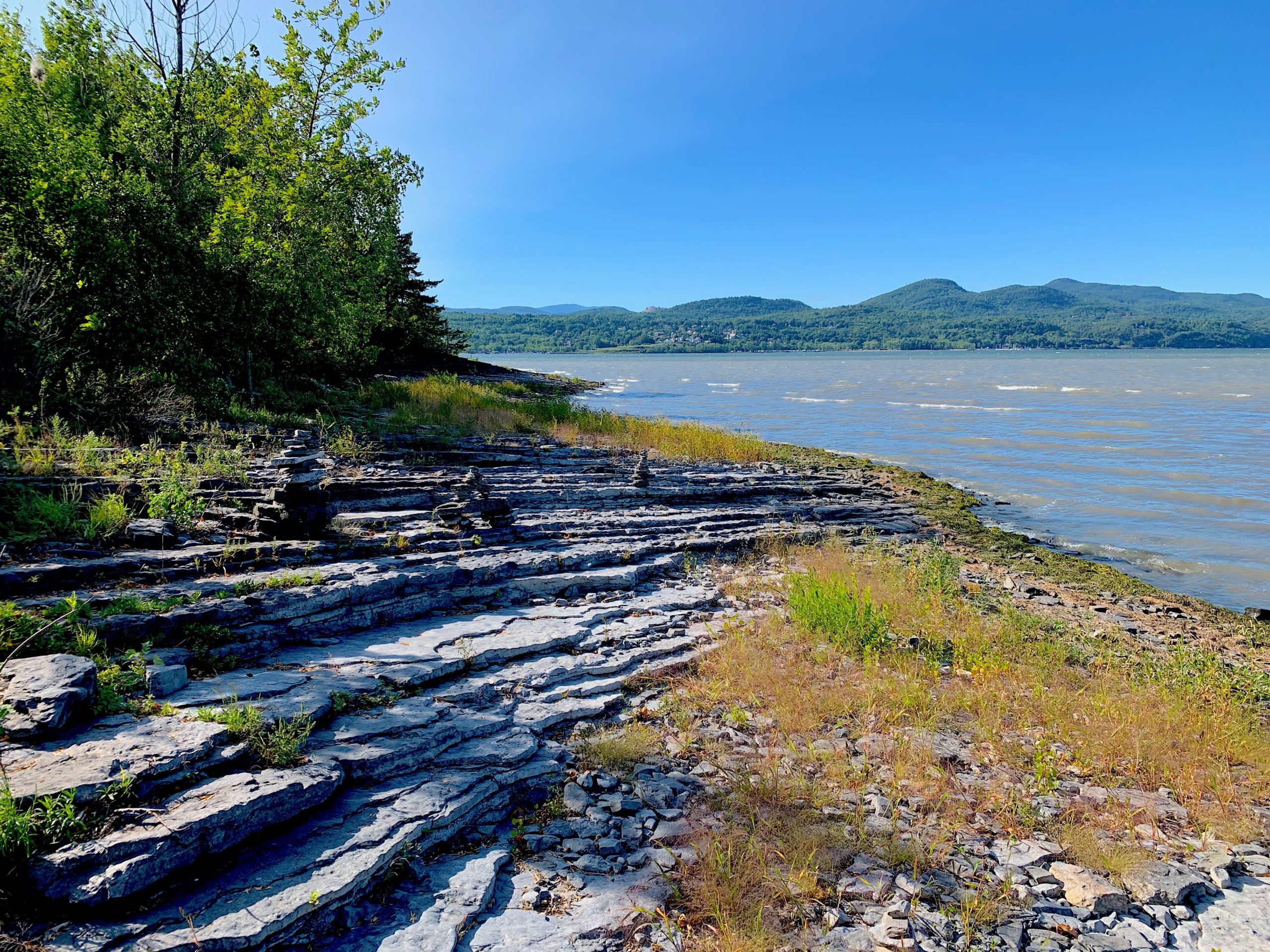
My first visit to Crown Point was in the company of noted author James Howard Kunstler in 1992. I was in the midst of a project that explored Civil War battlefields threatened by commercial development. Fitting my narrative as a spectacular military ruin I chose to overlook the hundred and two-year gap between its construction, and the sectional conflict that tore the nation apart in 1861. Since shifting my base this year from Manhattan to the Champlain Valley I made several visits to the site. After completing an inspection of Fort Saint-Frederique, and a circuit of the battlements of Fort Crown Point, my focus shifted from military history to the natural setting. Walking down a grassy track to a wooded finger of land pointing northward into the lake, a small green frog leaped across my path. Stepping from the grassy track onto a rocky shelf, I noticed the residue of macadam. To my left at the bottom of this ramp was a large pit carved out of the bank.
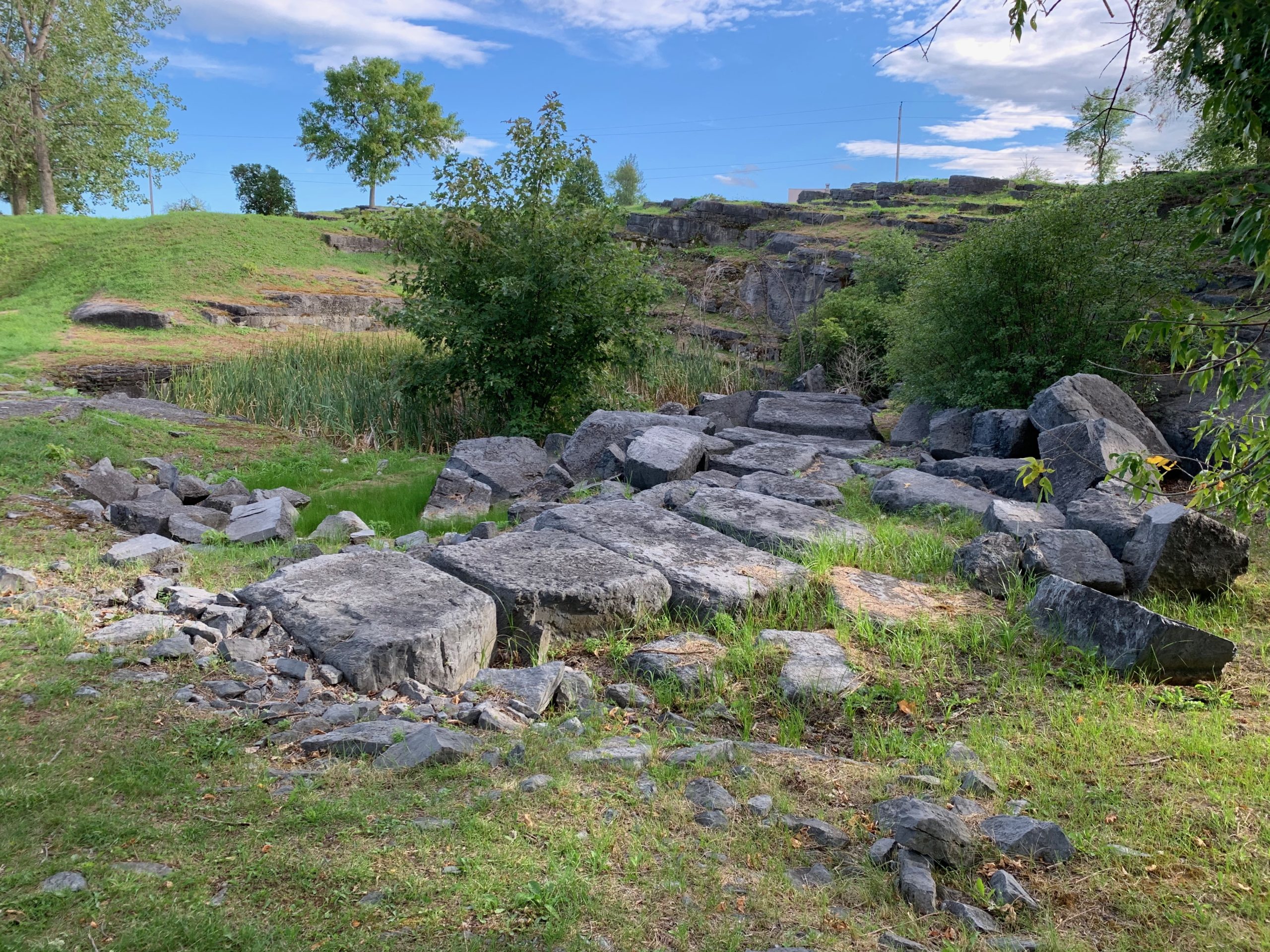
Quarry-pit northwest of Fort Crown Point
Undressed stones lay off to the right. Piles of smaller stones the size of brickbats lay scattered about in heaps. Too small for use as masonry, these would have been piled into one of the lime-kilns that once stood nearby. A cluster of large umbrageous trees at the landward end of the jetty reminded me of a Barbizon painting of Fontainebleau forest. Beyond this grove was a wide rocky beach; a broad crescent reaching westward. Crisscrossed with fractures, long diagonal slabs of limestone angled up from the shoreline. Upon one of these was heaped a gathering of small cairns, different from those I had seen a month ago. Beachcombers set them up. Someone, or something knocks them down. They are reassembled, and then toppled again, like the cycles of nature. Dashed against one of these limestone slabs, a large stone shattered. Instead of coherent fossils within the brittle chunk I found a dense, sparkling charcoal-grey mass variegated with organic patterns of slightly lighter material.
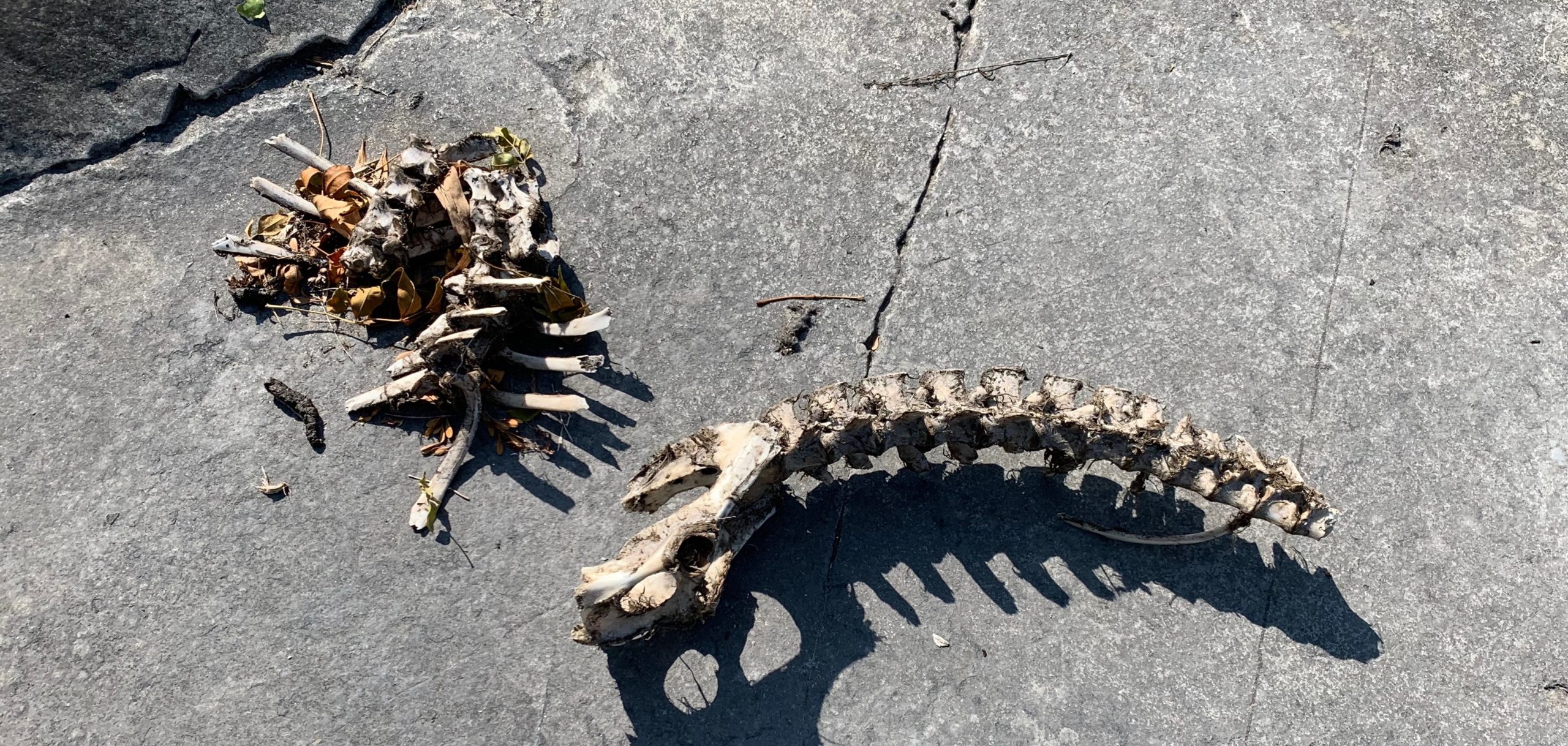
Resting on one of these broad rocky shelves was the spine and pelvis of a medium-sized mammal—perhaps a dog or coyote. A tangle of ribs and rotting lake-grass lay beside it. The absence of blood and the presence of vegetal material led me to wonder if the animal had not drowned. Having washed ashore the rotting carcass might have been dragged onto the rocks by ubiquitous turkey-vultures, leaving scraps from their feast for the gulls and racoons.
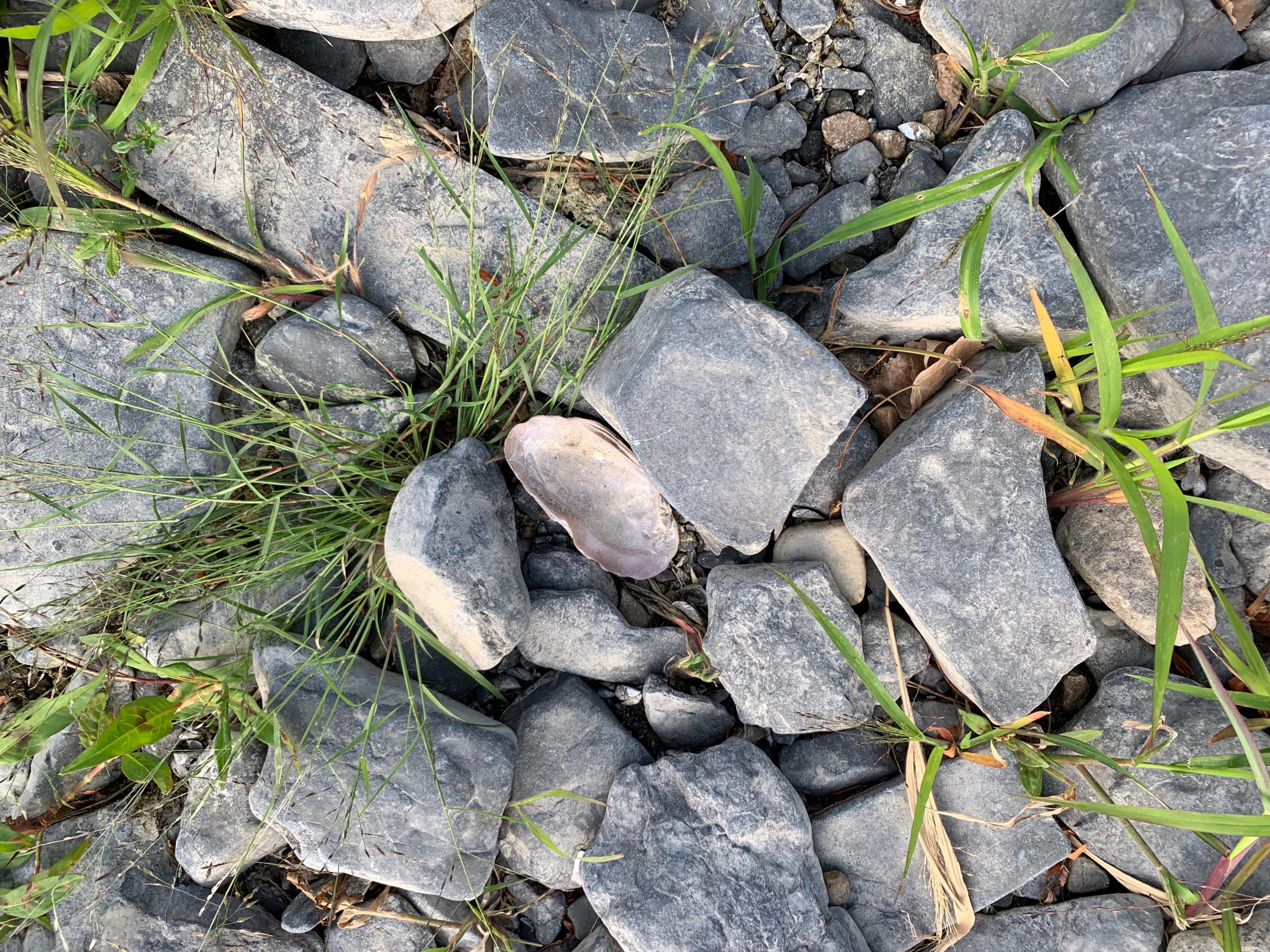
Freshwater oyster-shell, Crown Point New York.
Underfoot I find the shells of freshwater clams and oysters nestled among small rocks. Scaling the grassy slope, I pass the sun-bleached skull and bones of a large bass. A couple makes their way from the end of the rip-rap mole back to shore. The woman waved. The man nodded. Body-language suggested they might have met for a tryst. Following the embankment, a gravel road led into the woods. Passing another couple walking a dog, I was greeted with nods and shy looks. Finding a private residence at the end of the road, I backtracked to a cluster of utility sheds overlooking the green mass of Fort Crown Point to the right, the parking-lot, esplanade and Fort St.-Frederique. Spanning the narrows between New York and Vermont, the Champlain Bridge arced up above a wooded grove beside highway 903.
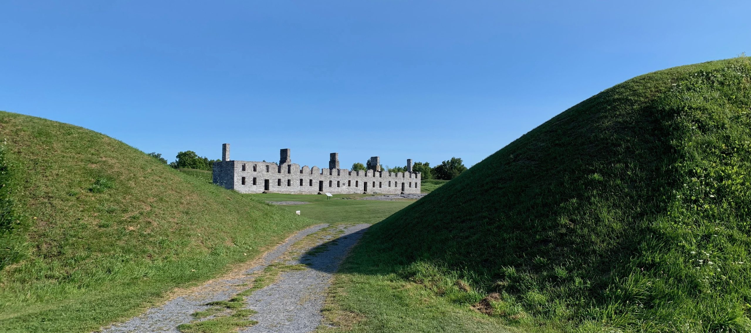
Ruins of the Barracks at Fort Crown Point. Built ca. 1759
Scanning the site, I was reminded that in June of 1775 one of my ancestors had been here; a thirty-eight-year-old first lieutenant in Griswold’s company of Benjamin Hinman’s Fourth Connecticut Regiment. Twenty-six years earlier Captain Thomas Davies of the Royal Artillery had produced a detailed watercolor of the facility from a position three hundred yards southeast of where I was standing. From what I could reckon by looking at maps of the period, today’s parking-area had been covered by workshops and warehouses serving the fort. General Amherst and his staff would have been lodged beside a little cove, just beyond the foot of today’s bridge. A picnic area and events-pavilion now stand on the site of an earthen French redoubt. Rangers and indigenous forces were quartered in huts and wigwams near the site of the present-day park-ranger station.
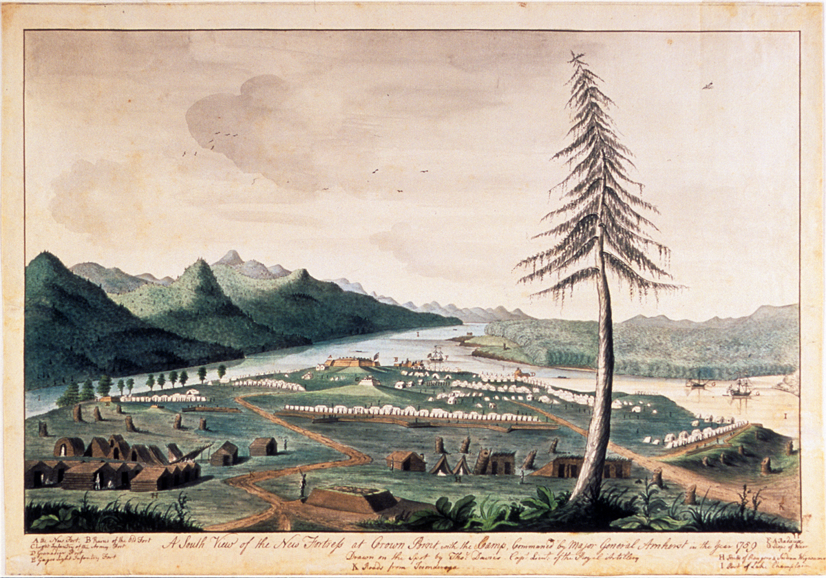
Thomas Davies. 1737-1812. View of Amherst’s army at Crown Point, 1759.
Embellished with picturesque touches, Davie’s finished watercolor is far from naïve in its rendering of the site. Twenty-first-century viewers might mistake topographical accuracy for a lack of optical verisimilitude. Davies was keenly aware that whatever artistic aims his painting might achieve, his primary goal was creating a chorographic vista one could read like a map. A hallmark of expeditionary art is the distortion of scale to render more legible certain features of terrain. I noted this on many occasions when my travels gave me the opportunity to compare the optical experience of beholding terrain with historic depictions more focused on conveying data. Richard Hovenden Kern’s 1849 view from Fort Marcy comes to mind. Standing on the hillock above Santa Fe looking south, one can focus the eye on the Ortiz mountains, Sandia mountains and La Tetilla hill, but taking all together in a single glance, each becomes nothing more than a speck on the horizon. Compressing distant features while minimizing the foreground, Kern privileged data over optics. This gave travelers and readers a guide to prominent landmarks in ways no photograph could. Apart from maximizing mobility the benefit of journal-painting is not in reproducing the appearance of things, but to transform the act of looking into knowledge and ideas—the art of seeing
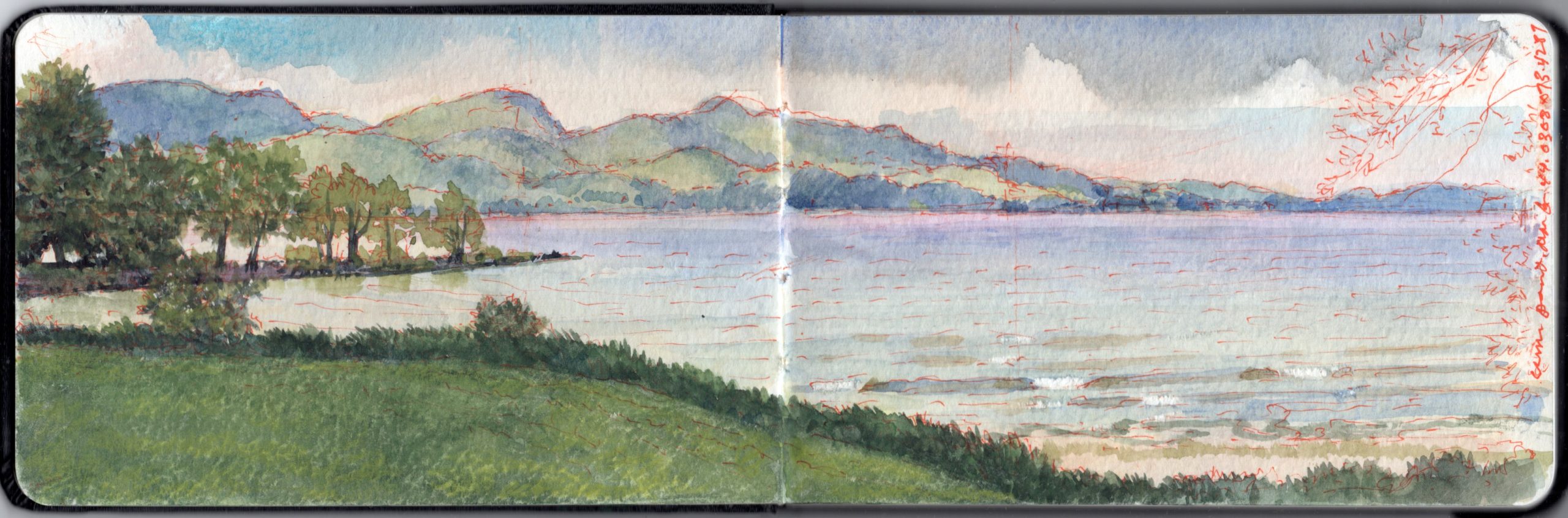
Looking northeast from 44.0308 x 73.4287. On the far shore is Port Henry, New York. In the far distance is Split Rock Mountain.
Follow James Lancel McElhinney and The Sketchbook Traveler on Facebook, Linkedin, Twitter and Instagram.
Peruse previous posts here. Dispatches #1-70. April 1-June 8, 2020.
Coming Soon: Hardcover. $24.95. From Schiffer Publishing. Release date: September 2020.