Category Archives: Dispatches

June 15, 2020. Sketchbook Traveler. Dispatch #70. Houston Rising


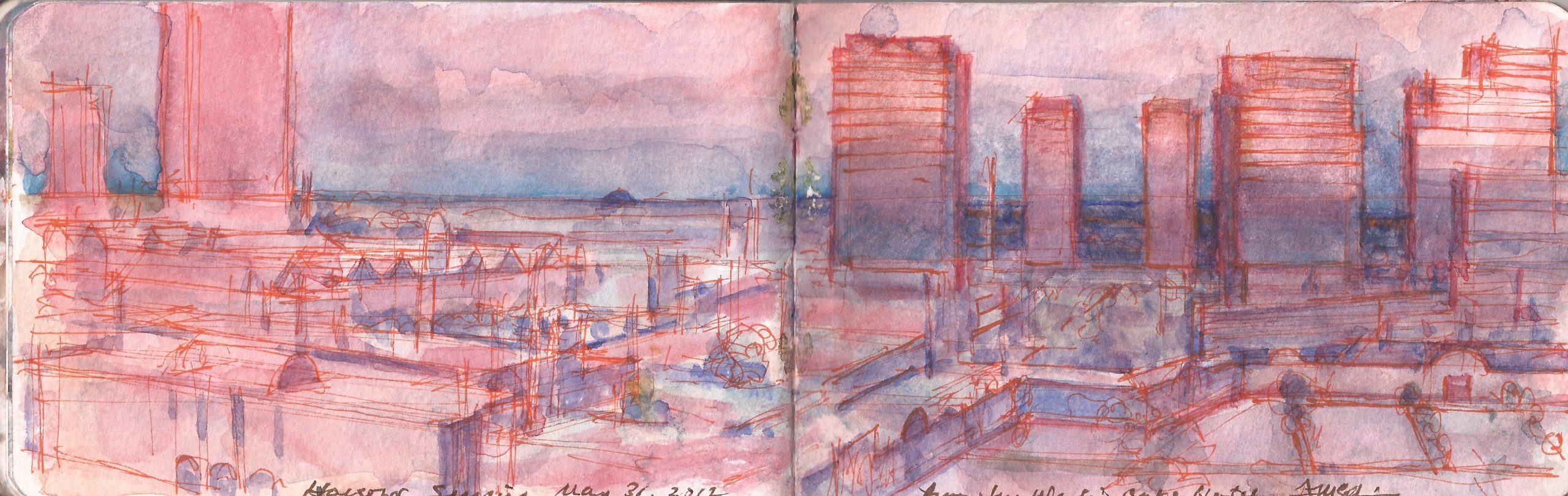
June 15 Houston Sunrise. Thursday, May 31, 2012

On Tuesday May 29, 2012, I traveled to Houston to attend the annual meeting of NAFSA, the National Association of Foreign Student Advisors: Association of International Educators.
Much of the visit was taken up with meetings and social events. I did get a opportunities to break away. Exploring the city by taxi, I noted that most of the drivers were Ethiopians, each of whom had a brother or uncle who owned the best Abyssinian restaurant in town. Clusters of affluence were surrounded by sprawling dystopic industrial zones, or sketchy residential neighborhoods.
My hotel was near Country Club Plaza, a mini-city-center near Rice University, several miles west of downtown. Planning an outing to visit San Jacinto Battlefield, I was surprised to learn that it was inaccessible via public transportation.
“We like our independence,” I was told by the concierge.
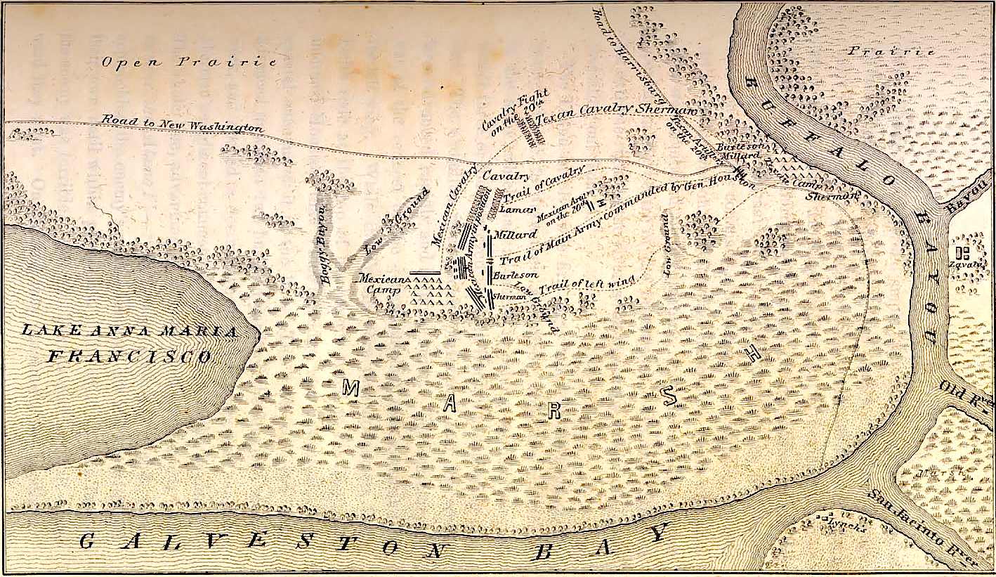

San Jacinto Battlefield. April 21, 1836.

Few states are prouder of their legendary roots than is Texas; an epic tale often told. Images of Laurence Harvey drawing a line in the sand, or Fess Parker swinging Old Betsy like a club as bloodthirsty Mexicans swarm into The Alamo have become indelible images of courage and sacrifice. The horrific slaughter of Texian defenders at Coleto Creek, after their surrender. Their wounded commander James Fannin was lashed to a chair. His face was shot to bits. Sam Houston’s final triumph came on a miasmic peninsula on Galveston Bay, near the mouth of Buffalo Bayou. Emily D. West, a.k.a. Emily Morgan was a free woman of color born in New Haven. Captured in a raid by Mexican cavalry, the beautiful twenty-one-year-old caught the roving eve of The Napoleon of the West; Mexican president Antonio Lopez de Santa Ana. Legend states that Morgan distracted the generalissimo with sexual favors while Houston quietly deployed his men to attack the Mexican camp. The battle lasted eighteen minutes. Disguised as a private, Santa Ana was captured and delivered to Houston, who had been slightly wounded in the battle. Morgan was immortalized by a popular song; “The Yellow Rose of Texas”. Historians may debate the facts, but most Texans are content to “print the legend”.
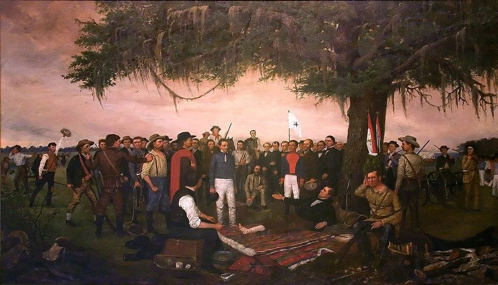

The Surrender of Santa Ana. William Henry Huddle. 1886. Texas Sate House. Reproduced under Fair Use, etc.

I met former National Park Service ranger Ed Shirley when we both served as volunteers in the U.S. Army Corps of engineers Living History Team for the Lewis & Clark Bicentennial. Ed was from the piney-woods of East Texas, born along the upper Sabine River. One of his ancestors had fought beside Houston at San Jacinto. Knowing me to be a city-dwelling dyed-in-the-wool Damned Yankee, and thus presumably easy prey to folksy humbug, Ed asked me if I knew why the Texas flag has only one star. Do tell, I replied.
“Why, we put it there to represent the United States, when we let them into the Union.”
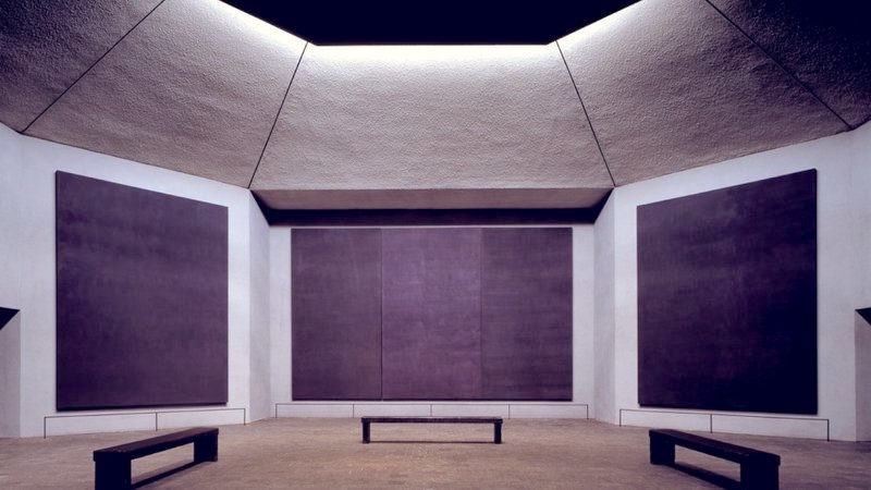

Rothko Chapel. Reproduced under fair Use, etc.

At the Houston Museum of Art was an exhibition curated by Yasufumi Nakamori. Utopia Dystopia included numerous living and historic artists including John Baldessari, Herbert Bayer, Christo, Marcel Duchamp, Hannah Hoch, Man Ray and Lazlo Moholy-Nagy. A stunning show of monumental Richard Serra drawings was on view at the de Menil Foundation. The Rothko Chapel was more intimate than I expected; the paintings more desperately tragic than I could have imagined. More like a mausoleum than a place of inspiration, it was a moving experience. Looking for comparisons, the feeling was similar to the Neue Wache in Berlin, the Central Memorial of the Federal Republic of Germany for the Victims of War and Dictatorship. The neoclassical stone guardhouse along the Unter den Linden is windowless, barren and empty. Open to the sky beneath the central oculus is a bronze Pietá by Kathie Kollowitz.
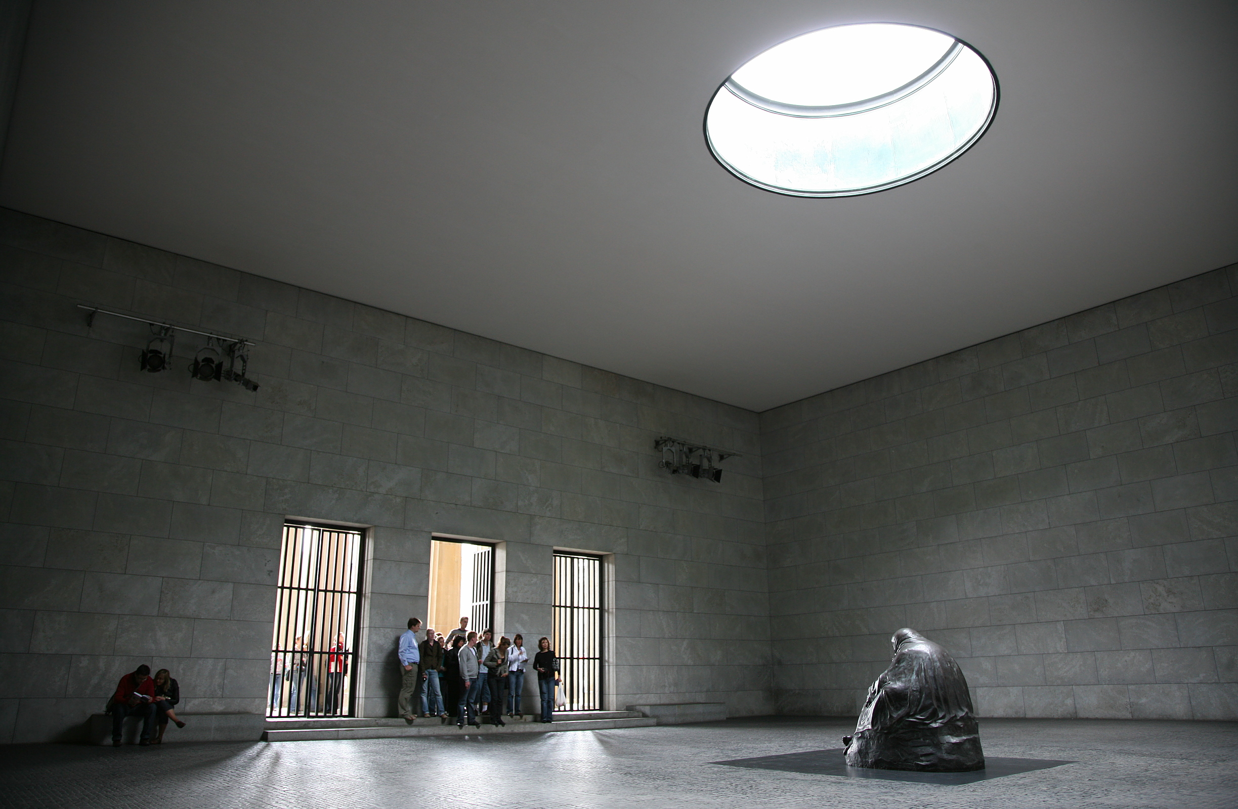

Neue Wache, Berlin. Reproduced under Fair Use, etc.

The conference was interesting, as both accredited and non-accredited institutions of higher learning were scrambling to keep pace with SEVP-ICA regulatory changes governing institutional sponsorship of J-1 visas. The presence of exhibitors from schools in Canada, the U.K. and elsewhere around made it clear that foreign student-recruitment. Sessions were informative, updates mostly on regulatory compliance and evolving protocols for academic advising. Given the number of institutions represented from various different countries, each with their own academic cultures and national immigration laws, keeping pace with changes in compliance seemed both labyrinthine and Sisyphean. Social events were like speed-dating meet & greet sessions where the goal was to exchange as many business-cards as possible. It was nice running into former colleagues, and meeting new ones. The first day wrapped up a group of new friends and old having dinner at a nearby hotel, followed by a cab-ride back to my hotel.
At six in the morning I received a wakeup call. Drawing back the curtains I beheld the high-rise buildings of Country Club Plaza, awash in rosy light. Beyond towers of glass, nocturnal gloom retreated to the west. Darkness pressed a leaden horizon, toward which extended the low-sprawling city. Having listened to the funeral of George Floyd a few days earlier, I went searching for this image. Looking west from an upper floor of a hotel, drinking hotel coffee I mapped out this view. I wondered at what my thoughts had been, that morning eight years ago. Were they hopeful or elegiac? My preference today favors the former. The earth turns. New days are born. Daybreak is a traditional moment for blindfolds and firing-squads. It also signals resurrection, the victory of compassion over cruelty and injustice. Looking toward the rising sun, facing the light, we move with earth’s rotation at a speed in excess of a thousand miles per hour. Looking away from the sun into the darkness, our gaze flows in the same direction as the light from its source, at a speed of one-hundred-eighty-six-thousand miles per second. Regardless of whichever way we face, solar energy warms us.
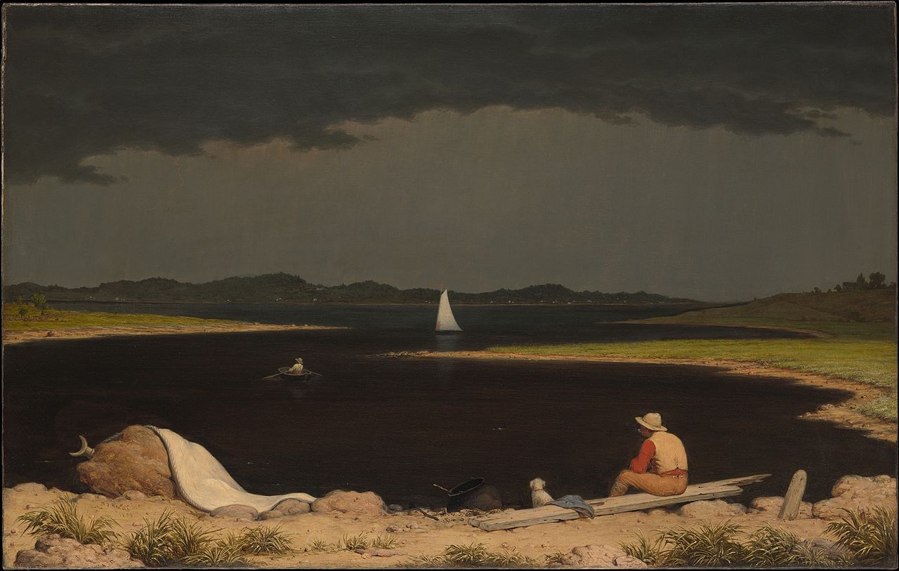

I think for a moment of Martin Johnson Heade’s 1859 painting Approaching Thunderstorm. 1859. Collection Metropolitan Museum of Art. (Reproduced under Fair Use., etc.)

Painted on the eve of the Civil War, Heade’s composition puts the sun at our backs, measuring the space along elliptical coastline into the umbrageous waters dividing us from the distant shore. My solitary Houston journal-painting is not one I would count as a success, but it holds a dash of Déjà-vu. In the nineteen-eighties a large part of my oeuvre was focused on urban landscapes, a project that resulted from a bit of unintentional self-administered artistic jujitsu, following my first painting-trip to New Mexico. That story is for another day.

Flag Day. A sprint through the genesis of the national colors of United States of America in six-hundred words

On Friday June 14, 1777 the Continental Congress authorized the design of a new national flag, designed by New Jersey congressman Francis Hopkinson. Representing the number of Britain’s Atlantic North American colonies removing themselves from Crown rule was a field of thirteen alternating red and white stripes. The canton, or upper left-hand section of the field was emblazoned blue, with a constellation that may spell “S U” with thirteen six-pointed stars. Apart from representing Judaism, the six-pointed star is Masonic iconography. Many of the founding fathers were freemasons. It may also pay tribute to the Polish-born Jewish financier Haym Salomon (1740-1785), who with Robert Morris (1734-1806) underwrote the American Revolution. Above the eagle on the verso of one-dollar bills is a Star of David composed of five-pointed stars.


Francis Hopkinson flag. June 14, 1777

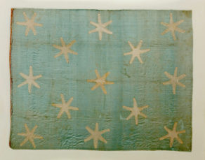
Legend has it that Betsy Ross convinced Master-Mason George Washington to let her provide the flag she was to make with five-pointed stars, one suspects to make her task less laborious. Washington’s own headquarters flag is a blue field with six-pointed (masonic) stars.


George Washington’s personal position flag. 1777. Reproduced under Fair Use, etc.

Ross also is credited with modifying Hopkinson’s design by arranging the stars in a circle. Her upholstery business was quickly repurposed to produce banners and uniforms for the patriot cause.


Betsy Ross flag. 1777.
This design was by no means uniform, with a range of variations inspired by the official design. But did the design just spring from the imagination of an artsy cousin of Benjamin West? Let’s look at few precedents.


The Grand Union Flag. 1775. Differentiated from the East India ensign by use of a square canton.

The Grand Union flag was adopted, or more correctly appropriated in 1775 as the designating colors of Continental forces in Massachusetts. In every part of the British Empire everyone recognized the design as the ensign of the British East India Company a private corporation that conducted itself like a sovereign state for 274 years.


Ensign of the British East India Company (1707-1874) The field of thirteen red and white stripes with a canton emblazoned with the overlapping crosses of Saints George, David, Andrew and Patrick dates to 1707.


British East India Company Ensign. First pattern. 1600-1668

Its precursor bearing only the red cross of saint George on a white canton had been in use since the formation of the company in 1600. The flag of the progressive Sons of Liberty kept the stripes, sans the tyrannical symbol of British rule.


Sons of Liberty Flag. 1765

When the flag was banned by the Crown, the S.O.L. modified the colors to nine vertical stripes, representing the organization’s nine founders. During the War of Independence from 1775-1784, a number of local variants were produced, with and without a starry canton.


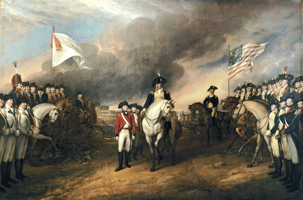
John Trumbull. The Surrender at Yorktown. 1819-1820. U.S Capitol Collection. The national colors portrayed here by a veteran of the war has been called into question. If the object every existed it has never been located. Trumbull’s depiction of twelve stars forming a box around a single central star has never been verified, and deviates from eyewitness sketches of American flags drawn by the British defenders. It nonetheless demonstrates the lack of uniform regulations specifying any single design


Star-Spangled Banner. Adopted 1795

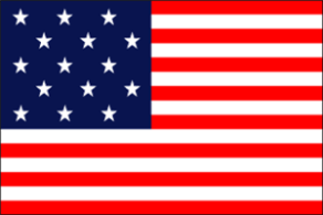
It was not until after the admission into the United States of Vermont in 1791, and Kentucky in 1792 that a fifteen-star predecessor of today’s national colors became the official flag of the United States of America on May 1, 1795. With so many contenders in the running, why in 1776 did the Continental Congress favor the East India Company pattern flag? Could it have been because that Congress pondered the formation of a sovereign state that could behave like a private corporation? Why were no allegorical figures of Liberty adopted, nor Roman eagles, Phrygian bonnets, nor arboreal devices? The answer may seem obvious. How did Flag Day begin? That is another story.

June 8, 2020. Sketchbook Traveler. Dispatch #69. Niagara Falls

Washington Heights, Manhattan. June 8, 2020

Since April 1, I have posted sixty-nine quotidian dispatches pairing images and texts. Apart from keeping myself occupied with a structured project during quarantine, these mini-travelogues were published as messages of hope, addressed to others sheltering in place. Thanks for following these dispatches. As parts of New York State begin to reopen, I will be devoting my attention to other pressing tasks. Today’s desktop road-trip will be the first of a new series of hebdomadal blogposts. Every week, look forward to another. The next installment will be on June 15.

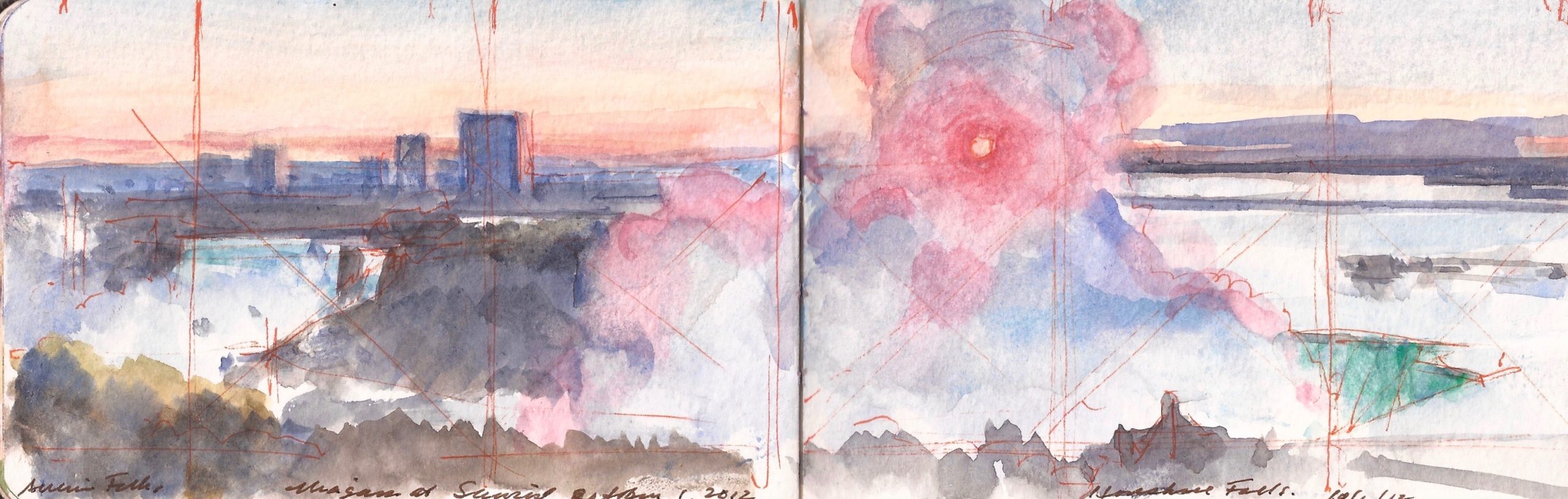
Niagara Falls. Sunday. September 30, 2012.
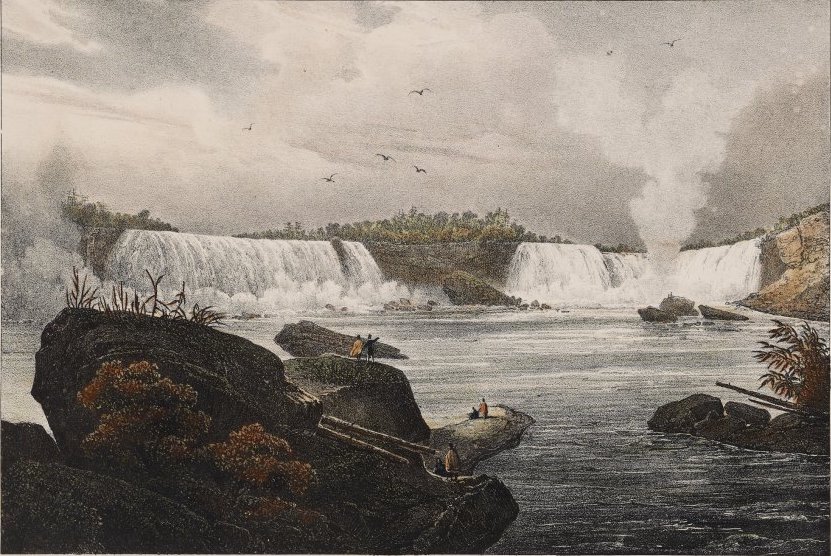
“…when viewing the falls from below and at a distance, it is hard to say from where the whole river comes. But finally the waters reach the rim, and they rush downward without encountering any obstacle. They do not however form a single mass, as they are separated by an island into two very distinct cataracts. The larger one, occupying the northwest side of the river and bordering the bank on which I approached belongs to the English and is called the Great Falls, or more frequently, the Horseshoe Falls because its summit is quite curved and the two ends, the one on the shore side being longer, project about 70 feet from the center. The top of this cataract forma a nearly horizontal line that is broken only by rocks projecting beneath the water. Masses of suspended rocks lie on the shores, and the quantity of their debris piled at the foot of the cataract attests constant disintegration. One of these projecting rocks was famous for its enormous dimensions, its position over the abysm, and the names that thousands of curious people, including the great Washington, had scratched on the surface. This narrow ledge, known as Table Rock, afforded a view of the whole cataract and the vast chasm below. Upon my arrival, I did not hesitate to venture out on such a perilous platform but, during the night, the gigantic mass broke loose and rolled into the precipice with a fearful noise, engulfing the frivolous glory of all those who had inscribed their names on the stone. Returning to the scene a few hours after the catastrophe, I was terrorstricken and thanked heaven for having preserved my life.”

–Jacques-Gerard Milbert. Picturesque Itinerary of the Hudson River and its Environs. 1826


Niagara Falls. Jacques-Gerard Milbert. Picturesque Itinerary of the Hudson River and its Environs. 1826

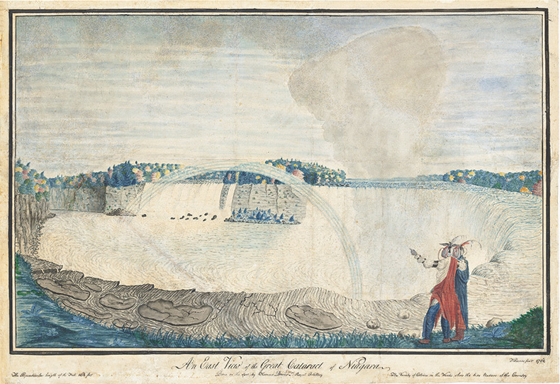
Lake Erie drains into Lake Ontario via the Niagara River, which flows over a ledge of Silurian Dolomite that extends east to the Adirondack Mountains, and west via a long northern loop through Bruce Peninsula, Manitoulin Island, around the Michigan Peninsula to Door Peninsula, along the southern shores of Green Bay, Wisconsin. The movement of six million cubic feet of water over the falls per minute erodes the ledge, moving its lip upstream (south) at a rate of two to four feet each year. The first European to describe the falls was Pere Antoine Hennepin (1626-1704), a Franciscan priest who accompanied explorer Rene-Robert Cavelier, Sieur de la Salle on an expedition through the Great Lakes in 1679. The Niagara peninsula became a battleground between invaders from the United States, and British forces supported by Canadian fencibles. On October 13, 1812, defenders held their ground at Queenstown Heights, at the loss of their dynamic young general Isaac Brock. On July 15, 1814, American regulars led by Winfield Scott defeated a larger British force at Chippawa, few miles above the falls near the mouth of the Welland River. A dozen miles south of Scott’s victory, a force of Irish-American Fenian invaders were defeated at the Battle of Ridgway on June 2, 1866, by a combined force of British regulars and Canadian militia. Many consider this minor battle a major event in the path to Canadian independence. On July 1, 1867, the North America Act established the dominion of Canada within the British Empire. Hibernian veterans of the U.S. Civil War continued harassing British-held Canada until 1870. What one might find astonishing is the number of artists who visited the area, including British artillery officer Thomas Davies, who also documented actions around New York City in 1776.


Niagara Falls. Thomas Davies. Royal Artillery

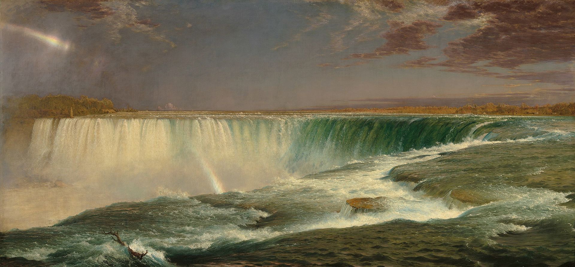
A few years after hostilities ceased in 1815, Rembrandt Peale, Jacques-Gerard Milbert and Samuel F.B. Morse all visited the falls, bidding for their shares in a booming market for picturesque views of exotic locations. Frederic Church produced several views of the falls, the most famous of which was exhibited in multiple venues like a theatrical event, or the equivalent of an Imax film today.


Frederic Edwin Church. Niagara. 1857. Corcoran Collection, National Gallery of Art. Washington DC (Reproduced under Fair Use, etc.)

On Sunday September 30, 2012, Kathie and I flew to Toronto. She was to attend a meeting of scholars and curators at the Art Gallery of Ontario, to plan a major survey of art the Americas. The exhibition would coincide with the Pan-American games being held in Toronto in 2015. Flying into the city on Porter Air, we landed on a little island linked to the mainland by a two-minute ferry ride. Having a few days to kill before her meetings, we decided to visit Niagara Falls. Taking a taxi to our car-rental facility, we got a vehicle and headed south. The trip to Niagara was shorter than expected. Driving through Burlington I noted the house of Thayendanegea, aka Joseph Brandt, the Mohawk war-chief who coordinated bloody raids as far south as Ulster County, New York with British forces and American loyalists. Brandt and a number of Haudenosaunee who had borne arms again the Continentals had relocated to Canada. The industrial city of Hamilton stands along the southern shore of Burlington Bay at the head of Lake Ontario. Crossing the James Allen Skyway, we entered the Niagara Peninsula. The terrain is flat, lush, agricultural and a center for wine production. Presuming the beverage would resemble the sweet white table-wines of New York’s Finger-Lakes, we were pleasantly surprised to find a greater variety. En route to our hotel we visited Brock’s Monument at Queenstown Heights, the massive fluted column surrounded by woods and manicured lawns.
The present monument was built in 1856 to replace another that had been dedicated in 1824, which had been damaged by insurrectionists. The landscaping reflects a similar impulse seen in the USA at the same time—the creation of pastoral settings for rural cemeteries, and later for city parks. After winding our way through the strip-commerce, we locate what remains of the battle-field of Lundy’s Lane, a small grassy park next to a Starbucks, across the street from a Presbyterian church and graveyard. Checking into the Oakes Hotel, we are stunned to find the management had put us on the eighth floor, with a stunning view of the falls.
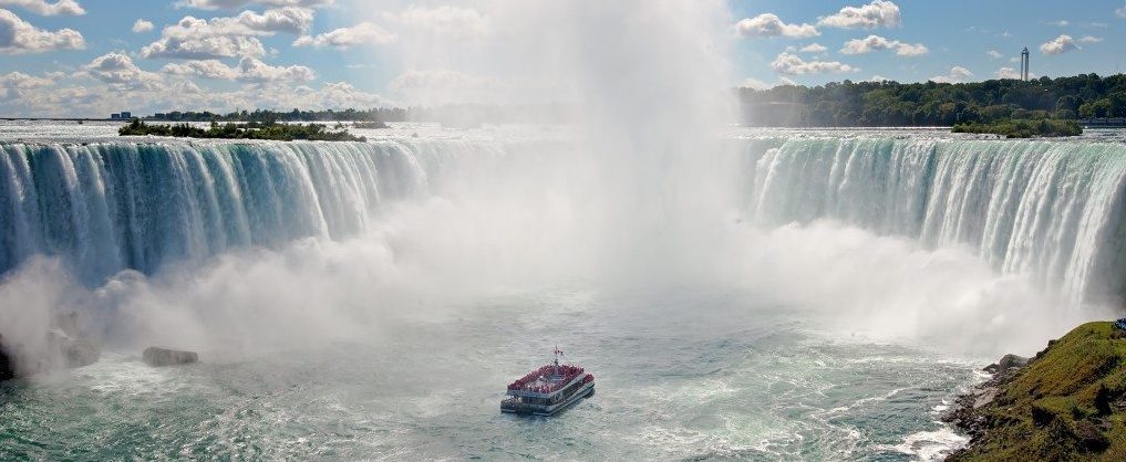
Walking down to the head of the Falls Incline Railway, we queued up for tickets then waited to board. Like funicular gondolas, the carriages were small and glazed on all sides. Greeting us at the bottom was the remains of Table Rock, and the constant roar of the cataract, as the river plunges nearly two hundred feet into the chasm below. Walking north past a monument to Nikolai Tesla, we find Hornblower Cruises, purchase tickets and fall in with the lowing herd.
Photographs were taken. Color-coded hoodie-ponchos were issued. We were in the blue group.
Filing on board, we made our way forward along the starboard rail. Following a short, narrated tour of the Niagara Gorge, the boat made its way toward Horseshoe Falls, hanging back for several minutes while another boat entered the pool at the base of the falls. As we crept forward, aerosol droplets of water filled the air, like rain falling from every direction. Unlike the hissing roar one hears from above the din was deafening like at ground zero of a nuclear explosion. Vibrating every bone, every ounce of quivering flesh, I was reminded of how it felt, the first time I heard Emmanuel—the great bell of Notre Dame de Paris. Metal striking metal. Its deep sonorous call. The voice of God. Dripping wet in our useless raingear, looking up at an avalanche of water, sheer terror is inundated up by an ecstatic flood of exhilaration. This mélange of fear and awe is what Romantic poets dubbed the Sublime.

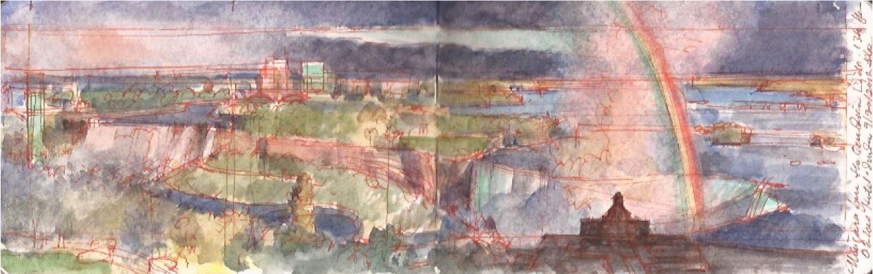
Back in our hotel-room I unpacked my journal and watercolors. Looking east, a rainbow leaped across Horseshoe Falls, anchored on Table Rock. Across the river was Goat Island and the American Falls. Behind a rosy plume of mist, the wide southern leg of the Niagara River stretched out to the horizon. I thought about doing a nocturne, the falls were illuminated by pulsing colored lights changing slowly from red to blue to green to white, and so forth until past midnight. Drawing the curtains, we called it a day.


Sunrise. Niagara Falls from Oakes Hotel. Monday October 1, 2012

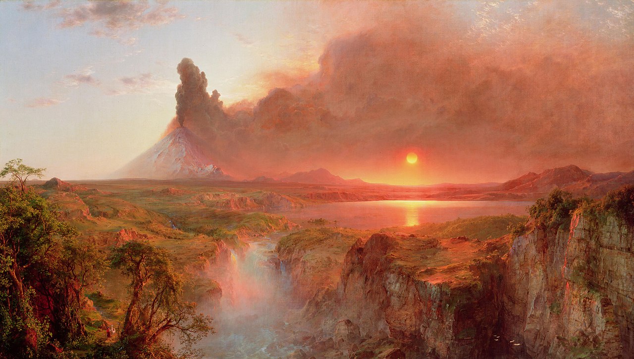
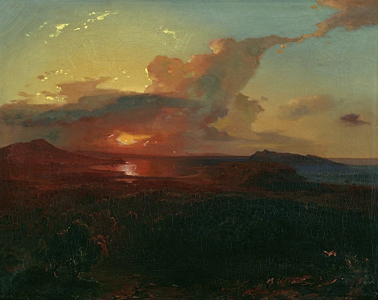
I arose the next morning at five o’clock. My sketchbook and materials still lay on the table beside the window. The sun had yet to appear as I mapped out the imaged. The perpetual mist-plume ascended from the pit. As the sun burned through the haze, its fiery shape hovered behind the clouds. I was reminded of Frederic Church’s 1862 Cotopaxi, Carl Rottman’s 1849 Epidarus, and of the fact that if one never goes on rambles, the scenery never changes.


Frederic Edwin Church. Cotopaxi. 1862. Detroit Institute of Art. (Reproduced under Fair Use, etc.)


Carl Rottman. Epidarus. 1849. Lenbach Haus. Munich. (Reproduced under Fair Use, etc.)

Check out April 2020 Quaranteam Traveler Dispatches

(A preview of SKETCHBOOK TRAVELER by James L. McElhinney (c) 2020. Schiffer Publishing).

Copyright James Lancel McElhinney (c) 2020 Texts and images may be reproduced (with proper citation) by permission of the author. To enquire, send a request to

ed******@ne***********.com


June 7, 2020. QT Dispatch #68. Humbug Luminism Booze Cruise

As civil unrest sweeps through our cities, we think of friends and loved-ones who continue to shelter in place. Immobilized for the time being, we can revisit destinations, near and far. join me in celebrating the joys of Quaranteam travel, the hope that these diversions might inspire us to value things we had taken for granted, to draw strength, wisdom and compassion from deeper engagements with nature.


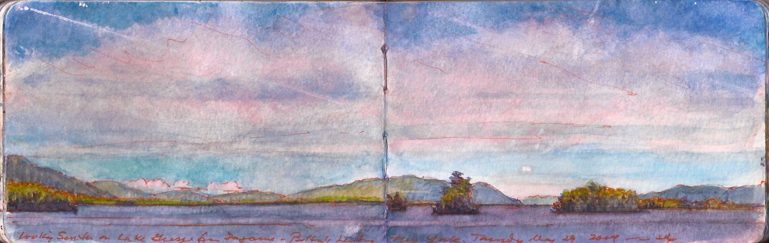
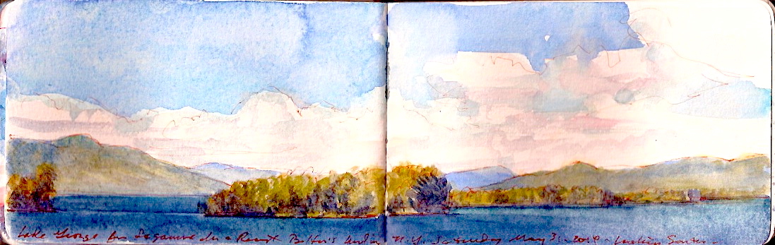
Lake George, Looking South from Sagamore Inn. Thursday May 29, 2014.

There are many things one can say to pick a fight. Derisive imputations concerning one’s honor, or the virtue of a mother or sister will often trigger a dust-up. Classic openers like “your momma” or “who’s your daddy?” would not agitate in the least my dear wife. But questioning the existence of Luminism—as I once did at breakfast—unleashes the full fury of Hellfire.
Sitting at the table, enjoying a second cup of coffee, the conversation drifted onto the subject of the Hudson River School, which I wondered might be a misleading term for several reasons.
Few of the founder-artists ever painted the river, while younger painters like Sanford Gifford, John Kensett and Samuel Colman did.
“You damn fool,” Kathie shot at me. “Those are Luminists.”
So. What’s the distinction? Was it geographic or stylistic? Had any of those artists ever heard a living soul utter the L-word. None of them had of course. The term was invented by art-historian John I.H. Baur in the nineteen-fifties, to identify stylistic differences between two generations of painters classified within the Hudson River canon. This Kathie confirmed.
“In other words,” I said, “there really is no such thing as Luminism.”
These words proved transformative. Suddenly my kind and loving wife became an incensed art-historical Boudicca.
“What about Fitz-Henry Lane? You damned fool. What about Martin Heade?”
I thought for a moment and replied,
“Isn’t Lane just a maritime painter? Why does he have to be a luminist?”
I thought her head was about to explode, or mine might be swept from my shoulders with a single savage blow. Ever since that conversation, Luminism has become a well-gnawed bone of contention. My position is that Luminism doesn’t exist. Hers is that squalid ignorance and stunted intellect render me incapable of understanding it. It’s our Tracy-Hepburn diversion, unpacked periodically to both annoy and amuse.


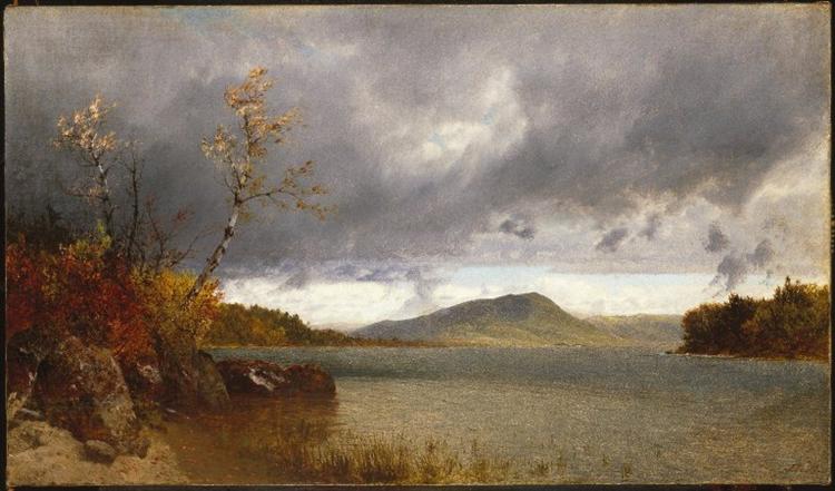
John Frederick Kensett (1816-1872). Lake George. 1870. Broolyn Musuem. (Reproduced under Fair Use, etc.)

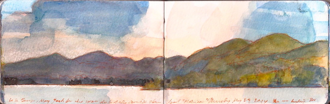
On Thursday May 29 2014, we drove south from Bolton Landing to Lake George Village, to embark on a cruise of the lake from head to spillway. Several day-lines run cruises from docks along the esplanade from the reconstructed Fort William Henry to the downtown cluster of honkytonk commerce. Presenting our tickets to board the Mohican, we were paused at dockside by a perky young woman who took our photo. The same drill is repeated at many attractions ranging from Niagara Falls to the Alamo. Pictures are taken upon entry, and then sold to visitors upon leaving. I have a shoebox full of these treasures. An ear-piercing whistle announces our departure. Backing away from the dock, the ship maneuvered around a homeward-bound tour-boat. A minute or two later a mellifluous voice welcomes us aboard, then launches into a concatenation of anecdotes about the Marquis de Montcalm, the French and Indian War, indigenous lore and robber-baron mansions lining the lakeshore. Basting our tender flesh with sunscreen, we purchase a few bottles of water and head for the upper deck.
Taking a seat above the fantail we settle in for a three-hour cruise. Having packed all my painting-gear in a travel-vest, I set out to document the voyage as much as possible, given the time allowed. Kathie used the time to break in a new digital SLR. I turned to her.
“Look over there. Is that a luminist moment?”


Prospect Mountain from the Mohican. Thursday May 29, 2014

She gave me a dirty look. The dark clouds hovered off the south, washing the summit of Prospect Mountain in sunlight. Behind Tea Island was a cove at the foot of a property once owned by the Stieglitz family, where Alfred and Georgia had summered. As I painted, a bank of clouds threw Prospect Mountain into shadow. Reflected on the surface of the waters, a huge thunderhead framed the rolling topography.


Prospect Mountain from the Mohican. Thursday May 29, 2014

“What do you think now? I asked Kathie, “Is that a luminist moment”
“You know it’s not you damned fool.” She replied.
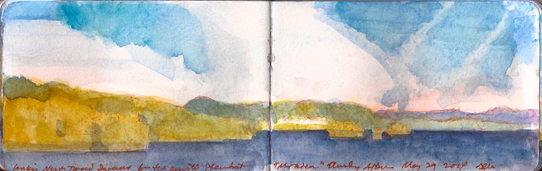
I went over to the port side, facing north as the Sagamore came into view. I called Kathie over, which patiently she did.
“Now what?”
I pointed to Sagamore. “What about that?”
Shaking her head, she went back to her seat.


Sagamore from the Mohican. Thursday May 29, 2014

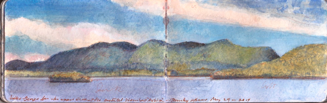
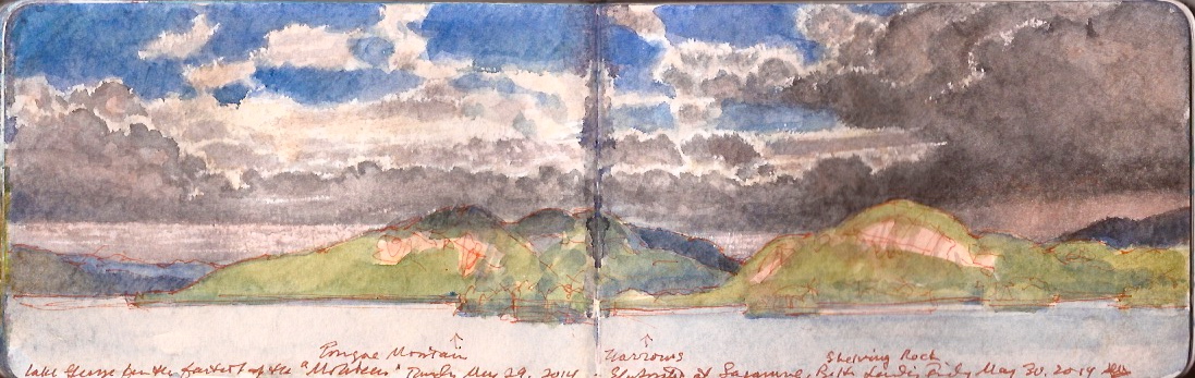
North of Sagamore the Mohican approached The Narrows. The narrator explained that Tongue Mountain to the west is a notorious denning-area for Timber Rattlesnakes—Crotalus Terribilis Terribilis. The reptiles are relatively docile if left unmolested. While fatalities from a single snakebite are rare, they can be painful and result in serious infection. Famed botanist Joh Bartram described his encounter with one of these animals while collecting specimens in Schuylkill County, Pennsylvania.

“After dinner we passed the openings of two ridges, the last of which was by the bank of the principal branch of Swataro, the soil poor and stoney; then we ascended a great ridge about a mile steep, and terribly stoney, most of the way: near the top is a fine tho’ small spring of good water. At this place we were warned by a well known alarm to keep our distance from an enraged rattle snake that had put himself into a coiled posture of defence, within a dozen yards of our path, but we punished his rage by striking him dead on the spot: he had been highly irritated by an Indian dog that barked eagerly at him, but was cunning enough to keep out of his reach, or nimble enough to avoid the snake when he sprung at him. We took notice that while provoked, he contracted the muscles of his scales so as to appear very bright and shining, but after the mortal stroke, his splendor became much diminished, this is likewise the case of many of our snakes.”

–John Bartram (1699-1777)

The unique danger to hikers venturing into nesting zones are high concentrations of these venomous creatures, as noted by Jacques Milbert in his Picturesque Itinerary of 1826.
Storm clouds broke up around The Narrows as the rain veered north toward Lake Champlain.
I called to Kathie. Looking over, she shook her head is dismay. I sensed she was amused.


Storm Clouds over the Narrows. Lake George. Thursday May 29, 2014

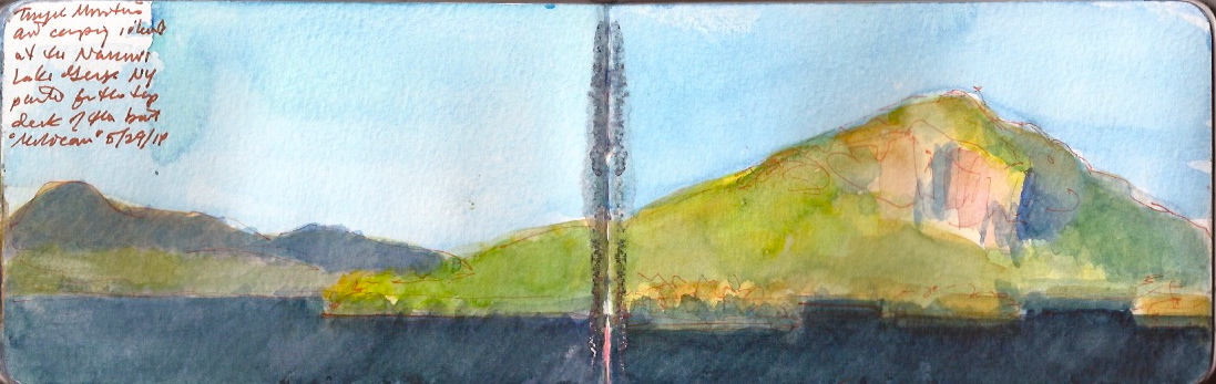
As we passed beneath the rocky eastern slopes of Tongue Mountain, I spared Kathie another round of questions. She called out to me.
“There you go. Do you see that? Know what that is? It’s NOT luminist!”


Tongue Mountain. Lake George. May 29, 2014.

Painting next day from the Sagamore Inn alfresco lakeside bar I had gotten drenched in a downpour. Kathie had gone to the pool for a swim. When she had finished she came over to see what I had been doing. I showed her my rain-spattered painting.
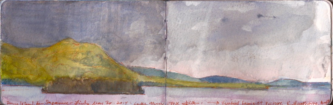
To the southeast toward Pilot Knob, rain-clouds darkened the skies, as the cool forms of distant hills were crowned with a rosy glow. Sunlight burned through the mist to the west. The wooded mountain glowed an eerie citron hue. The dark from of Dome Island rode like a massive barge upon violet waters. At once calming and terrifying, nature had paused, time stood still, hushed like an orchestra on the brink of a shattering crescendo. She looked at me, then pointed across the waters.
“There! THAT’S Luminism!!!”


Storm over Lake George from Sagamore Inn. Friday May 30, 2014.

At dinner I proudly showed her what I had done.
“Hopeless,” she said, “You’ll never be a Luminist.”

Check out April 2020 Quaranteam Traveler Dispatches

(A preview of SKETCHBOOK TRAVELER by James L. McElhinney (c) 2020. Schiffer Publishing).

Copyright James Lancel McElhinney (c) 2020 Texts and images may be reproduced (with proper citation) by permission of the author. To enquire, send a request to

ed******@ne***********.com


June 6, 2020. QT Dispatch #67. Lake George

As civil unrest sweeps through our cities, we think of friends and loved-ones who continue to shelter in place. Immobilized for the time being, we can revisit destinations, near and far. join me in celebrating the joys of Quaranteam travel, the hope that these diversions might inspire us to value things we had taken for granted, to draw strength, wisdom and compassion from deeper engagements with nature.


Lake George from Sagamore, Bolton Landing New York. Saturday May 31, 2014.

One thing that has not changed since the stone age is that ninety-percent of human goods still move by water. For thousands of years indigenous traders traveled between the Atlantic coast, the Great Lakes and the far west through a series of waterways linked by carrying-places known as portages. One could enter the Hudson at Sandy Hook, proceed upstream to Stillwater, ascend a series of waterfalls before making a short trek overland to the south end of Lake George. At the northern end of the lake one ascends a winding river, scales another set of falls before putting one’s canoe into the waters of Lake Champlain, which drains via the Richelieu River into the Saint Lawrence River. From Saint Joseph de Sorel, one could either paddle downstream to Gaspé and Newfoundland, or upriver through the Thousand Islands into Lake Ontario. After scaling the heights below Niagara Falls, paddling across Lake Erie, up the Detroit River into Lake Saint-Clair, the up the Saint-Clair River into Lake Huron, one reaches in inland sea. Heading north through Sault-Sainte-Marie, then south into Green Bay, one ascends the Fox River, crosses Lake Winnebago to Lac de Butte des Morts, paddles up the southern stretch of the Fox to Portage, where after a short carry one puts in to the Wisconsin River, which at Prairie du Chien joins the Mississippi. The mighty river is joined downstream by the Missouri and Arkansas Rivers, rising is the Rockies, descending across the Great Plains.During the early colonial period, these waterways were superhighways. Exporting trade goods to indigenous nations, trappers harvested millions of beaver-pelts needed by European hatmakers.


Great Seal of the City of New York. Notice the iconography; a Dutch Builder, a Lenape Warrior, a windmill. Beaver and molasses barrels. The colonial economy of Nieuw Amsterdam was driven by fur-trapping, sugar production and slavery.

Where the Hudson descends from the Adirondacks, below the mouth of Sacandaga River is Glen’s Falls, which featured prominently in James Fenimore Cooper’s novel The Last of the Mohicans. Just below the falls on the left back of the river is the carrying-place that links the Hudson to Lake George. Thirty-seven miles in length this body of water was known to indigenous tribes as HoriconJacques-Gerard Milbert traveled through much of New York State, publishing his writings and drawings as Itineraire Pittoresque du Fleuve Hudson et Des Partes Laterales en Amerique du Nord in 1826.


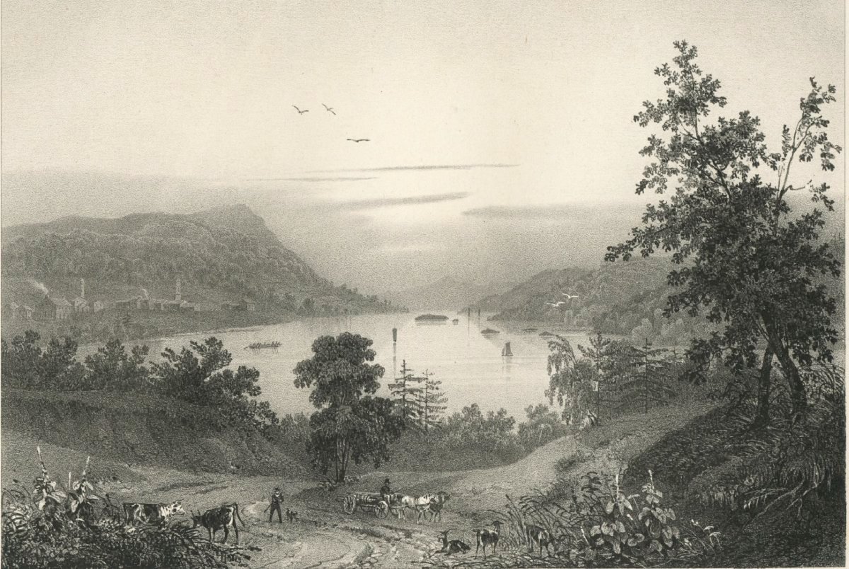
Jacques-Gerard Milbert. View of Lake George and Caldwell (Lake George Village). 1826. Adirondack Experience, Blue Mountain Lake NY (Reproduced under Fair Use etc.)

“Lake George lies amid mountains that separate in every direction, forming a valley…During the era of French control Lake George was called the Lake of the Holy Sacrament because all the Canadian churches used its clear water for their services. Thirty-six miles long, the lake varies between one and seven miles in width, and the water is so clear that fish can be seen swimming at great depths. One hundred and fifty feet higher than Lake Champlain. It empties into the latter by way of a narrow canal after traversing rapids and a waterfall near the ruins of Fort Ticonderoga. The lofty banks are bordered with magnificent trees, notably red cedars, that are valuable for shipbuilding. The surface is dotted with large numbers of islands of various sizes, some of them barren. One, that is known as Diamond, Island because quartz crystals are found there, was formerly infested with rattlesnakes, but they were exterminated by pigs imported for that purpose. The fearful reptiles are still to be found in large numbers on the mountain (Tongue Mountain), and bold mountaineers continue to hunt them for their skins, despite the fact that several men have been victims of their own intrepidity.”

–Jacque-Gerard Milbert. Picturesque Itinerary of the Hudson River and Its Environs in North America. 1826

In late May of 2014 Kathie and I splurged on a stay at the Sagamore Inn on Lake George. The hotel stands on a Green Island, just off the western shore of the lake, next to the village of Bolton Landing. Normally the place would have been out of our price-range but Kathie had received a special pre-Memorial Day offer. Founded in 1883, the sprawling Victorian-era inn faces south. The setting is stunning. A long, well-manicured lawn sloped down toward the water. We soon realized that our bargain getaway was in the basement of one of the modern dependencies built on the property, not in the grand hotel itself. I had never found the prospect of cruise-ship vacations very appealing but imagined that the American plan, in which hotel lodging included meal service would be similar to dining on one of those seaborne behemoths.We nevertheless gave it a whirl, and were not disappointed.


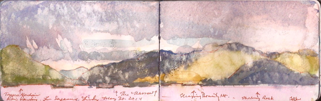
Rainstorm on Lake George. The Narrows from Sagamore. Friday May 30, 2014. Left to right: Tongue Mountain, The Narrows, Sleeping Beauty and Shelving Rock.

On Friday afternoon, May 30th, I wandered down to the lakeside bar, which had not yet opened for the season. Chairs and tables were partially set up. Unpacking my kit, I measured out the northwest vista across a page-spread and began to explore the scene. Dark clouds tumbled in from the west, throwing the waters into darkness. Sunlight and cloud-shadows rolled across the mountains lining the far shore. Just as the painting began to make sense, the temperature plummeted and the skies opened up. Leaning forward to shield the pages, I continued to work. Rain spilled off the brim of my hat. The wind drove raindrops onto the pages. Turning my back against the weather, I slipped a piece of paper towel between the pages. Closing the book, I moved into the partial shelter of the alfresco bar. Beholding the damage, it would be possible to elaborate the sketch later that evening. Hours later, I set out materials to make the corrections. Looking at my pages for the first time since the afternoon, I hesitated. The image was deranged but coherent. All the color notes were in place. Driven onto the page by windborne raindrops, the pale marks reminded me of bleach-spattered blue-jeans. Their angles recorded the wind-direction. I began to change my mind. Here was an authentic document of a place, at a specific moment in time, modified not by contrivance, but by the intervention of nature. Why for the sake of artistic conceit, should one disregard such a gift?

Check out April 2020 Quaranteam Traveler Dispatches

(A preview of SKETCHBOOK TRAVELER by James L. McElhinney (c) 2020. Schiffer Publishing).

Copyright James Lancel McElhinney (c) 2020 Texts and images may be reproduced (with proper citation) by permission of the author. To enquire, send a request to

ed******@ne***********.com


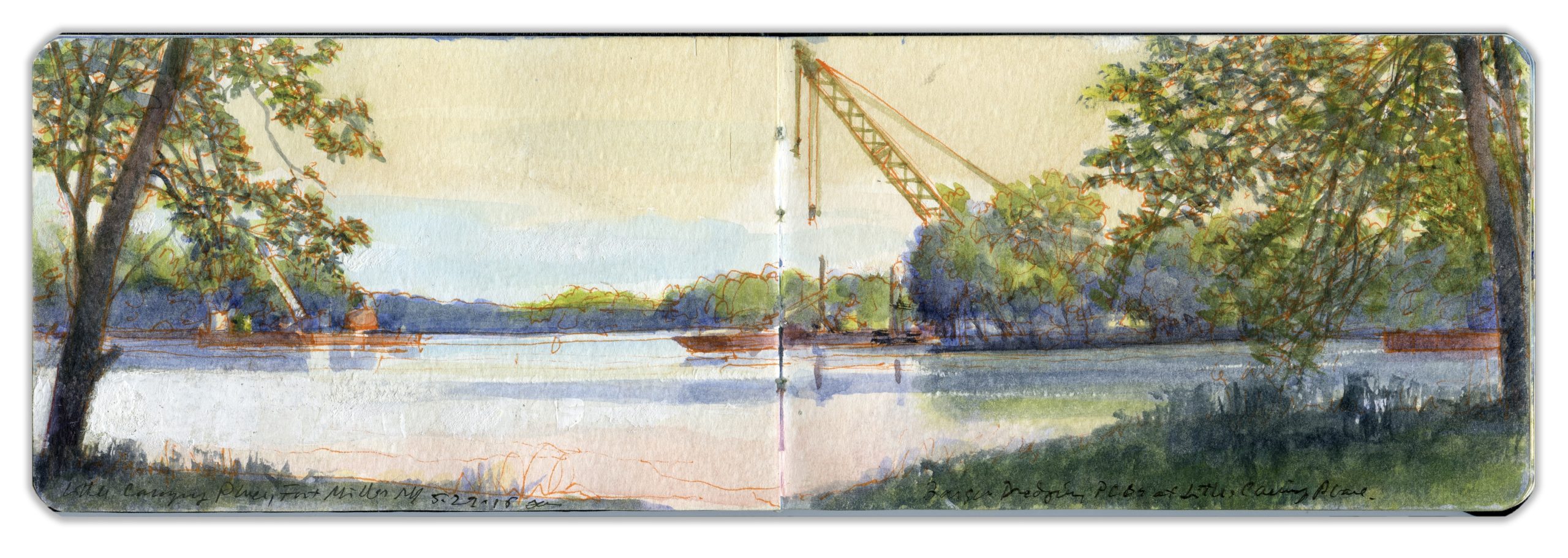
June 5, 2020. QT Dispatch #66. Near Fort Miller on the Hudson River. May 29, 2015

As civil unrest sweeps through our cities, we think of friends and loved-ones who continue to shelter in place. Immobilized for the time being, we can revisit destinations, near and far. join me in celebrating the joys of Quaranteam travel, the hope that these diversions might inspire us to value things we had taken for granted, to draw strength, wisdom and compassion from deeper engagements with nature.


The Hudson Near Fort Miller. Friday May 29, 2015

Image and text were featured in the exhibition James McElhinney. Discover the Hudson Anew, curated by Laura Vookles. Hudson River Museum. Yonkers, New York. September 13, 2019 to February 16, 2020. Published also as a limited-edition in Hudson Highlands. North River Suite Volume One. Needlewatcher Editions. New York. 2018.

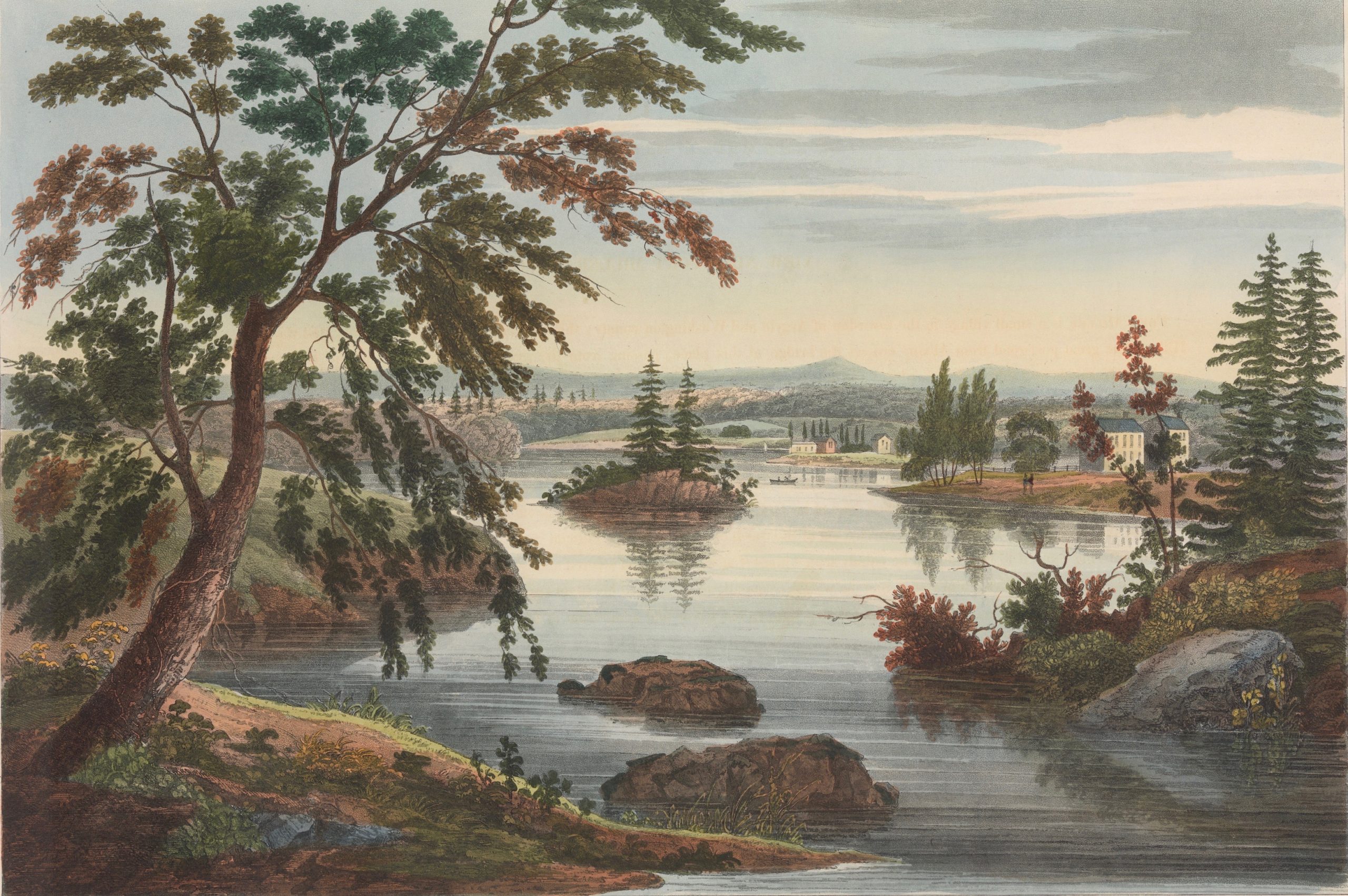
“Fort Miller is a small village in the township of Argyle and Washington County; thirty-seven miles north pf Albany and thirteen south of Sandy Hill. The great post-road from Albany crosses the bridge at this place, passing from the west to the east bank of the Hudson. There are some considerable falls and rapids near tis place; the latter of which were about eight feet in height when this view of the river was taken. Over these falls it is by no means unusual for raftmen to precipitate their rafts, whenever the state of the lumber-market at Albany is such as to offer inducement adequate to the risk; the usual course is by a short canal entering the Hudson at a short distance above and below the bridge, which avoids the falls altogether. General Putnam, when a major in the army, is said to have been the first to have tried this daring achievement. A part of Indians came suddenly upon him, as he lying near the rapids with a bateau and five men. A moment only was allowed for his determination, as to the best mode of conduct; already one of his men was stretched out dead at his feet, the balls flew in showers about his head; trusting to Providence he pushed off his boat, which by the force of the rapids was soon carried out of the reach of musket-shot…and although eddies whirled around him…he ultimately succeeded in rescuing himself from imminent destruction, to the terror and admiration of is superstitious enemies, who attributed his escape to the assistance of some supernatural power.”
–John Agg. Hudson River Port Folio. 1820


View Near Fort Miller. William Guy Wall. Hudson River Port Folio. Printed by John Hill for Henry Megary, 1822. Collection Metropolitan Museum of Art. (Reproduced under Fair Use, etc.)

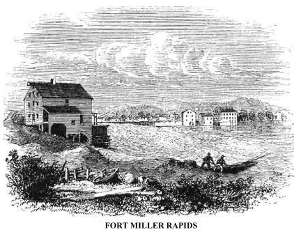
Preparing to produce a series of prints with accompanying texts, Irish painter William Guy Wall journeyed with travel-writer John Agg from New York City to the Adirondacks in 1820. Fort Miller had been constructed along the Hudson during the French and Indian War to protect a river crossing, or carrying-place above a small set of falls. The region was famous in the prelude to Burgoyne’s surrender at Schuylerville, four days and two years before Cornwallis laid down his arms at Yorktown. Burgoyne’s failure brought France into an alliance with the newly-formed United States. The area between the Mohawk River and Lake Champlain would soon become more well-known through the Leatherstocking novels of James Fenimore Cooper. Now, as then Fort Miller is a pleasant hamlet on the banks of the Hudson, next to one of the locks on the Champlain Canal that links tidewater Hudson to Lake Champlain. Architectural historian, novelist, and raconteur James Howard Kunstler has for many years been a plein-air painting companion. On May 29, 2015, we piled into his pickup truck and headed off in search of a motif. Arriving at Clark’s Mills, discouraged by new fences and threatening signage, we moved upriver to Fort Miller. A pair of dredging-barges ride on the stream, cranes at rest, cables slack, these dystopic gatecrashers, disrupting pastoral harmony with rusting dissonance remind us that The Hudson is a going concern, a working waterway that mingles muscle with beauty.


Fort Miller Rapids. Benson J. Lossing. The Hudson from the Wilderness to the Sea. 1866

Check out April 2020 Quaranteam Traveler Dispatches

(A preview of SKETCHBOOK TRAVELER by James L. McElhinney (c) 2020. Schiffer Publishing).

Copyright James Lancel McElhinney (c) 2020 Texts and images may be reproduced (with proper citation) by permission of the author. To enquire, send a request to

ed******@ne***********.com


June 4, 2020. QT Dispatch #65. Kaaterskill Falls. July 27, 2015

Waiting for the crisis to pass, our thoughts go out to friends and loved-ones who also shelter in place. Old friends pass away, people we loved and admired. Immobilized for the time being, we can revisit destinations, near and far. join me in celebrating the joys of Quaranteam travel, the hope that these diversions might inspire us to value things we had taken for granted, to draw strength, wisdom and compassion from deeper engagements with nature.


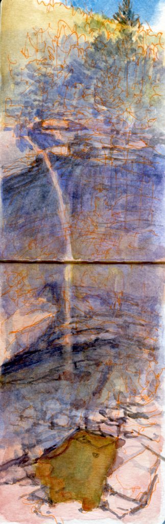
Kaaterskill falls. Monday. July 27, 2015

“Why, here’s a fall in the hills, where the water of two little ponds that lie near each other, breaks out of their bounds, and runs over the rocks into the valley. The stream is, may be, such a one as may turn a mill, if so useless a thing was wanted in the wilderness. But the hand that made that ‘Leap’ never made a mill! There the water comes crooking and winding among the rocks, first so slow that a trout might swim in it, and then starting and running, just like any creatur (sic) that might want to make a far spring, til it gets to where the mountain divides like the cleft hood of a deer, having a deep hollow for the brook to tumble into. The first pitch is nigh two hundred feet, and the water looks like flakes of drive snow afore it touches the bottom; and then the stream gathers itself together again for a new start, and may be flutters over fifty feet of flat rock, before it falls for another hundred, where it jumps from shelf to shelf, turning this-a-way and then turning that-a-way, striving to get out of the hollow, till it finally comes to the plain…the rock sweeps like mason-work in a half-round on both, and the shelves over both sides of the hill, and the shelves over the bottom for fifty feet, so that when I’ve been sitting at the foot of the first pitch, and my hounds have run into the caverns behind the sheet of water, they’ve looks no bigger than so many rabbits. To my judgement it’s the best piece of work I’ve met with in the woods; and none know how often the hand of God is seem in the wilderness, but them that rove it for a man’s life.”

–Natty Bumppo to Oliver Edwards, in The Pioneers by James Fenimore Cooper.

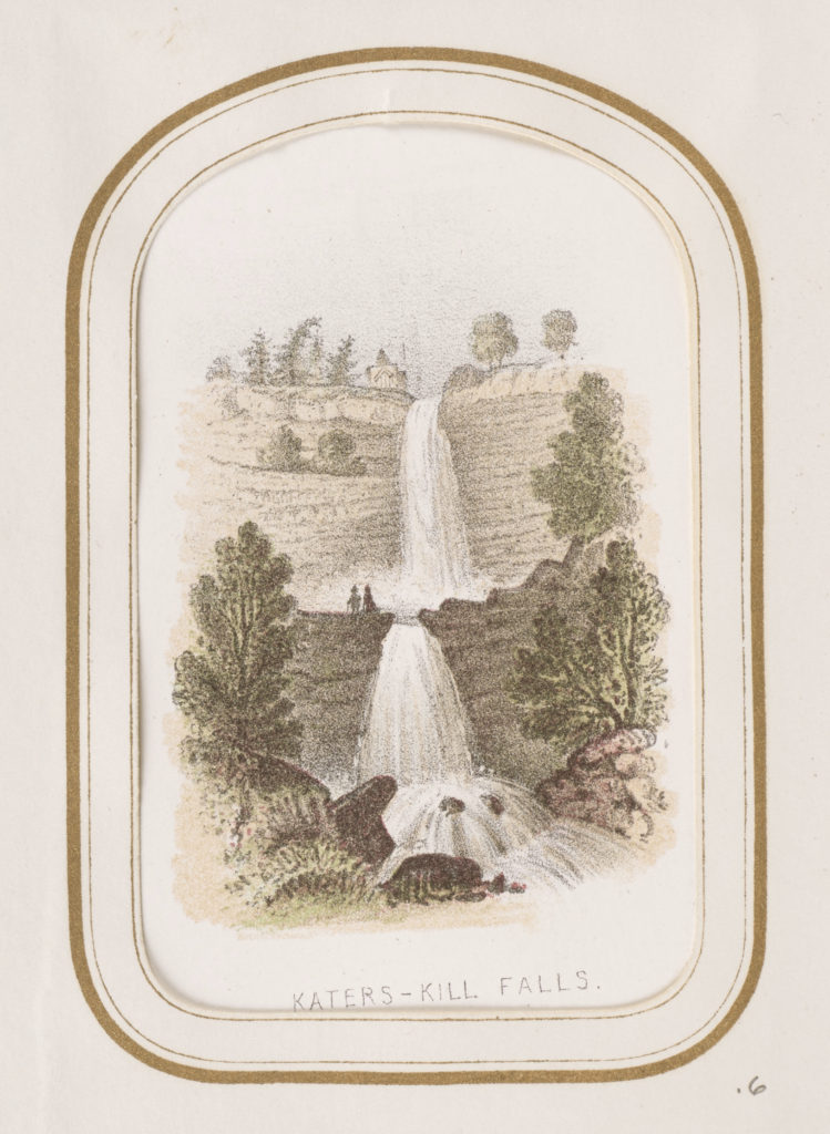
Katers-Kill Falls; Benson John Lossing (American, 1813 – 1891); New York, New York, United States; about 1860–1866; Chromolithograph; 7.1 × 5 cm (2 13/16 × 1 15/16 in.); 84.XD.869.6.6

Kaaterskill Falls. Benson J. Lossing. The Hudson from the Wilderness to the Sea. 1866. Collection Getty Museum. Reproduced under Fair Use, etc.

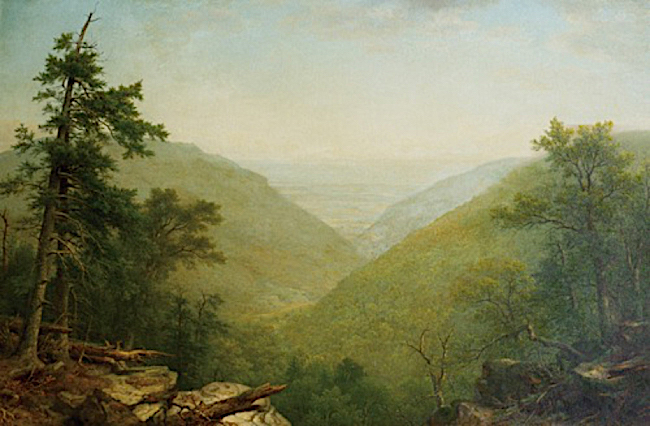
I had visited Kaaterskill Falls on numerous occasions. Following the stream than descends from Katers-Kill lakes one reaches a rocky shelf upon which find a large boulder. Climbing upon it I beheld a palimpsest of signatures hewn into the stone by previous visitors, including Hudson River School painter Sanford Gifford. A few feet beyond this glacial hitch-hiker the ground disappears into an airy amphitheater with an audience of thick woods. Opening first to the west, the cleft bends to the south as Kaaterskill Creek crashes down through rocky ravine between South Mountain and Roundtop. In his 1866 painting of the scene, Asher B. Durand has us looking at once from the head of the falls toward the west, and then southeast from the heights near Haines Falls. Someone like Benson Lossing might have detected the cagey old Jersey Huguenot’s bit of leger-de-main, but city swells at the Century Club would have praised it as God’s own truth.


Asher B. Durand. Kaaterskill Clove. 1866. Yale University Art Gallery

In late July of 2016 I returned to Kaaterskill Falls. My aim was to have a look at the new observation platform that had been built for viewing the falls from above. Other structures preceding this one has been built in the nineteenth century. These wooden follies had long ago collapsed into the wooded slopes, indistinguishable from deadfall. Just as contemporary realist painters confuse nineteenth-century verisimilitude with twenty-first century fact, people today imagine Thomas Cole, Durand and other Hudson River School artist roughing it in the mountains like Natty Bummpo and Chingachcook. Nothing could be farther from the truth. By 1830 he Erie Canal had been in business for five years, and Catskill Mountain House for six. The Hudson River bustled with traffic including steamboats landing tourists near sites made famous by Cooper’s Leatherstocking Tales. Durand’s 1849 memorial to Cole Kindred Spirits shows not two buckskinned longhunters but refined gentlemen, betogged in the historical-period equivalent of Orvis.
The lookout is reached by way of a well-established trail at the end of Laurel House Hill Road, off North Lake Road in North-South Lake State Park in Haines Falls, New York. Unlike its predecessors the military-grade steel tower is reached by a short bridge at the end of the trail. This adds stability to the vertical structure, which is built on a precipitous wooded slope on the north side of the falls. Unpacking my journal and paint-box I secured the page-ends of the book with small metal binder-clips, clipping the wire elements of one to a lanyard, lest a book full of paintings plummet into the jungle below. Lost in my work, deep in concentration, I heard a voice say, “Excuse me…excuse me.”
Looking up I beheld a pleasant young man in a black frock-coat. With a long-flowing brown beard, bright eyes, yarmulke, and lustrous curling payots, over his shoulders was cast a magnificent striped prayer-shawl. In his hand was a wooden staff, thick as a man’s wrist. He smiled. I smiled back. The last thing I expected to see in the mountains of Ulster County was a Biblical prophet. Stretching out his arm like Charlton Heston in Cecil B. De Mille’sThe Ten Commandments, he pointed to the falls.
“Who made that?” He asked.
Something told me he had never heard of Natty Bummpo, or Thomas Cole.
“Why, God made that” I replied. “God made everything in these woods, except for this tower we’re standing on.”
I went on to tell him the name of the falls was “Kaaterskill”, that “kill” was the Dutch word for a creek. These mountains I told him were once called the Katzenbergs. His eyes lit up. I figured that “Katzenbergh” had a cognate in Yiddish.
“Big cats, panthers used to live in these mountains. Some say they are coming back. Ergo the name. Katzen for cat, bergh for mountain. Now we call them Catskills, which is also the same name of another creek further north of here.”
Suddenly he looked worried. I turned around. A group of Hassidic brethren was clustered on the trail, preparing to depart. The Rabbi scowled and twitched his head as if to say, get away from that evil goy. I bade him farewell as he rejoined his flock.
Other conversations followed. As I was packing up to leave a mixed group of fit sweaty hikers approached.
“Been here long?” one them asked. Three or four hours, I told him.
“We’ve been here all day. Parked down on the road, climbed up the south side of the fall, went up to Sunset Rock and now we’re heading back.”
“Sounds like a great day,” I replied.
“This morning was a bummer,” he responded. “A kid fell off the top and was killed. Teenager taking a selfie. We got there just after it happened.”
“That must have been awful.”
“Hard to forget a thing like that,”
“Amid all this beauty,” I replied
“Yeah, ironic.”


Kaaterskill falls. Monday. July 27, 2015

Check out April 2020 Quaranteam Traveler Dispatches

(A preview of SKETCHBOOK TRAVELER by James L. McElhinney (c) 2020. Schiffer Publishing).

Copyright James Lancel McElhinney (c) 2020 Texts and images may be reproduced (with proper citation) by permission of the author. To enquire, send a request to

ed******@ne***********.com


June 3, 2020. QT Dispatch #64. On Top of Mount Greylock

As we continue under lockdown, and in New York City under a nightly curfew, join me in celebrating the joys of Quaranteam travel
The hope is that these dispatches might inspire us to value things we had taken for granted, to draw strength, wisdom and compassion from deeper engagements with nature, whenever we can resume our hikes, treks and voyages.


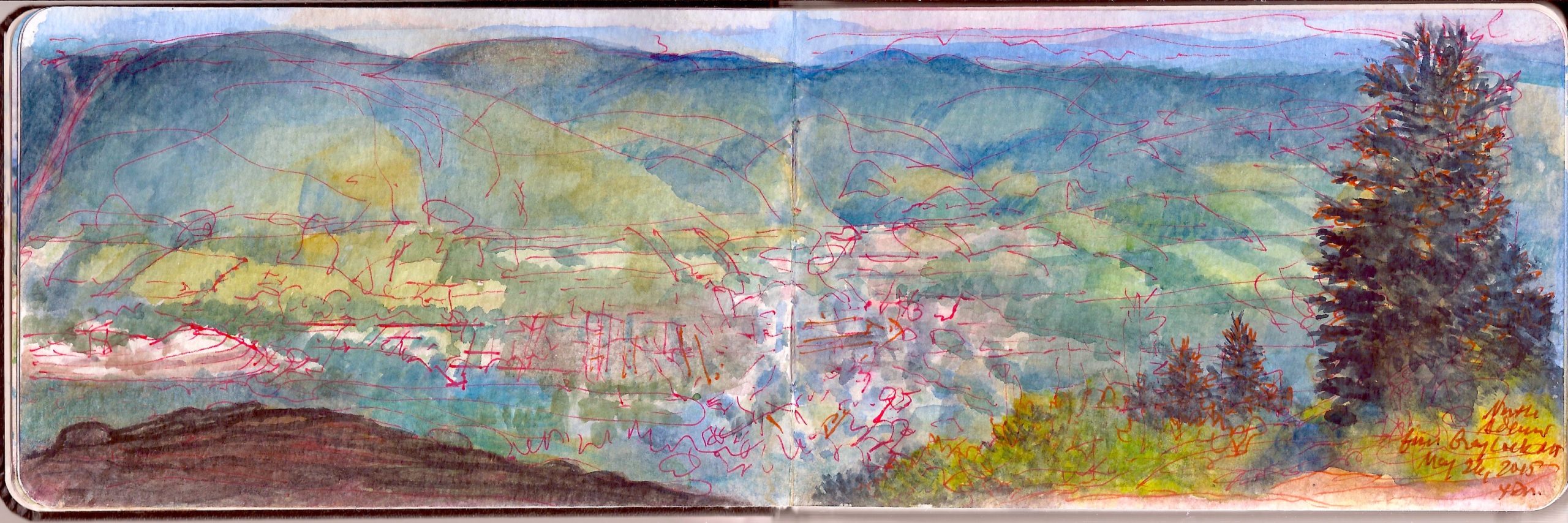
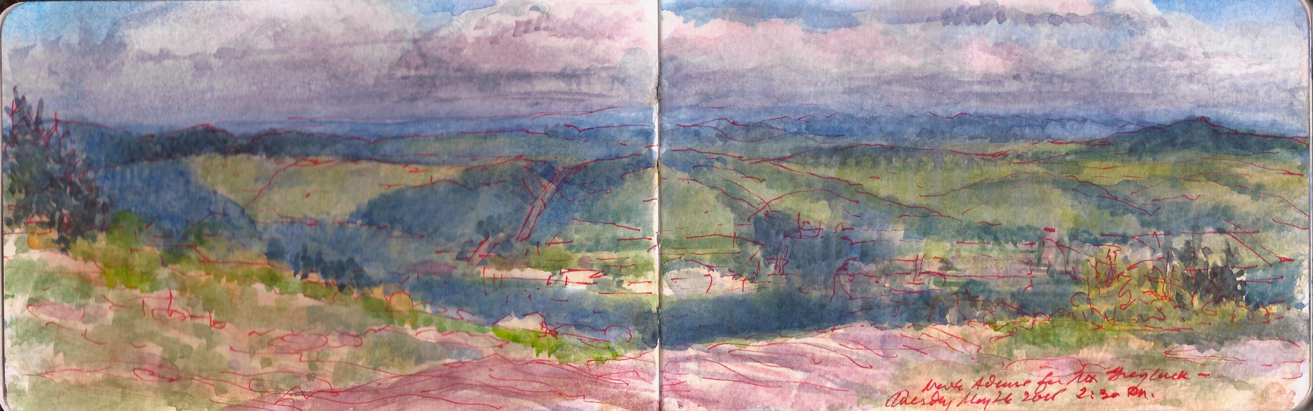
Adams Massachusetts from the Summit of Mount Greylock. Tuesday May 26, 2015.

“Or is it, that as in essence whiteness is not so much a color as the visible absence of color; and at the same time the concrete of all colors; is it for these reasons that there is such a dumb blankness, full of meaning, in a wide landscape of snows- a colorless, all-color of atheism from which we shrink? And when we consider that other theory of the natural philosophers, that all other earthly hues- every stately or lovely emblazoning- the sweet tinges of sunset skies and woods; yea, and the gilded velvets of butterflies, and the butterfly cheeks of young girls; all these are but subtile deceits, not actually inherent in substances, but only laid on from without; so that all deified Nature absolutely paints like the harlot, whose allurements cover nothing but the charnel-house within; and when we proceed further, and consider that the mystical cosmetic which produces every one of her hues, the great principle of light, for ever remains white or colorless in itself, and if operating without medium upon matter, would touch all objects, even tulips and roses, with its own blank tinge- pondering all this, the palsied universe lies before us a leper; and like wilful travellers in Lapland, who refuse to wear colored and coloring glasses upon their eyes, so the wretched infidel gazes himself blind at the monumental white shroud that wraps all the prospect around him”


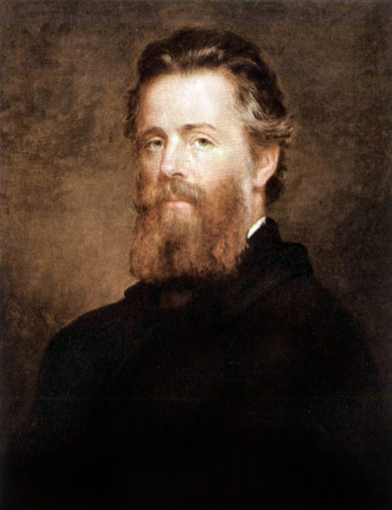
Portrait of Melville By Joseph Eaton. 1870
Getty Images (Reproduced under Fair Use, etc.)

Herman Melville (1819-1891) devoted an entire chapter of Moby Dick to the color white, which might resonate with us today, when people of color are being targeted by bigotry to suffer physical and mortal abuse. Having recently re-read the book, I had forgotten how much of it is meandering digression—a pre-Joyce stream of consciousness ranging from whaleboat mechanics to a field-guide to killing, butchering and rendering the wild leviathan. Spermaceti and ambergris; pale illumination ans seductive scents were the fruits of bloody slaughter.
The ship Pequod was a world turned upside down. Seldom present, under the spell of a mysterious west Asian, the monomaniacal captain may also be insane. Apart from his officers, the stars of the ship’s company are the harpooneers, people of color; a Pacific Islander, an African and a Gay Head Wampanoag. Ordinary Americans today may not imagine such diversity truly existed at that time. Yet a century or more before the novel is set, every seafaring tongue from around the globe was spoken on the waterfronts of New York and Nantucket.

Rising 3,489 feet above sea-level lies Mount Greylock, in the northern Berkshires. Viewed from his Pittsfield farmhouse, its snowy form resembling a whale is said to have inspired Melville. Nathaniel Hawthorne hiked its slopes. Other literary lights of the day such as William Cullen Bryant ascended its heights. Henry David Thoreau spent a night on the mountain in the summer of 1844. When he awoke, a cloud-bank rested on the summit.

“As the light increased
I discovered around me an ocean of mist,
which by chance reached up to exactly the base of the tower,
and shut out every vestige of the earth,
while I was left floating on this fragment
of the wreck of the world,
on my carved plank in cloudland;
a situation which required,
no aid from the imagination
to render it impressive.”

On more than one occasion I have found Mount Greylock buried in clouds. Large sheets of rock lie exposed at the summit, which has been cleared. The bell-shaped Veterans Memorial Tower stands on the highest point of ground. Its beacon marks the location at night. The northern end of the mountain faces Williamstown, North Adams, and the Mohawk Trail—Route 2, which runs between Troy, New York and Boston. Below to the east. the Hoosic River flows northward, entering the Hudson River near Stillwater, just above the falls. Mill-towns like Adams Massachusetts, birthplace of women’s rights activist Susan B. Anthony. As a center of light industry and textile manufacturing, the town flourished during the nineteenth-century. A century later it fell into decline and economic hardship. Today the town is enjoying a revival, as Berkshire County has become a popular destination for weekenders from New York and Boston.


Asher B. Durand (1796-1886). Kaaterskill Clove. 1866. Yale University Art Gallery

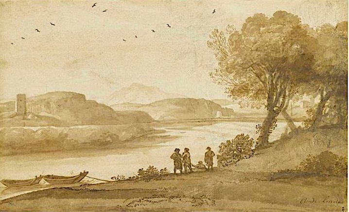
Working at such an elevation (2,700 feet above the valley floor) presents one with an almost aerial perspective. My approach to drawing is sapient rather than mimetic. Drawing on my knowledge of mapmaking, I sought to privilege certain landmarks for purposes of measuring the space and correcting it to scale. The town presented a rational footprint. Just to the north a quarry or gravel-pit cut a pale slash through the verdant bottomlands. Just beyond, high-tension towers marched up the ridge, in a diagonal pathway hewn through rising woodlands. Organizing the foreground in these dramatic vistas is always a challenge. My first encounter with kind of picture-making was in 1979 at Grant’s Last View of the Valley on the shoulder of Mount McGregor in Wilton New York. Here I was reminded of Asher B, Durand’s painting of Kaaterskill Clove. Instead of following the Claudian convention of a low diagonal leading us into the space along the bottom of the frame, colliding with a cluster of trees framing the scene, Durand framed his view with two of these compositional devices mirroring one another, and then echoes it in the overlapping arcs of the hills stepping back into the distance. Locating a pair of rocky ledges on the right and an alpine pasture on the left, I punctuated the left edge of the frame with a scrubby-looking spruce.


Claude Lorrain (1600-1682). A print from his Liber Veritatis. Claude Gelee, called “Le Lorrain” was a lowborn French expatriate who enjoyed a very successful career in Rome, which at the time was an international city, like New York, Singapore or London. Art-historians often classify him as “French” while neither he nor fellow Gallic expat Nicholas Poussin (1594-1665) had much use for a homeland where a hidebound caste-system would have hindered their advancement.


Looking East from Mount Greylock. Tuesday May 26, 2015.

Check out April 2020 Quaranteam Traveler Dispatches

(A preview of SKETCHBOOK TRAVELER by James L. McElhinney (c) 2020. Schiffer Publishing).

Copyright James Lancel McElhinney (c) 2020 Texts and images may be reproduced (with proper citation) by permission of the author. To enquire, send a request to

ed******@ne***********.com


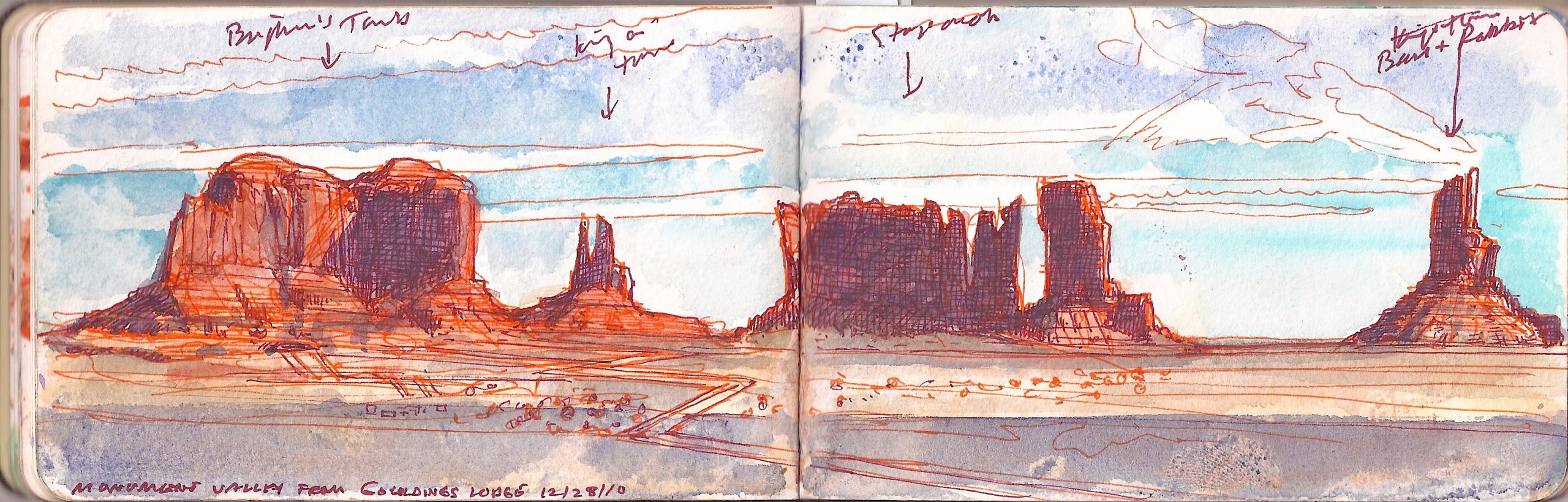
June 2, 2020. QT Dispatch #63. Tsé Biiʼ Ndzisgaii. December 28, 2010


Tsé Biiʼ Ndzisgaii (Monument Valley, Navajo Nation) December 28, 2010.
The view is from Goulding’s Lodge, the guest-ranch and hotel film director John Ford used as his base-camp in filming many of his westerns. Famous for its spectacular chessboard of tall sandstone buttes, it became synonymous with the cinematic west. Left to right: Brigham’s Tomb, King-in-his-Throne, Stagecoach, and Bear-and-Rabbit. Needless to say the locals have other names for these formations.

Saturday December 25, 2010. We awoke in our motel in (Little) Manhattan Kansas, after having celebrated Christmas with Kathie’s brother Mark and his son Sean the night before. Mark had reported for duty on Christmas at Fort Riley too early for all of us to meet again for breakfast. As a top sergeant, the idea of being the highest-ranking fighting man on base seemed to amuse him. He honored the event by showing up for work in his dress blues. Sean was asleep when we called and preferred slumber to a hot breakfast at iHop, the only restaurant in town that was open.
As I walked up to the car rental desk at Kansas City airport, the attendant asked what flight we had booked. Looking it up, he calmly informed us that due to a blizzard, nothing was flying in or out of any of the New York City airports. I asked if he could find out how long it would be to get out of town. Placing another call, he informed us that it would be five or six days before we could get seats on another flight; maybe Thursday or Friday. He also informed us that a massive winter storm was brewing on the Pacific coast. There had been snowfall in Los Angeles.
I asked him what the price would be for us to keep the car, drive east and drop off at Newark, where our car was parked. Sticker shock made me call the hotel where we had stayed in the Country Club district, only to find was booked solid for the entire week, full up with travelers stranded in the Paris of the Plains. Kathie looked at me and asked
“How far is it from here to Monument Valley?”
Trying to compose a quick, coherent answer, calculating the distance, potential obstacles, delays and the challenges of getting back to KC in time to catch our return flight, I started walking for the door and replied. “No worries. Let’s go.”
The tale of our road-trip will be unpacked in future dispatches. Today I want to invite fellow travelers to devote your attention to the plight of the Diné and Hopi communities during the COVID19 pandemic. The Navajo Nation is the largest indigenous territory in the country. Its territory encompasses lands occupied by the Puebloan Hopi tribe. These culturally rich economically-challenged communities have been hard hit by the Corona virus, with soaring infection and mortality rates.
Non-Natives may feel no connection to these communities, and thus no obligation to help them. This land was theirs for thousands of years before earlier pandemics wiped out ninety-percent of their numbers after their first contact with Europeans. Look at it this way. We are their guests. They are our hosts, our neighbors and friends. As human beings, we are all of one family. Please help. Please contribute.

June 1, 2020. QT Dispatch #62. George Washington Bridge from Billings Terrace, Fort Tryon Park. Monday, August , 2016

Waiting for the crisis to pass, our thoughts go out to friends and loved-ones who also shelter in place. Old friends pass away, people we loved and admired. Immobilized for the time being, we can revisit destinations, near and far. join me in celebrating the joys of Quaranteam travel, the hope that these diversions might inspire us to value things we had taken for granted, to draw strength, wisdom and compassion from deeper engagements with nature.

. (Image and text were featured in the exhibition James McElhinney. Discover the Hudson Anew, curated by Laura Vookles. Hudson River Museum. Yonkers, New York. September 13, 2019 to February 16, 2020. Published also as a limited-edition in Hudson Highlands. North River Suite Volume One. Needlewatcher Editions. New York. 2018)


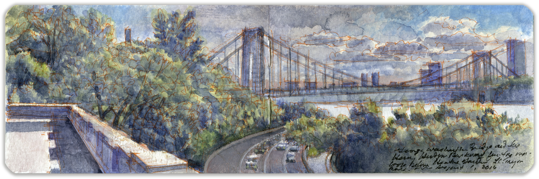
George Washington Bridge from Fort Tryon Park. Monday August 1, 2016

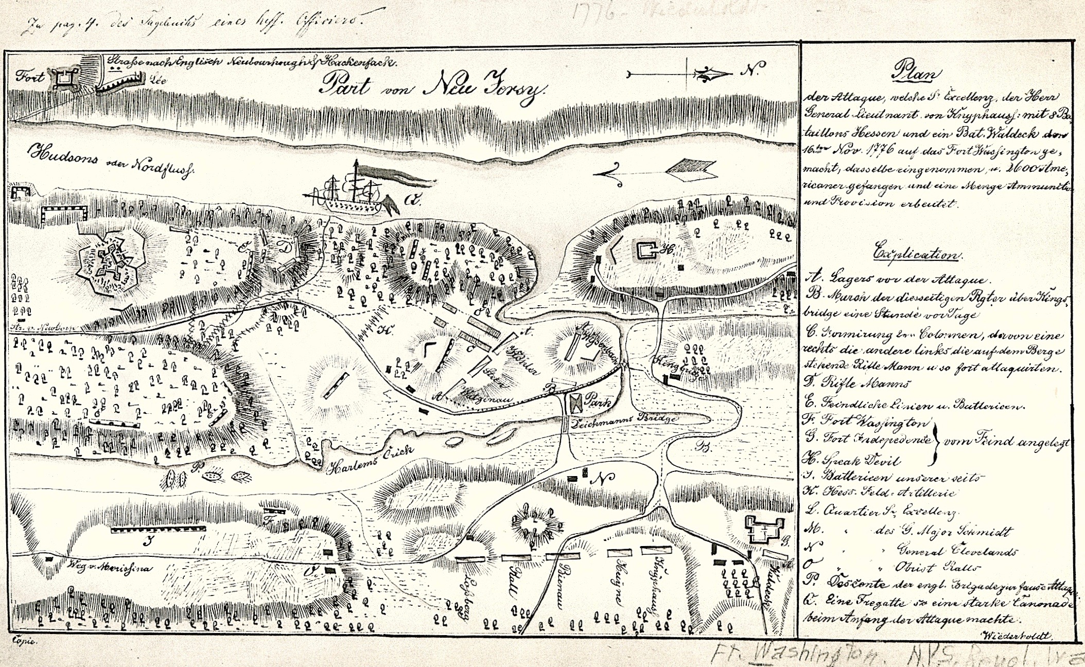
Construction of the George Washington Bridge, which opened in 1932, widened a notch in the basaltic diabase cliffs to accommodate the roadway. In 1937 New York and New Jersey created the Palisades Interstate Park Commission, with Monument Park (Fort Lee) as its southernmost terminus. Alternately identified in Revolutionary War documents as Fort Constitution, the fortified position was designed to operate in tandem with Fort Washington in Manhattan, to lay down fields of fire hindering the movement of British warships and transports. Lacking sufficient water-batteries, each position had been situated at too great an elevation for the plan to work. Stretching across the Hudson was a chevaux-de-frise of sunken ships and stout timbers designed to pierce the wooden hull of any ship that might run onto them. What remains of this obstacle lies directly below the deck of today’s bridge. Ascending the Harlem River on Saturday November 16, 1776, Hessian and British troops attacked Continental units defending three hills between Spuyten Duyvil Creek and Jeffrey’s hook. Across the river at Fort Lee, George Washington watched in horror as his positions were overrun.


Hessian Map of the Battle of Fort Washington. Saturday, November 16, 1776. New York Public Library. (Reproduced under Fair Use etc.)

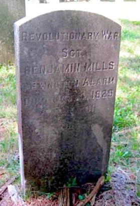
For the bicentennial of the American Revolution, parking lots and an interpretive center were built. Earthworks were restored to re-create the feeling of an eighteenth-century fort. When I first visited the site, in the 1990s, the fiberglass revetments had faded and were cracking. Recent improvements replaced these with timbers. A blockhouse and cabin were built, along with a coastal battery. On the anniversary of the battle, artillerymen fire salutes from the cannons, rattling Manhattan windowpane. Fact-checking another one of these posts I discovered that one of my fourth-great-grandfathers had been at Fort Lee/Constitution that fateful November day. On a return dated September 1776, Benjamin Mills’s (1738-1829) is listed as captain. One of the Connecticut minutemen who took up arms during the Lexington Alarm in 1775, Mills commanded a battalion at the Battle of Trenton. From what I can gather, rank in the Nutmegger militia was more a job-description than a mark of status. the fact that sergeant is inscribed on his tombstone suggests a low opinion of officers, despite having been one himself.

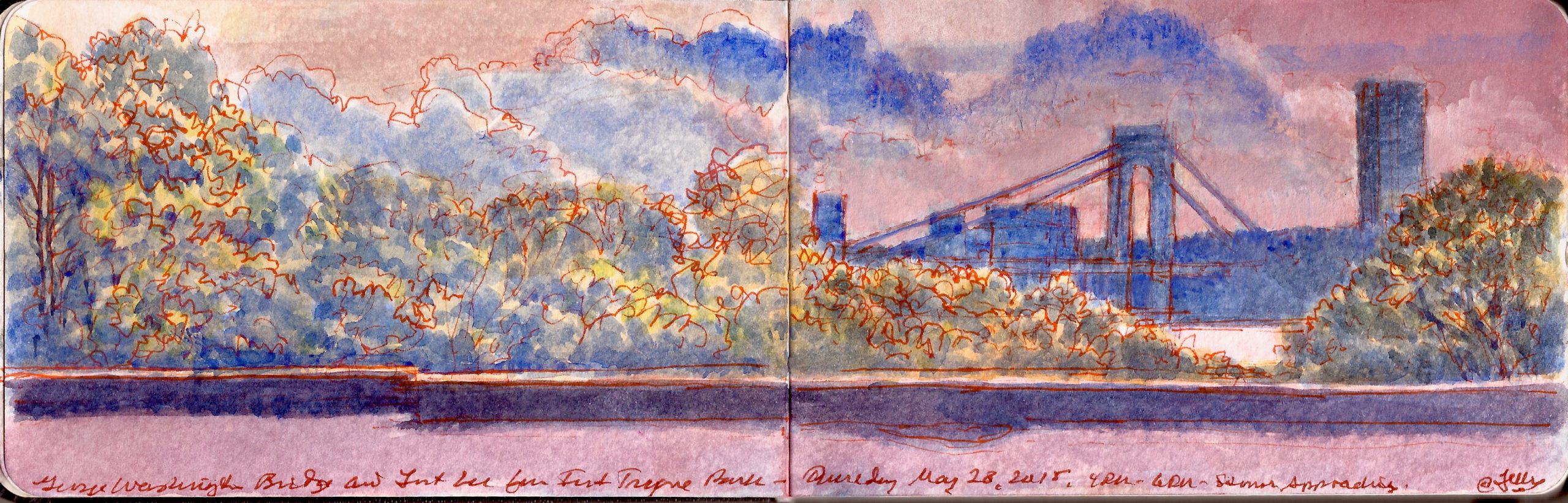
Looking southeast from a masonry terrace below Billings Lawn in Fort Tryon Park. Henry Hudson Parkway (Route 9A) runs along the western shore of Manhattan between the Bronx and the Battery. Crossing the George Washington Bridge, US Route 1 and Interstate 95 link Key West Florida to Kittery, Maine. Maritime traffic extends one-hundred-thirty miles up the Hudson River to the port of Albany. Beyond that barges and pleasure-craft navigate canals and waterways into the Great Lakes and Saint Lawrence River. What one might take as just a scenic urban vista is in fact a palimpsest of restless human mobility.


George Washington Bridge from Cloisters Lawn Terrace. Thursday May 28, 2015

Check out April 2020 Quaranteam Traveler Dispatches

(A preview of SKETCHBOOK TRAVELER by James L. McElhinney (c) 2020. Schiffer Publishing).

Copyright James Lancel McElhinney (c) 2020 Texts and images may be reproduced (with proper citation) by permission of the author. To enquire, send a request to

ed******@ne***********.com