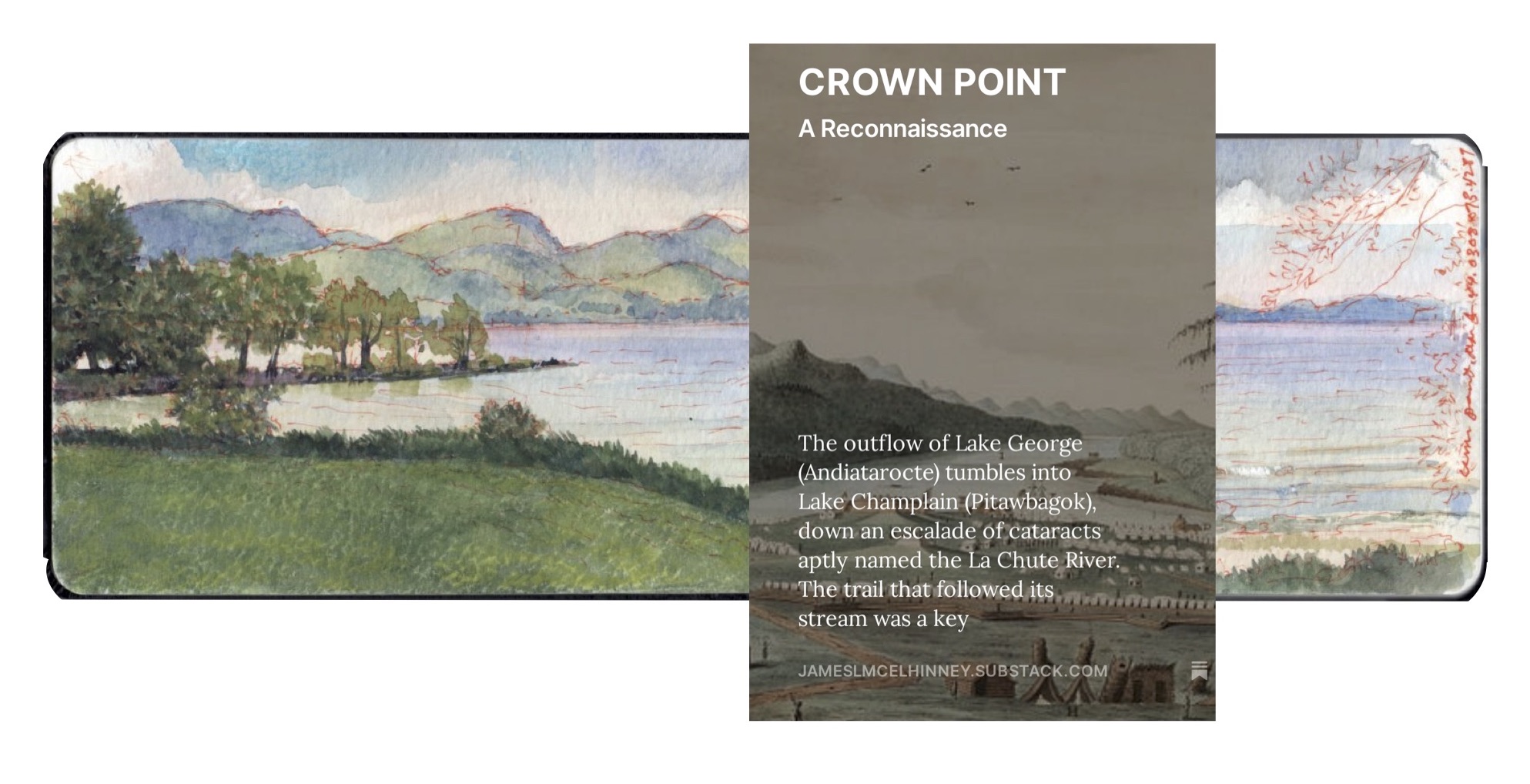
The outflow of Lake George (Andiatarocte) tumbles into Lake Champlain (Pitawbagok), down an escalade of cataracts aptly named the La Chute River. The trail that followed its stream was a key portage (carrying-place), between the Saint Lawrence watershed and the Hudson Valley. The land north of the narrow waterway functioned as a no-man’s-land between Mohawk (Kanien’kehá-ka) and Abenaki (Wôbanakiak) territories. To the west, the iron hills of the western Adirondacks. The eastern boundary of this contested ground is the river-like stretch of upper Lake Champlain. The northernmost extremity of this demilitarized zone is a thumb-shaped peninsula, bordered on the west by swampy wetlands and Bulwagga Bay. This finger of land is known today as Crown Point—not be confused with the village on Putnam Creek five miles to the south. The origin of its name is a matter of conjecture. The French dubbed it Pointe á la Chevelure, because its shape resembled a trophy scalp. During peacetime in precolonial times, this headland served as a meeting-place and trading hub. During periods of hostility, it became a bloody battleground. In 1609, Samuel de Champlain organized an expedition of Wyandot, Algonquin and Montagnais warriors to seize control of the strategic La Chute portage. Haudenosaunee warriors hastened from the Mohawk Valley, to meet the invaders somewhere between Crown Point and Ticonderoga. As both sides traded boasts and insults, the French explorer stepped forward with sang-froid, lowered his arquebus, and blasted a load of buck and ball into the Iroquois formation. When the smoke cleared, three chiefs lay dead on the field. The rest dispersed in terror, unaware that what awaited them in the centuries to come would prove to be far worse.