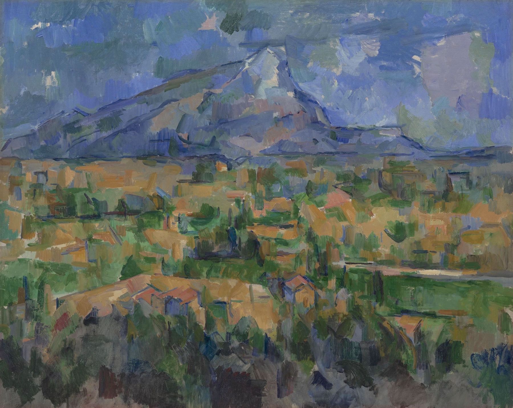
Paul Cézanne. Mont Sainte-Victoire. 1902-1904. Collection Philadelphia Museum of Art. An old friend since childhood, this painting was always at the top of my list of works to visit. Between the PMA and the Barnes Collection, Philadelphia is blessed with a greater concentration of works by Cézanne than anywhere else on earth.
In 1759, Captain Thomas Davies of the Royal Artillery made a drawing, ”…on the spot” of the encampment of Lord Jeffrey Amherst’s army from a position a few hundred yards southeast of His Majesty’s Fort at Crown Point. From what I could reckon by looking at maps of the period, today’s main parking-area just north of the fort had been covered by workshops and warehouses. General Amherst and his staff would have been lodged beside the little cove just beyond the foot of today’s Champlain Bridge. A picnic area and events-pavilion now stand on the site of an earthen French redoubt. Wooster’s Third Connecticut provincial regiment, including my ancestor, would have been encamped just to south behind a line of outworks along a natural uplift of the fossil-reef limestone that undergirds the peninsula. Rangers and indigenous forces were quartered in huts and wigwams further to the rear, near the site of the present-day park-ranger station and maintenance shed.
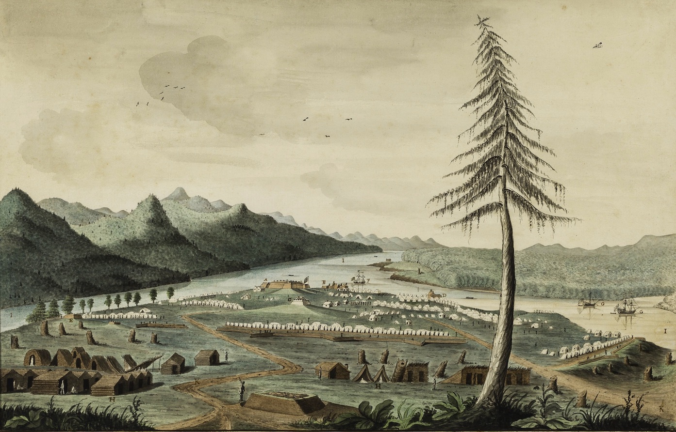
Thomas Davies. 1737-1812. View of Amherst’s army at Crown Point, 1759. Courtesy Wintherthur Museum, Delaware.
Embellished with picturesque touches, Davies’s finished watercolor is far from naïve in its rendering of the site. Twenty-first-century viewers might mistake topographical accuracy for a lack of optical verisimilitude. Davies was keenly aware that whatever artistic aims his painting might achieve, his primary goal was creating a chorographic vista one could read like a map. Eight years later professional watercolorist Paul Sandby took up a position to oversee the drawing curriculum at the Royal Military Academy in Woolwich. It was believed that artistic training would make keener observers of future military officers, enhancing the value as military intelligence whatever drawings they might make “on the spot”. It also gave them the ability to editorialize, to downplay or call attention to features and landmarks which might be regarded as advantageous. A hallmark of expeditionary art is the distortion of scale to render more legible certain elements of terrain. I noted this on many occasions when my travels gave me the opportunity to compare an optical experience of terrain with historic depictions more focused on conveying specific data.
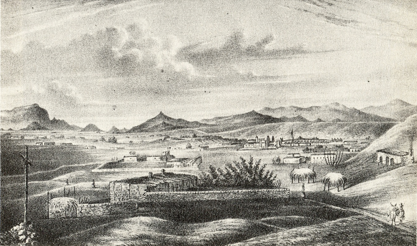
Richard Hovenden Kern’s 1849 view from Fort Marcy is a case in point. Looking south from a hillock along the northern margins of downtown Santa Fe, one’s gaze may seize first on the jagged Placer mountains, then the fall of the massive upthrusting Sandias. Panning right, we find the pinched summit of La Tetilla hill. Further on we find the Jemez range and Valles Caldera, looming up behind Ortiz Mountain and Montoso Peak. Viewed altogether in a single photographic exposure, these features become nothing more than illegible specks on the horizon.
By compressing the distance between these landmarks, while enlarging them and minimizing the foreground, Kern has chosen to privilege data over optics. His drawing provides a pictorial guide to prominent landmarks in ways that no still snapshot ever could.
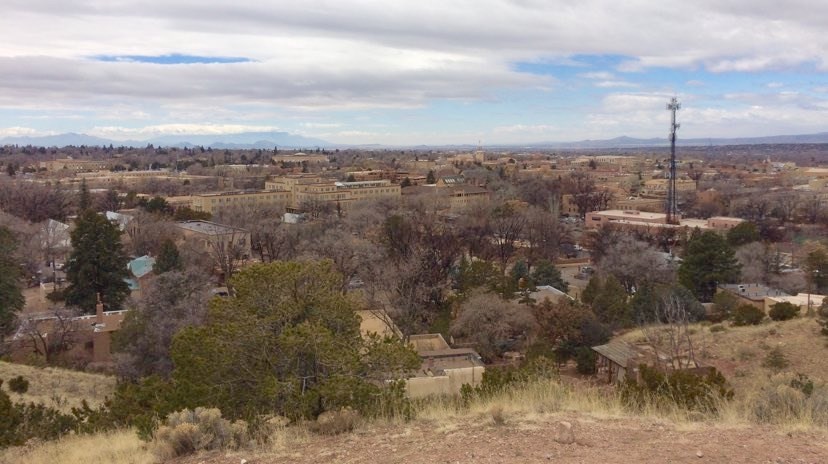
Santa Fe from Fort Marcy. March 4, 2019. Photograph by the author.
Conditioned by photography, later vistas from the same point-of-view embrace optical verisimilitude at the expense of useful data. Kern’s approach is reprised thirty-three years later in an aerial fly-overview of Santa Fe, one of the countless townscape panoramas produced in vast quantities during the denouement of the golden age of popular lithography.
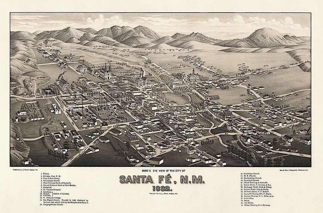
Looking east. Richard Kern’s point of view would have been from atop one of the hills visible along he left edge of this image, just beyond Bishop’s Lodge Road. More than three decades had passed since Kern visited the former Spanish possession, acquired from Mexico in 1848. The street grid has expanded. The downtown area between Rio Santa Fe and the row of low hills to the north filling up with new construction. Thirty years later Santa Fe had become a magnet for tourists, artists and writers. 19th-century Victorian and Spanish Revival architecture disappeared under the adobe façades of the Pueblo Revival style, expressing a strong regional flavor retained by the city today.
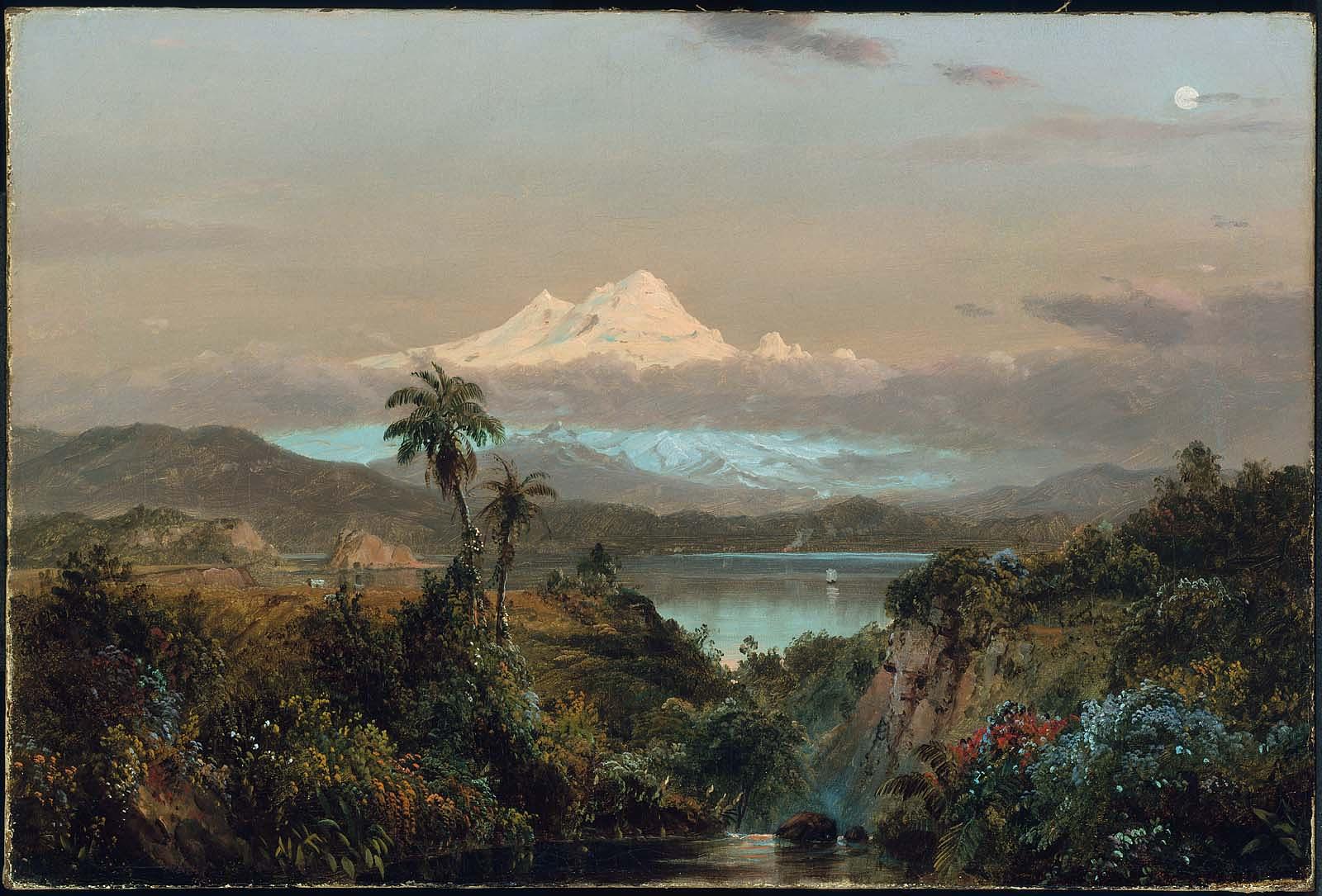
Frederic E Church. Cayambe. 1858. Museum of Fine Arts, Boston.
To the photo-conditioned eye, Kern’s drawing may seem naïve, but we find similar distortions in the works of professional artists like Frederic Edwin Church, Albert Bierstadt and John Frederic Kensett. For the Ecuadorian volcano Cayambe to be visible from Otavallo, looming over Lago San Pablo as it does in Church’s painting, the mountain would have to dwarf Everest. Similarly, Albert Bierstadt frames a fictitious alpine peak in a nebulous porthole, hovering above the summit of Mount Rosalie (present-day Mount Evans, Colorado).

Albert Bierstadt. A Storm in the Rockies (Mt. Rosalie) 1866. Brooklyn Museum
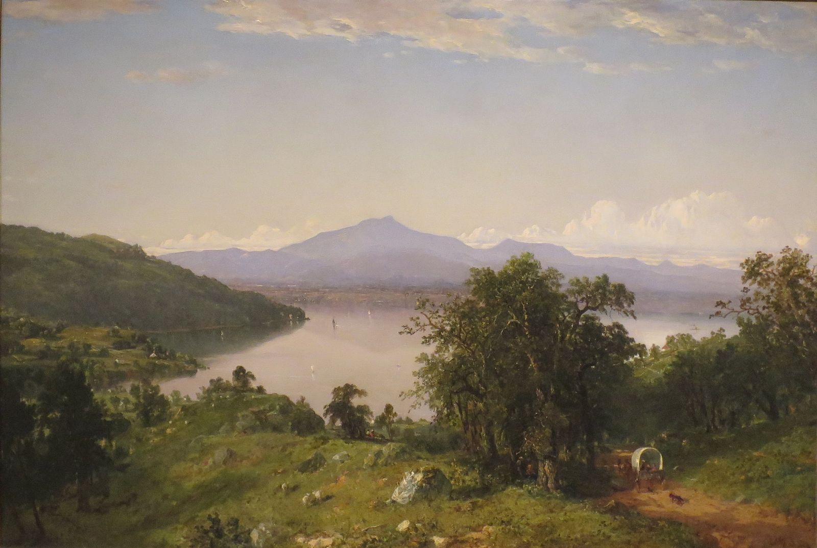
John Frederick Kensett. Camel’s Hump. 1852. Hugh Museum. Atlanta
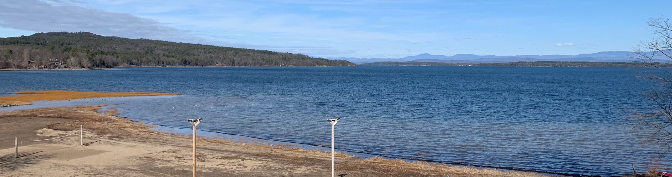
A recent photograph of Kensett’s perspective. 2021
Kensett’s view of Camel Hump Mountain in Vermont, as seen from Westport, New York is another foray into hyperbole. These artists followed the maxim that mere imitation can never attain the lofty realm of art, at the same time relying on the fact that their viewers were unlikely to question the data their pictures delivered. Later artists like Paul Cézanne employed a comparable intensity of empiricism. Eschewing traditional descriptive conventions, he developed idiosyncratic visual effects which superficial readings might confuse with style. Many of his watercolors read like maps of scientific knowledge; fragments of hard-won certainty, scattered across fields of unknowing, and yet legible as complete ideas.
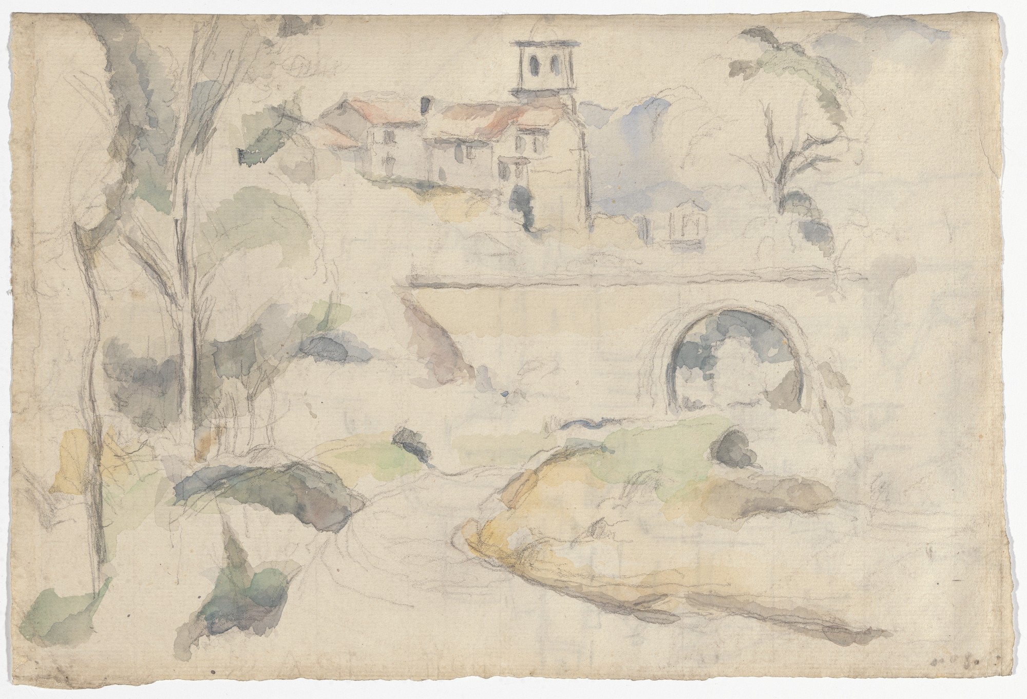
Paul Cézanne. Bridge at Gardanne. 1885-1886. Lillie P. Bliss Collection. MoMA
As tastes and methods changed, the goal of painting what is there was, and is less important than portraying the experience of discovering, exploring, and then seeing it. Few landscape painters understand this because most are trained in a bubble, a hall of mirrors in which a painting is a painting is a painting. “Landscapes,” as J.B. Jackson put it, “do not occur in nature but are created when people adapt terrain to their use.” The landscape is thus not composed of the physical features we behold, but how we come to know them. In other words, as far as a painting might be concerned, it is the landscape. Topographical artists were well aware of this, which is why they say no need to compromise valuable data for the sake of optical verisimilitude. Neither did Cézanne. The man who died of a chill, after being drenched by a downpour in the parched land of Provence, would have laughed at the formalist fairy-tale that he turned away from nature to set the corner-stone of modern art. On the contrary, he gave us new ways to look at nature, making his contributions more relevant today than ever before.
Now available to own: Sketchbook Traveler: Hudson Valley
Explore my Quaranteam Dispatches, from April 1-June 8, 2020
(c) 2021 by James Lancel McElhinney.
(All images reproduced under fair use for critical and educational purposes)