Category Archives: Dispatches

April 21, 2020. Quaranteam Traveler Dispatch #21.

The world we have known can never be the same. We can beguile ourselves with the vain hope that things will return to normal, forgetting that the world has always been in flux. Human evolution has been driven by geological upheaval, climate change and plagues. Mortal crises test us. For the first time in the history of the planet, a unique intelligent life-form has been focused on a single natural disaster, in real time, at the same moment in time.
Trying to make lemonade out of bitter fruit, these quotidian posts are offered as messages of hope, not just for our own survival, but as motivation to redirect our attention to the world around us, to treasure what we had previously taken for granted, drawing strength, wisdom and compassion from deeper engagements with nature.


POET’S WALK. Hudson Valley Sketchbook. July 7, 2011

(Image and text were featured in the exhibition James McElhinney. Discover the Hudson Anew, curated by Laura Vookles. Hudson River Museum. Yonkers, New York. September 13, 2019 to February 16, 2020.

Poets’ Walk, Annandale-on-Hudson, New York

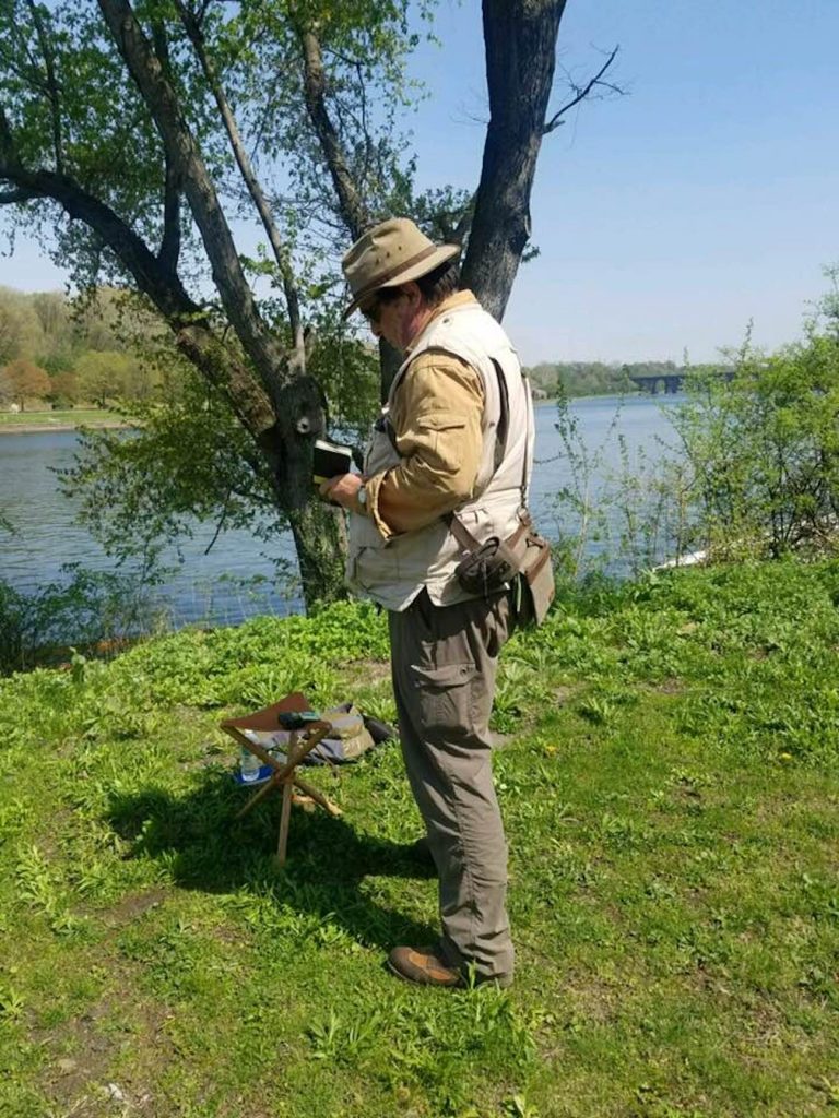
Located on the left bank of the Hudson a few miles upstream from Kingston-Rhinecliff Bridge is a rolling tract of land that was developed as a private pleasure-park in 1849. Wealthy families having built estates atop the bluffs set aside a tract of uncultivated land for the enjoyment of nature and the improvement of health. They hired German landscape architect Hans Jacob Ehler to divide the land between clearings and woodlands, laying out trails, view-sheds and pavilions. Washington Irving, William Cullen Bryant and other notable recipients of Delano and Astor hospitality are said to have drawn inspiration from their rambles at Poets’ Walk. In recent years the park has come under the control of Scenic Hudson Land Trust, which maintains the trails and other amenities for year-round public use. Having visited the park on numerous occasions, I have never failed to meet other hikers on the trails without the exchange of pleasant greetings. Setting up to work from one of the wooden benches set out along the trails, or on the portable stool strapped to my back, I never suffered any kind of interruption or distraction. Perhaps visitors might slow their pace as they pass me, or steal a glance over my shoulder as they stride by. It seems that such places might promote civility, as much as they inspire bards.

(A preview of SKETCHBOOK TRAVELER by James L. McElhinney (c) 2020. Schiffer Publishing).

Copyright James Lancel McElhinney (c) 2020 Texts and images may be reproduced (with proper citation) by permission of the author. To enquire, send a request to

ed******@ne***********.com


April 20, 2020. Quaranteam Traveler Dispatch #20

Despite our temporary confinement, we can still celebrate travel. These quotidian posts are shared as messages of hope, that when this crisis ends, we will discover outdoors, wonders we had taken for granted, drawing strength, wisdom and compassion from deeper engagements with nature.


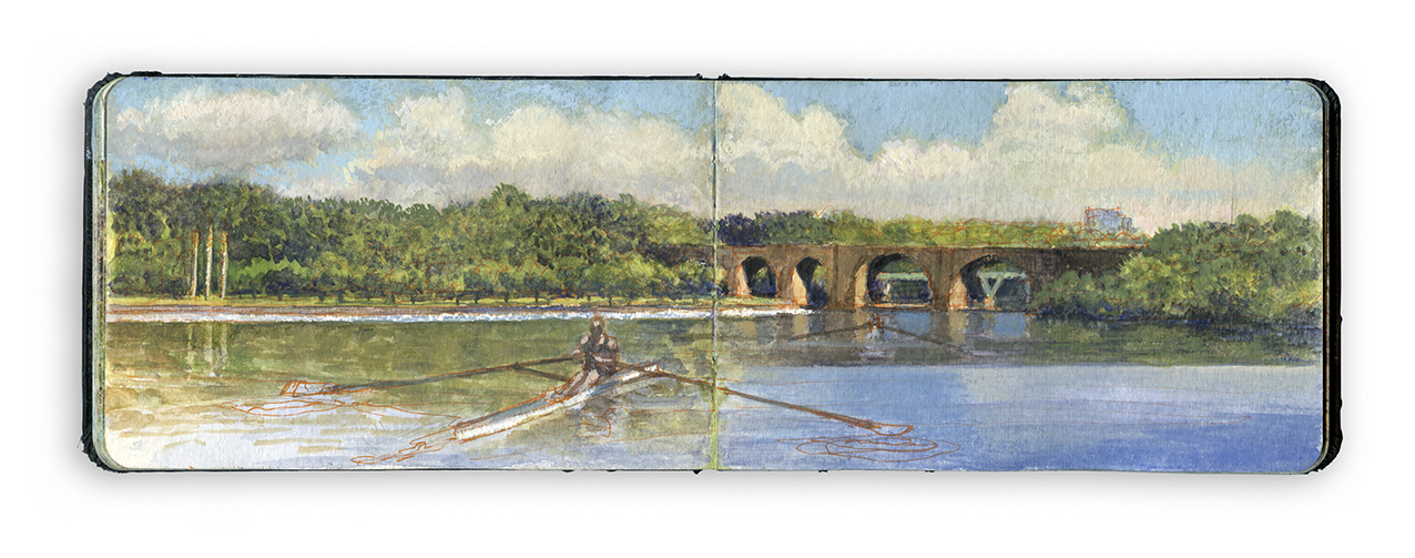
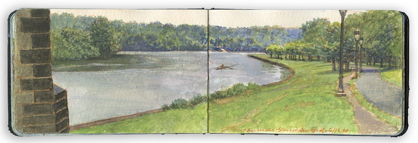
Looking North from Below the Connecting Railway Bridge.Schuylkill River Sketchbook.

Exploring the banks of the Schuylkill River in 2018, between the mouth of Wissahickon Creek and Fairmount Water-Works, I filled a sketchbook with journal-paintings. Later that year these would become a limited-edition suite of prints, and the centerpiece of the installation O.T.W. On the River, at Independence Seaport Museum in Philadelphia. The installation also included works by living artists Patrick Connors, Tom Judd, Stacy Levy, Deirdre Murphy, Jacob Rivkin and Joseph Sweeney and historic artists Edmund Darch Lewis, Johann Georg Martini and Granville Perkins.

LOOKING NORTH FROM BELOW THE CONNECTING RAILWAY BRIDGE
Surrounding this pastoral setting is a twenty-first-century city and a palimpsest of human mobility. For thousands of years prior to the arrival of Europeans, the Schuylkill River was a major thoroughfare for Native Americans. From 1815 to 1931 a series of locks and canals linked Pennsylvania coal regions with Allentown, Reading, Phoenixville, and Philadelphia. Footpaths, motorways, and railroads border both banks of the river. The Schuylkill is crossed by ten bridges between Fairmount and East Falls.
I began this painting on a rainy day, facing northwest, sheltered by one of the eastern arches of the Pennsylvania Railroad Connecting Bridge. Kelly Drive is at the right. A paved bike trail runs beside it, separated from traffic by grassy margins. Next to it, a worn dirt track follows the crest of a bank that descends to the river. Hidden behind the wooded western bank at the left is Martin Luther King Jr. Drive. Just beyond that, the roaring din of the Schuylkill Expressway restrains us from pastoral reverie. On the far shore, ahead is the wide metal ramp and dock operated by the Philadelphia Dragon Boat Association. On the water in the middle distance, a single scull sits where Eakins painted himself, pulling away from Max Schmitt.

April 19, 2020. Quaranteam Traveler. Dispatch #19.

These writings and artworks celebrate personal mobility, in pursuit of mindful engagements with history, nature and the environment. Beholding the world around us with care and attention is an act of reverence. Offered as messages of hope and solidarity, these quotidian posts will continue until the present emergency is behind us.

Traveling to New Mexico early in 2019, I explored the Rio Grande between John Dunn Bridge and Cochiti Reservoir. Sites were selected for narrative reasons, as well as for their visual allure. Many of the works I produced, including my painting-journal, were exhibited at Gerald Peters Gallery in Santa Fe, in the exhibitions Reimagining New Mexico, from June 28 to August 3, and Speaking to the Imagination / The Contemporary Artist’s Book, from June 21 to October 24.
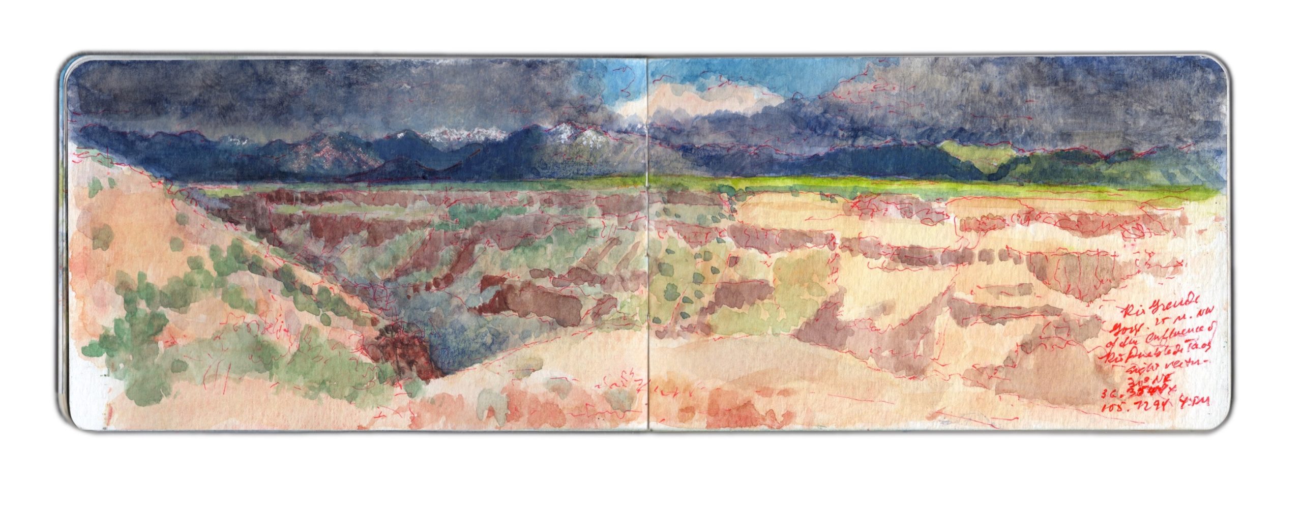

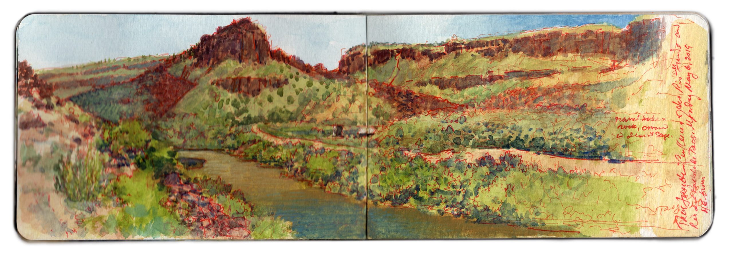
May 8, 2019. Near the Trail-head above Taos Junction. 30 degrees NE. 36.3544 x 105.7294

Wake early, make journal entries, posting them on social media. Simple breakfast. Work in the studio. Decide to try to produce a concertina book. Call Artisan, ordering cut foam-core to serve as (2 each) supports of the books (10 x 48”), and large works on paper (22 x 30”). Set out to work at White Rock Canyon, but dark clouds over the Jemez Caldera cause me to rethink my plan. Instead I drive pas Black Mesa, taking photos for reference. From there I follow the river to Ohkay Owingeh (San Juan Pueblo), crisscrossing the river. Chary of setting up in Indian land, I follow the Chama River for a distance before heading toward Ojo Caliente.
The area is agricultural. The village appears to survive off the revenue from guests staying at the eponymous spa and resort, surrounded by a modest number of satellite B&Bs and restaurants. I do not tarry A long mesa rises more than a thousand feet to my right (east). Continuing north on US285 toward Antonito, the land rises gradually, until the roadbed is level with the plain atop the mesa. I turn right onto NM567, passing a number of US Forest Service roads. I pull into one reddish dirt road, check my location and take a few photos looking south, toward the mouth of Rio Grande Gorge. Mental note. Rent a 4WD off-road vehicle. Ten miles to Canada de Embudo. Check the map later. Returning to NM567, I guide my Subaru eastward. The road seems to have been laid down onto the terrain with a straight-edge, running from west to east.
The land falls away to the south. Red soil gives way to sharp gravel and dark rocks. All is covered by the familiar scattering of sage and pinyon, a bushy sea of celadon and jade. Gullies widen into arroyos, revealing rocky layers like icing on a cake, breaking through the soil.
Suddenly, the drawing-board that plotted my course sends the two-lane blacktop into a ninety-degree turn to the left. Black and yellow zebra signs proclaim the event. I pause, look at the map. Country Road C-115 carries on to the north, toward US64 and the gorge high bridge.
State road 567 turns right, to the southeast, winding its way down to Taos Junction Bridge.
I follow the road, as it slowly descends along a gentle grade. Ahead can be seen the rocky walls of the Rio Grande Gorge. A few hundred yards to the left I see a group of parked cars, most with rooftop carriers. Just before the main road plunges down a series of OMG switchbacks, I turn left onto a dirt road, which leads to one of the western rim trailheads. I park alongside an SUV and walk toward the rim. Following a brief reconnaissance, I set up to paint. Selecting a sight-vector of 30 degrees northeast, I open the book and get to work. Measuring distances, gauging relative spatial depth, and mapping different features and landmarks, I find myself drawn to the simplicity of the composition—a dark leftward arrow, underlining the upper band of snow-capped mountains. Below the horizontal, abstract patterns of rock-layers and vegetation remind me why this very terrain had so enchanted Stuart Davis, Marsden Hartley and Georgia O’Keeffe. A thunderclap sounds behind me. Towering off to the west, black clouds seem to stride on graphite slabs—diaphanous curtains of promiscuous downpours. Scattered drops strike the dusty soil, like the shotgun pellets and .22 bullet-holes that pepper an interpretive sign at the parking-area. The storm moves eastward, four or five miles to the north. Native artists set up in the parking-lot next to the bridge on US64 must be scrambling to cover their tables, or put away their wares before the deluge arrives. Suddenly, bright sunshine warms my back. Shadows darken. Edges sharpen. The northern stretch of the canyon is thrown into darkness. Across the chasm, the vertiginous layer-cake effect of volcanic rock and alluvial sediment pales in the sunlight. Umbrageous clouds shroud the mountains beyond. Too much to absorb in one sitting, or to commit to paper with pigment, water and weasel hair.
One speaks of the Sublime, but talk is cheap. One cannot comprehend it, without knowing fear and awe. Speaking at a conference in New York in the nineteen-nineties, I shared that going into the wild, I sometimes wore a revolver on my hip—as an argument against feral dogs, rabid mammals and venomous snakes. Sitting in the audience, another presenter—the late Martha Mayer Erlebacher—raised her hand and commented. “I love it. Art as a life or death experience!”

(A preview of SKETCHBOOK TRAVELER by James L. McElhinney (c) 2020. Schiffer Publishing).
Copyright James Lancel McElhinney (c) 2020 Texts and images may be reproduced (with proper citation) by permission of the author. To enquire, send a request to

ed******@ne***********.com


April 18. 2020. QT Dispatch # 18

Despite our temporary confinement, we can still celebrate travel. These quotidian posts are shared as messages of hope, that when this crisis ends, we will discover outdoors, wonders we had taken for granted, drawing strength, wisdom and compassion from deeper engagements with nature.


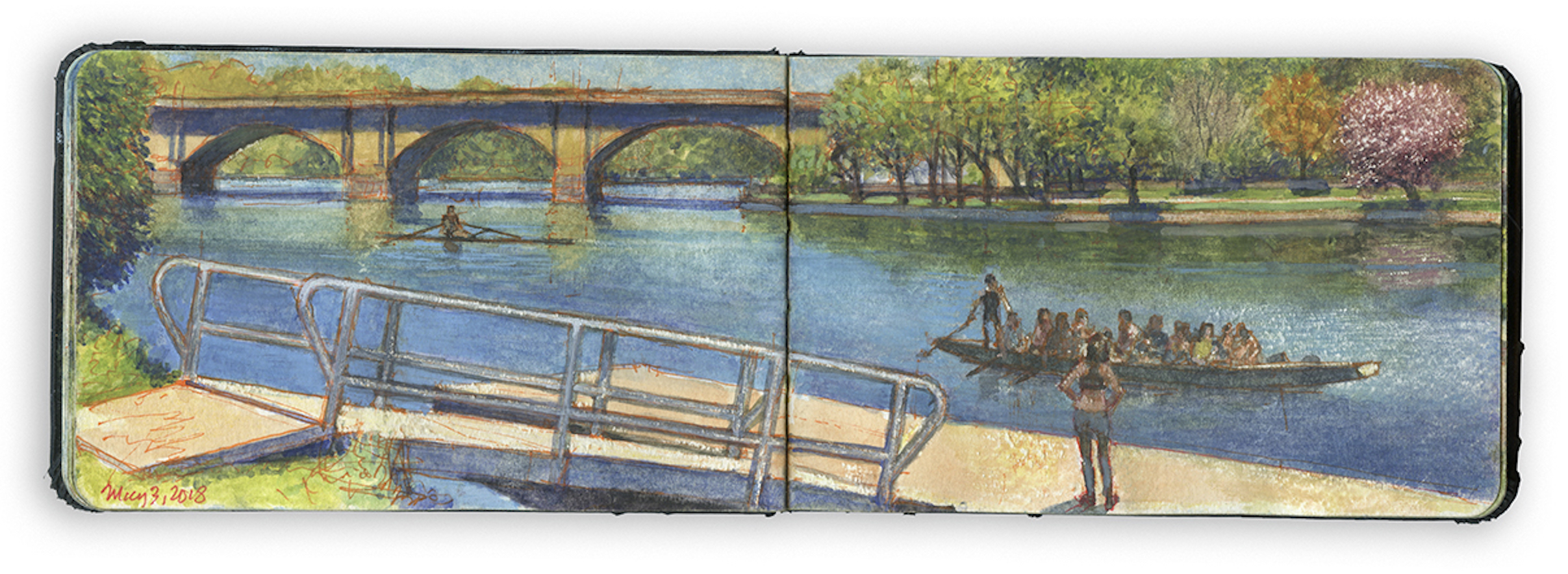
Dragon-Boat Dock. May 3, 2018. Schuylkill River Sketchbook.

Exploring the banks of the Schuylkill River in 2018, between the mouth of Wissahickon Creek and Fairmount Water-Works, I filled a sketchbook with journal-paintings. Later that year these would become a limited-edition suite of prints, and the centerpiece of the installation O.T.W. On the River, at Independence Seaport Museum in Philadelphia. The installation also included works by living artists Patrick Connors, Tom Judd, Stacy Levy, Deirdre Murphy, Jacob Rivkin and Joseph Sweeney and historic artists Edmund Darch Lewis, Johann Georg Martini and Granville Perkins.

Note on the image:

The Philadelphia Dragon Boat Association celebrates an ancient paddling tradition that began in South China, more than 2500 years ago. The sport was revived in Hong Kong in 1976. Within a few years, dragon-boats appeared on the Schuylkill River. The Philadelphia club has since won numerous international competition. Long, sleek and colorful, dragon-boats are unmistakable. With a crew of twenty-two, paddlers chant with every stroke. The sport has Asian roots, but crews are ethnically diverse. The dock used by the PDBA is located on the west bank, downriver from Columbia Railroad Bridge, near the intersection of Black Road and Martin Luther King Jr. Drive.
Below the bluffs, the floodplain behind the shoreline was once a series of marshes and wetlands, a breeding-grounds for mosquitoes. Deadly outbreaks of Yellow Fever led civic leaders to transform pestilential swamps into broad embankments. The eastern banks were girded with masonry revetments, while the western shore was treated with tender loving neglect. The Outrigger Canoe Club and P.D.B.A. have breathed new life into the wooded and less accessible right bank. Thomas Eakins chose this stretch of shoreline for his painting Max Schmidt in a Single Scull from this stretch of shoreline in 1871, the same year a monument to explorer Alexander von Humboldt by sculptor Frederick Johann Heinrich Drake was installed at the foot of the Pennsylvania Railroad Connecting Railway Bridge, a quarter-mile downstream. Moved from across river to its present location when the bridge was widened in 1912, Humboldt now stands in a grovw of trees behind the Dragon-Boat dock. A prominent member of the rowing community now wants to move the Humboldt monument from its sylvan abode to the campus of Drexel University. One suspects that Humboldt might not rather stay put.


On site near Dragon-Boat Dock.
Photograph by Virginia Baltzell.

(A preview of SKETCHBOOK TRAVELER by James L. McElhinney (c) 2020. Schiffer Publishing).

Copyright James Lancel McElhinney (c) 2020 Texts and images may be reproduced (with proper citation) by permission of the author. To enquire, send a request to

ed******@ne***********.com


April 17, 2020. Q.T. Dispatch #17

The world we have known can never be the same. We can beguile ourselves with the vain hope that things will return to normal, forgetting that the world has always been in flux. Human evolution has been driven by geological upheaval, climate change and plagues. Mortal crises test us, like running a marathon. In the last week, four people whom we loved and admired have passed away. Calamities like COVID-19 remind us of the fragility of life and the durability of the human spirit. For the first time in the history of the planet, a unique intelligent life-form has been focused on a single natural disaster, in real time, at the same moment in time.
Making lemonade out of bitter fruit, these quotidian posts are offered as messages of hope, not just for our own survival, but as motivation to turn our attention to the world around us, to treasure what we had previously taken for granted, to draw strength, wisdom and compassion from deeper engagements with nature.

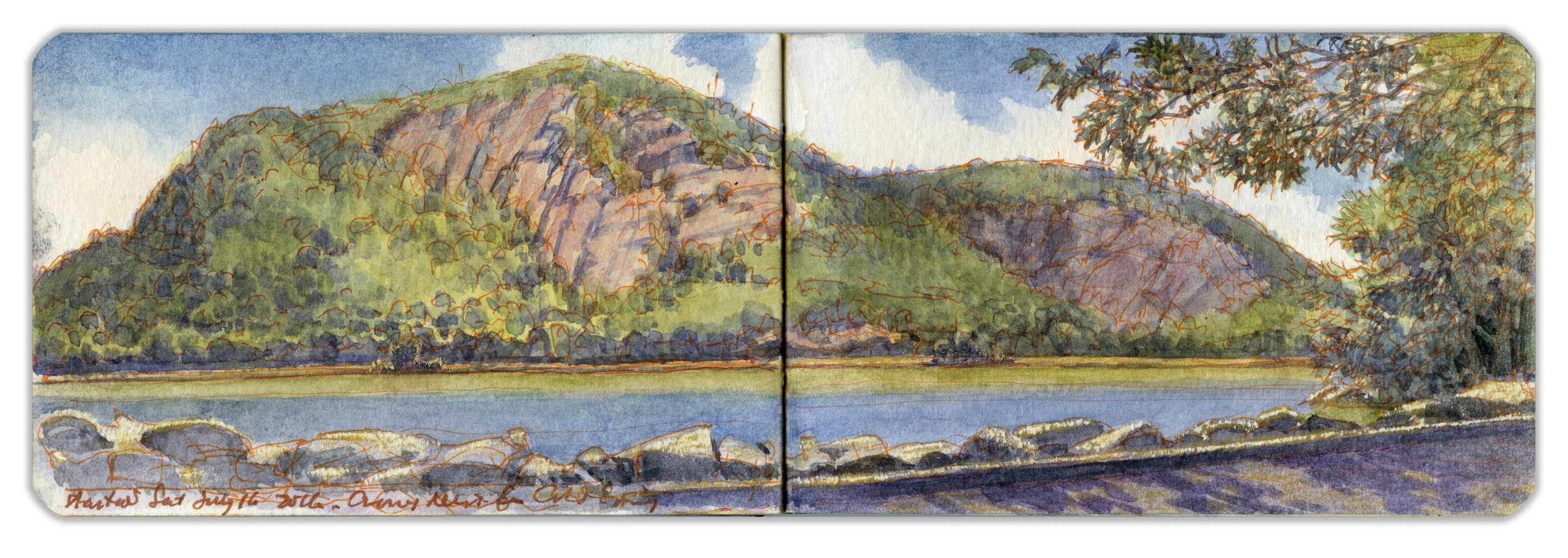
CROW’S NEST MOUNTAIN FROM COLD SPRING LANDING. Saturday July 16, 2016.

Located in the Hudson Highlands, an hour’s drive north of Manhattan, the village of Cold Spring was given its name by George Washington after refreshing himself at a nearby spring. In colonial times, the village was nothing more than a cluster of buildings by a river landing on the estate of Adolphus Philipse. In 1817, Gouvernor Kemble established the West Point Foundry just south of the village. For nearly a century, as the facility produced artillery-pieces and ammunition for the United States Army, the village grew into a town. Cannon tubes were finished, inspected, and tested by firing live rounds at Crow’s Nest Mountain, across the river. The rocky slopes are said to be littered with thousands of cannonballs and unknown quantities of unexploded ordnance. The infamous pirate William Kidd is said to have buried his loot at Kidd’s Plug, the rocky outcropping at the base of the distant cliffs. Putnam County poet George Pope Morris praised the mountain in verse:

“Where Hudson’s waves o’er silvery sands
Winds through the hills afar,
And Cro’ Nest like a monarch stands
Crowned with a single star.”

(Image and text were featured in the exhibition James McElhinney. Discover the Hudson Anew, curated by Laura Vookles. Hudson River Museum. Yonkers, New York. September 13, 2019 to February 16, 2020. Published also as a limited-edition in Hudson Highlands. North River Suite Volume One. Needlewatcher Editions. New York. 2018)

(A preview of SKETCHBOOK TRAVELER by James L. McElhinney (c) 2020. Schiffer Publishing).

Copyright James Lancel McElhinney (c) 2020 Texts and images may be reproduced (with proper citation) by permission of the author. To enquire, send a request to

ed******@ne***********.com


April 16. Q.T. Dispatch # 16.

.

Two weeks ago, I published the first in a series of daily website blog-posts. These writings and artworks that celebrate personal mobility, in pursuit of mindful engagements with history, nature and the environment. In relation to a finished painting, book, or an essay, this process is by itself as much a work of art as is the tree is to the fruit it bears. This practice might be seen as ceremonial. Beholding the world around us with care is an act of reverence. Offered as messages of hope and solidarity, these quotidian posts will continue, until the emergency is behind us.


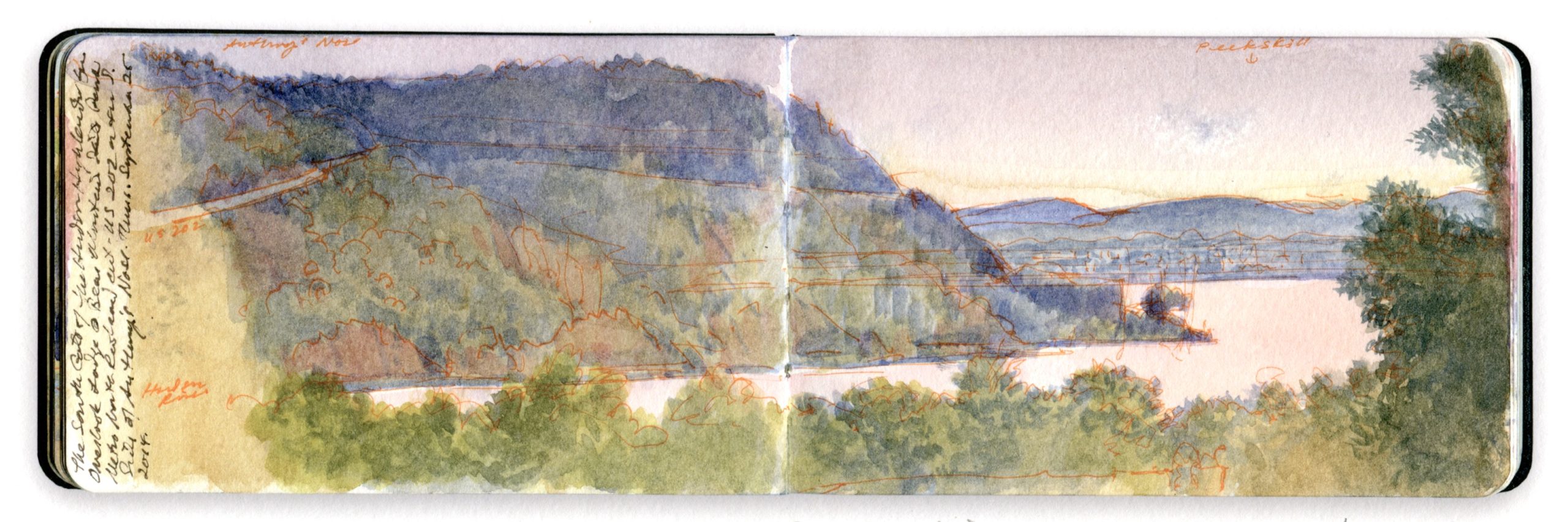
SOUTH GATE FROM BEAR MOUNTAIN. Watercolor and pen on Moleskine watercolor sketchbook. 3.5 x 10 inches. 2016

Bending around Trophy Point, the river follows a straight course for several miles, passing Buttermilk Falls and a small island known as Con Hook below the guns of Fort Montgomery on a bluff just north of where Popolopen Creek spills into the Hudson. It was here that American patriot forces stretched a heavy iron chain floating on a series of rafts across the river, below the mountain known as Anthony’s Nose. Connecting its vertiginous western face to Fort Clinton—Montgomery’s twin—on the bluff south of Popolopen Creek is Bear Mountain Bridge. Here the banks of the river widen again. A railway runs along a levee, enclosing an arm of the river that has become marshland over the years. The tracks cross Iona Island, which served as a naval weapons depot during the twentieth century. Parts of the rocky islet remain off-limits to the public. To the south, reaching eastward, is Dunderberg Mountain, or Thunder Hill, the downriver side of the south gate to the Hudson Highlands. Forming the northern gatepost is Roa Hook, below the southern declivity of Anthony’s Nose. Cast in shadow, a small concrete structure marks the location in this painting. The view is from the deck of Bear Mountain Inn’s Overlook Lodge, looking southeast toward the city of Peekskill, across the bay that bears its name.

Image and text were featured in the exhibition James McElhinney. Discover the Hudson Anew, curated by Laura Vookles. Hudson River Museum. Yonkers, New York. September 13, 2019 to February 16, 2020. Published also as a limited-edition in Hudson Highlands. North River Suite Volume One. Needlewatcher Editions. New York. 2018

(A preview of SKETCHBOOK TRAVELER by James L. McElhinney (c) 2020. Schiffer Publishing).

Copyright James Lancel McElhinney (c) 2020 Texts and images may be reproduced (with proper citation) by permission of the author. To enquire, send a request to

ed******@ne***********.com


April 15, 2020. Quaranteam Traveler Dispatch #15

Two weeks ago, I published the first in a series of daily website blog-posts. These writings and artworks that celebrate personal mobility, in pursuit of mindful engagements with history, nature and the environment. In relation to a finished painting, book, or an essay, this process is by itself as much a work of art as is the tree is to the fruit it bears. This practice might be seen as ceremonial. Beholding the world around us with care is an act of reverence. Offered as messages of hope and solidarity, these quotidian posts will continue, until the emergency is behind us.

Traveling to New Mexico early in 2019, I explored the Rio Grande between John Dunn Bridge and Cochiti Reservoir. Sites were selected for narrative reasons, as well as for their visual allure. Many of the works I produced, including my painting-journal, were exhibited at Gerald Peters Gallery in Santa Fe, in the exhibitions Reimagining New Mexico, from June 28 to August 3, and Speaking to the Imagination / The Contemporary Artist’s Book, from June 21 to October 24.

May 6, 2019. 59 degrees ESE. 36.3354 x 105.7346. Confluence of Rio Grande del Norte and Rio Pueblo de Taos.

Taos Junction Bridge is a Pratt riveted through-truss span 150 yards below the confluence of the Rio Grande del Norte and Rio Pueblo de Taos, flowing through a gorge seen to the right in this image. The confluence is undramatic, as Rio de Taos joins the great river, behind a screen of pinyon and sage. This might be considered the mouth of the Rio Grande Gorge, even though the river has another twenty-one miles to go before reaching the flood-plain at Velarde. On the left bank of the river, a dirt road winds its way past campgrounds to ascend the gorge, before connecting with blacktop roads on the plain above. From the western bridge-head, another unpaved road climbs through a series of hair-raising switchbacks, feeding onto County Road C-115, which meets US-64 just west of the Rio Grande Gorge Bridge.
Below the castle-rock towering above the confluence is a series of camp-sites, restrooms and utility sheds. Below the bridge is a parking area and boat-ramp. Carrying two kayaks, a car rolls into the dusty patch of bare soil. Within minutes, paddlers are on the river and away. Colorado snow-pack set records last winter. As snow melts, the river rises. In a week or two, or maybe tomorrow, it might be licking the girders under the bridge. Walking out onto the roadbed, a woman hold up her phone and snaps a few pictures. With the easy familiarity of an old married couple, two men walk up behind me, with their dog on a leash. One of the gents wears a porkpie hat and plaid shirt, the uniform of lumbersexual hipsters. The other taller fellow was the beau-ideal of sartorial practicality, wearing a ball-cap, light jacket and blue-jeans. Banging on about finance and investment, they disappear into the rock-fall and pinyon. Black clouds roll in from the west. The mercury drops. Packing up, I drive back toward Pilar. Passing Orilla Verde, I return to the audio-book version of Richard Powers’s The Overstory. As I turn south on highway 68, the car-radio squawks three times, followed by a flash-flood warning.

(A preview of SKETCHBOOK TRAVELER by James L. McElhinney (c) 2020. Schiffer Publishing).

Copyright James Lancel McElhinney (c) 2020 Texts and images may be reproduced (with proper citation) by permission of the author. To enquire, send a request to

ed******@ne***********.com


April 14, 2020. Quaranteam Traveler Dispatch # 14

Waiting for the crisis to pass, our thoughts go out to friends and loved-ones, who also shelter in place. News arrives of old friends passing away, people we knew and admired. Despite our temporary confinement, we can still celebrate travel. Sharing these pictures and memories also send messages of hope, not just for our own survival, but that when the crisis passes, we might discover thing we might have taken for granted, to draw strength, wisdom and compassion from deeper engagements with nature.

Exploring the banks of the Schuylkill River in 2018, between the mouth of Wissahickon Creek and Fairmount Water-Works, I filled a sketchbook with journal-paintings. Later that year these would become a limited-edition suite of prints, and the centerpiece of the installation O.T.W. On the River, at Independence Seaport Museum in Philadelphia.


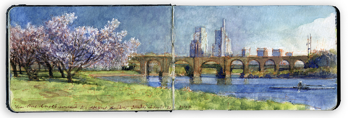
LOOKING SOUTH FROM THREE ANGELS April 22, 2018. Schuylkill River Sketchbook.

Widening into a bay North of Girard Avenue Bridge, below a point where the river turns left downstream of Columbia Bridge, broad grassy esplanade flanks the river’s banks. Created when landfill replaced pestilential wetlands, that once teemed with disease and mosquitoes. Along the left bank is a grove of Japanese cherry trees. Across Kelly Drive is Augustus Saint-Gaudens’s equestrian portrait of General Grant, at the foot of Fountain Green Drive.
Near the water, an angelic trio dances on narrow, twenty-foot concrete columns. Playing Angels is a work produced in 1950 by Swedish sculptor Carl Milles a former student of Auguste Rodin. From 1931, Milles lived for in the United States for twenty years, designing fountains and other public art for other cities like Detroit, Saint Louis, and Wilmington. Philadelphia owns the distinction of having one of the largest collections of public art in the world.

Flowering every spring, the nearby cherry-grove was established in 1926, when the government of Japan sent sixteen-hundred botanicals to Philadelphia, in honor of the sesquicentennial of American independence. Cherry trees were planted in various locations along the river and within Fairmount Park. Crossing the river downstream is the aforementioned Pennsylvania Railroad Connecting Railway Bridge. In 1873, its adjoining arches were enlarged. Further work was competed on widening the bridge in 1915, from two tracks to five. A statue of Prussian explorer Alexander von Humboldt that stood in the path of these improvement was moved across the river, near the present-day site of the Dragon-Boat dock.

The original iron truss-span that appears in Thomas Eakins’s 1871 painting Max Schmidt in a Single Scull was removed, and replaced with the great masonry arches we see today. Rising behind the viaduct is the distinctive form of the new Comcast Technology Center, art of Philadelphia’s ever-evolving skyline.Known to the rowing community as Three Angels, oarsmen and women pass it on the water.
Dancing to silent flutes, above flowering cherry-trees, the angels cheer them on.


Oarsman passing Three Angels. 3.5 x 10.5 inches. Schuylkill River Sketchbook. 2018

(A preview of SKETCHBOOK TRAVELER by James L. McElhinney (c) 2020. Schiffer Publishing).

Copyright James Lancel McElhinney (c) 2020 Texts and images may be reproduced (with proper citation) by permission of the author. To enquire, send a request to

ed******@ne***********.com


April 13, 2020. Q.T Dispatch #13

Being immobilized for the moment, more time can be found to reflect on past travels, and dream of future adventures. These quotidian posts will continue throughout our confinement as messages of hope, not just for our own survival, but that when storm-flags are taken down, we might begin to treasure what we had taken for granted, to draw strength, wisdom and compassion from deeper engagements with nature.


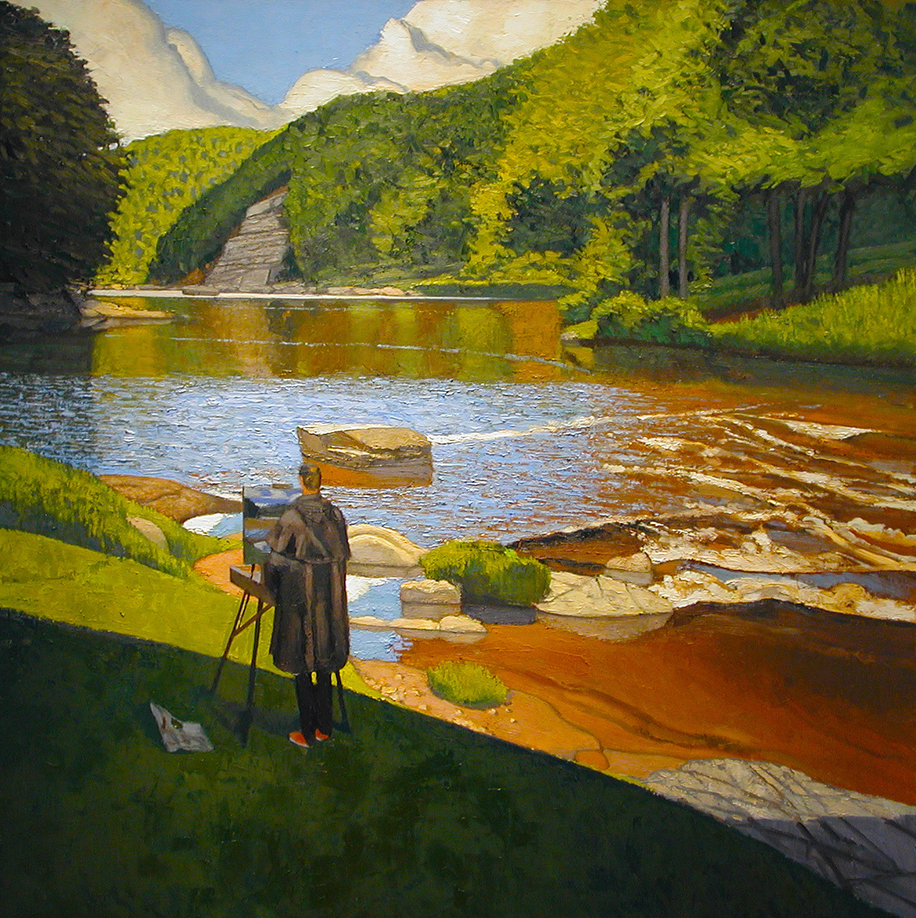
Confluent des Deux Creuses. Oil on canvas. 60 x 60 inches. 2002

In the summer of 2000. I made a road-trip from the Veneto to Paris with an old friend, by way of Franche-Comte and Limousin. Struggling with difficult relationships at home, we found solace in each other’s company. From Feltre to Bolzano, through the Brenner Pass to a spa in Zurich, then on to Ornans, hometown of Courbet. Descending into the chasm to the Source of the Loue, we stood at the base of a sheer wall of stone. Bursting forth from the dark grotto, tumbling down a rocky descent, the torrent fed a trout-stream below. Clear as glass, flowing quickly between wooded banks, the shaded river glowed bright in patches of sunlight.
Three or four days pass. We stood atop a precipitous hill, beside a medieval fortress. Its ramparts having collapsed, the ruined chateau became a quarry. Its stones provided masonry to build the village nearby. Looping around the foot of the hill, the River Creuse winds through the gorge. From atop the precipice, Crozant’s maiden-spinners would drop their spindles, to see whose would touch the water first. Taking our supper by a blazing hearth, a hard rain falls outside. Locking the door and filling our glasses, the innkeeper sings. Playing his guitar, Joel dit Buffalo, dreams of the Wild West, in a seventeenth-century tavern. Hanging on the wall are portraits of Sitting Bull and Custer.
Morning arrives, with warm sunshine. Puddles linger along the roadside. Exploring the village, we find every stone has a story. The door-stoop of a stone cottage had once been the lintel of a dungeon-door, within the ruined chateau. Passing shuttered dwellings, a lingering sense of long habitation is palpable, like a scent. Pop-music drifts past a cat, sitting in an open window. A dog barks. An old woman lights a cigarette. Magpie chatter. The postman passes by. Ghosts keep watch.
We drive to Fresselines. A hedgehog lies dead, in the center of the byway. Turning left, we follow a smaller road, until the pavement ends. Parking the car, we unpack our kit and follow a cow-path to a trail-head. Moistened by rainfall the night before, the steep muddy path descends through an umbrageous woodland. Our spirits are high. Beside us flows a murmuring stream, on its way to meet the river. Stepping from dark woods and into the light, we stand on a grassy rise. To our right, rocky substrates emerge from the bank. Tawny currents race foaming, across stony ledges.
Dropping our gear, we set up to paint. Rising from a widening stream, the vertiginous banks are thickly wooded. Along the right bank, a thinning in the understory forms an emerald chamber. Further downstream, exposed grey cliffs rise up from the shore. Drifting like Zeppelins, majestic clouds pile up in the distance, promising later rain.
Four hours pass. Crushing a large Badoit bottle, I stuff it into my knapsack. Folding our easels and packing our gear we depart, leaving no trace. Walking back through the woods under darkening skies, the patter of raindrops gives warning. The weather is changing. Quickening our step, each footfall sinks a little more into the moist earthen path. Birdsong stops. Silence is broken only by the sound of our movements. Upon entering a small clearing we stop. Among the trunks and branches, above the mosses and ferns, there hovers the perfume of thousands of flowers, but not a single bloom. I wonder. Could this enchantment a blessing, or might it be a curse? Churning overhead, dark clouds unleash a downpour. Racing beside the path, the gentle tributary has become an angry torrent. Climbing the path to the fields above, we are soaked when we reach the car. Returning to Crozant, the torrent abates. Blue skies peek through racing clouds. We pass a dead hedgehog, at peace in the middle of the road.

(A preview of SKETCHBOOK TRAVELER by James L. McElhinney (c) 2020. Schiffer Publishing).

Copyright James Lancel McElhinney (c) 2020 Texts and images may be reproduced (with proper citation) by permission of the author. To enquire, send a request to

ed******@ne***********.com


April 12, 2020. Easter. Quaranteam Traveler Dispatch #12.

Waiting for the crisis to pass, our thoughts go out to friends and loved-ones, who also shelter in place. News arrives of old friends passing away, people we knew and admired. Immobilized as we are, we can all relive our travels. I invite you to join me in celebrating the joys of Quaranteam travel. These are also messages of hope, not just for our own survival, but that we might begin to treasure what we had taken for granted, to draw strength, wisdom and compassion from deeper engagements with nature.
.

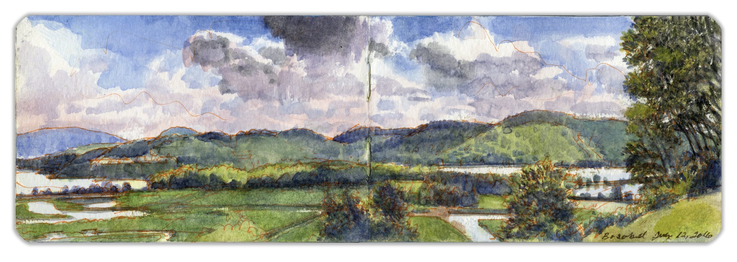
WESTERN HIGHLANDS FROM BOSCOBEL. Watercolor and pen on Moleskine watercolor sketchbook. 3.5 x 10 inches. 2016

To the southwest, the orderly divisions of Constitution Marsh become apparent. Channels were cut through the marshland during the second quarter of the nineteenth century for the cultivation of wild rice. The blue summit at left is Bear Mountain. The gray dashes in the foliage above the river are the stone buildings of West Point. Enclosed by the Hudson Line causeway to the right is Foundry Cove, which is fed by Indian Brook. By the late twentieth-century. industrial waste had resulted in the Hudson having the greatest concentration of cadmium pollution on the planet. Folksinger and activist Pete Seeger conceived the idea of building a replica nineteenth-century gaff-rigged sloop and offering cruises and concerts to promote the rehabilitation of the Hudson Estuary. Public outcry led Consolidated Edison to abandon plans for a massive hydroelectric facility that would have cut into the north slope of Storm King Mountain, several miles upriver. The land is now a state park. Constitution Marsh is today a wildlife refuge, providing habitat for local waterfowl such as herons and egrets as well as a number of songbirds, migratory birds, and raptors, including Bald Eagles. Every June almost one thousand snapping turtles come out of the marsh to lay their eggs. More than forty years later the sloop Clearwater continues to carry Seeger’s message up and down the river.

(A preview of SKETCHBOOK TRAVELER by James L. McElhinney (c) 2020. Schiffer Publishing).

Copyright James Lancel McElhinney (c) 2020 Texts and images may be reproduced (with proper citation) by permission of the author. To enquire, send a request to

ed******@ne***********.com