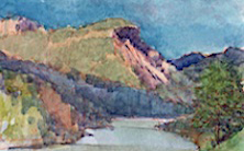
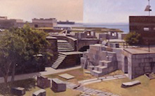
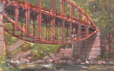
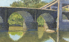
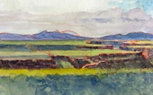
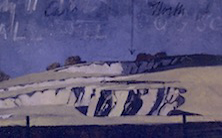
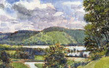
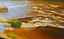
Waiting for the crisis to pass, our thoughts go out to friends and loved-ones who also shelter in place. Old friends pass away, people we loved and admired. Immobilized for the time being, we can revisit destinations, near and far. join me in celebrating the joys of Quaranteam travel, the hope that these diversions might inspire us to value things we had taken for granted, to draw strength, wisdom and compassion from deeper engagements with nature.
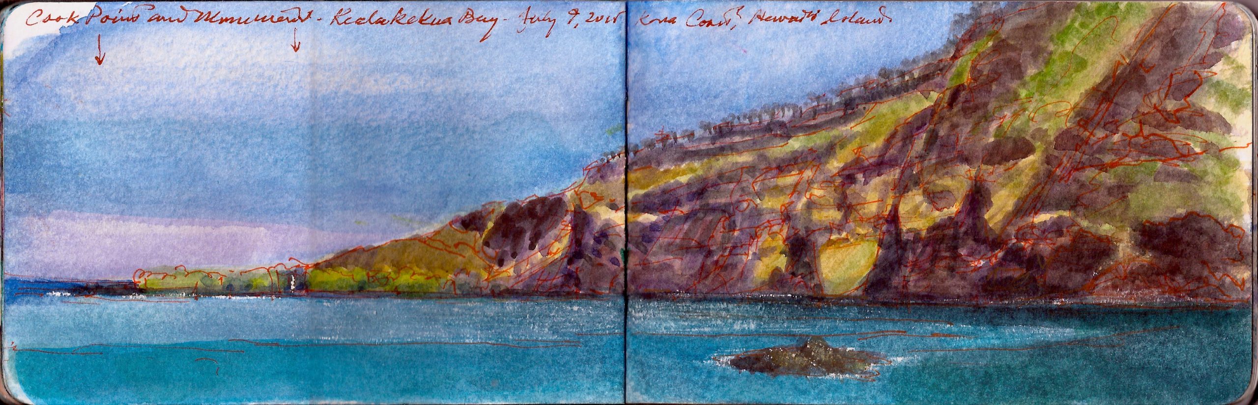
View of Kealakekua Bay from Hikiau Heiau. Thursday July 9, 2015
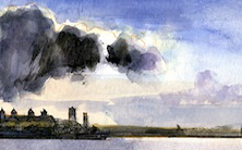
On Valentine’s Day 1779, Captain James Cook and a detachment of armed men landed on the northern shore of Kealakekua Bay on the (big) island of Hawai’i. One year prior, Cook’s little fleet consisting of the H.M.S. Resolution under Cook, and H.M.S. Discovery commanded by Charles Clerke had made landfall at Kauai. Like many indigenous first encounters with Europeans, Cook and his men were greeted with hospitality. Sailing north in search of a northwest passage around North America Cook spent a month anchored in Nootka Sound, trading with the locals, gathering intelligence, and planning to explore the northern Pacific.
His first voyage had won him celebrity for the discovery of Tahiti and Australia during his circumnavigation of the globe in H.M.S. Endeavor, between 1768 and 1771. His first voyage had included celebrated scientists Sir Joseph Banks and Daniel Solander. Men of learning and artist William Hodges accompanied Cook in his second voyage of 1772-1775, which crossed the Antarctic Circle, identified New Zealand and New Caledonia, exploring Polynesia as far east as Easter Island. By comparison his third voyage seems to have been less enchanting. Many had tried before, and failed to sail through the arctic between the Pacific and Atlantic oceans. Cook’s third expedition left England just eight days after thirteen of Britain’s North American colonies had declared their independence from the crown. Earlier that year, British military and civil authorities had been forced to evacuate Boston, following a siege directed by a rising star named George Washington. England was politically divided over the rebellion unfolding across the pond, requiring the conservative government to engage professional troop from German elector-states to augment British regulars, for a massive invasion of New York that would unfold in late summer. Despite his celebrity, a hidebound class system would never let Cook forget that he was the son of a common laborer. Few had risen so far as he, based alone on merit and performance. Further hopes for advancement would depend on his ability to pull another rabbit out of his hat. By the winter of 1778, Cook’s behavior had become moody and irascible. Returning to Hawai’I after New Year’s, during the tail end of the Mahakiki festival, Cook was welcomed to the big island as something like a deity. As the descendants of mariners, the Hawai’ians were impressed by Cook’s ships, and his own imposing presence. Standing well over six feet, his martial bearing and air of command was noted by his hosts. All had gone well until shortly after his departure Cook put back into Kealakekua Bay, to repair a broken mast.
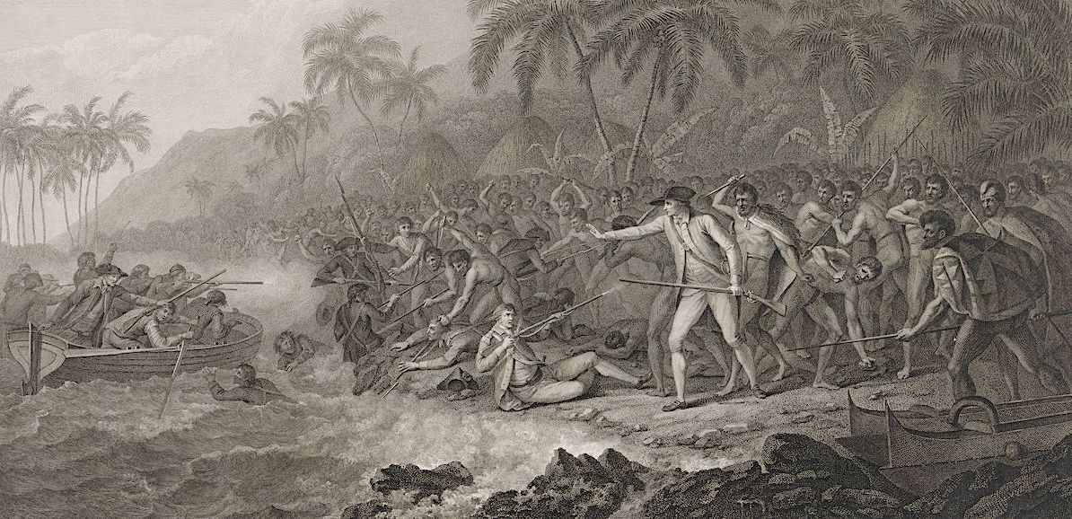
The Death of Captain Cook. (Detail) John Webber (1751-1791) official expeditionary artist aboard H.M.S. Resolution. 1779.
This was to prove anticlimactic. Cook’s semi-divine status was shattered, like Daniel Dravot in Rudyard Kipling’s short story, The Man Who Would Be King. Friction developed between Cook’s men and the locals, some of whom made off with a cutter—one of the small boats from the Resolution. Without the leavening influence of learned men like Joseph Banks, who understood the difference between indigenous peoples and savages, Cook’s growing frustration and native racism fueled a contempt for his former hosts. In a gambit to retrieve the lost rowboat Cook went ashore with an armed detail to take hostage King Kalani’öpu’u, who put up no resistance at first. Seeing their ruler heading for Cook’s boats, a large crowd gathered around them to prevent his departure. Some say Cook turned toward his marines, to order them to hold fire. Others say he bent down to help push his boat off the rocks. It was over in an instant. Having kept their distance for as long as Cook faced them, when he turned his back one chief crushed his skull with a club. Another stabbed him in the back as he fell into the surf. Marines standing closest to him were killed or wounded. Only two got away. The Hawai’ians carried off the body. For many years a legend persisted that his killers had eaten Cook. His body was in fact prepared for royal burial according to local custom. The corpse was roasted and boned. The remaining flesh was wrapped in a bundle and sent to H.M.S. Resolution for burial at sea. This horrified Cook’s first officer John Gore, who was ignorant of the great honor being shown his former boss. The irony is that all could have been avoided had Cook sent the king a keg of iron nails. With plenty of boats of their own, the Hawai’ians had no interest in Cook’s cutter. All they wanted were its nails.
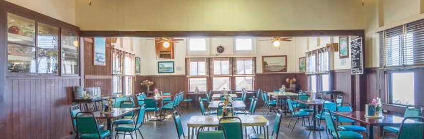
Dining-room, Manago Hotel Captain Cook, Hawai’i
On the Kona coast of the big island are many chain hotels and luxury B&Bs. On advice from former Yale classmate Michael Marshall, now professor of art at the University of Hawai’i at Hilo. After giving a talk at Donkey Mill Art Center in nearby Holualoa, Kathie and I decided not to drive back across the island to Hilo. We a room at the Manago Hotel, in the town of Captain Cook. The restaurant was reminiscent of a summer-camp dining hall, with high ceilings and windows on two sides. Suppertime entrees were the price of a Starbuck’s Grande Latte with syrup. A shot of Jack Daniels was three-fifty. The Big Island is famous for its prize beef, which is served in various preparations, many of which might be considered barbecue on the mainland. Reflecting the large number of Japanese brought to the islands to work on sugar and coffee plantations, dishes like the teriyaki I ordered are also popular. Our room for the night bore a striking resemblance to those I recall from nineteen-fifties family vacations on the Jersey Shore; minimal amenities, no television, and an electric-fan cooling-system, and a stunning view of the vast Pacific Ocean. It was heaven on earth.
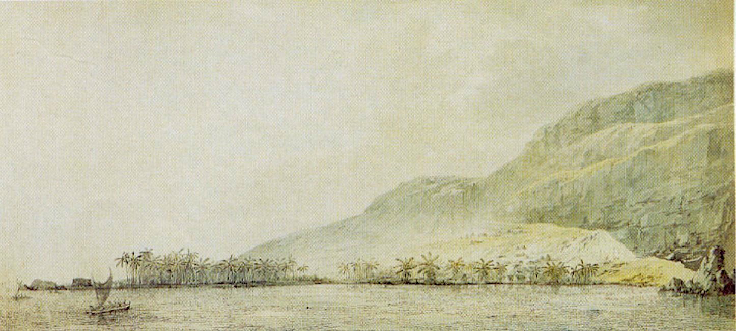
Kealakekua Bay and the Village of Kowroaa. John Webber (1751-1791) official expeditionary artist aboard H.M.S. Resolution. 1779.
I had wanted to hike down to the monument marking where Cook had fallen, but Kathie’s chariness of vertiginous trails ruled out that option. Instead after breakfast I drove down to the shoreline near, parking near Näpö’opo’o pier, next to Hikiau Heiau, a temple visited by Cook during happier times. A native woman and her daughter collected donations for a local church, while a couple of indigenous men stood around next to a pickup truck, discreetly asking visitors of they were looking for a snorkel-tour of the bay. Several shops on the Mamalahoa Highway were licensed as snorkel and kayak-guides. One of them told me that a heiau is kapu, a sacred place off-limits to all, especially foreign visitors. He explained that some heiau have been turned into tourist attractions, but ruined ones like Hikiau are hallowed ground—places where spirits linger with gods no longer worshipped. Christian missionaries came to the islands in 1820. Shortly after their conversion, Kamehameha II and his wife Queen Kaahumanu abolished the indigenous religion, which led to the destruction of many heiau. If specific religious ceremonies like human sacrifice were no longer practiced, I get the sense that indigenous Hawai’ians today still honor the old gods with a degree of reverence. Finding Webber’s view of the bay sometime after my visit it was clear that both he and I, separated by more than two centuries, had stood on the same spot to behold the same scene.
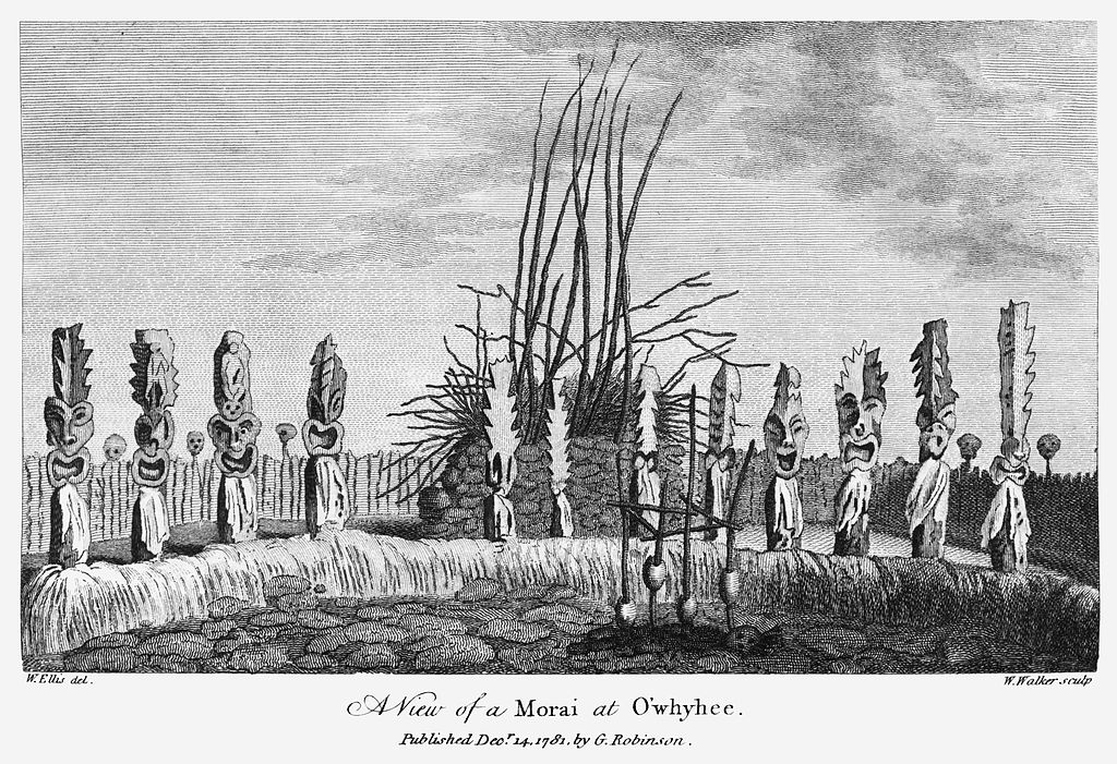
Hikiau Heinau. Engraving after a drawing by John Webber. 1779
Revisit April’s blogposts: 30 Dispatches from the Quaranteam Traveler
(A preview of SKETCHBOOK TRAVELER by James L. McElhinney (c) 2020. Schiffer Publishing).
Copyright James Lancel McElhinney (c) 2020 Texts and images may be reproduced (with proper citation) by permission of the author. To enquire, send a request to
ed******@ne***********.com
Waiting for the crisis to pass, our thoughts go out to friends and loved-ones who also shelter in place. Old friends pass away, people we loved and admired. Immobilized for the time being, we can revisit destinations, near and far. join me in celebrating the joys of Quaranteam travel, the hope that these diversions might inspire us to value things we had taken for granted, to draw strength, wisdom and compassion from deeper engagements with nature.
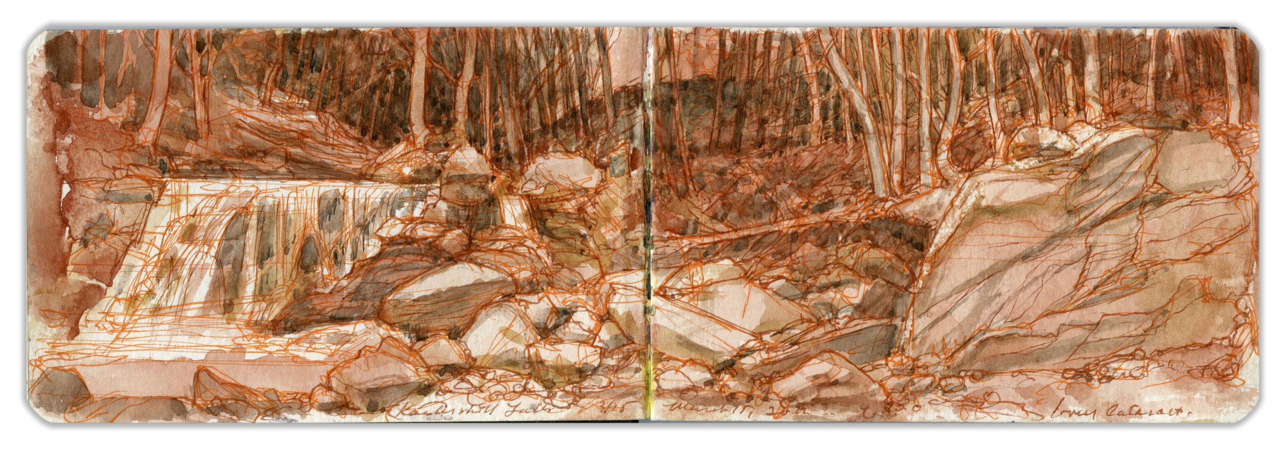
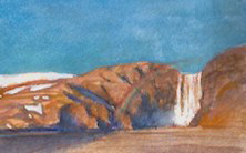
Lower Cataract, Kaaterskill Creek. March 15, 2012.
(Image and text were featured in the exhibition James McElhinney. Discover the Hudson Anew, curated by Laura Vookles. Hudson River Museum. Yonkers, New York. September 13, 2019 to February 16, 2020. Published also as a limited-edition in Hudson Highlands. North River Suite Volume One. Needlewatcher Editions. New York. 2018)
“The first pitch is nigh two hundred feet; and the water looks like flakes of driven snow afore it touches the bottom; and then the stream gathers itself together again for a new start, and may be flutters over fifty feet of flat rock, before it falls another hundred, where it jumps from shelf to shelf, first turning this-a-way, and then turning that-a-way, striving to get out of the hollow, until it finally comes to the plain…The rock sweeps like mason-work on both sides of the fall, and shelves over the bottom for fifty feet…it’s the best piece of work I’ve met with in the woods; and none know how often the hand of God is seen in the Wilderness, but them that rove it for a man’s life.”
–Benson J. Lossing (1813-1891). The Hudson from the Wilderness to the Sea. 1866
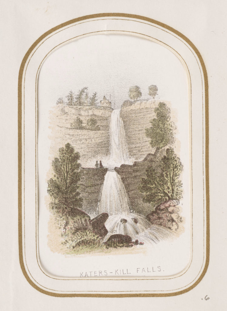
Katers-Kill Falls. Benson John Lossing. Chromolithograph. 1860-1866 (7.1 × 5 cm (2 13/16 × 1 15/16 in.). Collection. J. Paul Getty Museum, Los Angeles. (Reproduced under fair Use, etc.)
North-South Lake drains into Spruce Creek, which flows southward for roughly a mile, before plunging over a rocky precipice into a shallow pool on a broad ledge of rock, over which it cascades into a rocky defile known as Kaaterskill Clove. The combined height of the falls is 260 feet, neatly eighty feel taller than Niagara. Below the second falls the creek assumes a new identity, sharing its name with the gorge it has carved out the eastern escarpment of the Catskill mountains. Descending the gorge via a series of smaller falls and cataracts, treacherous waters give way to a chain of swimming-holes before the stream meanders across the floodplain and into to the Hudson, at the village of Catskill.
British-born Thomas Cole (1801-1848) had moved from England to Ohio with his family, but soon made his way east, to study in Philadelphia before settling in New York. The year after William Guy Wall published the last set of six prints in his Hudson River Portfolio—the same year the Erie Canal opened to traffic—Cole ventured upriver to visit what were well on their way to becoming bucket-list destinations. Both Sunset Rock and Kaaterskill Falls were within an easy walk of the Catskill Mountain House hotel. While he was not the first artist to behold these wonders, he was the first to establish them within the canon of American landscape painting. In Asher B. Durand’s memorial painting of Cole, the painter and his friend, poet William Cullen Bryant converse on an outcrop of Kaaterskill Clove. Bryant celebrated in verse the spectacle they both loved.
“Midst greens and shades the Katers-Kill leaps,
From cliffs where the wood-flower clings;
All summer he moistens his verdant steeps, with the sweet light spray of the mountain springs;
And he shakes the woods on the mountain side,
When they drip with the rains of the autumn tide”
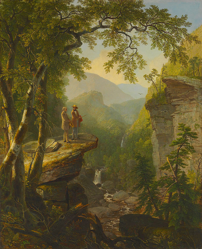
Asher B. Durand. Kindred Spirits. 1849. Collection Crystal Bridges Museum of American Art. (reproduced under Fair Use, etc.)
Check out April 2020 Quaranteam Traveler Dispatches
(A preview of SKETCHBOOK TRAVELER by James L. McElhinney (c) 2020. Schiffer Publishing).
Copyright James Lancel McElhinney (c) 2020 Texts and images may be reproduced (with proper citation) by permission of the author. To enquire, send a request to
ed******@ne***********.com
Waiting for the crisis to pass, our thoughts go out to friends and loved-ones who also shelter in place. Old friends pass away, people we loved and admired. Immobilized for the time being, we can revisit destinations, near and far. join me in celebrating the joys of Quaranteam travel, the hope that these diversions might inspire us to value things we had taken for granted, to draw strength, wisdom and compassion from deeper engagements with nature.
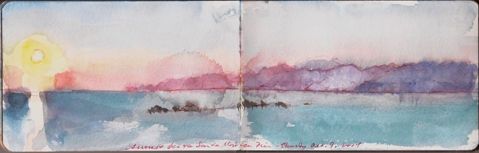
The Pacific Coast and Santa Monica Mountains from the pier. Thursday October 9, 2014.
Apart from mostly balmy weather, the first thing a visitor will notice about Southern California is the region’s utter dependence on automobiles. The freeways make eastern superhighways look like logging-roads. On our way to Laguna from Joshua Tree we had stopped for lunch at Idylllwild in the San Jacinto Mountains. We were on our way to the opening of California Mexicana was an exhibition curated by Kathie for the Laguna Museum of Art as part of Pacific Standard Time: LA/LA Los Angeles/Latin America.

Kathie was eager to get to the museum prior to closing-time. We also had dinner-plans with museum -director Malcolm Warner and his staff. It being Friday, traffic was bound to be heavy. Looking at the map we decided to head back to Riverside, coming down to Laguna through Anaheim and Irvine. We rolled the dice and came up snake-eyes. Traffic moved from a crawl to stop, crawl to stop for an hour or more before I decided to dead-reckon our way to Laguna on back roads around Santa Ana, down route 241 to 135. Arriving after four o’clock, we headed straight for the museum. Touring the exhibition, everything seemed to be in order. The Diego Rivera mural in San Francisco had been reproduced as a full-sized banner. One of the coups Kathie pulled off was getting the Crocker Museum in Sacramento to lend it monumental canvas by Charles Christian Nahl, of a colonial-era fandango. On a rearing horse in the composition is celebrated bandit Joaquin Murietta upon whom the fictional Zorro is based. The painting Kathie wanted was unbeknownst to her, installed at the Crocker in its original nineteenth-century setting. Temporary de-installation would be costly and potentially dangerous to the work. Fate intervened. A similar painting by Nahl was at the Santa Barbara Museum of Art, which was about to undergo renovations. If the Laguna Museum agreed look after the piece, it could be in the show.

La Plaza de Toros: Sunday Morning in Monterrey. Charles Christian Nahl. 1874. Santa Barbara Museum of Art. (Reproduced under Fair Use, etc.)
Another notable canvas was a painting of Mission San Gabriel Arcangel by German artist Fredinand Deppe, from Laguna’s own collection.
When we visited the mission a few years prior, we were horrified by the state of displays in its little museum. The chausable of Fray Junipero Serra lay in a dusty vitrine. Paintings and artifacts all exhibited need of care and conservation. The poverty of best-practices was due to the fact that San Gabriel was a working mission, serving the surrounding community. Things have greatly improved, but visitors to San Gabriel should not expect an experience like going to San Juan Capistrano. The latter is highly organized, like a Catholic theme-park. Mission de San Gabriel Arcangel is the real deal. Mission Road was torn up by the construction of light rail service. Stepping inside the compound was like stepping back in time. People prayed in its modest courtyard, the centerpiece of which is the Ramona Vine—a more than two-hundred-year-old grapevine said to have been planted by the heroine of Helen Hunt Jackson’s 1884 best-selling novel of racial prejudice, love lost and redeemed. Many consider its gnarled trunk and spreading arms to be the mother-vine of the California wine-industry. Inside the mission church, an elderly woman lights votive candles. On its walls is a series of paintings of The Stations of The Cross, by an indigenous Gabrieleno. In one of these retablos, a half-naked Roman hastens Christ along the Via Dolorosa. Legend has it the soldier in the picture represents one of the soldiers stationed at the Presidio, who had raped the painter’s daughter. Her father took his revenge with a paint-brush, ridiculing his daughter’s abuser in the House of God.
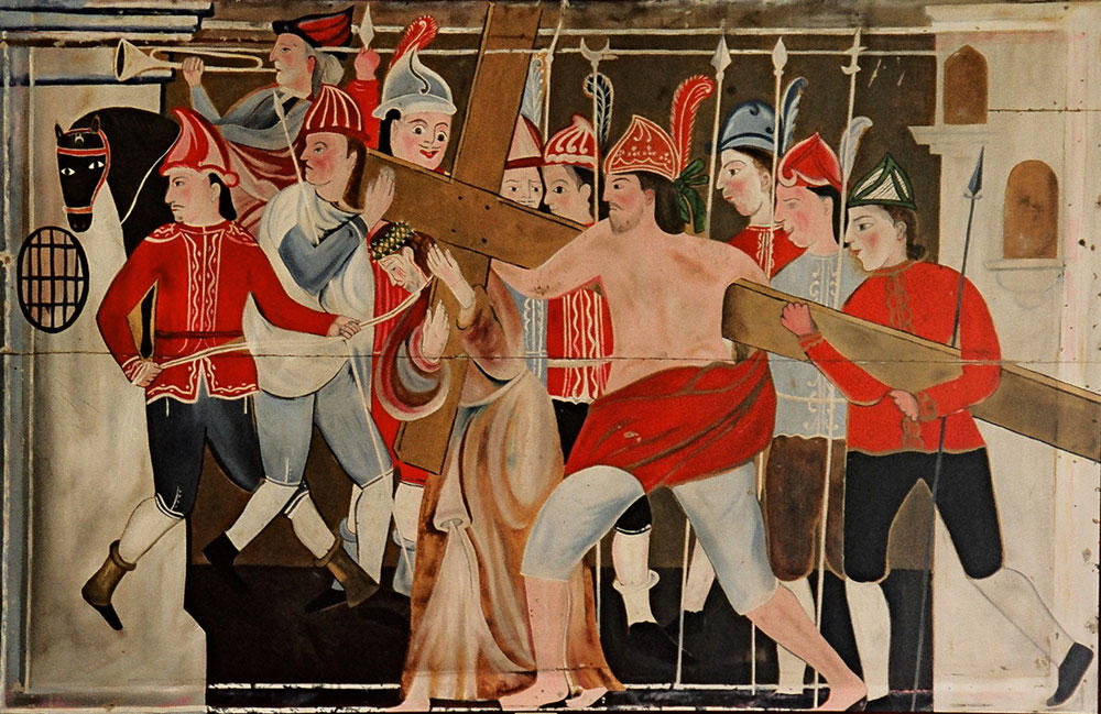
Stations of the Cross. Mission San Gabriel Arcangel, Los Angeles.Photo by Richard McLaughlin, on the website www.somosprimos.com (Reproduced under Fair Use, etc.)
Following the opening reception, we attended a dinner at the museum, we returned to the Inn at Laguna Beach. After coffee in our room the next morning, we wandered north in search of breakfast. A huge queue had assembled in from of Urth Café. We were told by one of those standing in line that the reason for the clusterf*ck was that Kanye West and Kim Kardashian had dined there recently. Pushing through the crowd we went next-door to Number Three Restaurant, a perfectly charming venue with alfresco garden seating. Returning to the hotel we checked out, retrieved our rented Honda Elantra (curiously with Maryland tags) and headed back toward Los Angeles on the North Coast Highway. Before dinner, we wandered up the strand to Santa Monica Pier.
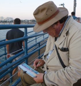
It was a fitting coda to our California sojourn. In 2014 Kathie had attended a conference at the Getty Foundation along with other curators and museum directors preparing exhibitions for Pacific Standard Time LA/LA.Along the Pacific coast in southern California the final hour of light in the day is magical. Even in summer, the mercury drops a few degrees. Pilobolus co-founder Robbie Barnett had called the eastern equivalent the green hour. There was nothing verdant about the L.A. beaches. A blazing sun hovered over a clam sea and the Santa Monica mountains; everything awash in violet, turquoise and gold.
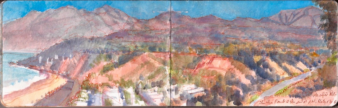
Looking North from Pacific Palisades, above Temescal Canyon Road.Monday, October 6, 2014.
From atop the bluffs above the Pacific Coast Highway, the view from a little park at the corner of Mount Holyoke Avenue and Via De Las Olas had become one of my favorite motifs in 1983. Revisiting the site in October of 2014 I was shocked to find that half the park had disappeared. Brush-fires and other conflagrations are common in the coastal mountains of southern California. Their foothills are little more than glorified sand-piles, held together by gravity, and the root-systems of indigenous and invasive flora. When plants and trees are consumed by fire, the exposed soil can become saturated by heavy rainfalls. Unable to bear its own weight, formations like coastal bluffs collapse in landslides. Vertiginous bluffs along the PCH are covered with scrubby vegetation. When this burns, landslides follow. Whole sections of the road can be closed for weeks at a time. An Angelino friend used to joke that if they turned off all the lawn-sprinklers, L.A. would just dry up and blow away. As I painted this view, a musclebound rapper and an insanely gorgeous African-American woman came jogging up. We chatted for a bit. They had just completed a ten-mile run in the hills. City of Angels. City of Superheroes.
In the summer of 1983 I did a teaching stint at UCLA. Taking up residence in Ocean Park, I house-sat a bungalow for a movie director who was shooting on location somewhere in the desert. Knowing very few people in Los Angeles, I had been given the names of some local residents by mutual friends. One of these was a woman who lived neat Third Street and Wiltshire in Santa Monica. Gloria Upson had grown up in the waspy country club set of Palos Verde, or P.V. to the anointed. The neighborhood had inspired the prime-time serial drama Knot’s Landing, which ran from 1979 to 1993. We never became romantically entangled. I was married. She had become discombobulated over a love-affair with a married man who refused to leave his wife. Perhaps once a week we would meet for coffee or dinner, when I would get an earful about the latest episode in her own private soap-opera. One Saturday evening I called to propose dinner at a sushi-bar along the strand in Venice Beach.
“I’m exhausted,” she said. “I spent the whole day at the beach. It was torture!”
I asked her why.
“My car is in the shop. It took forever to get a taxi.”
Again, I asked her why.
With a hint of indigence she replied.
“Well how else am I supposed to carry my blanket, chair, umbrella, music and cooler to the beach?”
I asked why since she lived so close to the beach, could she not have just left all that gear at home and walked.
Silence. Finally, in sotto voce, with utmost gravity she replied.
“Only Mexicans walk to the beach.”
(A preview of SKETCHBOOK TRAVELER by James L. McElhinney (c) 2020. Schiffer Publishing).
Copyright James Lancel McElhinney (c) 2020 Texts and images may be reproduced (with proper citation) by permission of the author. To enquire, send a request to
ed******@ne***********.com
After seventy-four days in quarantine, it is a pleasure to publish my fiftieth blogpost, dedicated an expeditionary spirit, hoping that these diversions might inspire us all to value things previously taken for granted, to draw strength, wisdom and compassion from deeper engagements with nature, and the world around us.
Exploring the banks of the Schuylkill River in 2018, between the mouth of Wissahickon Creek and Fairmount Water-Works I filled a sketchbook with paintings. Later that year, a suite of prints drawn from this journal would become the centerpiece of an installation at Independence Seaport Museum in Philadelphia.

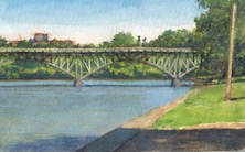
Under Strawberry Mansion Bridge. Schuylkill River Sketchbook. Wednesday June 20, 2018
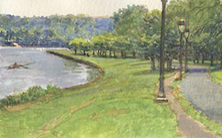
Stretching southward along the west bank of the Schuylkill, between the Gillin Boathouse at Saint Joseph’s University and the grandstand beside Columbia Railroad Bridge is a broad, grassy embankment sloping gently down from Kelly Drive to a stone bulkhead on the riverbank. Traversed by pedestrian and bike trails, the strand is sheltered beneath a canopy of trees. At its northern extremity is Strawberry Mansion Bridge. Taking its name from an eighteenth-century estate originally known as Summerville, the span was hailed as a marvel of modern engineering. Privately funded, the entire structure was prefabricated twenty-five miles upstream by Phoenix Iron Company and assembled at its present location in 1897. Its filigree steel arches soared above the river, carrying trolley-cars pedestrians, and vehicular traffic between the eastern and western sections of Fairmount Park. Trolleys stopped running in 1946. After decades of hard use and disrepair, a major restoration of the bridge was completed just two years shy of its centennial.
William Birch (1755-1834) Mendenhall Ferry. Birch’s Views of Philadelphia. 1800 Birch’s view is looking eastward toward Laurel Hill Mansion. Atop the bluffs today is Laurel Hill Cemetery, founded in 1836. Along with Mount Auburn Cemetery founded in 1831 and Green-Wood Cemetery founded in 1836, Laurel Hill represented part of the vanguard of the rural cemetery movement. Taking root in American cities during the nineteenth century, these pastoral graveyards employed principles of landscape design espoused by Lancelot “Capability” Brown (1715-1783), made possible by architectural methods devised in the construction of fortifications designed by Comte de Vauban (1633-1707). These rural cemeteries paved the way for the creation of the urban pastorale of New York Central Park, Fairmount Park in Philadelphia, Rock Creek Park in Washington D.C., and he campuses of America’s new land-grant colleges.
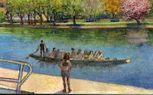
Competing crews assemble upstream at a chain of pontoon boats. The race begins. Passing under the bridge, slender hulls glide upon the water on their way downstream to the finish line. Following heavy rains, effluence from towns and tributaries upstream gives the water an orange hue, which makes for dazzling light effects under azure skies. In Eakins’s day, water pollution was far worse than it is today. Casting our gaze upriver one finds Mendenhall Ferry on the left, opposite he present-day intersection of Kelly Drive and Hunting Park Avenue, which bisects historic Laurel Hill Cemetery. Rising up from the distant tree-line is the cupola of Thomas Mifflin School in East Falls, behind the gray concrete viaduct of Roosevelt Boulevard, a.k.a. Route U.S. 1.

Strawberry Mansion Bridge from Beside Saint Joseph University Boathouse. Schuylkill River Sketchbook.2018
I became fascinated with the engineering of this prefabricated bridge. Its elements were all produced first as drawings, manufactured upriver in Phoenixville and then assembled at is present location. The complex system of arches and trusses expresses a certain beauty which has been lost to the expediency of reinforced concrete and I-beams. Prior to its construction, traffic crossed the river at Mendenhall Ferry.
Check out April 2020 Quaranteam Traveler Dispatches
(A preview of SKETCHBOOK TRAVELER by James L. McElhinney (c) 2020. Schiffer Publishing).
Copyright James Lancel McElhinney (c) 2020 Texts and images may be reproduced (with proper citation) by permission of the author. To enquire, send a request to
ed******@ne***********.com
Waiting for the crisis to pass, our thoughts go out to friends and loved-ones who also shelter in place. Old friends pass away, people we loved and admired. Immobilized for the time being, we can revisit destinations, near and far. join me in celebrating the joys of Quaranteam travel, the hope that these diversions might inspire us to value things we had taken for granted, to draw strength, wisdom and compassion from deeper engagements with nature.
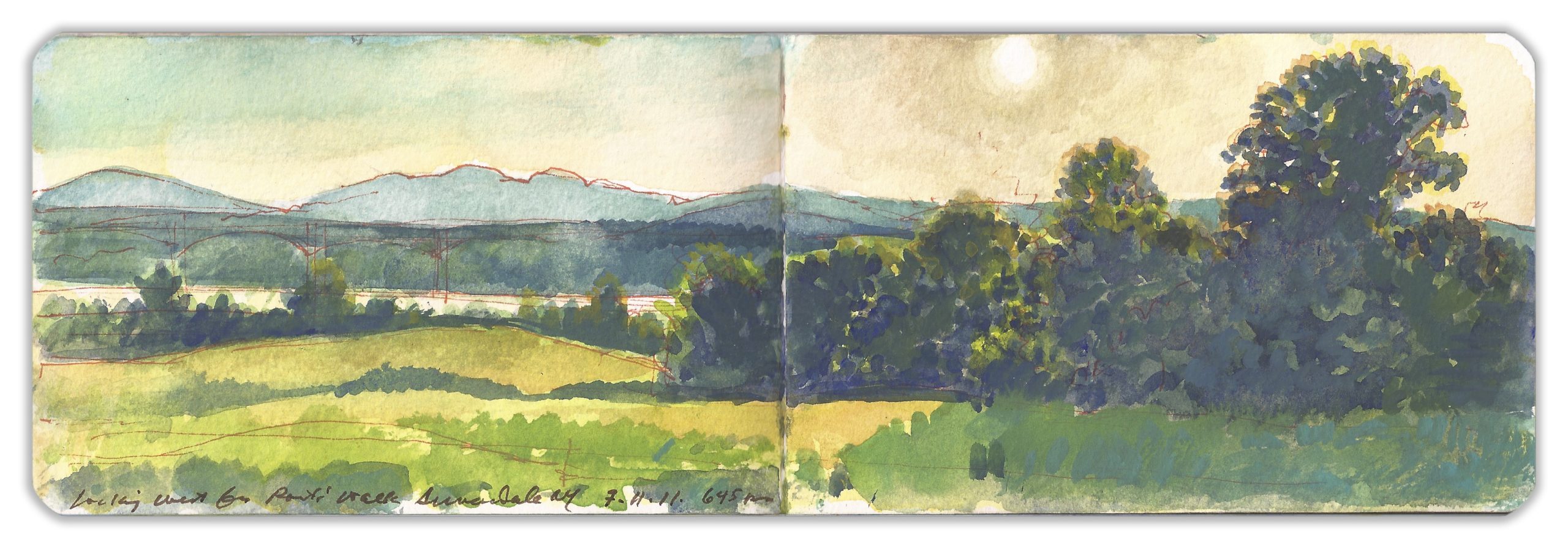
Late Light at Poets’ Walk. Red Hook, New York. July 11, 2011. 6:45 pm
(Image and text were featured in the exhibition James McElhinney. Discover the Hudson Anew, curated by Laura Vookles. Hudson River Museum. Yonkers, New York. September 13, 2019 to February 16, 2020. Published also as a limited-edition in Hudson Highlands. North River Suite Volume One. Needlewatcher Editions. New York. 2018)
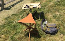
Located on the left bank of the Hudson a few miles above the Kingston-Rhinecliff Bridge is a rolling tract of land that was first developed into a private pleasure-park in 1849. Wealthy families having built estates atop the bluffs decided to set aside a tract of uncultivated land for the enjoyment of nature and the improvement of health. They hired German landscape architect Hans Jacob Ehler to divide the land between clearings and woodlands, laying out trails, view-sheds and pavilions. Washington Irving, William Cullen Bryant and other notable recipients Delano and Astor hospitality are said to have drawn inspiration from rambles at Poets’ Walk. In recent years the park has come under the control of Scenic Hudson Land Trust, which maintains the trails and other amenities for year-round public use. Having visited the park on numerous occasions, I have never failed to meet other hikers on the trails without the exchange of pleasant greetings. Setting up to work from one of the wooden benches set out along the trails, or on the portable stool strapped to my back, I never suffered any kind of interruption or distraction. Perhaps slowing their pace as they pass me, or stealing a glance as they stride by, it seems that such places might promote civility, as much as they inspire bards.
Revisit April’s adventures: April 2020 Quaranteam Traveler Dispatches
(A preview of SKETCHBOOK TRAVELER by James L. McElhinney (c) 2020. Schiffer Publishing).
Copyright James Lancel McElhinney (c) 2020 Texts and images may be reproduced (with proper citation) by permission of the author. To enquire, send a request to
ed******@ne***********.com
Waiting for the crisis to pass, our thoughts go out to friends and loved-ones who also shelter in place. Old friends pass away, people we loved and admired. Immobilized for the time being, we can revisit destinations, near and far. join me in celebrating the joys of Quaranteam travel, the hope that these diversions might inspire us to value things we had taken for granted, to draw strength, wisdom and compassion from deeper engagements with nature.
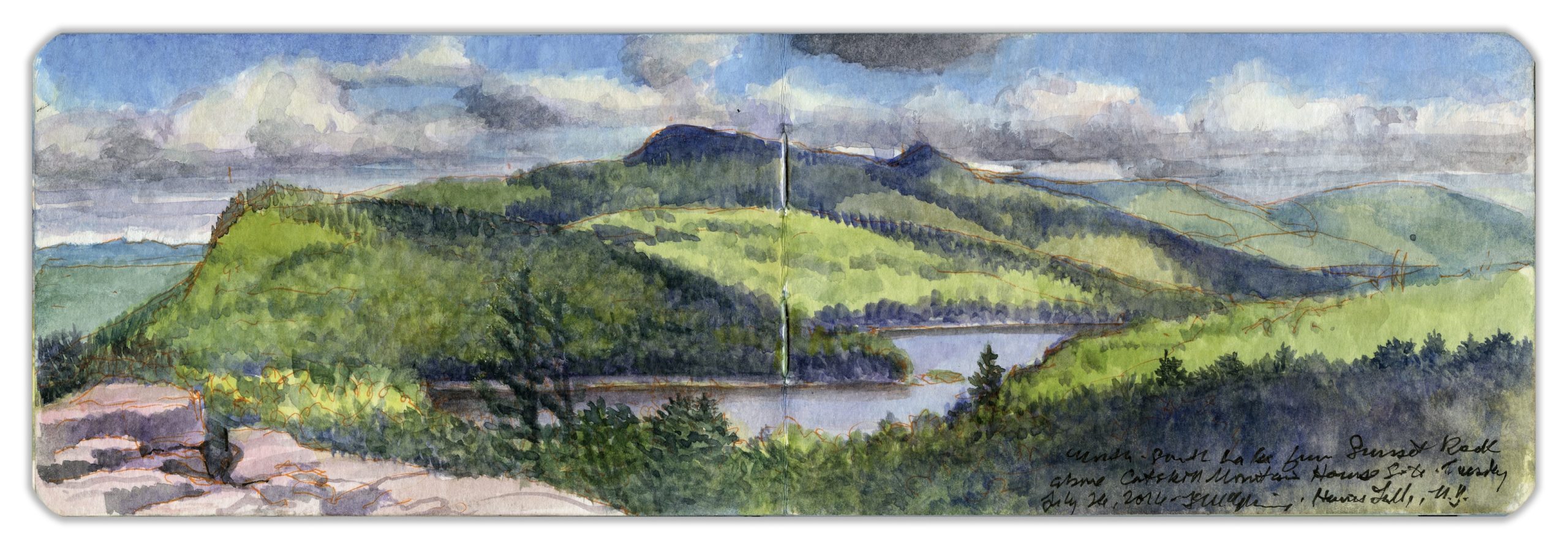
North-South Lake from Sunset Rock. July 26, 2016
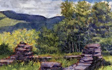
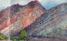
On the southeast shoulder of North Mountain, north of the Catskill Mountain House is an outcropping of exposed rocks interspersed with mostly deciduous trees, mixed with a variety of conifers. The outcropping is approached by a trail that follows the rim of the Catskill escarpment running north from the former site of Catskill Mountain House—a grand hotel built in 1824 and destroyed by fire in 1963. Halfway along the level part of the trail is a wide stone ledge known as Painters Rock, near the brink of a sheer drop of perhaps two hundred feet. From this point the trail rises, traversing rock-fall and ledges requiring hikers to advance hand over hand. The trail continues to climb, finally winding around the foot of a wall of stratified limestone, a former sea-floor. The trail ascends above the rim of this formation, entering a wooded understory of ferns and other leafy plants. The Escarpment Trail veers to the left, ascending westward to Newman’s Ledge and the summit of North Mountain. Here the hiker backtracks slightly to the east. Crisscrossing trails all lead to up a rocky deck, divided by deep fissures. The southwest corner of this surface holds an object that appears in paintings by Thomas Cole, Sanford Gifford and others.
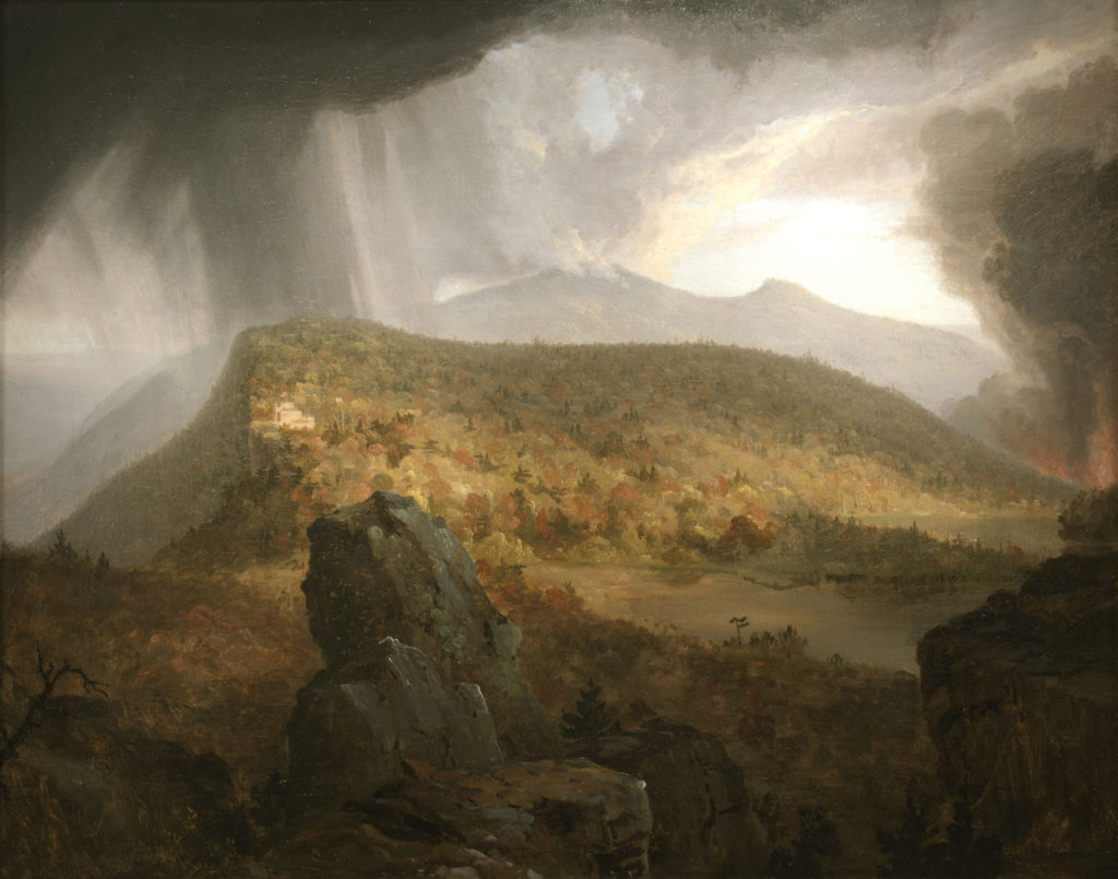
Thomas Cole. The Four Elements. 1843-1844. Private collection. (Reproduced under Fair Use etc.)
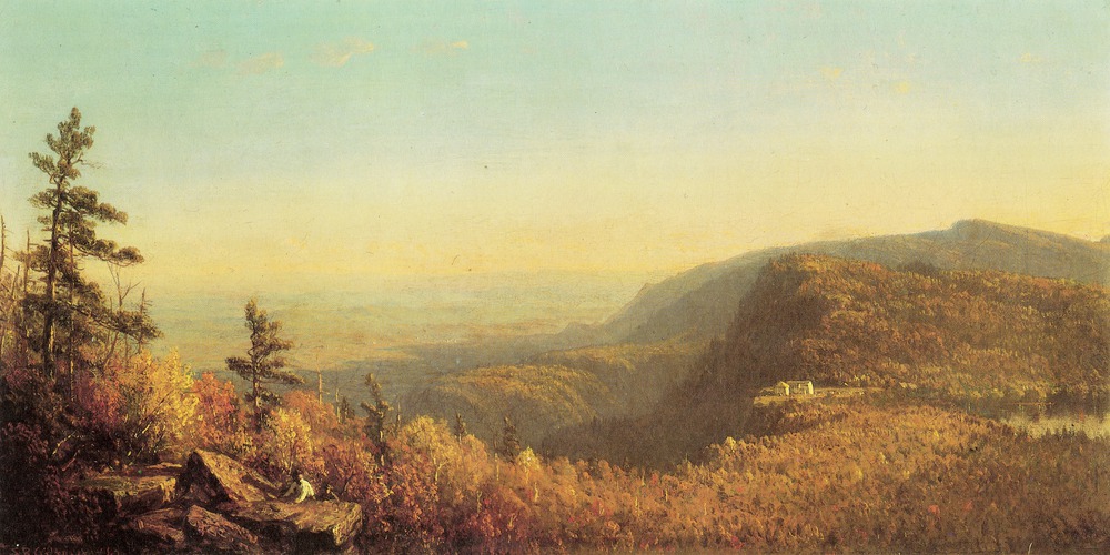
Sanford Gifford. The Catskill Mountain House. 1862. Private collection. (Reproduced under Fair Use etc.)
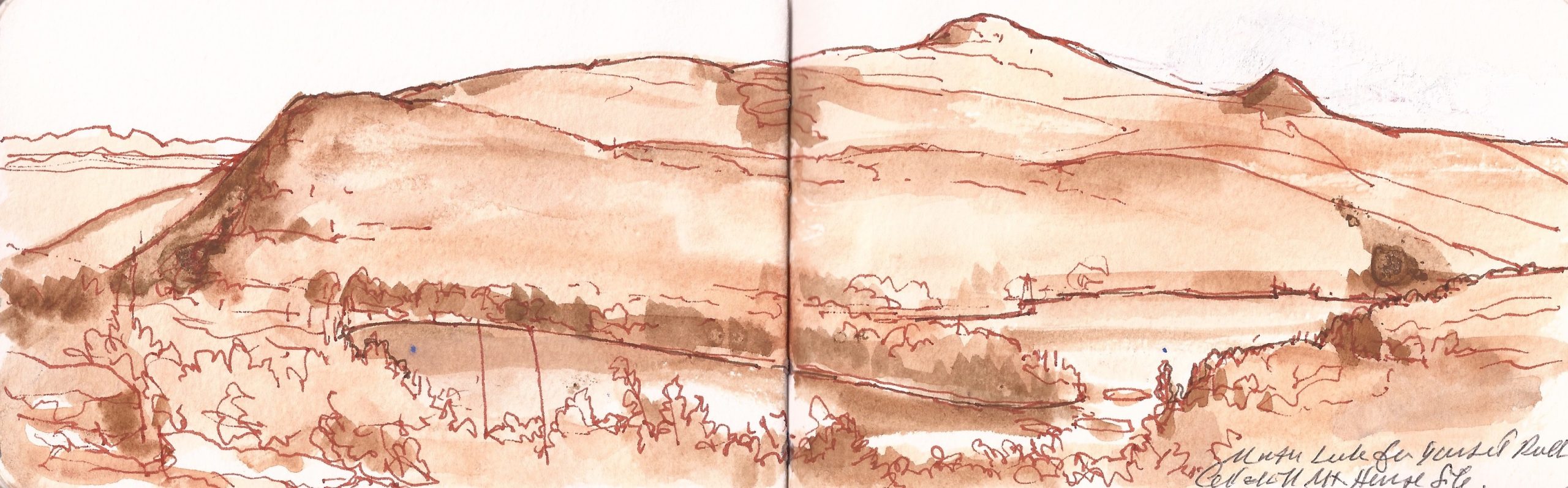
Topographical sketch from the same perspective as Cole and Gifford. 2013.
The stony overlook that provides this stunning vista is not so large. Reaching back through an open understory of woods and ferns to the shoulder of North Mountain, there is no higher elevation from which to view the scene prior to reaching the summit.
This exercise–measuring the view in a drawing–let me to prove to myself that Cole and Gifford had taken great liberties for picturesque effect, and understand why they did it. While many self-identified realist painters today strive for verisimilitude, neither Cole nor Gifford allowed themselves to be fettered by fact. Looking at Cole’s rendition of the eponymous rock, one would never know it was the same boulder. Descending the trail, I lost my footing on a rock scramble, dislocating a finger—not on my painting-hand. Popping it back into place, I proceeded down the mountain. That evening I painted the sunset from the shore of North Lake. A couple we met recalled spending a night on the mountain, to protect their injured dog, sans food, water or shelter, menaced by bears. With nothing worse than a swollen finger, I felt lucky.
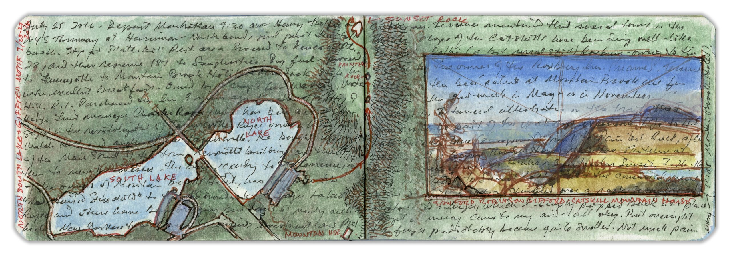
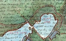
Map of North-South Lake and Sunset Rock. July 25-27, 2016
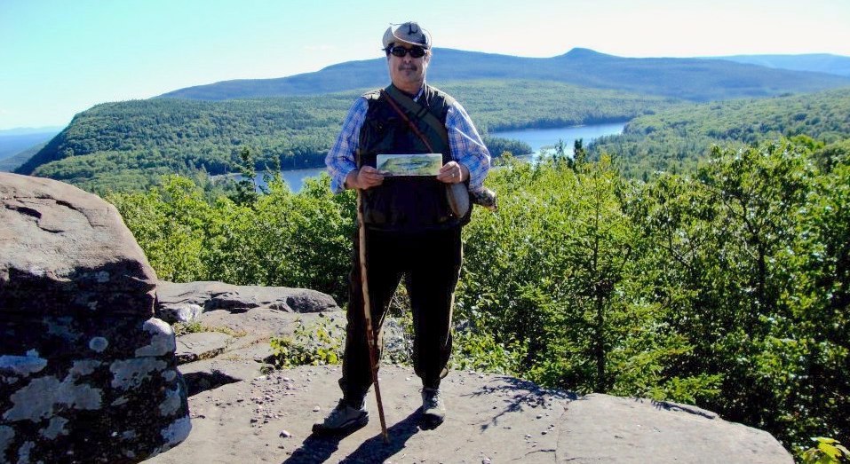
Painting at Sunset Rock.
. (Image and text were featured in the exhibition James McElhinney. Discover the Hudson Anew, curated by Laura Vookles. Hudson River Museum. Yonkers, New York. September 13, 2019 to February 16, 2020. Published also as a limited-edition in Hudson Highlands. North River Suite Volume One. Needlewatcher Editions. New York. 2018)
Check out April 2020 Quaranteam Traveler Dispatches
(A preview of SKETCHBOOK TRAVELER by James L. McElhinney (c) 2020. Schiffer Publishing).
Copyright James Lancel McElhinney (c) 2020 Texts and images may be reproduced (with proper citation) by permission of the author. To enquire, send a request to
ed******@ne***********.com
Waiting for the crisis to pass, our thoughts go out to friends and loved-ones who also shelter in place. Old friends pass away, people we loved and admired. Immobilized for the time being, we can revisit destinations, near and far. join me in celebrating the joys of Quaranteam travel, the hope that these diversions might inspire us to value things we had taken for granted, to draw strength, wisdom and compassion from deeper engagements with nature.
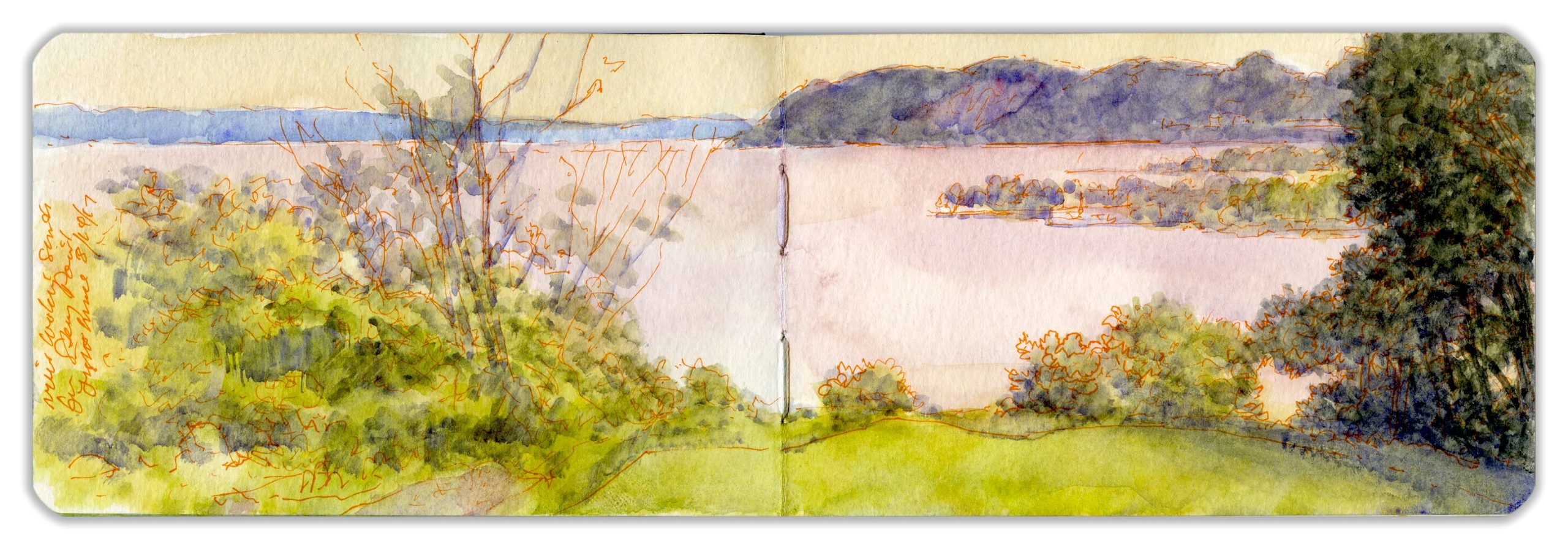
Haverstraw Bay and the Tors from Stony Point. August 14, 2017
. (Image and text were featured in the exhibition James McElhinney. Discover the Hudson Anew, curated by Laura Vookles. Hudson River Museum. Yonkers, New York. September 13, 2019 to February 16, 2020. Published also as a limited-edition in Hudson Highlands. North River Suite Volume One. Needlewatcher Editions. New York. 2018)
“Stony Point was the theater of stirring events in the summer of 1779. The fort there, and Fort Fayette 0n Verplanck’s Point, on the opposite side of the river, were captured by Sir Henry Clinton on the 1st of June of that year…The garrison at Stony Point was very small, and retired towards West Point on the approach of the British. The victors pointed the guns of the captured fortress, and cannon and bombs brought by themselves, upon Fort Fayette the following morning. General Vaughan assailed it from the rear, and the little garrison soon surrendered themselves prisoners of war. These fortresses, commanding the lower entrance to the Highlands, were very important. General Anthony Wayne… was then in command of the Americans in the neighborhood. Burning with desire to retake the forts, he applied to Washington for permission to make the attempt…The cautious Washington considered; when the impetuous Wayne, scorning all obstacles, said, “General, I’ll storm hell if you will only plan it!”
–Benson J. Lossing. The Hudson from the Wilderness to the Sea. 1866
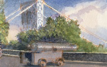
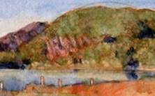
On July 16, 1779 General (Mad) Anthony Wayne led a night assault against a British garrison stationed on a rocky promontory on the right bank of the Hudson. Reaching across the river toward Verplanck’s Point on the eastern bank of the river, Stony Point marks the division between Haverstraw Bay and the southern waters of Peekskill Bay. Wading through waist-deep water in a soggy marsh, Wayne’s troops silently scaled the precipitous bluffs, taking the redcoats by surprise. Looking from one of the fortified positions, Hook Mountain and the Tors rise up along the southern horizon. A few miles north of the heights, Treason Creek flows into the Hudson. Along its banks near the confluence, Benedict Arnold had delivered to Major John Andre plans of the American fortifications at West Point. The site today is maintained as a state historic site, interpreting the Revolutionary period and the 1779 battle. The house where Arnold plotted treason was demolished years ago. The hill upon which it stood is occupied today by Helen Hayes Memorial Hospital. Hook Mountain and the Tors are preserved as part of the Palisades Interstate Park system, with hiking trails, lakes, and other recreational amenities.
Waiting for the crisis to pass, our thoughts go out to friends and loved-ones who also shelter in place. Old friends pass away, people we loved and admired. Immobilized for the time being, we can revisit destinations, near and far. join me in celebrating the joys of Quaranteam travel, the hope that these diversions might inspire us to value things we had taken for granted, to draw strength, wisdom and compassion from deeper engagements with nature.
Haverstraw Bay and the Tors from Stony Point. Monday, August 14. 2017
. (Image and text were featured in the exhibition James McElhinney. Discover the Hudson Anew, curated by Laura Vookles. Hudson River Museum. Yonkers, New York. September 13, 2019 to February 16, 2020. Published also as a limited-edition in Hudson Highlands. North River Suite Volume One. Needlewatcher Editions. New York. 2018)
“Stony Point was the theater of stirring events in the summer of 1779. The fort there, and Fort Fayette 0n Verplanck’s Point, on the opposite side of the river, were captured by Sir Henry Clinton on the 1st of June of that year…The garrison at Stony Point was very small, and retired towards West Point on the approach of the British. The victors pointed the guns of the captured fortress, and cannon and bombs brought by themselves, upon Fort Fayette the following morning. General Vaughan assailed it from the rear, and the little garrison soon surrendered themselves prisoners of war. These fortresses, commanding the lower entrance to the Highlands, were very important. General Anthony Wayne… was then in command of the Americans in the neighborhood. Burning with desire to retake the forts, he applied to Washington for permission to make the attempt…The cautious Washington considered; when the impetuous Wayne, scorning all obstacles, said, “General, I’ll storm hell if you will only plan it!”
–Benson J. Lossing. The Hudson from the Wilderness to the Sea. 1866
On July 16, 1779 General (Mad) Anthony Wayne led a night assault against a British garrison stationed on a rocky promontory on the right bank of the Hudson. Reaching across the river toward Verplanck’s Point on the eastern bank of the river, Stony Point marks the division between Haverstraw Bay and the southern waters of Peekskill Bay. Wading through waist-deep water in a soggy marsh, Wayne’s troops silently scaled the precipitous bluffs, taking the redcoats by surprise. Looking from one of the fortified positions, Hook Mountain and the Tors rise up along the southern horizon. A few miles north of the heights, Treason Creek, now known as Minisceongo Creek flows into the Hudson. Along its banks near the confluence, Benedict Arnold had delivered to Major John Andre plans of the American fortifications at West Point. The site today is maintained as a state historic site, interpreting the Revolutionary period and the 1779 battle. The house where Arnold plotted treason was demolished years ago. The hill upon which it stood is occupied today by Helen Hayes Memorial Hospital. Hook Mountain and the Tors are preserved as part of the Palisades Interstate Park system, with hiking trails, lakes, and other recreational amenities.
The site is approached off Route 9W via Battlefield Road. Descending to marshland north of the point the road crosses over a rail-line dedicated to freight-trains before terminating in a large parking-area at the foot of the promontory. Beyond this point the road is reserved for the use of park staff and volunteers. As I ascended toward the lighthouse a light mist turned to drizzle.
Surveying the site, leafy groves and grassy glades scattered with rocky outcroppings of Middle Ordovician limestone makes envisioning its appearance on July 15, 1776 nearly impossible. The interpretive center was closed. The only visitors apart from myself were two elderly women, and a young mother with her pre-K son. I set up my camp-stool and began mapping out the page-spread. In the distance are The Tors, rocky knobs rising above the steep northern face of Hook Mountain. Beyond Croton Point to the left lies the eastern shore of the Tappan Zee. Reaching into the Hudson from the right are silt-deposits of Minisceongo Creek, stabilized by landfill. Just south of Stony Point most of the tidal marsh Wayne’s men had traversed was bisected by the railway. A suburban subdivision stands on fill atop former landward wetlands. To the north, Tompkins Cove had been mined since 1837. When travel–writer Benson Lossing visited the facility in 1859 he found it bustling with activity.
“They are the most extensive works of the kind on the Hudson…at the foot of an immense cliff of limestone, nearly 200 feet in height, immediately behind the kilns, and extend more than half a mile along the river. One million bushels of lime were produced at the kilns each year…from 20,000 to 25,000 tons of the “gravel” were used each year in the construction of macadamized roads…The country behind, for many miles, is very wild, and almost uncultivated.”
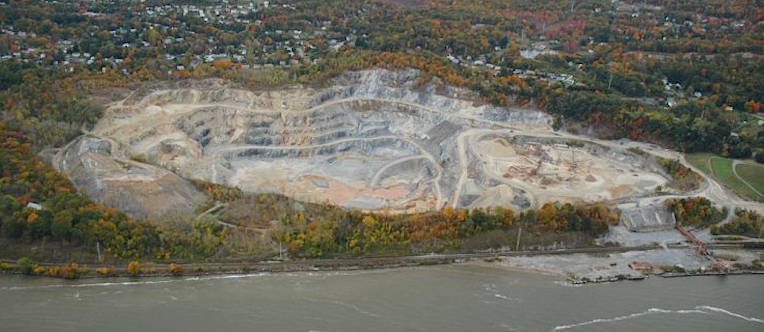
Tompkins Cover limestone mine (reproduced under Fair Use, etc.) The Center for Land Use interpretation. (Reproduced under Fair Use, etc.)
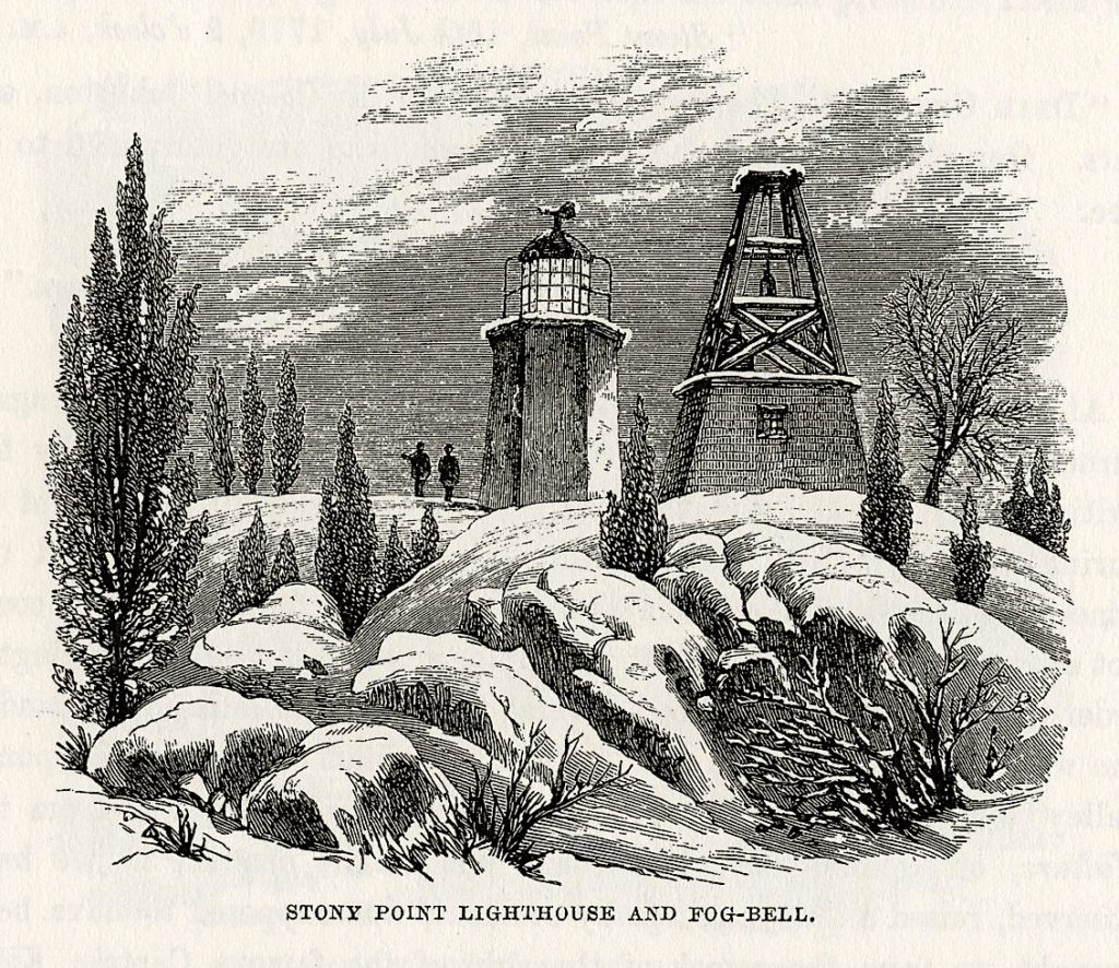
Hudson River Resources has proposed a land-reclamation project to transform the three-hundred-foot-deep pit-mine into a new green space for the community. Making color-notes on the page, I thought about my location and all I beheld. Behind me stands a lighthouse built in 1825, a beacon for navigators. Just as the railroad had divided wetlands from the river, it had severed Stony Point from the shore. I thought how much more difficult Wayne’s capture of the post would have been, has the British been blessed with the road-cut enhancing their defenses.
King’s Ferry since ceased operations long before, but the Stony Point and Verplanck’s Landing (now Steamboat Waterfront Park) resonated with the history of transportation. The market for limestone quarried next-door had included gravel used in blacktop pavements. It was obvious why this had been a strategic location. Recalling the words of J.B. Jackson,
“And I still find myself wondering if there is not always some deep similarity between the way war organizes space and movement, and the way the contemporary society organizes them;
that is, if the military landscape and military society are not both in essence intensified version of the peacetime landscape, intensified and vitalized by one overriding purpose which, of necessity, brings about a closer relationship between man and the environment, and between men.”
–John Brinckerhoff Jackson. “Landscape as Seen by the Military” (essay). Discovering the Vernacular Landscape. Yale University Press. New Haven. 1984.
Check out April 2020 Quaranteam Traveler Dispatches
(A preview of SKETCHBOOK TRAVELER by James L. McElhinney (c) 2020. Schiffer Publishing).
Copyright James Lancel McElhinney (c) 2020 Texts and images may be reproduced (with proper citation) by permission of the author. To enquire, send a request to
ed******@ne***********.com
May 16, 2020. Quaranteam Traveler Dispatch #46. Lone Oarsman Passing Three Angels
Waiting for the crisis to pass, our thoughts go out to friends and loved-ones who also shelter in place. Old friends pass away, people we loved and admired. Immobilized for the time being, we can revisit destinations, near and far. join me in celebrating the joys of Quaranteam travel, the hope that these diversions might inspire us to value things we had taken for granted, to draw strength, wisdom and compassion from deeper engagements with nature.
Exploring the banks of the Schuylkill River in 2018, between the mouth of Wissahickon Creek and Fairmount Water-Works I filled a sketchbook with paintings. Later that year, a suite of prints drawn from this journal would become the centerpiece of an installation at Independence Seaport Museum in Philadelphia.
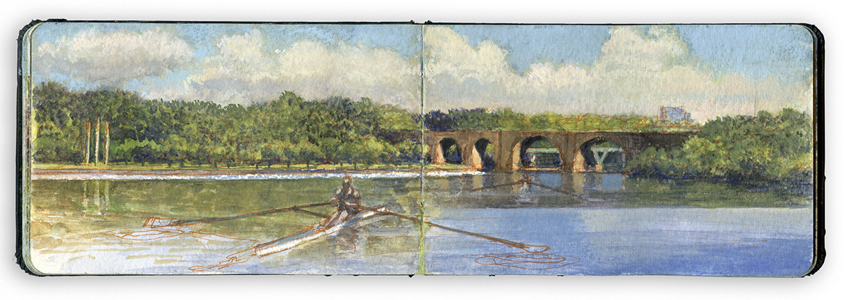
LONE OARSMAN OFF THREE ANGELS
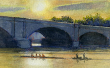
Standing on the western shore of the river near the Dragon Boat Dock, I imagined being in the middle of the river, looking southwest. A lone oarsman moves downriver, not far from where Thomas Eakins portrayed Max Schmitt. Marking a midpoint between bridges on the far shore is the sculpture Playing Angels, completed by Carl Milles in 1950 but not installed until 1972. Widening below Columbia Bridge, the Schuylkill River narrows again as it passes the Pennsylvania Railroad Connecting Railway Bridge. Completed in 1867, the bridge appears in Thomas Eakins’s 1871 painting Max Schmitt in a Single Scull, with an iron Whipple truss as its central span.
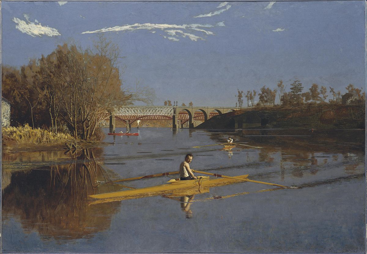
Thomas Eakins. Max Schmitt in a Single Scull. Metropolitan Museum of Art. 1871. Reproduced under Fair Use, etc.
Five years prior to Eakins’s painting a hydrographoc map of the river was produced. The landscape today is much changed. The Tow-Path and Long Island seen at the top of the image today no longer exist. The channel that once separated the island from the shore was filled to broaden the grassy esplanade.
The railroad following the right bank of the river behind the Tow-Path was rerouted onto a new grade constructed a few hundred yards to the west. The right of way shown on this map was converted first into a carriage-road and later improved for automotive traffic as West River Drive, later Martin Luther King Drive. My location in the journal-painting (39.9828 x 75.2081) above would be along the Tow-Path in the 1866 map, just to the south (left) of a small brook. My directional vector, based on the location of the binding-gutter in my sketchbook would roughly be South 170 degrees. The Schuylkill in Eakins’s day was a working river. Barge-traffic and pollutants such as coal silt from mining operations a hundred miles upriver soiled the waterway, along with effluence from towns and industries upstream. Rowing community old-timers tell of dreading to capsize. Following heavy rainfalls organic waste still tints the river a picturesque orange hue. Water quality has shown dramatic improvement, but silting remains an ongoing problem. The process requires the river to be dredged every twenty or thirty years. I heard tell a story about an bungled mob hit that took place a few years ago. The hoodlum’s feet had been encased in concrete. His would-be killers threw their victim into the Schuylkill, only to have him sink no deeper than his waist. The story may be apocryphal, but it makes a point.
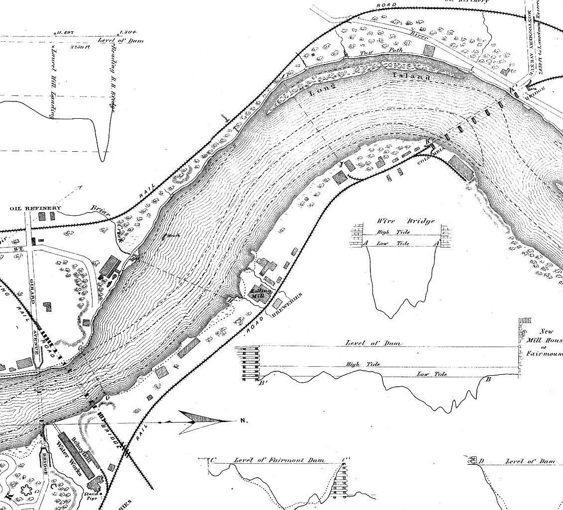
Hydographic map of the Schuylkill River from wire Bridge at Fairmount to Reading Railroad Bridge (Twin Stone). Philadelphia Water Department. Reproduced under fair Use, etc. Note the rolling-mill near the present-day site of Carl Milles’s Dancing Angels (Three Angels) and a brewery where Daniel Chester French’s equestrian portrait of U.S. Grant now stands. Also note the oil refinery indicated on the map, near the future entrance to the 1876 Centennial Exposition Fairgrounds and the Philadelphia Zoological Gardens across Girard Avenue.
Painting in book form presents a few challenges. The binding gutter forces every painting into a diptych format. While this restriction might be seen as an intrusion, obstacle, or vexation, it allows each page to exist in different moments while maintaining a kind of unity. It also serves as a way of determining my line-of-sight in relation to my geographic map-coordinates location (degree altitude x degrees longitude).
During the 1990s, experiments with temporal composites in my paintings of Civil War battlefields relate to nineteenth-century pictorial fictions such as Frederic Church’s Heart of the Andes. None of these journal works is concerned with simple reportage. All of them seek to transform experience into a kind of knowledge that breed ideas.
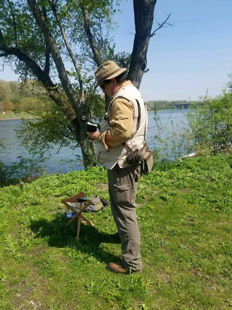
Working along the Schuylkill near the Dragon-Boat dock. Note the Railway Connecting Bridge in the Distance.
The land upon which I am standing appears in the 1866 map beside the letter g in Long Island.
Check out April 2020 Quaranteam Traveler Dispatches
(A preview of SKETCHBOOK TRAVELER by James L. McElhinney (c) 2020. Schiffer Publishing).
Copyright James Lancel McElhinney (c) 2020 Texts and images may be reproduced (with proper citation) by permission of the author. To enquire, send a request to
ed******@ne***********.com
Waiting for the crisis to pass, our thoughts go out to friends and loved-ones who also shelter in place. Old friends pass away, people we loved and admired. Immobilized for the time being, we can revisit destinations, near and far. join me in celebrating the joys of Quaranteam travel, the hope that these diversions might inspire us to value things we had taken for granted, to draw strength, wisdom and compassion from deeper engagements with nature.
Exploring the banks of the Schuylkill River in 2018, between the mouth of Wissahickon Creek and Fairmount Water-Works I filled a sketchbook with paintings. Later that year, a suite of prints drawn from this journal would become the centerpiece of an installation at Independence Seaport Museum in Philadelphia.
LONE OARSMAN OFF THREE ANGELS
Standing on the western shore of the river near the Dragon Boat Dock, I imagined being in the middle of the river, looking southwest. A lone oarsman moves downriver, not far from where Eakins portrayed Max Schmitt. Marking a midpoint between bridges on the far shore is the sculpture Playing Angels, completed by Carl Milles in 1950 but not installed until 1972. Widening below Columbia Bridge, the Schuylkill River narrows again as it passes the Pennsylvania Railroad Connecting Railway Bridge. Completed in 1867, the bridge appears in Thomas Eakins’s 1871 painting Max Schmitt in a Single Scull, with an iron Whipple truss as its central span.
Thomas Eakins. Max Schmidt in a Single Scull. Metropolitan Museum of Art. 1871. Reproduced under Fair Use, etc.
Five years prior to Eakins’s painting a hydrographoc map of the river was produced. The landscape today is much changed. The Tow-Path and Long Island today no longer exist. The channel that once separated the island from the shore was filled to broaden the esplanade
The railroad following the right bank of the river behind the Tow-Path was rerouted onto a new grade constructed a few hundred yards to the west. The right of way shown on this map was converted first into a carriage-road and later improved for automotive traffic as West River Drive, later Martin Luther King Drive. My location in the journal-painting (39.9828 x 75.2081) above would be along the Tow-Path in the 1866 map, just to the south (left) of a small brook. My directional vector, based on the location of the binding-gutter in my sketchbook would roughly be South 170 degrees. Unlike today, the Schuylkill in Eakins’s day was a working river full of barge-traffic and pollutants, such as black silt from coal-tailings eighty miles upriver, and effluence from towns and industries upstream. Rowing community old-timers tell of dreading to capsize. Following heavy rainfall organic waste still fills the river, giving it a picturesque orange hue. Water quality has shown dramatic improvement, but silting remains an ongoing problem. The process requires the river to be dredged every twenty or thirty years. I heard tell a story about an bungled mob hit that took place a few years ago. The hoodlum’s feet had been encased in concrete. His would-be killers threw their victim into the Schuylkill, only to have him sink no deeper than his waist. The story may be apocryphal, but it makes a point.
Hydographic map of the Schuylkill River from wire Bridge at Fairmount to Reading Railroad Bridge (Twin Stone). Philadelphia Water Department. Reproduced under fair Use, etc.
Working in book form presents a few challenges. The binding gutter forces every painting into a diptych format. While this restriction might be seen as an intrusion, obstacle, or vexation, it allows each page to exist in different moments while maintaining a kind of unity. During the 1990s, experiments with temporal composites in my paintings of Civil War battlefields relate to nineteenth-century pictorial fictions such as Frederic Church’s Heart of the Andes. None of these journal works is concerned with simple reportage. All of them seek to transform experience into a kind of knowledge that breed ideas.
Check out April 2020 Quaranteam Traveler Dispatches
(A preview of SKETCHBOOK TRAVELER by James L. McElhinney (c) 2020. Schiffer Publishing).
Copyright James Lancel McElhinney (c) 2020 Texts and images may be reproduced (with proper citation) by permission of the author. To enquire, send a request to
ed******@ne***********.com