Category Archives: Dispatches

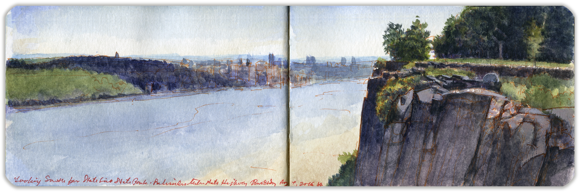
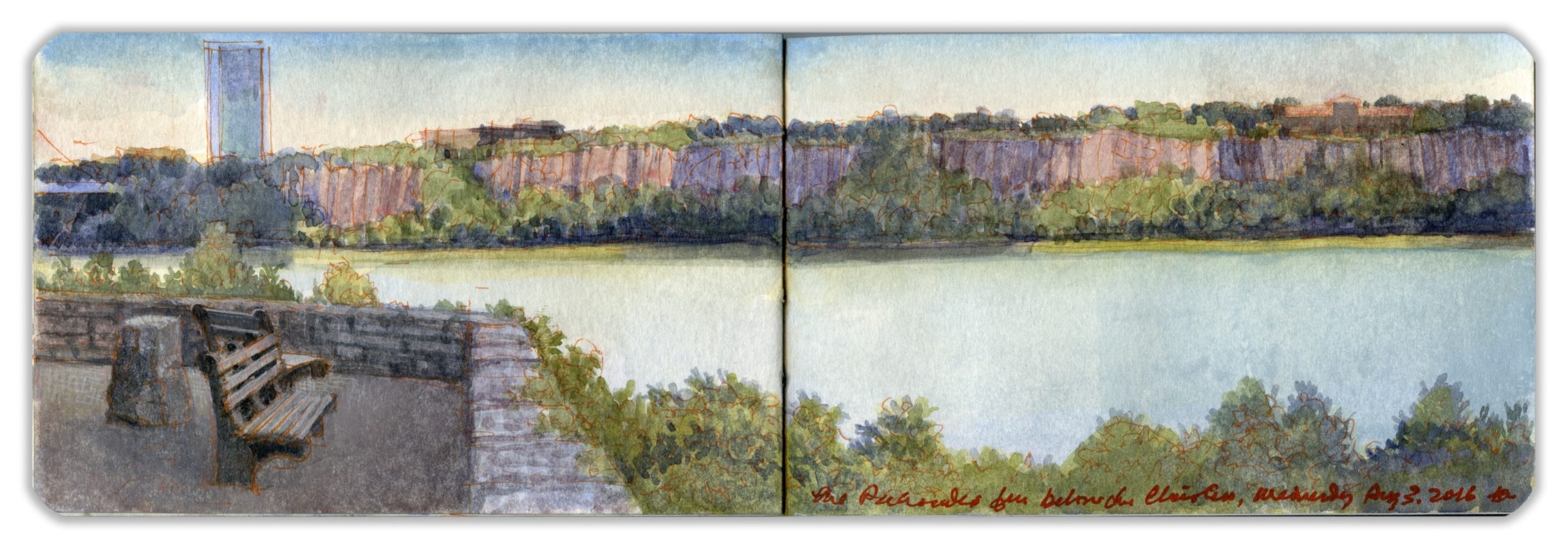
May 15. QT Dispatch #45. The Palisades from below The Met Cloisters, Northern Manhattan. August 3, 2016

Waiting for the crisis to pass, our thoughts go out to friends and loved-ones who also shelter in place. Old friends pass away, people we loved and admired. Immobilized for the time being, we can revisit destinations, near and far. join me in celebrating the joys of Quaranteam travel, the hope that these diversions might inspire us to value things we had taken for granted, to draw strength, wisdom and compassion from deeper engagements with nature.


The Palisades from Below The Met Cloisters, Fort Tryon Park. Northern Manhattan. Wednesday August 3, 2016

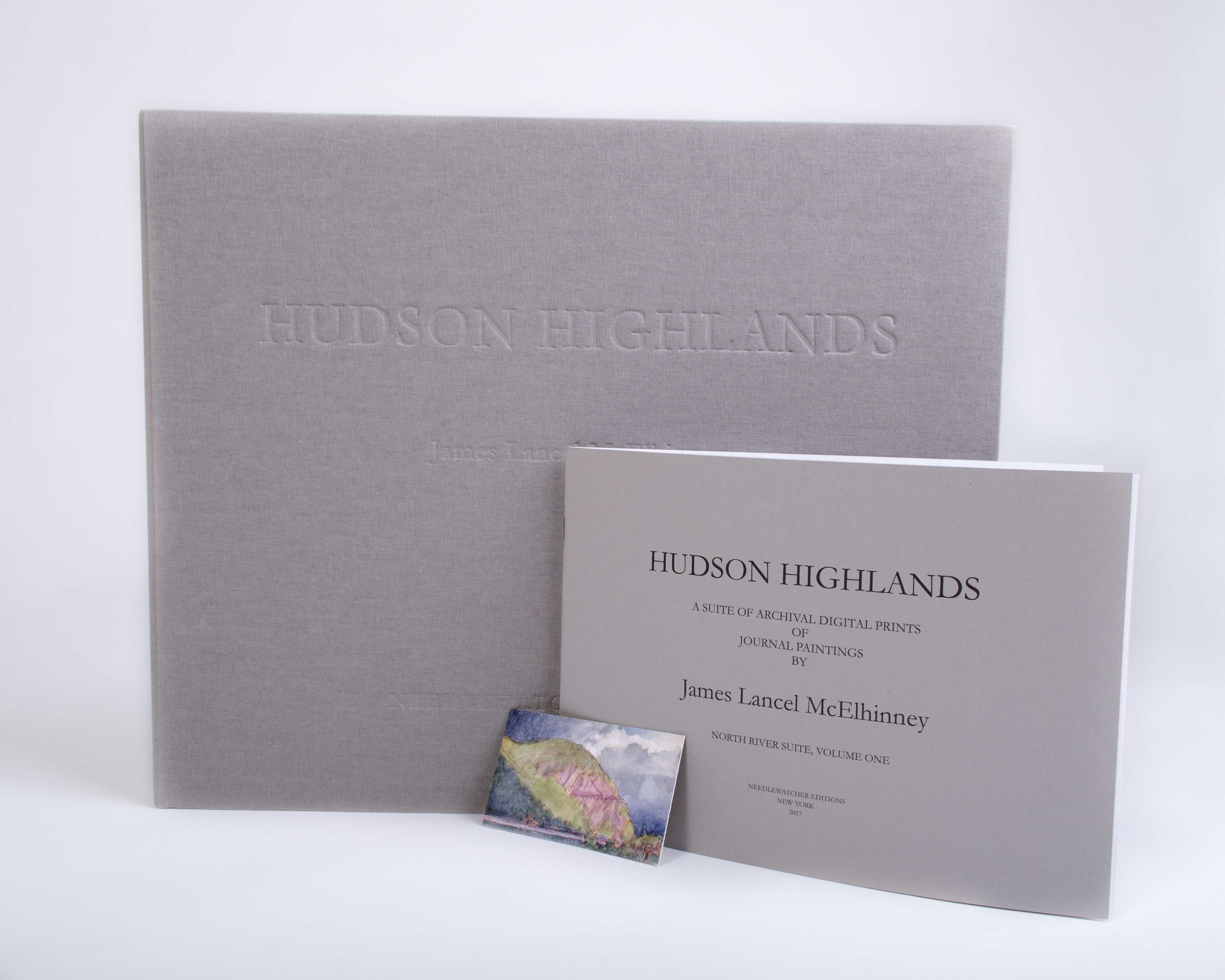
. (Image and text were featured in the exhibition James McElhinney. Discover the Hudson Anew, curated by Laura Vookles. Hudson River Museum. Yonkers, New York. September 13, 2019 to February 16, 2020. Published also as a limited-edition in Hudson Highlands. North River Suite Volume One. Needlewatcher Editions. New York. 2018)

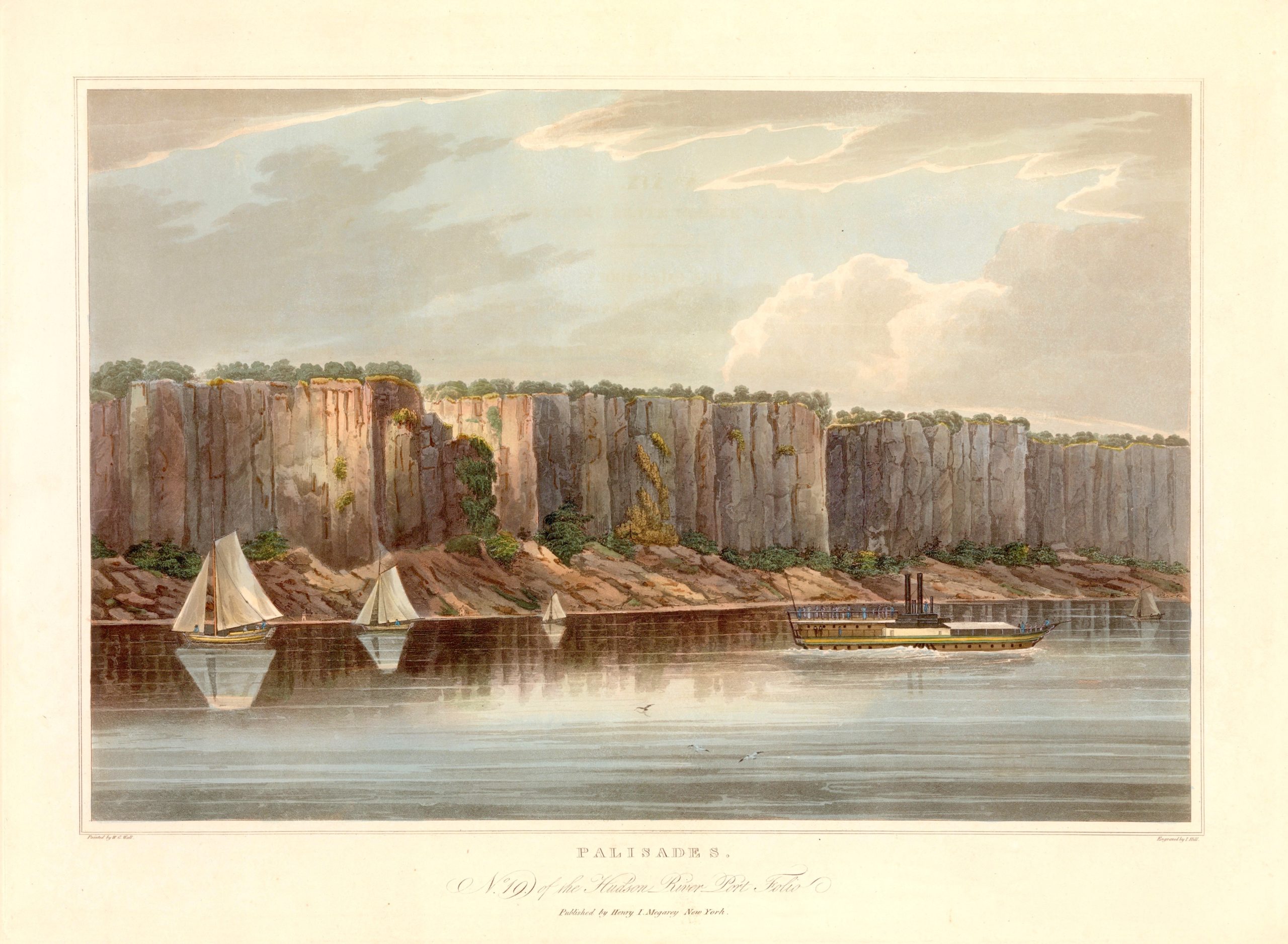
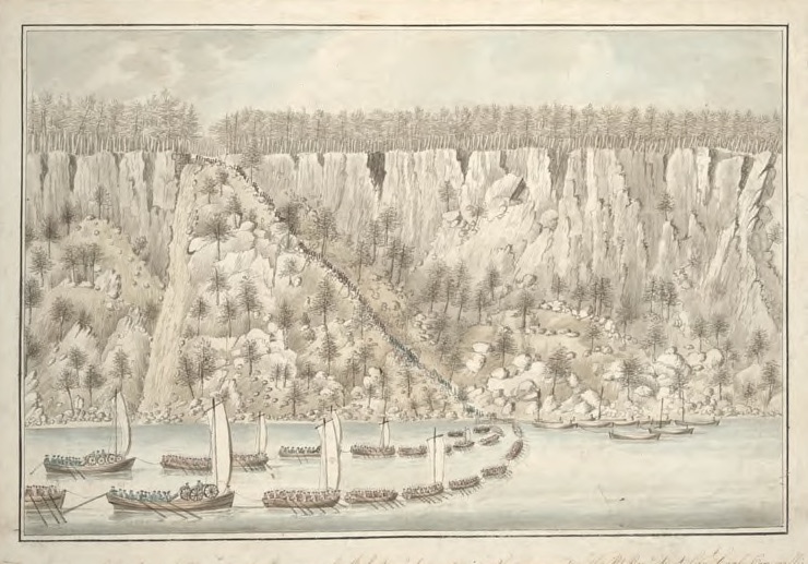
From a shaded esplanade running along the bluff, is a spectacular view of the Jersey Palisades—a sheer wall of basaltic diabase sill. Denoting a defensive wall constructed of upright poles, the word palisade is French, a military term also known in English as a pale, derived from the Latin pälus. Wall Street in lower Manhattan traces the course of such a defensive barrier from the East River to the Hudson. In places the cliffs have collapsed, undermined by the freezing and thawing of brooks and rivulets descending from the heights. These clefts appear as triangular patches of vegetation reaching to the summit, above the wooded shoreline. Extending into the the river at the foot of one of these formations is Ross Dock picnic-area, which accessible by car via Henry Hudson Drive. Further upriver at Alpine Landing, Charles Lord Cornwallis had disembarked with six thousand troops, to capture George Washington at Fort Lee. The operation was a tactical success. The fort was taken and destroyed, but the quarry had escaped.


Crown forces under Charles Lord Cornwallis ascending the Palisades at Closter (Alpine Landing) November 20, 1776.
Drawing by Thomas Davies/. Collection New York Public Library (Reproduced under Fair Use, etc.)

The rocky margin of natural rip-raps was formed by rock-fall over the millennia. These events are not uncommon, though seldom witnessed. Working at our desks a few years ago both Kathie and I heard a tremendous explosion, followed by a loud crash. Curiously, this was not followed by the familiar wail of police-sirens. Walking to the post office a few days later I approached a large sheet of gneiss, rising eighty feet above the street-level. Resting nose-down on the sidewalk was a massive rock. Crushing a retaining-wall in its descent, the stone was comparable in size to a Chevy Suburban. Traversing the rock-face above it was a large crack, next to which the surface was a lighter shade of grey. Police had enclosed the scene with a cordon of concrete traffic-barriers. Along the Palisades escarpment. light patches of yellowish stone signal recent losses. Decades may pass before exposed rock develops a patina.
A hundred yards to the southeast of this prospect stands The Cloisters—a facility operated by the Metropolitan Museum of Art as a museum of medieval art. Comprised of reconstructed enclosures, gardens and chapels collected by sculptor George Grey Barnard that later were acquired by John D. Rockefeller Jr. and reassembled atop North Hill in Washington Heights by architect Charles Collens, the site was previously occupied by an estate owned by industrialist, harness-racing enthusiast and art-collector C.K.G. Billings. Opening in 1938, the museum building became the centerpiece of Rockefeller’s vision for parklands he had first acquired in 1927. Known today as Fort Tryon Park, the land is rocky and vertiginous, crisscrossed by stairways, trails and terraces, woodlands and clearings that had been laid out by Frederick Law Olmsted Jr. Trails descend to Broadway and Dyckman Avenue, anchored at Tubby Hook on the Hudson, with access to a pedestrian and bike-path that follows the river downstream to The Battery. This view is from a ledge on the northwestern shoulder of North Hill, near the route taken by Johann Rall’s Hessians, advancing against Fort Washington on November 16, 1776. Wildlife has returned to the park. Visiting the park, I have beheld many species of raptors including Bald Eagles, as well as woodchucks, skunks, raccoons and a baby timber rattlesnake.


The Palisades
. William Guy Wall. Hudson River Port Folio. Megary. New York. 1825. Collection Metropolitan Museum of Art. (Reproduced under Fair Use, etc.)

Revisit April 2020 Quaranteam Traveler Dispatches

(A preview of SKETCHBOOK TRAVELER by James L. McElhinney (c) 2020. Schiffer Publishing).

Copyright James Lancel McElhinney (c) 2020 Texts and images may be reproduced (with proper citation) by permission of the author. To enquire, send a request to

ed******@ne***********.com


NEEDLEWATCHER EDITIONS: The Genesis of an Idea

For the past ten years the majority of my new painting activity has migrated into books. The change occurred gradually, according to no specific plan. No theoretical epiphany preceded the shift. The idea just caught up with me. As a bibliophile fond of travel, I succumbed to my fate without protest. It was liberating. Personal mobility actually expanded my artistic practice. Whatever materials I might need could be carried in my pockets, travel-vest or shoulder-bag.

Someone asked me, “Where is your studio”
“You’re looking at it” I replied

Having produced hundreds of page-spreads in dozens of sketchbooks, the question that arose was how to exhibit them. The traditional solution would be to lay them out in vitrines, open to single page-spreads. Another method was to transform painting-journals into animations, such as those that greet visitors to this website’s homepage. Neither mode of presentation could simulate the experience of perusing one of these books manually. Given their nature, it would be complicated logistically, exposing the objects to potential damage. If I were to exhibit these works in the conventional way, I had to be open to selling the books without cutting them up to accommodate some form of wall-display. Receiving a list of book-binders from the Center for Book Arts in New York City I found a few who could build me an octavo-sized solander (clamshell) box in which the original painted books could be housed. Following every conversation I came away with a case of sticker-shock. Many of these skilled craftspersons had a backlog of several weeks. I decided to do more research.
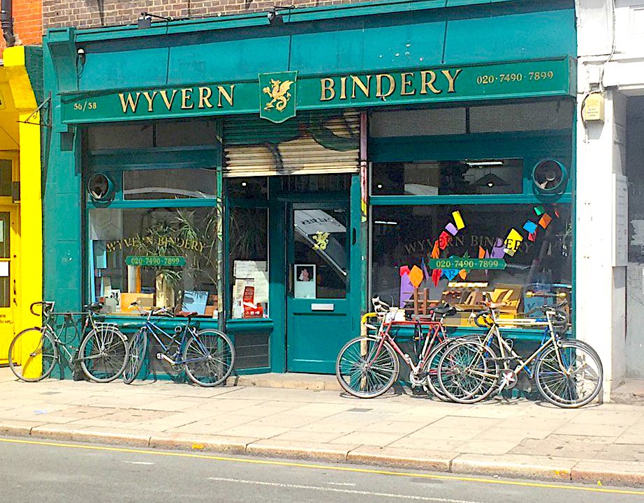
In August of 2016 my wife presented a paper at a symposium at Tate Britain. After visiting several paper-shops and binderies in London I brought one of these books to Wyvern Bindery on Clerkenwell Road.

/>

Stepping through the storefront door transported me to a Dickensian workshop filled with rolls of fabric, glue-pots, bustling workers and front-man Mark standing behind a wooden counter. I described my predicament. At the end of the following day he presented me with the solution, at a lower cost than would have been possible in New York. Manhattanites presume that everything on the planet is for them just a cab ride away. Not so. During the past two years, we have witnessed the extinction of the last privately-owned full-service art-supply stores in New York. Many bookstores have suffered similar fates. My impression is that London retains a culture of artisanal binderies, and a deeper commitment to books as works of art–not just delivery devices for texts and images. There are exceptions of course–the museum shops and venues like Strand, Printed Matter, McNally-Jackson, relocated Rizzoli and others. Books seem to be gaining visibility in museum exhibitions. Vitrines displaying sketchbooks and ephemera were seldom seen twenty years ago, but now are de rigeur. One question remained unanswered. As I continue to paint in books, how might I recreate for purposes of exhibition the experience of having a book in hand, open to a painted page-spread? I brought one of these books to a number of prominent New York art-dealers, who generously shared their suggestions. With a wink, he wondered aloud what kind of lunatic would ever think that paintings in books would be marketable. The question was “how to get the genie out of the bottle”, and suggested suggested that I consider turning them into prints. “You’re reviving a two hundred year old practice. You need to revive a two hundred year old business plan”. Audubon was mentioned.

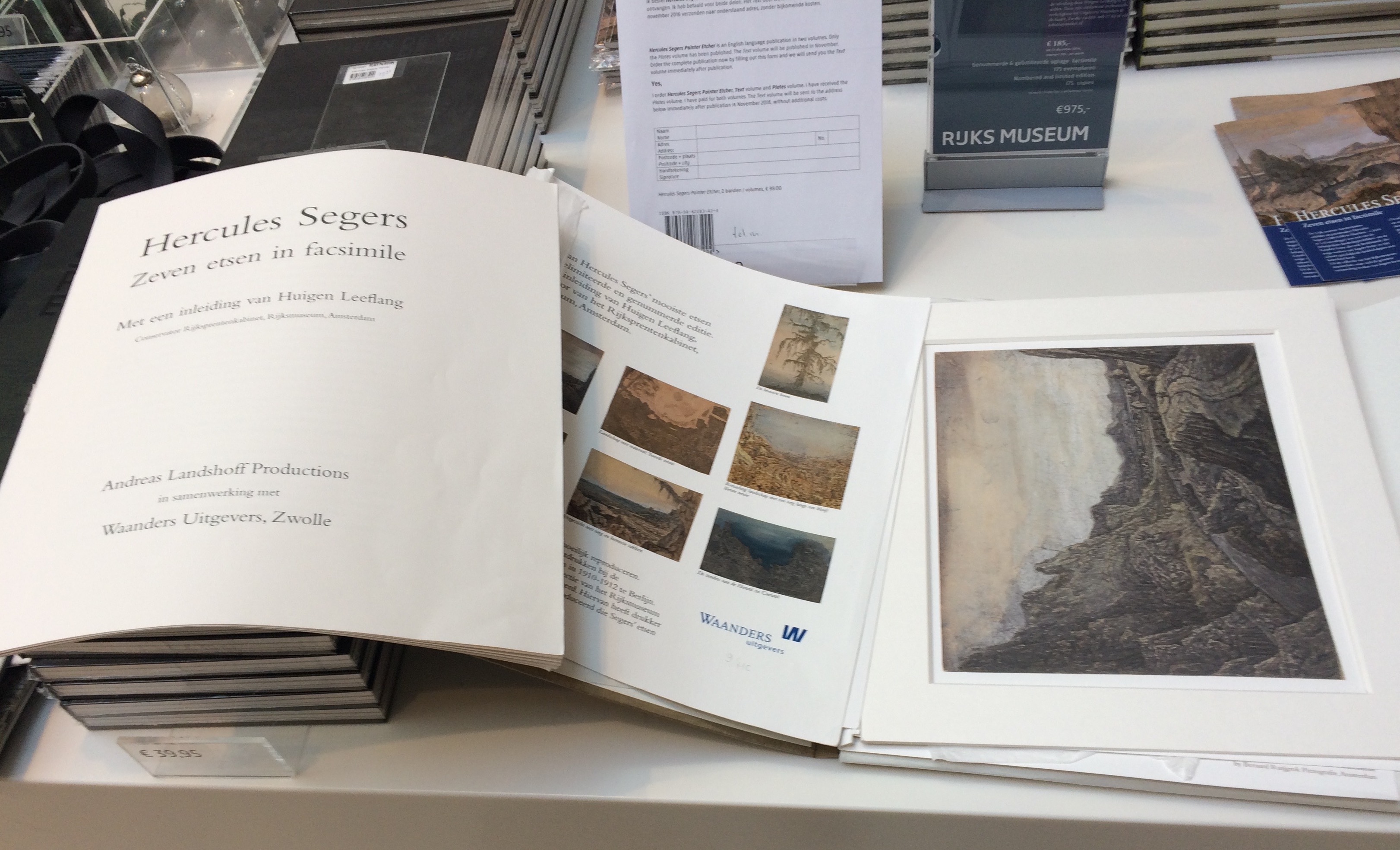
A month later I found myself in Berlin, spending the better part of a day in the back room at Walther Koenig Buchhandlung, at 27 Burgstrasse, next to the Museum Island. While most of the books were by contemporary artists, historical precedents became obvious. A few days later, while attending a retrospective of Hercules Segers at Rijksmuseum, I noticed for sale in the bookshop a facsimile set of Seger’s etchings. Seven archival pigment prints were offered in a limited edition, bound in a linen-covered portfolio.

Not only did I envision a dialogue with Claude Lorrain and Piranesi, but also with Hogarth and Turner. William Guy Wall’s Twenty-four Hudson River Portfolio, combined with Benson J. Lossing’s The Hudson from the Wilderness to the Sea, anchored my project within the history of American art, and with exploratory expeditions blazing trails that tourists would later follow. Visions of the land were thus inscribed upon national identity.


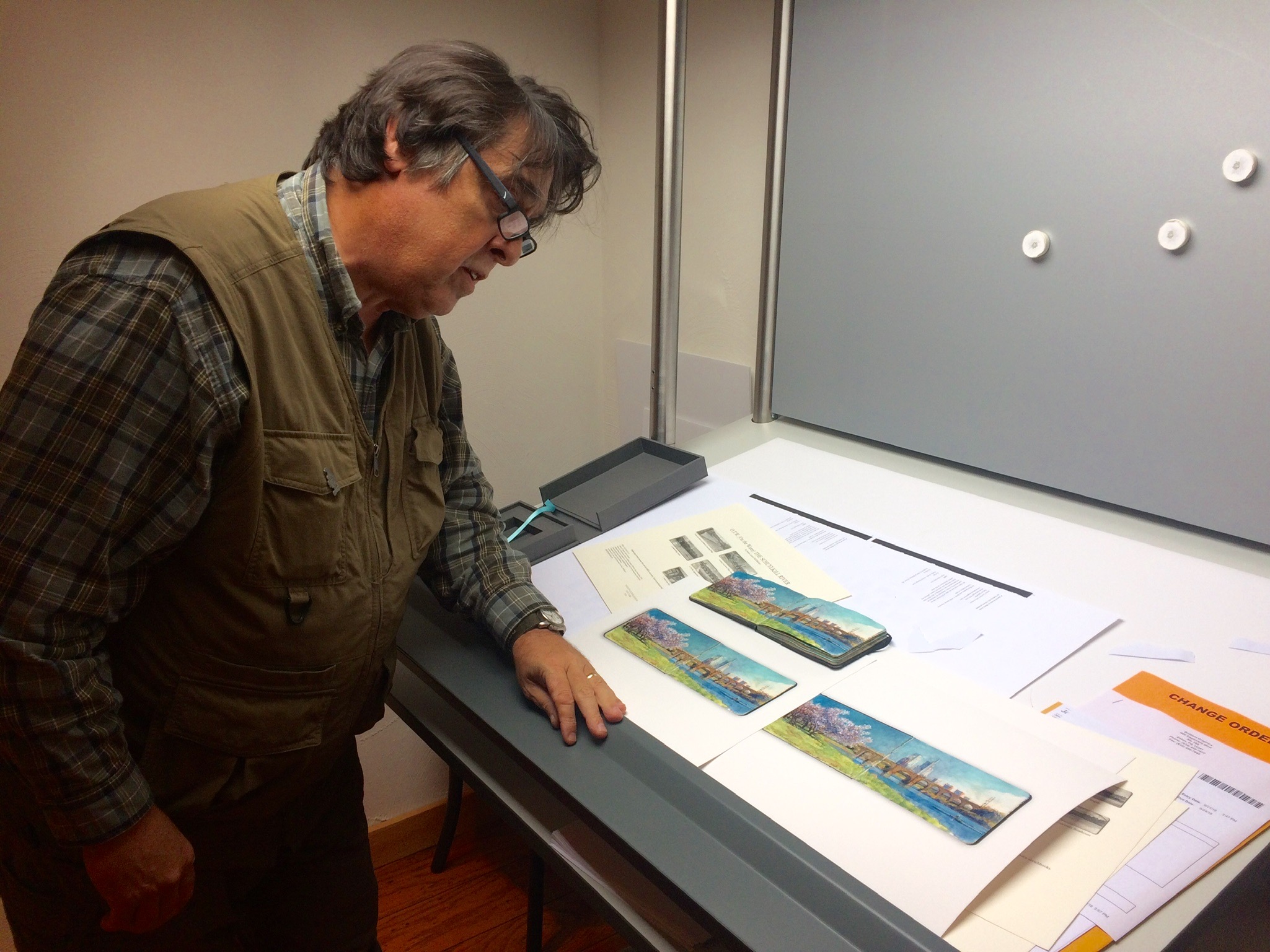
Reviewing proofs at Brilliant Graphics, Exton, Pennsylvania.

Reviewing proofs at Brilliant Graphics, Exton, Pennsylvania

These prints, developed in collaboration the skilled production team at Brilliant Graphics in Exton, Pennsylvania, recreate the feeling of a whole book, open to a single page-spread. Some aspects of each painting is easier to read in this secondary iteration, than in its original book-form. For this reason, the prints must not be seen as reproductions, but as reiterations enhancing the original. See below:

GRAND RIVER SKETCHBOOK

THE PALISADES: North River Suite, Volume Two

O.T.W. THE SCHUYLKILL RIVER

Twin Stone. 3.5 x 10 inches. Archival pigment print from watercolor sketchbook. 2018

HUDSON HIGHLANDS: North River Suite, Volume One

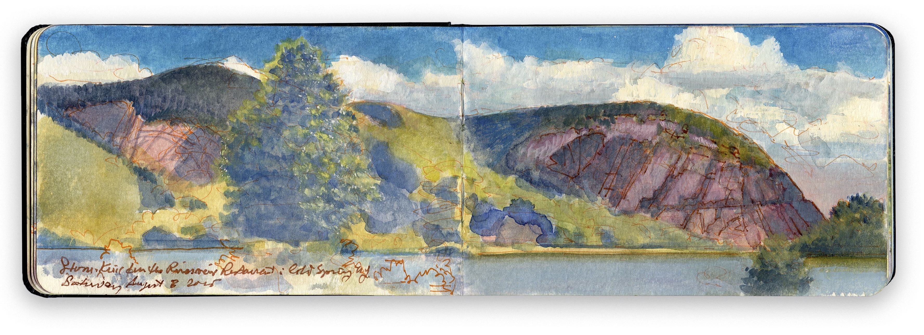
Storm King from Cold Spring. 3.5 x 10 inches. Archival pigment print from watercolor sketchbook. 2016

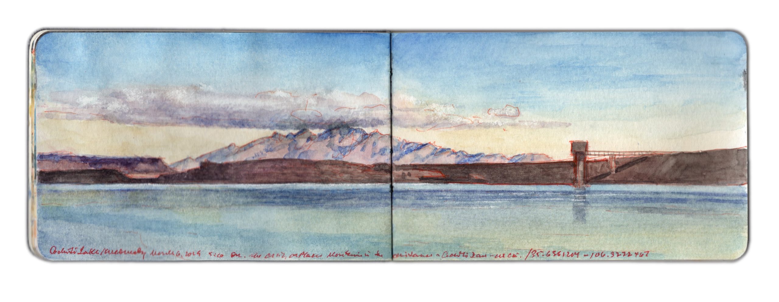
May 14, 2020. QT Dispatch #44. Cochiti Lake and Dam. Wednesday March 6, 2019. 5:00 PM

Waiting for the crisis to pass, our thoughts go out to friends and loved-ones who also shelter in place. Old friends pass away, people we loved and admired. Immobilized for the time being, we can revisit destinations, near and far. join me in celebrating the joys of Quaranteam travel, the hope that these diversions might inspire us to value things we had taken for granted, to draw strength, wisdom and compassion from deeper engagements with nature.


Cochiti Lake and Dam. Wednesday March 6, 2019. 5:00 pm. Southeast from 35.6361204 x 106.333467

Below White Rock Canyon the Rio Grande flows below table-lands to the east and a series of cañadas to the west—deep ravines clawed into the southeastern slopes of the Jemez volcano, as if by a giant hand. Through these defiles seasonal creeks dump rainwater and snowmelt into the river. One of these—Rito de los Frijoles descends through Bandelier National Monument. Named for noted archaeologist, ethnologist and preservationist Adolf Bandelier (1840-1914), the National Park Service interprets more than thirty thousand acres ranging in elevation from five to the thousand feet. Visible evidence of human habitation spanning thousands of years included Tyounyi ruins and other excavated pueblos, along with modern reconstructions, original cliff-dwellings and petroglyphs.
Winding beneath high bluffs, the river widens gradually. Its flow rate decreases as the current enters the upper reaches of Cochiti Lake. An impoundment of nearly forty million gallons on average, this body of water is created by a large dam built by the Army Corps of Engineers between 1965 and 1973. One would presume that in such a dry country the function of the dam would be water-collection for irrigation. Prior to its construction, the combination of heavy snowmelt and a narrow channel would transform the Rio Grande into a raging torrent. Flooding bottomlands dedicated to agriculture, the damage wrought immense hardship on indigenous communities downriver, such as Cochiti and Santo Domingo Pueblo, and Spanish settlements Peña Blanca and Algodones. These, and other farming settlements up and down the river depended on a system of acequias, water-bearing ditches shared by the community. New Mexicans are by nature friendly and easy-going. In picking fights, a mother’s virtue always works. In New Mexico, water-rights will get you there quicker.
I first visited Cochiti Pubelo in 1980. The lake was seven years old. Unlike today, the reservation was open to public use. Unpaved roads led north to the ash-fields and cañadas below Valles Caldera, or west to the tent-rocks at Kasha-Katuwe, Keresan for white rocks. In 2001 the area was designated a National Monument. Santa Fe County and Albuquerque have over the past thirty years both doubled in population, leading the Cochiti tribe to close its lands to unauthorized visitors. At the same time, one is greeted today by a modern welcome center, café and gift-shop. One of the few areas open to the public is Cochiti Dam.
Driving toward the hamlet of Cochiti Lake I turn right, passing a cluster of tribal utility buildings. Veering right again, I descend a long incline that terminated at a wide-boat-landing with a short dock to its left. A local man stood in the water, wrestling his boat onto a trailer. To either side of the ramp are short stretches of beach. Parking in the lot to the right, I carried my gear across the boat-ramp, sitting down at one of the concrete picnic-tables behind the beach. I am the only non-indigenous person at the site. A young couple sits at the next table, staring into their cellphones. A fisherman walks by, looks at me and nods. Before long my work absorbs me, not so much that I would be grateful for the absence of curious onlookers. One expects diffidence from Native Americans toward European ethnic types visiting Indian land. History has given them no reason to trust our kind. I am mindful also that the lake and its shores are under the control of the Army Corps of Engineers, which adds yet another nervous level to the human layer-cake one finds in The Land of Enchantment.


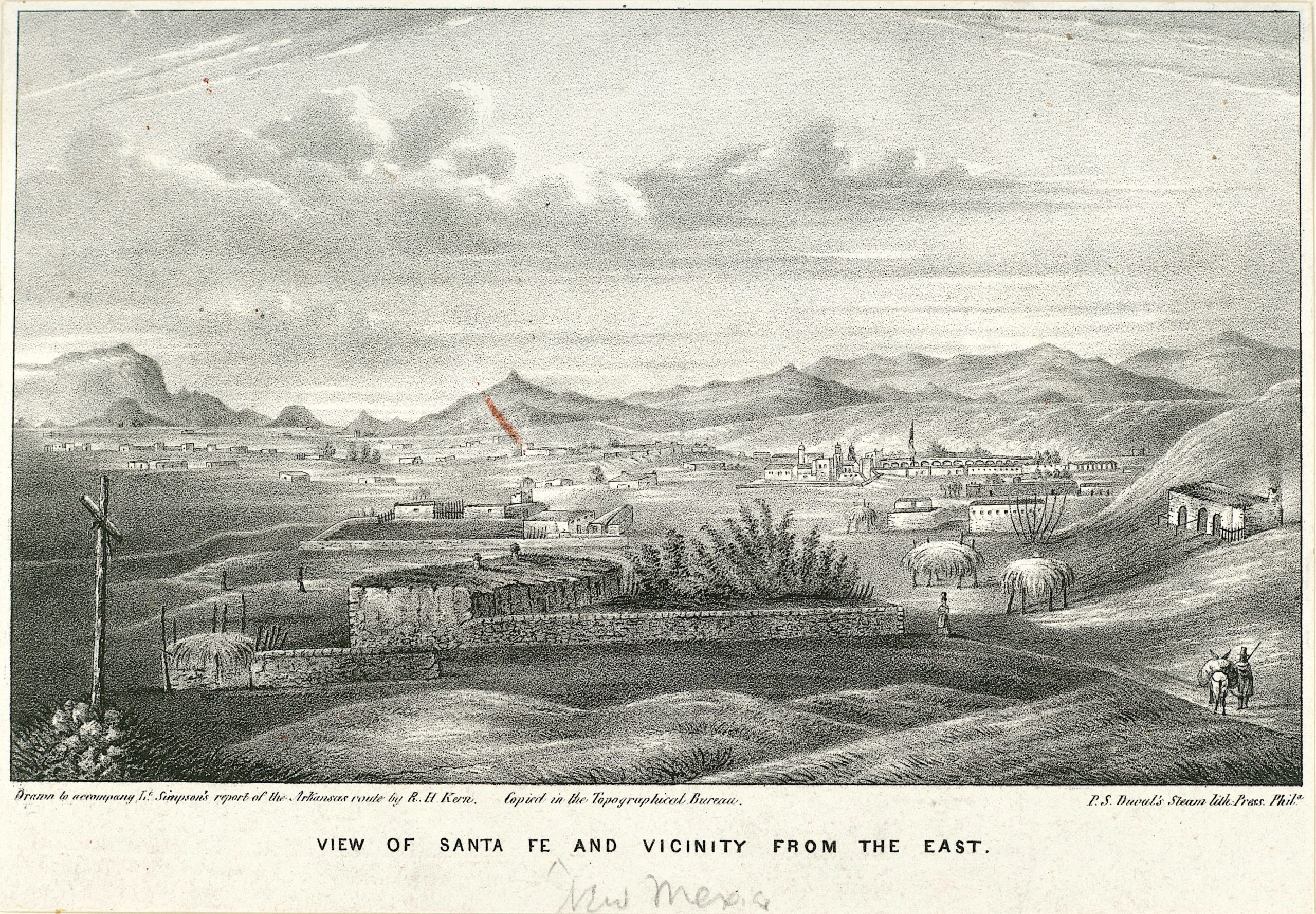
Richard Hovenden Kern (1821-1853). View of Santa Fe and Vicinity. 1848. Collection New York Public Library. (Reproduced under Fair Use, etc.)

Looking east beyond the dam lie the Ortiz Mountains, which on Dick Kern’s 1848 view of Santa Fe from Fort Marcy are identified as the Placer Mountains. Curious to compare Kern’s rendering of the vista with how it might look today, I went to the ruins of the fort and looked southward.I soon realized that the legend under the historic print was in error. That I was in the right location was confirmed by the presence in Kern’s view of the Martyr’s Cross, honoring the twenty-one Franciscans and numerous settlers killed during the Pueblo Revolt of 1680. What struck me about the Kern were liberties he took in representing various landmarks in scale. The Sandias are instantly identifiable, as is Cerro Tetilla (nipple hill), and east-facing slopes of the Jemez Mountains to the right. The drawing was more dedicated to identifying specific features of terrain that to a faithful representation of an optical experience.


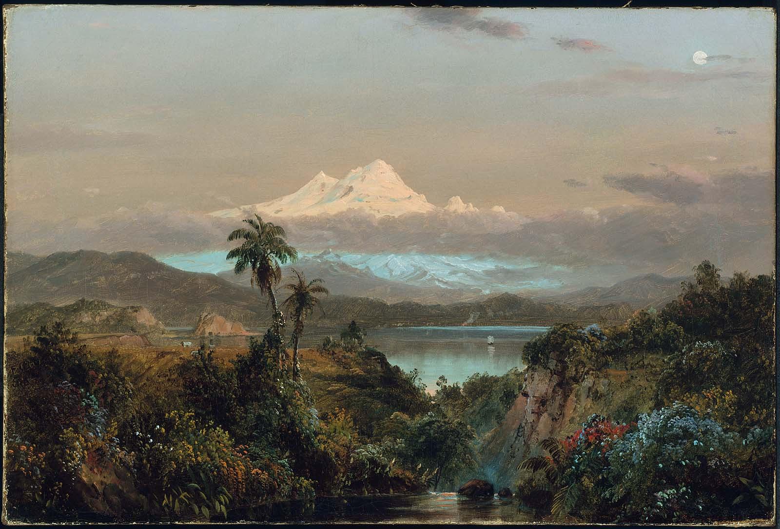
Frederic Church. Cayambe. Boston Museum of Fine Arts. Oil on canvas. 1858. Gift of Martha C. Karolik for the M. and M. Karolik Collection of American Paintings, 1815–1865(Reproduced under Fair Use, etc.)

This same kind of visual jujitsu occurs in Frederic Church’s Cayambe, in which the snowy volcano is portrayed at many times its actual size. Church had done this for visual effect, Kern for calling attention to data.
Gazing across the water, I snapped a photo with my phone. The Ortiz-Placer range was miniscule, barely visible. Taking a page out of the Kern-Church playbook, I enlarge the distant mountains in relation to the lake and dam. An hour before dusk, shadows crawled down the hillside and marched across the lake. Moored to the faraway peaks was a raft of dark clouds, a common phenomenon in these parts. The Sandia Mountains lay shadowed by cloud-banks on many days. Richard Kern’s drawing of Blanca Peak shows a cloud at its summit. Coming through Fort Garland a week before, I had beheld the same sight. Consumed with my task, I failed to notice that everyone had left. A police SUV idled in the parking-lot. Better to leave without waiting to be asked.

Check out April 2020 Quaranteam Traveler Dispatches

(A preview of SKETCHBOOK TRAVELER by James L. McElhinney (c) 2020. Schiffer Publishing).

Copyright James Lancel McElhinney (c) 2020 Texts and images may be reproduced (with proper citation) by permission of the author. To enquire, send a request to

ed******@ne***********.com


May 13, 2020. QT Dispatch #43. Hook Mountain and Tappan Zee from Croton Point. July 16, 2016

Waiting for the crisis to pass, our thoughts go out to friends and loved-ones who also shelter in place. Old friends pass away, people we loved and admired. Immobilized for the time being, we can revisit destinations, near and far. join me in celebrating the joys of Quaranteam travel, the hope that these diversions might inspire us to value things we had taken for granted, to draw strength, wisdom and compassion from deeper engagements with nature.


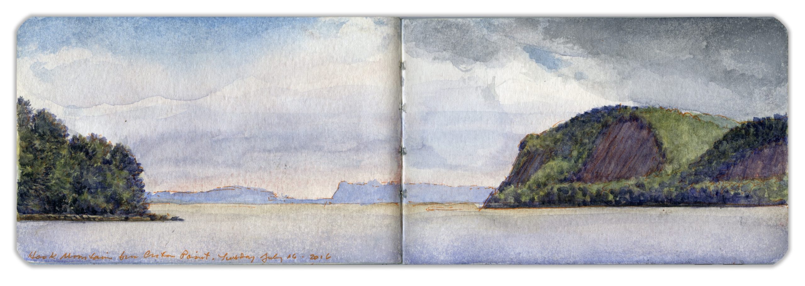
Hook Mountain and Tappan Zee from Croton Point. July 16, 2016

(Image and text were featured in the exhibition James McElhinney. Discover the Hudson Anew, curated by Laura Vookles. Hudson River Museum. Yonkers, New York. September 13, 2019 to February 16, 2020. Published also as a limited-edition in Hudson Highlands. North River Suite Volume One. Needlewatcher Editions. New York. 2018)

Extending from Nyack to the Tors towering over West Haverstraw, Hook Mountain is considered a northern extension of The Palisades, despite its separation from the geological formation just south of Piermont. A sheer basaltic escarpment, crowned by a narrow ridge, its name was inspired by its appearance on maps—as an inverted hook, with its point at High Tor.
Formed by silt deposits on the north side of the mouth of Croton River, the hilly peninsula known as Croton Point reaches into the Hudson in a southwesterly direction. Marking the division between Tappan Zee and Haverstraw Bay, the land today is maintained by Westchester County as a public park. The name is not botanical, as some may suspect. It is an Anglicization of Kenotin—the name of an Muh-he-ko-neok tribal leader who lived in colonial times near the mouth of the eponymous river. The cluster of trees to the left is Crawbuckie Park. Visible in the distance, across the Tappan Zee, is a bluff occupied by Tallman Mountain State Park, the north end of the southern palisades. Traveling upriver, one finds the lower Hudson is a concatenation of seas and bays, from The Narrows and New York harbor past the Palisades along the North River channel, to Tappan Zee, Haverstraw Bay and Peekskill Bay. It is in fact a tidal estuary for another hundred and thirty miles upstream.

April QT Posts have been archived online.
Revisit them day-by-day. Click here

(A preview of SKETCHBOOK TRAVELER by James L. McElhinney (c) 2020. Schiffer Publishing).

Copyright James Lancel McElhinney (c) 2020 Texts and images may be reproduced (with proper citation) by permission of the author. To enquire, send a request to

ed******@ne***********.com


May 12, 2020. QT Dispatch # 42. Machu Picchu. August 4, 2014

Our thoughts go out to friends and loved-ones who also shelter in place. Old friends pass away, people we loved and admired. Immobilized for the time being, we can revisit destinations, near and far. Join me in celebrating the joys of Quaranteam Travel, the hope that these diversions might inspire us to value things we had taken for granted, to draw strength, wisdom and compassion from deeper engagements with nature.


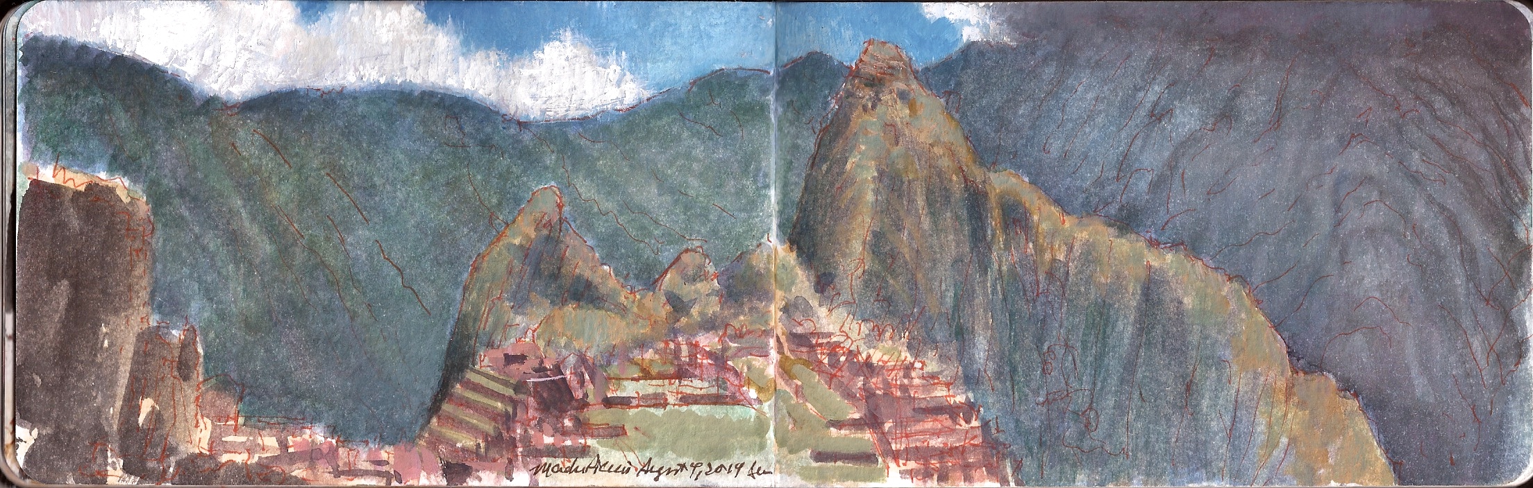
Machu Picchu. Peru. August 4, 2014.

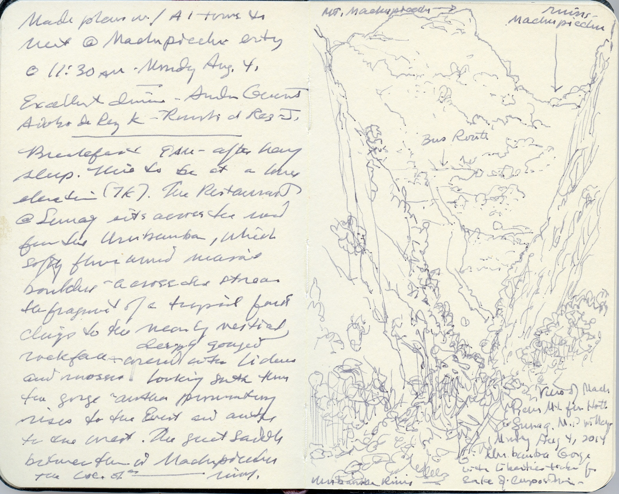
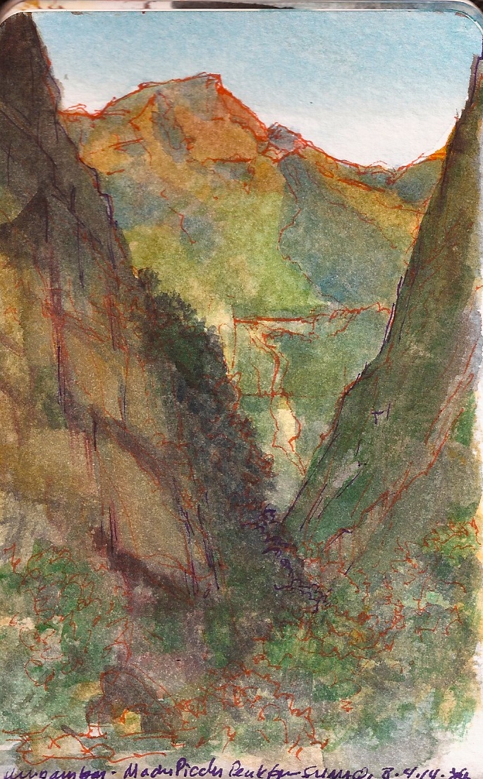
Back in Cusco we had made plans with Gate-1 Travel to meet at Machu Picchu at 11:30 Monday morning August 4, 2014. Having confirmed our plans with the tour company on Sunday, we rose at 9am after a heavy sleep. Altitude in Aguas Calientes is roughly 7K, more or less comparable to Santa Fe. A heavy mist filled the gorge. Across the road from Hotel Sumaq, Rio Urubamba flows gently around massive boulders strewn across the stream. Fragments of the topical cloud-forest, mosses and lichens cling to the nearly vertical, deeply gouged rock-face. I was struck by the ubiquity of invasive species coming up the river by train through Ollantaytambo. Prevalent among these is the Australian Eucalyptus globulus tree. Hundreds of thousands of these imports had been planted during the past hundred years by the government to reforest the Andes, provide timber for mining, and fuel for campesinos, former migrant laborers resettled in ambitious land-distribution programs.

Looking downstream through the gorge the fog began to clear, reveling two promontories with blue sky behind them. Above the clouds in the great saddle between them stand the ruins of Macchu Picchu.

desayuno of lavish proportions. I asked the desk if the hotel could arrange a bus to take us up to the Sanctuary Lodge—where the guide named Linder would meet us. She was schedule to arrive at 11:30, giving us time to get oriented before embarking on another death-march with a Peruvian tour-guide.


Urubamba Gorge. Aguas Calientes, Peru. August 4, 2014.

Grinding gears, groaning under its burden, the bus climbed the vertiginous slope through a series of thirteen hairpin switch-backs; the same number of steps leading up to a gallows. Disgorged from our transport onto an asphalt pad below Sanctuary Lodge, Kathie went to the Ladies’ Room. I acquired a light backpack for my iPad and journaling gear for nineteen American dollars, embroidered with the legend Sanctuary Lodge, Machu Picchu. Reunited, we proceeded to the punto de reunion looking for Linder. I spotted a cheery young woman in an orange Gate-1 tee-shirt. This must be Linder. Hailing her, I asked if she were our guide. She was not. I asked if she could find out when our guide will arrive. Calling Linder, she got no answer. She too was waiting; a guide without a group. As we were without a guide, and she was without a group to lead I proposed that she give us the tour and let Linder lead her group when they arrived. Offering her a small gratuity, she got on her phone and called her boss. He told her that Linder would be there in five minutes. I asked her to let her boss know that we would wait six minutes and then proceed, with or without Linder. After getting our passports stamped, we buy a couple of bottles of water and begin our ascent. Not being fond of heights, Kathie preferred to take the trail up through the forest, rather than follow the heavily-traveled walkway along the precipice. As we were about to disappear into the woods, the Gate-1 Tours woman hollers up to us.
“Linder is coming. She will meet you at the first rest area. Wait there!” she cries. “Stay there. Take pictures. Linder is coming.”
We wait five or ten minutes. No Linder. Kathie loses patience and starts up the steps leading to the Inca Road. I hasten to help her. She is terrified, but climbing. At the trail-head Kathie looked to the right, over toward the Caretaker’s House and decided it was better to take our chances climbing through the cloud forest. Following a series of dirt tracks and stone steps, the grade becomes quite steep. We zigzag back and forth seven or eight switchbacks in our ascent before hitting a logjam. Blocking the trail is a team of EMS workers attach a series of hooks and harnesses that will allow them to carry a stretcher downhill on their shoulders. Strapped to the stretcher, an elderly woman wrapped in an orange blanket clutches a small tank of Oxygen. Running from the tank, a thin plastic tube leads to the nasal cannula encircling her head. The paramedics hoist her aloft. Going by, she waves.
“Have fun,” she says. “Don’t worry about me.”
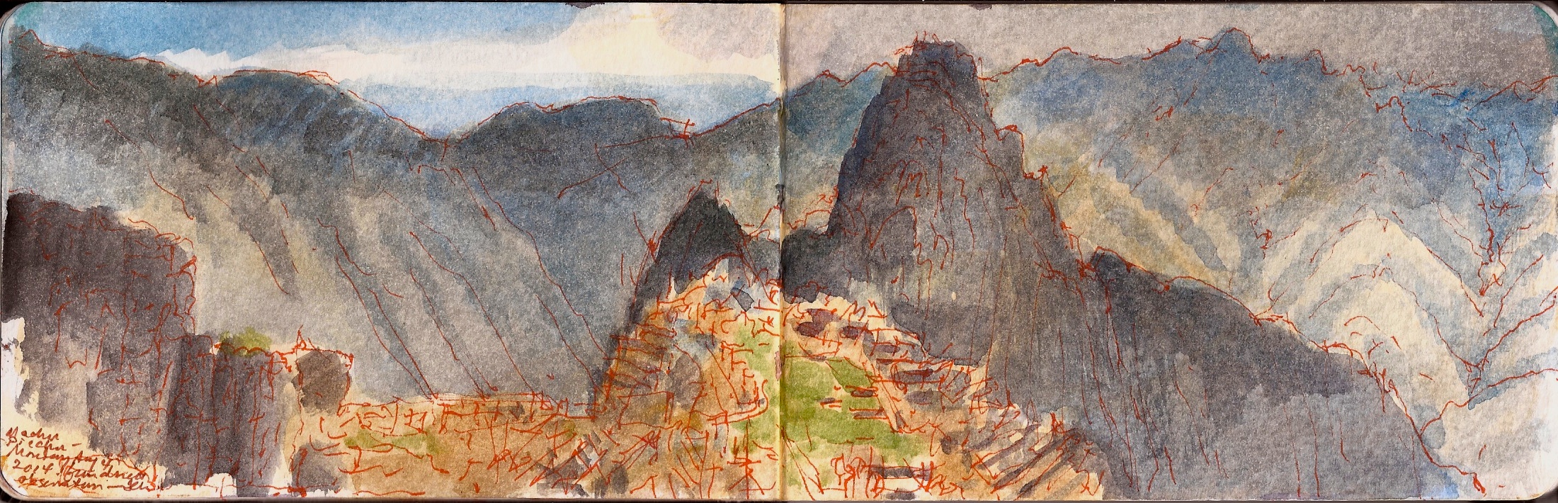
A long, final ascent lands us to an embankment—the shoulder of the Inca Road. Below, the Urubamba flows down through the mountains, toward its meeting with Rio Tambo to form Rio Ucayali, the prime tributary of the Amazon River. Dead ahead is the familiar vista of Machu Picchu, plastered across the travel-agency walls, airport terminals, and the covers of in-flight magazines. The trope is as canonically Peruvian as my second Pisco Sour or the endless refrains of El Condor Pass that drives me to order a third. Kathie sits down on a rock to secure her shoelaces herself. It was unclear how much farther she would dared to go.
Advancing a little deeper into the ruins, we took a few pictures. Witnessing boneheaded daredevil selfies and other stunts, we were struck by what seemed a vast number of European and South American tourists, recognizing some of the same folks who had been on our madcap tour of Cusco on Saturday, two days prior. Reaching the final paved stretch of the Inca Trail we were both shocked and amused by the behavior of some of our fellow visitors. Wearing neither cap nor sunglasses, a pretty young blonde in skintight yoga-pants saunters past in high-heel sandals, her bosom swimming beneath a sheer, silken halter-top; milky neck and bare shoulders a deep shade of painful pink. A pair of police officers–a man and a woman–stroll by in crisp blue uniforms. She wears a London Bobby helmet. He wears a storm-trooper-style peaked cap. Both wear aviator sunglasses. A chubby young man under a sideways Dodgers ball-cap, baggy black Nine-Inch-Nails tee-shirt, droopy shorts and flip-flops next greeted our gaze. Hoping we spoke English he asks,
“Where you all from?”
New York, we tell him.
“San Antonio,” he replies, then points to the ruins.
“Dude. Can you believe it? That’s some AWESOME shit!”

Kathie and I find a place to rest in the shade of a wall running alongside the western edge of the Inca Trail. Wandering down to a steep drop, I establish a perch atop the stone wall and start working. Ninety minutes later enough notes were on the page to let me elaborate details later. Kathie joins me. We wander a bit deeper into the complex, drink the last of our water and commence our descent. Marching toward us we see the pleasant young woman from Gate I Travel, a small group of visitors trailing behind her.
“Where’s Linder?” She asks.
“Not a clue.” I reply.


Machu Picchu. Peru. August 4, 2014.

Alejandro, our guide in Cusco was a graduate student whose focus was history. As he shared with us, “It used to be that only educated people came to Peru, intellectuals, poets, artists, archaeologists. Now EVERYONE comes here. People who never heard of Inca before they arrive. The only thing they learn is from their tour-guide, mostly where to go shopping. Be careful. They sell you wool and tell you it’s baby Alpaca.”
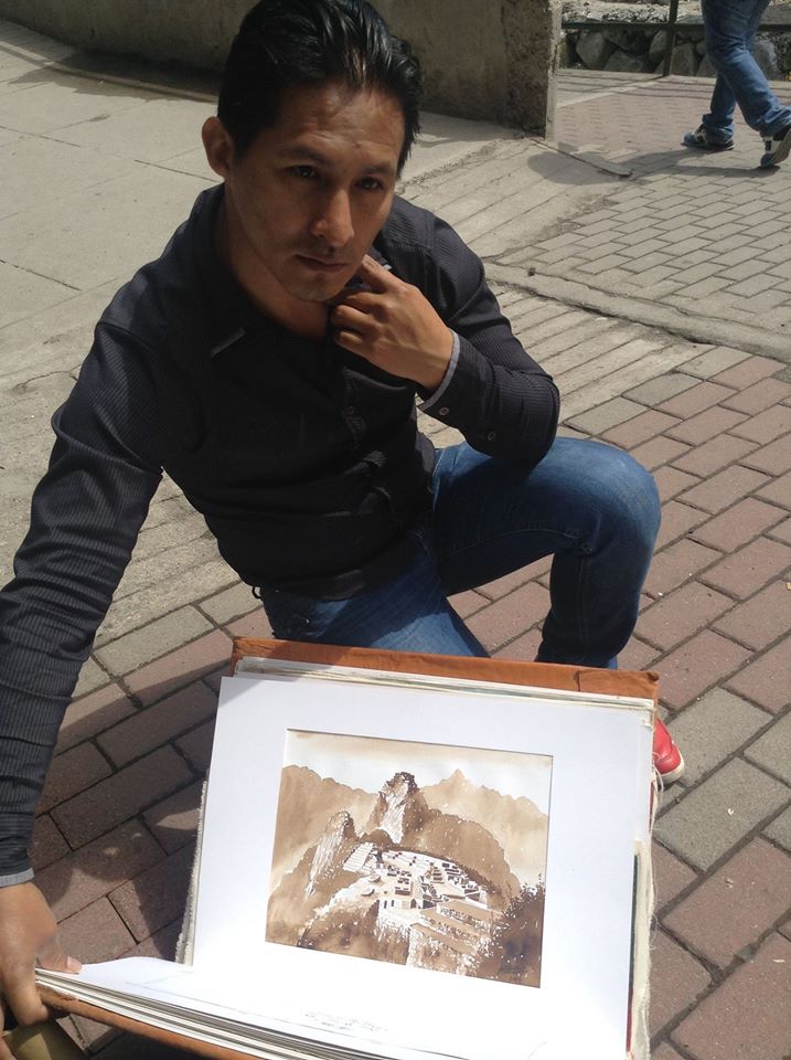
We took his sage advice to heart when later we toured the crafts market later in the day, below the mountain in Aguas Calientes. The seller of a shoulder-bag I admired informed us that it had been made by his blind grandmother. Any pair of mittens or socks shorn from sightless Llamas were sold as baby Alpaca. Around the market’s perifery was a collection of local artists, each one of whom had names like Leonardo, Michelangelo or Botero. Like Senegalese handbag-peddlers in Venice, they seemed a bit roguish, nervous and watchful; waiting for management or the law to drive them off. Each of them carried a portfolio filled with plastic sleeves loaded with what they claimed were their artworks. Most were lurid slapdash touristic views of snowy peaks, colonial churches and Machu Picchu.


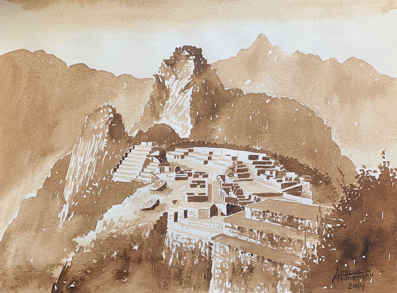
Americo Carbajal, local artist. Aguas Calientes. August 4, 2014

One young man’s work caught our eye. His name was Americo Carbajal. His work was unique in this milieu, drawn from observation or photographs using a secret technique in which coffee was the coloring agent. I showed him my sketchbook and watercolors. Having studied with an academically-trained artist in the nearby hamlet of Fica (which I could find on no map), he was forbidden access to television or Internet until he completed the five-year apprenticeship. Producing standard fare for the tourist trade, these coffee- drawings were things he did for himself. I asked how much for his view of the Sanctuario. Forty dollars, he said. I gave him fifty.


Machupicchu-Cusco-Peru. Americo Carbajal. 26 Julio-2014

(A preview of SKETCHBOOK TRAVELER by James L. McElhinney (c) 2020. Schiffer Publishing).

Copyright James Lancel McElhinney (c) 2020 Texts and images may be reproduced (with proper citation) by permission of the author. To enquire, send a request to

ed******@ne***********.com


May 11, 2020. QT Dispatch # 41. Double Upstream from Columbia Bridge. 2018

Three weeks ago, I published the first in a series of daily website blog-posts, of writings and artworks that celebrate personal mobility, in pursuit of mindful engagements with history, nature and the environment. In relation to a finished painting or essay, this process is no less a work of art than is the tree to the fruit it bears. Shared as messages of hope and solidarity, these posts will appear every day, until these dark days are behind us.

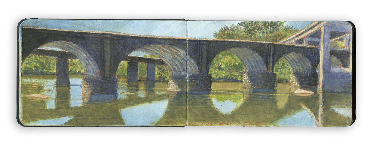
Exploring the banks of the Schuylkill River in 2018, between the mouth of Wissahickon Creek and Fairmount Water-Works I filled a sketchbook with paintings. Later that year, a suite of prints drawn from this journal would become the centerpiece of an installation at Independence Seaport Museum in Philadelphia. A month after the show opened, a fine-press suite of seven archival pigment prints drawn from the series was published in a limited-edition of fifty copies by Needlewatcher Editions. These were acquired b a number of distinguished local institutions including Free Library of Philadelphia, Historical Society of Pennsylvania, Independence Seaport Museum, Pennsylvania Academy of Fine Arts and Temple University’s Paley Library. The remainder weer acquired by a number of private individuals, including some notable members of the rowing community.


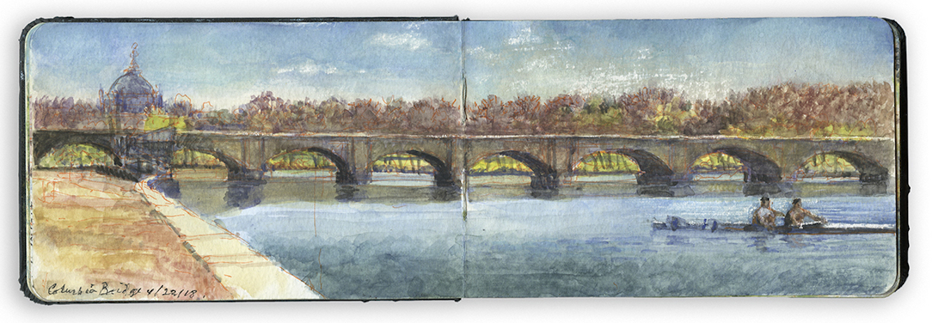
Double Upstream from COLUMBIA RAILROAD BRIDGE. Schuylkill River Sketchbook. Sunday, April 22. 2018

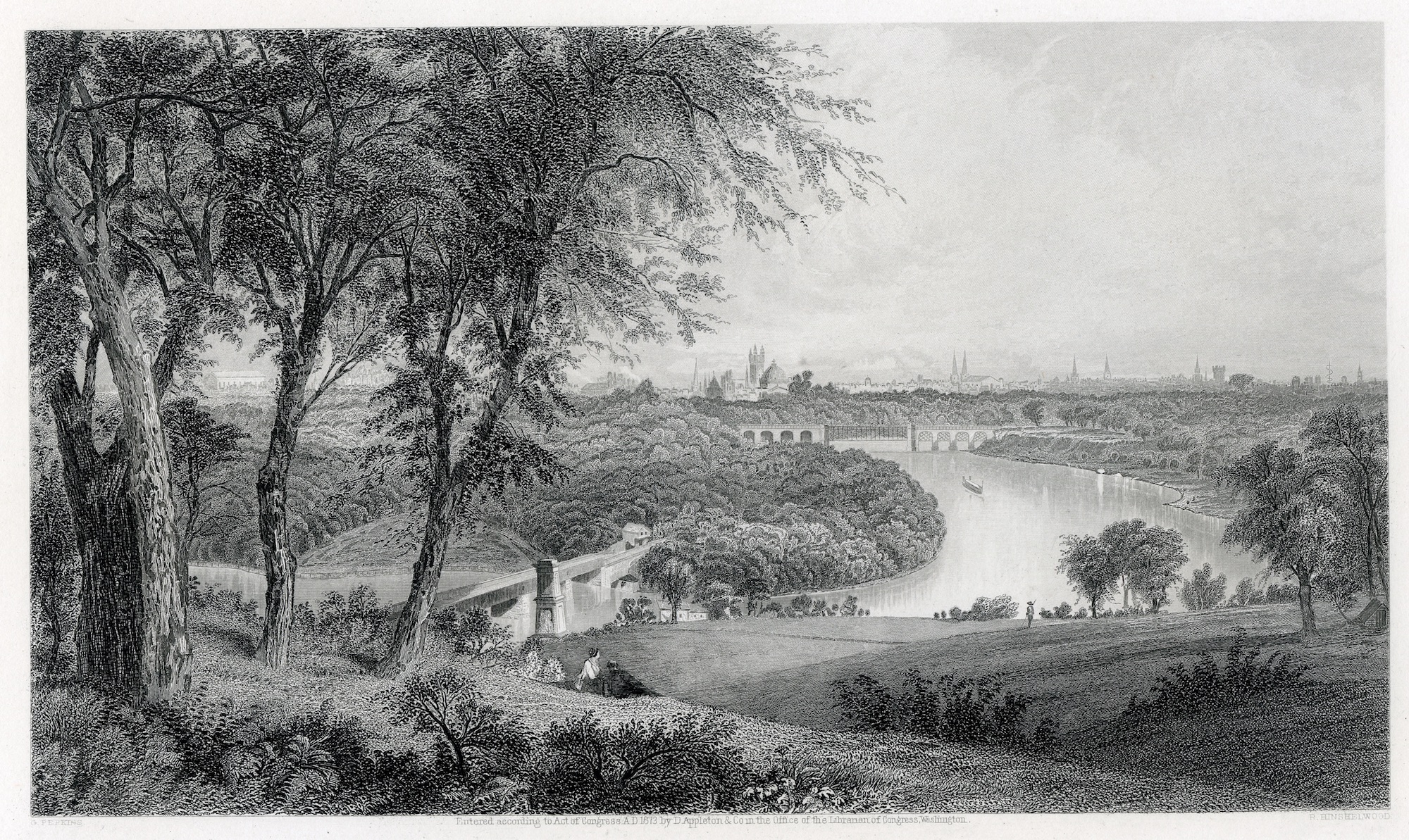
Crossing the Schuylkill where the river turns sharply from southwest to southeast is the Columbia Railroad Bridge, constructed in 1920. The concrete-arch structure replaced an 1866 railroad-bridge built on the site of a covered bridge constructed in 1834.


Granville Perkins (1830-1895) View of the Schuylkill River from Belmont, from Picturesque America. 1870. The 1866 bridge can be seen in the lower left

For joggers, cyclists, and pedestrians, Columbia Bridge marks a halfway point between the Philadelphia Museum of Art and East Falls. Just north of the bridge sits a partially covered grandstand built so viewers could watch the frequent regattas organized by the Schuylkill Navy, legendary meets with names like the Stotesbury Cup, Dad Vale and Head of the Schuylkill. Competitive amateur rowing was not in its early days reserved for privileged elites, despite being portrayed in that light by popular media. On the contrary. Founded in 1856, Undine barge club was named for the central character in an 1814 book by Friedrich Heinrich Karl, Baron Motte-Fouque about a legendary water-nymph, drawn by love into the world of humans. Members included Civil War hero and architect Frank Furness, who designed Undine’s upriver clubhouse, Castle Ringstetten and painter Thomas Eakins. The sport today caters to athletes of diverse backgrounds and ethnicity, from scions of ancient families to immigrants. Bank presidents might find themselves on the water with bricklayers.

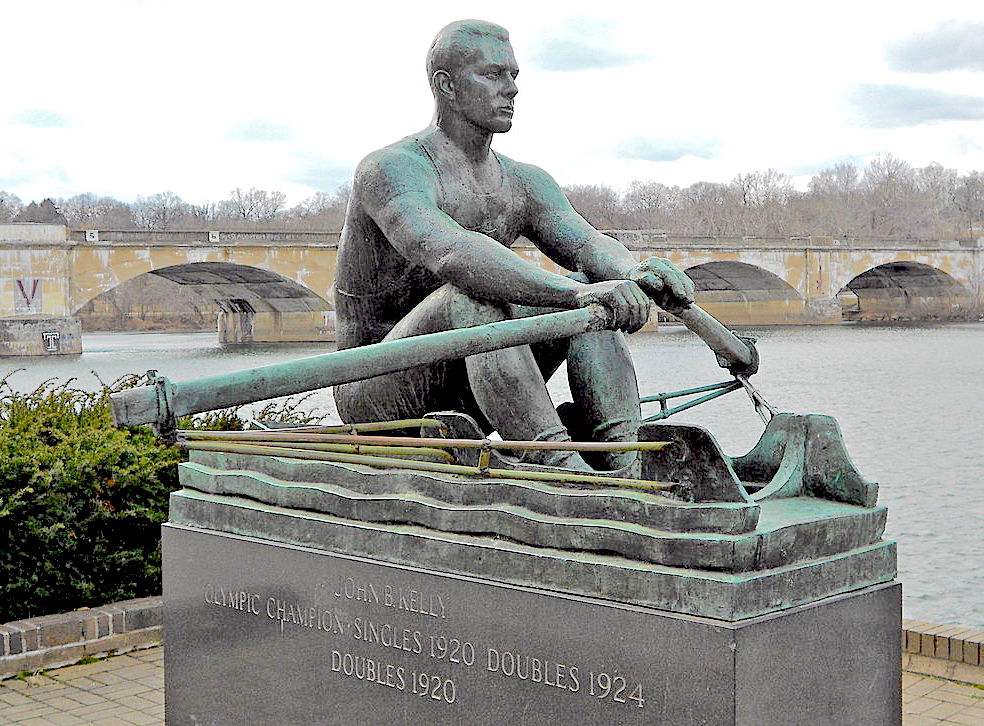
John B. Kelley Sr. by Harry Rosin (1897-1973)
At the northern end of the grandstand a bronze sculpture honors the son of an Irish immigrant. John Brendan Kelly Sr.(1889-1960), who was barred from competing in the 1920 Henley Regatta. Having worked for his father as a bricklayer, Kelly was disqualified for possessing an unfair physical advantage over respectable gentlemen who had never done a day’s work in their lives. Kelly was vindicated later that year by winning gold at the Olympic games in Antwerp. Kelly’s son continued the family tradition of rowing and philanthropy, while his daughter became a noted actress and later, Princess of Monaco.


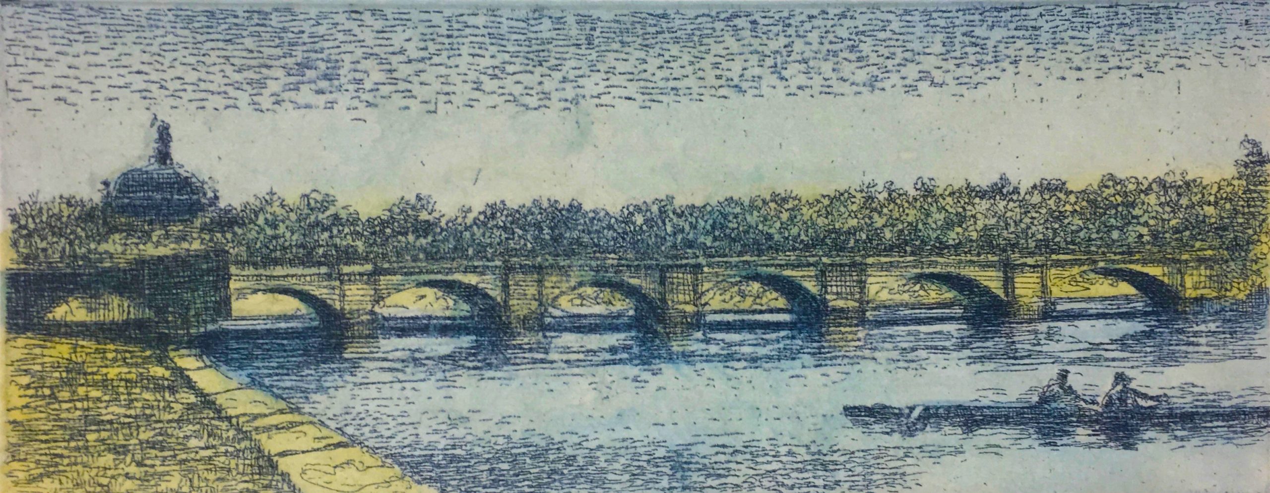
Double Upstream from Columbia Bridge. Color intaglio print with mixed media. Printed by master printer C.R. Ettinger, Philadelphia.
Rising behind the tree line, on the west side of the river is the dome of Memorial Hall. Built to serve as the art-gallery for the 1876 Centennial Exposition. it now houses the Please Touch Museum today.


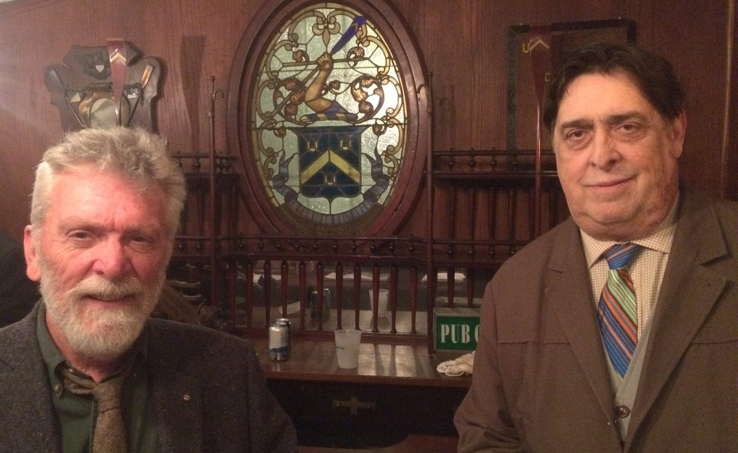
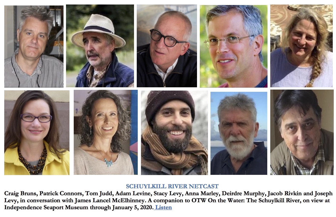
With Undine artist-in-residence Joseph Sweeney, at Castle Ringstetten on October 26, 2018. Listen to my interview with Joe Sweeney, conducted at Undne Barge Club, as part of the Schuylkill River Netcast, created for the installation On the Water, The Schuylkill River at Independence Seaport Museum in Philadelphia.

(A preview of SKETCHBOOK TRAVELER by James L. McElhinney (c) 2020. Schiffer Publishing).

Copyright James Lancel McElhinney (c) 2020 Texts and images may be reproduced (with proper citation) by permission of the author. To enquire, send a request to

ed******@ne***********.com


May 10, 2020. QT Dispatch #40. Looking South from Lamont Weather Station at Piermont

Waiting for the crisis to pass, our thoughts go out to friends and loved-ones who also shelter in place. Old friends pass away, people we loved and admired. Immobilized for the time being, we can revisit destinations, near and far. join me in celebrating the joys of Quaranteam travel, the hope that these diversions might inspire us to value things we had taken for granted, to draw strength, wisdom and compassion from deeper engagements with nature.

(Image and text were featured in the exhibition James McElhinney. Discover the Hudson Anew, curated by Laura Vookles. Hudson River Museum. Yonkers, New York. September 13, 2019 to February 16, 2020. Published also as a limited-edition in Hudson Highlands. North River Suite Volume One. Needlewatcher Editions. New York. 2018)


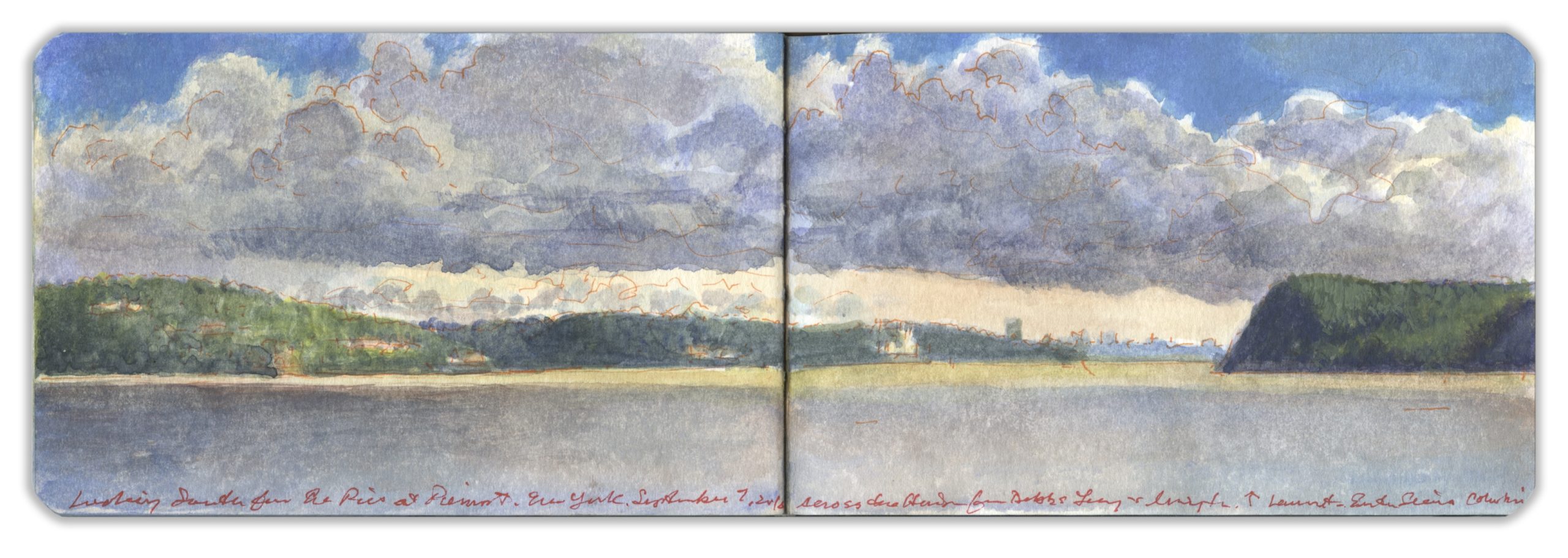
Looking South from Lamont Weather Station at Piermont. Wednesday. September 7, 2016

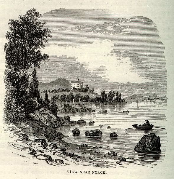
“About four miles below Nyack is Piermont, at which is the terminus of the New York and Erie Railway. The village is a child of that road, and its life depends mainly upon the sustenance it receives from it. The (railroad) company has an iron foundry and extensive repairing shops there; and it is the chief freight depot of the road. Its name is derived from a pier that juts a mile into the river. From it, freight is transferred to cars and barges. Tappantown, where Major Andre was executed, is about two miles from Piermont.”

–Benson J. Lossing. The Hudson from the Wilderness to the Sea. H.B. Nims & Co. Troy, N.Y. 1866

Piermont jetty juts into the stream by the marsh at Sparkill. Below Tallman Mountain, the western shore becomes a wall of tall basalt. At its foot, thickly wooded margins shade heaps of giant rock fall. Slipping past the eastern shore, past stately homes of patriots, poets, and robber barons, past Manhattan, the harbor islands, and the Narrows, past Brooklyn’s sandy beaches, through Raritan Bay, and beyond Sandy Hook, the Hudson disappears into the Atlantic Ocean. The river is 507 miles long. At a rate of flow averaging three miles per hour, a specific volume of water takes one week to move from the source to the sea. It is intermittently navigable above the tidewater stretch of the river but famously is fraught with treacherous tides and currents. Its indigenous name, Mahicannituck, is translated as “waters that are never still,” or “the river that flows both ways.” A weather-station operated by the Lamont-Doherty Earth Observatory stands at the end of a four-thousand-foot-long pier reaching into the Hudson from the village of Piermont. According to its mission statement, Lamont-Doherty is,

“…a core component of the Earth Institute, Columbia University. Nearly 200 Ph.D. level researchers work and teach there, and 80-90 graduate students are involved in research. Lamont also operates a federally funded research ship, the Marcus G. Langseth, which uses seismic data to map the sub-seafloor, highlighting hidden faults and other earthquake hazards.”

The pier was built in 1838 to accommodate the transfer of cargo and passengers from steamboats and ferries to the Erie Lackawanna Railway. During the Second World War it was a point of embarkation for a million troops. Today the narrow finger of land is maintained as a recreational resource by the village of Piermont. Reaching halfway across the river, he pier is a popular destination for anglers. When the pier was completed, low-patterns created a backwater downstream, around the mouth of Sparkill Creek. A tidal marsh was formed, which is preserved as a classroom for environmental studies and general recreation by the New York State Department of Environmental Conservation. Just downstream of the marsh is Tallman State Park, the northern terminus of the Palisades that extend southward past Weehawken.
The local police diligently patrol the pier, ticketing anyone reckless enough to leave a vehicle unattended. Having established a dialogue with team-members at Lamont, they were kind enough to let me park in one of their spaces. Falling into conversation with one of the locals, I got an earful about how the pier was state land, and thus outside the jurisdiction of village police. The argument made sense. Having never fought a ticket, I never had an opportunity to try it on the judge.

Looking south from the easternmost edge of the pier, the bluffs of Tallman State Mountain Park stand to the right. Punctuating a wooded shoreline, the villages of Dobbs Ferry and Hastings-on-Hudson are followed by the jagged blue profile of Yonkers. Casting shadows broken by golden light, long bands of heavy grey clouds float eastward across the river. At four in the afternoon, the temperature is in the low seventies, with light breezes coming from the west. Barges and pleasure-craft pass by. There is no way to encapsulate for others my awareness of this place in a singular vista. Being mindful of its history and present utility helps sharpen my focus on what I behold, empowered by that knowledge. To paraphrase J.B. Jackson, landscape is human desire, projected upon the terrain. Even if the viewer is unable to extract so much data from my painting, perhaps they will sense it is there and go find it for themselves.

Check out April 2020 Quaranteam Traveler Dispatches

(A preview of SKETCHBOOK TRAVELER by James L. McElhinney (c) 2020. Schiffer Publishing).

Copyright James Lancel McElhinney (c) 2020 Texts and images may be reproduced (with proper citation) by permission of the author. To enquire, send a request to

ed******@ne***********.com


May 9, 2020. QT Dispatch # 39. A Ghost in the Corn

Waiting for the crisis to pass, our thoughts go out to friends and loved-ones who also shelter in place. Old friends pass away, people we loved and admired. Immobilized for the time being, we can revisit destinations, near and far. join me in celebrating the joys of Quaranteam travel, the hope that these diversions might inspire us to value things we had taken for granted, to draw strength, wisdom and compassion from deeper engagements with nature.

I relocated from Philadelphia to Richmond Virginia in January of 1991, with the intention of painting Civil War battlefields which then, as now were under threat from real-estate development and the invasion of big-box commerce. The subject seems to me a piquant metaphor for how the American landscape has always been a quarrel between civic responsibility and property-rights; economic priorities versus environmental sustainability. Suddenly with our nation divided again, all that work I did almost thirty years ago seems more apt than ever.

Under the present quarantine, I have reconfigured my 1990-1994 journals to unpack my travels and artworks into a prose narrative. After two months of work, I am a bit astonished to behold a three-hundred-page first draft for a memoir of the American landscape.
One of the durable friendships I formed was with noted Virginia artist Willie Anne Wright; a painter whose path had led her from the easel into photography. When I first met Willie Anne she was traveling to reenactments to make pinhole photographs of the participants. Other photographers had figured out wet-plate processes, catering to the hobby by producing 19th-century style tintypes and ambrotypes. The pinhole camera made more sense because of its mobility, and compatibility with readily-available film-stock. Period photographers were encumbered with complicated tentage, dangerous chemicals and persnickety clients.
On July 1, I had driven the route of J.E.B. Stuart’s cavalry circumvallation around McClellan’s Army of the Potomac with local author Ben Carlos “Chuck” Cleary. One of the stops we made was at the grave of William D. Latane, the only fatality on Stuart’s ride. Nether the death of an obscure cavalry-officer, nor his unorthodox burial seemed worthy of legend.
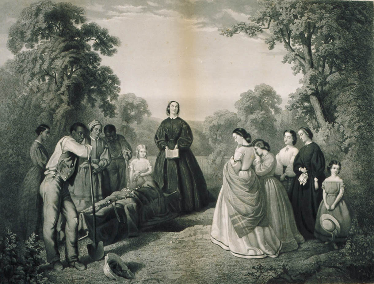

The Burial of Latane, engraving after William Washington’s 1864 painting. The print in the collection of Virginia Historical Society, Richmond, Virginia. (reproduced under fair use, etc.)

As reports of how Latane had perished in equestrian single combat like a chivalric knight of old, an epic poem was composed in his honor. The poem inspired a painting, which was reproduced in engravings that hung in Southern parlors as patriotic icons—celebrating both a martyr to The Lost Cause, and the forbearance of women on the home-front.
Latane’s grave seemed like a perfect subject for Willie Anne, who had shifted her focus from reenactors to historic sites, years before Sally Mann. And so the story unfolds.

“With a shout and a roar, the leading squadron, that of Capt. William Latane, dashed forward and threw itself squarely against the Federals. For a few minutes, there was a mad melee, sword against pistol; then the Federals made off. A brief second stand, a short distance to the rear, ended in the same manner. When the clash was over, Captain Latane was dead, pierced by five bullets. The Federal Captain who had met him in combat was said to have been wounded badly by a blow from Latane’s saber.”
–Douglas Southall Freeman–Lee’s Lieutenants. Chapter XX

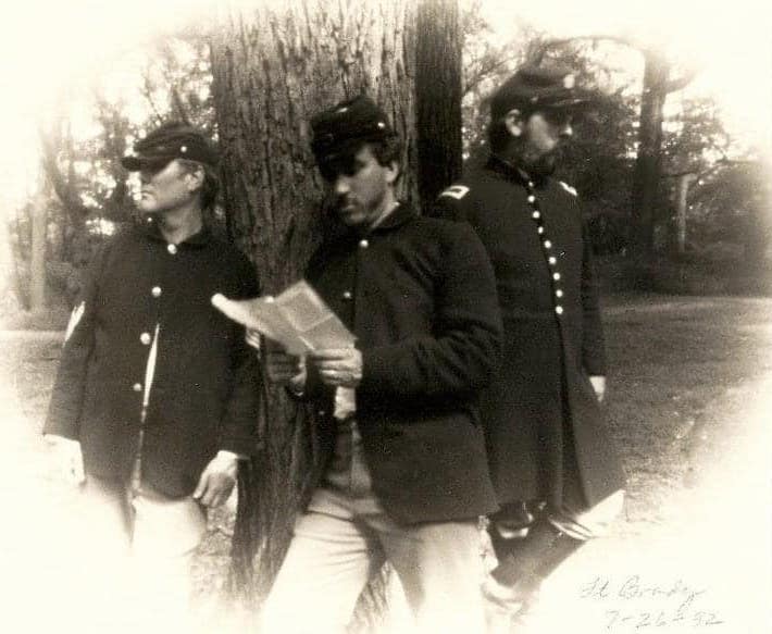
Sunday. July 26, 1992. Willie Anne brings her lensless photography setup to the living history encampment at Fort Brady. The day before had been beastly hot, which was unfortunate because the program for the day was the back-breaking task of making fascines. Early in the morning we had cut vines and briars alongside the dump behind the National Park Service utility shed at Fort Harrison-Burnham. Wearing heavy knee-boots I was less likely to being bitten by a copperhead lurking in the weeds. I did sustain several stings from yellow-jackets, which my comrades declared must have been confederate bees. Heaps of vines, briars and brush were dumped in the back of a pickup truck and carted down the road. Fort Brady is an earthen enclosure with a large bombproof. Built in 1864, it was armed with massive 15-inch Rodman guns to answer rebel Columbiads across the river at Mill Rock.
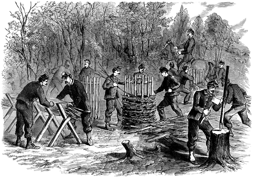

Sappers building fascines and gabions. Harper’s weekly. Civil War period image

Fabricating fascines involves several steps. First, stout timbers are driven into the ground at a 60-degree angle, with care taken to ensure equal inclinations. These are then lashed or bolted together. A row of three of four of these cross-bars are set in an alignment at three-foot/one-meter intervals. To prevent them from shifting a straight narrow board or sapling may be secured to the underside of the cross-bars. Into the V-shaped embrace of this cradle are placed vines, briars, branches, along its length. A stout chain five to six feet in length is secured at opposite ends to the middle of a pair of hand-spikes, aka trailspikes–tapering wooden staffs used to maneuver the trail of a cannon-carriage. Two men face one another at opposite sides of the cradled brush-pile. One man hold both spikes. He passes one under the brush-pile to his partner. Holding the spikes upward with the chain below the brush, each man passes his spike to the other, catching the brush against the edge of the spike. Both men then push their spikes downward, so that their tips pass each other below the brush-pile. This action compresses the brush into a tight bundle, which is then secured with stout twine, hemp or sisal rope. This process generally starts and one end, moving down the line from cradle to cradle until the fascine has been completed. End are trimmed with a saw. In this way, lumber can be fabricated quickly to build shelters, fortification revetments or even road-surfaces. The work was exhausting. Producing two or three lumpy specimens gave us a grudging admiration for those who mastered these seemingly simple tasks. Recovering from our toils, we spent a tranquil morning in camp on Sunday morning. Willie Anne appeared in the afternoon to pinhole the scene. She poses Alex Johnson, Howard Bartholf and me in a pastiche after a wartime photo by Matthew Brady. I mention to her that I had recently visited the grave of William Latane, suggesting that we might take a ride up to Hanover County later in the week.
July 31, 1992. I collect Willie Anne at her house in the Fan district. We drive to Hanover Court House, grab lunch at the HoundsTooth Café. En route I regale her with thrilling details of Stuart’s ride around McClellan, and how Style Weekly editor Ben Cleary and I had retraced the route at the beginning of the month. Following the same route, we come to Summer Hill plantation, where legend has it that George Armstrong Custer had gallantly delivered a supply of rations to the womenfolk during The Late Unpleasantness.
Mrs. Ruby Newton had just come in from the garden, gone in for a nap and none too eager for guests. As it was on her land, we sought permission to visit Latane’s grave. She said we were welcome to do so, and kindly gave us directions. I refrain from telling her of my visit one month prior. Cleary and I had stopped to call on her, but found no one at home.
Getting back in the car we drive back to River Road, which curves leftward in its descent to the floodplain. Flanked on both sides by farm-fields, the road comes to a T intersection. Straight ahead lies a band of trees along the Pamunkey River.
To the south, fields stretch into the distance. The ground rises gently, forming low bluffs on the right.
At the tree-line we make a ninety-degree left-hand turn, and then left again onto a grassy farm-road running between the fields. HNow heading west, the fields on either side are planted with corn, with stalks eight to nine feet high. I ask Willie if being in high corn was the same as being in high cotton. She couldn’t say.
We turn right onto another farm-road running north between the fields. Patches of the maize the size of city blocks had already been harvested, hewn to a stubble. Through one of these clearings I behold a cluster of trees. Following another bumpy farm-road, we come to a grassy lane, turn right and find ourselves at the edge of a small family graveyard. Willie is amazed at the remoteness of the site, comparing it to the spot where Stonewall Jackson’s arm is buried, on the Lacy farm near Wilderness Church. Getting out of the car, we walk around the little park. Planted with boxwood hedges, an ancient tree towers overheads, providing welcome shade.
Arrayed within the walls we find an orderly collection of eighteenth-century stone sepulchers, but no sign of Latane’s grave.
Nestled within a clump of shrubbery we find a cast-iron state historic marker set atop a stone altar. Its text unfolds the tale of Latane’s death, and his burial by the Brockenbrough women. Setting her homemade wooden box-camera on a tripod, Willie makes half a dozen exposures. Finally, I am ready for my closeup. She readjusts the camera. I lean on the marker.
With utmost gravity, Willie says, “Now. Hold still!”
“Don’t forget to get the ghost,” I shoot back.
“That’s not funny!” she replies with a pained look. “Hold still. Don’t talk.”
Thirty seconds elapse in silence. A dragonfly buzzes around my head.
As Willie covers the aperture with a strip of black tape, a mosquito bites her. Whatever enchantment had drawn us to this place, the spell had been broken. Hastily we pack up and return to the car.Taking the dedicated access road back to River Road, we head back to Richmond. On the return trip the car clutch starts to slip. Leaving it in third gear, I massage the gearbox. At full stops, I figure out how to get from first to third. Dropping Willie Anne back at her home, I swing by the video store and rent “At Play in the Fields of the Lord,” a cautionary tale that in hindsight seems apt for the day.

August 4. Monday. Willie Anne calls to invite me to dinner with her and Jack, their daughter Anne, her husband Chuck Savage, and their daughter Audrey would be there. My contribution is a nice bottle of wine, a 1987 Seaview Semillon-Chardonnay from Australia. Once we all were assembled, we look through Chuck’s photos of the First New York Engineers at Fort Brady, some of which will be reproduced in the Yellow Pages of the new Richmond telephone directory. Willie gives me several versions of photos of her reprise of the three soldiers by Matthew Brady, for which Howard Bartholf, Alex Johnson and I had served as models.
Willie paused and says, “I don’t know if I ought to show you this one. It’s spooky.”
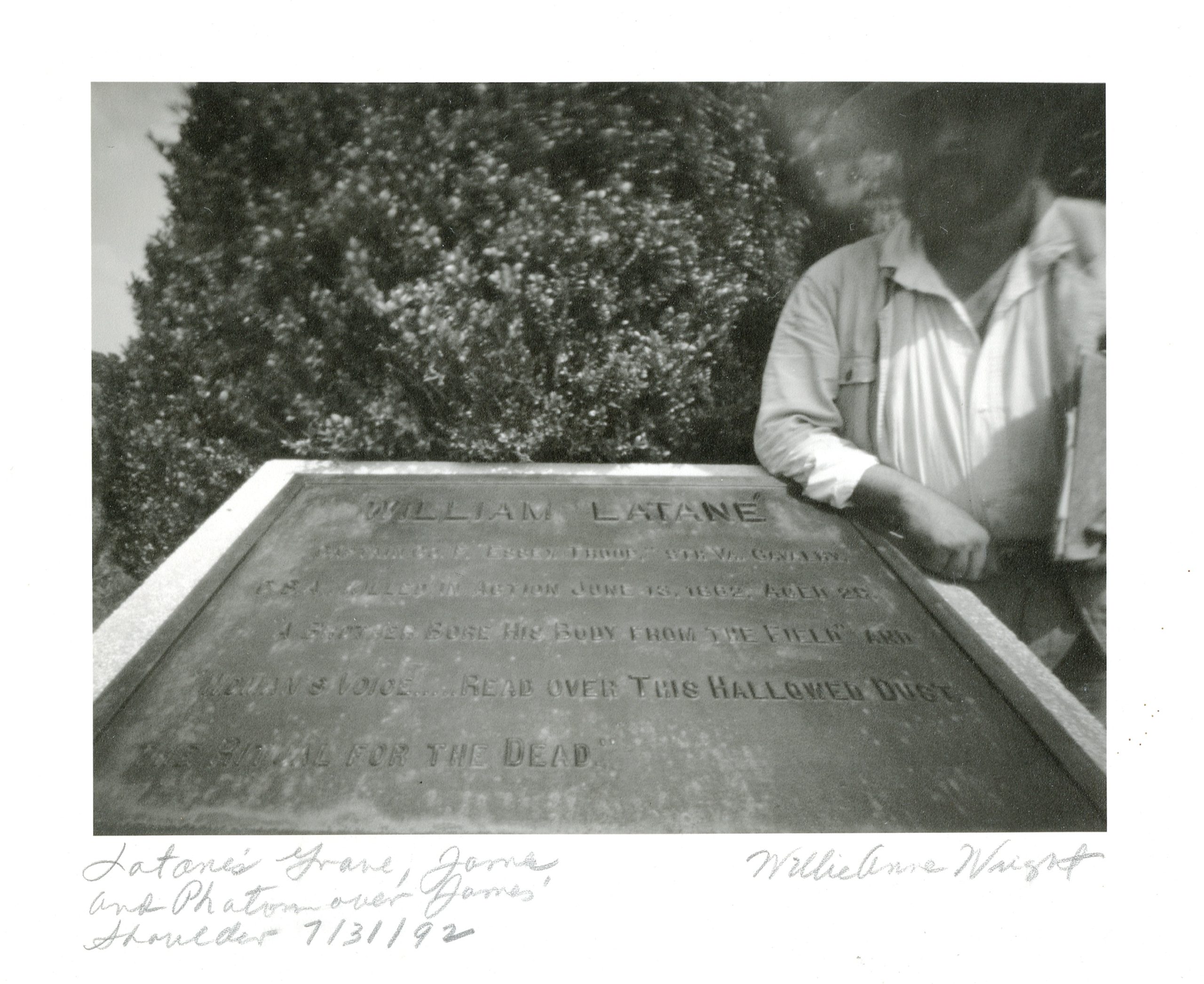
She pushes the glassine sleeve toward me. I slip out the photo. In it there is Latane’s Douglas Southall Freeman-era historical marker. Wearing an Amish straw hat I stand beside it, leaning on my right elbow. Over my shoulder, emerging from the foliage is what appears to be mustached face, and the brim of a hat. I look up at her. She stares back.
“It’s him. Once we got out there I had a really bad feeling.”
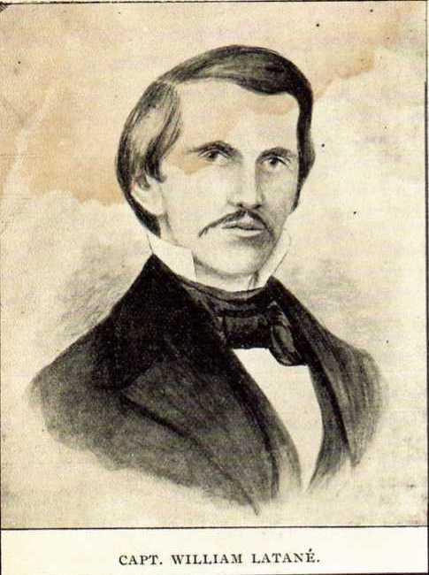

William Latane. Coll. Virginia Historical Society.
(Reproduced under fair use, etc.)

Thinking back to Friday, all had been well until we interrupted Ms. Newton’s nap. I remember driving out to the graveyard, posing for the photo, my wisecrack about ghosts, Willie’s mosquito bite, the nervous ride home, my failing clutch. Coincidence, perhaps, or just bad luck. Later in the week I went to Virginia Historical Society to locate a portrait of Latane. The primitive likeness I found in a newspaper at the time did not look unlike the features in the photo. On repeated occasions, I tried to get Willie to return, but she always refused, and to this day will not budge.

Revisit previous QT Dispatches: April is now Online.

(A preview of SKETCHBOOK TRAVELER by James L. McElhinney (c) 2020. Schiffer Publishing).
Copyright James Lancel McElhinney (c) 2020 Texts and images may be reproduced (with proper citation) by permission of the author. To enquire, send a request to

ed******@ne***********.com


May 8, 2020. QT Dispatch # 38. Rondout Creek below High Falls. July 4, 2010

Waiting for the crisis to pass, our thoughts go out to friends and loved-ones who also shelter in place. Old friends pass away, people we loved and admired. Immobilized for the time being, we can revisit destinations, near and far. join me in celebrating the joys of Quaranteam travel, the hope that these diversions might inspire us to value things we had taken for granted, to draw strength, wisdom and compassion from deeper engagements with nature.


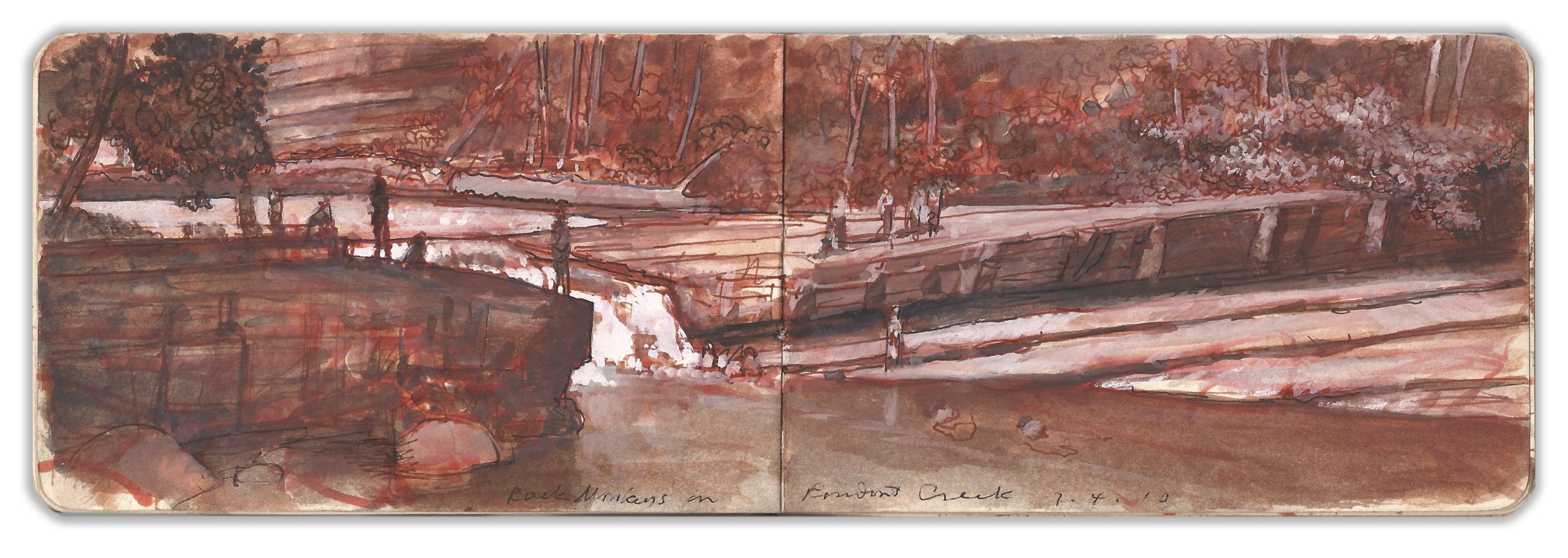
Rondout Creek below High Falls. July 4, 2010

(Image and text were featured in the exhibition James McElhinney. Discover the Hudson Anew, curated by Laura Vookles. Hudson River Museum. Yonkers, New York. September 13, 2019 to February 16, 2020. Published also as a limited-edition in Hudson Highlands. North River Suite Volume One. Needlewatcher Editions. New York. 2018)

Rondout Creek is born at the confluence of Sandburg Creek and Shingle Gully, just east of Ellenville. The stream flows in a northwesterly direction, parallel to the Shawangunk Range, through Kerhonkson and Accord, north of which it turns abruptly to the east, falling in a vertical drop of twenty feet into a swift declivity hewn through sedimentary limestone. Inclined stratifications bend and buckle as trees cling to its walls. Every summer bathers gather on the rocky ledges bordering the creek, defiant of its dangers and of local ordinances. A hundred yards downstream from this place two stone bridgeheads stand opposite one another across the creek–once linked by a canal-bridge carrying barge-traffic on the Delaware and Hudson Canal between Honesdale PA and Kingston, NY. Almost like a pagan rite of passage, young divers would run along the towpath, leaping from the tower to plunge into the stream. Every year it seemed that someone either lost their life, or suffered crippling injury by misjudging their trajectory and colliding with submerged rocks. Lat year I visited High Falls, the eponymous village where Marc Chagall resided from 1946 to 1948. Walking along the towpath, my way was blocked by a new chain-link security-fence, enclosing the perilous diving-platform. No doubt reckless youth with invent new modes of recreational suicide.

Check out April 2020 Quaranteam Traveler Dispatches

(A preview of SKETCHBOOK TRAVELER by James L. McElhinney (c) 2020. Schiffer Publishing).

Copyright James Lancel McElhinney (c) 2020 Texts and images may be reproduced (with proper citation) by permission of the author. To enquire, send a request to

ed******@ne***********.com


SEEING THE ELEPHANT: Travels in a Troubled Land


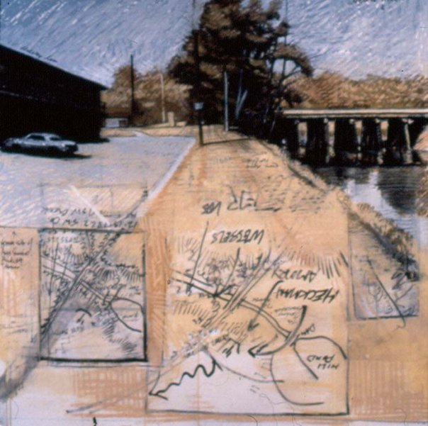
Battlefield of Kinston Bridge. Mixed media on paper. 1996. Collection Asheville Art Museum. Asheville NC

Thirty years ago I embarked on a project that defined my trajectory every since. Drawing on a lifelong interest in history I discovered that landscape, as painters understood it in 1990 had nothing whatsoever to do with how society organizes space in relation to the environment. Suddenly, formalist notions of pattern, color, personal expression and polemics of style, oblivious to powerful narratives shaping the terrain struck me as petty and self-indulgent. In the years that followed I discovered a handful of other painters who shared the same concerns, and a considerably larger number of conceptual and environmental artists who felt likewise. Since commencing our quarantine on March 8, Kathie has written several essays and worked on edits for two books coming out in the fall. I have been working on edits for one book while writing another that unpacks my 1990-94 journals as prose narrative. So far the manuscript is up to 275 pages. Exploring Civil War battlefields under threat from development, I sought to understand how the American landscape came to be a quarrel about what it is. My website has been expanded to house new content related to this project. Have a look. More to follow