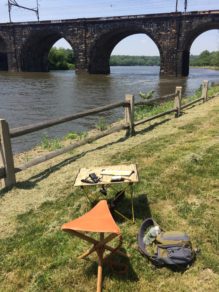
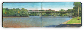
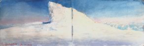
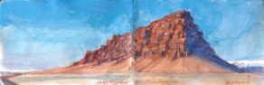
Category Archives: Dispatches

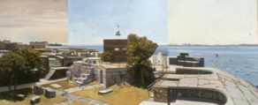
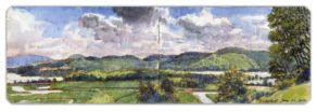
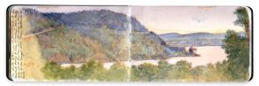
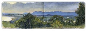
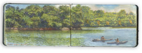
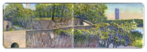
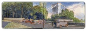
May 7, 2020. QT Dispatch #36. Looking South from Fort Lee

Waiting for the crisis to pass, our thoughts go out to friends and loved-ones who also shelter in place. Old friends pass away, people we loved and admired. Immobilized for the time being, we can revisit destinations, near and far. join me in celebrating the joys of Quaranteam travel, the hope that these diversions might inspire us to value things we had taken for granted, to draw strength, wisdom and compassion from deeper engagements with nature.


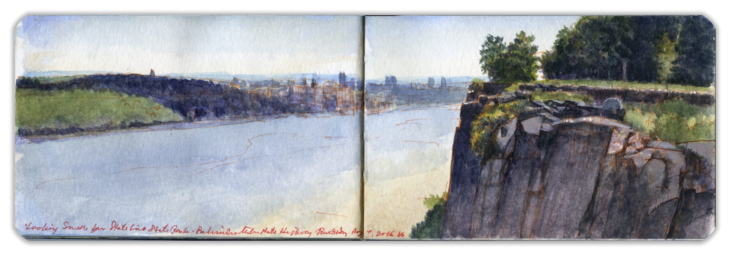
Looking South from Fort Lee. Saturday September 10, 2016.

. (Image and text were featured in the exhibition James McElhinney. Discover the Hudson Anew, curated by Laura Vookles. Hudson River Museum. Yonkers, New York. September 13, 2019 to February 16, 2020. Published also as a limited-edition in Hudson Highlands. North River Suite Volume One. Needlewatcher Editions. New York. 2018)

“The view from the high point…of Fort Lee is extensive and interesting, up and down the river. Across are seen the villages of Carmansville and Manhattanville, ad fine country seats near; while southward, on the left, the city of New York stretches into the dim distance, with Staten Island and the Narrows still beyond. On the right are the wooded cliffs extending to Hoboken, with the little villages of Pleasant Valley, Bull’s Ferry, Weehawk, and Hoboken, along the shore.”

–Benson J. Lossing. The Hudson From the Wilderness to the Sea. 1866

The southern end of a basalt diabase sill known as The Palisades had been fortified in the summer of 1776, in anticipation of an invasion by British Forces. Armed with several batteries of cannon, the earthen fort projected fields of fire across the Hudson to the east, while Fort Washington stood on the highest point on the island of Manhattan, its guns facing westward. A chevaux-de frise of sunken ships stretched in a row across the river, from Jeffrey’s Hook to the foot of the cliffs below Fort Lee. Today’s George Washington Bridge stands directly above the remains of this obstacle. On November 16, 1776, a helpless and frustrated George Washington looked across the river, to observe British and Hessian troops overrun the fortification that bore his name. On November 20, Charles Lord Cornwallis led British regulars up a cleft in the escarpment to cut off Washington’s line of retreat. The maneuver failed. Thirty-four days later Washington and the remainder of his army surprised and captured the Hessian garrison at Trenton, New Jersey, striking a blow for independence.
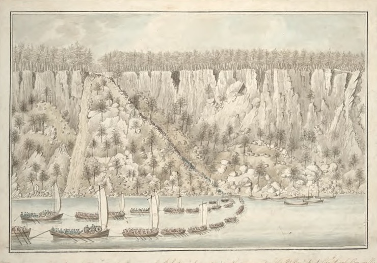

Troops under Charles Lord Cornwallis scaling the Palisades on November 20, 1776. Watercolor by Thomas Davies.
Collection of New York Public Library. (Reproduced here under fair use, etc.)

The Lenni-Lenape called the Palisades Weehawken: “rocks that look like trees”. On a grassy ledge, just north of the western portal of the Lincoln Tunnel, Vice President Aaron Burr mortally wounded former Secretary or the Treasury Alexander Hamilton in a duel fought on July 11, 1804. The site is six miles downstream from this overlook. The southern end of Fort Lee State Park is marked by a steep declivity, a break in the sheer precipice that girds the western bank of river.
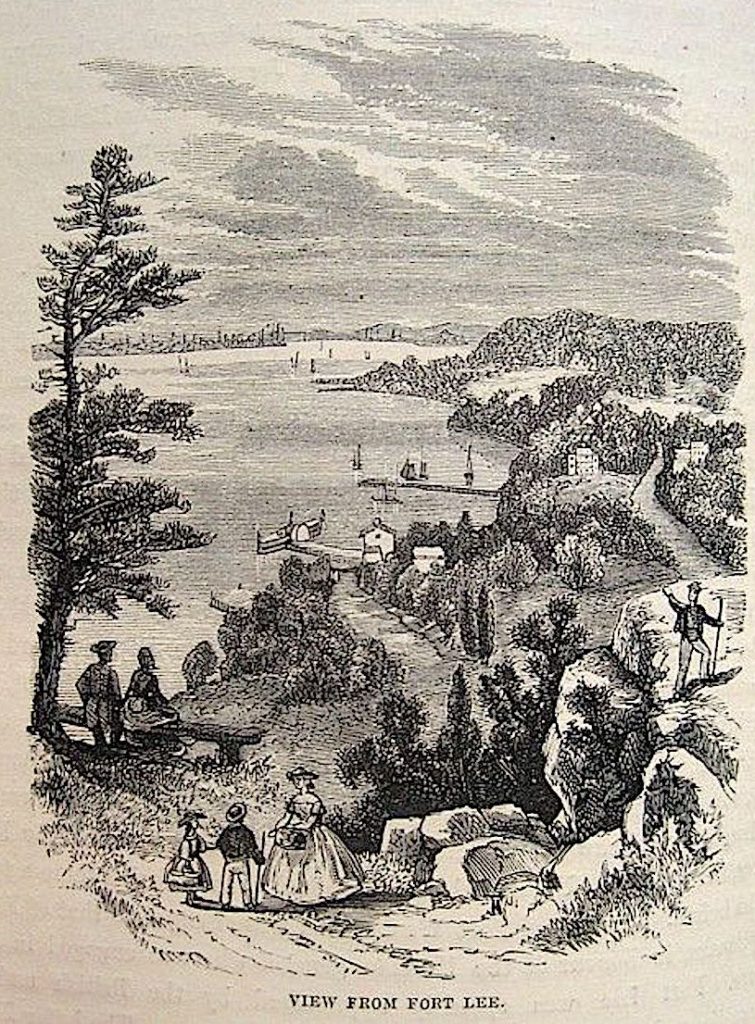

Benson J. Lossing. View from Fort Lee. 1866

Across the Hudson river, northern Manhattan landmarks like Riverside Church and Grant’s Tomb are visible, with the towers of Midtown and Lower Manhattan beyond. A pair of Asian women speed-walked along the park trail behind where I was painting.
A century earlier, Fort Lee had become a major center of motion-picture production. William Fox established Fox Film Corporation in 1915. Young Thomas Hart Benton worked in Fort Lee as a scenic artist. Film crews shot cliffhanger endings along the Palisades, for serials like The Perils of Pauline starring Pearl White.

Despite the sylvan setting, there was a constant roar from the bridge. Nearly four hundred vehicles cross the bridge every minute, spewing legal emissions. On the day before the fifteenth anniversary of the attacks on the World Trade Center, there had been a piece in the news this morning about an apology by former New Jersey governor and EPA chief Christine Todd Whitman for saying that the air around Ground Zero was safe to breathe, just days after the 9/11 attacks. The mercury hit ninety. Humidity levels cast a haze over the city, flattening the distant skyline into a pale silhouette. A teenaged couple hovered nearby, before wandering over to the precipice. Leaning against the guard-rail, they started making out. I can take a hint.

People mistakenly imagine that painting from observation is just a prolonged a snapshot.
All of the most important decisions regarding composition and color I had made on Saturday (September 10). Returning on Thursday afternoon (September 15) the park was abandoned, except for two Korean women speed-walking laps on the park-trail. They had paused before, to look at me from afar. This time they slowed to a halt, then wandered up to peer over my shoulder. I looked up and smiled.
They smiled back. “Any questions?” I asked.
“Yes” said the older one. “Are you married?”

Check out April 2020 Quaranteam Traveler Dispatches

(A preview of SKETCHBOOK TRAVELER by James L. McElhinney (c) 2020. Schiffer Publishing).
Copyright James Lancel McElhinney (c) 2020 Texts and images may be reproduced (with proper citation) by permission of the author. To enquire, send a request to

ed******@ne***********.com


May 6, 2020. QT Dispatch #36. Coachella Valley from Keys View

Waiting for the crisis to pass, our thoughts go out to friends and loved-ones who also shelter in place. Old friends pass away, people we loved and admired. Immobilized for the time being, we can revisit destinations, near and far. join me in celebrating the joys of Quaranteam travel, the hope that these diversions might inspire us to value things we had taken for granted, to draw strength, wisdom and compassion from deeper engagements with nature.

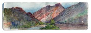
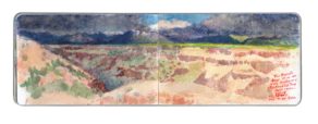
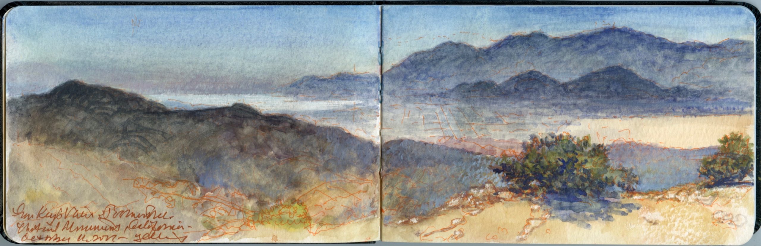
Coachella Valley from Keys View, Joshua Tree National Park. October 11, 2017

We had come to Southern California to attend the opening of the exhibition California Mexicana, which Kathie had curated for the Laguna Art Museum. The show was part of the PST2 Pacific Standard Time LA/LA (Los Angeles/Latin America) cycle of exhibitions and cultural events funded by the Getty Foundation. We decided to fly out early to see the Visual Voyages exhibition at Huntington Library in San Marino curated by Daniela Bleichmar, and to spend a few days in the desert before heading to Orange County.

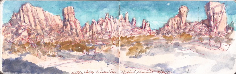
Joshua Tree National Park sits atop a plateau where the Mojave Desert to the north meets the Sonoran Desert to the Southeast. The park is named after a distinctive species known officially as Yucca Brevifolia, to the Spanish as Izote de desierto (desert-yucca), before receiving its popular name Joshua Tree from a band of Mormon settlers. Unearthly rock formations created by volcanism and erosion, cyclopean boulders and outcroppings sculpted by erosion provide a perfect backdrop for Westerns, science-fiction movies and automobile commercials.


Near Hidden Valley, Joshua Tree National Park. February 21, 2012

Heading south into the park from the town of Twenty-Nine Palms, one passes striking rock-formations with colorful names like Skull Rock and Hall of Horrors, where I nearly had a run-in with a deadly Southern Pacific rattlesnake. It and its cousin the Mojave Sidewinder have a distinctive pattern of green-and-buff coloration. Taking note of one another, we parted without incident. As Kathie and I withdrew from the site, we warned a group of youths in light raiment wearing flip-flops and suntan lotion not to proceed. Scornful of danger, and sage advice from their elders, they forged ahead. A ranger back at the visitor center brought out a loose-leaf binder.
“We have seven venomous species in the park. The one you saw is one of the deadliest, with three kinds of poison; a hemotoxin, neurotoxin and powerful flesh-rotting digestive enzymes. He was probably out looking to score another meal before going into hibernation.” I asked how many get visitors get bitten each year. Relatively few, he tells me. The ones who do usually provoked the creature, or threatened it in some way. People lose a lot of dogs out here by letting them run off the leash in warmer seasons when snakes are active. The nearest hospital is in Yucca Valley, at least a forty-five-minute drive from where I saw the rattler. No cellphone reception exists until comes within a few miles of Twentynine Palms.

Traveling southeast on the park road, one finds less abundant plant-life before entering a scorched wasteland at the foot of the Hexie Mountains. En-route to the Cottonwood Visitor Center at the southeastern portal is a large patch of fuzzy Cholla cactus, feared by hikers for its flesh-piercing nettles. The trail is well-marked, with frequent signage cautioning against touching the plants. Nevertheless, a small group of pretty Asian women in party-dresses and heels ran around taking selfies and othersies with no regard for their safety. A huge SUV arrives. Out steps a very large man in an evening-gown, having a Priscilla Queen of the Desert moment.Three men and a woman-photographer follow him through the Cholla garden as he strikes poses. His diaphanous yellow scarf streams in light breezes, its selvedge licking the Chollas.


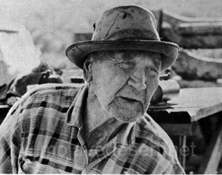
William F. “Bill” Keys. Joshua Tree Rancher. 1879-1972

Throughout the park are scattered the ruins of played-out mines and failed farms. Russian immigrant William F. Keys (1879-1972) first came to Twentynine Palms to work in the Desert Queen Mine. He later filed a claim and established a ranch. The property is now located within the confines of the park. During a 1946 dispute Keys shot and killed an interloper. Convicted for murder, he did eleven years at San Quentin before winning a pardon due in large part to the efforts of lawyer and Perry Mason mystery-writer Erle Stanley Gardner.
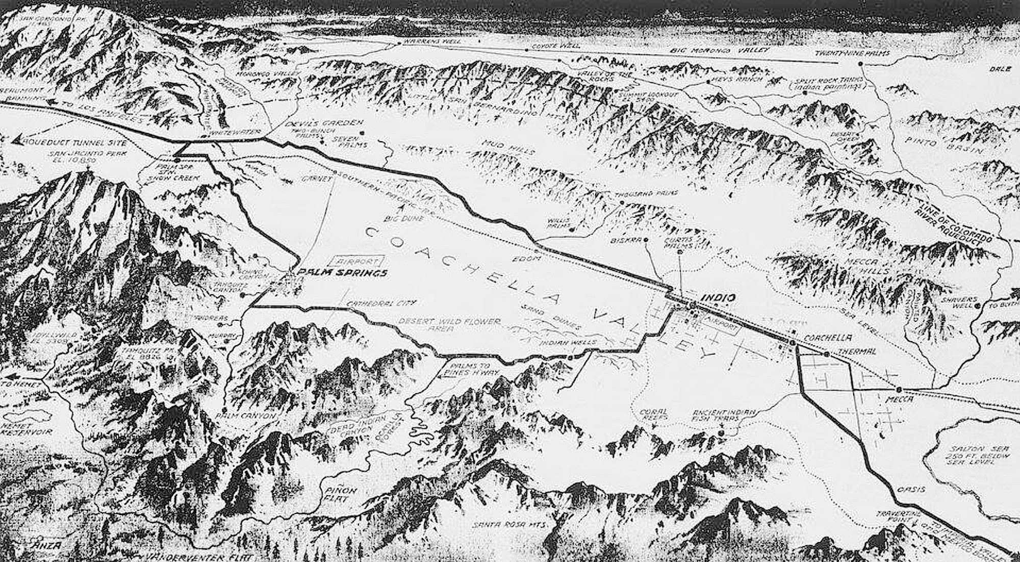
One of the park’s frequently visited attractions is Key’s View—a rocky promontory at the edge of the plateau, along the northern rim of Coachella Valley. Once the seabed of an inlet reaching up from the Sea of Cortez, the valley floor is a mile below the overlook, traversed longitudinally by a low ridge marking the San Andreas fault.
To the south is Salton Sea, 230 feet below sea-level. Beyond that is the Imperial Valley, which once was part of the Colorado River watershed. Directly to the south are the San Jacinto mountains. Their eponymous peak has an elevation of just under eleven-thousand feet. Upscale communities including Palm Springs and Palm Desert spread out below its slopes. The head of the valley between Desert Springs and Banning to the west. Hundreds of wind-turbines rise up from dry earth, skeletal dandelions, their florets rotation majestic.


1930s aerial map of Coachella Valley. The area marked “Mud Hills” follows the San Andreas Fault. Joshua Tree National Park isidentified as “Valley of the Rocks”. Keys View is identified as “Summit Lookout”

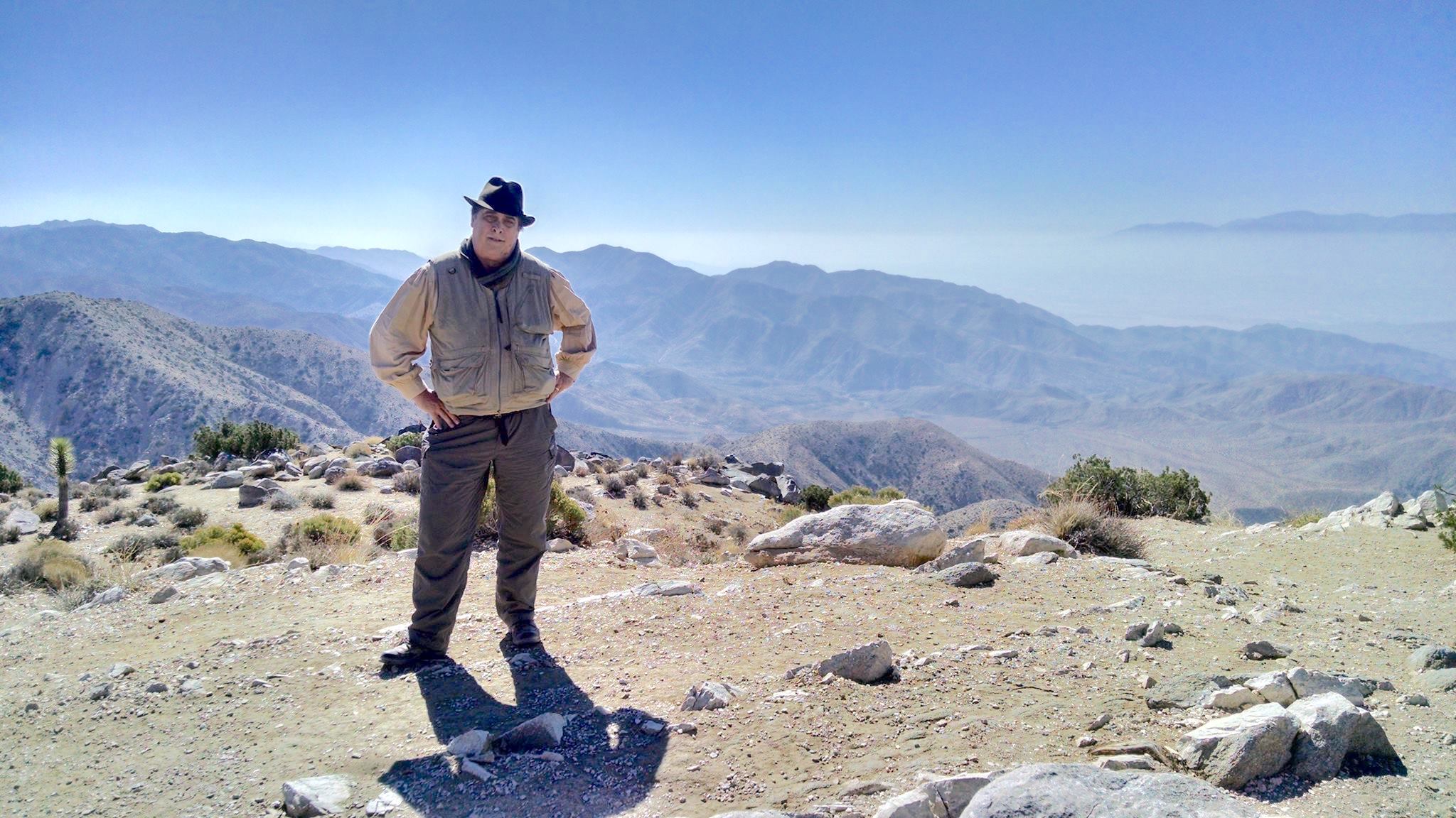
The road descends perhaps a hundred feet to a long, looping turnaround. From the parking-area ascends a wide concrete foot-path to a viewing-area perhaps fifty feet above the road below. Looking across, the valley floor lies beneath a milky haze drifting east from Los Angeles, augmented by vehicle-emissions on The Ten passing through Riverside County. Unfolding my camp stool, Kathie wanders off to experiment with her new Leica digital camera.
Measuring the space, I map out a composition, noting the difference between the foliage on the slopes below and the Joshua Trees on the plateau above. A bus pulls in below. German tourists climb the path. A song-bird lands in the Piñon-tree beside me. I wet my brush, touch the half-pan of Ultramarine blue, wet it again and begin to paint.


At Key’s View aka Summit Lookout. October 11, 2017. Photograph by Katherine Manthorne

(All images reproduced under fair use, etc.)

Check out April 2020 Quaranteam Traveler Dispatches

(A preview of SKETCHBOOK TRAVELER by James L. McElhinney (c) 2020. Schiffer Publishing).

Copyright James Lancel McElhinney (c) 2020 Texts and images may be reproduced (with proper citation) by permission of the author. To enquire, send a request to

ed******@ne***********.com


May 5, 2020. Quaranteam Traveler Dispatch #35. Heather Garden, Fort Tryon Park.

Waiting for the crisis to pass, our thoughts go out to friends and loved-ones who also shelter in place. Old friends pass away, people we loved and admired. Immobilized for the time being, we can revisit destinations, near and far. join me in celebrating the joys of Quaranteam travel, the hope that these diversions might inspire us to value things we had taken for granted, to draw strength, wisdom and compassion from deeper engagements with nature.


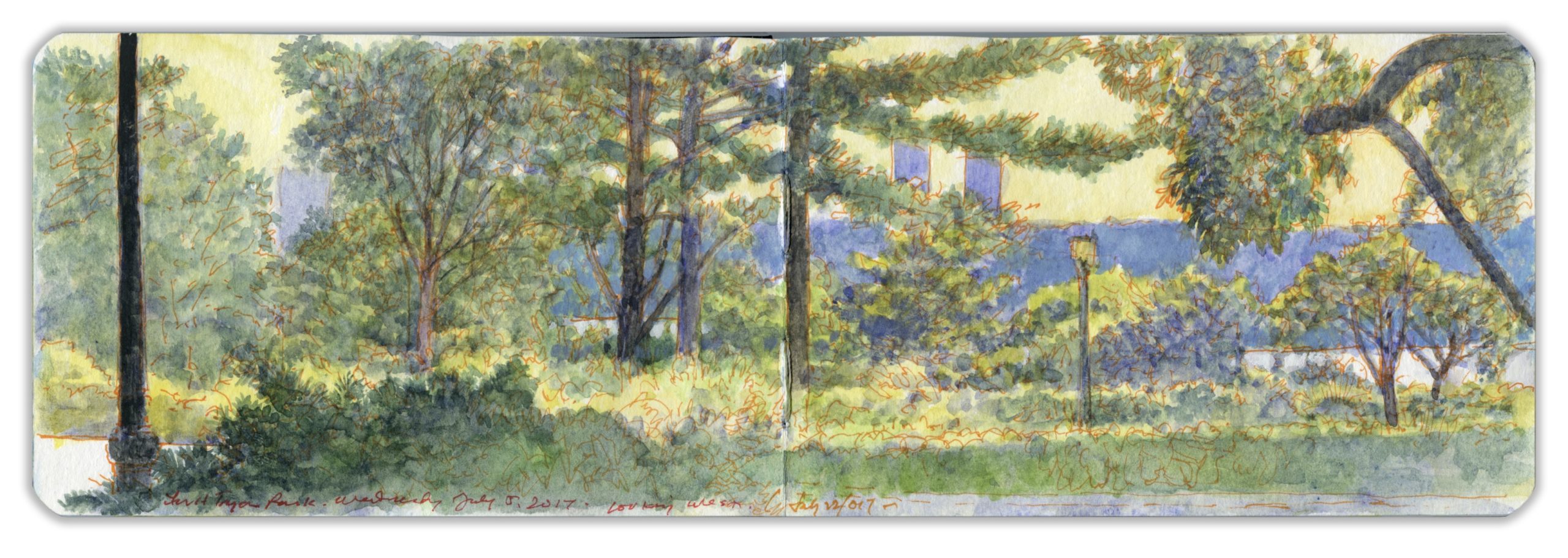
Heather Garden, Fort Tryon Park. Looking West. 190th Street and Margaret Corbin Drive, Manhattan. Saturday, July 22, 2017.

(Image and text were featured in the exhibition James McElhinney. Discover the Hudson Anew, curated by Laura Vookles. Hudson River Museum. Yonkers, New York. September 13, 2019 to February 16, 2020. Published also as a limited-edition in Hudson Highlands. North River Suite Volume One. Needlewatcher Editions. New York. 2018)

As Quakers, John and William Bartram were chary of taking a life, even if it belonged to a dangerous reptile. Their pursuit of natural science also put their beliefs at odds with the Friends’ Meeting. Hiking on South Mountain in the Catskill escarpment, Billy narrowly escaped being bitten by a timber rattler. Both father and son protested its murder at the hands of their rustic guide.
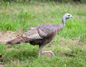
It is hard to imagine. Today’s coastal forest, stretching from the Gulf of Mexico into Canada, covers an area far larger than the woodlands the Bartrams would had known during the eighteenth century. The forest’s return in the late twentieth century restored the habitat of long-absent predators such as bear, wild cats, coyotes and wolves. The White-Tail Deer population went off the charts. Species seldom seen in settled areas became commonplace. In our own neighborhood we have seen osprey, bald eagles, skunk, raccoon, woodchucks, and countless species of songbirds. Walking through The Ramble one day in Central Park, a turkey-hen foraged in a clearing. On a nearby bench sat a homeless man, his worldly possessions piled beside him. His eyes were fixed on the bird.
Seeing me approach he called out, “Hey mister. What’s that bird?”
“A female turkey,” I replied. He looked relieved.
“Thanks! I knew it weren’t no pigeon.”

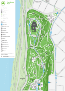
Northern Manhattan possesses nearly five hundred acres of park-lands, divided primarily between Highbridge Park, Fort Tryon Park and Inwood Hill Park, together with smaller parks and green spaces scattered across the island above 155th Street. Since the 1970s, nonprofit conservancies have played a key role in locating non-government funding for the maintenance and improvement of New York parklands. The New York Restoration Project planted a million trees, making New York one of the greenest cities in the nation. The Heather Garden and Alpine Garden in Fort Tryon Park attract thousands of visitors every year.


(Click on the image for a larger view)

Like many city parks today, Fort Tryon Park is the beneficiary of a private neighborhood-based nonprofit organization. One of its most famous board-members is celebrity psychosexual therapist Dr. Ruth Westheimer, who resides a few blocks away. Another notable neighbor is Mother Francesca Cabrini, the patron-saint of immigrants whose relics are enshrined within the altar of a church at 701 Fort Washington Avenue.
As I worked on this painting, my wife cried out, pointing to a small snake writhing on the hot asphalt, cooking under a burning sun. I rushed over, lifted it carefully with the end of my brush and laid it under a bush. sprinkling it with cooling water, I studied its form, the shape of its triangular head, narrow neck, taupe coloring, and the marking running down either side of its spine. What are you? I wondered. And suddenly, I knew. It was a timber rattlesnake. These creatures are not hatched from eggs but born live, a dozen at a time. So, I wondered. Where’s your mother? Where’s the rest of the family? Regaining its composure at last, the little serpent disappeared into one of the stone walls.
John Bartram would have approved. So would Billy.


Revisit April’s QT Traveler Dispatches, day by day.

(A preview of SKETCHBOOK TRAVELER by James L. McElhinney (c) 2020. Schiffer Publishing).

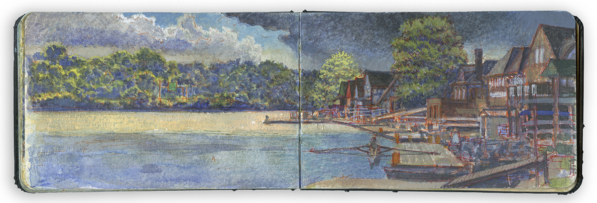
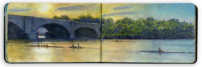
May 4, 2020. QT Dispatch # 34. Boat House Row from Behind Lloyd Hall. Wednesday August 8, 2018. 4:30 pm

Exploring the banks of the Schuylkill River in 2018, between the mouth of Wissahickon Creek and Fairmount Water-Works I filled a sketchbook with paintings. Later that year, a suite of prints drawn from this journal would become the centerpiece of an installation at Independence Seaport Museum in Philadelphia.

Boat House Row from behind Lloyd Hall. Schuylkill River Sketchbook. Wednesday August 8, 2018. 4:30 pm

At the foot of Lemon Hill on the left bank of the Schuylkill is a line of historic barge-clubs. Competitive amateur rowing was first inspired by races held between colonial-era oarsmen who ferried passengers and cargo to and from ships riding at anchor on the Delaware.
Wagers would be placed on these early contests, but as the sport developed, crews rowed for symbolic rewards; trophies and acclaim. The first organized regatta was held on November 12, 1835, an event depicted by Italian-American painter Nicolino Calyo (1799-1884)

The sport evolved in tandem with the development of Fairmount Park, a conglomeration of colonial estates atop the bluffs between the Water-Works and Laurel Hill Cemetery on the left bank; and from Girard Avenue to Belmont on the right. During the nineteenth century rowing-crews shared the waterway with canal-barges navigating between the locks at Manayunk and Fairmount dam. While a salubrious pastorale was being organized along its banks, the city’s primary water-supply was fouled with industrial and organic pollutants. Things got even worse below the dam. The canal ceased operations in 1931. In the 1950s, major cleanup efforts were underway. More than sixty years later wildlife has returned to its waters. Forty species of freshwater fish abide in its waters, hunted by wading-birds seen on its shores. Painted and snapping-turtles are common sights. At the western end of Fairmount dam, the Army Corps of Engineers built a fish-ladder to allow shad to spawn upstream.


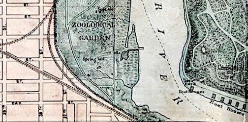
Detail of an 1876 map created for the Centennial Exposition,
showing the location of boat-houses at lower right

In pursuing this project, a view of Boat House Row would be de riguer. Determined to avoid the familiar trope of the barge-clubs lined up cheek-to-jowl, I positioned myself behind Lloyd Hall. The building is in constant use, with basketball courts, public restrooms, a small coffee-shop, outdoor dining-area and bike-rental kiosk. A finger of water reaches east behind the building. Floating docks behind Lloyd hall served the Adaptive Rowing program created for people with sensory, mental or physical challenges. A number of the participants are veterans.
Across this narrow inlet is a peninsula, newly formed by silt, covered with a new-growth of trees. In 2018 the area was enclosed by chain-link fences, as work-crews built a nature-trail. Beyond this stretching south is a shaded parking-area that ends at the Azalea Garden roundabout. Further south is a broad grassy expanse covering the Forebay from which Fairmount Water-Works drew water. Its reservoir was later incorporated into the foundation of Philadelphia Museum of Art.

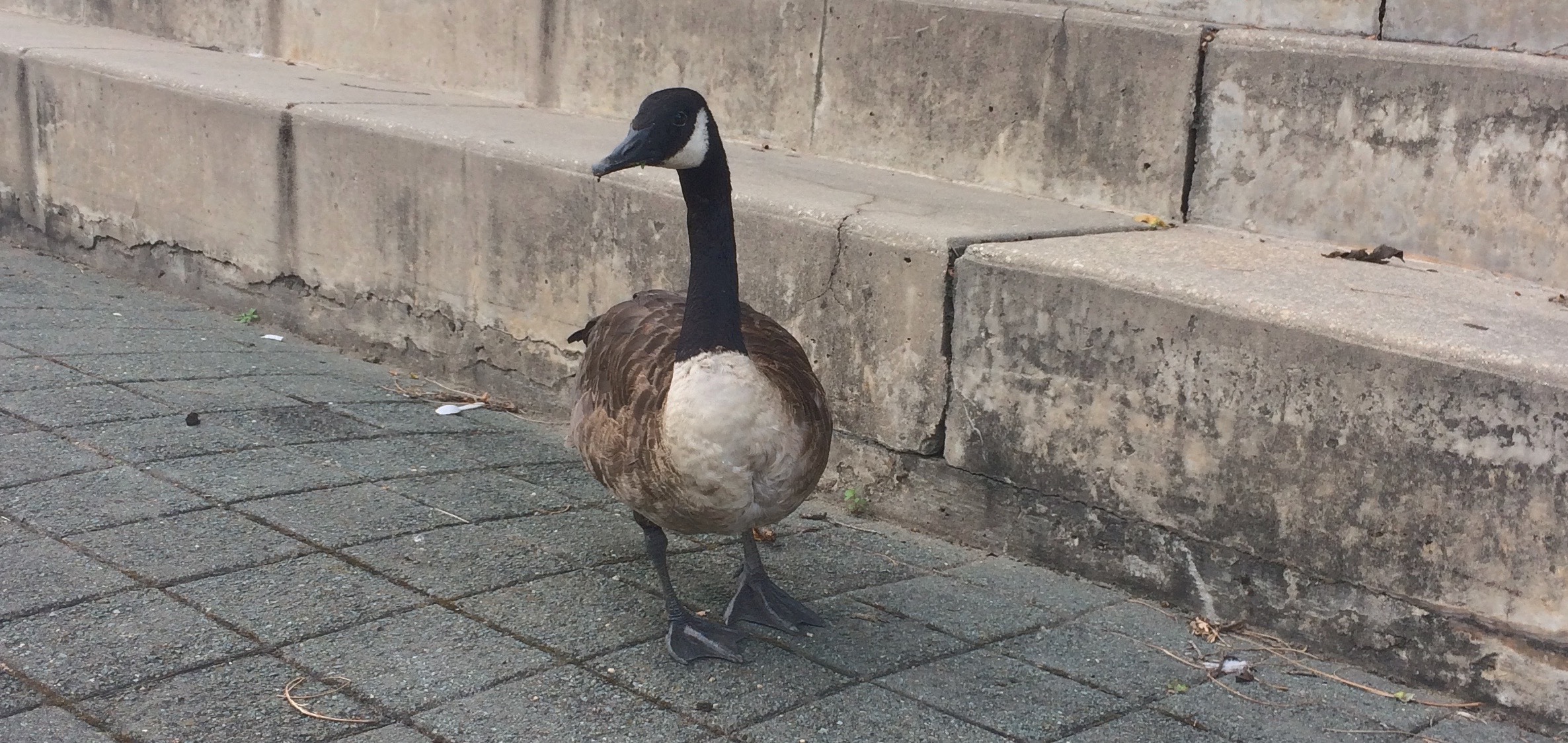
Looking west across the river gave me a foreshortened, unconventional view of the boathouses. Across the wide basin a green directional sign on the Schuylkill Expressway hovered about the leafy riverbank. Oarsmen and women embarked from floating docks behind the clubhouses. Behind Lloyd Hall is a series of grassy terraces enclosed by concrete risers. Using one of these as my perch, the work progressed. At the water’s edge a group of geese took note of my presence. Having been warned that these birds were aggressive and pugnacious, I ignored them and kept working. One of their number walked toward me. Approaching, he thrust forward his neck, horizontal to the ground. This gave me warning, or perhaps a challenge. The bird drew closer. I looked straight at him and calmly said “hello.” He stopped, raised his head, turned it this way and that to examine me.

Watch the video: IMG_6524

I repeated the greeting. Replying in kind he sat down, signaling his timorous posse to approach. One sat beside me. Another goose put his head in my bag, looking for snacks. One foraged my feet. Others kept their distance. Remaining calm, I moved as little as possible. After a while they grew bored, and drifted over to the dining area.
“Bye,” I said. Alpha-goose turned his head and gave me a look. A young woman and her daughter sat down to enjoy their ice-cream. The goose headed their way. The girl smiled.
“Don’t go messing with those mean dirty creatures,” said the mother.

Suddenly the temperature dropped. A cool breeze crossed the water. Dark clouds rolled in from the west. Golden sunlight danced on the river. Rain began to fall.

(A preview of SKETCHBOOK TRAVELER by James L. McElhinney (c) 2020. Schiffer Publishing).

Copyright James Lancel McElhinney (c) 2020 Texts and images may be reproduced (with proper citation) by permission of the author. To enquire, send a request to

ed******@ne***********.com


May 3, 2020. QT Dispatch # 33. Yonkers from State Line Overlook. Alpine, New York

Waiting for the crisis to pass, our thoughts go out to friends and loved-ones who also shelter in place. Old friends pass away, people we loved and admired. Immobilized for the time being, we can revisit destinations, near and far. join me in celebrating the joys of Quaranteam travel, the hope that these diversions might inspire us to value things we had taken for granted, to draw strength, wisdom and compassion from deeper engagements with nature.


View of Yonkers from State Line Overlook. Alpine. New Jersey. Thursday August 4, 2016
(Image and text were featured in the exhibition James McElhinney. Discover the Hudson Anew, curated by Laura Vookles. Hudson River Museum. Yonkers, New York. September 13, 2019 to February 16, 2020. Published also as a limited-edition in Hudson Highlands. North River Suite Volume One. Needlewatcher Editions. New York. 2018)

The Palisades Interstate Park Commission was created in 1900, by a mutual agreement between the states of New York and New Jersey to preserve the natural environment on the right bank of the Hudson River, and to protect the Palisades from being quarried like Hook Mountain, an extension of the same basaltic sill that rises up from the northwestern shores of Tappan Zee. Parklands atop the Palisades are traversed by The Long Path—an historic trail, now part of the Empire State Trail. A short distance south of the boundary-line between the two states the trail reaches State Line Overlook, which is also accessible from the northbound lanes of the Palisades Interstate Parkway. A large parking lot serves the café, visitor center and book-store. The path at this point is macadamized. Several walled promontories have been built at the very edge of the cliffs. Looking north across the river one finds the village of Hastings-on-Hudson, with Dobbs Ferry beyond. To the south are wooded hills occupied by Lenoir Preserve, Untermeyer Gardens and Trevor Park. Beyond, the warm tones masonry and tall buildings mark the location of downtown Yonkers. I took note of the number of oceangoing ships and oil barges that pass by, trying to envision the Hudson in 1820, with its quotidian flotilla of several hundred steamboats and sailing-vessels plying its waters, a major artery of trade and empire.

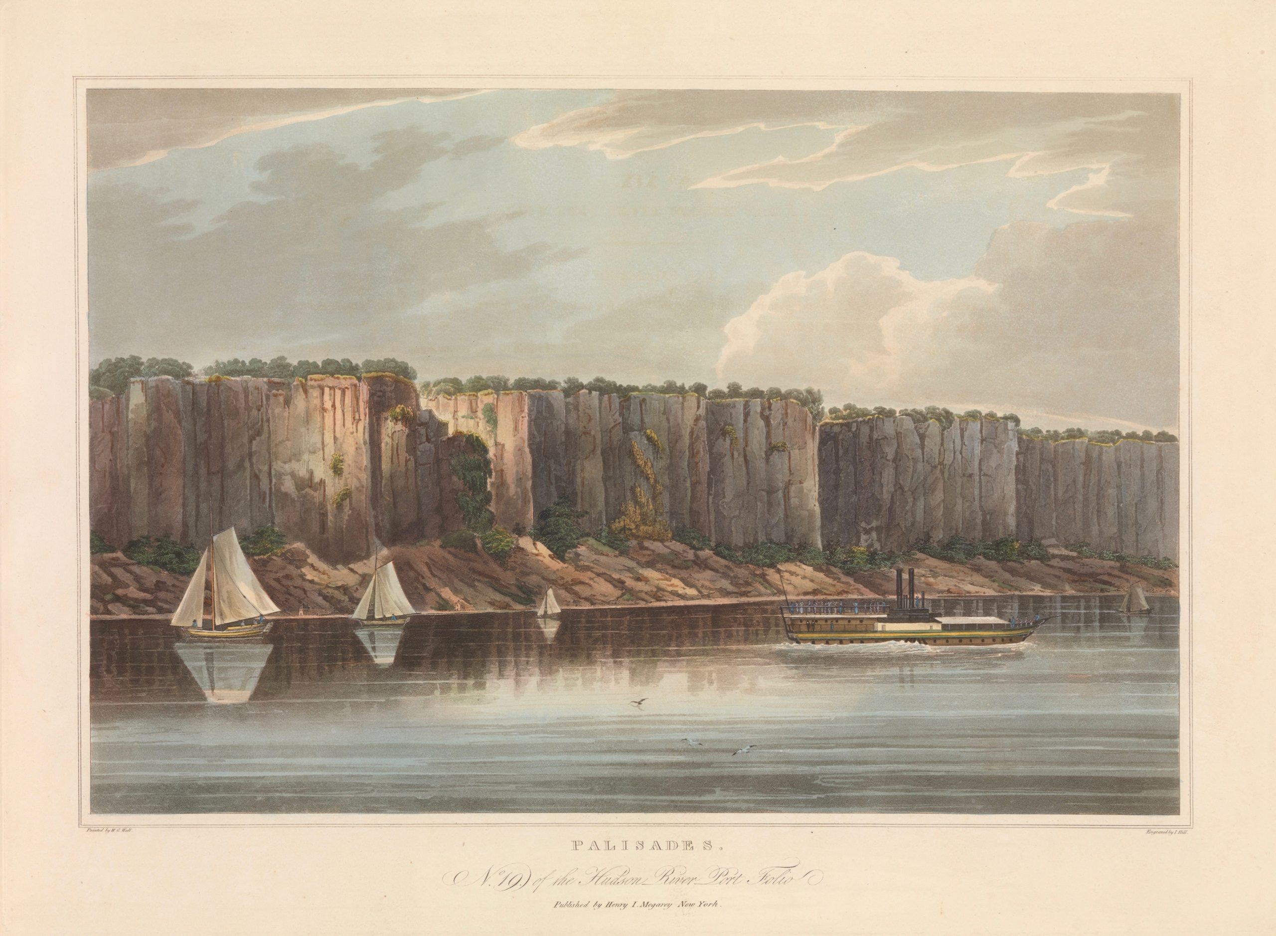
In 1820, Irish-American topographical artist William Guy Wall traveled the length of the Hudson River with travel-writer John Agg. Wall produced sketches and watercolors of sites they visited, while Agg captured them in words. The following year Wall’s pictures and Agg’s prose were published together by Henry L. Megary starting in 1822. Hudson River Portfolio: Twenty=Four Views on the North River consisted of hand-colored aquatints of compositions by Wall, produced by master-printer John Hill. Agg’s texts were presented as letterpress texts alongside Wall’s pictures. Prints were issued in suites of four. Wrapping the sets in blue paper sent a subliminal message to purchasers. Sugar-cones were at the time were marks of affluence and refinement. These were also wrapped in blue paper at point-of-purchase. Agg writes,

“Oak, hickory, chestnut, butternut and maple, are to be found among the trees that adorn the summit of the Pallisadoes, and grow to a magnitude which would scarcely be credited…Considerable quantities of wood are annually cut from this abundant source, and being plunged down the precipice, are easily thrown into vessels which lie close under the shore…rising from 400 to 800 feet, exhibiting i. every interval of verdure, steep and solid masses of stupendous stone…where the eagle builds his nest among the cliffs, secure from the reach of human enmity.”

http://www.metmuseum.org/art/collection/search/418428

No. XIX Of The Hudson River Port Folio. THE PALLISADOES.(Metropolitan Museum of Art. Reproduced according to fair use, etc.)

A significant number of Wall’s views represent waterfalls, suggesting that one of the goals of his project had been to promote industrial development of the upper Hudson. Only twenty of the twenty-four intended views were actually produced. One suspects the project was abandoned for commercial reasons. The Erie Canal opened for traffic in 1825. Investors looked to the west for more fertile opportunities than the foothills of the Adirondacks.


In 1859 Benson John Lossing (1813 – 1891) traveled with his new bride and a male companion from New York City to the summit of Mount Marcy. Their party was led by Abenaki guide Mitchell Sabbatis, who later guided Winslow Homer on treks into the mountains. From Newcomb the trio descended the Hudson to its mouth. Publication of his account of the jounrey was delayed by four years of Civil War. In 1866 H.B. Nims & Company of Troy, New York published The Hudson From the Wilderness to the Sea. Unlike Wall and Agg, Lossing both wrote the texts and produced the illustrations. An excerpt:

“Here the Palisades proper have their northernmost termination; and from here to Fort Lee their columnar range is almost unbroken. This place is better known as Sneeden’s Landing. Here Cornwallis and six thousand British troops landed, and marched upon Fort Lee…The dividing line between that state (New Jersey) and New York is a short distance below Rockland, or Sneeden’s Landing; and it is only a short distance from between there and its mouth (about twenty miles) that that the Hudson washes any soil but that of the State of New York.”

My own Hudson River journey has been fragmented, spanning more than a decade of day trips, overnights and weekends. Both Wall and Lossing provided me with narrative models in a way similar to the late Don Nice (1932-2019) following Jacques-Gerard Milbert’s 1828-1829 Itineraire Pittoresque du fleuve Hudson et des Parties Laterales de l’Amerique du Nord on his toru of the Hudson during the 1980s.


Revisit April’s QT Traveler Dispatches, day by day.

(A preview of SKETCHBOOK TRAVELER by James L. McElhinney (c) 2020. Schiffer Publishing).

Copyright James Lancel McElhinney (c) 2020 Texts and images may be reproduced (with proper citation) by permission of the author. To enquire, send a request to

ed******@ne***********.com


Quaranteam Traveler: April Dispatches Now Archived and Available

My life is a project. It always has been. On Wednesday, April 1, 2020. Kathie and I were already twenty-four days into self-imposed quarantine. New York City was seeing a sharp rise in new cases, hospitalizations and fatalities. This would continue for several weeks before infection rate showed signs of ebbing. Unable to get to my studio in Haverstraw, New York I kept busy writing, transforming my journals from 1990 to 1992 when I visited and painted Civil War battlefields under threat from development. At the time it seemed like a piquant metaphor for how the American landscape is a quarrel about what it is. In a divided nation thirty years later, it seems timely again. My intention had always been to write a book on the subject. Suddenly I had time to devote to the task.
Pouring over pairings of words and texts, like in my recent exhibition curated by Laura Vookles at Hudson River Museum, it occurred to me to start a quotidian blog that celebrates travel, making art and keeping journals. In other words, paying attention. Perhaps I thought it might provide some with relief from cabin-fever, or soothe the anxiety of those gripped by fear. Now in the second month of this project, I find the process has had a beneficial effect on me, and hope that it brings comfort to others.

At the end of each month, daily posts will be archived on new webpages. Below is the page for April 2020.
The reader will find a lot of content in each of these links. Alternately you could download the PDF
Save the document to your desktop. Click on links in it to access quotidian posts.


April 2020. Making Lemonade


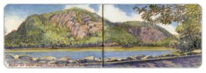
April 1. North Gate, Hudson Highlands


April 2. Thursday. North-South Lake, Haines Falls, New York


April 3. Friday. Ellis Island, New York Harbor.


April 4. Saturday. Rio Grande near Embudo Station


April 5. Sunday. Sunset, Columbia Railroad Bridge. Schuylkill River


April 6. Monday. The Rio Grande Below Pilar, New Mexico


April 7. Tuesday. Fort Wool, Rip-Raps Island, Hampton Roads, Virginia


April 8. Passover. Wednesday. Twin Bridges at the Mouth of the Sacandaga


April 9. Maundy Thursday. Twin Stone Bridges, Schuylkill River


April 10. Good Friday. Roadside Vista. Rio Grande Gorge


April 11. Saturday. Summit Springs Battleground. Sterling, Colorado


April 12. Easter Sunday. Western Highlands from Boscobel


April 13. Monday. Confluent Des Creuses


April 14. Tuesday. Looking South from Three Angels


April 15. Wednesday. Confluence of Rio Grande and Rio Pueblo de Taos


April 16. Thursday. South Gate. Hudson Highlands


April 17. Friday. Crows’ Nest Mountain. Hudson Highlands


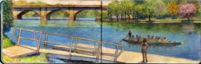
April 18. Saturday. Dragon-Boat Dock


April 19. Sunday. From the Rim of Rio Grande Gorge.


April 20. Monday. Below the Railway Connecting Bridge, Schuylkill River


April 21. Tuesday. Poets’ Walk. Annandale-on-Hudson, New York


April 21. Tuesday (part two). Bonus Dispatch: Field Gear


April 22. Wednesday. Earth Day. Picturesque Effluence in the Schuylkill River


April 23. Thursday. The Summit of Eyjafjallajoküll


April 24. Friday. Under the Volcano (Eyjafjallajoküll)


April 25. Saturday. The View from Olana


April 26. Sunday. Outriggers on the Schuylkill


APRIL 27. Monday. Fort Tryon Park, Manhattan


APRIL 28. Tuesday. Revolutionary War Battery, Fort Lee, New Jersey


APRIL 29. Wednesday. Tracking Eliza: An Art-Historical Detective Story


APRIL 30. Thursday. John Burroughs Grave-site, Roxbury, New York

Due out in late September. Reserve your copy now.

(A preview of SKETCHBOOK TRAVELER by James L. McElhinney (c) 2020. Schiffer Publishing).

Copyright James Lancel McElhinney (c) 2020 Texts and images may be reproduced (with proper citation) by permission of the author. To enquire, send a request to

ed******@ne***********.com


Links Day-by-Day: Downloadable PDF

APRIL 2020: A month of SKETCHBOOK TRAVELER blogposts

My life is a project. It always has been. On Wednesday, April 1, 2020. Kathie and I were already twenty-four days into self-imposed quarantine. New York City was seeing a sharp rise in new cases, hospitalizations and fatalities. This would continue for several weeks before infection rate showed signs of ebbing. Unable to get to my studio in Haverstraw, New York I kept busy writing, transforming my journals from 1990 to 1992 when I visited and painted Civil War battlefields under threat from development. At the time it seemed like a piquant metaphor for how the American landscape is a quarrel about what it is. In a divided nation thirty years later, it seems timely again. My intention had always been to write a book on the subject. Suddenly I had time to devote to the task.
Pouring over pairings of words and texts, like in my recent exhibition curated by Laura Vookles at Hudson River Museum, it occurred to me to start a quotidian blog that celebrates travel, making art and keeping journals. In other words, paying attention. Perhaps I thought it might provide some with relief from cabin-fever, or soothe the anxiety of those gripped by fear. Now in the second month of this project, I find the process has had a beneficial effect on me, and hope that it brings comfort to others.

At the end of each month, daily posts will be archived on new webpages. Below is the page for April 2020.
The reader will find a lot of content in each of these links. Alternately you could download the PDF
Save the document to your desktop. Click on links in it to access quotidian posts.


April 2020. Making Lemonade


April 1. North Gate, Hudson Highlands


April 2. Thursday. North-South Lake, Haines Falls, New York


April 3. Friday. Ellis Island, New York Harbor.


April 4. Saturday. Rio Grande near Embudo Station


April 5. Sunday. Sunset, Columbia Railroad Bridge. Schuylkill River


April 6. Monday. The Rio Grande Below Pilar, New Mexico


April 7. Tuesday. Fort Wool, Rip-Raps Island, Hampton Roads, Virginia


April 8. Passover. Wednesday. Twin Bridges at the Mouth of the Sacandaga


April 9. Maundy Thursday. Twin Stone Bridges, Schuylkill River


April 10. Good Friday. Roadside Vista. Rio Grande Gorge


April 11. Saturday. Summit Springs Battleground. Sterling, Colorado


April 12. Easter Sunday. Western Highlands from Boscobel


April 13. Monday. Confluent Des Creuses


April 14. Tuesday. Looking South from Three Angels


April 15. Wednesday. Confluence of Rio Grande and Rio Pueblo de Taos


April 16. Thursday. South Gate. Hudson Highlands


April 17. Friday. Crows’ Nest Mountain. Hudson Highlands


April 18. Saturday. Dragon-Boat Dock


April 19. Sunday. From the Rim of Rio Grande Gorge.


April 20. Monday. Below the Railway Connecting Bridge, Schuylkill River


April 21. Tuesday. Poets’ Walk. Annandale-on-Hudson, New York


April 21. Tuesday (part two). Bonus Dispatch: Field Gear


April 22. Wednesday. Earth Day. Picturesque Effluence in the Schuylkill River


April 23. Thursday. The Summit of Eyjafjallajoküll


April 24. Friday. Under the Volcano (Eyjafjallajoküll)


April 25. Saturday. The View from Olana


April 26. Sunday. Outriggers on the Schuylkill


APRIL 27. Monday. Fort Tryon Park, Manhattan


APRIL 28. Tuesday. Revolutionary War Battery, Fort Lee, New Jersey


APRIL 29. Wednesday. Tracking Eliza: An Art-Historical Detective Story


APRIL 30. Thursday. John Burroughs Grave-site, Roxbury, New York

Due out in late September. Reserve your copy now.

(A preview of SKETCHBOOK TRAVELER by James L. McElhinney (c) 2020. Schiffer Publishing).

Copyright James Lancel McElhinney (c) 2020 Texts and images may be reproduced (with proper citation) by permission of the author. To enquire, send a request to

ed******@ne***********.com


Links Day-by-Day: Downloadable PDF

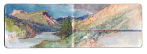
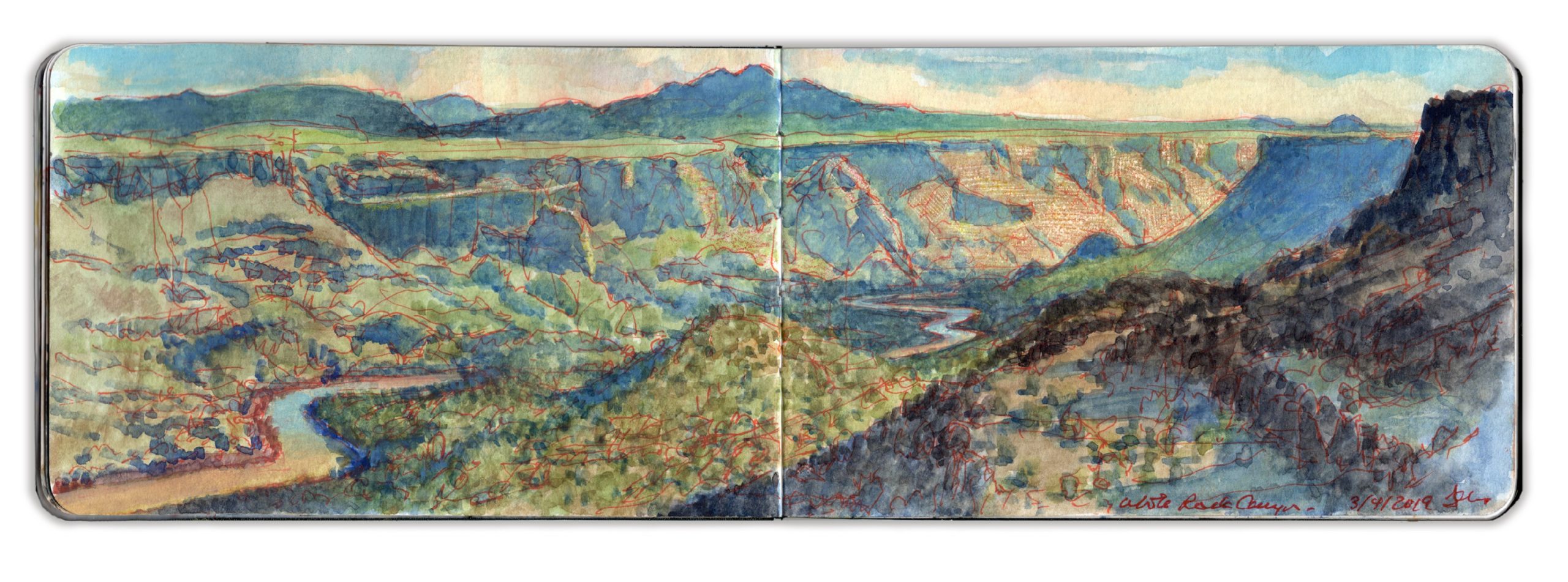
May 2, 2020. Quaranteam Traveler Dispatch #32. White Rock Canyon. March 4, 2019

(First published during the early stages of the Covid-19 pandemic, when Kathie and I were living under lockdown in our Washington Heights apartment).

Waiting for the crisis to pass, our thoughts go out to friends and loved-ones who also shelter in place. Old friends pass away, people we loved and admired. Immobilized for the time being, we can revisit destinations, near and far. join me in celebrating the joys of Quaranteam travel, the hope that these diversions might inspire us to value things we had taken for granted, to draw strength, wisdom and compassion from deeper engagements with nature.


Late Light, White Rock Canyon. March 4, 2019. Looking South from 35.8257 x 106.1810

Traveling to New Mexico early in 2019, I explored the Rio Grande between John Dunn Bridge and Cochiti Reservoir. Sites were selected for narrative reasons, as well as for their visual allure. Many of the works I produced, including my painting-journal, were exhibited at Gerald Peters Gallery in Santa Fe, in the exhibitions Reimagining New Mexico, from June 28 to August 3, and Speaking to the Imagination / The Contemporary Artist’s Book, from June 21 to October 24.

White Rock Canyon is a stunning declivity carved by the Rio Grande through volcanic sediment, running south from Otowi Peak, aka Buckman Mesa. Below Cochiti Reservoir the river snakes across a wide plain, passing Cochiti Pueblo, Pena Blanca, Kewa (Santo Domingo) Pueblo, Algodones and the ruins of Kuaua Pueblo, now interpreted as Coronado Historic Site. Located on the historic route El Camino Real de Tierra Adentro, Spanish explorer Francisco Vasquez de Coronado received hospitality from the indigenous people in 1541 before pushing east in search of golden Quivira in 1542. Below Bernalillo the river flows through the northern outskirts of Albuquerque before reaching Old Town below Interstate 40.
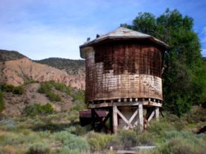
Winding through the bottom of White Rock Canyon, the Rio Grande runs narrow and swift. The geology resembles the gorge forty miles to the north, basaltic uplifts towering above heaps of rock-fall ascending from ribbons of greenery along the riverbanks. An old narrow-gauge spur of the Denver & Rio Grande Railroad known as The Chili Line stopped at Diablo Canyon, at the confluence of Cañada Ancha, a seasonal creek-bed across the Rio Grande from White Rock.
Steam-powered locomotives were no less thirsty than living things in such a parched land, and thus like El Camino Real, it followed the river. The decision to build a narrow-gauge railroad may have been predicated on water-consumption as much as those challenges presented by terrain.


(Left) Water-tower built for the narrow-gauge The Chili Line of the Denver & Rio Grande Railroad, Embudo Station, New Mexico

Descending through Frijoles Canyon in Bandelier National Monument, Rio Frijoles joins the river a few miles downstream. Breaking the horizon, the voluptuous contours of Ortiz Mountain rises up from the distant plain. Beyond it lies La Tetilla (the nipple), a hill just north of La Bajada. (the descent) where the road from Santa Fe to Albuquerque plunges from the rim of the plateau, down into the Rio Grande Valley below Cochiti Dam.

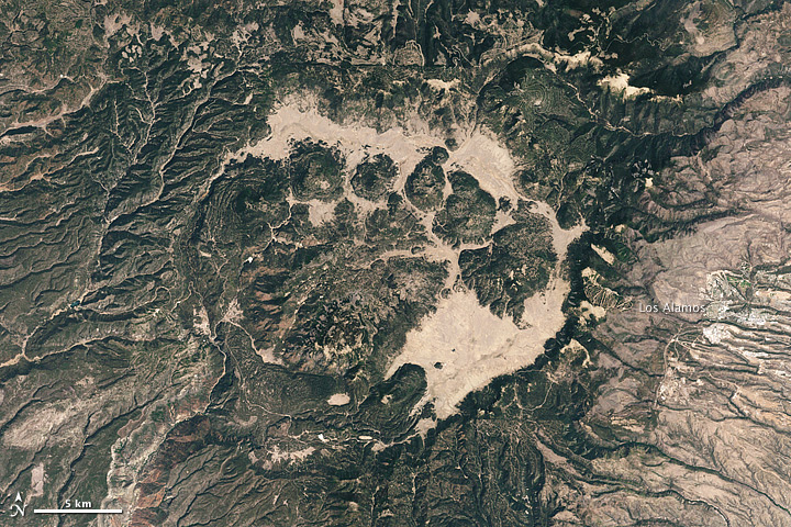
Standing atop the basalt escarpment, open patches of porous black rock are strewn with pebbles of similar porous material. Ascending westward, the terrain rises from high piñon desert through alpine forests to Valles Caldera, a vast mountaintop meadow, once of several located within the crater of a dormant volcano. More than a million years ago the violent eruption of the Jemez super-volcano buried the surrounding area under a pyroclastic flow of ash and rocks. The ground underfoot had been deposited by the cataclysm. Ash-falls spread as far east as the Llanos Estacado (staked plains) of West Texas. As a resurgent lava-cone forms under Redondo Peak, the most visible volcanic activity presents as a concatenation of hot-springs resorts running north into Colorado.


Satellite view of Jemez Caldera (Reproduced under fair use, etc.)

The town of White Rock was hastily built at the canyon’s edge as temporary housing for a growing number of postwar employees at Los Alamos Nuclear Laboratory. By 1957 residents had abandoned the settlement for more permanent dwellings. The site was leveled. By 1962, a growing population motivated developers to build permanent homes on the site of the abandoned town, along with schools, shopping, parks, playing-fields and picnic-pavilions. Trails were developed for hiking that followed the western rim of the canyon-wall. Others descended to the river several hundred feet below. Signs caution hikers to be on the lookout for rattlesnakes. These serpents tend to concentrate in areas that allow them to winter in dens. At sixty-five hundred feet of altitude, White Rock Canyon approaches the uppermost extremity of their range. The first week of March was too early for these predators to be active.

At the northern end of the town is a parking-area and overlook. Looking north one can see Otowi Peak to the right. A mile or more beyond it stands an unmistakable formation known as Black Mesa, where during the Reconquista, indigenous warriors fought the Spanish to a standstill.
People would visit me while I worked. One couple had just moved to Los Alamos from the Midwest. He worked for the Lab. I knew better than to ask what he did.
Another day I was painting half a mile south of the point, on a rocky outcropping. An Anglo couple approached. She seemed much older. Both appeared to be working-class. The man calmly told me that when he was a boy, he and a friend used to comb the canyon for artifacts, looting graves when they found them. His friend still has a couple of skulls on his dresser at home. I asked how he felt about that. He confessed that it troubled him, it didn’t seem right.
I suggested that whatever things he had taken, he better return them. No good can ever come from tampering with the dead. I suggested instead that if he is interested in the indigenous culture, maybe he should read about it, or talk to the people. A better understanding of their ways might inspire more respect. While many depend on fry-bread tourism and the art-market for their economy, any diffidence shown toward non-natives is well-founded.

As on many of my forays, I had begun multiple compositions of different views from the western rim of the canyon. Facing south, I decided to push one of these compositions. Warm sunlight and cool shadows carved marvelous forms in its eastern walls. A large hawk glided past, following the canyon rim. Landing in the piñon-tree beside me, a large crow greets me with a squawk. My keys lay on top pf my field-bag. I put them in my pocket.

(A preview of SKETCHBOOK TRAVELER by James L. McElhinney (c) 2020. Schiffer Publishing).

Copyright James Lancel McElhinney (c) 2020 Texts and images may be reproduced (with proper citation) by permission of the author. To enquire, send a request to

ed******@ne***********.com


May 1, 2020. QT Dispatch # 31. Gory Brook Meadow, Sleepy Hollow, New York

Waiting for the crisis to pass, our thoughts go out to friends and loved-ones who also shelter in place. Old friends pass away, people we loved and admired. Immobilized for the time being, we can revisit destinations, near and far. join me in celebrating the joys of Quaranteam travel, the hope that these diversions might inspire us to value things we had taken for granted, to draw strength, wisdom and compassion from deeper engagements with nature.


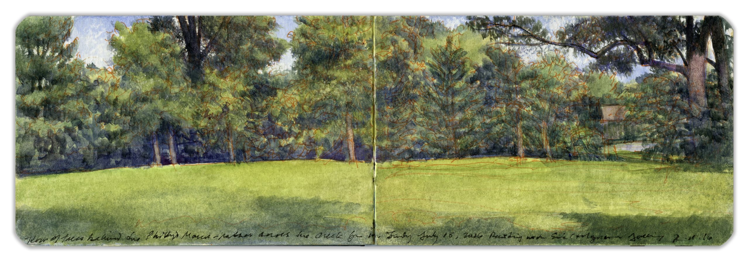
Gory Brook Meadow near Phillipse Mill. Sleepy Hollow, New York. July 11, 2016
(Image and text were featured in the exhibition James McElhinney. Discover the Hudson Anew, curated by Laura Vookles. Hudson River Museum. Yonkers, New York. September 13, 2019 to February 16, 2020. Published also as a limited-edition in Hudson Highlands. North River Suite Volume One. Needlewatcher Editions. New York. 2018)

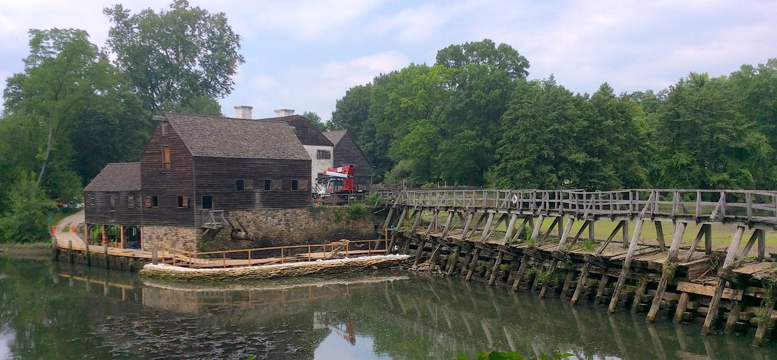
Through the village of Sleepy Hollow, just north of Tarrytown flows the Pocantico River, alternately known as Gory Brook—a tributary of the Hudson that was harnessed for hydropower by a grist-mill fed by a large pond, bordered on the west by a long, timber-built dam undergirding a narrow bridge with a wooden deck. Legend, or more correctly, the imagination of Washington Irving tells us that Yankee schoolmaster Ichabod Crane, besotted with a local girl, was pursued across this bridge and driven out of town by a Headless Horseman.
The mill and the land upon which it stands belonged to the Philipse family. Prior to the Revolutionary War they held much of Westchester County as a hereditary estate. As loyalists during the conflict, there would be no place for them in the new independent republic. Nearby Sleepy Hollow Cemetery provides eternal rest to notables such as Andrew Carnegie, Walter Chrysler, Jasper Cropsey, Samuel Gompers, Washington Irving, and Carl Schurz.


Phillipse Mill, Sleepy Hollow. Westchester County. New York. July 11, 2016

The site today is a National Historic Landmark accessible through the visitor center and gift-shop of Philipse Manor, from which bus tours depart for Kykuit, the former estate of the late New York governor and former U.S. Vice-President Nelson Aldrich Rockefeller. The grounds include a remarkable sculpture-gardenwhile the house contains an important collection of modern art.

On July 15, 2016, I drove upriver with a wonderful painter, a friend for nearly half a century. Eric Holzman had grown up in Yonkers and thus was intimate with the river-towns opposite the Palisades, and upriver along the shores of the Tappan Zee. Adjusting his French easel, Ric set out four or five canvases along a grassy path, behind a screen of wetland plants along the creek. Otherworldly vine-strangled trees across the creek held him enthralled. Walking through a stand of trees, I set up at the far end of a small field. We took breaks, exchanged critiques. It was a productive day for us both. Such days are forever.

(A preview of SKETCHBOOK TRAVELER by James L. McElhinney (c) 2020. Schiffer Publishing).

Copyright James Lancel McElhinney (c) 2020 Texts and images may be reproduced (with proper citation) by permission of the author. To enquire, send a request to

ed******@ne***********.com


April 30, 2020. QT Dispatch #30


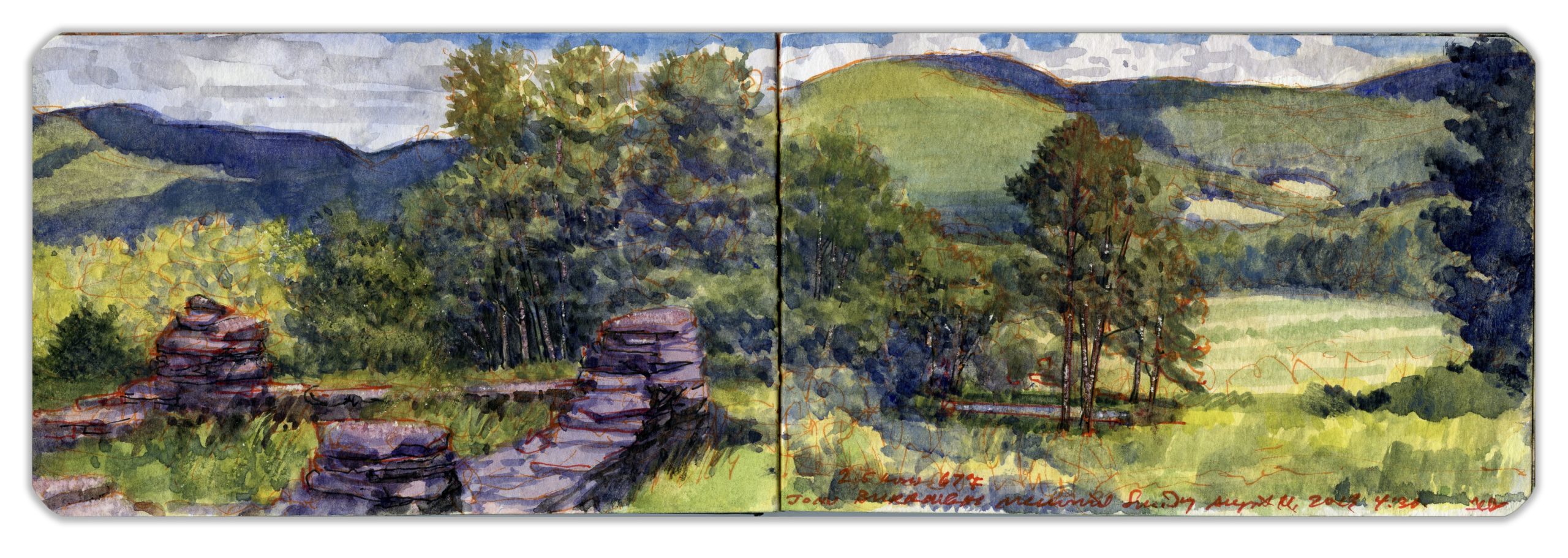
John Burroughs Gravesite. Sunday, September 11, 2013.
(Image and text were featured in the exhibition James McElhinney. Discover the Hudson Anew, curated by Laura Vookles. Hudson River Museum. Yonkers, New York. September 13, 2019 to February 16, 2020. Published also as a limited-edition in Hudson Highlands. North River Suite Volume One. Needlewatcher Editions. New York. 2018)

Waiting for the crisis to pass, our thoughts go out to friends and loved-ones who also shelter in place. Old friends pass away, people we loved and admired. Immobilized for the time being, we can revisit destinations, near and far. join me in celebrating the joys of Quaranteam travel, the hope that these diversions might inspire us to value things we had taken for granted, to draw strength, wisdom and compassion from deeper engagements with nature.
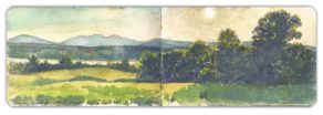

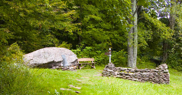
John Burroughs grave-site, looking north from the trail.

Kathie and I first discovered the site on a ramble into the western Catskills. Parking along the shoulder of Burroughs Memorial Road, we follow a narrow track north through the woods to a clearing. Descending eastward, wild meadows welcome us to broad vistas, no less inspiring in bucolic charm than majestic wonders like Grimsel Pass or Grand Canyon. Hewn by the east branch of the Delaware River and the headwaters of Schoharie Creek, the little valley is the source of two mighty watersheds—the Delaware and the Hudson. Beheld from Burroughs’s boulder, a harmonious patchwork of farm-fields and woodlots presents a soothing view. One forgets. Roxbury’s farming-community relied upon railway-depots in Arvkville and Margaretville to deliver its bounty to market. Burroughs’s youth knew the clamor of steam-powered machinery echoing through the valley. The song of the axe was heard deep in its woods. Burroughs’s vista was just far enough to escape such distractions, to stand between the land of men, and God’s country.

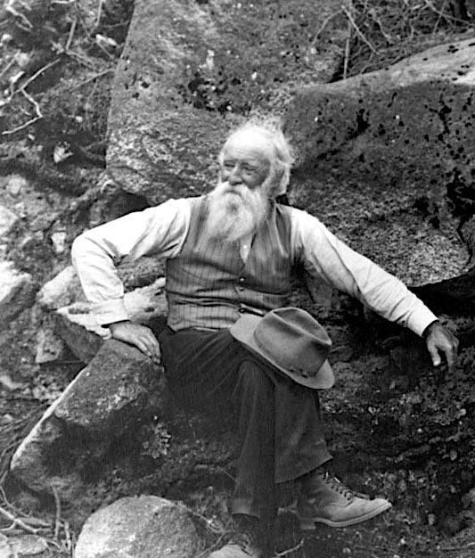
Literary Naturalist John Burroughs (1837-1921) was born near Roxbury in the Western Catskills. He later lived at Slabsides, his woodland refuge near Kingston, New York in Ulster County. Drawing heavily on travels through the mountainous regions around the Hudson Valley and New England, Burroughs argued that deeper connections with nature would develop the mind and nourish the soul, advocating the practice of close observation. In his essay, The Art of Seeing Things, published in Leaf and Tendril, 1908, Burroughs writes,

“To know is not all; it is only half. To love is the other half.”

To a neighbor complaining that birds no longer visited her home, Burroughs replied that during their conversation he had noted the songs of several, and named the species one by one. “You must have the bird in your heart”, he told her, “before you can find it in the bush.” Toward the end of his life Burroughs repaired to Woodchuck Lodge, a rustic farmhouse on the slopes of Clump Mountain, near the farm where he was born. His fondest retreat was a large recumbent boulder he called Boyhood Rock. By its foot he rests beside his wife. Fieldstone walls shelter their grave. In sweeping views of the beloved valley he abides.


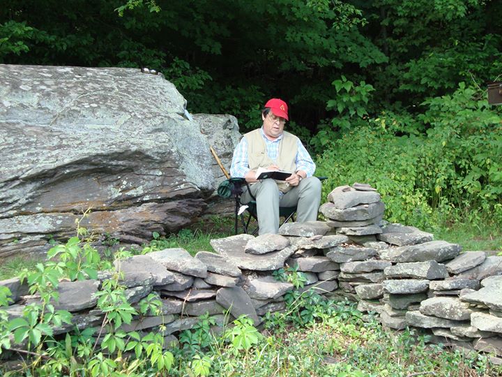
Painting next to Boyhood Rock at John Burroughs’s grave, Roxbury, New York

John Burroughs’s mission and legacy is celebrated today by the John Burroughs Association, which maintains his Ulster County retreat Slabsides, and is developing new trails along Black Creek near Highlands, New York. Annually it presents a number of literary awards for nature-writing including the prestigious John Burroughs Medal. I heartily recommend membership in this wonderful organization.


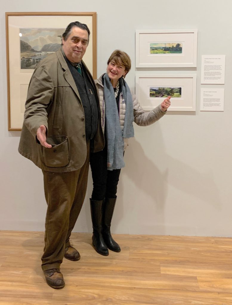
With Joan Burroughs, President of the John Burroughs Association at Discover the Hudson Anew at Hudson River Museum, February 16, 2020.

(A preview of SKETCHBOOK TRAVELER by James L. McElhinney (c) 2020. Schiffer Publishing).

Copyright James Lancel McElhinney (c) 2020 Texts and images may be reproduced (with proper citation) by permission of the author. To enquire, send a request to

ed******@ne***********.com