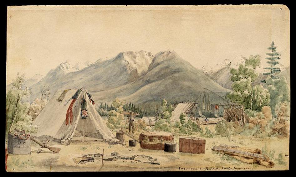
Paul Kane (1810-1871) was born at Mallow, County Cork, Ireland, and emigrated with his family to York (Toronto) in Upper Canada (Ontario) in 1819. Paul displayed artistic talent at an early age. Trained as a sign-painter and furniture-decorator, he received some formal training from a local professor. In 1836 he moved to Detroit, from whence he embarked on a career as an itinerant portrait-painter; traveling through the Midwest and into the Deep South. In 1841, he sailed from New Orleans to Marseilles to commence a walking-tour of Europe that led to Naples, Rome, Bolzano, Paris and London, where he may have met George Catlin—whose Indian Gallery was then on view at Piccadilly. In 1843, Kane returned to The States, where he resumed his portrait business in Mobile, Alabama. He returned to Canada the following year.
Kane’s exposure to Catlin’s work and ideas about Indians as a “vanishing race” grew into an ambitious project of his own; to travel amongst the First Nations of Canada’s western territories, as Catlin had done south of the border. Like the Group of Seven more than sixty years later, Kane began by exploring the wild margins of the Great Lakes in 1845. With support from the Hudson’s Bay Company the following year, he traveled from Toronto to Fort Vancouver, located in present-day Washington State. The Oregon Treaty of 1846 established the boundary between Canada and the U.S. along the 49th parallel north of the equator. Kane was present during the transition period that spanned several years. In 1848, he returned to Toronto. An exhibition of his works was met with great acclaim. Apart from a stint as an expeditionary artist in 1849, Kane spent the remainder of his life in Toronto; raising a family and elaborating his fieldwork into finished paintings.
(Encampment, Foot of the Rocky Mountains. Journal-painting by Paul Kane, ca. 1846-48)
Like Thomas Davies in the 18th century, or Tom Thomson and The Group of Seven at the beginning of the 20th century, Kane’s work is rooted in expeditionary practice. As a traveler-artist, he has been described as the first Canadian tourist. Apart from inspiring eponymous parks, schools, and postage-stamps, Kane’s legacy contributed to the national policies concerning cultural resources. In the late 1950s a cache of Kane’s sketches, watercolors and paintings were put on the market by a member of his family. When the Canadian government passed on the offer, the lot was purchased by Texan art collectors Nelda C. and H.J. Lutcher Stark. These works now reside in the Stark Museum of Western Art in Orange, Texas (opened in 1978). Taking heat for allowing these works to slip through its grasp, the Ottawa government enacted laws prohibiting the possession of artworks deemed national treasures, by foreign owners outside of Canada.
(Jasper House. Journal-painting by Paul Kane. 1847)
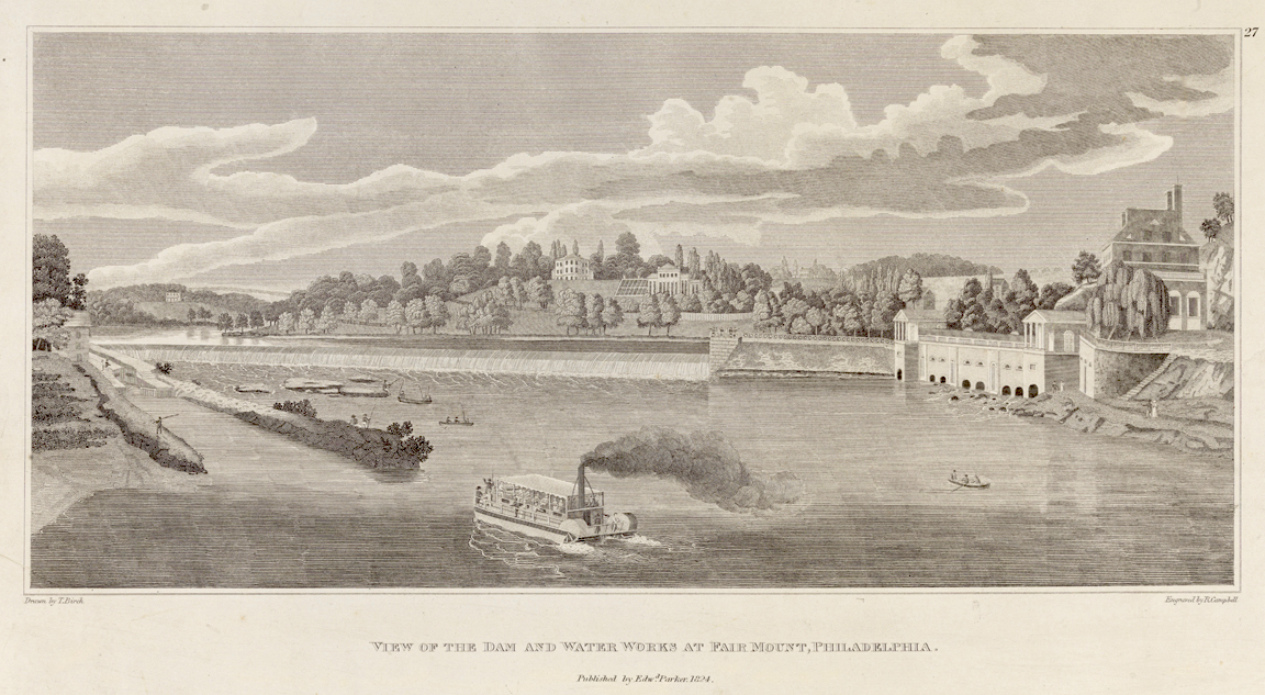
Few parcels of American terrain possess a richer palimpsest of enterprise, memory and desire than does a stretch of the Schuylkill River between East Falls and Fairmount Dam. Its waterworks provided the city with a safer source of drinking water, and a Neoclassical bucket-list destination for tourists. Malarial swamps were buried under broad esplanades. Parklands cobbled together from colonial estates protected the water-supply from industrial polluters. Flat water above Fairmount dam gave amateur rowers an ideal venue for training and competition, while inspiring artists from Birch and Calyo to Eakins and beyond.
Robert Campbell after Thomas Birch (1779-1851). View of the Dam and Water Works at Fairmount, Philadelphia. Collection of Pennsylvania Academy of the Fine Arts, Philadelphia PA. (Reproduced under Fair Use, etc.) During the late 18th and into the early 19th-century, Philadelphia was the center of art-publishing in the United States. The city remained a significant force in the publishing industry well into the 20th century. Prints like these with descriptive captions reproduced fine art paintings for popular consumption. Contrary to popular belief these were not necessarily created for wall display. Viewed through contraptions like the Zograscope, used as a form of visual entertainment. The genesis of the American landscape tradition predates the emergence of Thomas Cole as a leading proponent of landscape painting. Prior to his arrival in New York, Cole honed his skills by working in a Philadelphia engraver’s studio. The demand for Grand Tour scenery had been established a century prior, as reproductions of landscape paintings by Richard Wilson, Canaletto, and others. Following the French and Indian War, British military officers such as Governor Pownall and Thomas Davies collected sketches of North American topography that were published in various iterations, including Scenographia Americana in 1768.
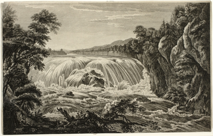
Governor Thomas Pownall and Thomas Sandby. View of the The Falls of Cohoes. ca. 1768. Engraved by William Elliot. Published by Bowles, Bowles, Sayer, Jeffrys & Parker. London. Collection Albany Institute of History and Art. Albany, N.Y.
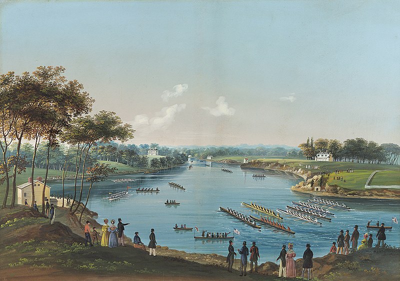
Following the disruptions of the American war of independence (1776-1783), professional artists emigrated to the new republic to capitalize on its natural wonders. William Birch, Thomas Birch, Joshua Shaw, and Samuel Seymour established themselves in Philadelphia. A Yellow Fever epidemic ravaged the city in 1793, motivating civic leaders to harness the Schuylkill River as a safe source of drinking-water. A dam was thrown across the river, at the foot of a large rocky outcropping dubbed Fair Mount. Pestilential marshes that served as breeding-grounds for mosquitos lined the banks that reached back to East Falls. Many were submerged by the rise in water-level. What remained was later buried under broad esplanades traversed by footpaths and carriage-roads. The course of the river was directed through a series of neoclassical buildings at the foot of Fair Mount, into which had been excavated a vast reservoir. William Strickland’s Water Works, and the nearby Colossus (Spring Garden Street) Bridge became bucket-list tourist attractions. In 1835, a group fo amateur rowing-clubs held the first official regatta, which led to formation of a world-class venue for competitive oarsmen, and later; women.
Nicolino Calyo. The First Schuylkill Regatta. Watercolor and gouache on paper. (ca. 1835). Debra Force Fine Art. The painting for many years hung in Castle Ringstetten, the upriver clubhouse of Undine Barge Club, of which painter Thomas Eakins and architect Frank Furness were both members
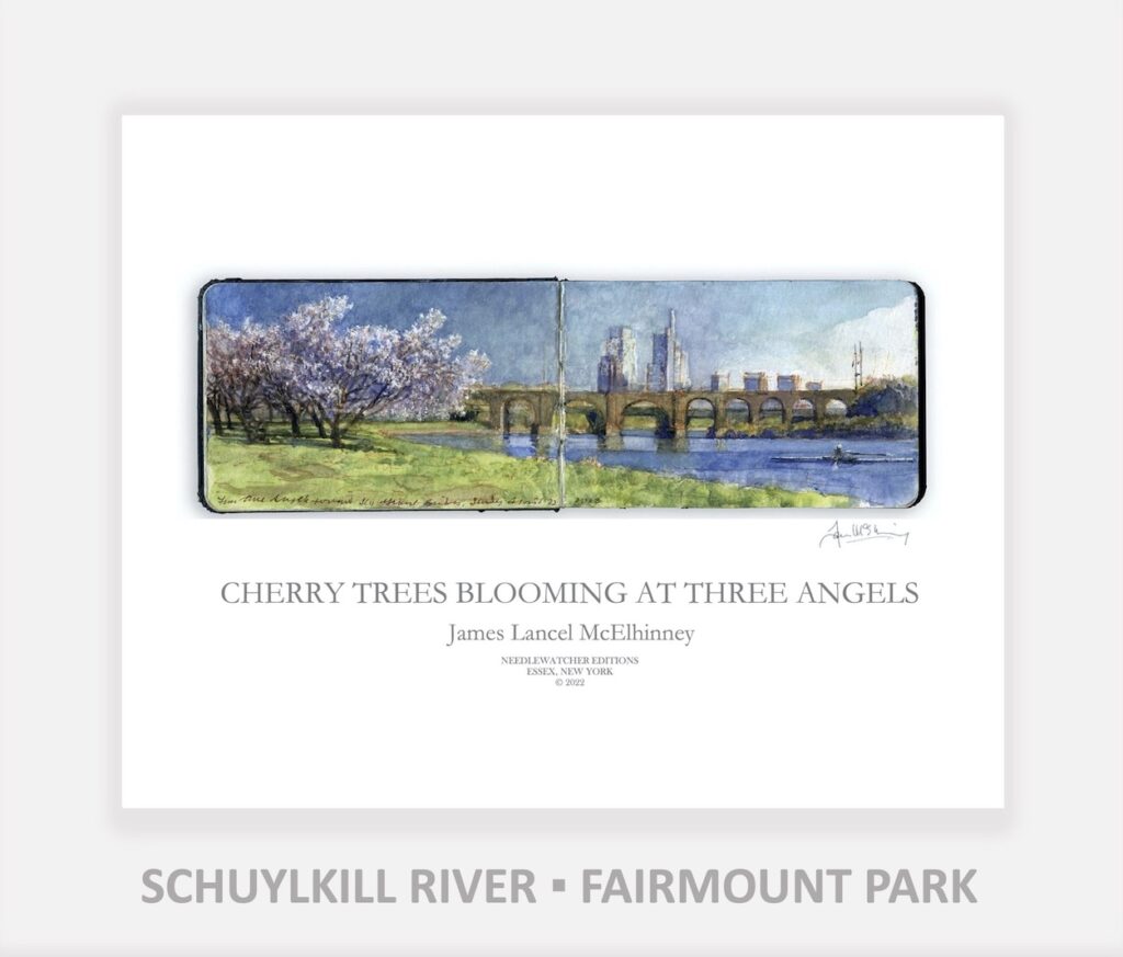
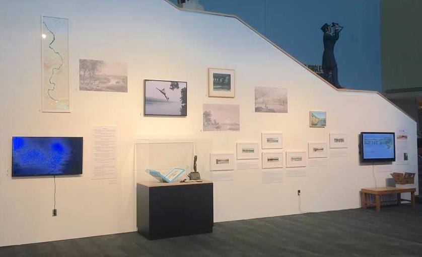
In 2017-18, I filled a painting-journal with sites along the river, from East Falls to Fairmount. These formed the centerpiece of an installation at Independence Seaport Museum at Philadelphia’s Penns’ Landing. Seven of those images were published as a fine press limited edition. Those views and and more are now being unpacked by Needlewatcher Editions as affordable individual archival pigment prints, in the spirit of expeditionary & Grand Tour loose-sheets and bookplates.
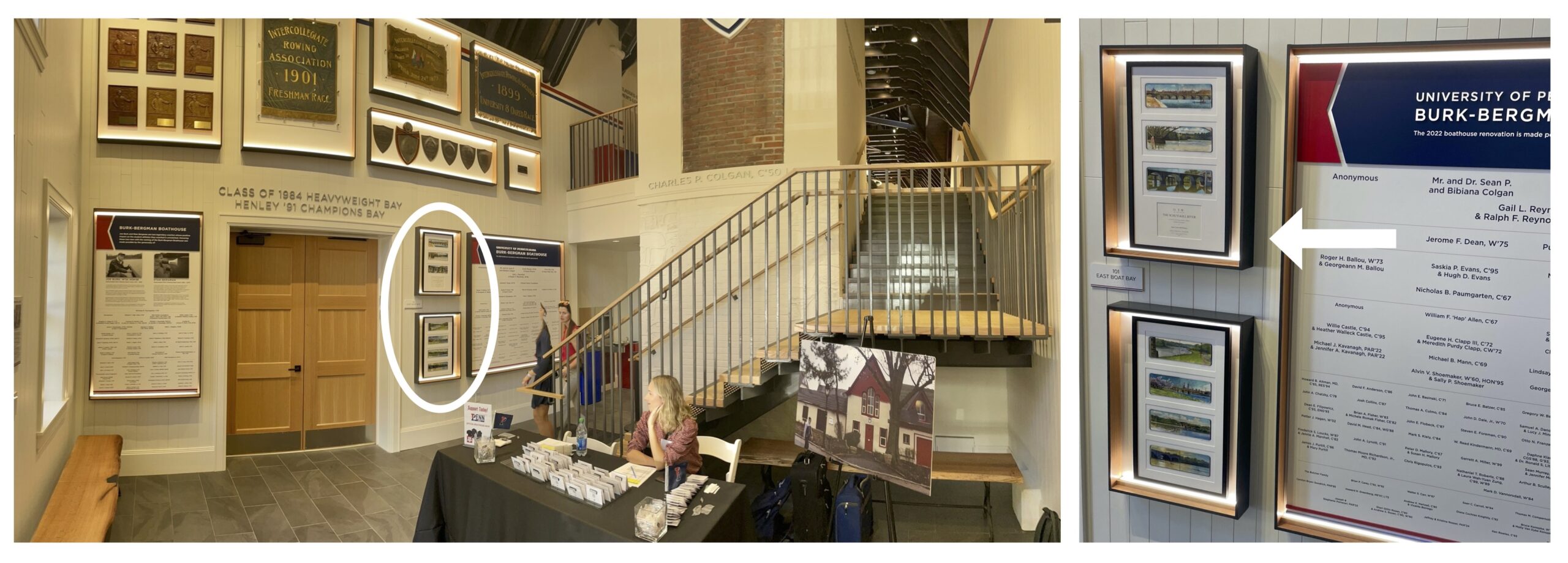
Prints from O.T.W. On the Water. The Schuylkill River have been installed in the lobby of the newly-renovated Burk-Bergman University of Pennsylvania Boat House, on Philadelphia’s historic Boat House Row (below)
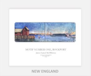
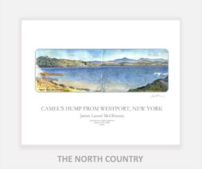
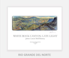
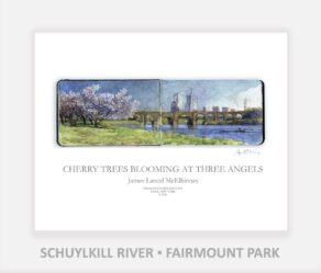
Format: Each archival pigment print is on high-quality acid-free paper. Sheet size: 11 x 14 inches. Image size: 3.5 x 10.5 inches. Printed by Orion Studios in Santa Fe, New Mexico. Following the traditions of expeditionary art, a descriptive legend is printed below a full-size facsimile print of one of James Lancel McElhinney’s journal paintings; signed by hand below the lower right-hand corner.
EXPLORE THE SCHUYLKILL RIVER
FROM FAIRMOUNT TO THE FALLS
(Scroll down)
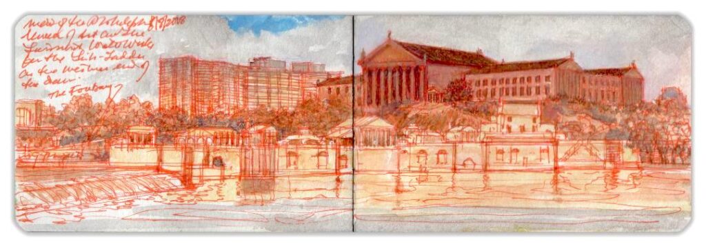
OTW_1. Fairmount Waterworks and Philadelphia Art Museum.
OTW_2. Fairmount Dam from the Summit. $250.00 Purchase now
Limited copies of O.T.W. The Schuylkill Riverare still available: Click on the image below for more details about the fine press limited edition of 50 copies released in 2018.
American landscape painting was born not on the easel of Thomas Cole, but in the sketchbooks of British military officers like Thomas Davies and Governor Pownall during the French and Indian War. Elaborated by professional artists such as Paul Sandby, these North America vistas published in London as Scenographia Americanamotivated a new generation of artists such as William and Thomas Birch, Joshua Shaw, William Guy Wall and Samuel Seymour to expand the Grand Tour aesthetic to the New World, again in the form of prints created for popular consumption. J.M.W. Turner cut his teeth translating topographical drawings of the Second Anglo-Mysore War for a booming art-publishing industry. Albert Bierstadt, F.E. Church and Thomas Moran all translated their grand visions of South America and the Rocky Mountain West into chromolithographs and etchings. In 1872 and 1874, Appleton & Company released William Cullen Bryant’s Picturesque America; a compendium of scenic destinations across the United States. Its publication coincided with the rise of a tourism industry that delivered visitors to natural wonders that a nascent environmental movement hastened to protect.
A new set of prints is now being developed, built on this tradition. Drawn from my painting-journals, like the Sketchbook Travelerbooks produced by Schiffer Publishing, these individual prints celebrate personal travel with an environmentally mindful expeditionary spirit.
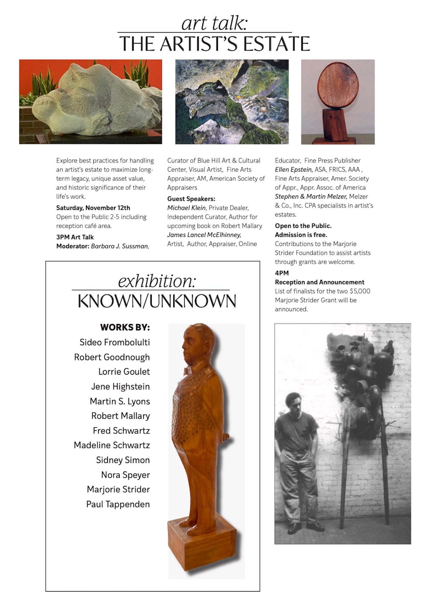
(Preliminary comments I delivered at Art Talk/The Artist’s Estate; a panel discussion held in conjunction with the exhibition Known/Unknown: Artists’ Estates, at Blue Hill Center for the Arts in Pearl River, New York. November 12, 2022.)
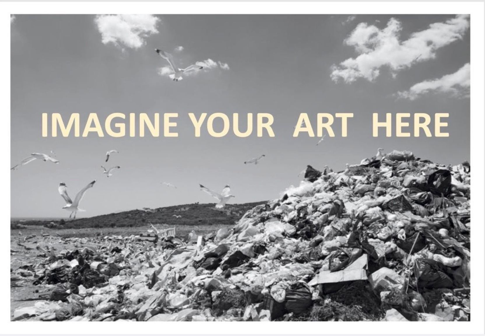
Let me begin by telling you a story, Exploring a wooded island-chain in the vast waters of Secaucus Bay, hundreds of years in the future, a team of archaeologists makes a startling discovery. Boring down into sylvan prominences that once were landfills, excavators bring up cylindrical soil samples. Something captures their attention. At a level corresponding to the second quarter of the 21st century, they notice an anomalous, brightly-colored band—the residue of countless works of art. Other digs yielded similar findings.
A plastic Ziplock bag is retrieved from a former dumpsite near the ruins of Santa Fe. Contained within is a cassette-tape of Terry Allen’s 1979 album Lubbock on Everything. One track holds particular interest. Truckload of Art recalls a highway fatality, when blue-chip artworks worth millions of dollars were consumed in the fiery wreck of a westbound Cab-over Peterbilt 18-wheeler, somewhere in Flyover Country.
Could it be a clue? Why was so much artwork abandoned during such a brief period of time? What could explain this massive surplus? Archaeologists compared their colorful cake-layer to strata from volcanic cataclysms, or fallout from the asteroid-strike that wiped out the dinosaurs. Farmers were known to have plowed under crops in exchange for government subsidies, but what calamity had compelled society to shed so quickly such massive quantities of artwork? Lacking sufficient primary documents to support or refute any of the theories pout forward, the search for clues continues. . .
Before anything like this comes to pass, mankind could be annihilated by a nuclear holocaust or killer plagues. Or—just maybe—artists might wake up to the fact that none of them will live forever, and take steps to preserve their legacies.
In all likelihood, a majority of makers will leave their heirs with a chaotic assortment of objects and papers, with no plan of action for its management. Restrained by sentiment, grief, and vain hope of future sales, the inheritors warehouse these heirlooms at great cost. Decades pass. Nothing happens. Bleeding money, the heirs make the painful decision to get rid of it. Sometime later, one of the paintings comes to light at a flea-market, hanging on a snow-fence. Another sells for peanuts at a rural auction. “Listed Artist” is lettered in pencil, on a paper tag dangling from a loop of thread, taped to a battered frame. The artist’s name rings a bell, but nobody remembers why.
We (Boomer artists) are sailing into a perfect storm. A sea-change is underway in how artworks are produced and consumed. When Tom Wolfe published “The Painted Word” in 1975, he predicted dire consequences, as a result of art-schools and universities flooding the gallery scene with legions of graduates wielding “artist’s statements.” Some of his predictions have come true, but he missed the mark when it came to foregrounding the backstory. Artworks may speak for themselves, but only to those who know how to listen.
While art fairs, auction houses, online sales platforms and social media now provide makers and dealers with many ways to sell art, new hires in studio art at art schools and colleges are in decline. As boomer art professors retire, their job lines disappear. Whole departments are being allowed to vanish through attrition. For the sake of brevity, let’s look at how this small corner of the market is being affected by these trends.
Studio art professors regard themselves as professional artists. The blue-chip art business sees them quite differently, despite the fact that many have been producing and exhibiting artworks for decades. Let’s say that a teaching artist shows twenty works at a gallery. Only ten manage to sell. The remainder are returned to the artist, who squirrels them away; saving them for future buyers, or a pipe-dream retrospective. The problem with this line of reasoning is that it defies real market practices. For example. One consigns an object to be sold at auction. If bidding fails to reach the “reserve”, it is “bought in.” Having been exposed to the market, as an unsold lot it would be considered “burned,” unsaleable for at least a few years, when it might be offered again–in a different market setting, perhaps at a lower price. Publishers release hardcover editions. Some become bestsellers. Others that die on the shelf are remaindered, to be sold at cut-rate prices.
Having taught in higher education for decades, I have come to understand why teaching artists are benighted to these facts of life. They consider themselves exempt. It’s too easy to conflate the meritocracy of academe with market validation, despite the fact that one has nothing to do with the other. A solo show at a gallery could be the equivalent to publishing an essay in a peer-reviewed journal, and thus count toward meeting expectations at one’s day job, and advance their progress toward tenure and promotion. Sales are not part of that calculus. Showing is enough.
But what of those works that came back from these exhibitions? Having been exposed to the market and refused a sale, why are they exempt from the taint of failure—like auction-house “buy-ins,” or remaindered books? The answer is simple. They were made not to be consumed by the market, but to generate academic capital. In other words, most teaching artists are not subject to the rules of the game because they are not on the field. They’re not even in the locker room. Despite this fact, a large number of studio artists working in academe continue to believe that they are shaping culture in durable ways. One supposes they are—by way of the “Butterfly Effect.” What most will accomplish is to be blessed with a creative lifestyle; no small achievement in itself. Unless steps are taken by these folks to establish some kind of durable public legacy; as part of their creative practice, all will be forgotten. It’s one thing to be recognized by one’s peers in one’s lifetime. It’s quite another matter to be remembered by posterity. If the future cannot find you, you were never here.
Let’s do a little math. A painting professor might have had solo exhibitions every two years. Each show featured twenty works, half of which sold. The other half went into storage. Retiring after a forty-year career, the professor find herself/himself burdened with the care and feeding of hundreds of artworks for which no market exists. What can be done? Of course, there will always be dauntless souls who churn out new works until they drop, leaving to their inheritors a chaotic assortment of equipment, papers, sketches, paintings, drawings, and maquettes. Loath to consign all this treasure to dumpsters and landfills, Heirs are often clueless about how to manage it all. What are their options? How might they proceed? Finding answers to those questions is why we are gathered here today.”
These images are drawn from James Lancel McElhinney’s 2018 painting-journal featured in the installation O.T.W. On the Water. The Schuylkill River, an Installation on view at Independence Seaport Museum in Philadelphia. October 24, 2018- January 5, 2020
OTW_1. Fairmount Waterworks and Philadelphia Art Museum.
Sheet size: 11 x 14 inches. Image size 3.,5 x 10.5 inches. All prints are produced with archival materials. Each is signed and dated. Shipping is included on smaller purchases. Prints are available matted, or unmatted, according to the buyer’s preference.
Unmatted Price: $250.00 USD
Matted Price: $300.00 USD
To purchase a print, or for information about print and digital licensing contact: ed******@ne***********.com
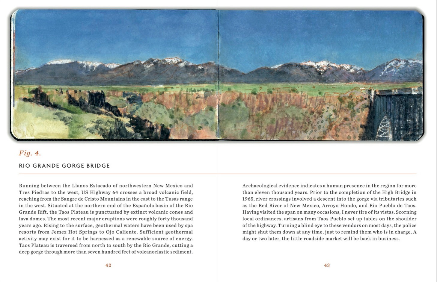
In March of 2019 I drove from Washington Heights at the northern end of Manhattan, to Santa Fe. Establishing my base of operations first in a casita owned Gerald Peters Gallery, and later in a wing of a house belonging to longtime dear friends, I set out to explore the Rio Grande from John Dunn Bridge to Bernalillo. The result of these endeavors was a sketchbook filled with paintings, ten of which were published as a suite of archival pigment prints in the hand-bound fine-press limited editionGrand River Sketchbook. Over the n ext seven months I made three more trips back and forth from New York, finally expanding my travels north to the headwaters of the Rio Grande above Creede, in the San Juan Mountains of Colorado.
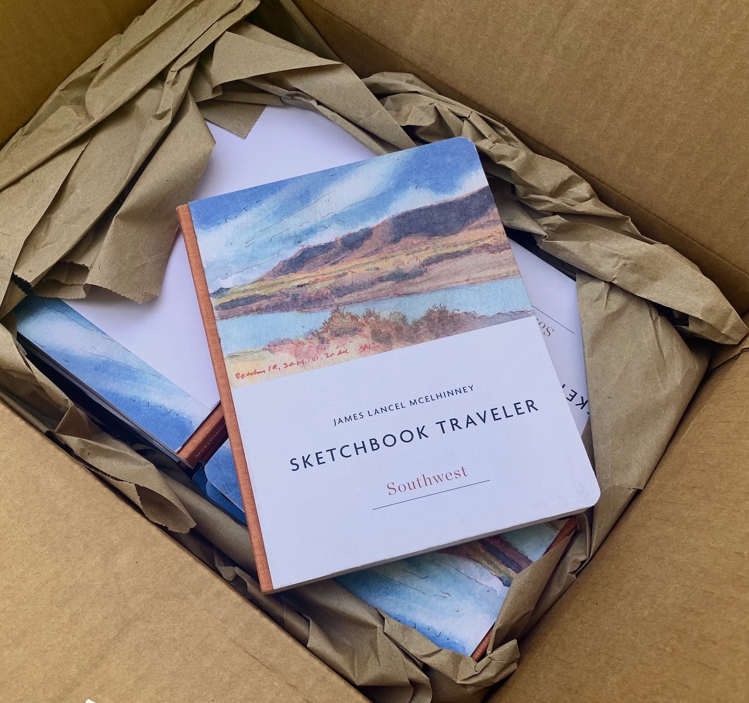
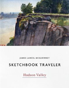
At that time, efforts were already underway to publish a hybrid coffee-table/backpacker art-book focused on the Hudson River, from its headwaters above Newcomb in the Adirondacks to Fort Lee on the Jersey Palisades. Amazingly the book was released on time in November 2020, at the height of the Covid pandemic. Sketchbook Traveler Hudson Valley was the first in a three-book contract with Schiffer Publishing, to be followed by a second volume on the American Southwest, and a third devoted to New England (scheduled to be released in the fall of 2023).
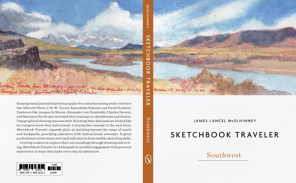
The cover design:
Publisher’s promotional text:
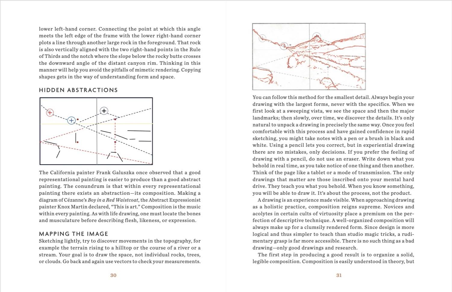
“Keeping visual journals has been popular for centuries among artist-travelers like Albrecht Dürer, J. M. W. Turner, Katsushika Hokusai, and David Hockney. Explorers like Jacques le Moyne, Alexander von Humboldt, Charles Darwin, and Marianne North also recorded their journeys in sketchbooks and diaries. Topographical drawing was essential. Knowing what destinations looked like let voyagers know they had arrived. Carrying this concept to the next level, Sketchbook Traveler expands plein air painting beyond the range of easels and backpacks, providing educators with instructional concepts. It gives professional artists many new (and old) ways to hone mobile sketching skills. Inviting readers to explore their surroundings through drawing and writing, Sketchbook Traveler is a field guide to mindful engagement with personal experience in ways that make every day an adventure.”
Located in between New Russia and Mineville, New York, Lincoln Pond is a small artificial lake in the eastern Adirondacks. In 1911 a tributary of the Boquet River in the eastern Adirondacks was blocked by an earthen and concrete barrier known as Kingdom Dam, transforming a chain of smaller ponds and wetlands along the Black River into the body of water now visible today. Currently in disrepair, the dam may eventually fail, damaging and destroying downstream properties, while returning the current shoreline to its historic contours.
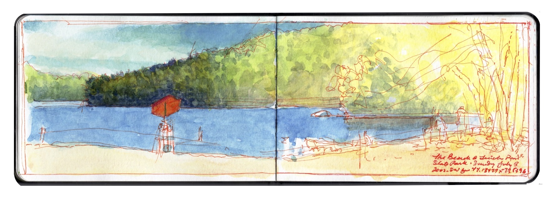
Lincoln Pond. Map courtesy National Geographic Society, reproduced under fair use, etc.Lincoln Pond. New Russia, New York. Aqueous media on paper (Moleskine watercolor sketchbook) 3.5 x 10.5 inches. July 3, 2022.
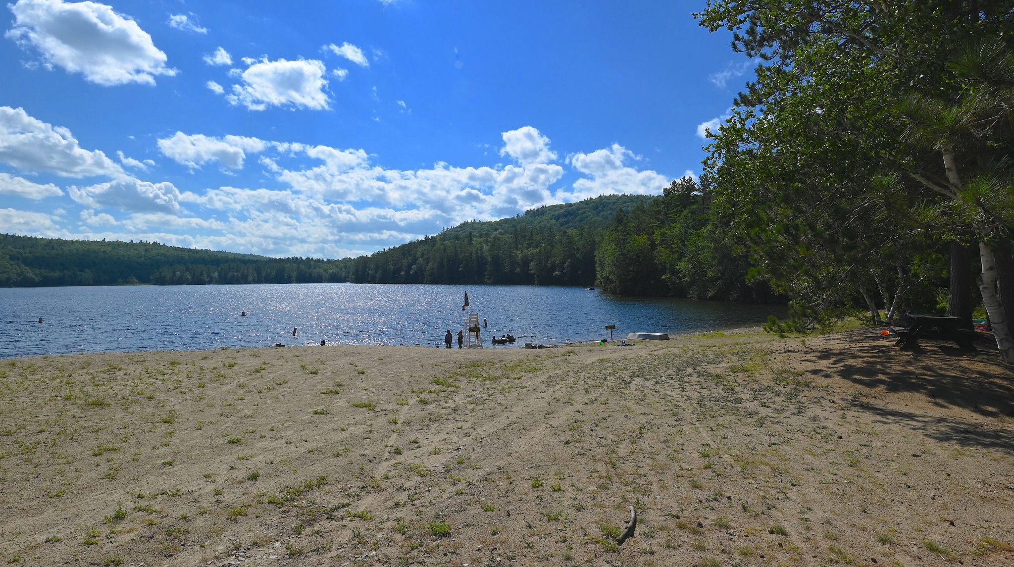
A popular destination for paddlers and fishermen, Lincoln Pond is divided by County Route 7 into an upper (south) and lower (northern pond). Along the western bank of the upper pond, the state of New York Department of Environmental Conservation maintains and operates a season campground and day-use recreation area that includes a bathhouse, picnic areas, dining pavilion, kayak rentals, and a beach. During a recent visit, I noted an increase in francophone Quebecois, who during the pandemic were unable to cross the border. For many in The North Country and Quebec Province, the international border is nothing more than a bureaucratic obstacle, to which wildlife, weather and terrain are completely indifferent. Downstream parts of nearby Lake Champlain reach northward into Canada. The St.-Regis Mohawk Indian reservation straddles the border, across which indigenous locals can move somewhat unhindered. .
Lincoln Pond. Essex County, New York. (c) 2022 James Lancel McElhinney
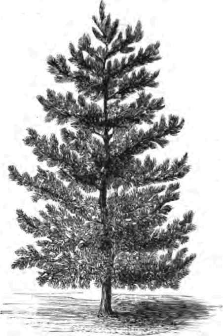
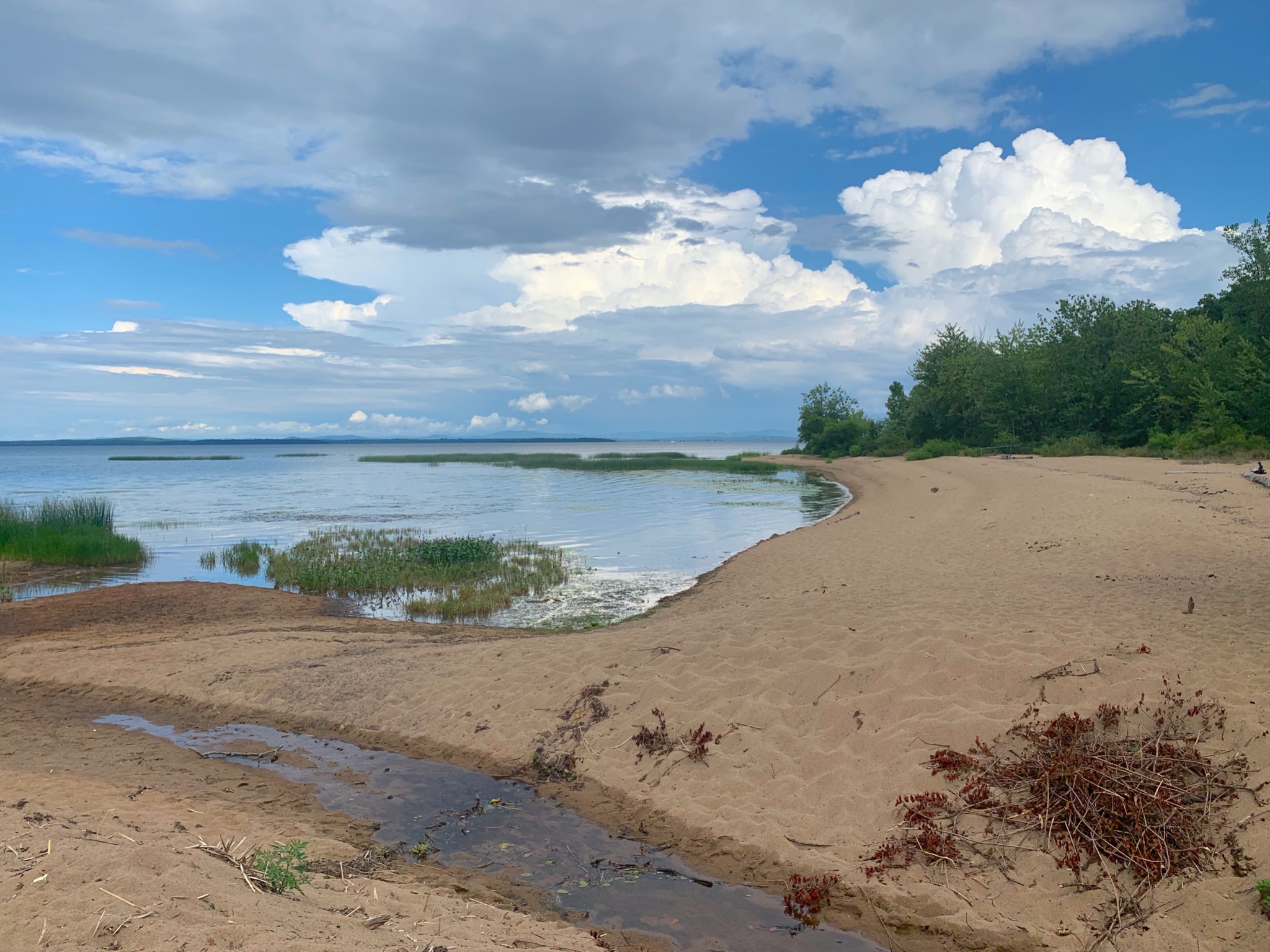
Studying the shoreline and the heights rising above it, I was struck by the large number of invasive deciduous trees in relation to the native Eastern White Pine (Pinus Strobus). When the Adirondack Park had been created in the late 19th-century, much of the view shed along the banks of Black River would have been cleared for farming or cut for timber. What I beheld was not a true wilderness, but a parcel of terrain, carefully manipulated to create the illusion of one for the sake of human consumption. Just beyond the wooded ridge on the far side of the beach, is traffic barreling up and down Interstate 87.
Eastern White Pine (Pinus Strobus), which was adopted by both the Haudenosaunee and New England colonists as a regional and cultural symbol of unity.Left: The flag of the Haudenosaunee Confederacy, with the White Pine as its central symbol of unity. Right: The red flag of New England, with the pine tree in the upper left quadrant of Saint George’s cross.
COMING SOON: September 27, 2022
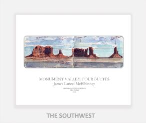
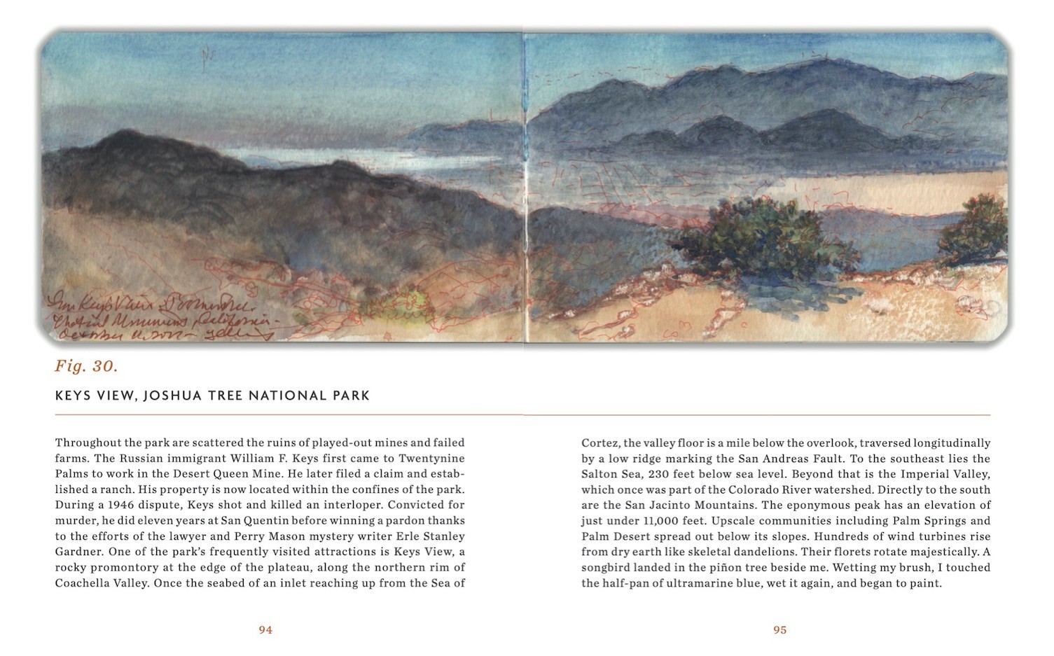
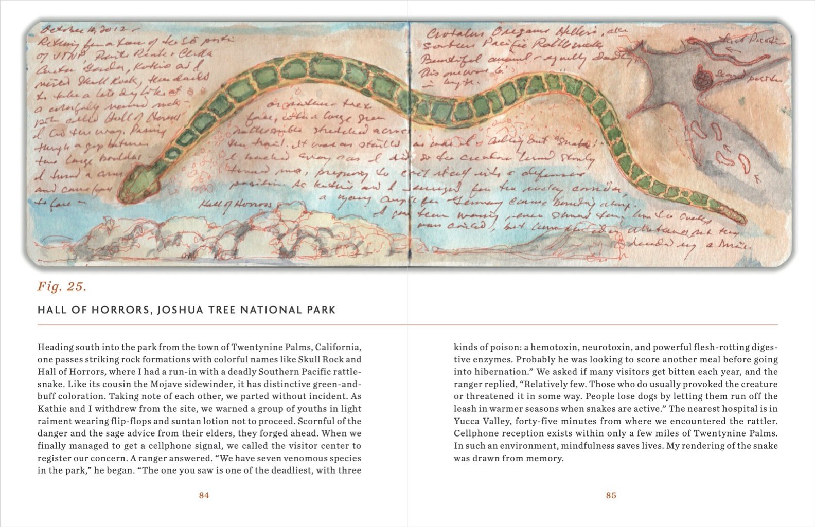
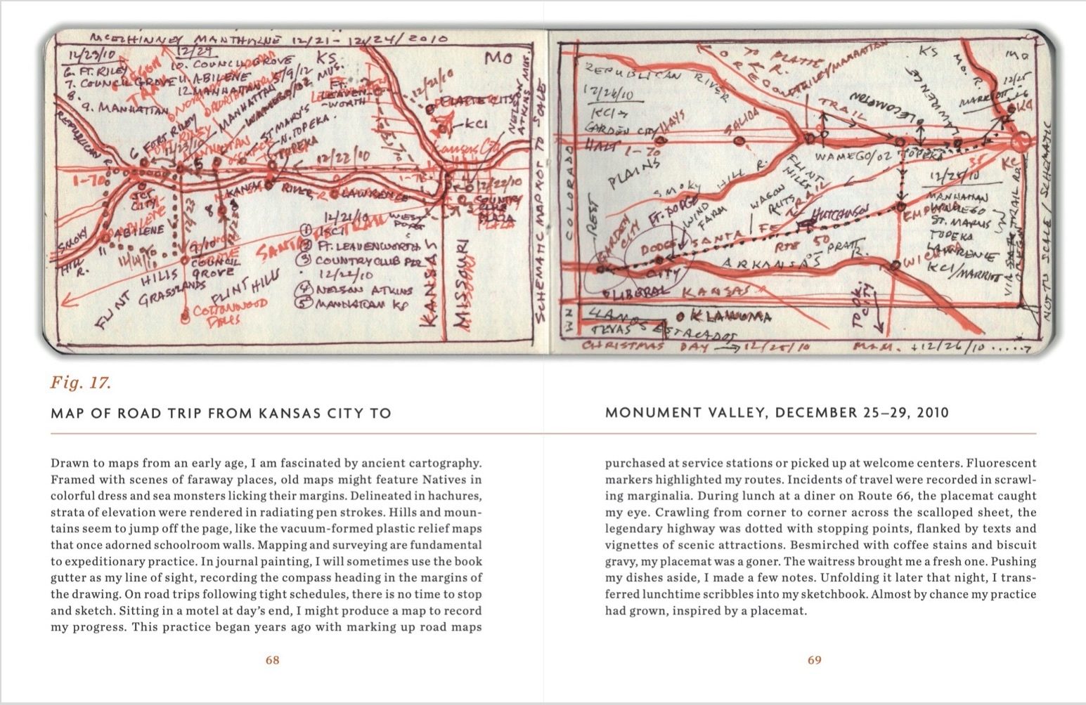
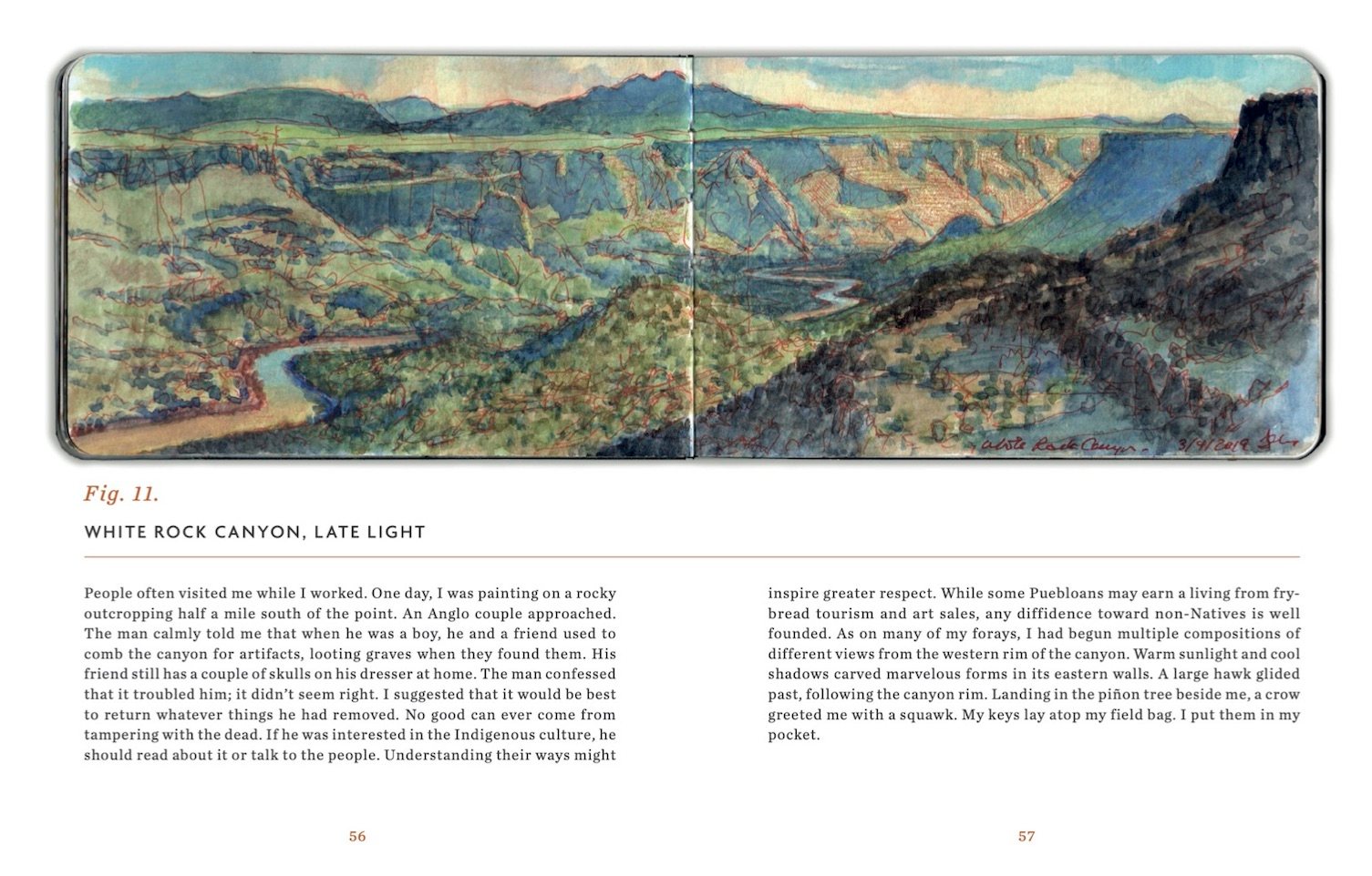
Sketchbook Traveler. Southwest was due to be released in May, but due to supply chain issues related to the Covid pandemic, the first edition (which has been printed overseas) is due to arrive in late summer. Following up on the success of Sketchbook Traveler: Hudson Valley, volume 2 in this trilogy explores the American Southwest from New Mexico to the Mojave Desert in journal-paintings and field notes by the author. Conceived as a backpacker’s field-guide and coffee-table art book, this compact volume includes lessons in print; a “why-to” guide to augmenting ubiquitous photographic devices. Blank pages scattered with inspirational quotes are provided for keeping one’s own traveler’s sketchbook. Pre-order here: LINK
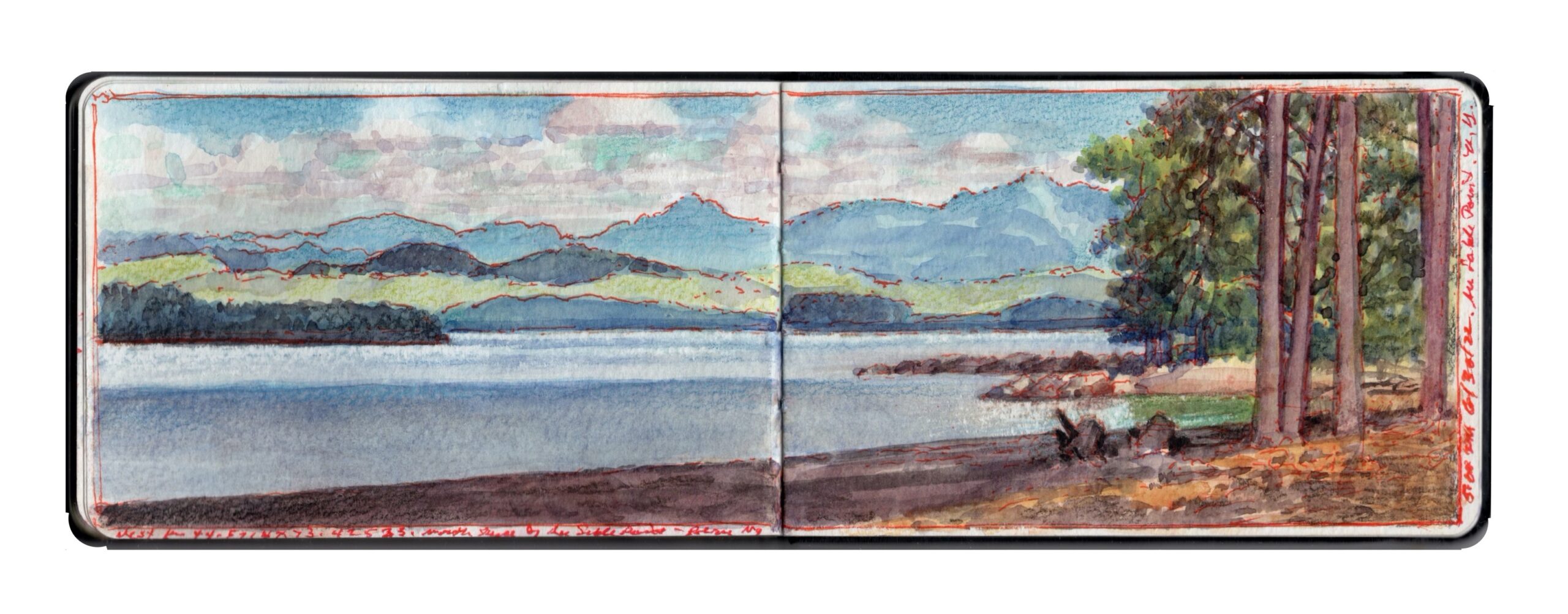
Mount Mansfield from the north beach at Ausable Point. Journal Painting. Aqueous media on paper. 3.5 x 10.5 inches. 2022
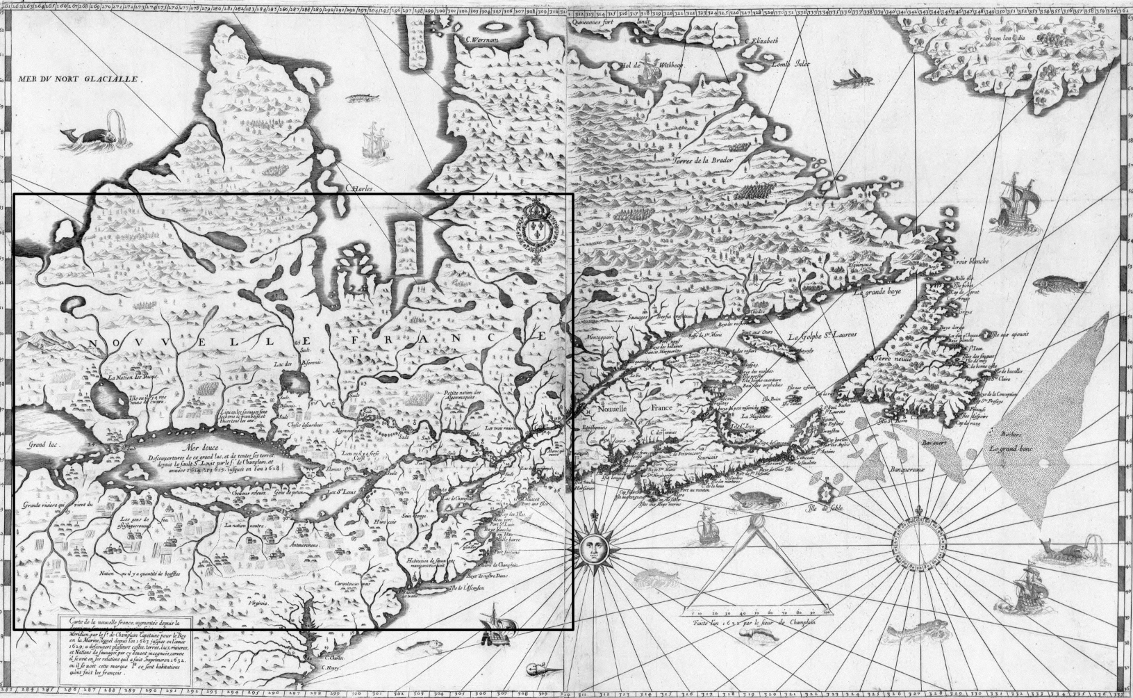
Believed by some to be the illegitimate son of “Le Vert Galante” King Henri IV, the peripatetic Samuel de Champlain explored the Atlantic coast of North America, before ascending the Saint Lawrence to establish the dominion of New France. At the base of a rocky promontory, Champlain established his base of operations at “Keh-beck”, meaning “narrows” in the local Abenaki dialect.
While it has become fashionable today to regard the practice of assigning place-names as exertions of personal vanity and colonial oppression, it had a far more practical raison d’etre, as a necessary means of identifying specific features of terrain. The coast of Maine and its rivers today mostly bear indigenous names, such as Androscoggin; “cliff-shelters river”, Damariscotta “many alewives”, Kennebec; “bay”, Kennebunk “long cut bank”, Penobscot “white-rocks people”, Ogunquit; “beautiful seaside”, Schoodic; “point of land”, and Wiscasset; “hidden harbor”. Sailing down east, explorers would have learned these traditional place-names from interacting with the natives. In many instances, when indigenous place-names were unknown, the cartographer would provide one of his own, in his native language. Having charted much of the Atlantic seaboard from Nantucket to Gaspee, Champlain bowed to ignorance and necessity by labeling some locations en le Français, such as Ile au Haut; “lofty island”, or Ile Mont-Desert; “island of deserted mountains”.
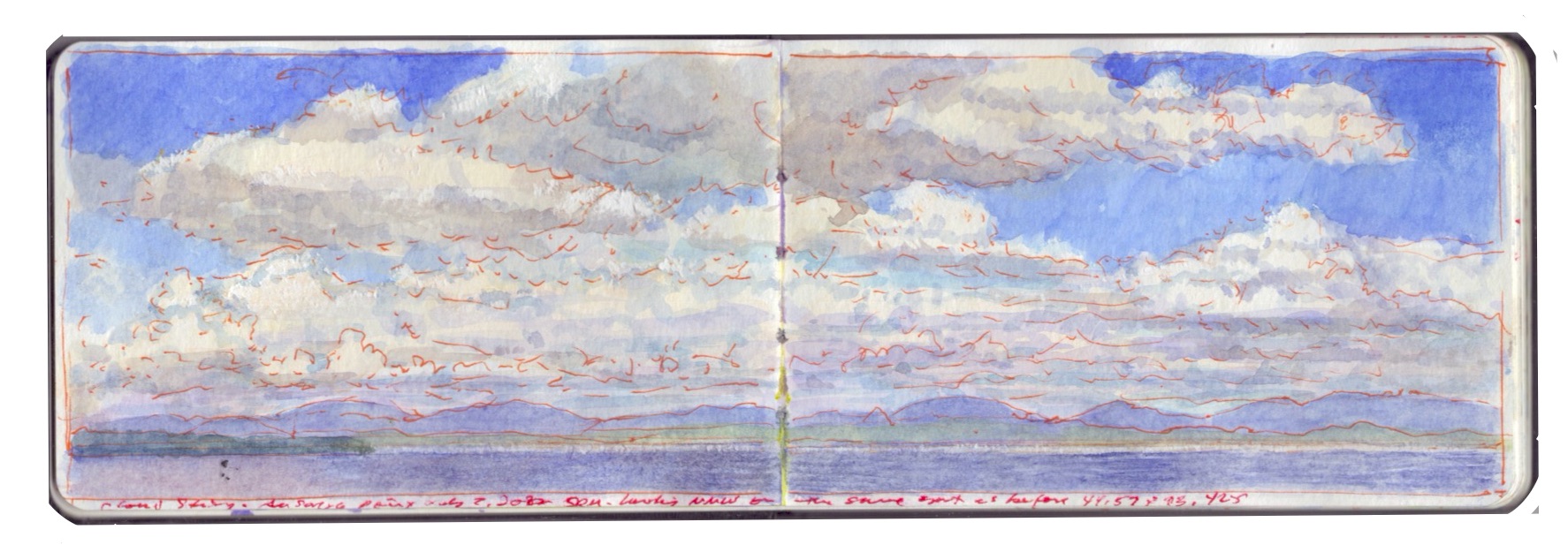
Lake Champlain from Ausable Point. Journal Painting. Aqueous media on paper. 3.5 x 10.5 inches. 2022
In 1609, Champlain ascended the Richelieu River to an inland sea known to his Abenaki allies as Pe-ton-bowk; “the waters between”; as it was recognized as the natural boundary between them and their Mohawk foes to the west. As de–facto ruler of New France, and a key player in the booming fur trade, Champlain had by 1609 evolved from the youthful explorer into a determined imperialist. Unabashed about assigning his name to the body of water upon which he ascended, Champlain and his Abenaki, Huron and Mi’qmak allies sought to drive the Kanienʼkehá꞉ka “Mohawk” out of the eastern Adirondack region. The goal was to gain control of key carrying-places; short overland links to Lake George and the Hudson Valley beyond. Paddling south, past clusters of islands, the flotilla of war-canoes entered a broad expanse of water. Mountains rose up from the western shore. A long ridge of low peaks stood off to the east, back from the water’s edge. Jutting out from the right bank was the wooded sandy delta of a river known to his companions as Nágwiadzóak; “underground stream’, to which Champlain gave the name Au Sable; “in the sand”.
The expedition was a success. On July 30, 1609, during the tense opening moments of an encounter with Mohawk warriors, Champlain stepped forward with an arquebus, loaded with buckshot. When the white smoke had cleared from its thundering discharge, two chiefs lay dead, with a third gravely wounded. Fighting alongside their British allies a century and a half later, Mohawks helped to expel the French from the Champlain Valley forever.
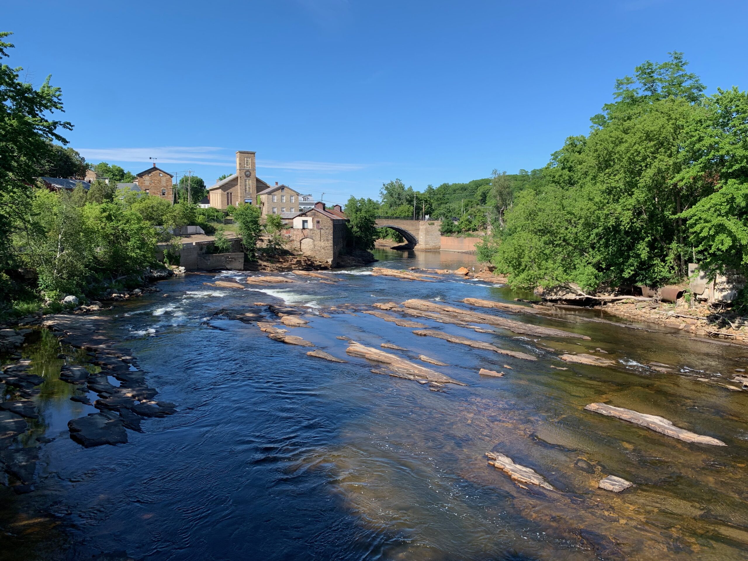
Looking downriver above Anderson Falls, Keeseville, New York. In August of 1858, Ralph Waldo Emerson, Louis Agassiz, James Russell Lowell, Judge Hoar, and other members of Boston’s elite Saturday Club passed through Keeseville, en route to Follensbee Pond via Saranac Lake. The nail factory they visited survives, and is visible to the left of the great keystone arch bridge, built in 1843. The town straddles two counties: Essex and Clinton. It is also home to ADKAction, which was formed to address “. . . unmet needs, promote vibrant communities, and preserve the natural beauty of the Adirondacks for all”. with offices located in the same historic building, Adirondack Architectural Heritage promotes better understanding, appreciation & stewardship of the Adirondacks’ unique and diverse architectural heritage.
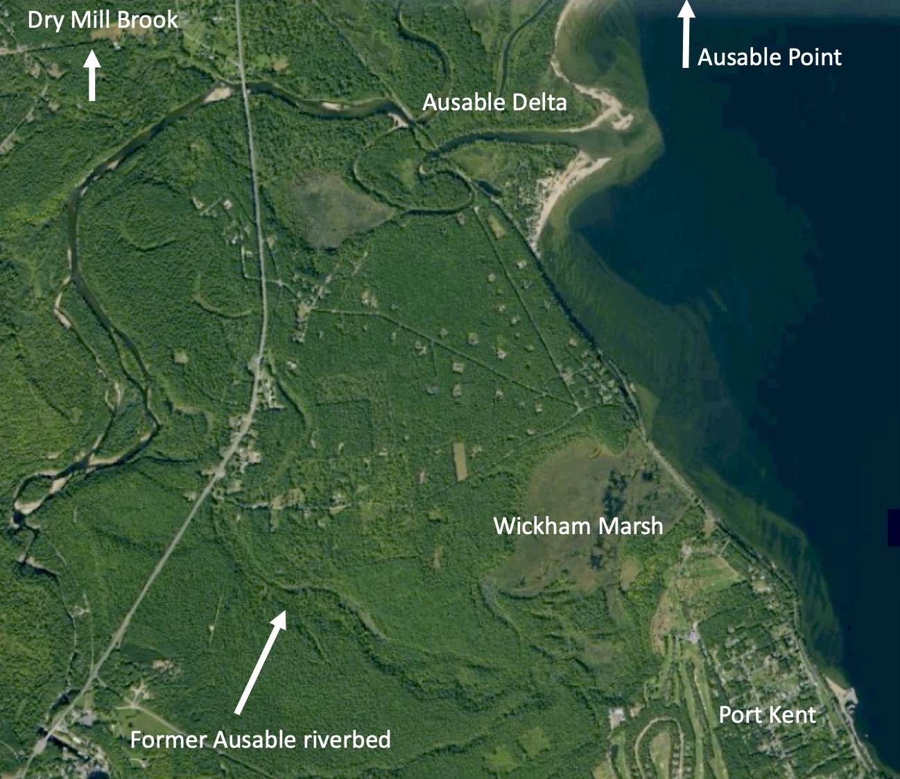
Located midway between Corlaer Bay and Valcour Island, the Ausable River mingles its waters with Lake Champlain. After tumbling over the falls at Keeseville, the river plunges over Rainbow Falls into Ausable Chasm; a narrow, vertiginous canyon hewn by rushing waters, which has awed millions of tourists since 1870. From here the river runs through a series of breaks, in several streams divided by steep, rocky buttes. Upon reaching the floodplain, the Ausable winds gently to the northeast. At its confluence with Southwick Creek, the river passes between a cluster of small islands before veering eastward through looping meanders, flanked by marshland, before spilling into the lake. Thousands of years ago, a rocky ledge blocked its northward passage, forcing the Ausable to seek an outlet located several miles to the south, at Wickham Marsh just north of Port Kent. Skirting the northern edge of the blocking ledge, Dry Mill Brook fed into Lake Champlain just below the present site of Ausable Point. When meandering arms of the river and brook finally merged, the river took the shorter route, leaving a dry channel where once it had flowed. Its former course is still visible in satellite photographs.
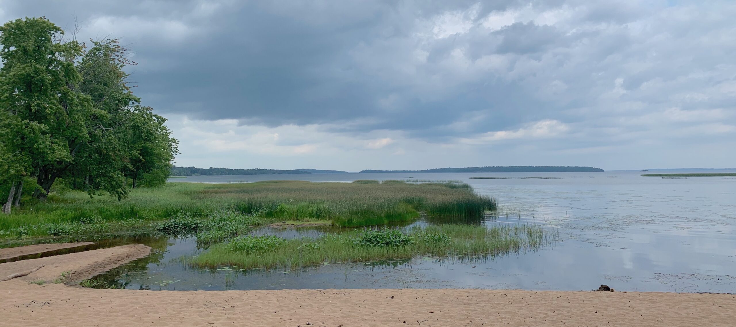
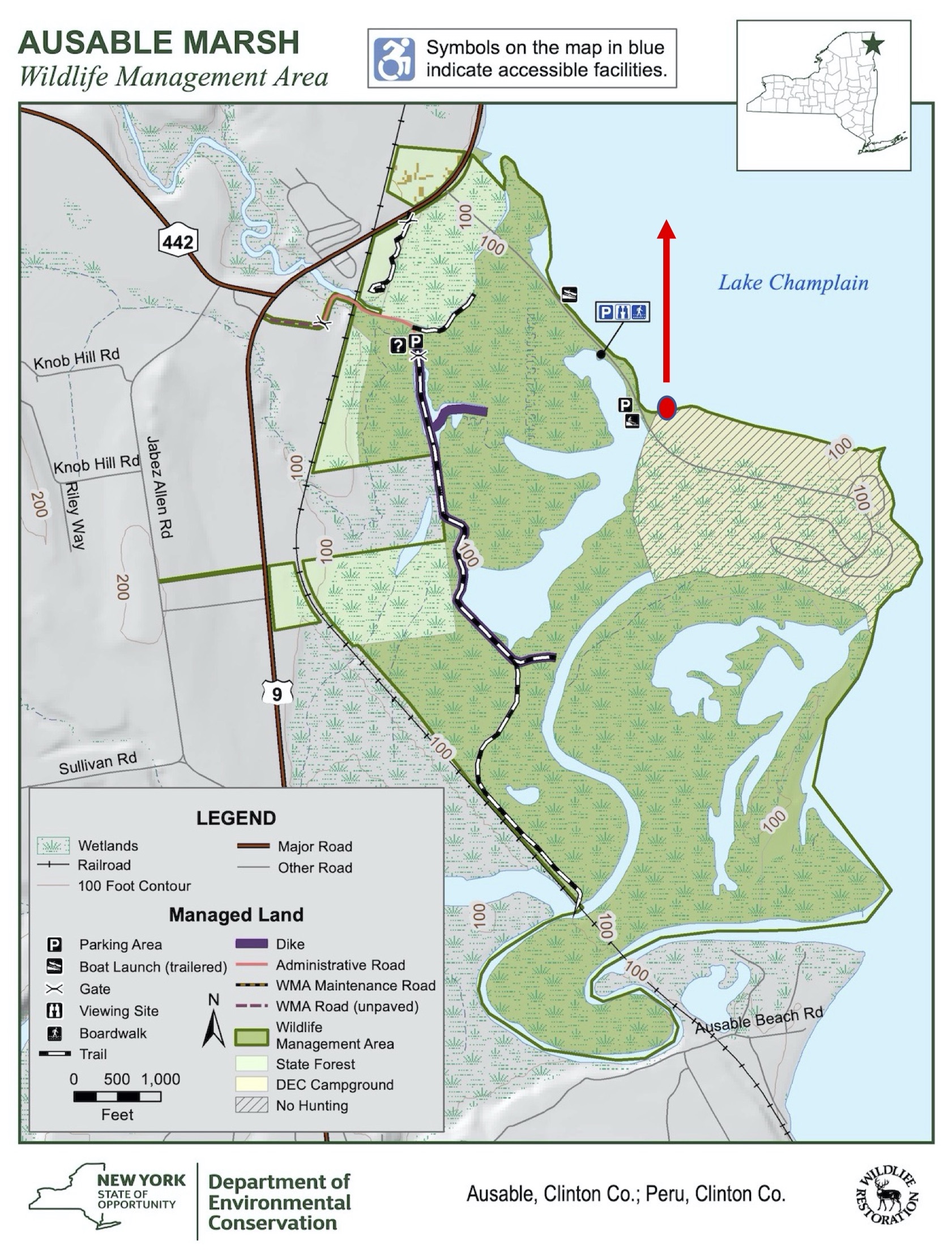
On the northern side of its outflow lies the sandy point that now bears the river’s name. Formerly an island, Ausable Point is today connected to the mainland by a roadway crossing the Little Ausable River, then proceeding over an earthen causeway to the gatehouse of a state park. Maintained for day-use and overnight camping at tent sites along a looping unpaved road, that winds back through the woods to the edge of Dead Creek Marsh. Along the north shore of the point is a long, sandy beach. Its sand particles display a ruddy hue; effluvia from iron deposits located further upriver. A small area is roped off for swimming. The beach is seldom crowded. Traversing the delta of the eponymous river, Ausable Wildlife Management Area provides a refuge for a wide variety of waterfowl, songbirds, raptors, reptiles and mammals. Avid birders are drawn to the mouth of the Ausable River, to observe the diverse resident and migratory species that frequent the Champlain Valley.
Looking north toward Valcour Island, from the eastern end of the causeway. The Point of view is indicated on the map below
In their bellicose ascent of the lake in 1609, its colonialist namesake and his indigenous companions would have deceived themselves by imagining that they were unique in their understanding of geography, and the significance of “The Great Warpath”; a series of waterways that linked the Saint Lawrence Valley with the mouth of the Hudson River, four hundred miles to the south. Pintail Ducks, Snow Geese, Tennessee Warblers, and dozens of other avian travelers had been following the same route for millions of years.
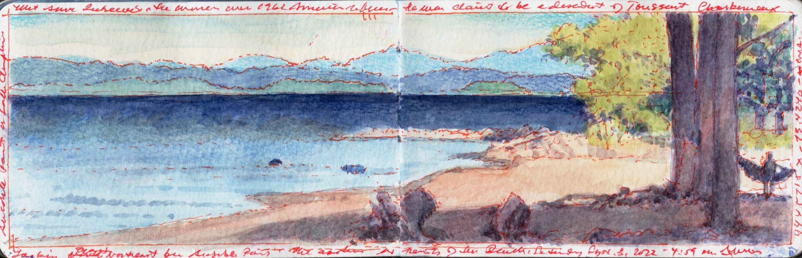
ENE from the beach at Ausable Point. September 3, 2022. Aqueous media on paper(Moleskine watercolor sketchbook) 3.5 x 10.5 inches
(CURRENTLY AVAILABLE:SKETCHBOOK TRAVELER by James L. McElhinney (c) 2020. Schiffer Publishing).
COMING SOON: Release date: September 27, 2022
Sketchbook Traveler. Southwest was due to be released in May, but due to supply chain issues related to the Covid pandemic, the first edition (which has been printed overseas) is due to arrive in late summer. Following up on the success of Sketchbook Traveler: Hudson Valley, volume 2 in this trilogy explores the American Southwest from New Mexico to the Mojave Desert in journal-paintings and field notes by the author. Conceived as a backpacker’s field-guide and coffee-table art book, this compact volume includes lessons in print; a “why-to” guide to augmenting ubiquitous photographic devices. Blank pages scattered with inspirational quotes are provided for keeping one’s own traveler’s sketchbook. Pre-order here: LINK
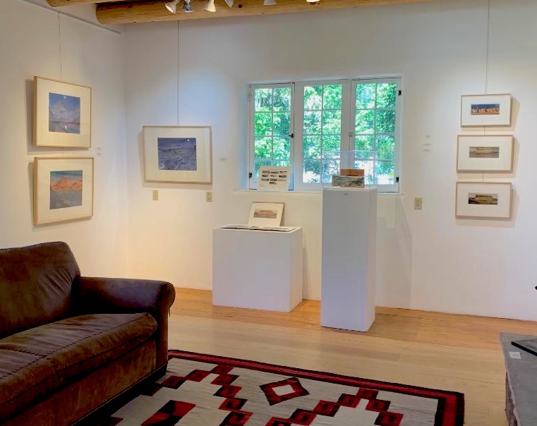
Installation view: The Western Gallery, Gerald Peters Gallery in Santa Fe, NM.
Contact Maria Hajic at: mhajic@gpgallery.com, or call (505) 954-5769
Backstory
In 2018, I traveled along the Rio Grande from Creede, Colorado to Bernalillo, New Mexico, keeping a journal and producing images of various sites along the river. In the spirit of 19th-century artist-explorers such as the Kern brothers, Seth Eastman, Albert Bierstadt, Tomas Moran and William Henry Jackson, my focus was painting in sketchbooks, making photographs, and producing written narratives. While all three of these activities have traditionally been regarded as note-taking, research, or rehearsals for “major works”, I regard them instead as elements, within a single practice, in which the art abides. I was also mindful of the cultural diversity of the parched region through which this waterway flows, and how using a codex as the substrate for painting puts my work in dialogue with major non-Western book-arts traditions; from the Islamic world and the Himalayas to East Asia and Mesoamerica. Synthetic outcomes from this project include monoprints produced with Michael Costello @ Hand Graphics in Santa Fe; Grand River Sketchbook; a fine-press limited edition (25) suite of ten (10) archival pigment prints, printed by Orion Studios in Santa Fe, in a find handmade binding by Peter Geraty of Praxis Bindery in Easthampton, Mass. Also on view are hand-embellished color intaglio copperplate etchings, with digital chine-colle produced by Philadelphia master printer Cindi Royce Ettinger, and original watercolors. Contact Maria Hajic at: mhajic@gpgallery.com, or call (505) 954-5769. A number of these works have been installed at Gerald Peters Gallery in Santa Fe, where they will remain on view through the summer.
Grand River Sketchbook (unique original painting journal). Watercolor sketchbook 3.5 x 10.5 inches (open) in a fine handmade Solander box by Mita Saldana, Against the Grain Book Binding, Albuquerque NM. Contact Maria Hajic at: mhajic@gpgallery.com, or call (505) 954-5769
Moonrise, White Rock Canyon. Image size: 14.5 x 19 inches. Monoprint on paper. Sheet size 22 x 30 inches. Printed by Hand Graphics, Santa Fe, NM. 2019
Contact Maria Hajic at: mhajic@gpgallery.com, or call (505) 954-5769
Confluence: Rio Grande & Rio Pueblo de Taos. Image size: 14.5 x 19 inches. Monoprint on paper. Sheet size 22 x 30 inches. printed by Hand Graphics, Santa Fe, NM. 2019
Contact Maria Hajic at:mhajic@gpgallery.com, or call (505) 954-5769
Moonrise, Confluence. Image size: 14.5 x 19 inches. Monoprint on paper. Sheet size 22 x 30 inches. printed by Hand Graphics, Santa Fe, NM. 2019. Contact Maria Hajic at: mhajic@gpgallery.com, or call (505) 954-5769
Tunyo, or The Black Mesa. (#3) Hand-embellished color intaglio copperplate etching with digital Chine-colle, printed by Philadelphia Master Printer Cindi Royce Ettinger. 2020. Contact Maria Hajic at:mhajic@gpgallery.com, or call (505) 954-5769
Tunyo, or The Black Mesa (#4) Hand-embellished color intaglio copperplate etching with digital Chine-colle, printed by Philadelphia Master PrinterCindi Royce Ettinger2020. Contact Maria Hajic at: mhajic@gpgallery.com, or call (505) 954-5769
Limited edition of 25: Grand River Sketchbook. 2020. A suite of 10 archival pigment prints. Printed byOrion Studios, Santa Fe; Binding by Peter Geraty,Praxis Bindery, Easthampton Mass. View the edition HERE. Contact Maria Hajic at: mhajic@gpgallery.com, or call (505) 954-5769
1005 Paseo de Peralta
Sante Fe, New Mexico 87501
For information about Needlewatcher Editions, write to editions@needlewatcher.com
Needlewatcher Editions. PO Box 233. Essex, New York. 12936-0233. (347) 266-5652


 (Encampment, Foot of the Rocky Mountains. Journal-painting by Paul Kane, ca. 1846-48)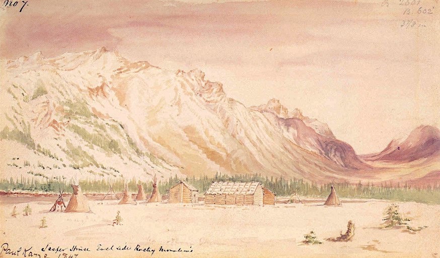

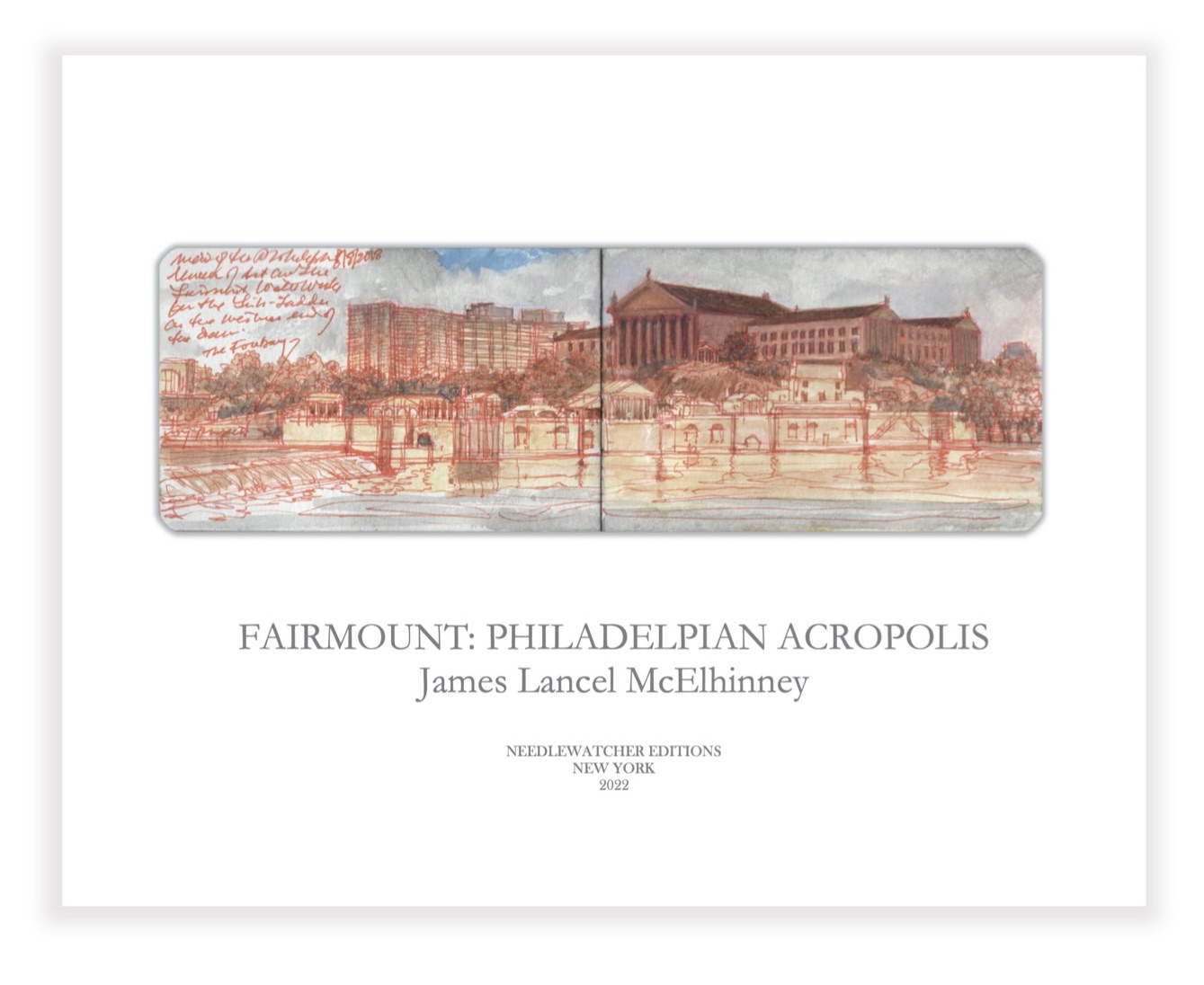 OTW_1. Fairmount Waterworks and Philadelphia Art Museum.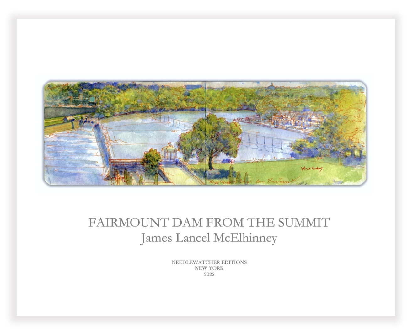
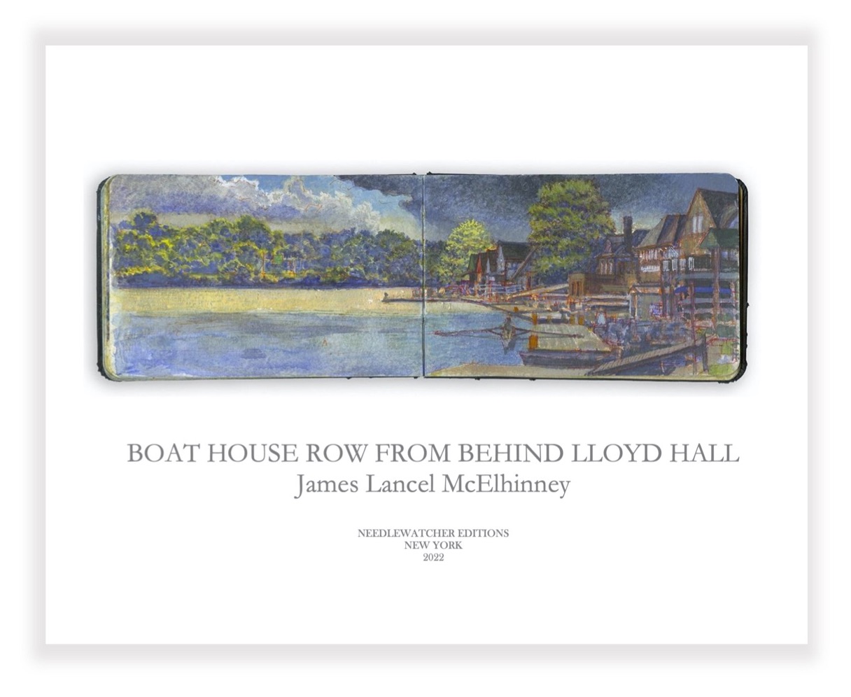 OTW_3. Boat House Row from behind Lloyd Hall. Included in the limited edition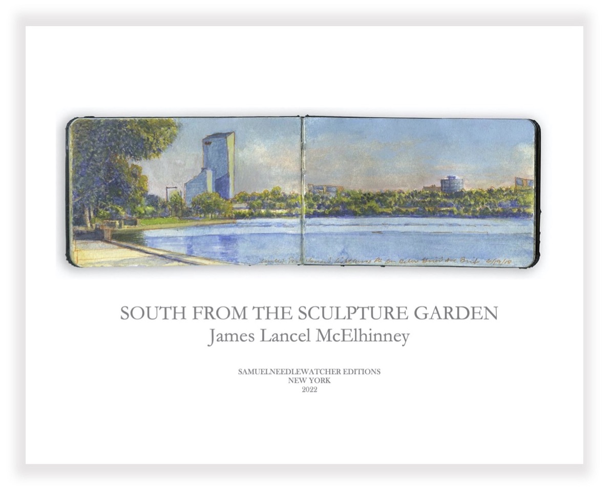
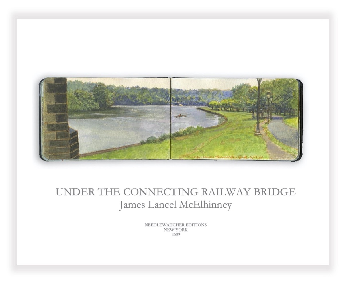 OTW_5. North from under the Railway Connecting Bridge. Included in the limited edition
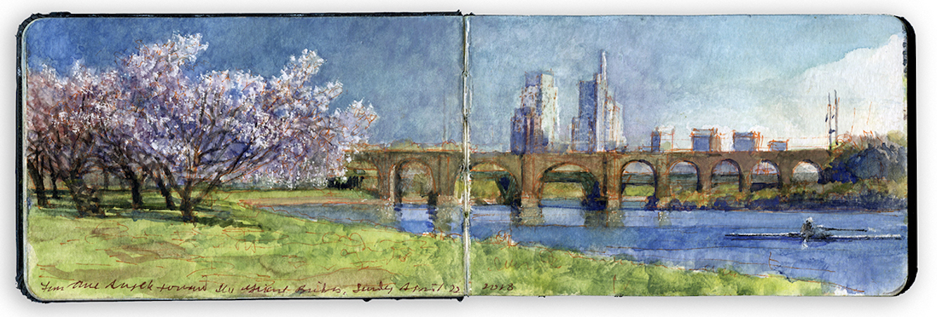
 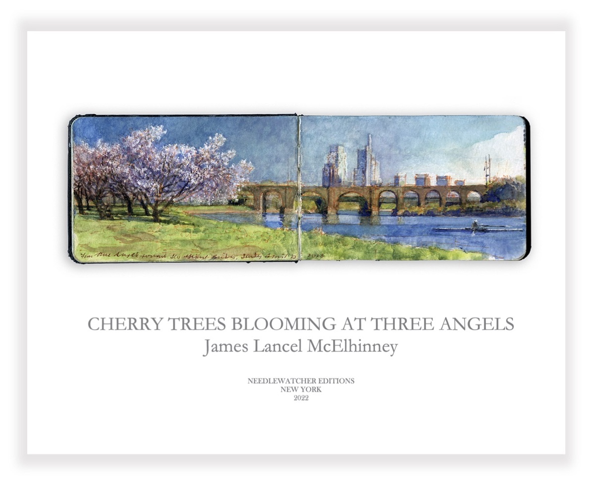 OTW_6. Cherry Trees Blooming at Three Angels. Included in the limited edition
 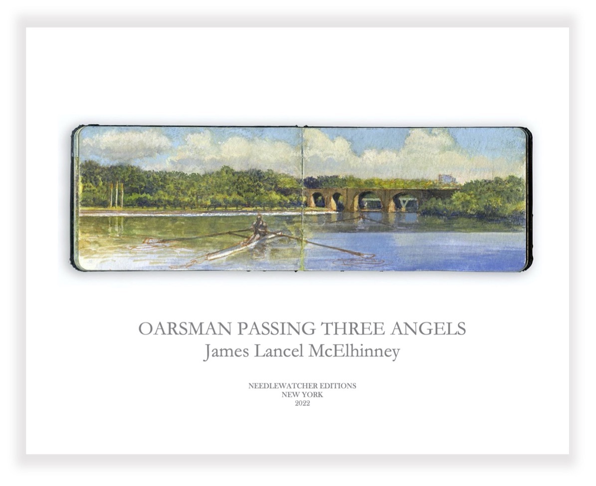 OTW_7. Oarsman passing Three Angels. Included in the limited edition
 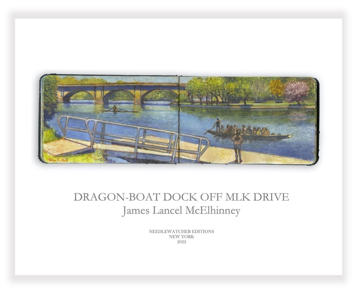 OTW_8. Columbia Bridge and the Dragon-Boat Dock. Price: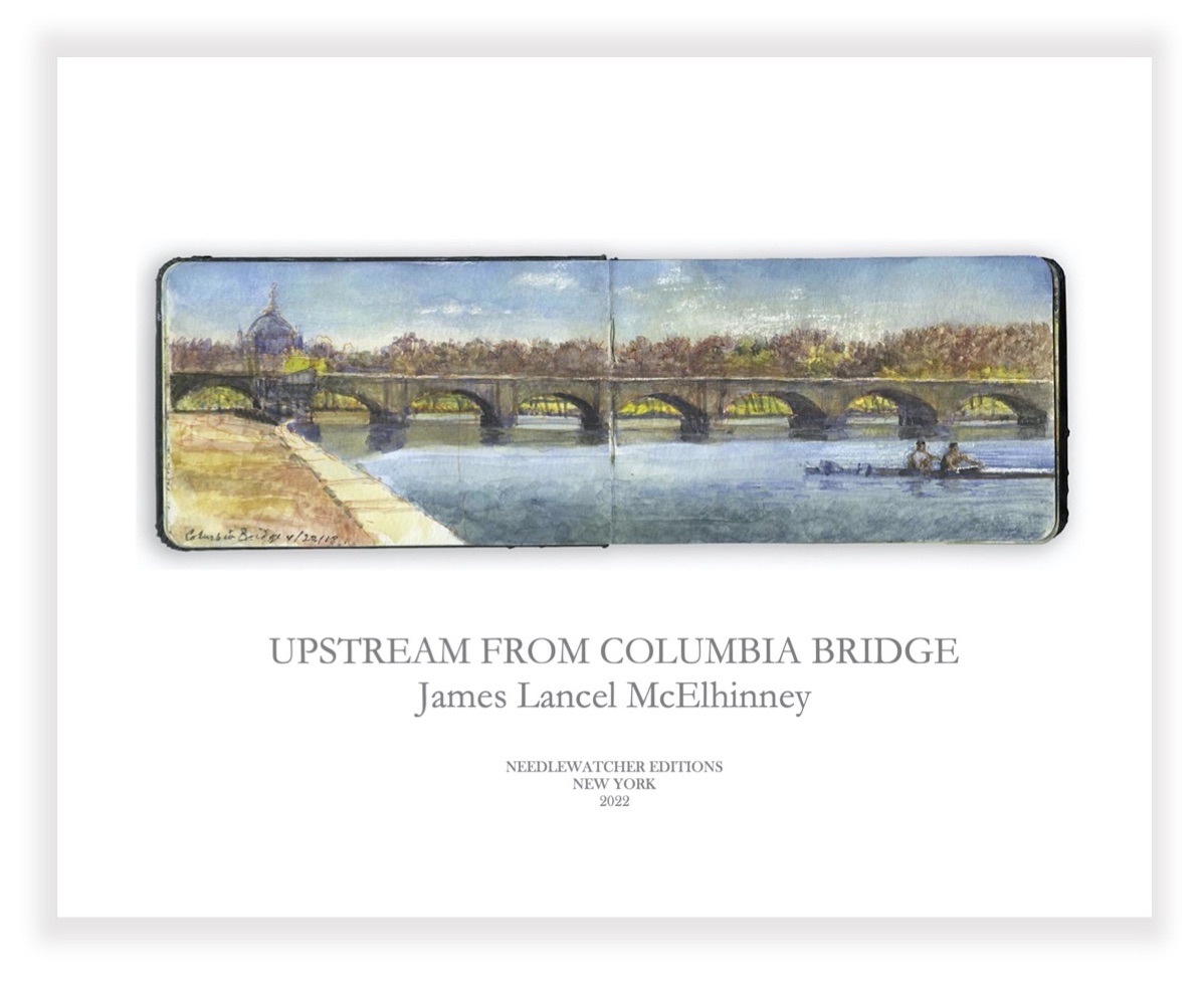
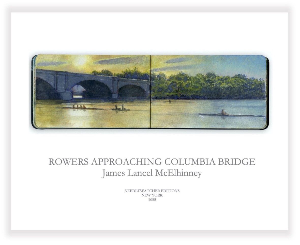 OTW_10. Rowers approaching Columbia Bridge. Included in the limited edition
 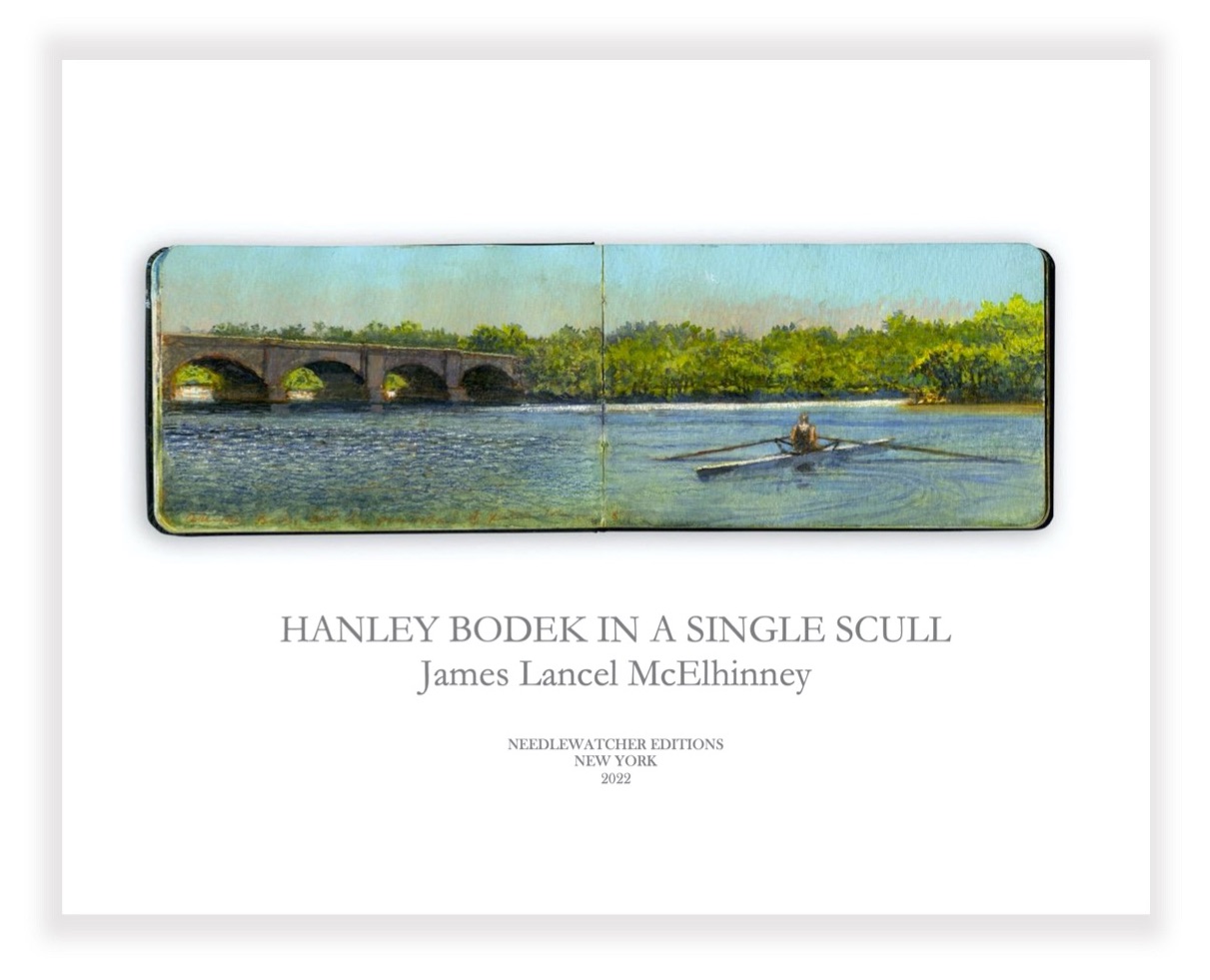 OTW_11. Single. Columbia Bridge. Peters Island.
 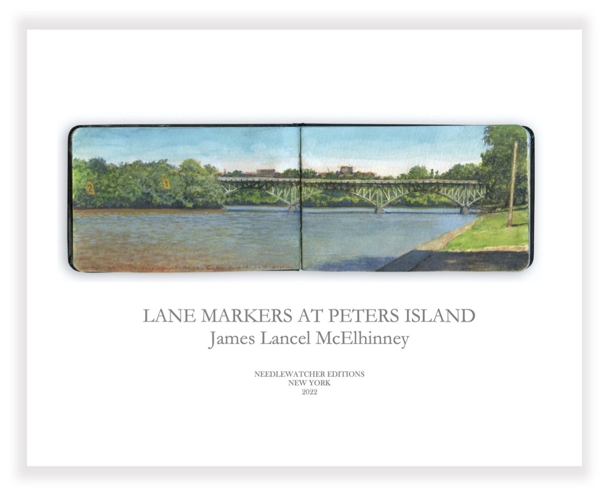 OTW_12. Lane Markers at Peters Island. Price:
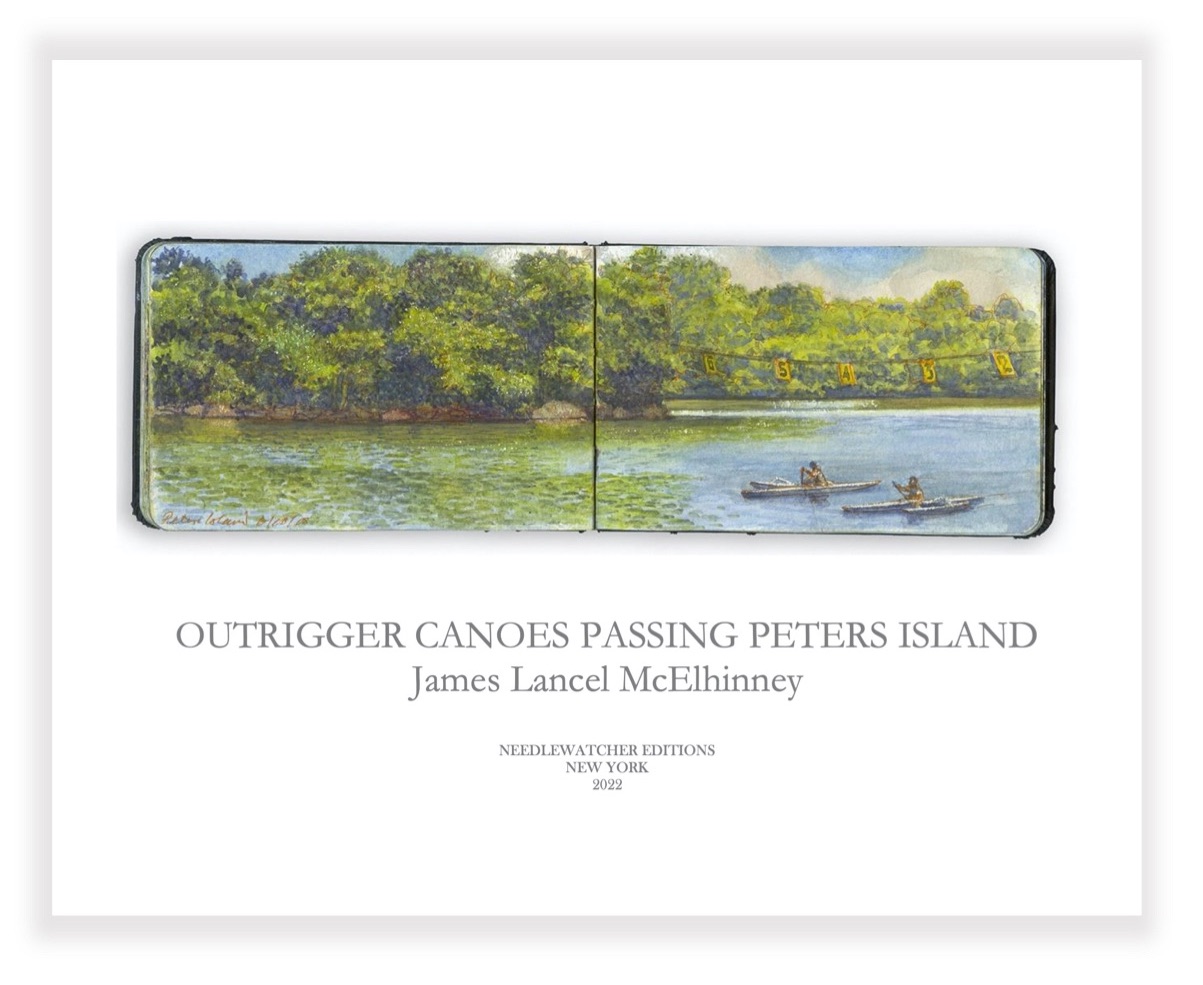 OTW_14. Outrigger Canoes Passing Peters Island.
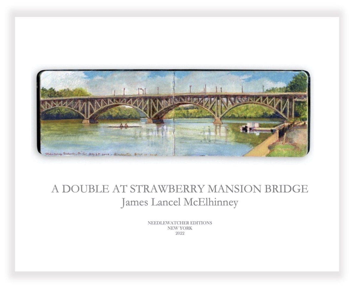 OTW_15. Strawberry Mansion Bridge from Temple Boathouse.
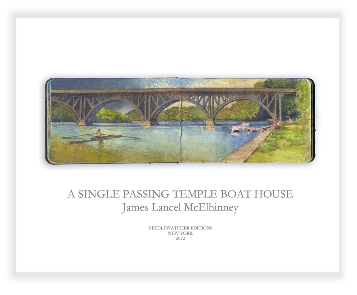 OTW_16. Single Scull Passing Strawberry Mansion Bridge.
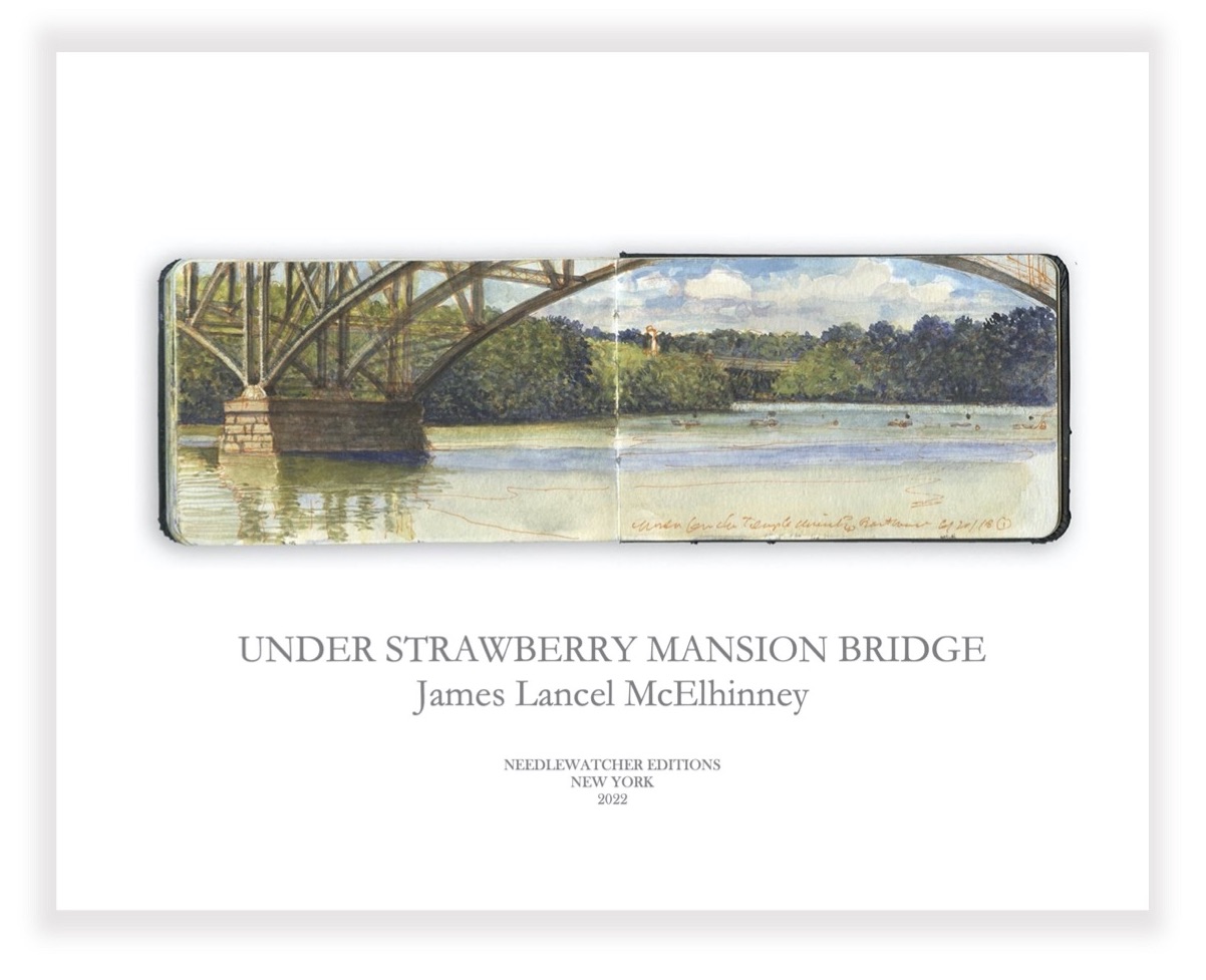 OTW_17. Under Strawberry Mansion Bridge. Included in the limited edition
 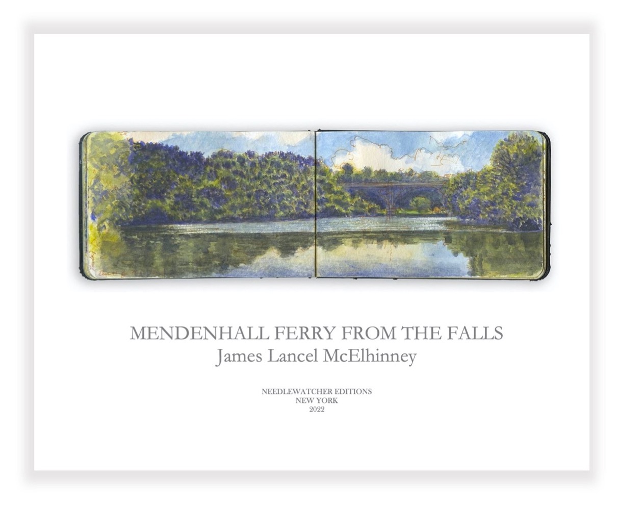 OTW_18. Mendenhall Ferry. Below the Falls.
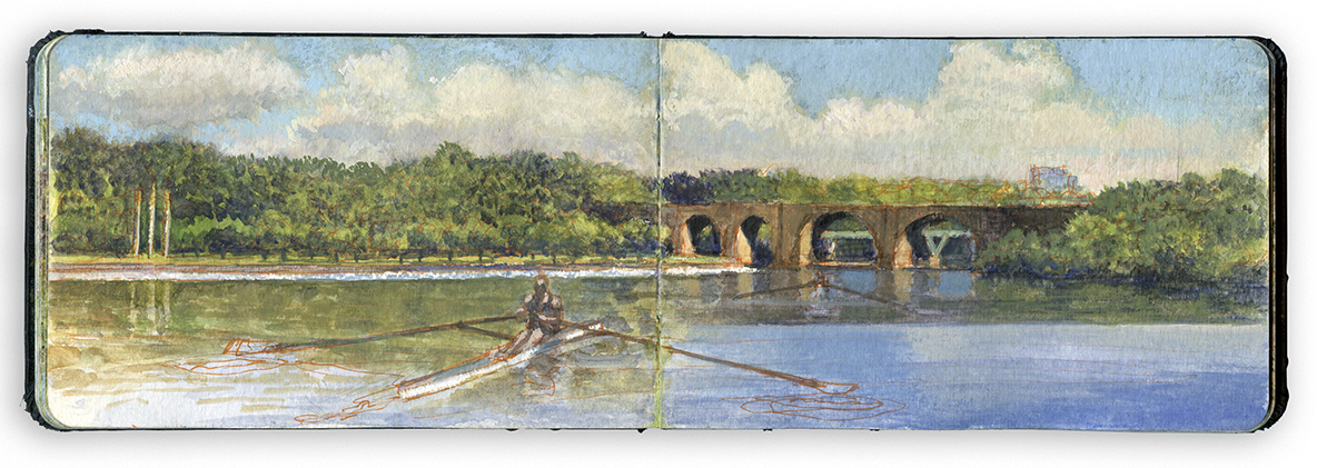
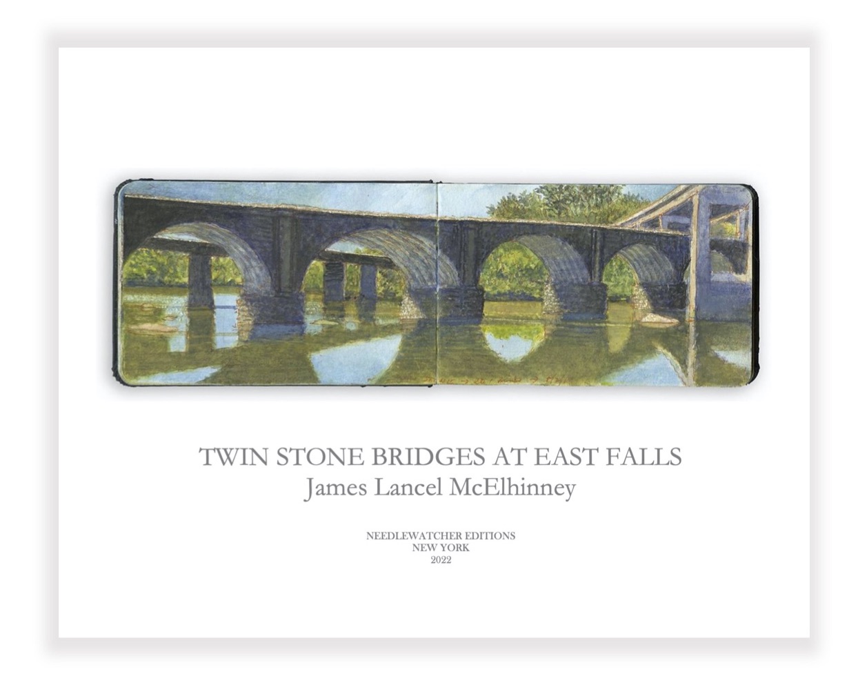 OTW_19. Twin Stone Bridges. East Falls. Included in the limited edition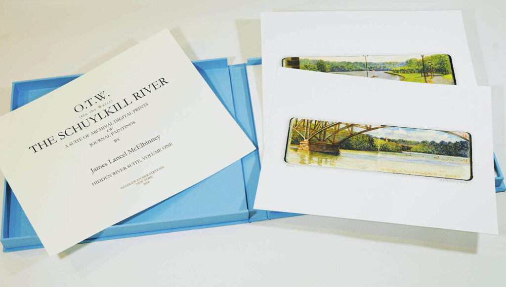
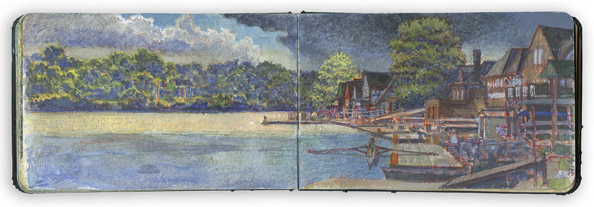 OTW_2. Boat House Row from behind Lloyd Hall. Included in the limited edition
 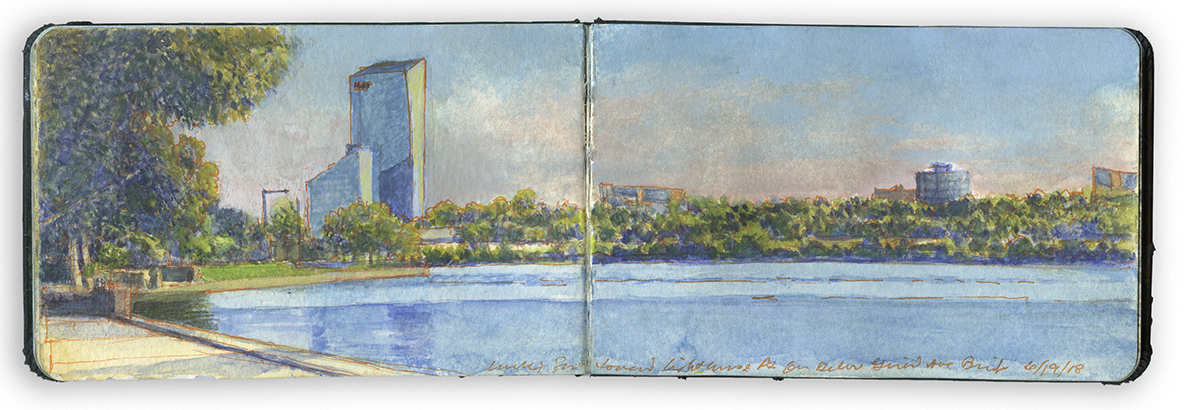 OTW_3. Looking south from the Ellen Philips Samuel Memorial Sculpture Garden.
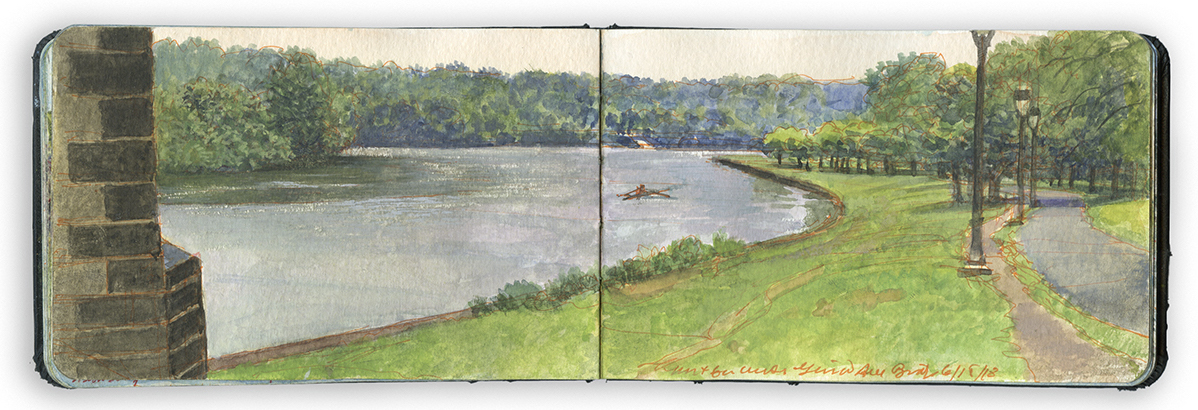 OTW_4. North from under the Railway Connecting Bridge. Included in the limited edition
 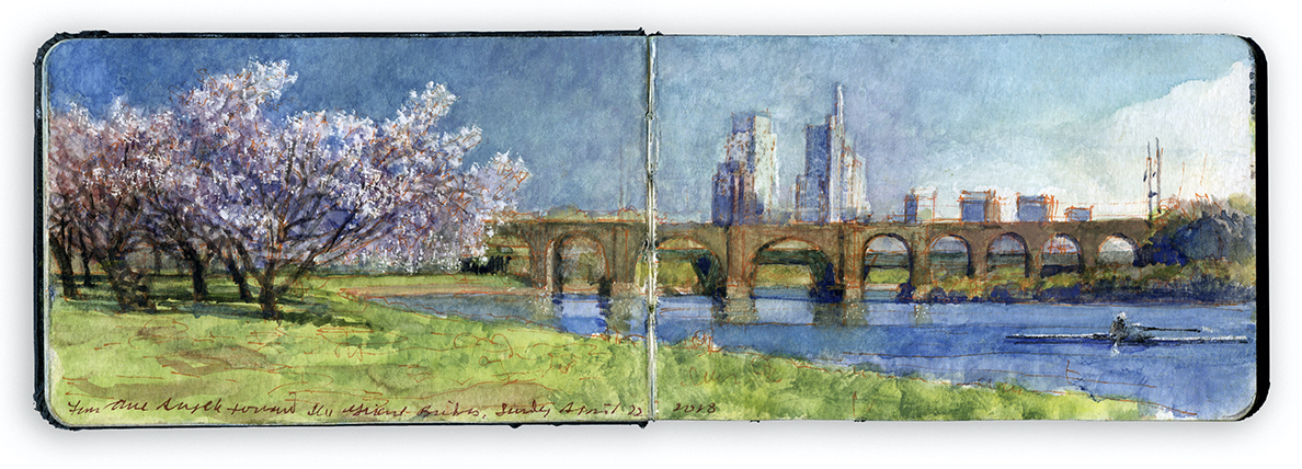 OTW_5. Cherry Blossoms near Three Angels. Included in the limited edition
 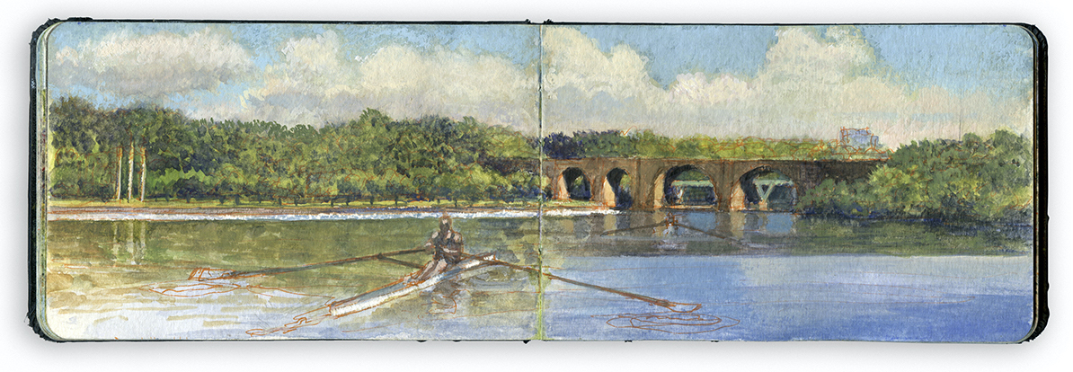 OTW_6. Oarsman passing Three Angels. Included in the limited edition
 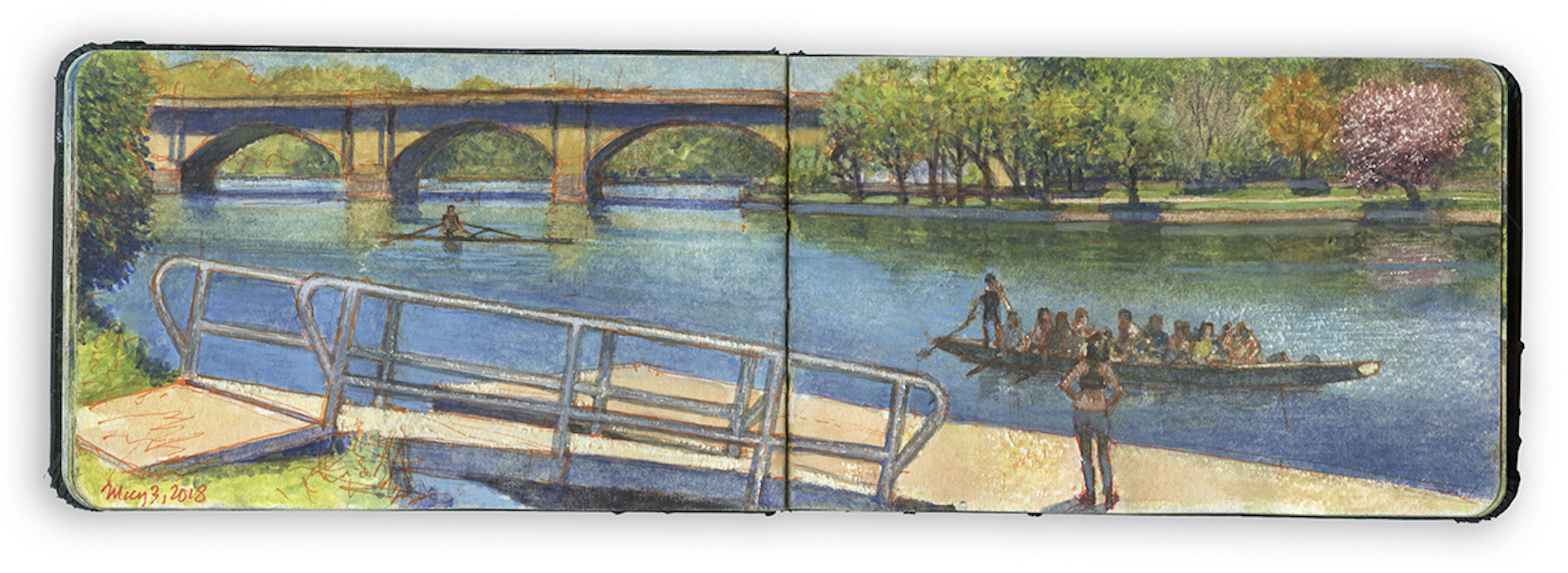 OTW_7. Columbia Bridge and the Dragon-Boat Dock.
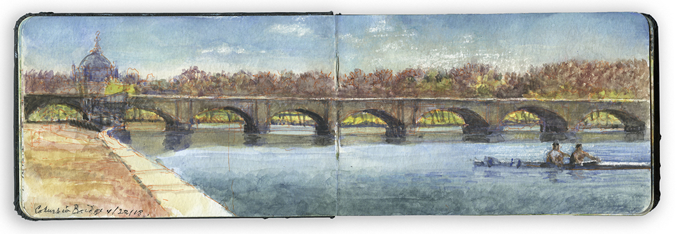 OTW_8. Columbia Double with Memorial Hall. Included in the limited edition
 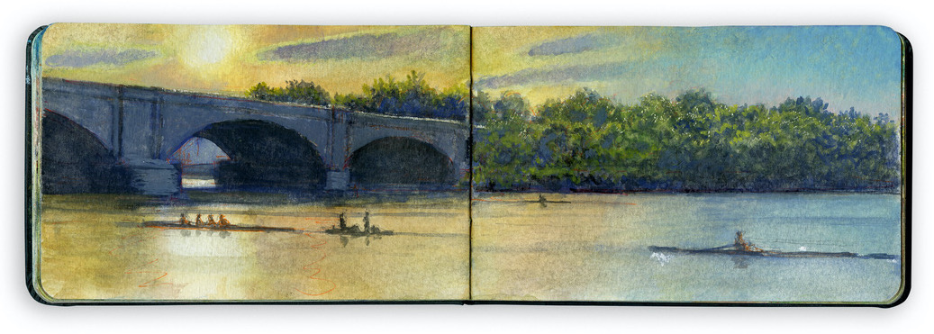 OTW_9. Columbia Bridge at Sunset. Included in the limited edition
 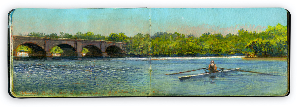 OTW_10. Single. Columbia Bridge. Peters Island.
 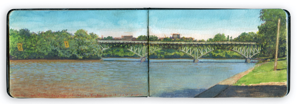 OTW_11. Lane Markers Beside Peters Island.
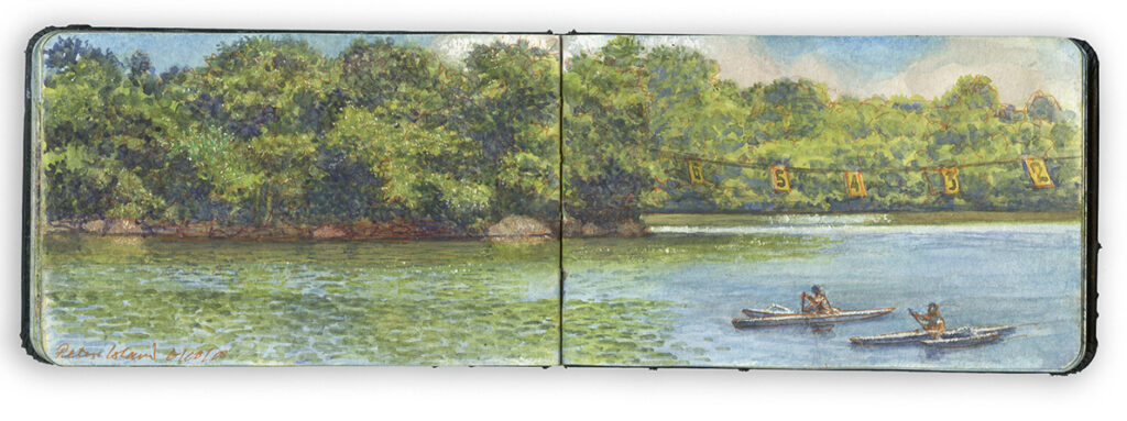 OTW_12. Outrigger Canoes Passing Peters Island. Price:
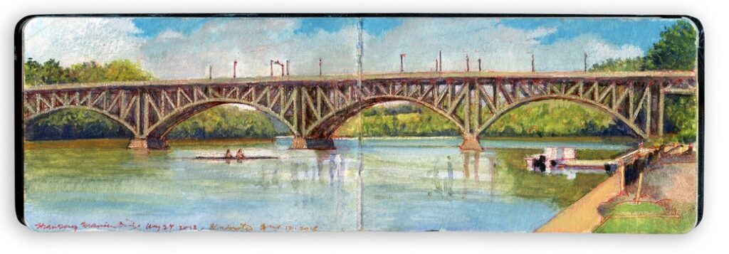 OTW_13. Strawberry Mansion Bridge from Temple Boathouse.
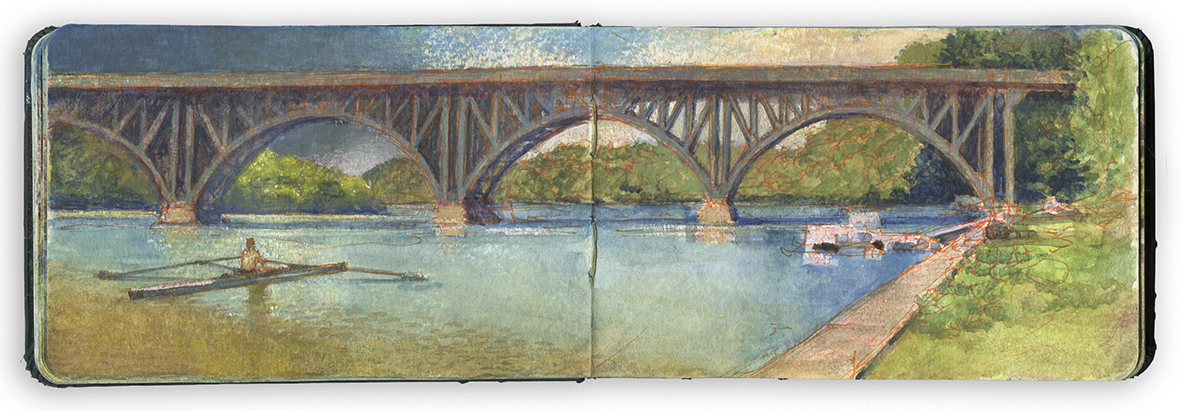 OTW_14. Single Scull Passing Strawberry Mansion Bridge.
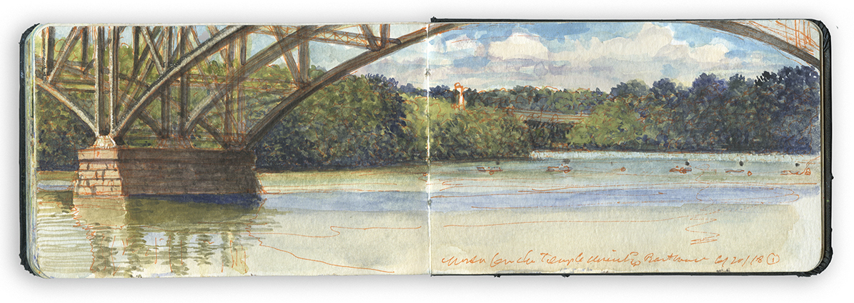 OTW_15. Under Strawberry Mansion Bridge. Included in the limited edition
 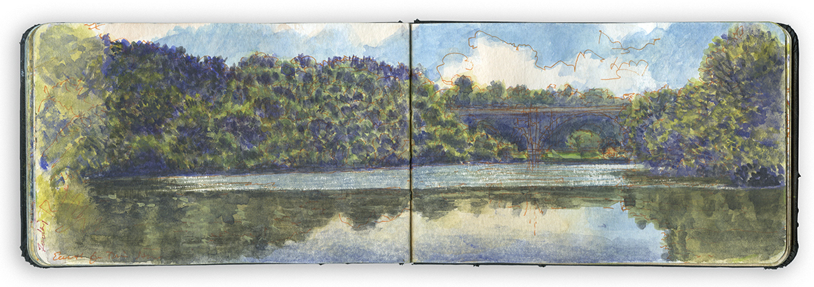 OTW_16. Mendenhall Ferry. Below the Falls.
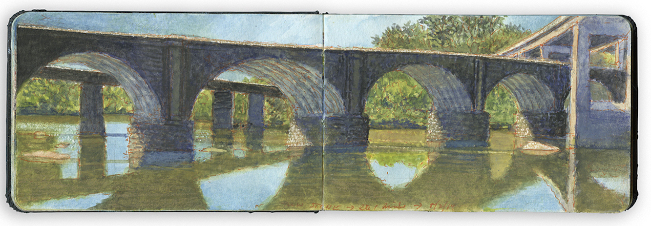 OTW_17. Twin Stone Bridges. East Falls. Included in the limited edition
  At that time, efforts were already underway to publish a hybrid coffee-table/backpacker art-book focused on the Hudson River, from its headwaters above Newcomb in the Adirondacks to Fort Lee on the Jersey Palisades. Amazingly the book was released on time in November 2020, at the height of the Covid pandemic.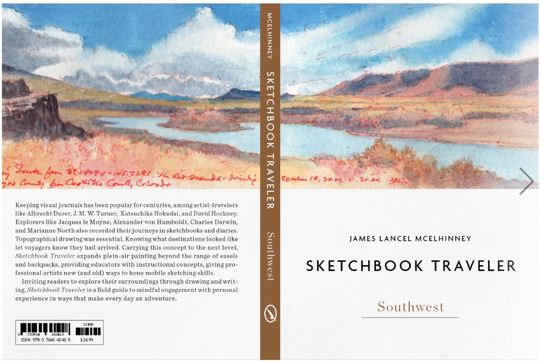

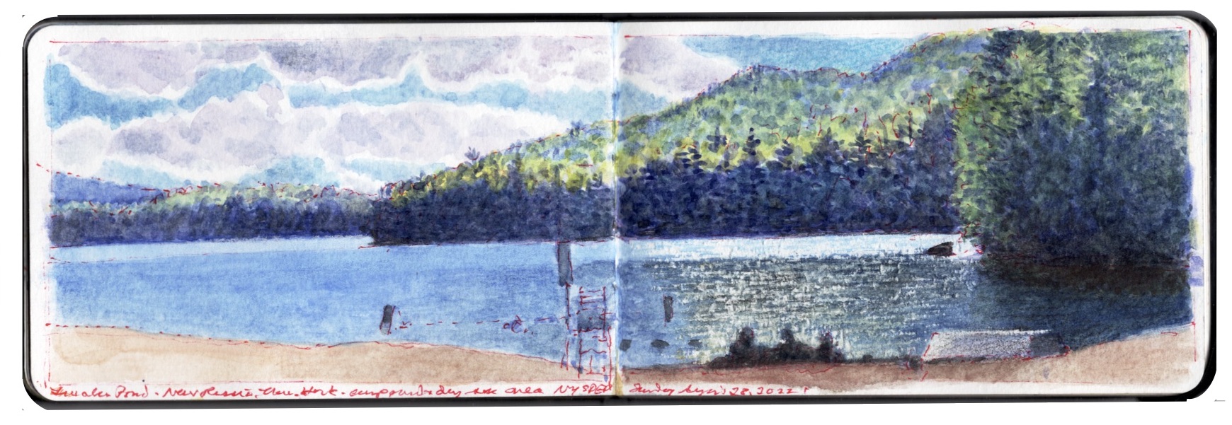 Located in between New Russia and Mineville, New York, Lincoln Pond is a small artificial lake in the eastern Adirondacks. In 1911 a tributary of the Boquet River in the eastern Adirondacks was blocked by an earthen and concrete barrier known as Kingdom Dam, transforming a chain of smaller ponds and wetlands along the Black River into the body of water now visible today. Currently in disrepair, the dam may eventually fail, damaging and destroying downstream properties, while returning the current shoreline to its historic contours.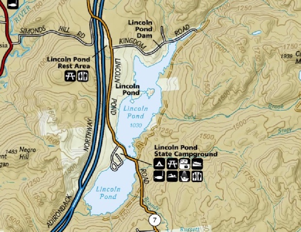

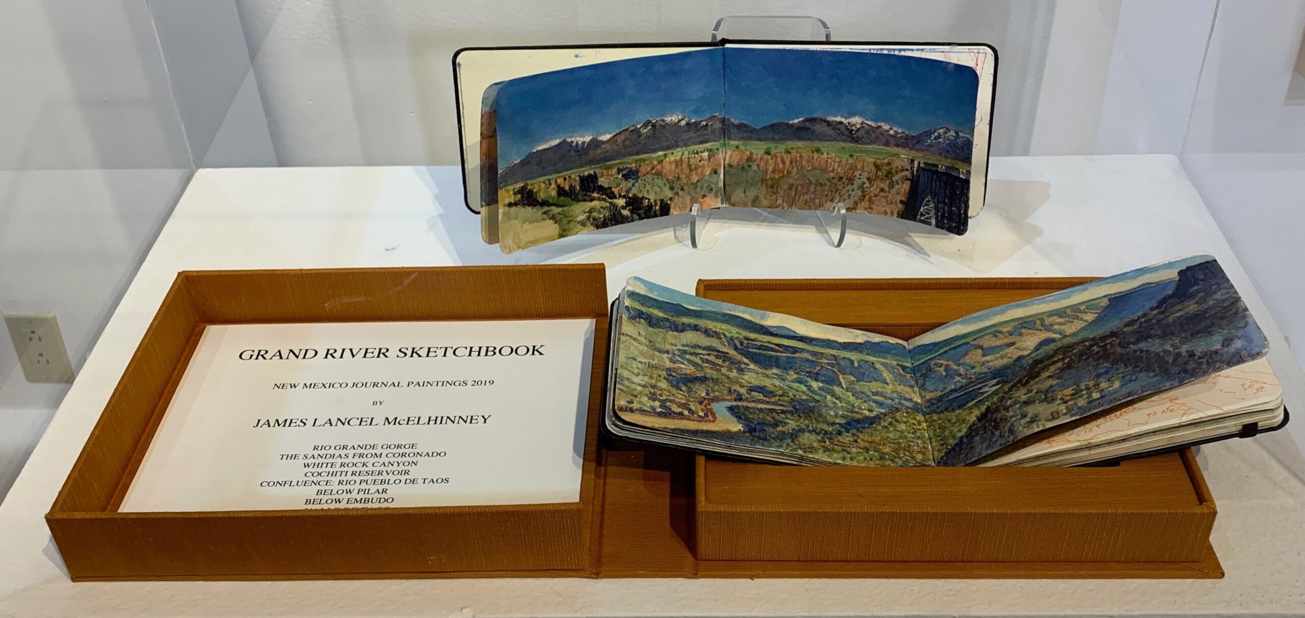 Grand River Sketchbook (unique original painting journal). Watercolor sketchbook 3.5 x 10.5 inches (open) in a fine handmade Solander box by Mita Saldana, Against the Grain Book Binding, Albuquerque NM. Contact Maria Hajic at:
 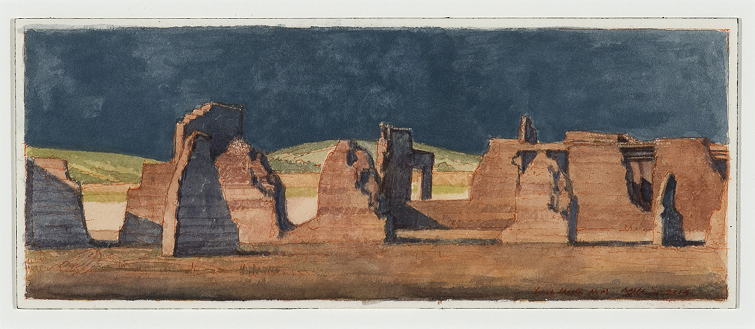 Fort Union. Watercolor. 4 x 10 inches. 2019
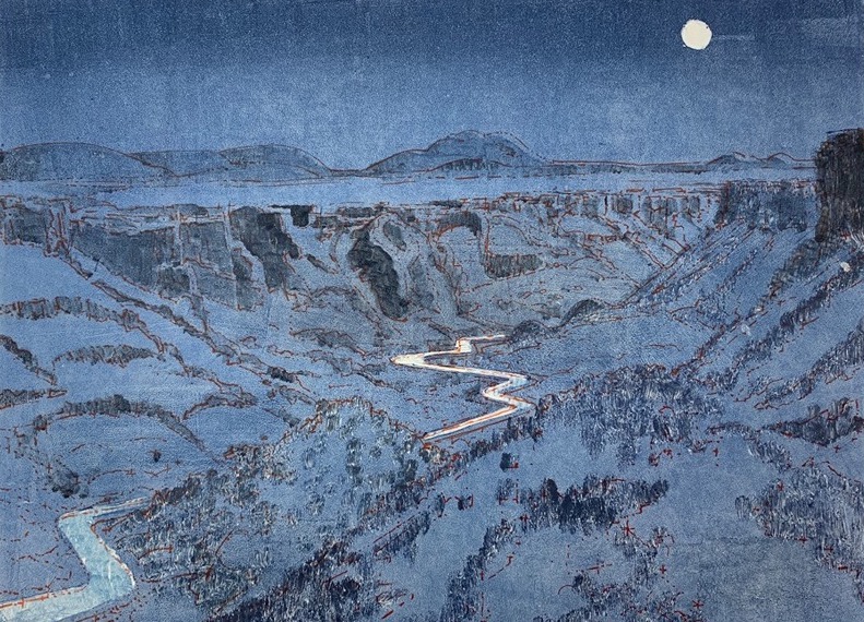 Moonrise, White Rock Canyon. Image size: 14.5 x 19 inches. Monoprint on paper. Sheet size 22 x 30 inches. Printed by
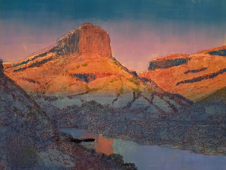 Confluence: Rio Grande & Rio Pueblo de Taos. Image size: 14.5 x 19 inches. Monoprint on paper. Sheet size 22 x 30 inches. printed by Hand Graphics, Santa Fe, NM. 2019
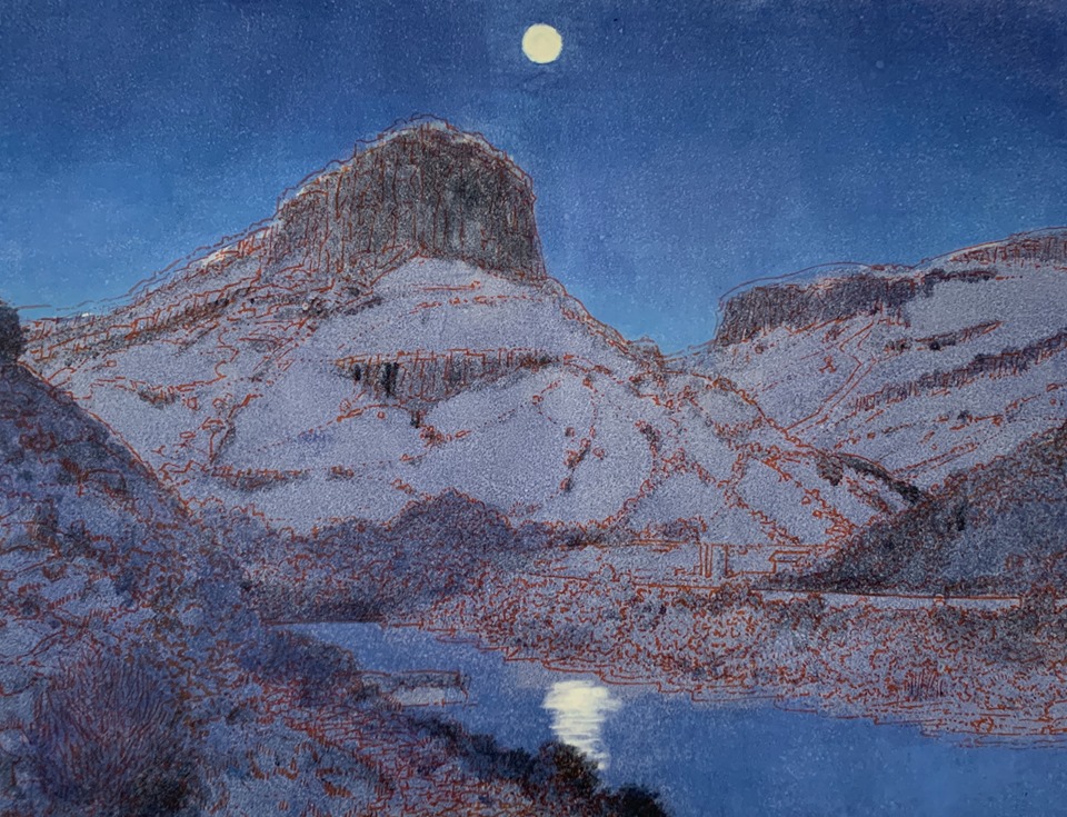 Moonrise, Confluence. Image size: 14.5 x 19 inches. Monoprint on paper. Sheet size 22 x 30 inches. printed by Hand Graphics, Santa Fe, NM. 2019. Contact Maria Hajic at:
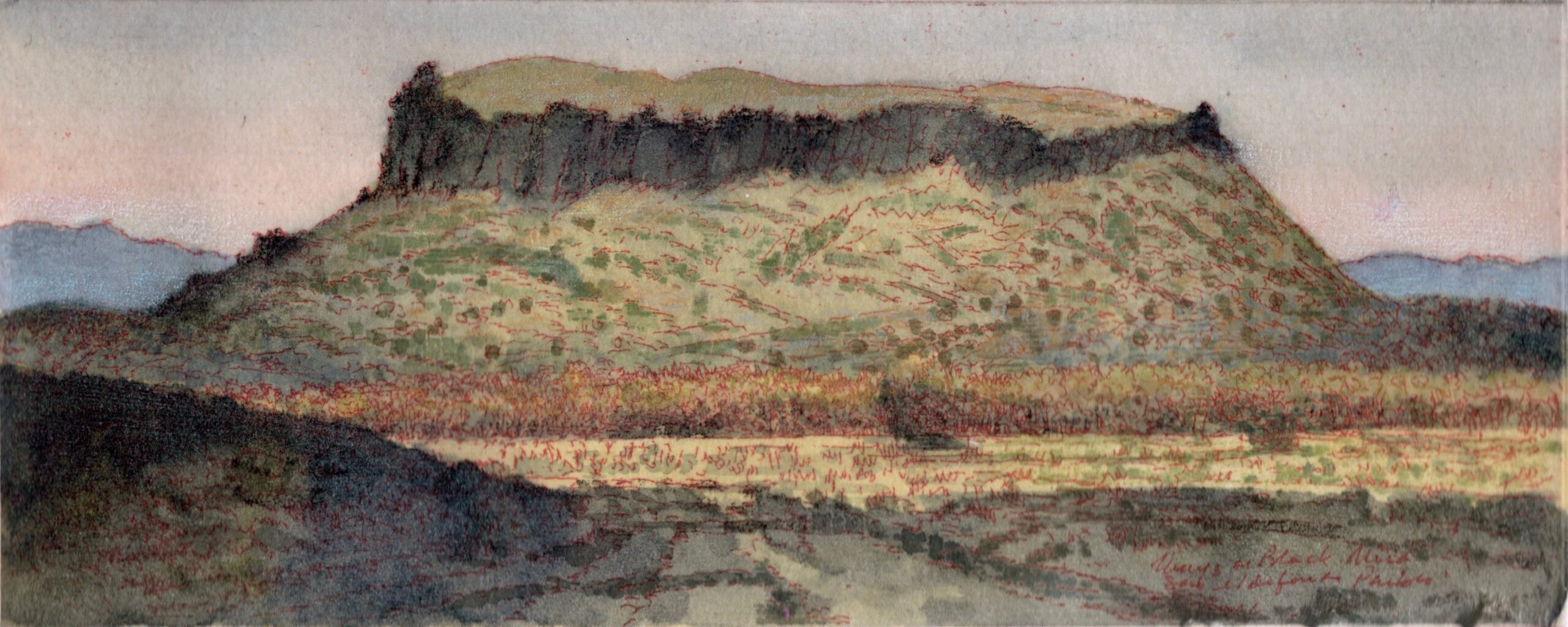 Tunyo, or The Black Mesa. (#3) Hand-embellished color intaglio copperplate etching with digital Chine-colle, printed by Philadelphia Master Printer
 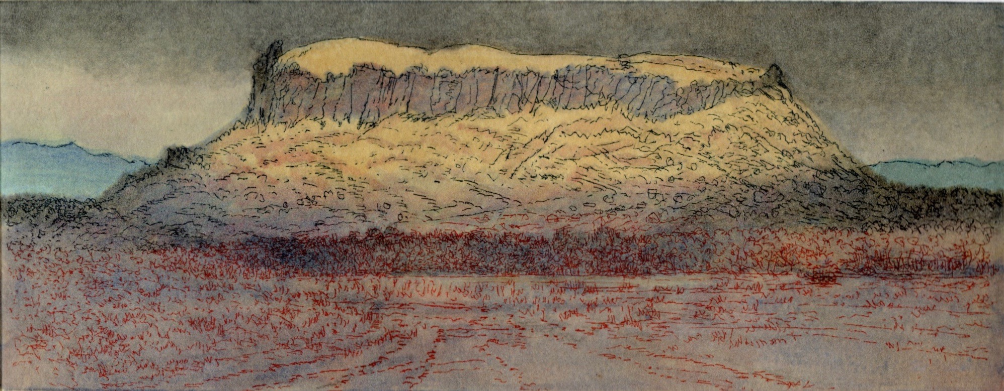 Tunyo, or The Black Mesa (#4) Hand-embellished color intaglio copperplate etching with digital Chine-colle, printed by Philadelphia Master Printer
 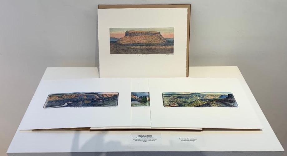 Limited edition of 25: Grand River Sketchbook. 2020. A suite of 10 archival pigment prints. Printed by
  1005 Paseo de Peralta