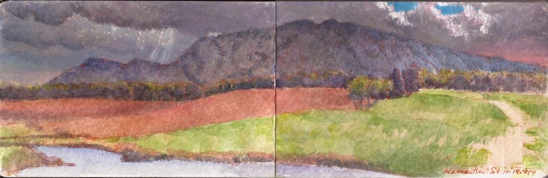
Massanutten Mountain from Belle Grove Plantation. October 18, 2014
Catching a few more winks before reveille, federal troops camped west of the Valley Turnpike just north of a tributary of the north fork of the Shenandoah River called Cedar Creek. Awakened by the piercing yell of thousands of confederates, slumbering federals were driven out of their bivouac. Rather than follow up on the surprise attack with determined pursuit, confederate soldiers fell to looting. By the time order was restored by their commanders, the confederates faced two army corps deployed along the high ground two miles to the north. As the opposing forces met, a crushing counterattack drove the rebels back across Cedar Creek in disarray. Following his defeat on October 19, 1864 Jubal Early never again commanded troops in battle. His opponent Philip Sheridan was promoted to the rank of major in the regular army. The pretty wife of one of his cavalry commanders delivered captured flags to President Lincoln at the white House. She and her husband Autie Custer became celebrities overnight. The drama played out in the shadow of Massanutten, synclinal limestone ridge rising twenty-three hundred feet above the Shenandoah valley in Northern Virginia.

Jedediah Hotchkiss (1828-1899) had been born in Windsor, New York. After completing his secondary education, he taught briefly in Pennsylvania before opening a school in Augusta County, Virginia. Moonlighting as a mining engineer, he took up topographical drawing as a hobby. When sectional conflict erupted in 1861, Hotchkiss joined the confederate army. His mapmaking skills and intimate knowledge of the rails and byways of the Shenandoah Valley made him an invaluable asset to the process of collecting military intelligence and planning operations. On October 18, 1864 Hotchkiss and confederate commander General Jubal A. Early climbed up to Pilot Knob on Massanutten mountain, to view the deployment of Horatio Wright’s VI Corps atop the bluffs north of Cedar Creek.
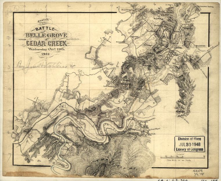
Jedediah Hotchkiss. Map of the battlefield of Cedar Creek. October 19, 1864. the northern end of Massanutten Mountain including Pilot Knob is at the bottom center of the map. MY POV was in the center of grid-section 2-3 horizontal x 4-5 vertical, looking southeast.
I first encountered Hotchkiss’s maps when I met paper conservator Susan Filter. A friend of Roy Goodman, curator of collections at the American Philosophical Society, Susan was working on a large project conserving Hotchkiss material in the collection of the Library of Congress. Timing was perfect. I was at that moment preparing to move to Richmond, Virginia to explore the physical memories of the Civil War, in the form of battlefields threatened by development. Part of my process required comparing historical maps with modern roadmaps and USGS topographical sections. Like Hotchkiss, I was an autodidact where mapmaking was concerned.
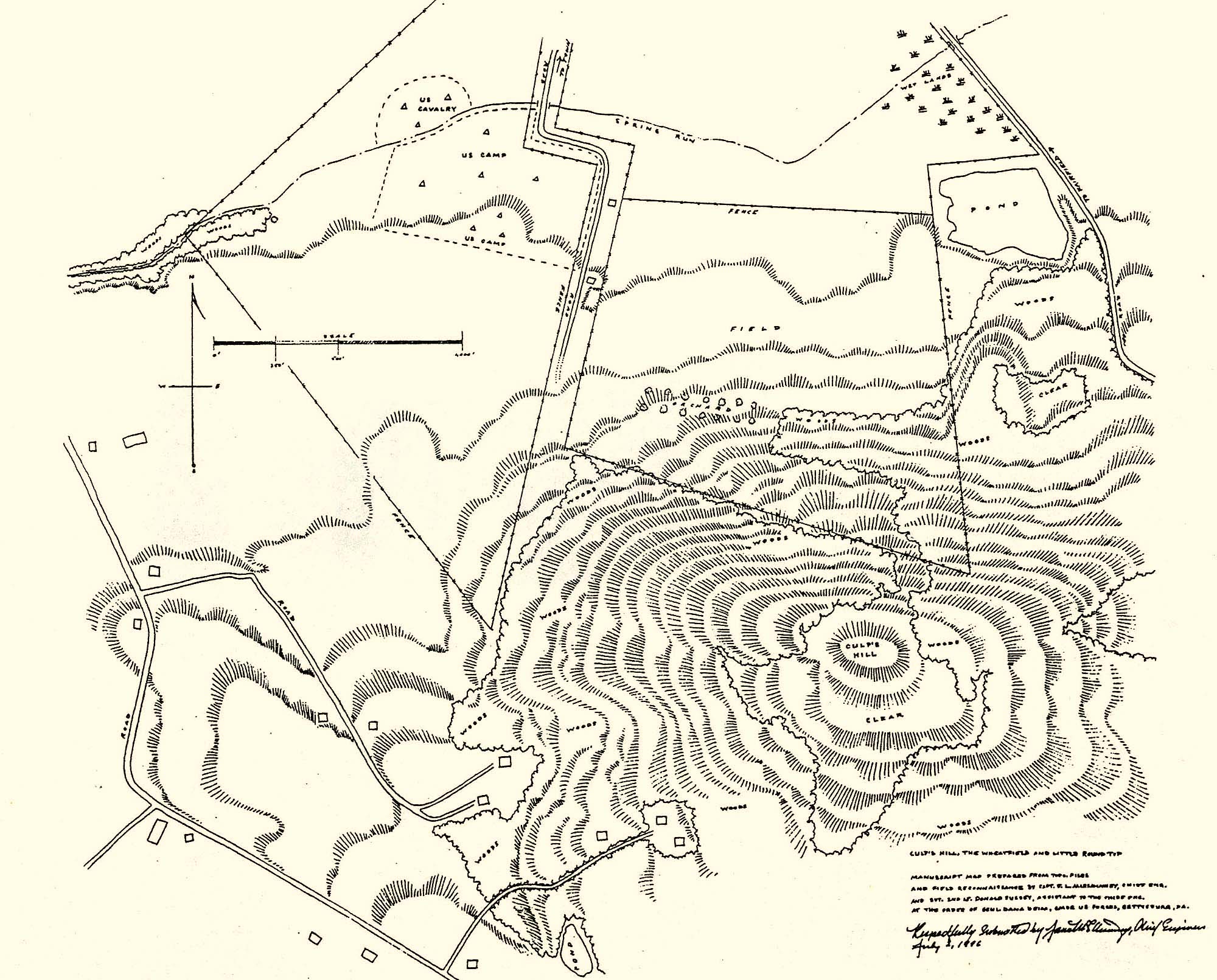
James L. McElhinney. Map of the 143rd anniversary reenactment of the battle of Gettysburg. Fairfield PA. July 2, 1996
On October 15, 2014 I traveled to Middletown Virginia, to participate in the 150th anniversary observances of the battle of Cedar Creek. My role in the reenactment as quartermaster for the National Regiment included laying out the federal camp according to regulations, into a series of company streets, with a separate row of tents for the headquarters and staff. This required measuring the appropriate distances between each street using a Gunter’s chain, then laying them onto the ground with stakes and surveyor’s tape. In effect, the result was a giant drawing several hundred feet in length. I had done something similar the previous year in laying out the camp for the National Regiment behind the Pennsylvania Monument, for the National Park Service Sesquicentennial of the battle of Gettysburg.
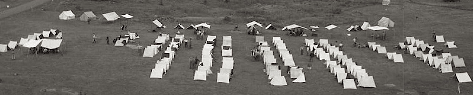
Panoramic view of the federal camp at Gettysburg. July 1-3, 2013
The second step involved directing tenants to their proper place in the camp. More than once someone would set up in the street by lining up the back of their tent with the tape-line. One or two grumbled about having to take everything down and set up again. One feisty individual refused to correct their error, suffering ridicule until he complied. Spraining an ankle before the day was over, I was forced to find quarters in the town. Being hors de combat for the weekend I hobbled around camp for a while, then made my way over to Belle Grove Plantation.
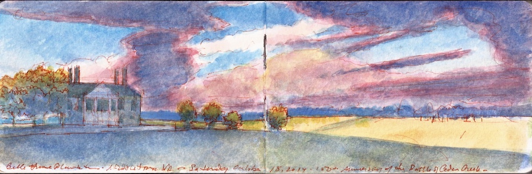
Belle Grove Plantation. Middletown Virginia. October 18, 2014
At the time none of us could have foreseen the events that would follow a three years later, when a suspicious device resembling a pipe-bomb was discovered at the 2017 Cedar Creek reenactment. No one was injured. Following in the wake of neo-confederate and Alt-right protests in Charlottesville a few months prior, anti-fascist activist were blamed for the stunt. Subsequent investigations revealed the culprit was a deeply troubled individual who had been banished from the reenacting unit to which he belonged. The annual reenactment was cancelled in 2018. Attendance the following year suffered from lingering fears stemming from the 2017 bomb-threat. Cedar Creek battlefield is one of the most beautiful and picturesque pieces of rolling rural landscape in Virginia. It and the historic Belle Grove mansion have been preserved by the Cedar Creek Battlefield Foundation, a private nonprofit organization for which the annual reenactments provided a much-needed source of revenue. Plans are underway to hold another reenactment on October 17-18 of this year. In the midst of a global pandemic, and one of the most chaotic election years in U.S. history, all is uncertain. It may be that by lashing out at monuments, American society is drawing on some fundamental iconoclastic Puritanism. Monuments after all, did not enter the canon of American art in any serious way until the late nineteenth century. The land is a different story. New England village greens, and southern courthouse squares represent common ground, where neighbors meet in peace. Fields and pastures where neighbors met in battle are no less sacred. All is hallowed ground.
“In great deeds, something abides. On great fields, something stays. Forms change and pass; bodies disappear; but spirits linger, to consecrate ground for the vision-place of souls… generations that know us not and that we know not of, heart-drawn to see where and by whom great things were suffered and done for them, shall come to this deathless field, to ponder and dream; and lo! the shadow of a mighty presence shall wrap them in its bosom, and the power of the vision pass into their souls.”
–Joshua Lawrence Chamberlain (1828-1914)
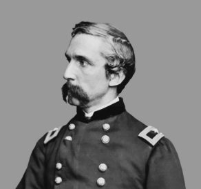
J.L. Chamberlain in the uniform of a brigadier general, ca. 1865
Follow The Sketchbook Traveler on Facebook, Linkedin, Twitter and Instagram.
Peruse previous posts here. Dispatches #1-70. April 1-June 8, 2020.
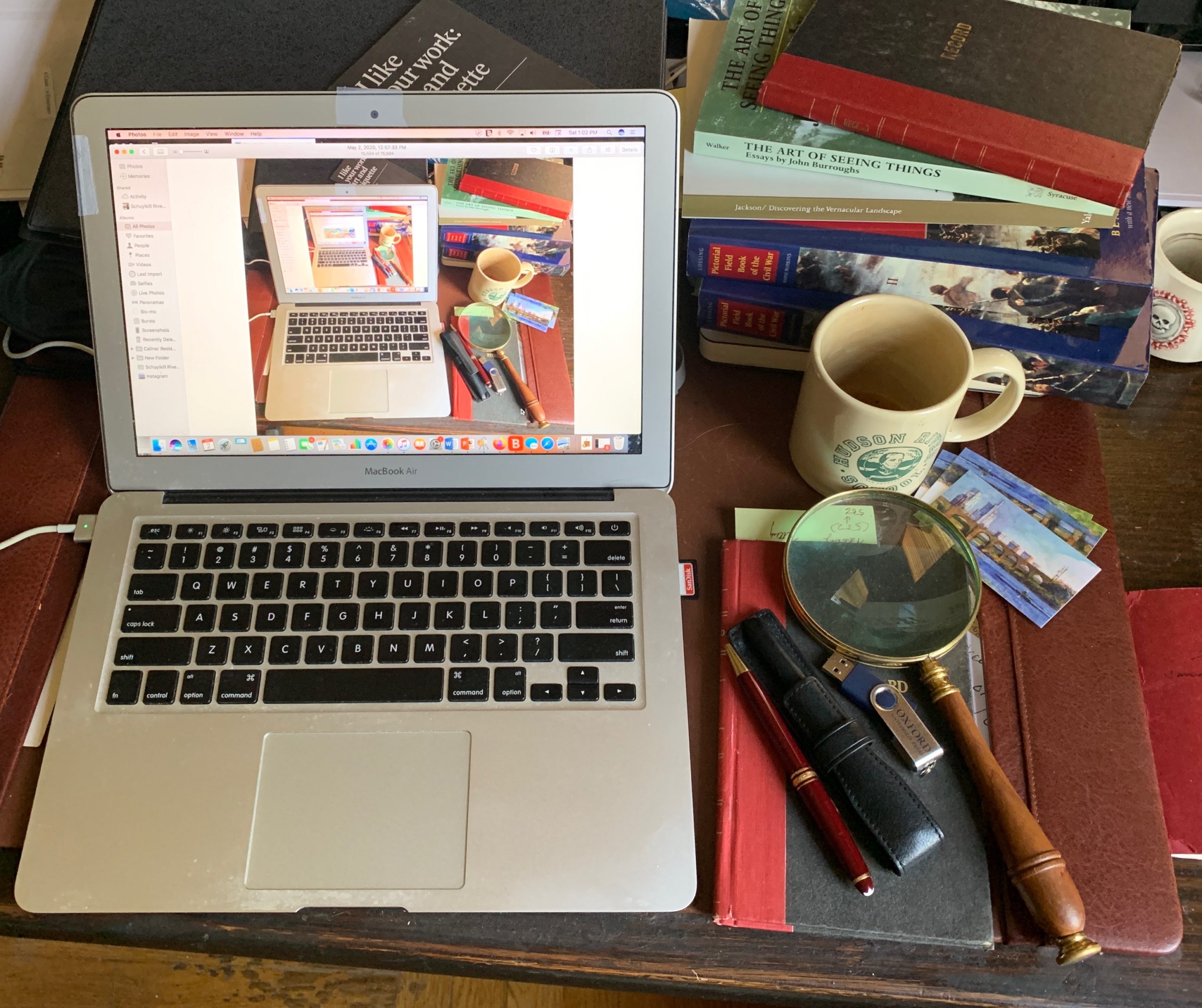
Coming Soon: Hardcover. $24.95. From Schiffer Publishing. Release date: September 2020.