All posts by James L. Mcelhinney

SKETCHBOOK TRAVELER: Dispatch #86. Hall of Horrors


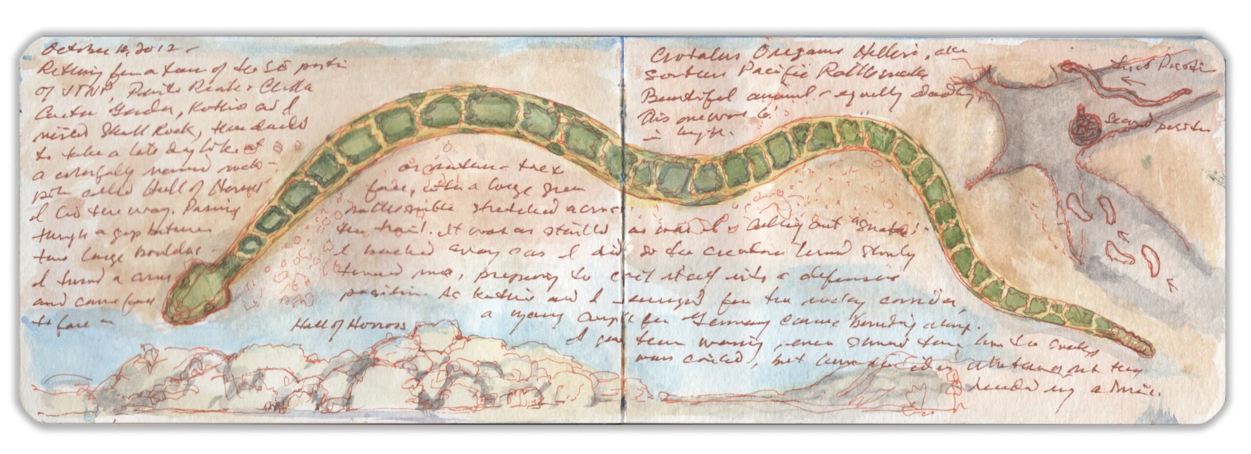
Crotalus oreganus helleri. Joshua Tree National Monument. October 11, 2017

Heading south into the park from the town of Twenty-Nine Palms, one passes striking rock-formations with colorful names like Skull Rock and Hall of Horrors, where I had a run-in with a deadly Southern Pacific rattlesnake. Like its cousin the Mojave Sidewinder, it has distinctive green-and-buff coloration. Taking note of one another, we parted without incident. As Kathie and I withdrew from the site, we warned a group of youths in light raiment wearing flip-flops and suntan lotion not to proceed. Scornful of the danger and sage advice from their elders, they forged ahead. When we got finally got a cellphone signal, we called the visitor center to note our concern. A ranger back at the visitor center brought out a loose-leaf binder. “We have seven venomous species in the park. The one you saw is one of the deadliest, with three kinds of poison; a hemotoxin, neurotoxin and powerful flesh-rotting digestive enzymes. Probably he was looking to score another meal before going into hibernation.” I ask if many visitors get bitten each year. Relatively few, he tells me. Those who do usually provoked the creature, or threatened it in some way. People lose dogs by letting them run off the leash in warmer seasons when snakes are active. The nearest hospital is in Yucca Valley, forty-five-minutes from where we encountered the rattler. Cellphone reception exists only within a few miles of Twentynine Palms. In such an environment, being mindfulness can save lives.

Journal entry:
“October 11, 2017. Returning from a tour of the SE portion of JTNP, Pinto Peak + Cholla Cactus Garden, Kathie and I visited Skull Rock, then decided to take a late-day look at a colorfully-named rock-pile called hall of Horrors. I led the way. Passing between two boulders, I turned a corner and came face-to-face, or rather foot-to-face with a large green rattlesnake stretched across the trail. It was as startled as was I. Calling out “snake” I backed away. As I did, the creature turned slowly toward me, preparing to coil itself into a defensive position. As Kathie and I emerged from the rocky corridor, a young couple from Germany came bounding along. I gave them warning, even showed them how the snake was coiled, but haven’t (an) idea whether or not they heeded my advice. Crotalus Oreganus helleri, aka Southern Pacific Rattlesnake. Beautiful animal—equally deadly. This one was six feet in length.”

Now available to own: Sketchbook Traveler: Hudson Valley

Explore my Quaranteam Dispatches, from April 1-June 8, 2020

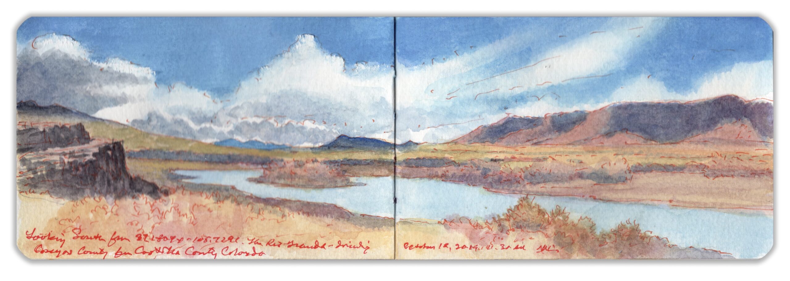
SKETCHBOOK TRAVELER. Dispatch # 85. The Rio Grande: Looking South from Colorado Highway 142.

“It was at the same time one of the most sublime and beautiful inland prospects every presented to the eyes of man…”
–Zebulon Pike. 1807

Dividing Conejos County to the west from Costilla County to the east the Rio Grande traverses the southern margins of the San Luis Basin, then descends between ever steeper and higher banks that downstream widen up to a quarter-mile, reaching depths of more than eight hundred feet. Rising in the San Juan mountains west of Creede the river flows east past Alamosa, turning south past the mouth of Rio Conejos (Rabbit River) to meet another tributary—Rio Costilla (Rib River) just across the New Mexico Border. After studying maps over breakfast at the Windsor Hotel in Del Norte, I follow the Rio Grande past Monte Vista to Alamosa, where I turn south onto Highway 285—the road to Santa Fe. Passing the village of La Jara—named for Cistaceae, a species of desert-flower commonly known as rockrose. Turning east onto Highway 142 at Romeo, past Manassa the road traverses the Conejos River a few miles below its confluence with the Rio Grande. Undulating grasslands spread out to the north, across the San Luis Valley. Further to the south, high-desert sage and pinyon cling to rocky soil. Parking my rental car on the east bank of the Rio Grande in Costilla County, I walk back across the bridge in search of a compelling visual narrative. Big Year birders from Montreal arrive, in search of a migratory rarity spotted in the area. Both upstream and down, the waterway is flanked by modest outcroppings worn by erosion. Green tendrils swayed beneath the clear water. I was surprised to learn that the elevation was eight thousand feet—

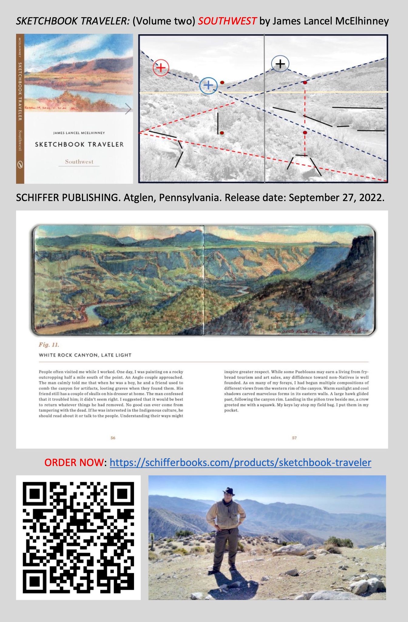
This text is an excerpt from SKETCHBOOK TRAVELER SOUTHWEST,  Now available worldwide.

Watch the recorded book-launch: CLICK on the image below

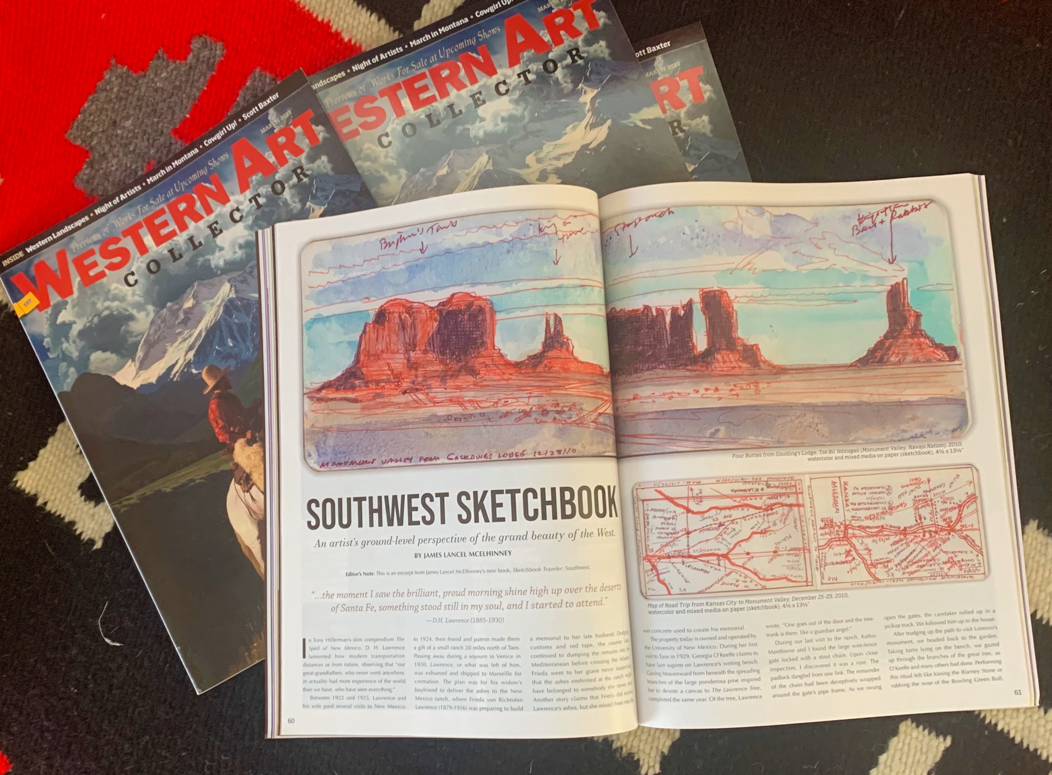
SKETCHBOOK TRAVELER SOUTHWEST is featured in the March 2023 issue of Western Art Collector magazine:

Now available to own: Sketchbook Traveler: Hudson Valley

Explore my Quaranteam Dispatches, from April 1-June 8, 2020

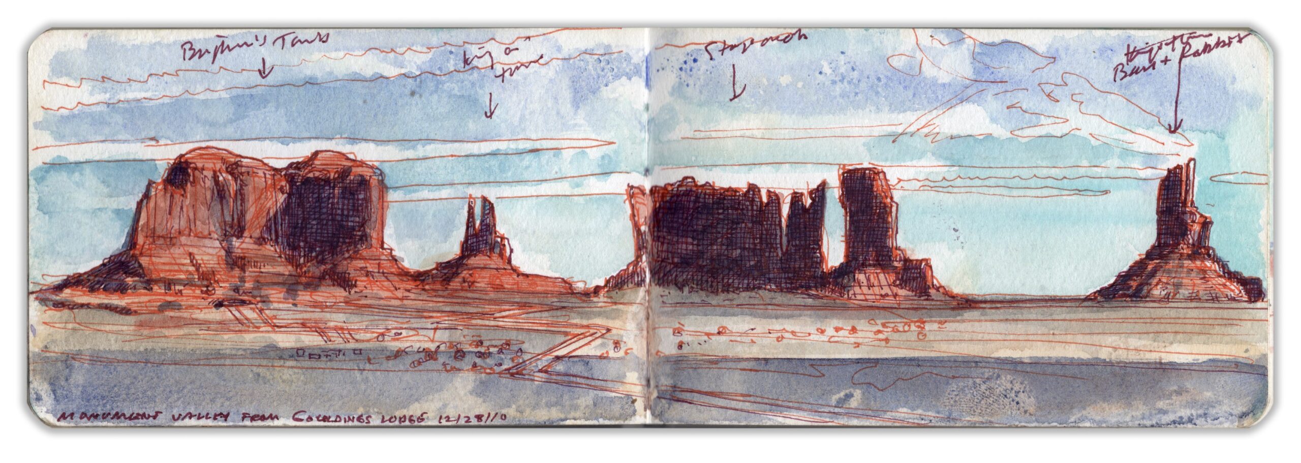
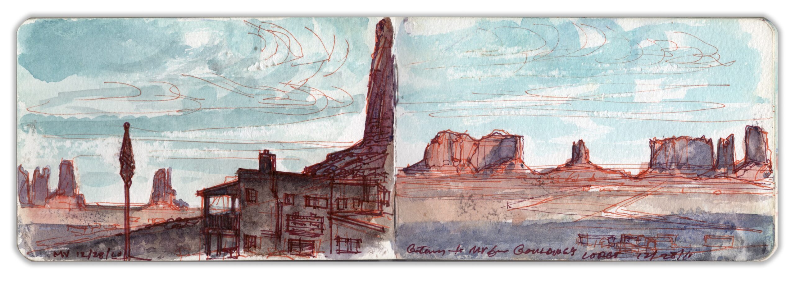
SKETCHBOOK TRAVELER: THE SOUTHWEST: Dispatch # 84. Four Buttes from Goulding’s Lodge. Tsé Biiʼ Ndzisgaii (Monument Valley, Navajo Nation) December 28, 2010.

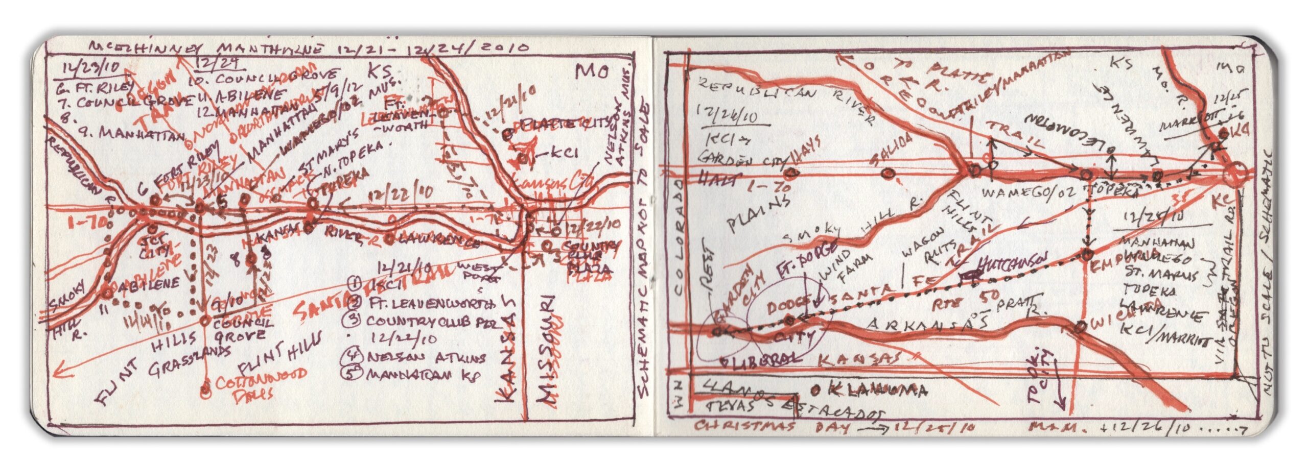
Saturday December 25, 2010. Walking up to the car rental desk at Kansas City airport, I laid the contract on the counter. The attendant asked for our flight number. Looking it up, he calmly informed us that due to a blizzard on the east coast, nothing was flying in or out of any of the New York City airports. I asked if he could find out how long this would continue. Placing another call, he informed us that it would be five or six days before we could get seats on another flight. No guarantee, but maybe next Thursday or Friday. He also informed us that a massive winter storm was brewing on the Pacific coast. There had been snowfall in Los Angeles for the first time in many years. Kathie looked at me and asked, “How far is it from here to Monument Valley?” Trying to compose a quick, coherent answer, I calculated the distance, potential delays, and the challenges of returning in time to catch our return flight, then gave her my answer. “Let’s go”.

Crossing the Missouri River back into Kansas, we picked up the Santa Fe Trail, shadowing US Route 50 beyond Emporia. Along the roadside, wagon-ruts could still be seen, carved into the rolling prairie. Following a late lunch in Dodge City, we spent the night in Garden City. After breakfast we crossed into Colorado, calling at the ruins of the WW2-era Amache Japanese-American internment camp before pausing in La Junta for lunch, and a visit to Bent’s Old Fort National Historic Site. Passing Spanish Peaks and La Veta Pass, we pressed on across the San Luis Valley. As we retired for the night at a hotel in Durango, we learned that Wolf Creek Pass, which we had traversed just hours before was again buried in snow.
Rising before dawn we descended past Mesa Verde in our approach to the Four Corners area. A rosy point of light to the south, the pinnacle of Ship Rock soared above the vast grey expanse below. Famished, we stopped for breakfast at Kayenta–known locally as “K-town”. Two elderly Navaho men sat by the window, enjoying their breakfast. Apart from them, we were the only customers. Switching back and forth between English and Dine, a radio announcer unpacked the weather report and tribal news. Our server was polite but diffident. Locals had long ago gotten used to belagana (Americanos) passing through en route to Monument Valley.Half an hour after paying our check we arrived Goulding’s Lodge, the guest-ranch and hotel used by John Ford as his base-camp in filming many of his westerns. Famous for its spectacular chessboard of tall sandstone buttes, it became synonymous with the cinematic west. Left to right: Brigham’s Tomb, King-in-his-Throne, Stagecoach, and Bear-and-Rabbit. Needless to say, the Diné have other names for these formations. This page-spread was delineated upon our arrival.

SKETCHBOOK TRAVELER: Dispatch # 83. Pinto Peak. Joshua Tree National Park. October 12, 2017.


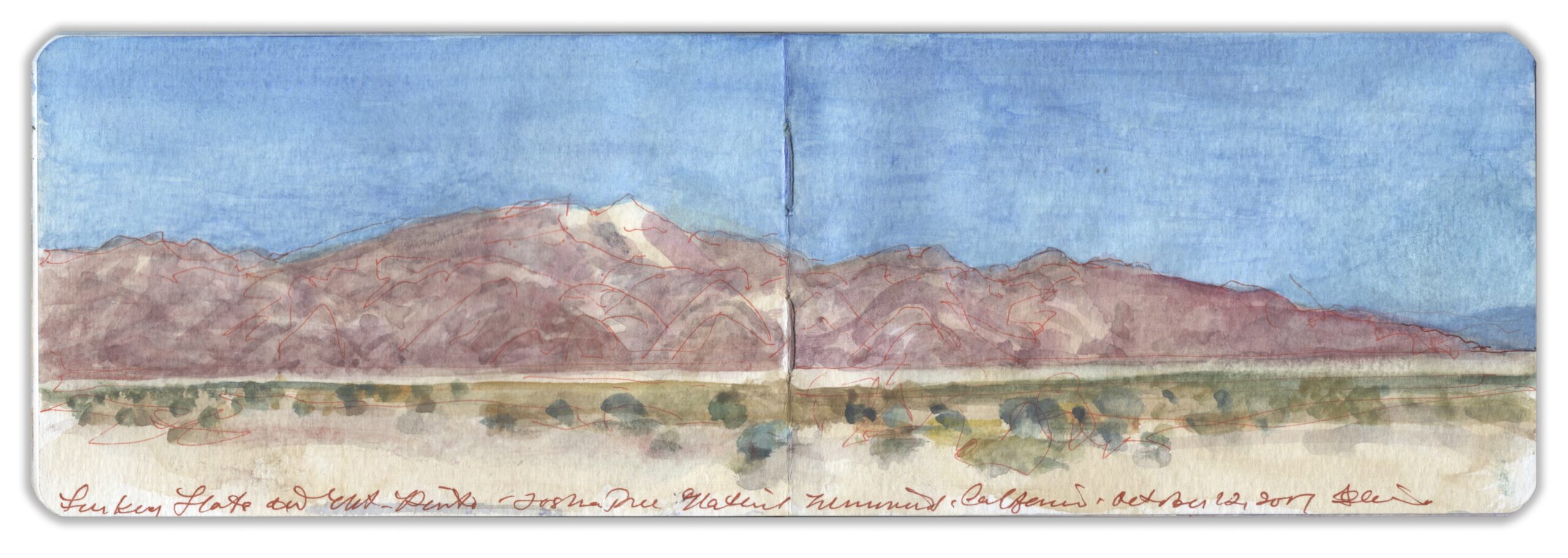
Turkey Flats and Pinto Peak. Joshua Tree National Monument. California. October 12, 2017. Watercolor on paper. 3.5 x 10.5 inches (Moleskine watercolor journal)

Joshua Tree National Monument sits atop a plateau where the Mojave Desert to the north meets the Sonoran Desert to the Southeast. The park is named after a distinctive species known officially as Yucca Brevifolia, to the Spanish as Izote de desierto, before receiving its popular name Joshua Tree from a band of Mormon settlers. Otherworldly rock formations created by volcanism and erosion, cyclopean boulders and outcroppings sculpted by erosion provide a perfect backdrop for Westerns, science-fiction movies and automobile commercials.


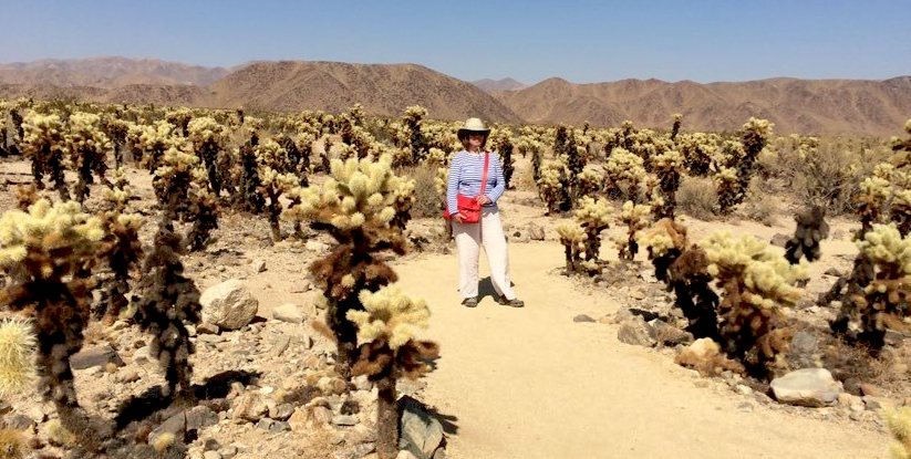
Kathie Manthorne among the “jumping” Cholla. October 12, 2017

Traveling southeast on the park road, one finds less abundant plant-life before entering a scorched wasteland at the foot of the Hexie Mountains. En-route to the Cottonwood Visitor Center is a large patch of fuzzy Cholla cactus. Cylindropuntia fulgia is dreaded for its flesh-stinging nettles that are said to leap at passers-by. The trail is well-marked, with frequent cautions against touching the plants. A small group of insouciant pretty young Asian women in party-dresses and high-heels run among the cacti snapping selfies and othersies. As they gambol among the Cholla, a massive SUV arrives. Out of the vehicle steps a very large man in an evening-gown, having a Priscilla Queen of the Desert moment. Three male handlers and female photographer follow him through the Cholla-garden as he strikes poses. His long diaphanous yellow scarf floats on light breezes, its selvedge licking the nettles. Further along Pinto Basin Road a parking-area faces a desolate plain known as Turkey Flats. To the southeast, Pinto Mountain rises to an elevation of nearly five thousand feet.

Now available to own: Sketchbook Traveler: Hudson Valley

Explore my Quaranteam Dispatches, from April 1-June 8, 2020

SKETCHBOOK TRAVELER: Dispatch Number 82. Headwaters of the Rio Grande

An excerpt from Sketchbook Traveler: Southwest. Schiffer Publishing. September 27, 2022. Click on the image below for a look inside the book:

Bachelor Mountain above Creede, Colorado from below Wagon Wheel Gap Journal-painting 3.5 x 10.5 inches. October 17, 2019

North of Del Norte Colorado is the La Garita caldera. Its massive eruption during the Cenozoic era dumped vast quantities of ash and debris across the surrounding terrain. Twenty-five-million years of erosion have created rocky spires and other picturesque formations located within the Wheeler Geological Area managed by the U.S. Forest Service. Similar formations extending to the west include Bachelor Mountain, which rises above the village of Creede, Colorado. During the 1880s, silver mines fueled a booming community. Like many mining-camps Creede became a den of iniquity, infested by organized crime. Silver mining declined in the wake of the Panic of 1893. Ranching continued in the bottomlands south and west of Creede. Mining survived on Lead, Zinc and Copper. Dude ranches and fly-fishing camps along the headwaters of Rio Grande today contribute to the local economy. Driving north from del Norte past South Fork, Colorado Highway 149 ascends the Rio Grande through a deep defile, framing the distant distinctive mass of Bachelor Mountain—an outlier of the Wheeler formations ten miles to the east. Readers wondering why I did not hike to the ridge-line for a better view, the first rule of traveling in wilderness areas is never to do it alone. Leaving the car on a wide shoulder above the river, I located this prospect looking northwest from 37.7592 x -106.7813. Framed by high wooded ridged on both sides, Bachelor Mountain was reminiscent of Titian’s Dolomites, Thomas Moran’s Mount of the Holy Cross and Cezanne’s Mont Sainte-Victoire.

Now available: Sketchbook Traveler Southwest. Schiffer Publishing. September 27, 2022

Click on the image below to learn about Sketchbook Traveler: Hudson Valley

SKETCHBOOK TRAVELER. DISPATCH # 81. Facts and Fictions


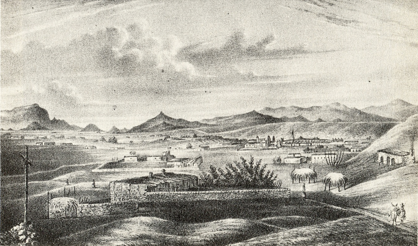
Richard Hovenden Kern. View of Santa Fe from Fort Marcy. 1849, Notice the emphasis given to distant landmarks.

Looking east beyond the dam lie the Ortiz Mountains, which on Dick Kern’s view of Santa Fe from Fort Marcy are identified as the Placer Mountains. Curious to compare Kern’s rendering of the vista with how it might look today, I climb up to the ruins of the fort and look southward.
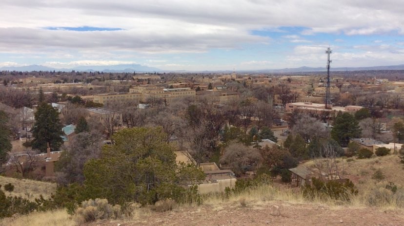

View of Santa Fe. March 4, 2019. 10:52 AM. Photo by the author. Notice how minuscule are the topographical elements which in Kern’s drawing are so prominent.

Confirming that I was in the right location was the presence on the right of Bishop’s Lodge Road, known in 1849 as the Old Road to Taos. The rugged cross on the left of Kern’s drawing honors the twenty-one Franciscans killed during the Pueblo Revolt of 1680. What strikes me about Kern’s drawing are liberties he took in representing various landmarks in scale. The Sandias are instantly identifiable, as is Cerro Tetilla (nipple hill), and east-facing slopes of the Jemez Mountains to the right.
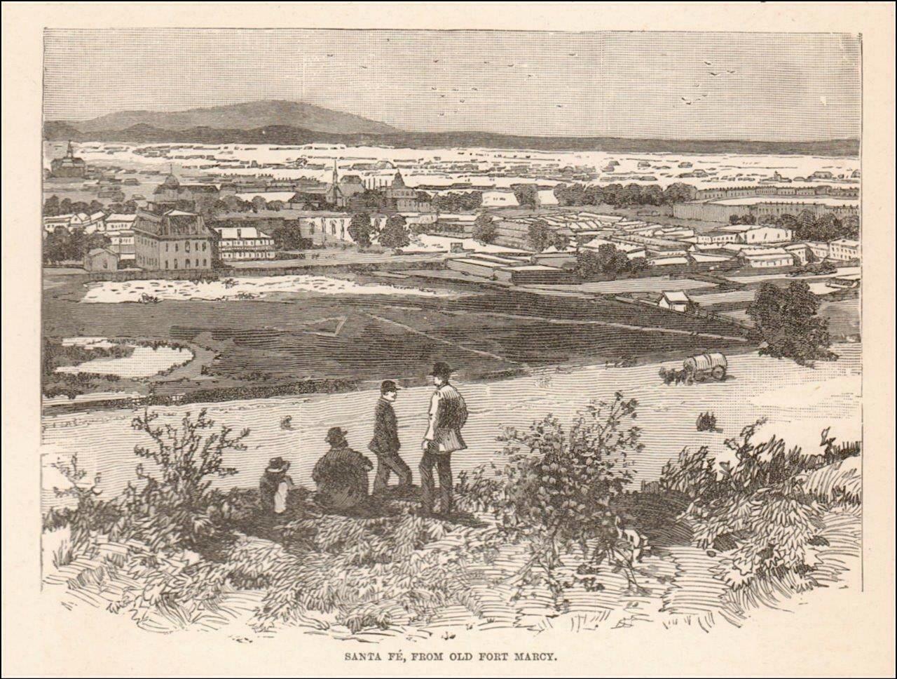

View of Santa Fe. Newspaper engraving. 1879.

A later view of Santa Fe from Fort Marcy is clearly done from a photograph. All the topographical features so visible in Kern’s 1848 rendering have been reduced to a silhouette along the horizon. The broad, open foreground in this engraving is a fiction. The town in fact comes right up to the foot of the bluff. Contemporary realist painters today might praise the verisimilitude of the later view, condemning Kern’s inaccuracies as primitive. They would be missing the point entirely. Apart from being a trained draftsman, Kern was an accomplished topographer who with his brother Ned produced maps for the official reports of the expeditions that employed them. Kern’s view from Fort Marcy blends a picturesque vista with a bird’s eye view of the town in relation to distant landmarks, to help orient the reader.
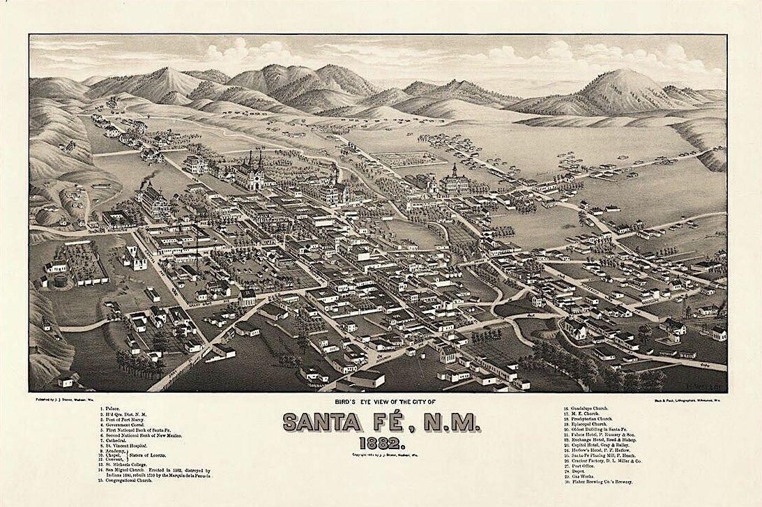

Bird’s eye view of Santa Fe, looking east. 1882 During the late 19th century these chorographic hybrids were very popular– forerunners of the tear-off map-pads available in so many tourist-information centers around the world. The designer-draftsman of this pictorial map probably never visited Santa Fe. Certain features are prominent, while others are missing. the ruins of Fort Marcy are locted on the hills to the left, just beyond the Old Taos Road.

Bohemian purists might dismiss Kern’s drawing as mere illustration, but as we have seen in the works of serious artists like Church and Bierstadt, the same tactics are used in the production of fine art. Both artists careers spanned the years during which photography became art, holding firmly to the belief that for something to be art, it must improve upon fact—even if that meant playing fast-and-loose with data. The later view of Santa Fe is nothing more than a manual-mechanical reiteration of a photomechanical factoid. Demonstrating perhaps technical skill and optical accuracy, one can learn nothing from it. Bereft of curiosity, intelligence or purpose, it is the product of mindless mimesis; the work of a copyist, not an artist.

Kern’s drawing was dedicated to identifying specific features of terrain beyond the range of optical experience. This same kind of visual jujitsu occurs in Frederic Church’s Cayambe, in which the snowy volcano is portrayed at many times its actual size. Church had done this for visual effect, Kern for calling attention to data.
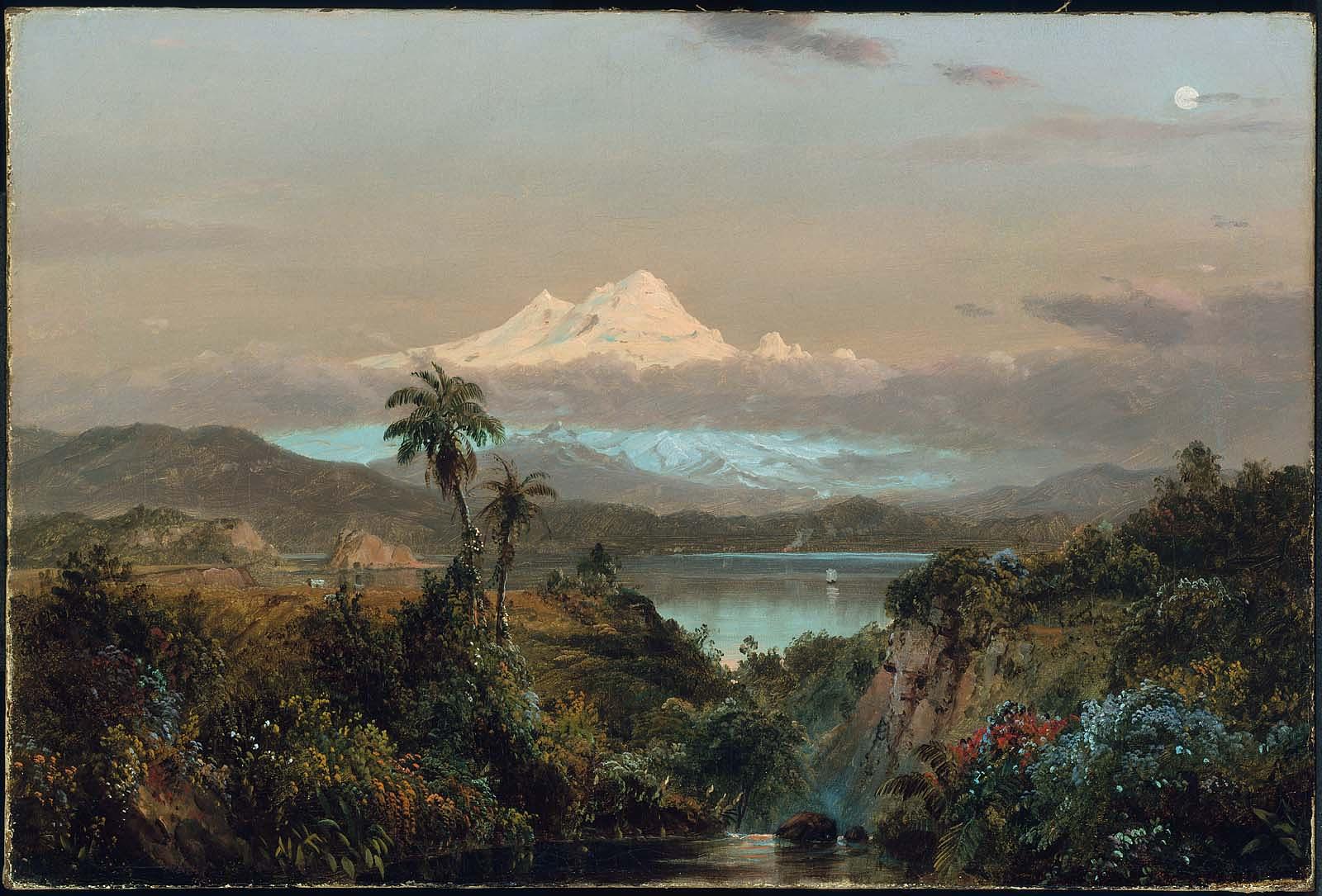

Frederic Edwin Church. Cayambe. 1858. Boston Museum of Fine Arts. (Reproduced under fair use, etc.)
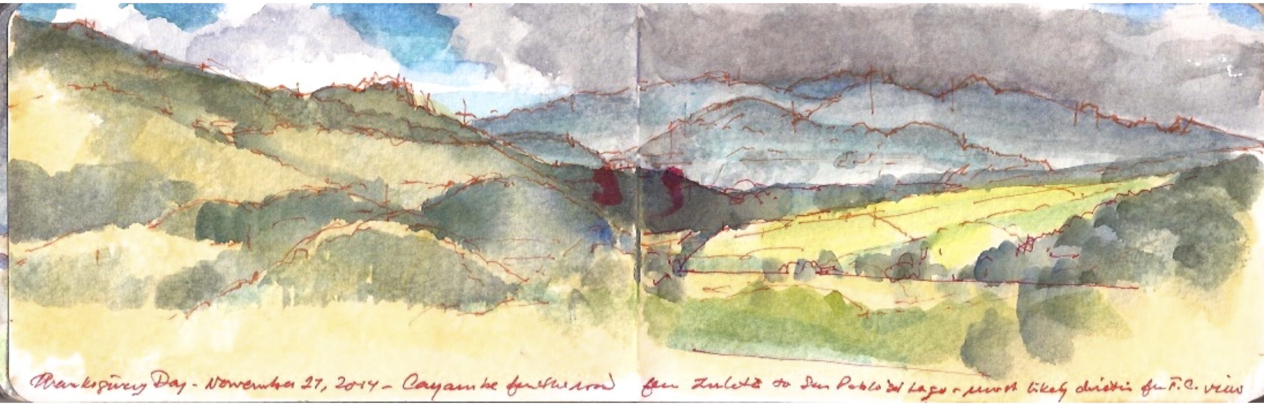

November 27, 2014. Thanksgiving Day. Cayambe seen from the high road between Zuleta and San Pable del Lago.

On a trip to Ecuador I tried to determine Church’s point of view, but found the peak of Cayambe shrouded in clouds. Comparing my sketch to Church’s painting gave me insight into how he might have assembled his composites. Looking back toward Imbabura from Otavallo, Cayambe would have been nothing more than a white speck on the horizon. By bringing it forward, Church lets us experience in the same moment landmarks that in fact are quite distant from one another. Moving us through time, Church takes us on a tour of northern Ecuador in a single vista. This is not plein-air painting. Nor is it realism.


Albert Bierstadt. A Storm in the Rockies. Mount Rosalie. 1866. Brooklyn Museum.

Albert Bierstadt pulls a similar trick in his 1866 painting Storm in the Rockies. Mount Rosalie (Mount Evans), now in the collection of the Brooklyn Museum. In his painting, the factual summit of the mountain is buried in clouds, into which Bierstadt punches a porthole through which we behold a preposterous snowy peak. The painting is based on sketches he produced in 1863 while traveling with author and explorer Fitz Hugh Ludlow, whose wife had become Bierstadt’s mistress. That is another story. I have been to the summit of Mount Evans on several occasions. The ascent requires a hair-raising drive along the edge of a precipice, dodging wild sheep and daredevil cyclists.
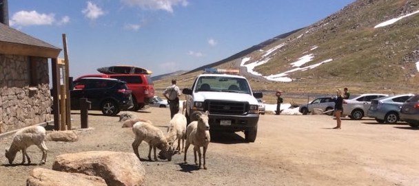

Wild Sheep at summit Lake parking area (above) June 18, 2016

Summit of Mount Evans (below) June 18, 2016
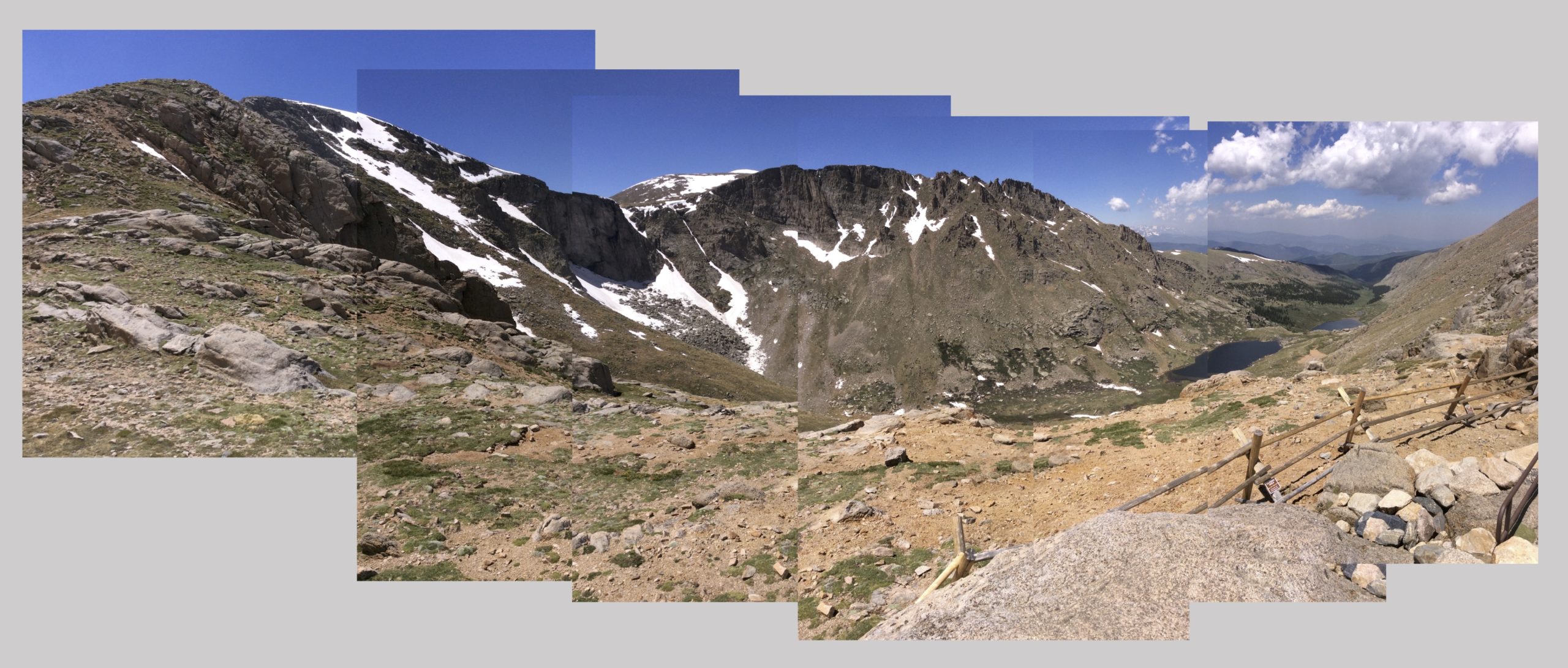
The actual summit of Mount Evans-Rosalie is on the left-hand side of this composite photograph. The Chicago lakes are visible to the right. Just below the summit one can walk to the edge of an alpine lake that drains into a declivity on the north face of the mountain, into an escalade of small lakes. Bierstadt’s point of view was near the lowest of these, (31.6191 x 105.6313) near where its outflow forms Chicago Creek. Its waters descend through Idaho Springs, feeding into Clear Creek, which passes Golden en route to its confluence with the South Platte river just north of Denver.
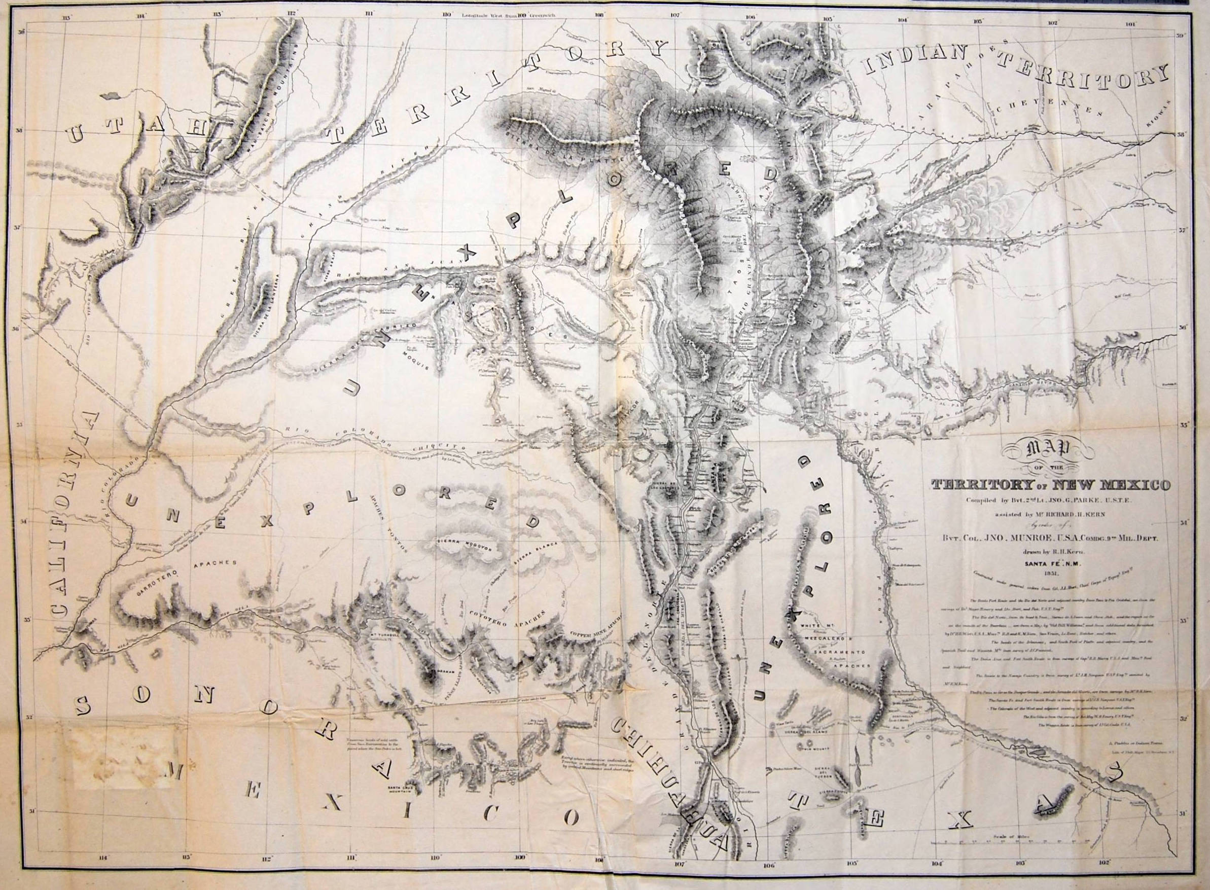

Map of New Mexico Territory. Richard H. Kern. 1851. Collection Huntington Library. San Marino, CA

Below White Rock Canyon the Rio Grande flows below table-lands to the east and a series of cañadas to the west—deep ravines clawed into the southeastern slopes of the Jemez volcano, as if by a giant hand. Through these defiles seasonal creeks dump rainwater and snowmelt into the river. One of these—Rito de los Frijoles descends through Bandelier National Monument. Named for noted archaeologist, ethnologist and preservationist Adolf Bandelier (1840-1914), the National Park Service interprets more than thirty thousand acres ranging in elevation from five to ten thousand feet. Visible evidence of human habitation spanning thousands of years included Tyounyi ruins and other excavated pueblos, along with modern reconstructions, original cliff-dwellings and petroglyphs.
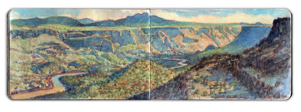

White Rock Canyon

Winding beneath high bluffs, the river widens gradually. Its flow rate decreases as the current enters the upper reaches of Cochiti Lake. An impoundment of nearly forty million gallons on average, this body of water is created by a large dam built by the Army Corps of Engineers between 1965 and 1973. One would presume that in such a dry country the function of the dam would be water-collection for irrigation. Prior to its construction, the combination of heavy snowmelt and a narrow channel would transform the Rio Grande into a raging torrent. Flooding bottomlands dedicated to agriculture, the damage wrought immense hardship on indigenous communities downriver, such as Cochiti and Santo Domingo pueblo, and Spanish settlements Peña Blanca and Algodones. These, and other farming settlements up and down the river depended on a system of acequias, water-bearing ditches shared by the community. New Mexicans are by nature friendly and easy-going. In picking a fight, defaming a mother’s virtue always works. In New Mexico, a disagreement over water-rights will get you there quicker.
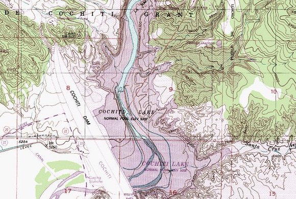

Topo map of Cochiti Dam and Lake.

I first visited Cochiti in 1980. The lake was seven years old. Unlike today, the reservation was open to public use. Unpaved roads led north to the ash-fields and cañadas below Valles Caldera, or west to the tent-rocks at Kasha-Katuwe, Keresan for white rocks. In 2001 the area was designated a National Monument. Santa Fe County and Albuquerque have over the past thirty years both doubled in population, leading the Cochiti Pueblo community to close its lands to unauthorized visitors. At the same time, one is greeted today by a modern welcome center, café and gift-shop. One of the few areas open to the public is Cochiti Dam.
Driving toward the hamlet of Cochiti Lake I turn right, passing a cluster of tribal utility buildings. Veering right again, I descend a long incline that terminated at a wide-boat-landing with a short dock to its left. A local man stood in the water, wrestling his boat onto a trailer. To either side of the ramp are short stretches of beach. Parking in the lot to the right, I carried my gear across the boat-ramp, sitting down at one of the concrete picnic-tables behind the beach. I am the only non-indigenous person at the site. A young couple sits at the next table, staring into their cellphones. A fisherman walks by, looks at me and nods. Before long my work absorbs me, not so much that I would be grateful for the absence of curious onlookers. One expects diffidence from Native Americans toward Anglos visiting Indian land. History has given them no reason to trust our kind. I am mindful also that the lake and its shores are under the control of the Army Corps of Engineers, which adds yet another nervous level to the human layer-cake one finds in The Land of Enchantment.
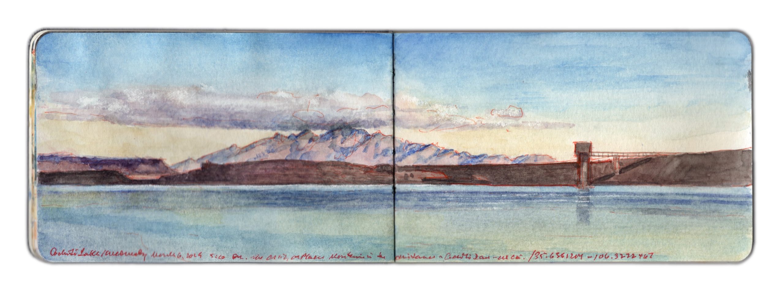

Cochiti Reservoir. March 6, 2019. Southeast from 35.6361204 x 106.3222467

Gazing across the water, the Ortiz-Placer range is minuscule, barely visible. Taking a page out of the Kern-Church playbook, I enlarge the distant mountains in relation to the lake and dam. An hour before dusk, shadows crawl down the hillside and march across the lake. Rosy light wash the faraway peaks. Consumed with my task, I fail to notice that everyone had left. A police SUV idles in the parking-lot. Better to leave without waiting to be asked.
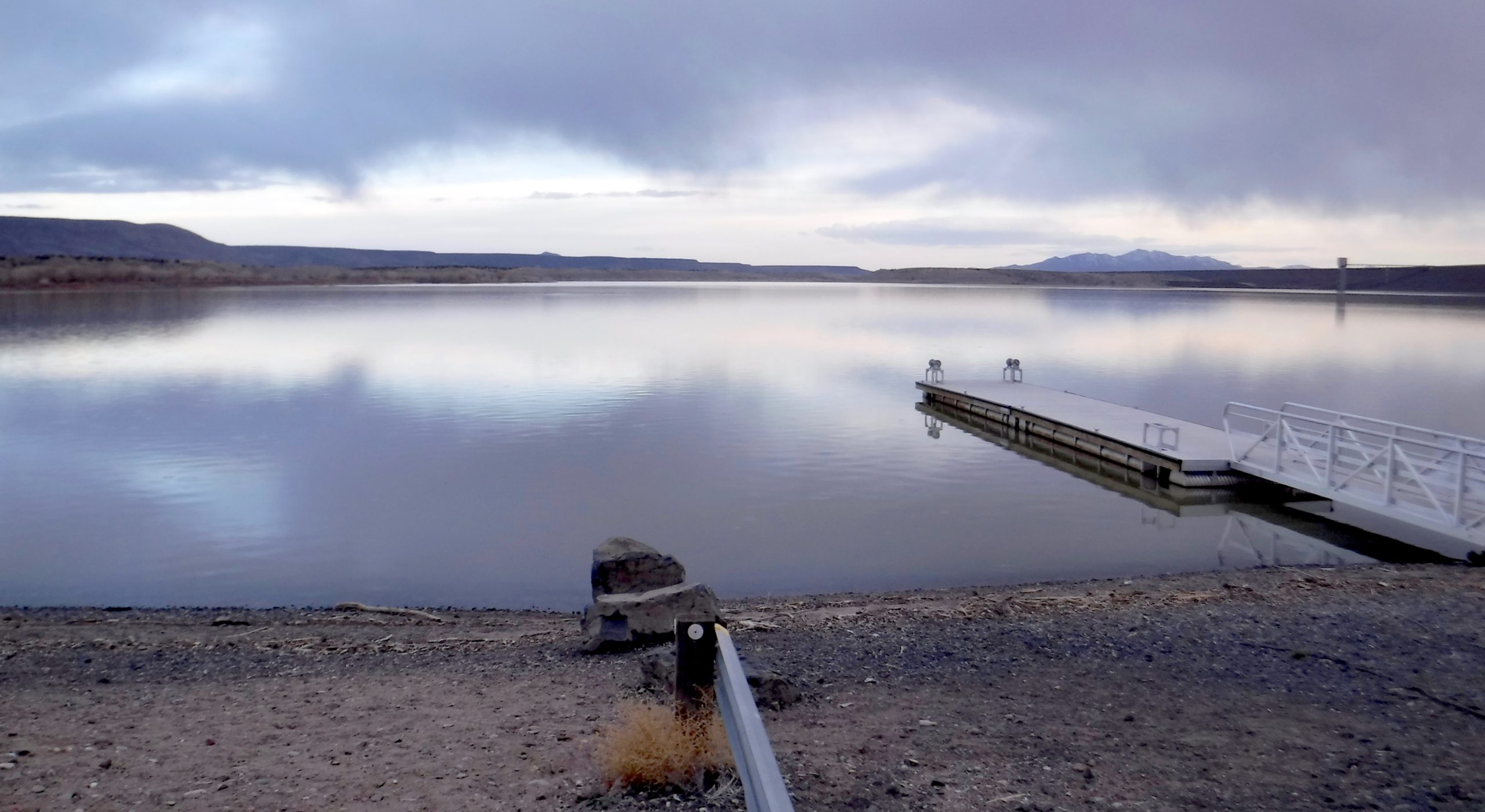
March 6, 2019. Looking  Southeast across Cochiti Lake. Photograph by the author.


Follow James Lancel McElhinney and The Sketchbook Traveler on Facebook, Linkedin, Twitter and Instagram.

Peruse previous posts here. Dispatches #1-70. April 1-June 8, 2020.
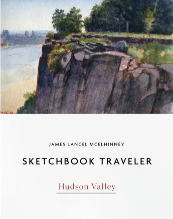
Coming Soon: Hardcover. $24.95. From Schiffer Publishing. Release date: September 2020.
 

SKETCHBOOK TRAVELER. Dispatch # 80. Crown Point Update


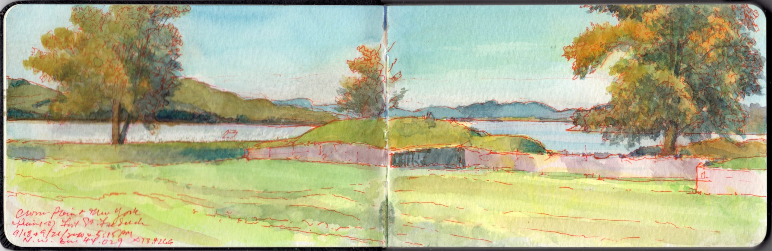
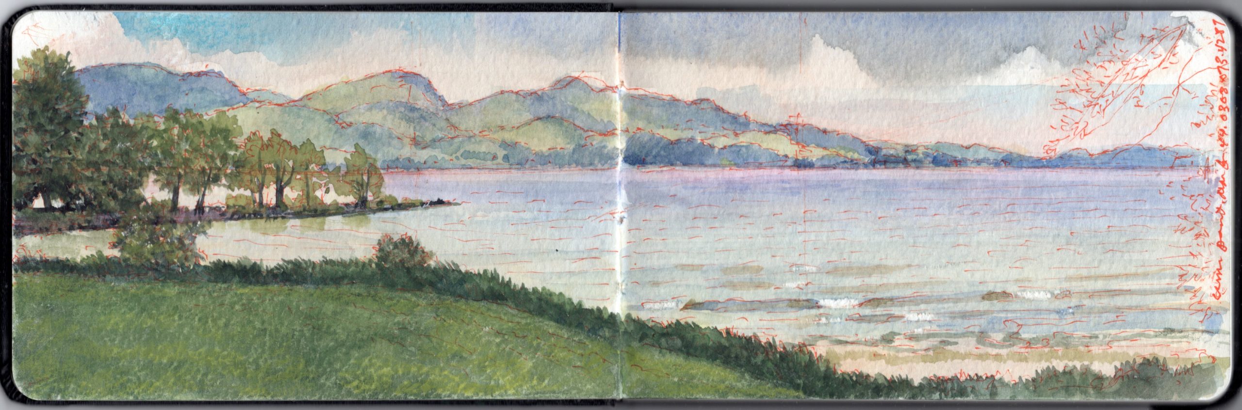
Northwest from 44.029 x 73.4266. The Ruins of Fort St-Frederic, Crown Point State Historic Site on Lake Champlain.

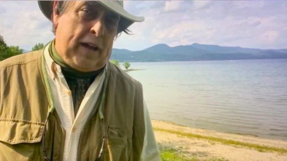
Journal-painting begun during a field-trial of new live, online outdoor workshop format, of Friday September 18, 2020. The result was that most of the technology cooperated, and that I now have a means of presenting a workshop live, in real time, outdoors and online. Many plein-air workshops focus on technique, getting to a finished product. The approach I promote is to provide people with the motivation to rediscover the outdoors. Journaling enriches activities like hiking, camping, visiting historic sites and natural wonders. This is not about technique. It’s a practice that transforms experience into knowledge.

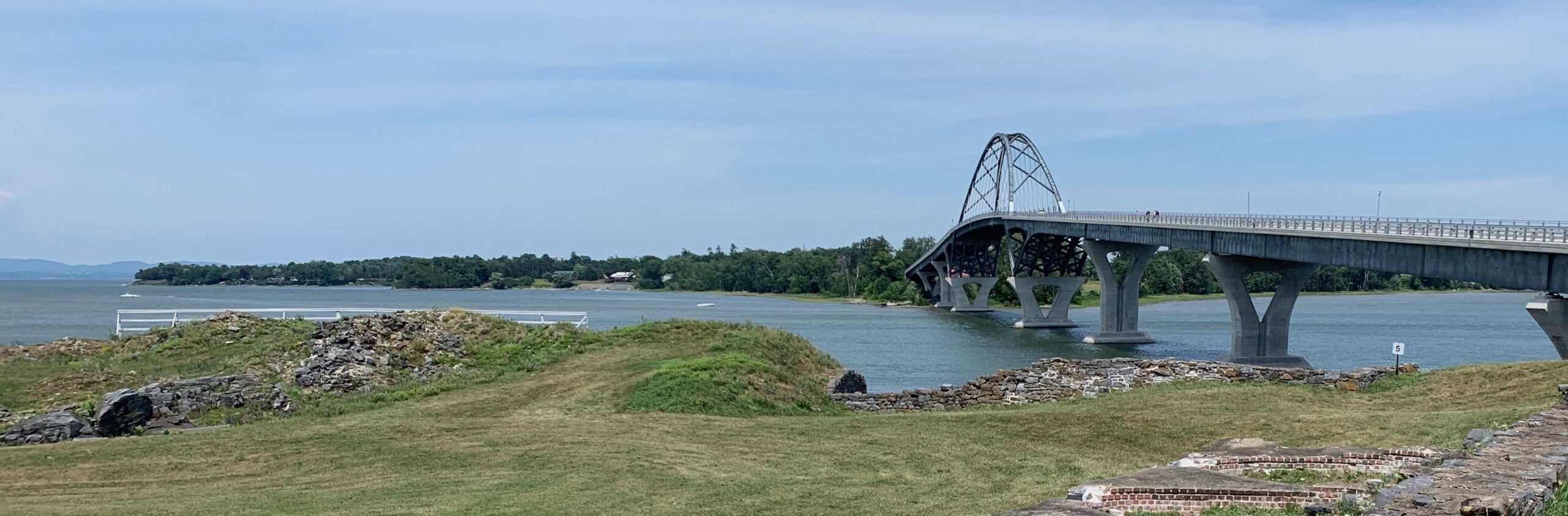
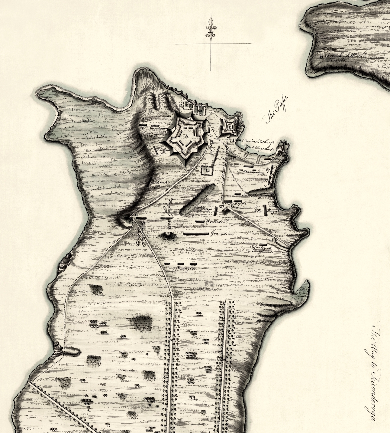
The peninsula north of Riviere de la Chute, which carries water from Lake George into Lake Champlain was militarily strategic because it commands the portages between the Saint Lawrence watershed, Lake Champlain (Pitawbagok) Lake George (Kandiatarocte) and the Hudson Valley. The eastern corner of Crown Point reaches toward Chimney Point, on the western shoreline of Vermont.  The vehicular bridge that first spanned the narrows in 1929 was replaced in 2011.


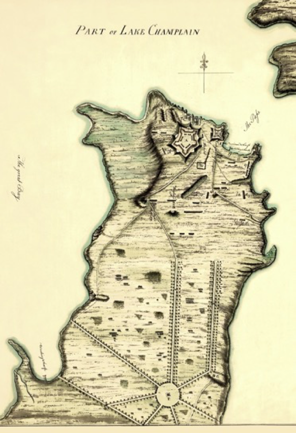
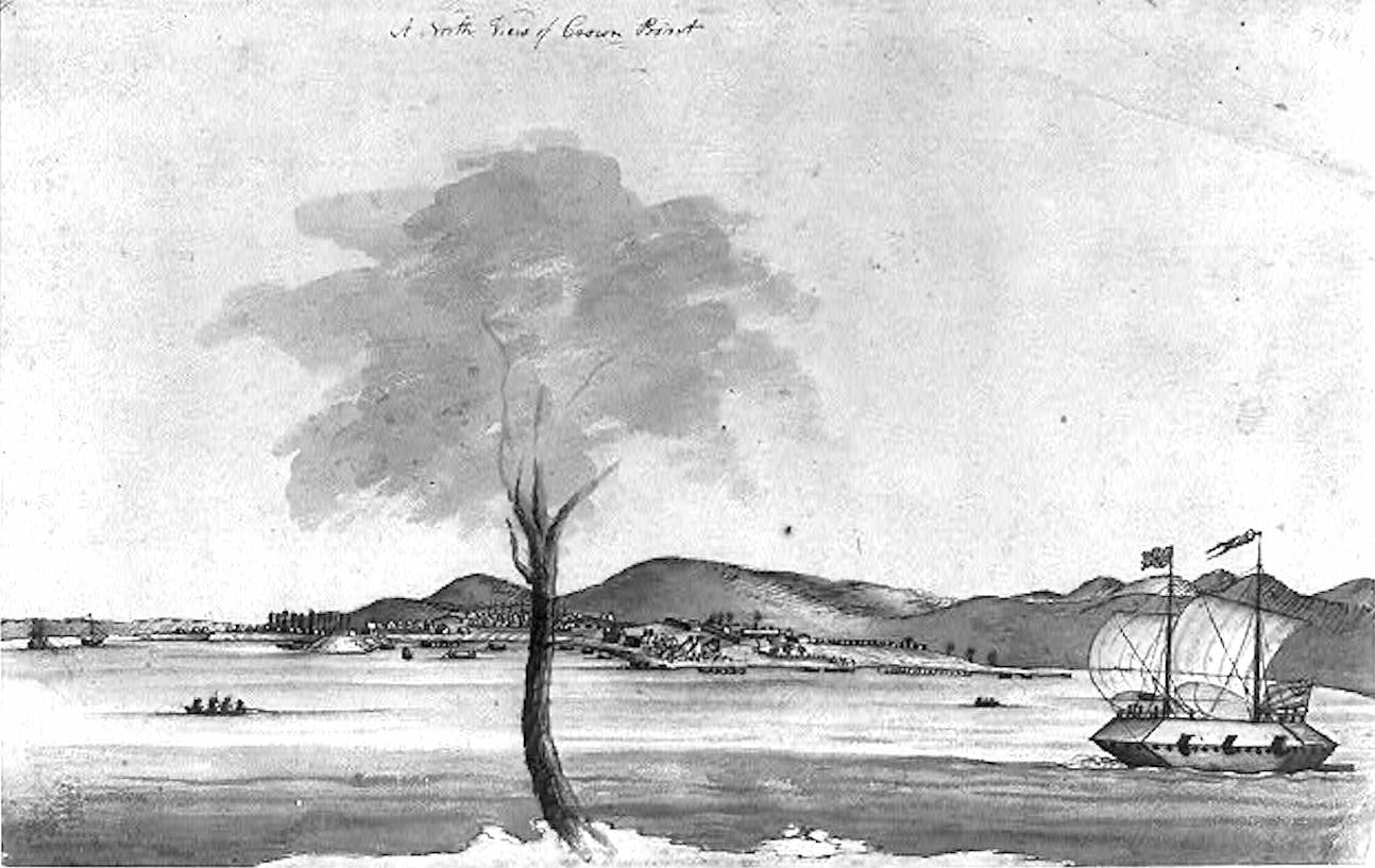
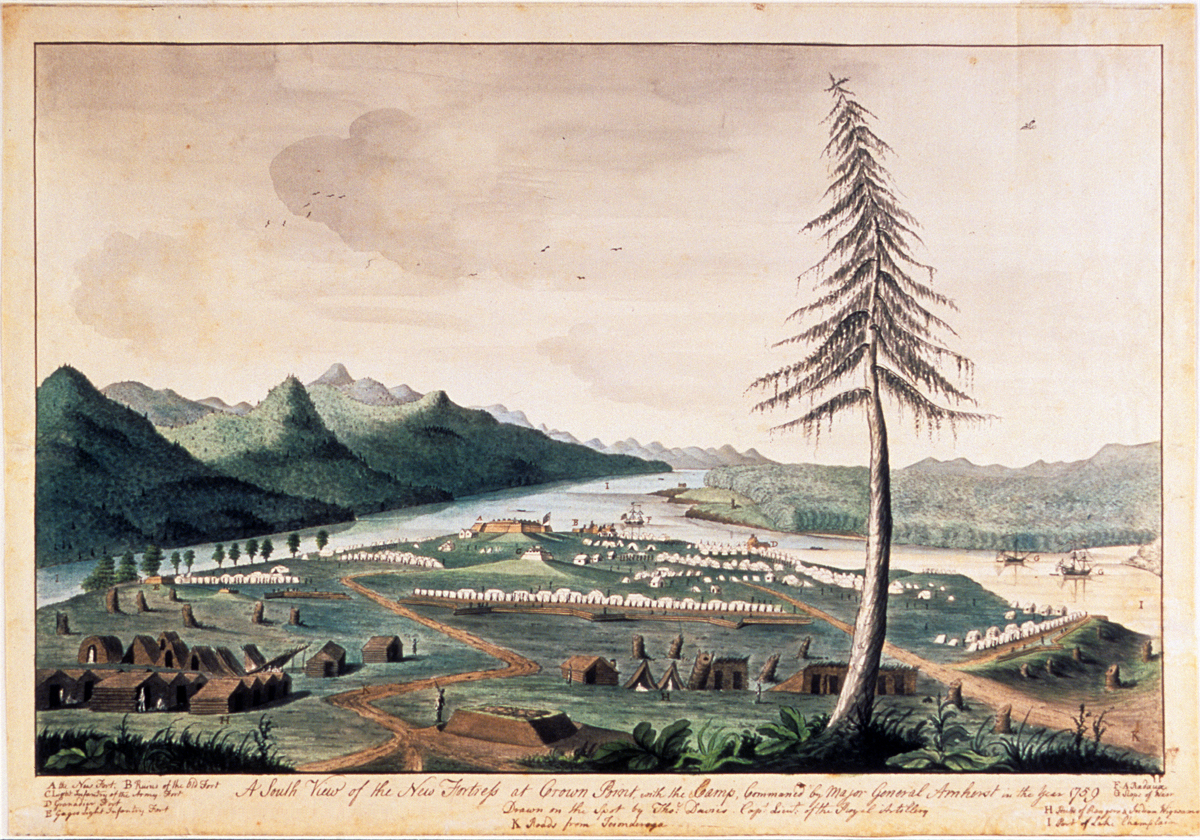
Crown Point, New York. 1759. showing the Grand Fort, the ruins of the French citadel, the disposition of British army camps. Chimney Point, Vermont is seen at top right.


Thomas Davies. Captain, Royal Artillery. 1737-1812. Southerly View of Crown Point. 1759. Davies went on to become a Lieutenant-General and noted naturalist artist. The curious craft is a timber-clad gunboat.

Reaching fifty miles northward from South Bay, Lake Champlain seems no wider than a river in some places. Beyond Crown Point the waters broaden into a series of expansive bays. In pre-colonial days the area between the La Chute and Crown Point was no-man’s-land between territories controlled by the Mohawk nation (Kanienkehake) to the south, and the Abenaki to the north and east. In peacetime it served as a meeting-place and trading hub. During periods of hostility, it became a battleground. Having allied themselves with these traditional enemies, the colonial powers of France and Britain found themselves at odds on the same contested ground. Crown Point served a military function again, during the American War of independence when it changed hands several times. Since 1910 the site has been maintained as a park by the State of New York, with picnic areas, a small museum and hiking trails. Champlain Memorial Lighthouse stands on the easternmost tip of the peninsula.


Champlain Bridge (NY Rte 903/ VT Rte 17) Looking north from the ruins of Fort St-Frederic. Crown Point, New York.

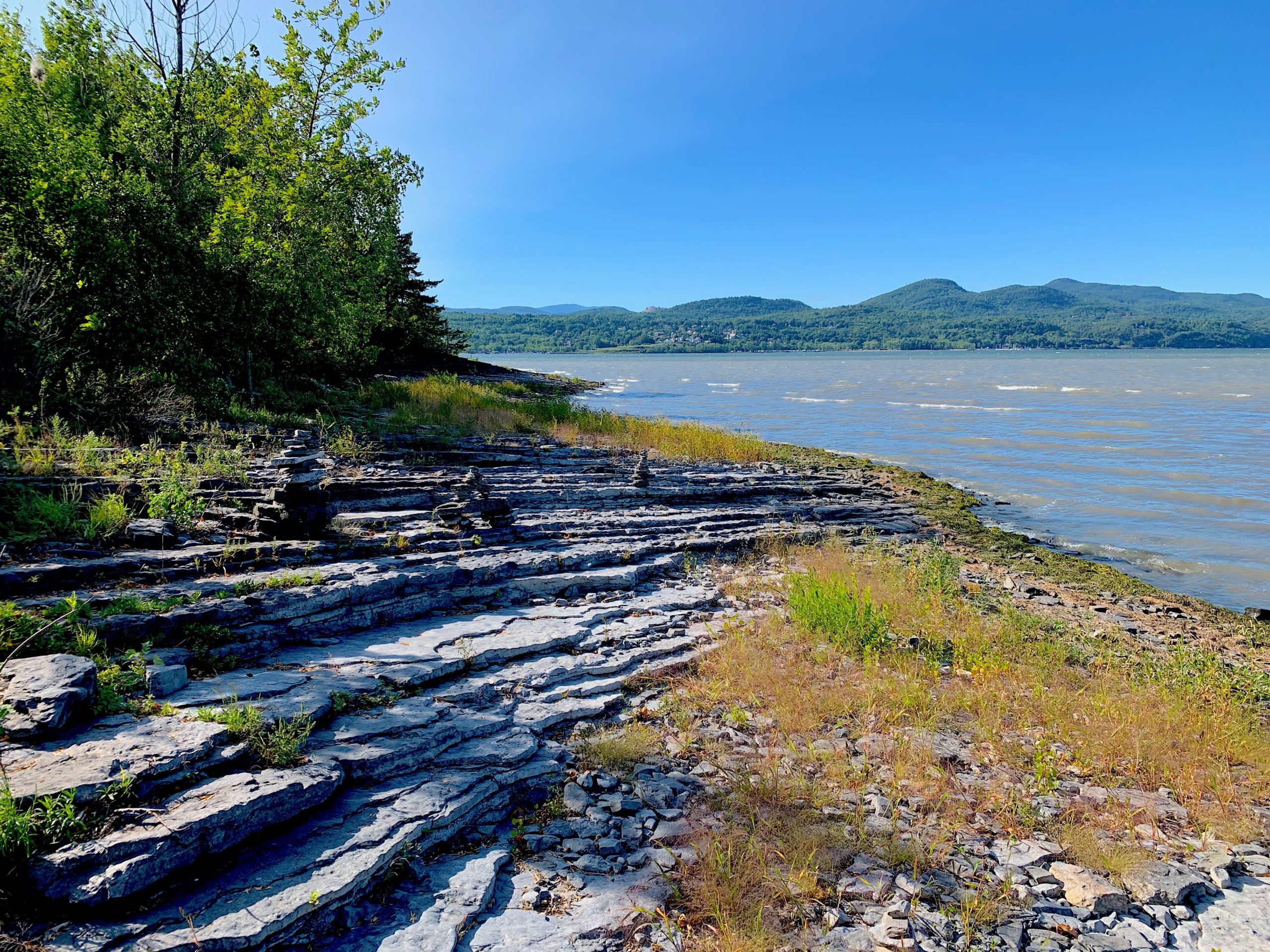
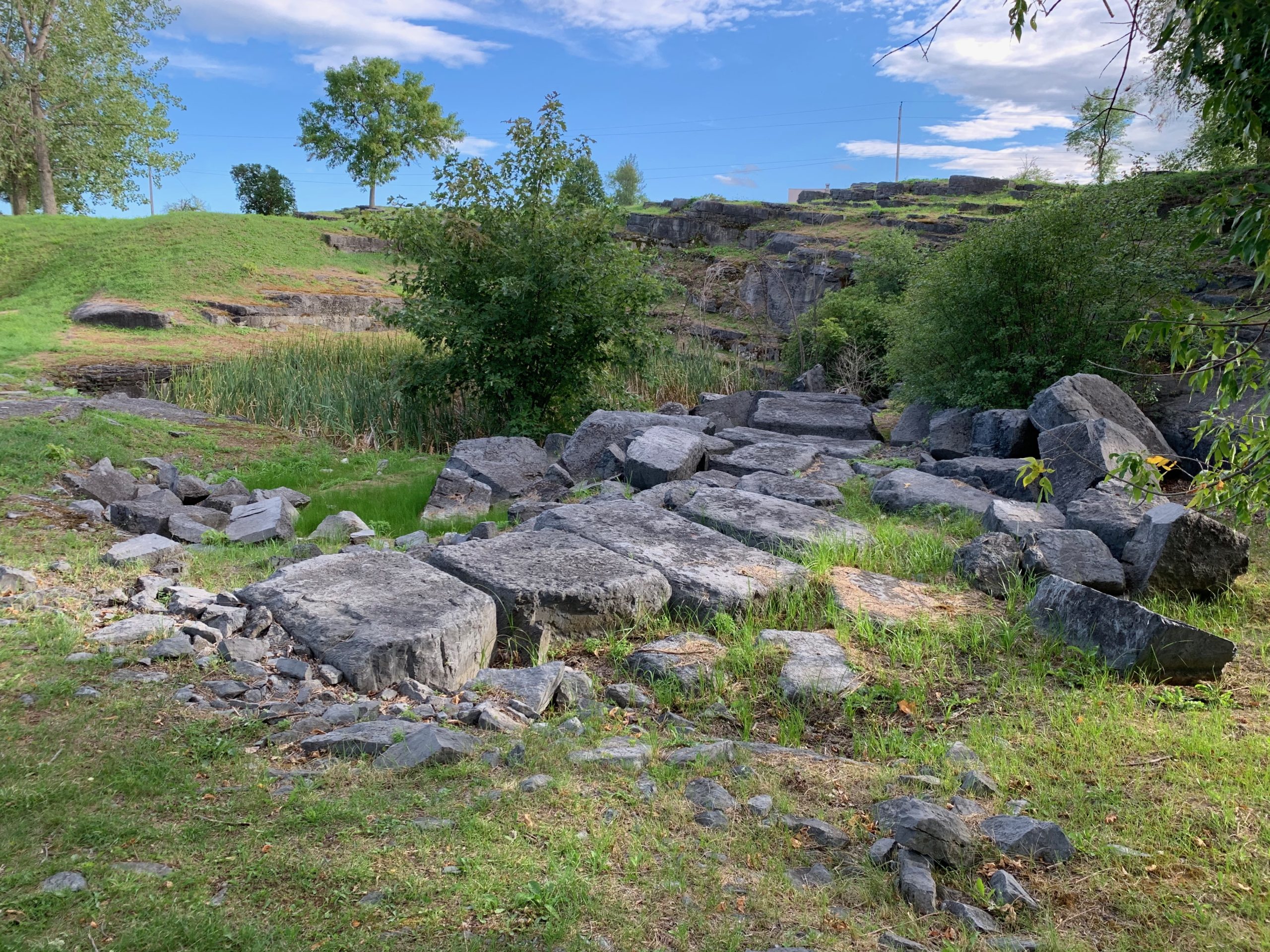
Crown Point and much of the Champlain region is undergirded with fossilized Ordovician limestone also known as the Chazy Fossil-Reef that stretches from Tennessee to Newfoundland. Formed half a billion years ago, its most recognizable characteristic is a layer-cake of strata. The brittle dark grey rock shatters easily under a hammer-stroke, to reveal one of the most diverse arrays of fossils on Earth. This stone was quarried by the French for material to construct Fort Carillon, later Ticonderoga. It was also quarried at Crown Point (Pointe de Chevelure) to build Fort St-Frederic. After 1759 the British built Fort Crown Point with masonry salvaged from the French fortress, augmented with freshly cut stones. Unfinished blocks can still be seen lying near borrow-pits along the shoreline. During the nineteenth century masonry from the historic forts was cannibalized to feed new construction in nearby towns and dwellings. New pits carved out of the ground fed the production of lime.


Graffiti on the rocky ledges, Parade-ground at Ft. Crown Point. Photo: September 2020

Looking at the ruins of eighteenth-century Fort Crown Point, one finds the surrounding moat filled with haps of broken spoil from outcroppings dressed to serve as part of the fort’s outer wall. These surfaces were then covered in masonry, some of which is visible today. Rising up from the parade ground within the fort are several large uptilted rafts of grey limestone. One supposes that General Amherst’s fort had covered these with soil. Perhaps they emerged after the centuries or exposure to the elements. Carved into them are the names of visitors dating back to the nineteenth century. It is hard to imagine red-coated regulars drilling in close formations on such broken ground. These limestone uplifts appear all over the peninsula—some stretching down to the water in broad layered sheets.

My first visit to Crown Point was in the company of noted author James Howard Kunstler in 1992. I was in the midst of a project that explored Civil War battlefields threatened by commercial development.  Fitting my narrative as a spectacular military ruin I chose to overlook the hundred and two-year gap between its construction, and the sectional conflict that tore the nation apart in 1861. Since shifting my base this year from Manhattan to the Champlain Valley I made several visits to the site. After completing an inspection of Fort Saint-Frederic, and a circuit of the battlements of Fort Crown Point, my focus shifted from military history to the natural setting. Walking down a grassy track to a wooded finger of land pointing northward into the lake, a small green frog leaped across my path. Stepping from the grassy track onto a rocky shelf, I noticed the residue of macadam. To my left at the bottom of this ramp was a large pit carved out of the bank.


Quarry-pit northwest of Fort Crown Point

Undressed stones lay off to the right. Piles of smaller stones the size of brickbats lay scattered about in heaps. Too small for use as masonry, these would have been piled into one of the lime-kilns that once stood nearby. A cluster of large umbrageous trees at the landward end of the jetty reminded me of a Barbizon painting of Fontainebleau forest. Beyond this grove was a wide rocky beach; a broad crescent reaching westward. Crisscrossed with fractures, long diagonal slabs of limestone angled up from the shoreline. Upon one of these was heaped a gathering of small cairns, different from those I had seen a month ago. Beachcombers set them up. Someone, or something knocks them down. They are reassembled, and then toppled again, like the cycles of nature. Dashed against one of these limestone slabs, a large stone shattered. Instead of coherent fossils within the brittle chunk I found a dense, sparkling charcoal-grey mass variegated with organic patterns of slightly lighter material.


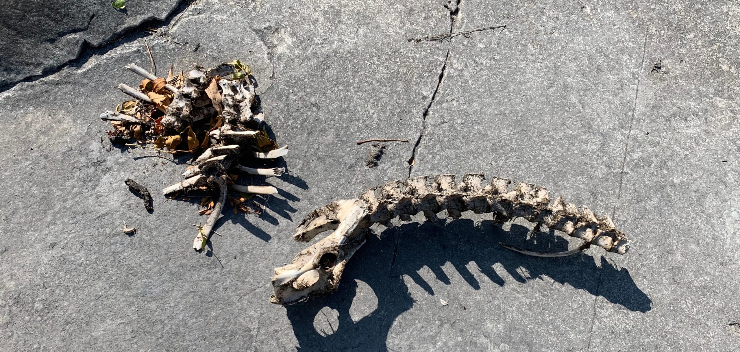
Resting on one of these broad rocky shelves was the spine and pelvis of a medium-sized mammal—perhaps a dog or coyote. A tangle of ribs and rotting lake-grass lay beside it. The absence of blood and the presence of vegetal material led me to wonder if the animal had not drowned. Having washed ashore the rotting carcass might have been dragged onto the rocks by ubiquitous turkey-vultures, leaving scraps from their feast for the gulls and raccoons.


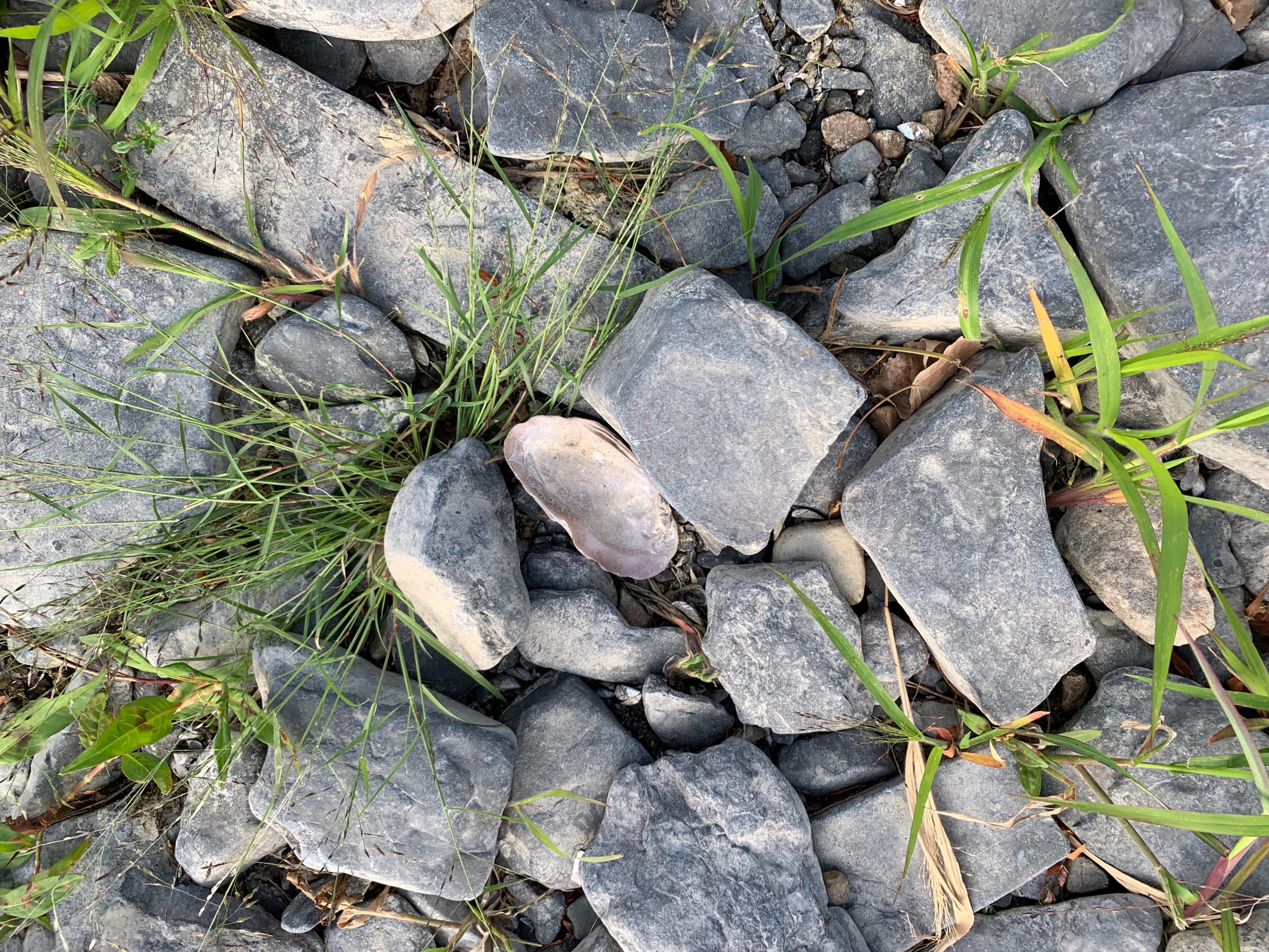
Freshwater oyster-shell, Crown Point  New York.

Underfoot I find the shells of freshwater clams and oysters nestled among small rocks. Scaling the grassy slope, I pass the sun-bleached skull and bones of a large bass. A couple makes their way from the end of the rip-rap mole back to shore. The woman waved. The man nodded. Body-language suggested they might have met for a tryst. Following the embankment, a gravel road led into the woods. Passing another couple walking a dog, I was greeted with nods and shy looks. Finding a private residence at the end of the road, I backtracked to a cluster of utility sheds overlooking the green mass of Fort Crown Point to the right, the parking-lot, esplanade and Fort St.-Frederic. Spanning the narrows between New York and Vermont, the Champlain Bridge arced up above a wooded grove beside highway 903.


(Above Ruins of the Barracks at Fort Crown Point. Built ca. 1759. (Below) Aerial view of His Majesty’s Fort at Crown Point.

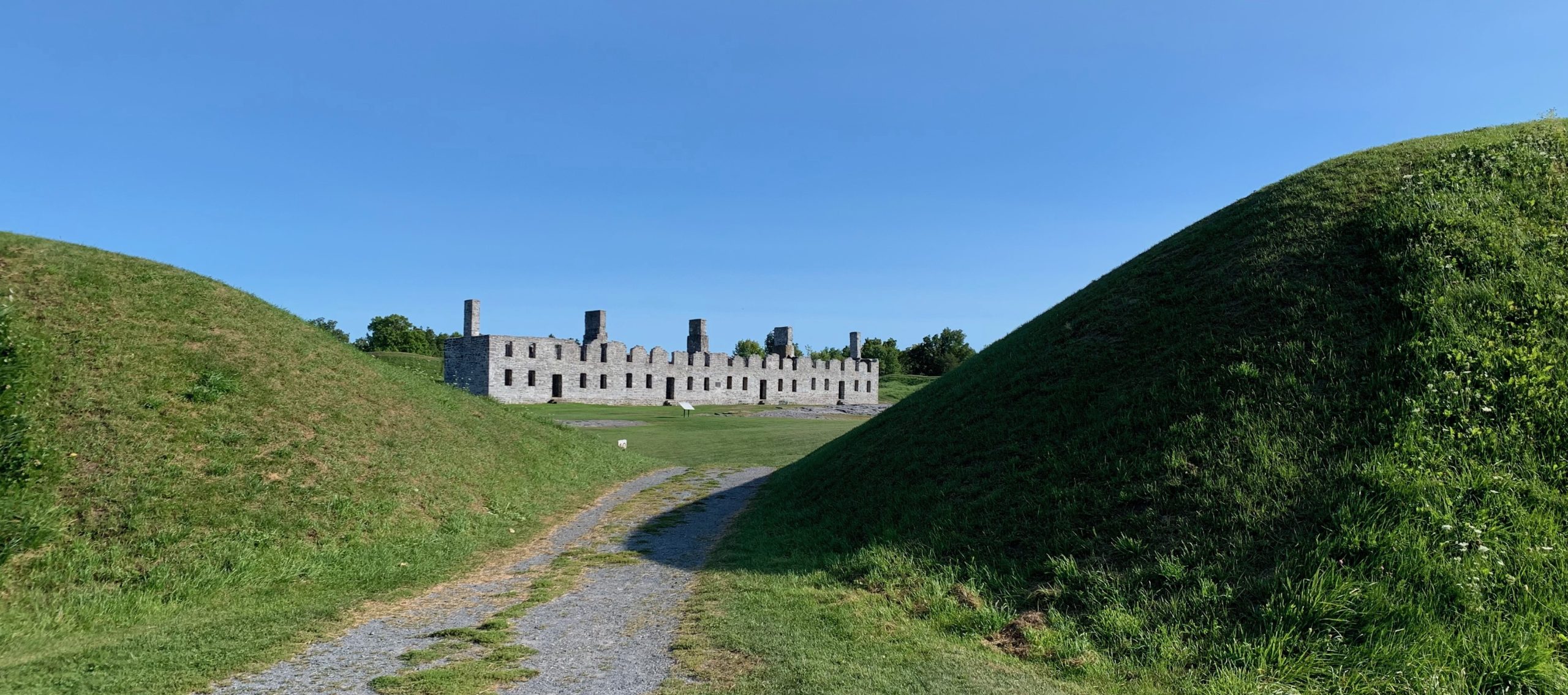
The large pentagonal star-fort was built expeditiously. The eastern moat was blasted out of the limestone that undergirds the peninsula. The original walls were timber set on stone footings covered with earth. The barracks were gutted by fire in 1773. Occupying the site in 1775, American troops constructed new shelters and warehouses. Benjamin Franklin visited Crown Point en route to secret negotiations in Montreal. Richard Montgomery assembled his forces here for his invasion of Canada. Half the guns Henry Knox brought to Boston in March of 1776 had come from Fort Crown Point, with the rest from Ticonderoga. As a British fleet entered Lake Champlain in the fall of 1776, Continental forces put their base to the torch, withdrawing behind Montcalm’s former defenses at Fort Carillon/Ticonderoga. Having been bested by Burgoyne’s army the following year, their post was abandoned. In 1910 the military ruins at Crown Point were acquired by the State of New York, to be preserved as a park for public use and recreation.


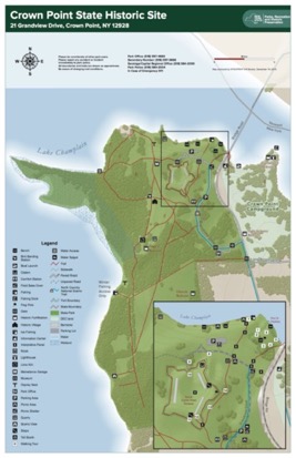
Map of Crown Point State Historic Site. Trail Map LINK

Scanning the site, I was reminded that in June of 1775 one of my ancestors had been here; a thirty-eight-year-old first lieutenant in Griswold’s Fifth Company of Benjamin Hinman’s Fourth Connecticut Regiment. Sixteen years earlier Captain Thomas Davies of the Royal Artillery had produced a detailed watercolor of the facility from a position three hundred yards southeast of where I was standing. From what I could reckon by looking at maps of the period, today’s parking-area had been covered by workshops and warehouses serving the fort. General Amherst and his staff would have been lodged beside a little cove, just beyond the foot of today’s bridge. A picnic area and events-pavilion now stand on the site of an earthen French redoubt. Rangers and indigenous forces were quartered in huts and wigwams near the site of the present-day park-ranger station and maintenance area.


Thomas Davies. 1737-1812. View of Amherst’s army at Crown Point, 1759. Courtesy Wintherthur Museum, Delaware.

Embellished with picturesque touches, Davies’s finished watercolor is far from naïve in its rendering of the site. Twenty-first-century viewers might mistake topographical accuracy for a lack of optical verisimilitude. Davies was keenly aware that whatever artistic aims his painting might achieve, his primary goal was creating a chorographic vista one could read like a map. A hallmark of expeditionary art is the distortion of scale to render more legible certain features of terrain. I noted this on many occasions when my travels gave me the opportunity to compare the optical experience of beholding terrain with historic depictions more focused on conveying data. Richard Hovenden Kern’s 1849 view from Fort Marcy comes to mind. Standing on the hillock above Santa Fe looking south, one can focus the eye on the Ortiz mountains, Sandia mountains and La Tetilla hill, but taking all together in a single glance, each becomes nothing more than a speck on the horizon. Compressing distant features while minimizing the foreground, Kern privileged data over optics. This gave travelers and readers a guide to prominent landmarks in ways no photograph could. Apart from maximizing mobility the benefit of journal-painting is not in reproducing the appearance of things, but to transform the act of looking into knowledge and ideas—the art of seeing


Looking northeast from 44.0308 x 73.4287. On the far shore is Port Henry, New York. In the far distance is Split Rock Mountain.

Follow James Lancel McElhinney and The Sketchbook Traveler on Facebook, Linkedin, Twitter and Instagram.

Peruse previous posts here. Dispatches #1-70. April 1-June 8, 2020.

Now Available to Own: Hardcover. $24.95. From Schiffer Publishing. 2020.


SKETCHBOOK TRAVELER. DISPATCH #79. CROWN POINT


The Ruins of Fort St-Frederic, Crown Point on Lake Champlain. Journal-painting begun during a field-trial of new live, online outdoor workshop format, of Friday September 18, 2020.

The peninsula north of Riviere de la Chute, which carries water from Lake George into Lake Champlain was militarily strategic because it commands the portages between the Saint Lawrence watershed, Lake Champlain (Pitawbagok) Lake George (Horicon) and the Hudson Valley. The eastern corner of Crown Point reaches toward Chimney Point, on the western shoreline of Vermont.  The vehicular bridge that first spanned the narrows in 1929 was replaced in 2011.

Crown Point, New York. 1759. showing the Grand Fort, the ruins of the French citadel, the disposition of British army camps. Chimney Point, Vermont is seen at top right.

Thomas Davies. Captain, Royal Artillery. 1737-1812. South View of Crown Point. 1759. Davies went on to become a Lieutenant-General and noted naturalist artist. The curious craft is a timber-clad gunboat.

Reaching fifty miles northward from South Bay, Lake Champlain seems no wider than a river in some places. Beyond Crown Point the waters broaden into a series of expansive bays. In pre-colonial days the area between the La Chute and Crown Point was no-man’s-land between territories controlled by the Mohawk nation (Kanienkehake) to the south, and the Abenaki to the north and east. In peacetime it served as a meeting-place and trading hub. During periods of hostility, it became a battleground. Having allied themselves with these traditional enemies, the colonial powers of France and Britain found themselves at odds on the same contested ground. Crown Point served a military function again, during the American War of independence when it changed hands several times. Since 1910 the site has been maintained as a park by the State of New York, with picnic areas, a small museum and hiking trails. Champlain Memorial Lighthouse stands on the easternmost tip of the peninsula.

Crown Point and much of the Champlain region is undergirded with fossilized Ordovician limestone also known as the Chazy Fossil Reef that stretches from Tennessee to Newfoundland. Formed half a billion years ago, its most recognizable characteristic is a layer-cake of strata. The brittle dark grey rock shatters easily under a hammer-stroke, to reveal one of the most diverse arrays of fossils on Earth. This stone was quarried by the French for material to construct Fort Carillon, later Ticonderoga. It was also quarried at Crown Point (Pointe de Chevelure) to build Fort St-Frederique. After 1759 the British built Fort Crown Point with masonry salvaged from the French fortress, augmented with freshly cut stones. Unfinished blocks can still be seen lying near borrow-pits along the shoreline. During the nineteenth century masonry from the historic forts was cannibalized to feed new construction in nearby towns and dwellings. New pits carved out of the ground fed the production of lime.

Graffitti on the rocky ledges, Parade-ground at Ft. Crown Point. Photo: September 2020

Looking at the ruins of eighteenth-century Fort Crown Point, one finds the surrounding moat filled with haps of broken spoil from outcroppings dressed to serve as part of the fort’s outer wall. These surfaces were then covered in masonry, some of which is visible today. Rising up from the parade ground within the fort are several large uptilted rafts of grey limestone. One supposes that General Amherst’s fort had covered these with soil. Perhaps they emerged after the centuries or exposure to the elements. Carved into them are the names of visitors dating back to the nineteenth century. It is hard to imagine red-coated regulars drilling in close formations on such broken ground. These limestone uplifts appear all over the peninsula—some stretching down to the water in broad layered sheets.

My first visit to Crown Point was in the company of noted author James Howard Kunstler in 1992. I was in the midst of a project that explored Civil War battlefields threatened by commercial development.  Fitting my narrative as a spectacular military ruin I chose to overlook the hundred and two-year gap between its construction, and the sectional conflict that tore the nation apart in 1861. Since shifting my base this year from Manhattan to the Champlain Valley I made several visits to the site. After completing an inspection of Fort Saint-Frederique, and a circuit of the battlements of Fort Crown Point, my focus shifted from military history to the natural setting. Walking down a grassy track to a wooded finger of land pointing northward into the lake, a small green frog leaped across my path. Stepping from the grassy track onto a rocky shelf, I noticed the residue of macadam. To my left at the bottom of this ramp was a large pit carved out of the bank.

Quarry-pit northwest of Fort Crown Point

Undressed stones lay off to the right. Piles of smaller stones the size of brickbats lay scattered about in heaps. Too small for use as masonry, these would have been piled into one of the lime-kilns that once stood nearby. A cluster of large umbrageous trees at the landward end of the jetty reminded me of a Barbizon painting of Fontainebleau forest. Beyond this grove was a wide rocky beach; a broad crescent reaching westward. Crisscrossed with fractures, long diagonal slabs of limestone angled up from the shoreline. Upon one of these was heaped a gathering of small cairns, different from those I had seen a month ago. Beachcombers set them up. Someone, or something knocks them down. They are reassembled, and then toppled again, like the cycles of nature. Dashed against one of these limestone slabs, a large stone shattered. Instead of coherent fossils within the brittle chunk I found a dense, sparkling charcoal-grey mass variegated with organic patterns of slightly lighter material.

Resting on one of these broad rocky shelves was the spine and pelvis of a medium-sized mammal—perhaps a dog or coyote. A tangle of ribs and rotting lake-grass lay beside it. The absence of blood and the presence of vegetal material led me to wonder if the animal had not drowned. Having washed ashore the rotting carcass might have been dragged onto the rocks by ubiquitous turkey-vultures, leaving scraps from their feast for the gulls and racoons.

Freshwater oyster-shell, Crown Point  New York.

Underfoot I find the shells of freshwater clams and oysters nestled among small rocks. Scaling the grassy slope, I pass the sun-bleached skull and bones of a large bass. A couple makes their way from the end of the rip-rap mole back to shore. The woman waved. The man nodded. Body-language suggested they might have met for a tryst. Following the embankment, a gravel road led into the woods. Passing another couple walking a dog, I was greeted with nods and shy looks. Finding a private residence at the end of the road, I backtracked to a cluster of utility sheds overlooking the green mass of Fort Crown Point to the right, the parking-lot, esplanade and Fort St.-Frederique. Spanning the narrows between New York and Vermont, the Champlain Bridge arced up above a wooded grove beside highway 903.

Ruins of the Barracks at Fort Crown Point. Built ca. 1759

Scanning the site, I was reminded that in June of 1775 one of my ancestors had been here; a thirty-eight-year-old first lieutenant in Griswold’s company of Benjamin Hinman’s Fourth Connecticut Regiment. Twenty-six years earlier Captain Thomas Davies of the Royal Artillery had produced a detailed watercolor of the facility from a position three hundred yards southeast of where I was standing. From what I could reckon by looking at maps of the period, today’s parking-area had been covered by workshops and warehouses serving the fort. General Amherst and his staff would have been lodged beside a little cove, just beyond the foot of today’s bridge. A picnic area and events-pavilion now stand on the site of an earthen French redoubt. Rangers and indigenous forces were quartered in huts and wigwams near the site of the present-day park-ranger station.

Thomas Davies. 1737-1812. View of Amherst’s army at Crown Point, 1759.

Embellished with picturesque touches, Davie’s finished watercolor is far from naïve in its rendering of the site. Twenty-first-century viewers might mistake topographical accuracy for a lack of optical verisimilitude. Davies was keenly aware that whatever artistic aims his painting might achieve, his primary goal was creating a chorographic vista one could read like a map. A hallmark of expeditionary art is the distortion of scale to render more legible certain features of terrain. I noted this on many occasions when my travels gave me the opportunity to compare the optical experience of beholding terrain with historic depictions more focused on conveying data. Richard Hovenden Kern’s 1849 view from Fort Marcy comes to mind. Standing on the hillock above Santa Fe looking south, one can focus the eye on the Ortiz mountains, Sandia mountains and La Tetilla hill, but taking all together in a single glance, each becomes nothing more than a speck on the horizon. Compressing distant features while minimizing the foreground, Kern privileged data over optics. This gave travelers and readers a guide to prominent landmarks in ways no photograph could. Apart from maximizing mobility the benefit of journal-painting is not in reproducing the appearance of things, but to transform the act of looking into knowledge and ideas—the art of seeing

Looking northeast from 44.0308 x 73.4287. On the far shore is Port Henry, New York. In the far distance is Split Rock Mountain.

Follow James Lancel McElhinney and The Sketchbook Traveler on Facebook, Linkedin, Twitter and Instagram.

Peruse previous posts here. Dispatches #1-70. April 1-June 8, 2020.

Coming Soon: Hardcover. $24.95. From Schiffer Publishing. Release date: September 2020.
 

SKETCHBOOK TRAVELER: A Field Guide to Mindful Journeys


James McElhinney at Crown Point, New York

Travelers since the Medieval period have recorded their journeys by keeping journals noting itineraries, incidents and images. Voyages of exploration often had in their company artists like Jacques Le Moyne, John White or William Hodges, who filled sketchbooks with drawings and paintings with exotic destinations, flora, fauna and peoples. This practice was emulated by those following the Grand Tour, and further refined through the inclusion of chorographic drawing in the curriculum of eighteenth and nineteenth-century military academies. Alexander von Humboldt stressed the importance for exploring expeditions to include professional artists and naturalists. Decades before the invention of photography and cinema, works produced by expeditionary artists like Dominique Vivant Denon, Frederick Catherwood, Seth Eastman carried readers and print collectors off to faraway lands. Picturesque itineraries were popularized in America by artists such as William Birch, William Guy Wall, Pavel Svin’in and Jacques-Gerard Milbert. J.M.W. Turner’s Liber Studiorumdrew on this traditon, and upon a landscape esthetic codified two centuries earlier by Claude Lorrain.

Looking Northwest from 44.0308 x 73.4287. 16:00. Thursday september 10, 2020. Journal-painting. Aqueous media on paper. 3.5 x 10.5 inches. Crown Point or Pointe Chevreuse isthe tip of a penisula on Lake Champlain marking the historic boundary between the Haudenosaunee and Abenaki, also between Fremnch and British territory prior to 1759, when retreating French forces razed Fort St. Frederique and the British began construction on massive Fort Crown Point.

With the rise in popularity of plein-air painting, Sketchbook Traveler proposes a deeper engament with nature by focusing also on the history and science of any location one might visit. This more immersive approach to drawing and painting outdoors not only develops visual skills. It deepens our awareness of environmental conditions, the world around us, and our place in it.


On Friday, September 18 2020, James McElhinney will present a live ZOOM webinar from the fortified peninsula of Crown Point on Lake Champlain. This will be a pilot program–a trial balloon for future workshops and webinars to be offered on Needlewatcher Marketplace, and in partnership with Frederick Church’s Olana, Greeenwich Art Society and other institutions. To be notified of future events, please send us an email to:


wo*******@ne***********.com


McElhinney_ST_PR101

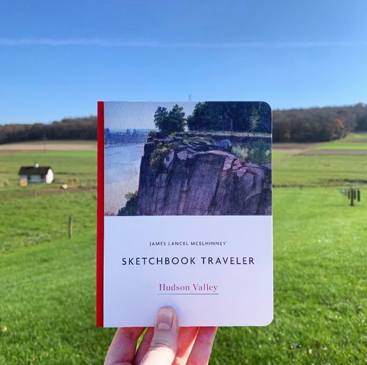
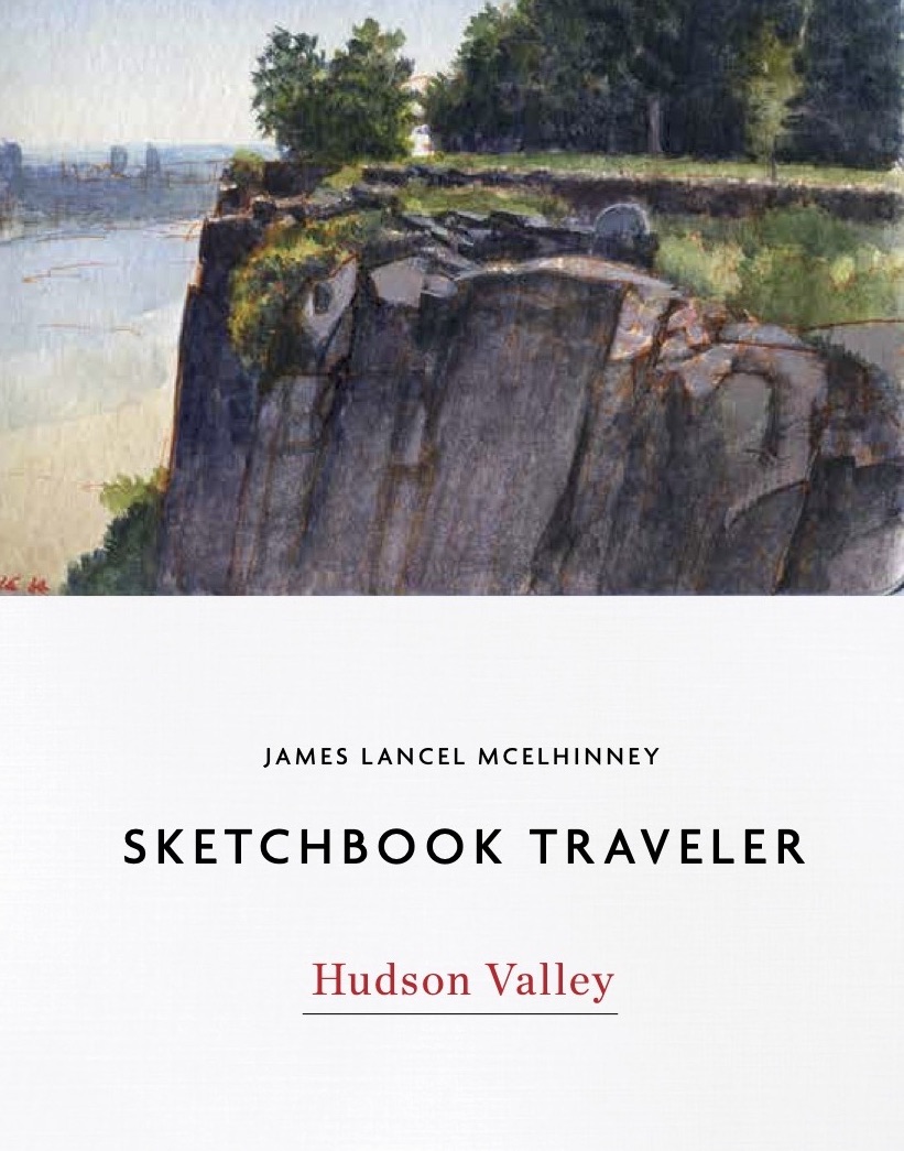
Just arrived: Advance copy of SKETCHBOOK TRAVELER: HUDSON VALLEY

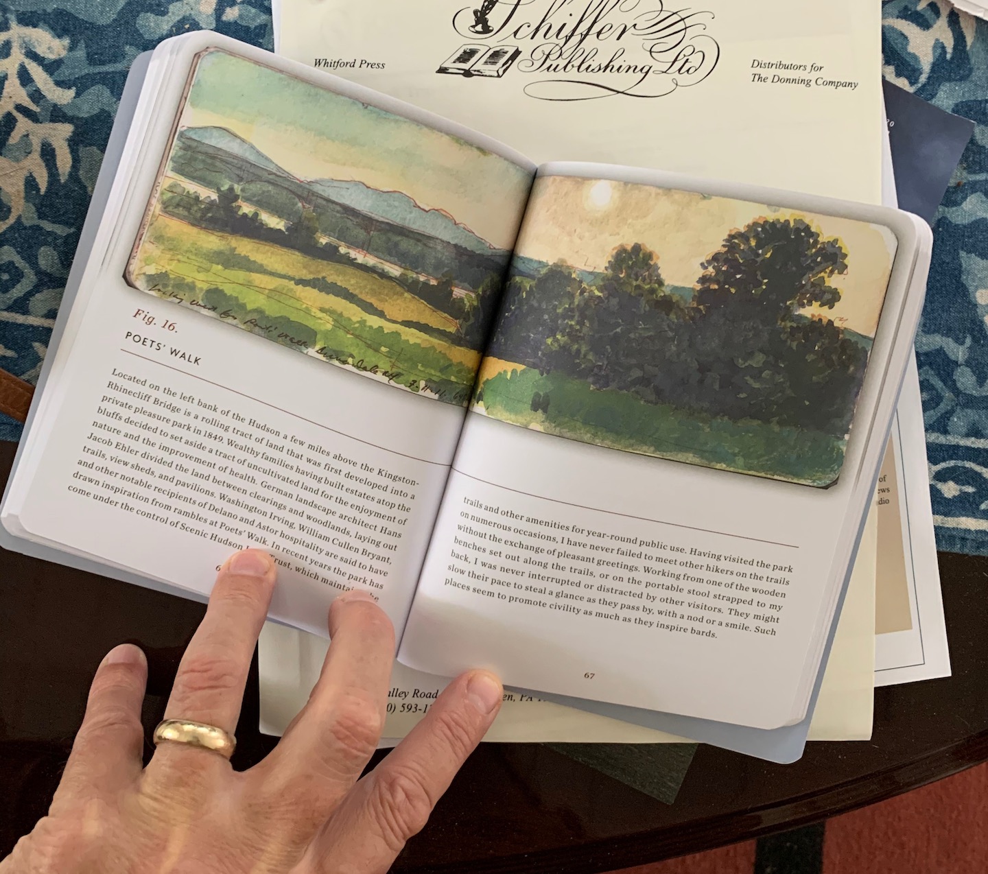
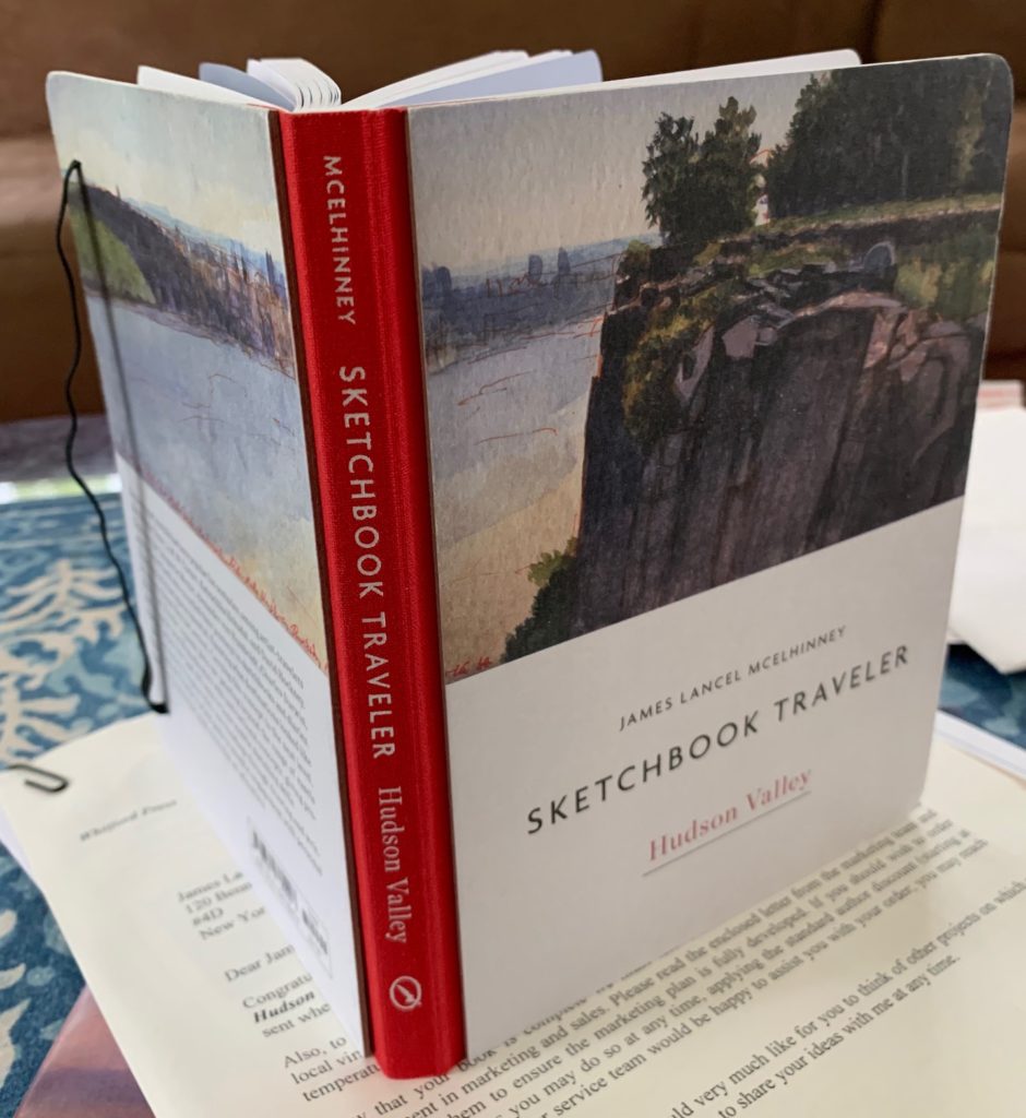
An advance copy of Sketchbook Traveler: Hudson Valley has just arrived! The brilliant crew at the Schiffer book farm in Atglen, PA have outdone themselves.
The impetus for this project was to create a hybrid that would be part art-book, part field-guide and journal, unpacking the mindful art of traveling light. We envisioned a book that would be equally at home in a backpack, or on a shelf in one’s library  I couldn’t be more pleased to find a volume that feels both like a journal one might carry in a backpack, or an attractive addition to ones library.


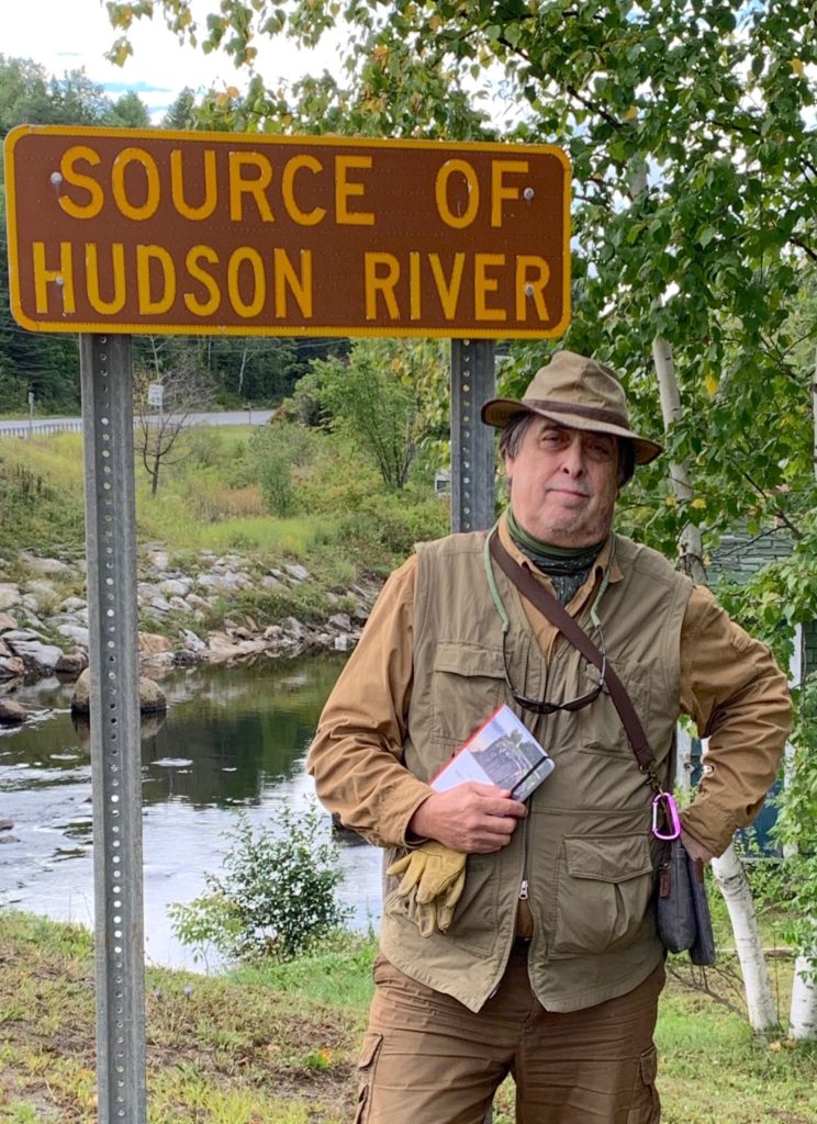
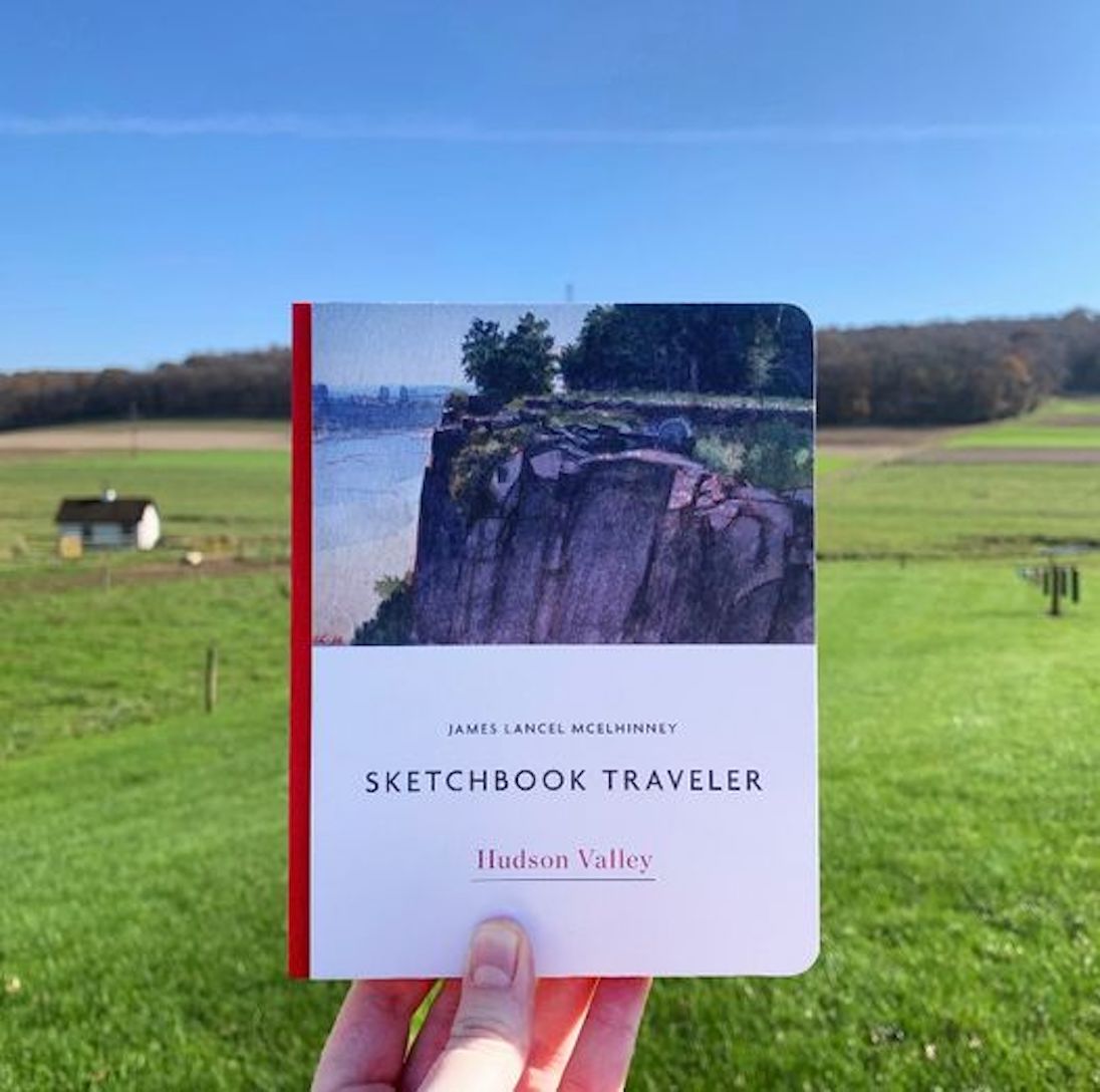
At Newcomb, New York. The head of navigation of the Hudson River. lake Tear of the Clouds on the slopes of Mount Marcy is the source of Feldspar Brook, which due to its elevation at 4,293 feet is accepted as the literal source of the Hudson. This can be a bit misleading if one ignores the fact that in its descent to the confluence of waters at Newcomb, the Hudson is assembled from Calamity Brook, Indian Pass Brook, Fishing Brook, Opalescent River, Newcomb Lake and others. It was here that famed Abenaki guide Mitchell Sabbattis met traveler-artists like Benson Lossing and Winslow Homer. The photo gives readers an idea of the size pf the book–large enough to festoon a coffee-table, yet small enough to carry in a knapsack.the book includes a section of work-pages with inspirational quotes.

The official publication date is late October, but the book is available now for advance purchase.

ORDER: SKETCHBOOK TRAVELER by James L. McElhinney (c) 2020. Schiffer Publishing).

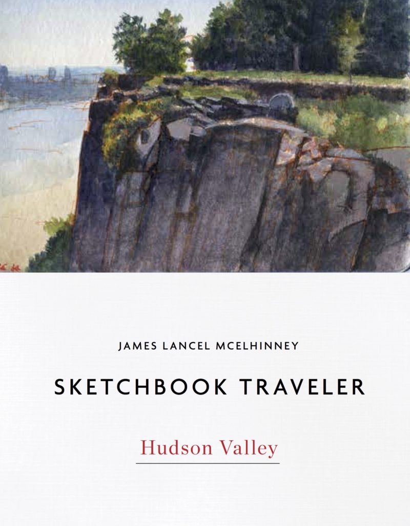
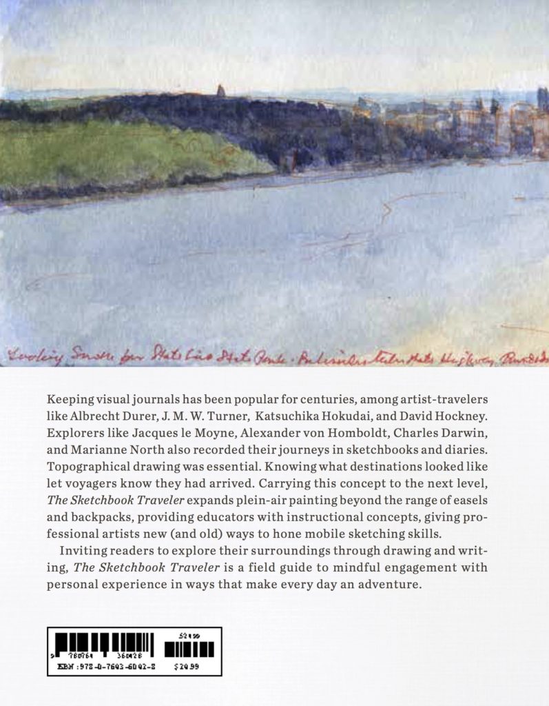
Front cover (above). Back cover (below)  The spine is bound in red cloth. The book is provided with a black elastic strap, like a field-journal