All posts by James L. Mcelhinney

SKETCHBOOK TRAVELER: DISPATCH #78. AUGUST 3, 2020. Seneca Fall, Lake Cauyga and Taughannock Falls.


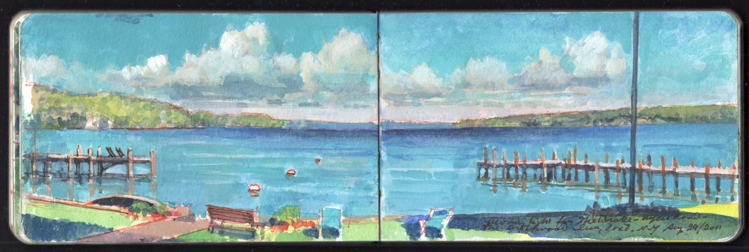
Lake Cayuga from Sheldrake Point August 29, 2011.

Thick clouds rolled across a rosy sky. Puddles sat in the road. Having crossed the lake, the deluge shed the last of its burden on the rolling plains of Upper Canada.
Going online we discovered major road closures between Sackett’s Harbor and New York City. The hurricane had come straight up the Hudson Valley, flooding creeks and downing trees in the Catskills before plowing into the Adirondacks. Its path had stretched from the Berkshires to the Finger Lakes. Fortified by a hot American breakfast, we decided to return home via a circuitous route through Seneca Falls and Ithaca.
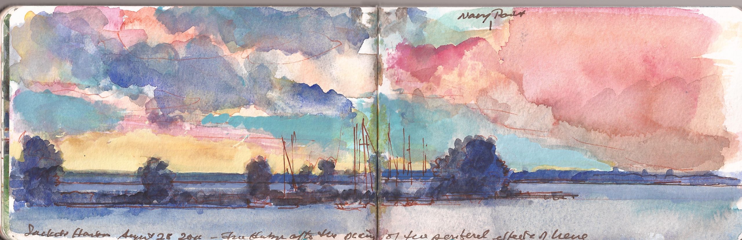

Navy Point and Sacketts Harbor after the passing of Hurricane Irene. August 28, 2011

Following the lakeshore, we reached Oswego. Visiting Fort Ontario, we walked the circuit of its grassy parapet, which afforded wonderful vistas of the lake and city. Our impromptu call was ill-timed for a reunion with Paul Lear—an old friend working as curator at the site.
Dropping down through Hannibal we followed blue highways and rural two-lane blacktop roads through places like Cato. Above Weedsport we reached the Seneca River, in service at that point as a stretch of the Erie Canal. All along the route we noticed a dearth of traffic and a number for trees knocked down by the storm, ripped apart, or deprived of a limb. The rolling terrain offers no barrier to Arctic blasts that mingle with warmer air drifting up from the south to generate heavy deposits of Lake Effect snow.
Crossing the northern end of Lake Cayuga on Highway 20 we arrived at Seneca Falls. Visiting the Women’s Rights National Historic Park—a deconsecrated Methodist church and other buildings where on July 19-20, 1848 the first women’s rights convention was held, resulting in a Declaration of Sentiments. Ninety-nine signers of both genders included Lucretia Mott, Elizabeth Cady Stanton and Frederick Douglass. The centerpiece of the visitor-center was a cluster of bronze figures conveying the effect of a life-sized Rogers-group.
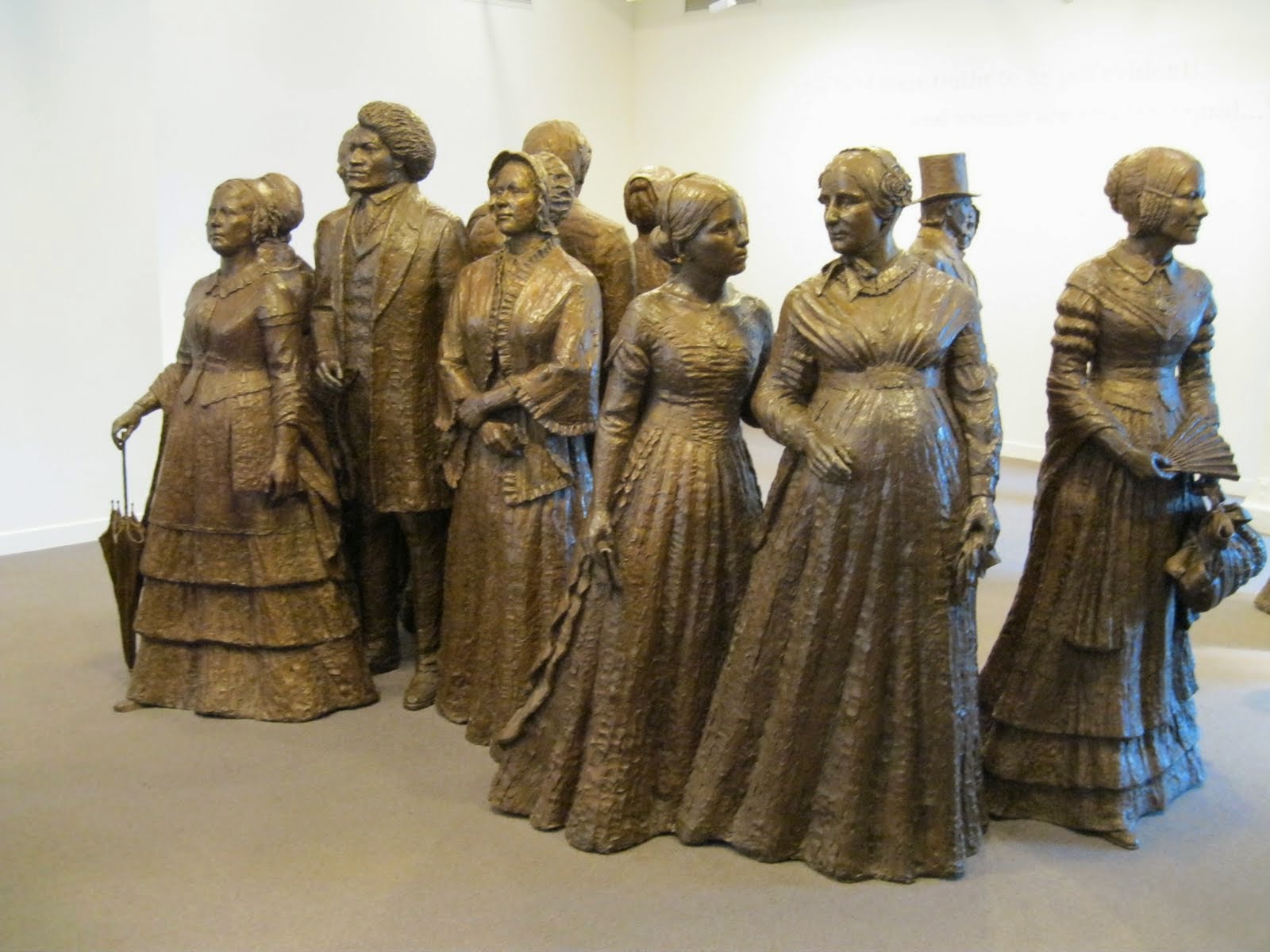

The First Wave. Sculptor: Lloyd Lillie (1932-2020) Women’s Rights National Historic Park. Seneca Falls, New York

Visiting the region in April 2010, we traveled to Leroy, New York–famed as the birthplace of Jell-O. It had also been the location of Adam Pratt’s dry-goods cash-and-carry store. This would mean nothing, were it not for the fact that his sister Eliza Pratt Greatorex (1819-1897) had lived there briefly, and returned on several occasions with her husband to give concerts in a local church. Henry Greatorex would provide the accompaniment for Eliza’s sweet contralto renditions of songs they had written together. One of them became a hit. Ironically, despite Eliza and Henry being ardent abolitionists, Love Me! today is found under the heading of Confederate popular music.
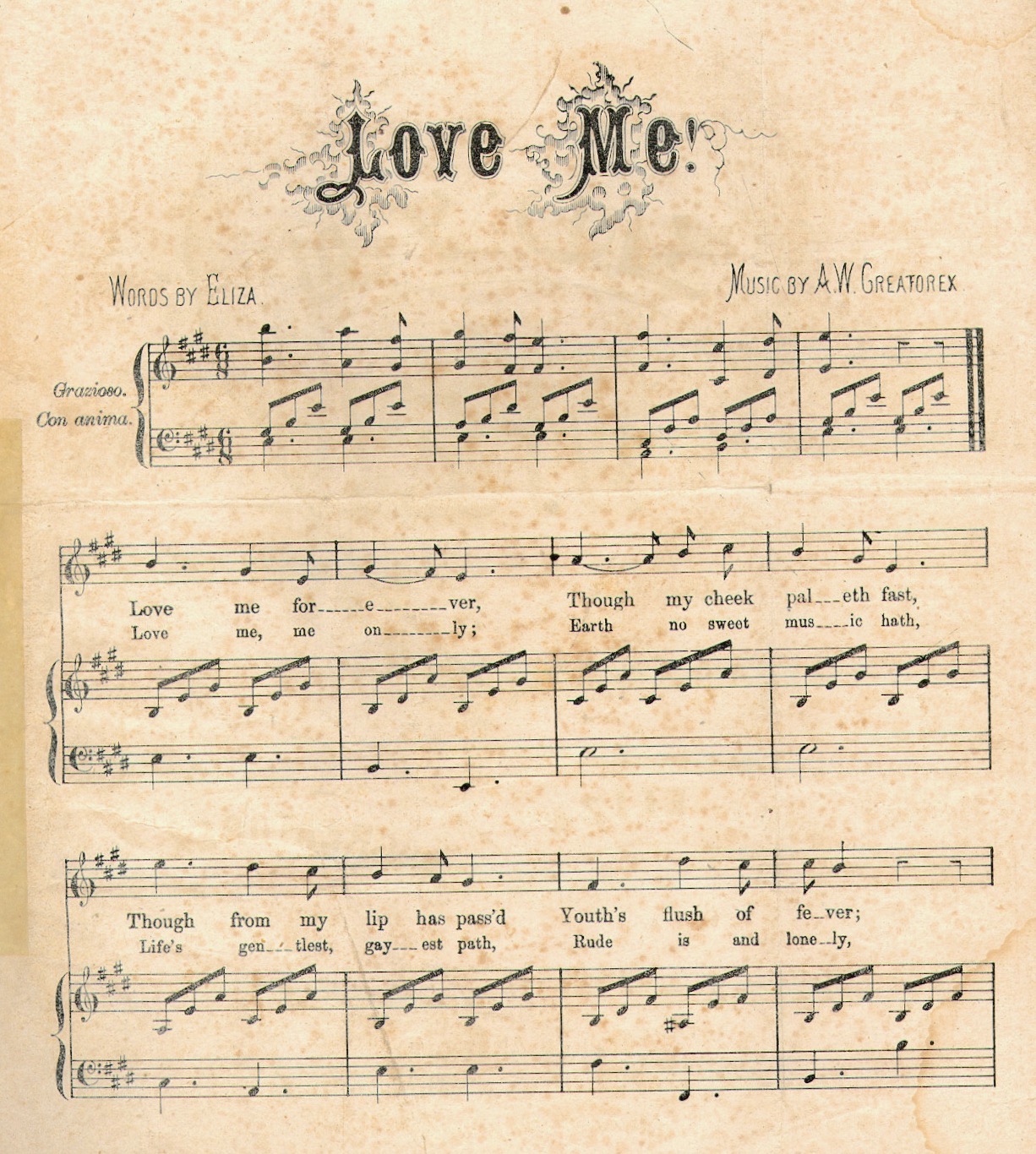

Listen: IMG_4307

East of Le Roy, between Rochester and Canandaigua is a reconstruction of Ganondagan, once a major political center for the Haudenosaunee (People of the Longhouse), where it is believed the Great Law of Peace was proclaimed in either the mid fifteenth or late twelfth century. The so-called Iroquois Constitution spelled out how the original five tribal nations would interact and cooperate, in order to preserve social stability and a sustainable economy. A sixth nation—the Tuscarora were brought into the confederacy in 1722. The oral document was encoded on symbolic beaded belts known as Wampum. It is said to have influenced the composition of the U.S. Constitution. The powers it gave to women did help spark the Women’s Movement of the mid-19th century and inspire the organizers of the 1848 Seneca Falls Convention. Western New York State by 1825 had been traversed by the Erie Canal. It produced a number of charismatic religious leaders, including Joseph Smith, the founder of Mormonism, and the creation of new Christian sects such as the Millerites, aka Seventh-Day Adventists and Jehovah’s Witnesses. Known as The Burned-over District for its religious fervor, it was also a hotbed of political progressivism. Out of the Second Great Awakening came notable figures such as Sojourner Truth, Brigham Young, and Frederick Douglass. Utopian communities were formed. Schools practiced racial integration. A seventy-two-year campaign for universal suffrage was launched, forty miles from Ganondagan.
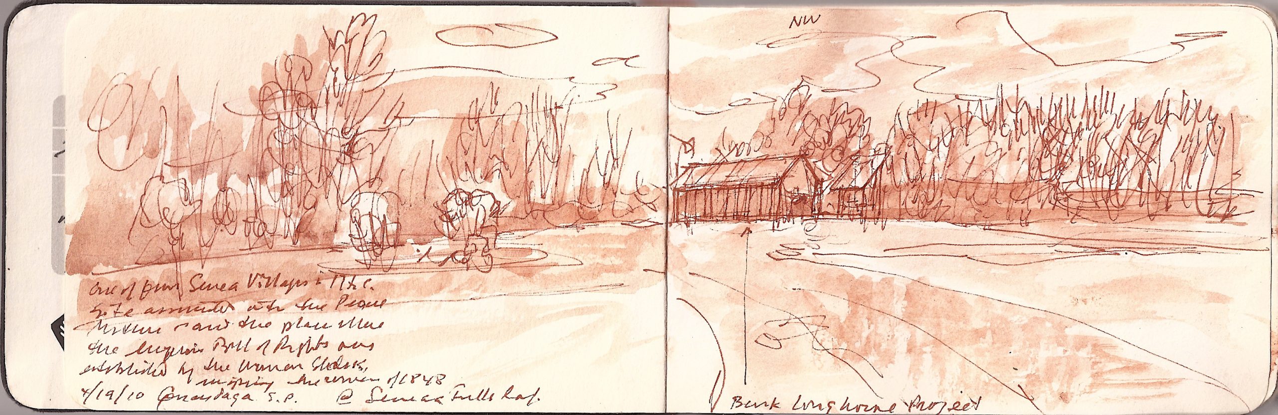

Reconstructed longhouse. Ganondagan State Park. April 19, 2010

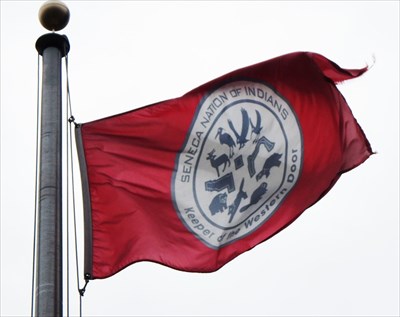
We visited the site in 2009, when Governor David Patterson was threatening to close state parks as a cost-savings measure. The site supervisor and his wife were both members of the Seneca Nation. I asked what they would do it the state shut them down. On the 135th anniversary of rthe battloes of Lexington & Concord, I liked their reply.
“We’ll wait a day or two, cut off the padlock and raise the Seneca flag, take back the land.”
OLYMPUS DIGITAL CAMERA

Flag of the Seneca Nation (Haudenosaunee Confederation)

After lunch we drove from Seneca Falls to Sheldrake Point, on the western shore of Lake Cayuga. Accommodations were not plentiful, but we found a comfortable roost at the Driftwood Inn, run by a woman named Tammy and her husband Jim. The great-grand-daughter of the couple who built the inn in 1912, Tammy was petite, fit and pretty—like an Olympic gymnast, with the efficient bearing of a sergeant-major. One of their sons worked at a nearby restaurant. Wrapping around the house was a veranda, with a sweeping north-facing view of the lake beyond. A small beach met the water at the far edge of the lawn. Road closures continued to be reported between Ithaca and Binghamton, as well as points further south. As we had been made to feel so welcome, and found our lodgings agreeable, we decided to stay another night.
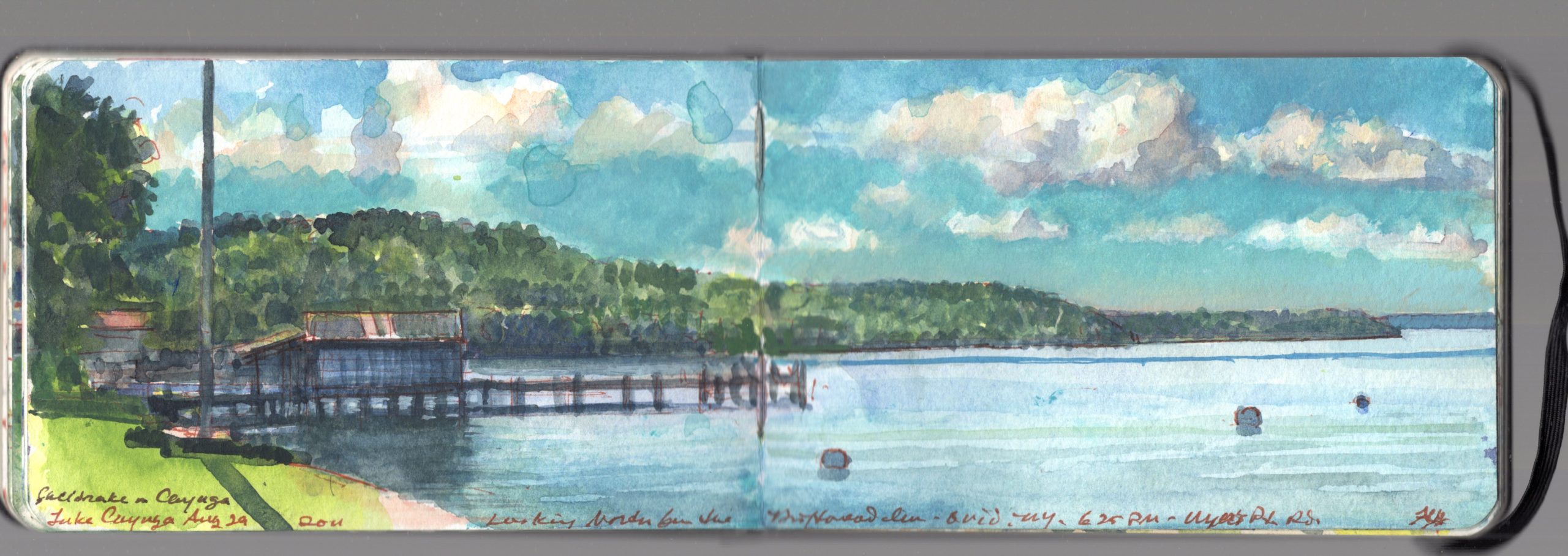

Lake Cayuga from Sheldrake Point. August 29, 2011.

The following day we determined to return to Manhattan by whatever route was open, regardless of how circuitous it might be. Following the lakeshore road (County Road 153) to Highway 89 we headed south toward Ithaca through pastoral countryside. Crossing Trumansburg Creek, we noticed a sign for Taughannock Falls. My maternal grandfather had gone to Cornell (Class of 1916). He always spoke fondly of his time there, and of the various gorges in and around Ithaca. A story he told about his college days involved a fraternity hazing ceremony demanding trust-fall. The new pledge would be led blindfolded to the edge of a gorge and told by his brothers to jump. The victim would be unaware that he had been turned to face the landward side of the path, and thus in no danger. On one occasion a mistrustful pledge went in the opposite direction, leaping to his death at the foot of a cliff. Reluctant to let facts stand in the way of a ripping yarn, my grandfather never verified the tale.

Like many well-groomed natural wonders, Taughannock Falls Overlook offers plenty of parking and masonry escalade leading down to the belvedere. The creek drops 215 feet into a rocky wooded glen, rimmed by Devonian limestone. The falls are twenty-five feet higher than Niagara. I was reminded of Kaaterskill Falls, which descends across the mouth of a cavern. Taughannock’s waters lick the cliff-face rising above the pool. As I stood drawing, a steady stream of visitors arrived. Snapping one or two shots of the falls, and perhaps a selfie or two, they climbed back up the steps to their cars. I calculated that most of the sightseers spent no more than thirty seconds, a minute at most beholding the scene.
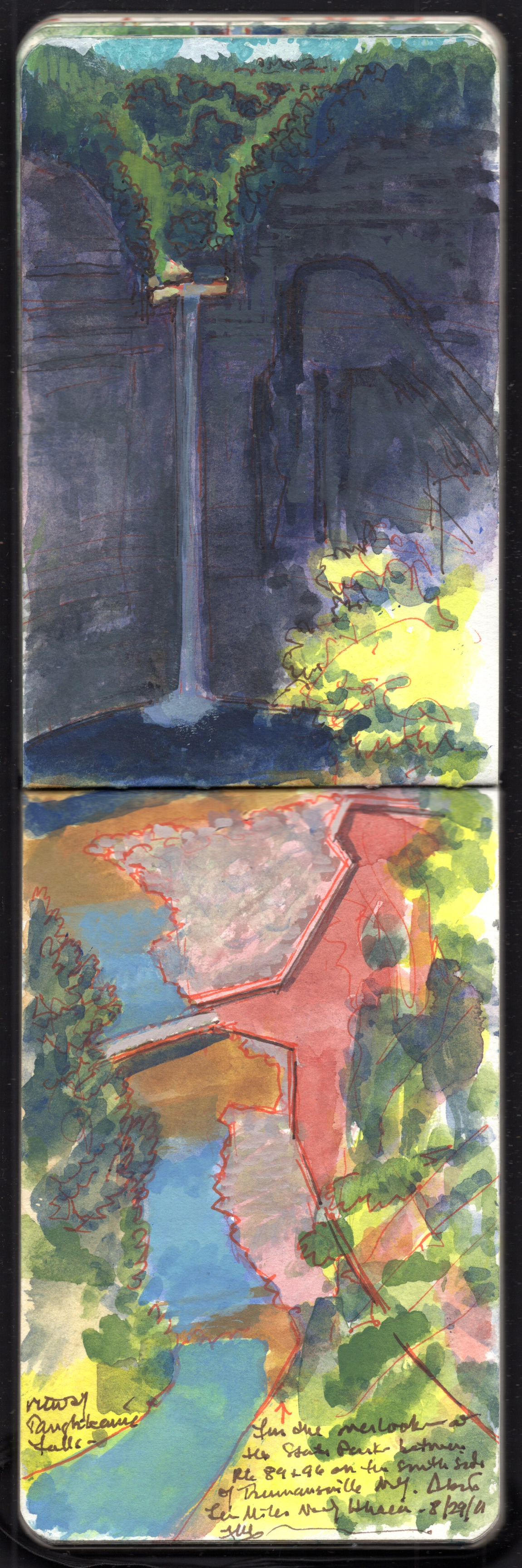

Taughannock Falls, Trumansburg New York. August 29, 2011

We could have weathered Irene in Manhattan but the storm had set us in motion. It had driven us to explore new places, and to discover things previously unknown to us. I could drive for days and be happy. Perhaps this wanderlust can be traced back to my New Bedford ancestors, hunting oil-rich Leviathans in the Pacific, or to Kathie’s seafaring Lusitanian roots. We Americans retain an immigrant gene—that restless impulse to get beyond the horizon, to risk it all on an uncertain future in unknown lands. Hearing third-generation nativists describe newcomers as invaders, I am tempted to chasten them furiously with my Mayflower pedigree. But that is nothing, compared to the dozens of millennia indigenous people had made homes in this land. Their names and words are written on modern maps; Taughannock, Cayuga, Oneida, Seneca, Oswego, Owasco, Otsego, Adirondack, Ticonderoga, Taconic and Manhattan. Over the years I have come to identify with all of these places as a guest. Material possessions beyond one’s knowledge are illusions, when we all must travel one day to an undiscovered country. The only way to own something is to honor it with our attention. The only way to encounter new things is to set oneself in motion. As Mark Twain wrote in The Innocents Abroad: The New Pilgrim’s Progress (1869)
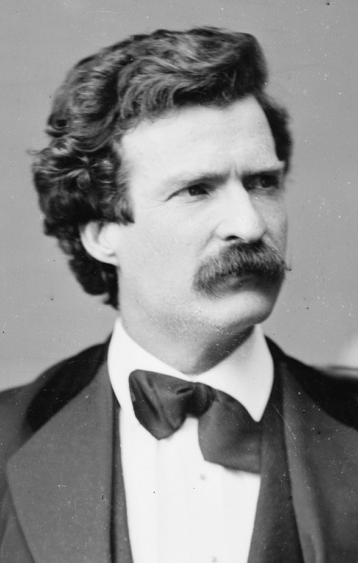

“Travel is fatal to prejudice, bigotry and narrow-mindedness”
ARTWORKS

PAINTINGS

MONOPRINTS

INTAGLIO & MIXED MEDIA PRINTS

LIMITED EDITIONS

PAINTING JOURNALS

PODCASTS

SCHUYLKILL RIVER NETCAST. INDEPENDENCE SEAPORT MUSEUM

FINE PRESS PUBLISHING

PALISADES: NORTH RIVER SUITE VOLUME TWO.

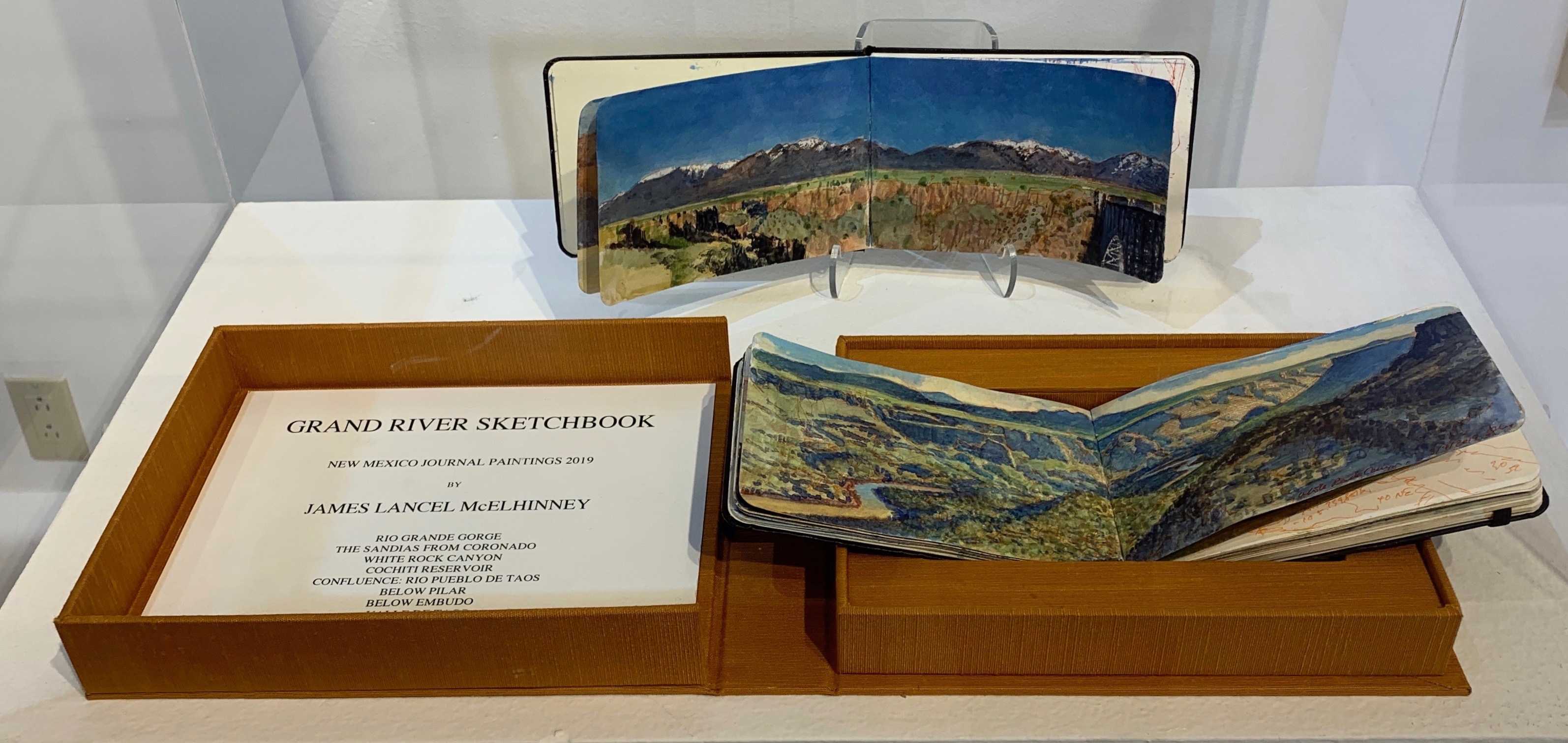
GRAND RIVER SKETCHBOOK.

O.T.W. ON THE WATER: THE SCHUYLKILL RIVER: HIDDEN RIVER SUITE VOLUME ONE

HUDSON HIGHLANDS.NORTH RIVER SUITE VOLUME ONE

Works on Paper in a new Online Exhibition.

Drawings make visible the mind of the artist. In collecting oral histories for the Archives of American Art I had the privilege of spending considerable amounts of time with prominent art-dealers and collectors. The late Eugene V. Thaw had a passion for drawing, as did the late Richard Gray. Both seemed to regard the connoisseurship of drawing as a mark of the most advanced collectors.


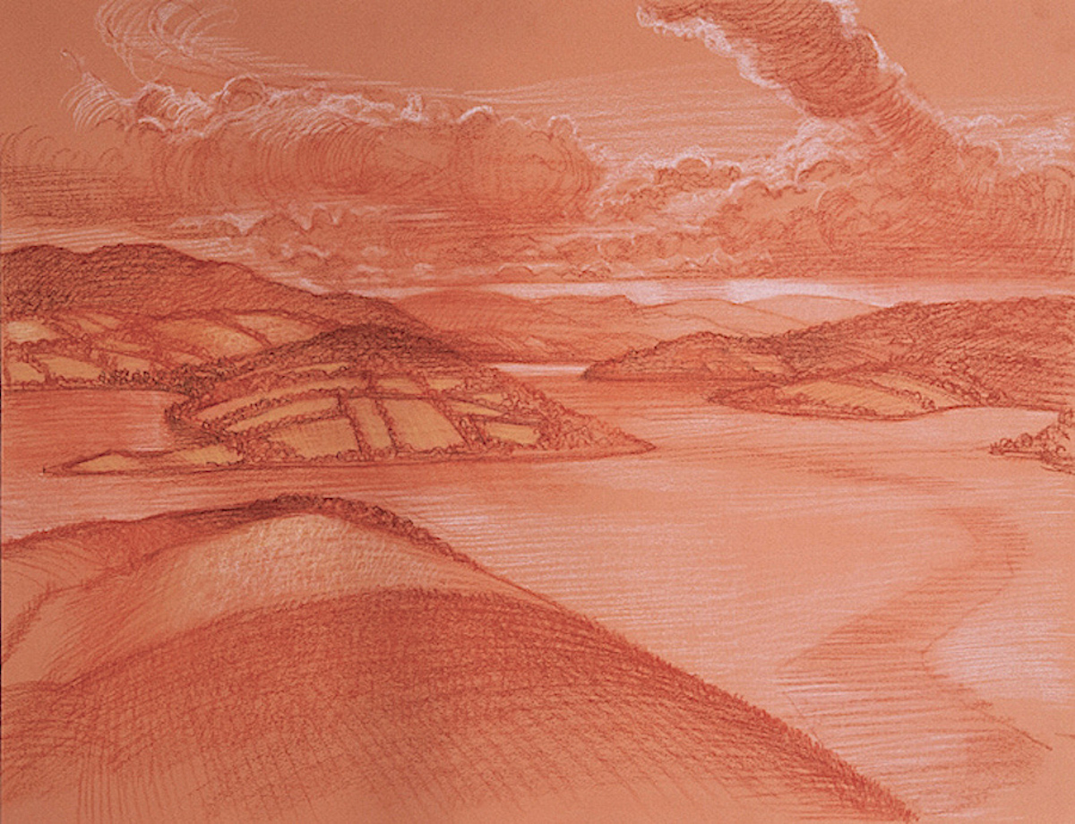
James Lancel McElhinney. Ballyheerin, Knockalla and Mulroy Bay from Leatbeg. Dry media on paper. 17.5 x 25 inches. Framed

I am grateful to Tony Carretta for curating several of my works in the online exhibition Drawing Today 2020.
Tony’s enterprising spirit has rallied an admirable roster of wonderful artists, many of whom have been dear friends over many years.
The exhibiton is a reminder that while life is short, art endures. Hope abides in the age of COVID.

Drawing from observation remains the best way to transform visual experience into knowledge and ideas. Drawing from memory allows one to shape knowledge into new visual experiences. Each of these practices informs the other. Fieldwork is generally regarded as preparations for the studio production of finished works. My approach is slightly different. The practice is the art, to which research, travel, sketchbook and studio activities are integral, reciprocal processes. After seeing a collection of penschildern by Van de Velde at the National Maritime Museum in Greenwich, I was encouraged to revisit the idea of graphic painting. In the late nineties I had produced a series of large palimpsests, combining maps, pictures and texts celebrating historic sites. As with my journal-paintings today, these works scorn the notion that drawing was mere lab-work, somehow inferior to paintings on canvas.

A selection of works available:


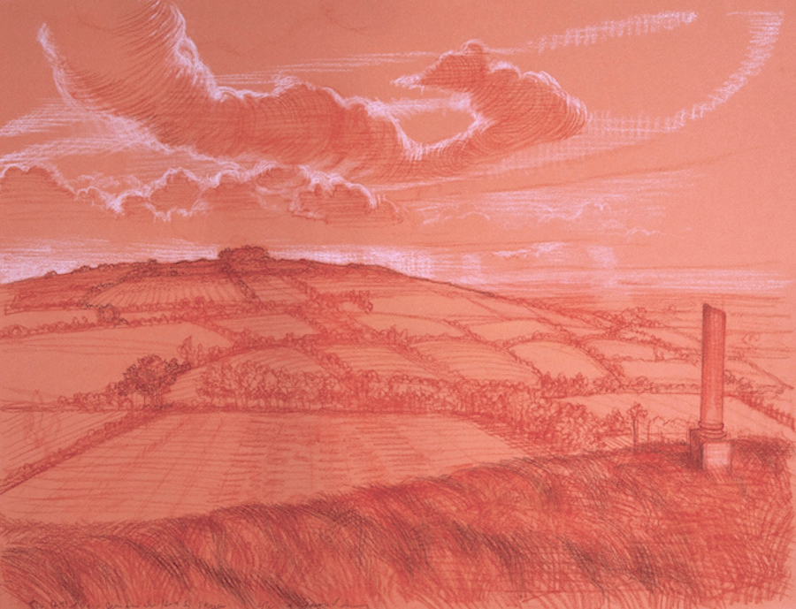
James Lancel McElhinney. Tara From Skreen. 17.5 x 24 inches. Framed


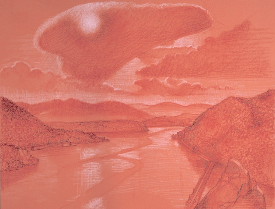
James Lancel McElhinney. Hudson Highlands from Storm King 17.5 x 24 inches. Framed


James Lancel McElhinney. Fort Washington on ther Potomac. 17.5 x 24 inches. Framed


James Lancel McElhinney. In the Margin of the Rockies. 17.5 x 24 inches. Framed


James Lancel McElhinney. Fort Lee aka Fort Constitution. 17.5 x 24 inches. Framed


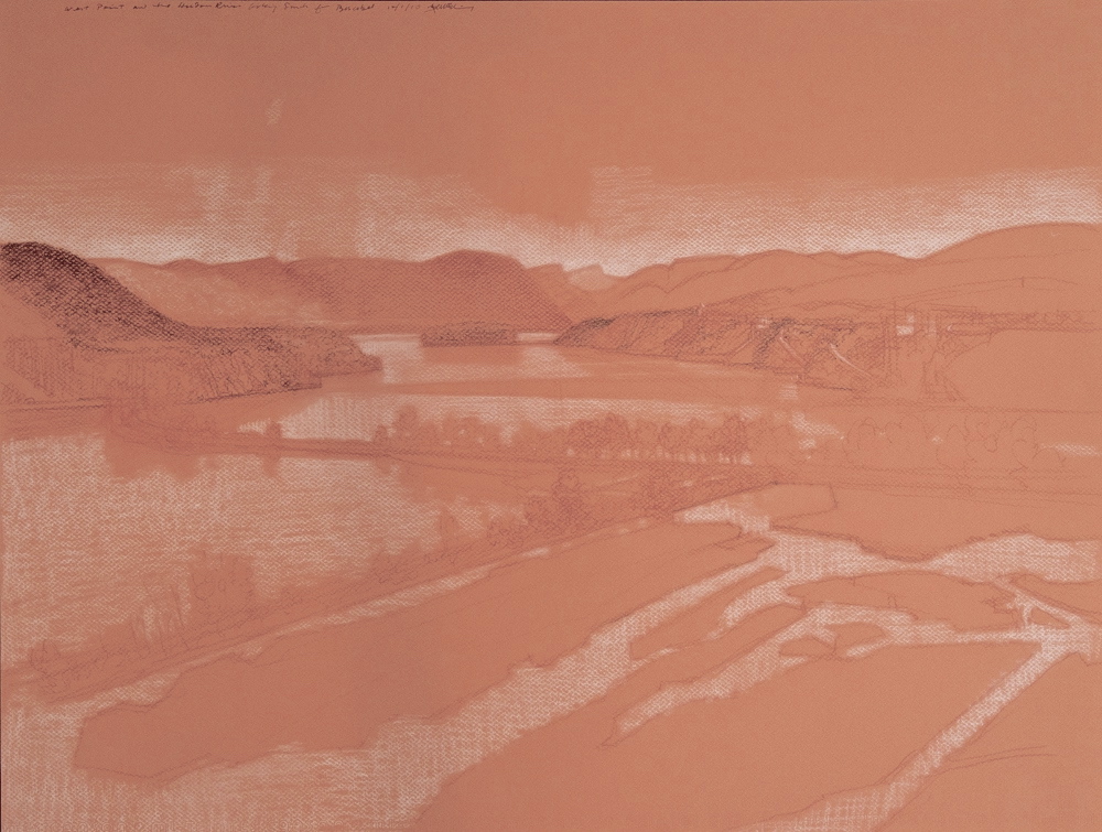
James Lancel McElhinney. Bastion Belvedere: Constitution Marsh and West Point from Boscobel. 17.5 x 24 inches. Framed


James Lancel McElhinney. Canyon de Los Frijoles. Bandelier National Monument. 17.5 x 24 inches. Framed


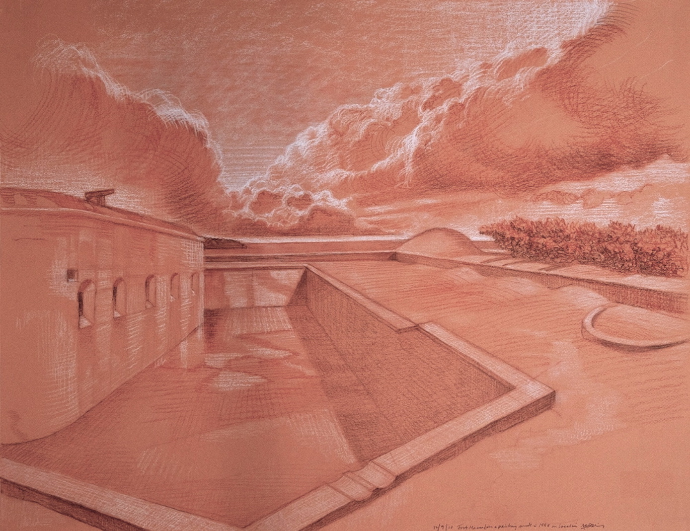
James Lancel McElhinney. Fort Macon. North Carolina. 17.5 x 24 inches. Framed

Drawing Today 2020. Curated by Tony Carretta. New Arts Projects, Litchfield Connecticut.
PDF:

Download (PDF, 266KB)


All works in the exhibition are available for purchase.

Follow James Lancel McElhinney and The Sketchbook Traveler on Facebook, Linkedin, Twitter and Instagram.

Peruse previous posts here. Dispatches #1-70. April 1-June 8, 2020.

Coming Soon: Hardcover. $24.95. From Schiffer Publishing. Release date: September 2020.

SKETCHBOOK TRAVELER: July 27, 2020. Dispatch # 77. Sackett’s Harbor


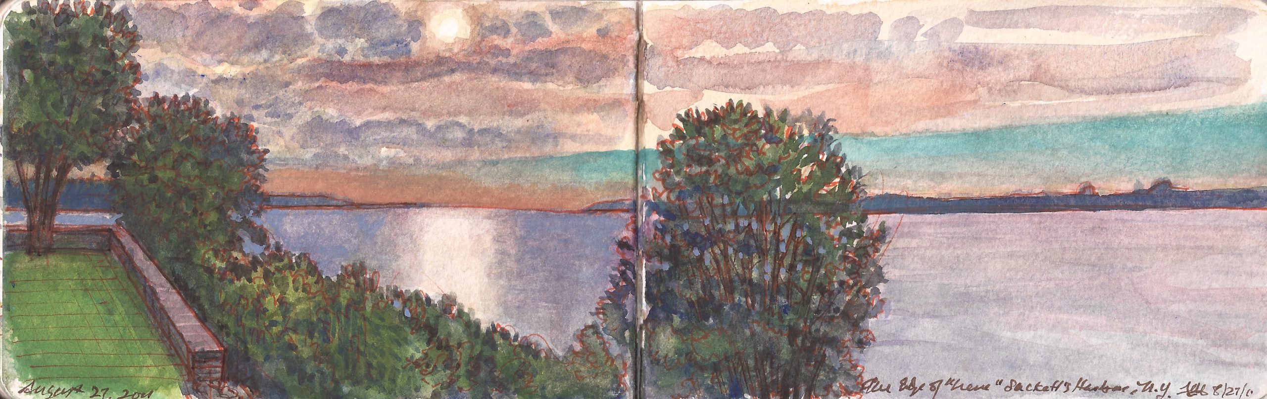
Late Light, Sackett’s Harbor. August 27, 2011

Looking at this morning’s reports of Hurricane Hannah battering the Houston area, I am reminded of the devastating effects of Hurricane Sandy on New York City in October 2012.
In August of the previous year Hurricane Irene slammed into Puerto Rico and tore up the Outer Banks before reaching the mouth of the Hudson River. Kathie and I decided to get out of town. Impending natural disaster gave use an excuse to take a short vacation prior to the start of the academic year. Deciding where to go was easy; north, away from the storm. The question remained where to go. Maine, Niagara Falls, Lake Champlain and the Saint Lawrence Valley were considered. We finally settled on a destination at the eastern end of Lake Ontario.
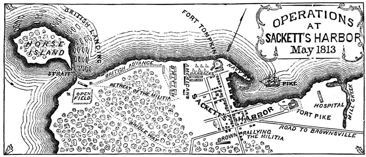
Driving north through Binghamton to Oswego, where we visited Fort Ontario. From there we proceeded east and north, following the shoreline until we came to Sackett’s Harbor. The village is focused on its sheltered anchorage and waterfront, which is lined with an assortment of dining establishments and a brewpub. Dividing the Harbor from Black River Bay is a crooked finger of land known as Navy Point. During the war of 1812, Britain and the United States were locked in an arms race. Britain commenced building a powerful fleet in the shipyards at Kingston in Upper Canada. The Americans did the same, forty miles away at Sackett’s Harbor, which twice the British tried to capture without success.


The Battle of Sackett’s Harbor. May 29, 1813. Benson J. Lossing. Pictorial Field Book of the War of 1812.

In late May of 1813, seven hundred regulars landed at Horse Island, a mile south of the village. After scattering a force of New york militia the Brits marched northeast along the shoreline to be faced with a solid line of defense, which repeated attempts could not penetrate. Owning to poor coordination, British gunboats failed to support the attack. Had they not withdrawn just before the arrival of a full regiment of U.S. regulars, the attacking force would have been destroyed or captured.
To behold the wooded grove and manicured fields south of the on August 27, 2012, it was difficult to imagine the momentous events of May 29, 1813. News reports were coming in of storm damage along the Jersey Shore, Long Island and the New York metro-area. After barreling over the city, the storm uprooted trees in the Catskills before pressing north to Lake Ontario. We awoke the following morning to a howling gale. Sheets of rain lashed the windows of our hotel-room for most of the day. By evening skies were clearing. Dark clouds raced across the harbor in the failing light.


Looking across Navy Point, Sackett’s Harbor. After the Storm. August 28, 2011.

In the morning we checked the news, only to discover that stretches of the New York State Thruway, I-81, Route 17 and numeorus back roads were impassible at many locations. Exploring the north end of town after breakfast, we found a former army base had been developed into a marina and hotels. Former officers’ quarters seemed to have become private dwellings. In the small national cemetery associated with Madison Barracks we found the grave of explorer Zebulon Pike (1779-1813) whose 1806 expedition to locate the source of the Arkansas River was a thinly veiled attempt to gather intelligence about the disposition of Spanish military deployments in what is now Colorado and New Mexico.


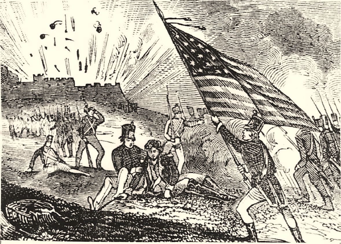
Imaginative depiction of the death of Zebulon Pike.

Following his capture of Fort York (Toronto) on April 27, 1813 Pike was standing on the parade-ground of Fort York (Toronto), interrogating a British sergeant. Unbeknownst to Pike, is men and most of their captives, a slow fuse had been lit inside the fort’s powder-magazine. The explosion launched tons of debris into the heavens, including a large stone block which crushed Pike. What was left of the newly minted general was returned to Sackett’s Harbor for burial. In retaliation for the death of their commander, and for what many on the ground regarded as a cowardly act, the village of York was put to the torch. Sixteen months later the British replied by burning the U.S. Capitol, The White House, and other government buildings in Washington D.C.
Extending our stay another night, we planned to return to the city on the following day. August 30 arrived with many road-closures still in effect. Instead of fighting our way back, we decided to head west to Seneca Falls, drop down along the shores of Lake Cayuga to Ithaca, hoping by then that the highways leading back to New York City would have been cleared. But that is another story.

James McElhinney is represented by Gerald Peters Gallery in Santa Fe

Read prior dispatches from The Sketchbook Traveler by James Lancel McElhinney (c) 2020

Coming Soon: Hardcover. $24.95. From Schiffer Publishing. Release date: September 2020.

SKETCHBOOK TRAVELER. July 20, 2020. Dispatch #76. Battlefield of Cedar Creek. October 17-19, 2014.


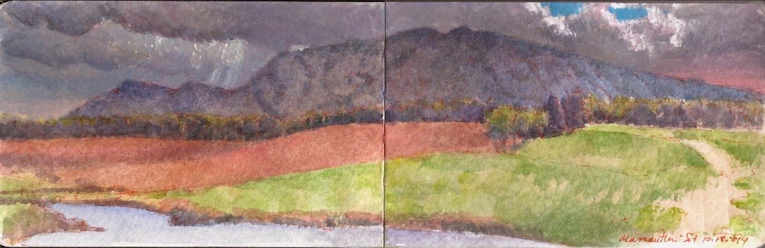
Massanutten Mountain from Belle Grove Plantation. October 18, 2014

Catching a few more winks before reveille, federal troops camped west of the Valley Turnpike just north of a tributary of the north fork of the Shenandoah River called Cedar Creek. Awakened by the piercing yell of thousands of confederates, slumbering federals were driven out of their bivouac. Rather than follow up on the surprise attack with determined pursuit, confederate soldiers fell to looting. By the time order was restored by their commanders, the confederates faced two army corps deployed along the high ground two miles to the north. As the opposing forces met, a crushing counterattack drove the rebels back across Cedar Creek in disarray. Following his defeat on October 19, 1864 Jubal Early never again commanded troops in battle. His opponent Philip Sheridan was promoted to the rank of major in the regular army. The pretty wife of one of his cavalry commanders delivered captured flags to President Lincoln at the white House. She and her husband Autie Custer became celebrities overnight. The drama played out in the shadow of Massanutten, synclinal limestone ridge rising twenty-three hundred feet above the Shenandoah valley in Northern Virginia.

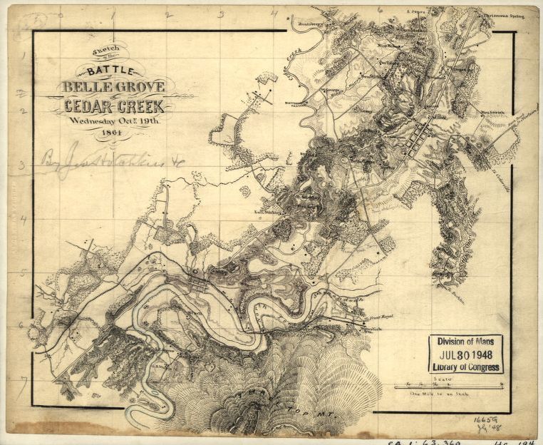
Jedediah Hotchkiss (1828-1899) had been born in Windsor, New York. After completing his secondary education, he taught briefly in Pennsylvania before opening a school in Augusta County, Virginia. Moonlighting as a mining engineer, he took up topographical drawing as a hobby. When sectional conflict erupted in 1861, Hotchkiss joined the confederate army. His mapmaking skills and intimate knowledge of the rails and byways of the Shenandoah Valley made him an invaluable asset to the process of collecting military intelligence and planning operations. On October 18, 1864 Hotchkiss and confederate commander General Jubal A. Early climbed up to Pilot Knob on Massanutten mountain, to view the deployment of Horatio Wright’s VI Corps atop the bluffs north of Cedar Creek.


Jedediah Hotchkiss. Map of the battlefield of Cedar Creek. October 19, 1864. the northern end of Massanutten Mountain including Pilot Knob is at the bottom center of the map. MY POV was in the center of grid-section 2-3 horizontal x 4-5 vertical, looking southeast.

I first encountered Hotchkiss’s maps when I met paper conservator Susan Filter. A friend of Roy Goodman, curator of collections at the American Philosophical Society, Susan was working on a large project conserving Hotchkiss material in the collection of the Library of Congress. Timing was perfect. I was at that moment preparing to move to Richmond, Virginia to explore the physical memories of the Civil War, in the form of battlefields threatened by development. Part of my process required comparing historical maps with modern roadmaps and USGS topographical sections. Like Hotchkiss, I was an autodidact where mapmaking was concerned.


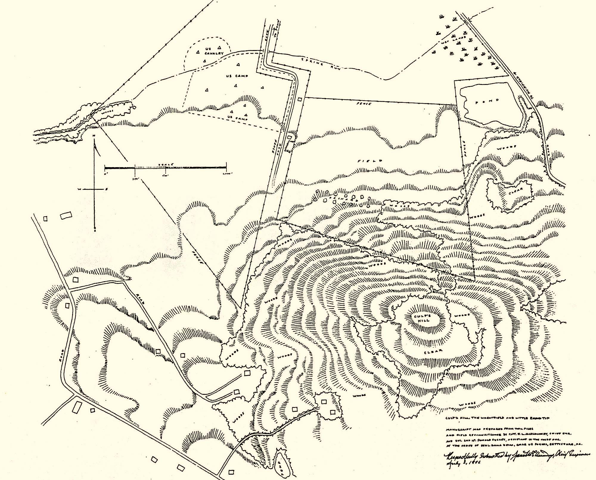
James L. McElhinney. Map of the 143rd anniversary reenactment of the battle of Gettysburg. Fairfield PA. July 2, 1996

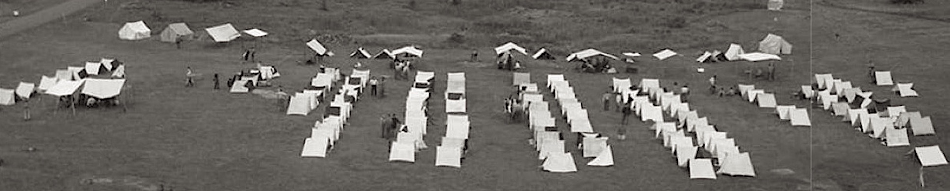
On October 15, 2014 I traveled to Middletown Virginia, to participate in the 150th anniversary observances of the battle of Cedar Creek. My role in the reenactment as quartermaster for the National Regiment included laying out the federal camp according to regulations, into a series of company streets, with a separate row of tents for the headquarters and staff. This required measuring the appropriate distances between each street using a Gunter’s chain, then laying them onto the ground with stakes and surveyor’s tape. In effect, the result was a giant drawing several hundred feet in length. I had done something similar the previous year in laying out the camp for the National Regiment behind the Pennsylvania Monument, for the National Park Service Sesquicentennial of the battle of Gettysburg.


Panoramic view of the federal camp at Gettysburg. July 1-3, 2013

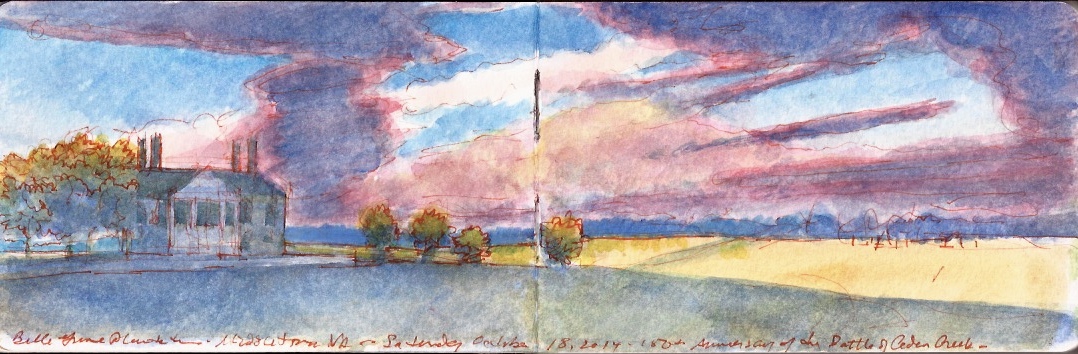
The second step involved directing tenants to their proper place in the camp. More than once someone would set up in the street by lining up the back of their tent with the tape-line. One or two grumbled about having to take everything down and set up again. One feisty individual refused to correct their error, suffering ridicule until he complied. Spraining an ankle before the day was over, I was forced to find quarters in the town. Being hors de combat for the weekend I hobbled around camp for a while, then made my way over to Belle Grove Plantation.


Belle Grove Plantation. Middletown Virginia. October 18, 2014

At the time none of us could have foreseen the events that would follow a three years later, when a suspicious device resembling a pipe-bomb was discovered at the 2017 Cedar Creek reenactment. No one was injured. Following in the wake of neo-confederate and Alt-right protests in Charlottesville a few months prior, anti-fascist activist were blamed for the stunt. Subsequent investigations revealed the culprit was a deeply troubled individual who had been banished from the reenacting unit to which he belonged. The annual reenactment was cancelled in 2018. Attendance the following year suffered from lingering fears stemming from the 2017 bomb-threat. Cedar Creek battlefield is one of the most beautiful and picturesque pieces of rolling rural landscape in Virginia. It and the historic Belle Grove mansion have been preserved by the Cedar Creek Battlefield Foundation, a private nonprofit organization for which the annual reenactments provided a much-needed source of revenue. Plans are underway to hold another reenactment on October 17-18 of this year. In the midst of a global pandemic, and one of the most chaotic election years in U.S. history, all is uncertain. It may be that by lashing out at monuments, American society is drawing on some fundamental iconoclastic Puritanism. Monuments after all, did not enter the canon of American art in any serious way until the late nineteenth century. The land is a different story. New England village greens, and southern courthouse squares represent common ground, where neighbors meet in peace. Fields and pastures where neighbors met in battle are no less sacred. All is hallowed ground.

“In great deeds, something abides. On great fields, something stays. Forms change and pass; bodies disappear; but spirits linger, to consecrate ground for the vision-place of souls… generations that know us not and that we know not of, heart-drawn to see where and by whom great things were suffered and done for them, shall come to this deathless field, to ponder and dream; and lo! the shadow of a mighty presence shall wrap them in its bosom, and the power of the vision pass into their souls.”

–Joshua Lawrence Chamberlain (1828-1914)


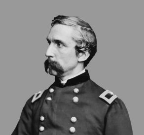
J.L. Chamberlain in the uniform of a brigadier general, ca. 1865

Follow The Sketchbook Traveler on Facebook, Linkedin, Twitter and Instagram.

Peruse previous posts here. Dispatches #1-70. April 1-June 8, 2020.

Coming Soon: Hardcover. $24.95. From Schiffer Publishing. Release date: September 2020.

SKETCHBOOK TRAVELER. July 14, 2020. Update. New Viewing Format for Quaranteam Dispatches

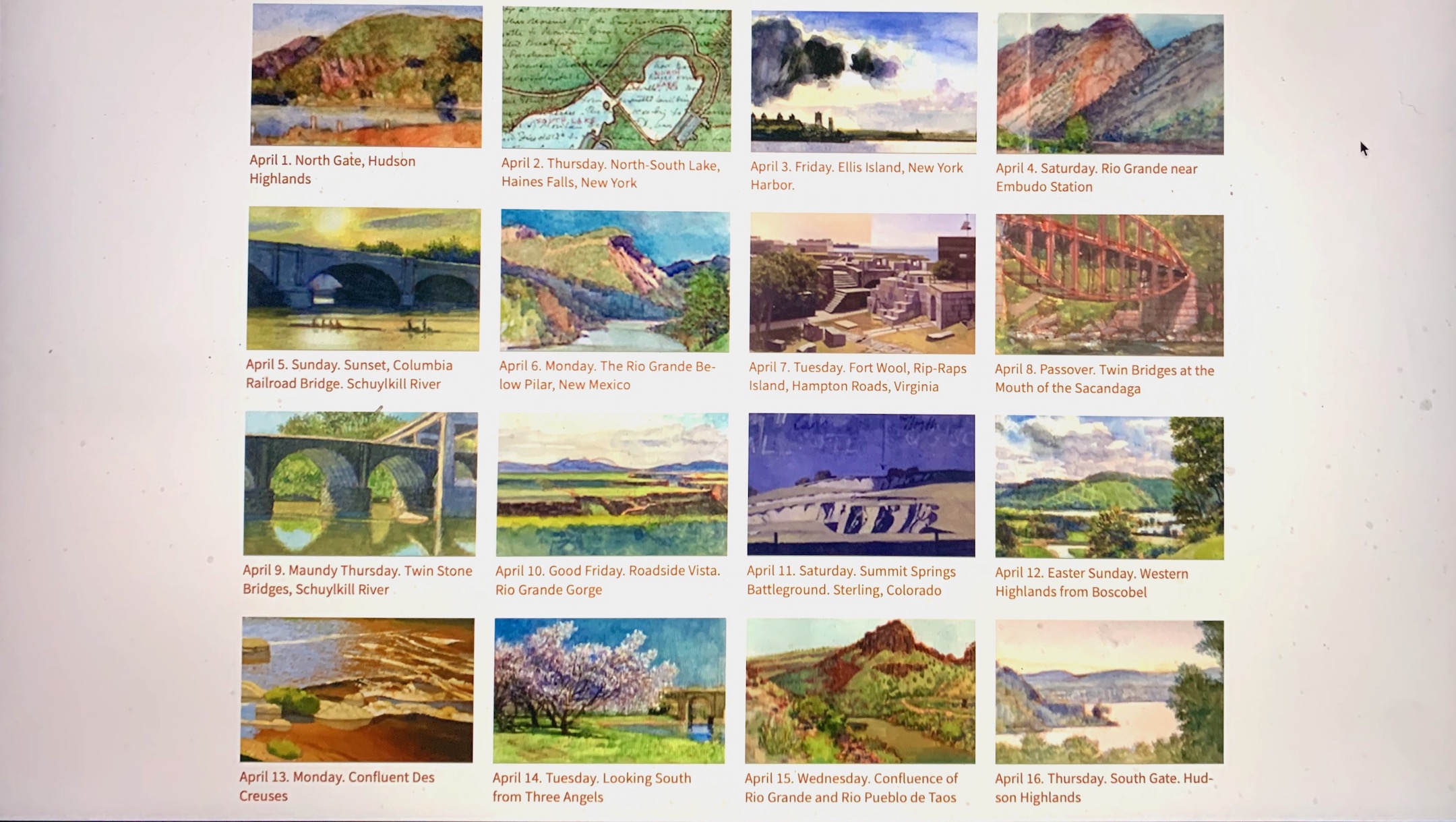
At the outbreak of COVID-19, Kathie and I retreated to our Manhattan apartment. Sitting down to write every day temporarily replaced the practice of making visual art. Family, friends and colleagues endured similar confinement. These posts were written with them in mind, in solidarity with others sheltering-in-place. Graham White designed a calendar-grid compendium of seventy quotidian dispatches posted between April 1 and June 8. On June 15 these posts moved to a weekly schedule. Open the link. Pick a destination. Enjoy!

Click on the image below:


Sample view. Sixteen of seventy thumbnail links to Quaranteam Dispatches. Designed by Graham White.

COMING SOON:

Coming Soon: Hardcover. $24.95. From Schiffer Publishing. Release date: September 2020.

Follow The Sketchbook Traveler on Facebook, Linkedin, Twitter and Instagram.

Peruse previous posts here. Dispatches #1-70. April 1-June 8, 2020.

SKETCHBOOK TRAVELER. July 13, 2020. Dispatch #75. Cape Ann, Massachusetts


Thatcher’s Island from Long Beach. Cape Ann. Thursday April 12, 2012

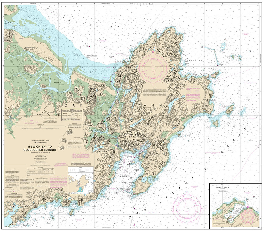
Cape Ann is a headland on the Massachusetts coast located forty miles northeast of Boston. The name has come to designate the island from which it projects into the Atlantic, separated from the mainland by a marshy channel known as the Annisquam River. The island has been a magnet for artists since the nineteenth century.


Nautical map of Cape Ann.

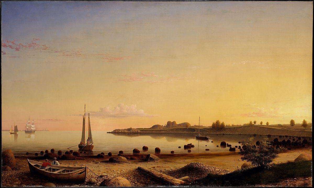
Nathaniel Rogers Lane, better-known as Fitz Henry Lane (1804-1865) became a celebrated painter of maritime subjects characterized by a refinement and use of light later dubbed Luminism. Winslow Homer spent the summer of 1880 living on Tenpound Island, in the middle of Gloucester harbor. Other seasonal residents of Cape Ann include Anna Hyatt Huntington, Walter Hancock, Paul Manship, Edward Hopper and Jo Nivison; Marsden Hartley, John Marin. Like Provincetown, Gloucester became an art colony, and summer resort. Unlike P-town, Cape Ann’s quarries and blue-collar maritime industries continue to contribute to the local economy year round.


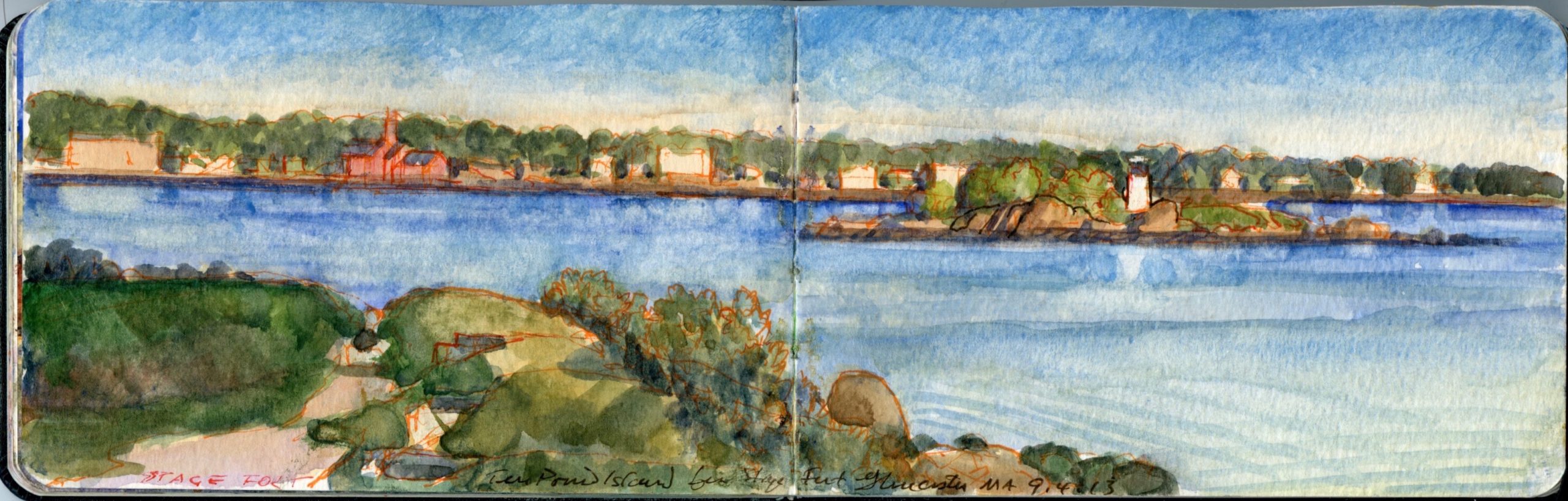
Gloucester Harbor: Tenpound Island from Stage Fort. Wednesday September 4, 2013.


Cloudburst over the Atlantic, from Rockport Massachusetts. Monday April 1, 2013.
I first visited Cape Ann en route to a family vacation on Mount Desert Island. After lunch in Rockport we visited the tourist shops along Bear Skin Neck. Hand-whittled Old Salts, wooden Sperm Whale welcome-plaques, along with views of Motif Number One tempted shoppers with a dizzying array of decorative souvenirs. Even in my teens I knew about Homer. Lane (then “Fitz Hugh”) was a revelation. Sunday painters had set up along the landside bulkhead, focused on the red fishing-shack famed as prime among all dockside motifs. Bernard Chaet (1924-2012) and his family kept a summer cottage a mile north in the village of Pigeon Cove. Driving by Motif Number One he would shout advice at its worshippers.
“More blue!”


Fitz Henry Lane. (1806-1865) Stage Fort Across Gloucester Harbor. 1862. Courtesy Metropolitan Museum of Art, New York

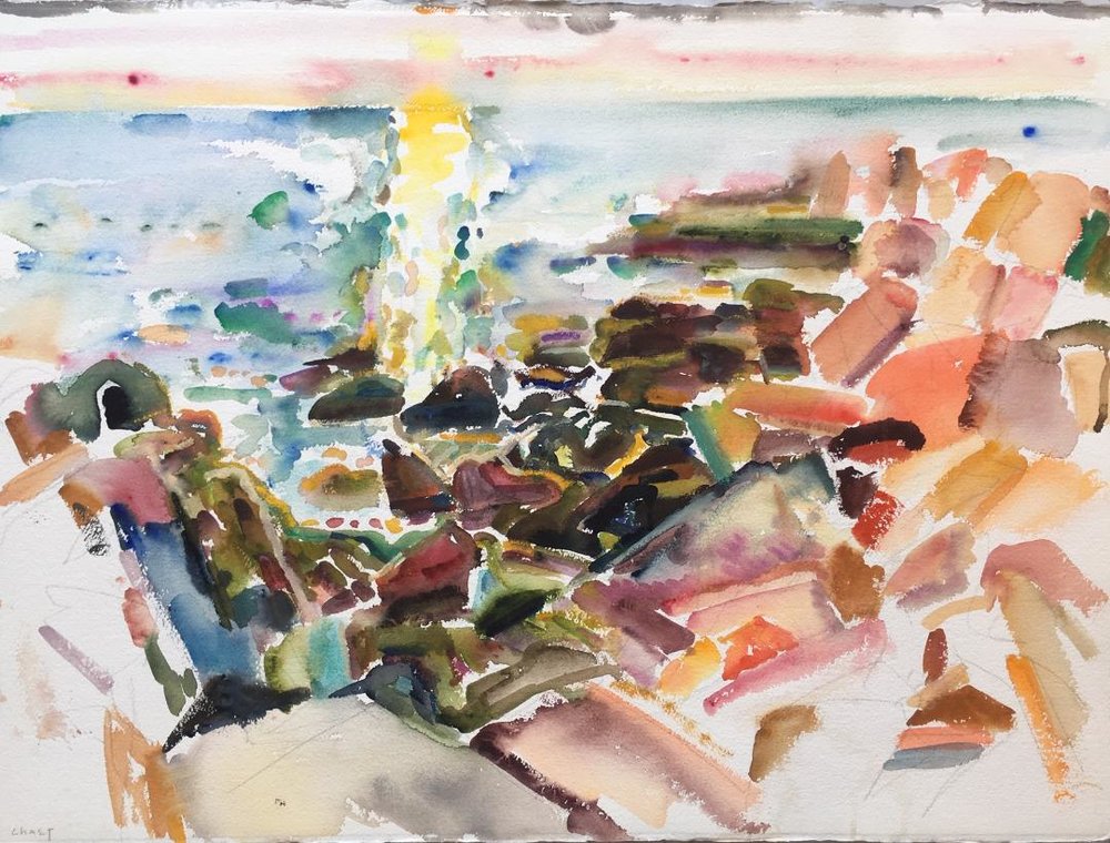
My first visit to Bernie on Cape Ann was during the summer of 1976, shortly after my graduation from Yale. Serving as his teaching assistant during my final year in the MFA program, we had developed a friendly rapport. My companion at the time was Randi Danforth, whose family lived in Groton. As she visited friends on the North Shore, I drove up to Cape Ann to call on the Chaets. Bernie had grown up in Boston. He and his friend Alan Fink, the founder of Alpha Gallery purchased seasonal homes near an old quarry in the hamlet of Pigeon Cove. At some point, Bernie had taken to rising in the morning to paint the sunrise from Cathedral Rocks, and other points along the rocky shoreline. It became his motif number one for as long as he was physically capable of negotiating the broken ground along the rocky shore. This discipline, his practice yielded some marvelous improvisations that resonated with his lifelong love of Jazz.


Bernard Chaet. Warm & Yellow. 1990. Watercolor. Courtesy Alpha Gallery, Boston, MA

The painter Dan Gustin graduated from Yale two years before me. He remained in New Haen for several years until he landed a teaching-job in Chicago. I sometimes lent him my student ID so that he and Bernie could play tennis on campus. One day Dan arrived at Chaet’s house on Cold Spring Avenue, ready to hit the court. He rang the doorbell. Nothing.
He rang it again several times. No response. Coming from inside the house Dan heard music. Stepping off the porch he looked through the living-room window. Spinning in the stereo was a jazz album. Not Chet Baker, something wild. Bernie danced around the room in a bacchanalian frenzy. I witnessed something similar one evening when Bernie and I went to listen to his old friend, jazz trumpeter Ruby Braff (1927-2003) at Jimmy Ryan’s on 54th Street in Manhattan. Bernie paid the cover. I bought the first round of drinks. Scotch on the rocks. The venue was intimate. That night is was packed. Looking around the room through a haze of cigarette smoke, there was no sign of Bernie. Seated at a small table was a man possessed. Arms flailing, fingers snapping, both knees bounced up and down. His head shook from side-to-side like a retriever shedding water. I put a drink in front of him. He paused and looked up. It was Bernie.
“This is a real treat” he said. “This guy is GREAT!”
Arriving in Pigeon Cove one Sunday for brunch and a visit, I found Bernie putting the stereo speakers onto the window-sills, facing outward. He switched on the radio and cranked up the volume, so we could sit in the yard while listening to his Sunday morning radio show. Ninon stepped out of the house.
“Bernard. Don’t you think the music is bit loud? We don’t want to disturb the neighbors.”
“Screw ‘em,” he replied with a wicked grin. We had to listen to their Rock & Roll all hours of the night. They can listen to some REAL music!”


Cathedral Rocks from the Emerson Inn, Rockport Massachusetts. Monday September 3, 2012

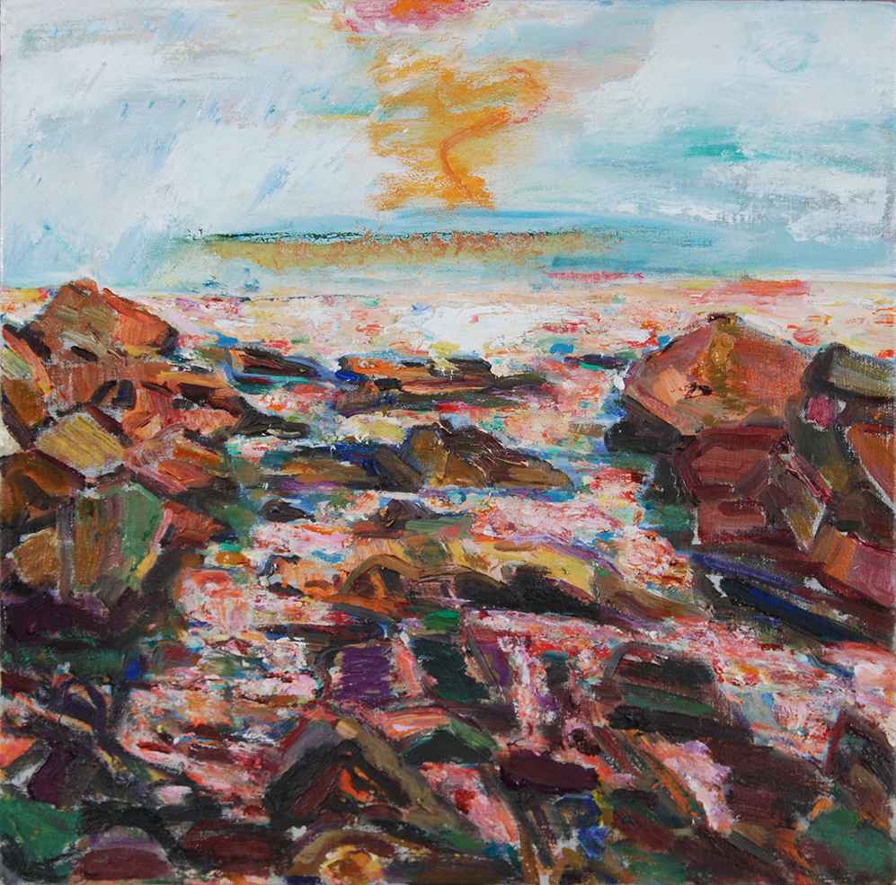
Over the years I returned to Gloucester. Kathie’s parents lived in Andover. Visiting them we would often make excursions to Essex and Cape Ann. Attending a conference at the Cape Ann Historical Museum, we stayed at the Emerson Inn near Cathedral Rocks. The years had finally caught up with Bernie, who had lost the nimbleness that once allowed him to scramble over the rocks to the sea at dawn. I visited a few of his motifs, but never saw them in the same way. For Bernie, the scattered boulders, jumbled clouds, rhythmic waves, and dancing light were like players in a jazz-ensemble; their music translated into marks and colors.


Bernard Chaet. Bass Rocks. 2001-2002. Oil on canvas. 18 x 18 inches.Courtesy Lewallen Gallery, Santa Fe, New Mexico

Bernard Chaet’s estate in represented by Alpha Gallery in Boston and by Lewallen Gallery in Santa Fe

James McElhinney is represented by Gerald Peters Gallery in Santa Fe

Read prior dispatches from The Sketchbook Traveler by James Lancel McElhinney (c) 2020

Coming Soon: Hardcover. $24.95. From Schiffer Publishing. Release date: September 2020.

Sketchbook Traveler. July 7, 2020. Dispatch # 74. March 7-8, 1862 Battlefield of Pea Ridge / Elkhorn Tavern. April 7, 2014


March 8, 1862 Battlefield of Pea Ridge/Elkhorn Tavern. Arkansas. April 7, 2014.

In February of 2014 Kathie began a residency at Crystal Bridges Museum of American Art in Bentonville Arkansas. She had never been to that part of the country. I had traveled to the Ozarks once before.

In 1977, Yale School of Art professor Bernard Chaet (1924-2012), and his wife Ninon Lacey enlisted my help in collecting a few pieces of furniture from the home of his wife’s parents in Keene, New Hampshire. Judge Lacey’s house was being put on the market. All of its contents had to be removed. Upon my arrival I was stunned to encounter Guy Harris on a similar errand. We  had known each other since we were toddlers, but had grown apart over the years. He and I both shared a passion for drawing. While Guy remained focused on wildlife subjects, I was drawn more to the figure and landscape.  He had recently married Ninon’s niece Liz Lacey, whom I had never met before. Later that summer I visited Guy and Liz at their home in the Lehigh Valley, only to learn that they were planning to relocate to the Ozarks. Almost fifty years later, the details are vague. Guy and Liz each owned a vehicle, which raised the question who would drive a truckload of household goods from eastern Pennsylvania to northern Arkansas. Being to parsimonious to hire a moving company, I was invited to join the expedition. Once the rented truck was packed, Guy took the wheel, while I drove his heavily laden Japanese-made pickup truck. Liz stayed behind to clear out whatever remained, close the house, and drive to their new home near Mountain View.  A full account of our road-trip will have to wait. Driving through Memphis, I noticed a bumper-sticker that read “THE KING AIN’T DEAD. HE JUST MOVED TO A BETTER TOWN.”


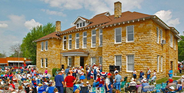
Stone County Courthouse, Mountain View, Arkansas. Like many buildings in town, the courthouse is built of the distinctive yellow local limestone.

Crossing the Big Muddy, Interstate 40 traversed miles of dark soil planted with cotton, blanketed with a pungent cloud of Malathion. Veering off to the north we traveled on blue highways—two-lane blacktop. As with crossing the plains, one ascends in elevation imperceptibly. Our route skirted the White River, which descends through a series of man-made lakes along the Missouri border. They in turn are fed by another series of lakes near Eureka Springs into which flows the headwaters of the White River, the watershed forming what resembles a giant question-mark, looping up toward Missouri before draining into the Mississippi just north of the mouth of the Arkansas River. The Ozarks are unlike the Appalachians or the Rockies in that they are more down than up, created not by geologic upheavals forming high peaks and ridges, but heavily-wooded table-lands riven by declivities hewn by the White River and its tributaries. Much of the town of Mountain View is built of locally-quarried yellow sandstone, similar to the material used for fence-posts found in treeless areas of the Flint Hills of eastern Kansas. It took me a while to realize that the language people spoke was English. The house was off a winding mountain road south of town. I was taken aback at my first sight of it. The wooden bungalow had solid bones, but could be described as having been preserved by benign neglect. The yard was completely overgrown. It needed to be cleared, as did the small barn that stood nearby. We each carried a sidearm lest we encounter a copperhead, which we did more than once. Blue-tailed Skinks ran all over the buildings. One of the first things we carried into the house was a large terrarium, which we set up on the porch. Millions of insects chattered and screamed in the enervating heat. Running into town, we collected necessities at the hardware store. A group of men clustered around a new color-television. Recognizing the theme music, I peered over their shoulders. Onscreen were the towers and canyons of Manhattan. Bald cop. Lollipop. Who loves ya, baby?
We were a long way from The Big Apple.
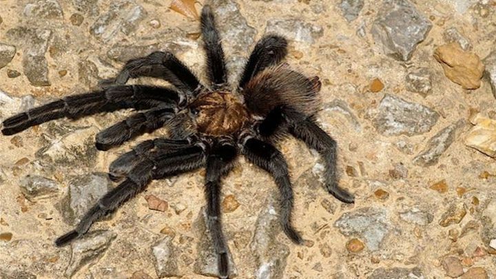
Returning to the house, Guy slammed on the brakes. Reaching under the seat, he handed me a large Mason-jar. Jumping out of the pickup he ran back down the road. Moments later he returned, gingerly holding a struggling tarantula by the waist. Quickly I unscrewed the lid. Planting its feel firmly against the rim, the stubborn arachnid resisted confinement with all its strength. Guy would not be denied. Flipping the spider upside-down he dropped it legs up into the jar. Before the fearsome creature could right itself, I closed the jar. Guy stabbed five or six air-holes in the lid with a large belt-knife. The first chore to be tackled upon our return was releasing our quarry into the terrarium. We discovered at sunrise the cover of the glass box ajar. Our guest had vanished. Due to leave in a day or two, I was nervous about our new roommate. He must have cared little for our company, as we never saw him again.

Following the College Art Association meeting in Chicago Kathie headed for Bentonville, while I returned to New York. Crystal Bridges provided scholars with accommodation in “The Farmhouse”—a sprawling home beside the museum campus. She was the only resident at the time, and could walk to the museum by way of a footpath from the backyard through a wooded margin. As resident scholar, she was given an office from which she was expected to conduct most of her activities. The working environment was very corporate, orderly and civil. Once an employee who succumbed to a fit of blue language was sent home to ponder what they had done.


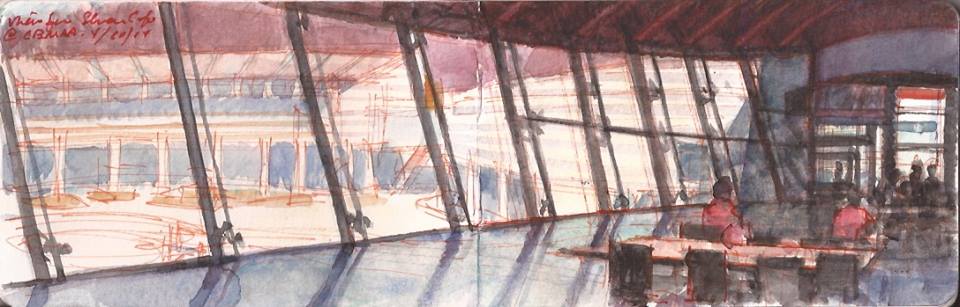
“Eleven” restaurant: Crystal Bridges Museum of American Art. Bentonville, Arkansas

During one of my visits to see her I traveled to Pea Ridge battlefield. As a deluge of ink celebrates the deeds of Lee, Jackson, McClellan and Grant, little attention is paid to Civil War actions fought west of the Mississippi. Apache Pass, Cabin Creek, Honey Springs, Prairie Grove and Wilson’s Creek are eclipsed by Antietam, Chattanooga and Gettysburg.


Battlefield of Pea Ridge.

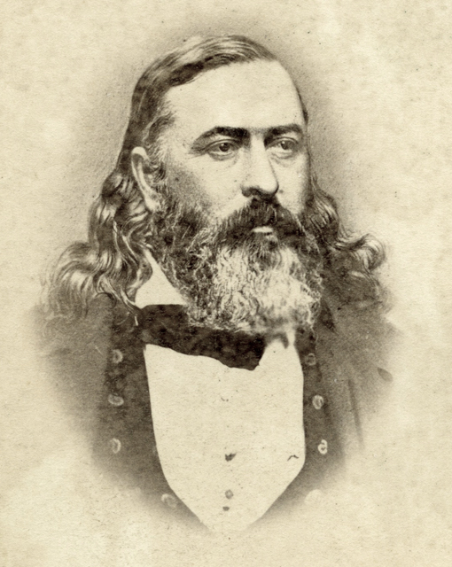
Established as a military park in 1956, the battlefield of Pea Ridge—also known as Elkhorn Tavern—stretches northward of Route 86 between Avoca and Garfield. On March 7-8, 1862, farm field had yet to be planted. Trees were bare. The mercury hovered near freezing.Confederate forces under Earl van Dorn had been driven out of Missouri, pursued by federals under Samuel R. Curtis. Like a dizzy cotillion, the two-day engagement followed a week-long series of disjointed maneuvers by both armies, each attempting to outflank or envelope the other. Franz Siegel, a firebrand Forty-Eighter whose Germans constituted nearly half of Curtis’s forces, bristled under the authority of his American-born commanding officer. While fellow West Pointer Eugene Asa Carr had no difficulty working within the chain of command, some of Curtis’s officers commanding volunteer units were inclined to exercising their own initiative. Despite the contempt shown militia by the regulars, during the fight a quick-thinking Missourian plugged a gap in Curtis’s line.Confederates also struggled with command and control issues. Earl van Dorn had his hands full coordinating Ben McCullough’s Texans, Sterling Price’s Missourians and a Cherokee Brigade led by Albert Pike (1809-1891).

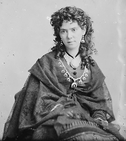
As a sidebar, a monument in Washington DC honoring Pike’s contribution to Freemasonry was destroyed by protesters on June 19th of this year. A strong advocate of sculptress Lavinia Ellen “Vinnie” Ream (1847-1914), Pike sponsored her membership in the Order of the Eastern Star. Ream had an antebellum romantic relationship with Cherokee leader Elias Boudinot(1835-1890). After the war Vinnie was rumored to have been the secret lover of General William Tecumseh Sherman (1820-1891).


Vinnie Ream. 1847-1914. Celebrated beauty and noted American sculptor whose portrait of Lincoln in the the U.S. Capitol. Lincoln sat for the portrait just prior to his assassination. Mary Lincoln gave Ream the clothes Lincoln wore at Ford’s Theater, so that she could complete the sculpture. Ream’sportrait of Admiral David Farragut stands in the eponymous square in Washington D.C., opposite the Army-Navy Club. In this photograph Vinnie is shown wearing regalia of the Order of the Eastern Star.

When the two armies finally met, it was across farm-fields north of Sugar Creek, fifteen miles northeast of Bentonville. Along the north bank of a feeder-creek to the north is an unpaved trace traversed by the Cherokee and other tribes in 1837-39, bound for Indian Territory on the Trail of Tears.

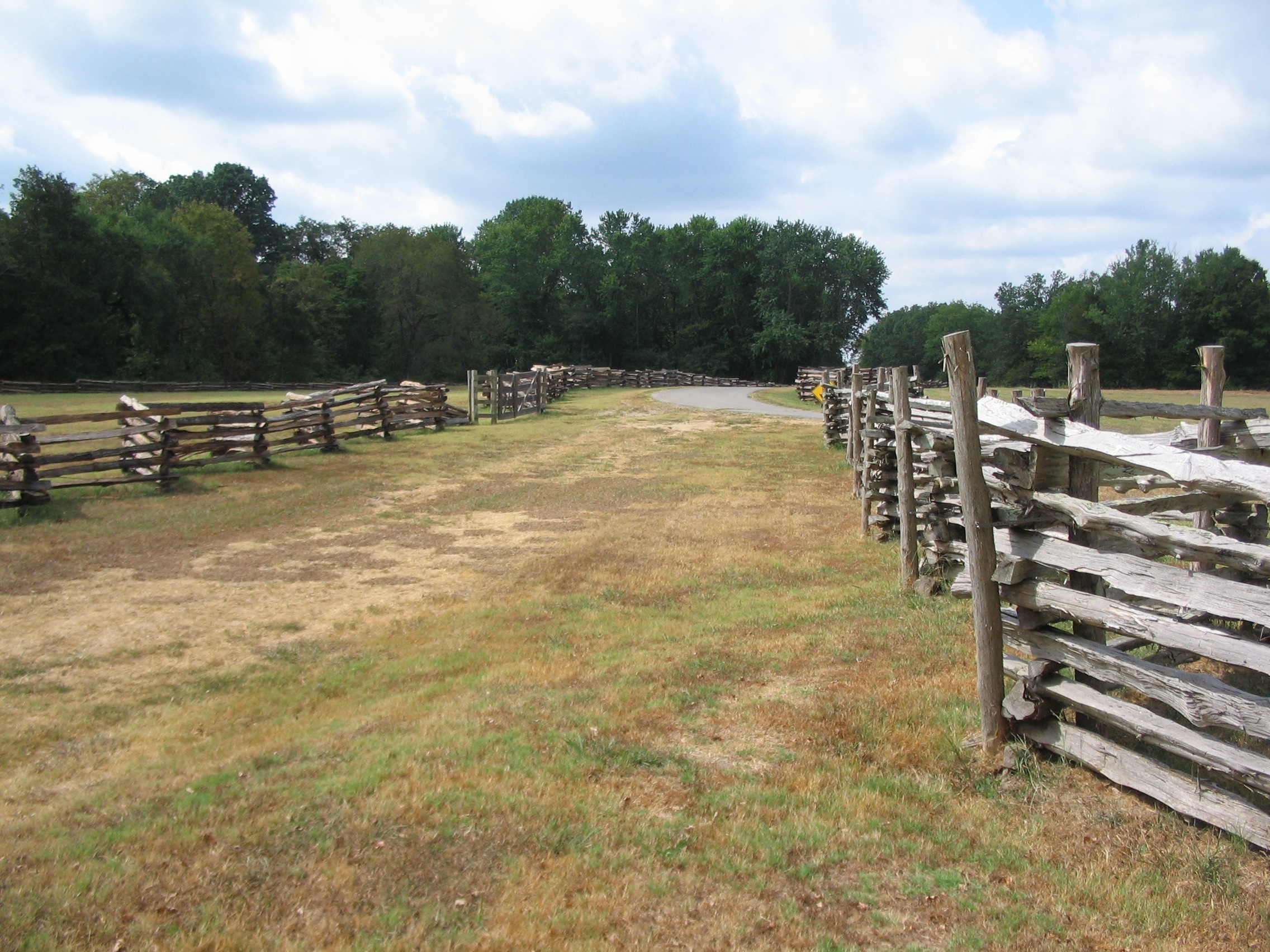
Telegraph or Wire-Road, near Elkhorn Tavern. This roadway was traversed in 1837-39 by victims of the Indian Removal Act of 1830. The various routes followed by Cherokee and other eastern indigenous tribes is known as The Trail of Tears.

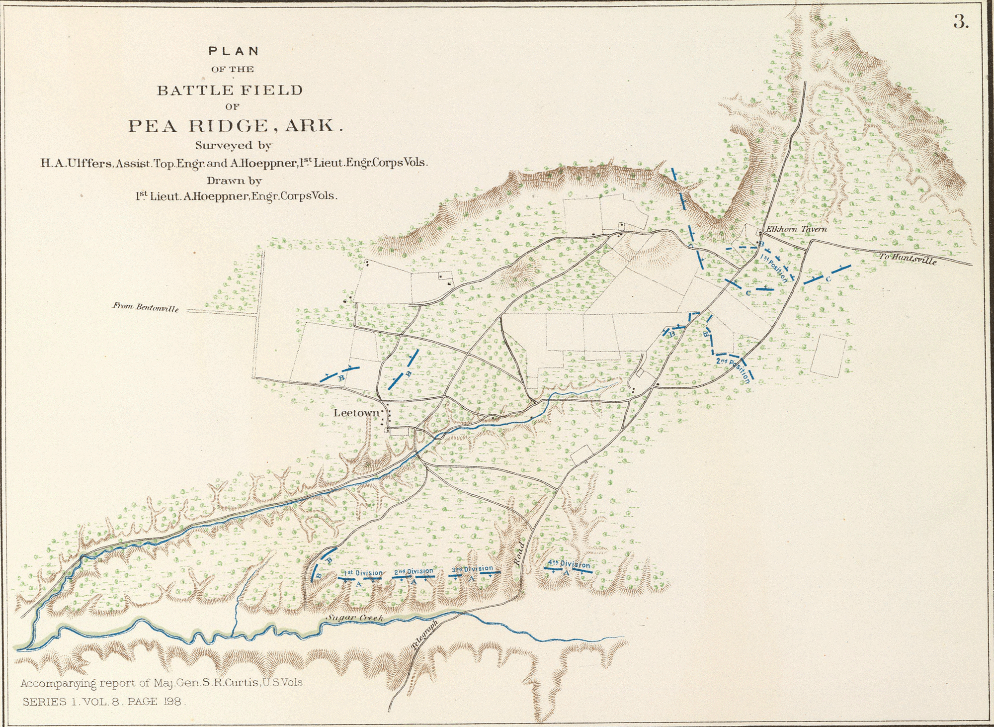
Observing federal deployments near Leetown, Texas general Ben McCullough was shot from his horse by a federal marksman. His death was kept secret for reasons of morale, adding to confusion within the confederate command structure. The first day of fighting was bloody, confused and indecisive. Federal soldiers killed by confederate Cherokees were subjected to scalping, and ritual mutilation. When the sun rose on March 8, confederate commander Earl Van Dorn was informed that his supply train had been withdrawn, a logistical blunder that put him on a cautious footing. Curtis presented the confederates with a textbook line-of-battle across the Telegraph Road facing an eminence known as Big Mountain. Sigel’s artillery opened fire on confederates sheltering below the rise, blasting trees into splinters, shattering the cliff-face into bits of rocky shrapnel. The federal left under Osterhaus attacked the battered rebels, followed by the center led by Jefferson C. Davis and the right, under Eugene Carr. Running low on ammunition, despite superior numbers, Van Dorn ordered a withdrawal, leaving much of southern Missouri and northern Arkansas under federal control.


Battle of Leetown (March 7, 1862) and Elkhorn Tavern (March 8) collectively known as the Battle of Pea Ridge.

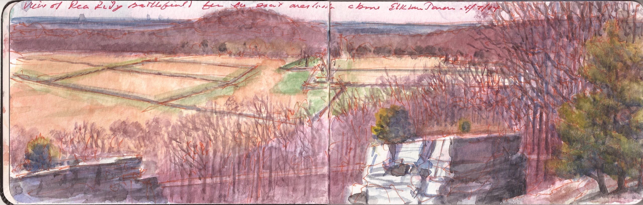
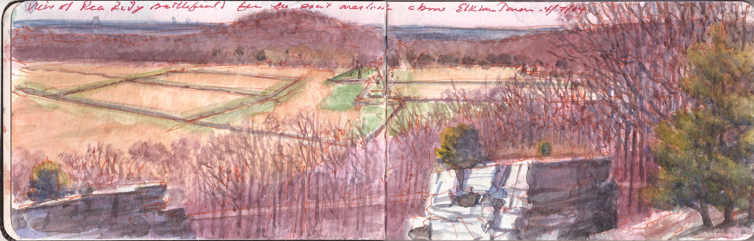
The park road carries visitors through fields and woodlots that retain in much the same positions they held in 1862. My rental-car passed cyclists pedaling along the edge of the road. Clusters of cannon mark interpretive sites. Elkhorn Tavern has been reconstructed, with a weathered Wapiti skull decorating it s forward gable. The Telegraph Road or “Wire-Road” that existed during the battle shadowed the same foot-trace followed by victims of the Indian Removal Act of 1830, as they approached their destination in Oklahoma—or “Indian Territory,” as it was known at the time. From parking-areas along the winding road at the summit of Big Mountain, trails lead off to different scenic prospects along the rocky escarpment. Choosing a view overlooking the battlefield of March 8, I opened my sketchbook and produced a watercolor painting across one page-spread. Noting the layout of the fields, tree-lines, and a low prominence known as Little Mountain, I was mindful that the fissured ledge at my feet was where so many confederate casualties were suffered by Siegel’s bombardment. Gone is the caravan of refugees. Gone is the din of mortal combat; the moans of the wounded, and the harvest of death. What I beheld was more than historic scenery; a palimpsest of pioneer enterprise, indigenous genocide, and internecine violence that over time has become both educational tool and recreational destination. Similar tales abide in any location, should one make the effort to discover them.

Inscribed across the top of the pages: “View of Pea Ridge Battlefield from the great overlook above Elkhorn Tavern. 4/7/14”

Follow The Sketchbook Traveler on Facebook, Linkedin, Twitter and Instagram.

Peruse previous posts here. Dispatches #1-70. April 1-June 8, 2020.