All posts by James L. Mcelhinney

SKETCHBOOK TRAVELER: DISPATCH #111. Barges and Gunboats


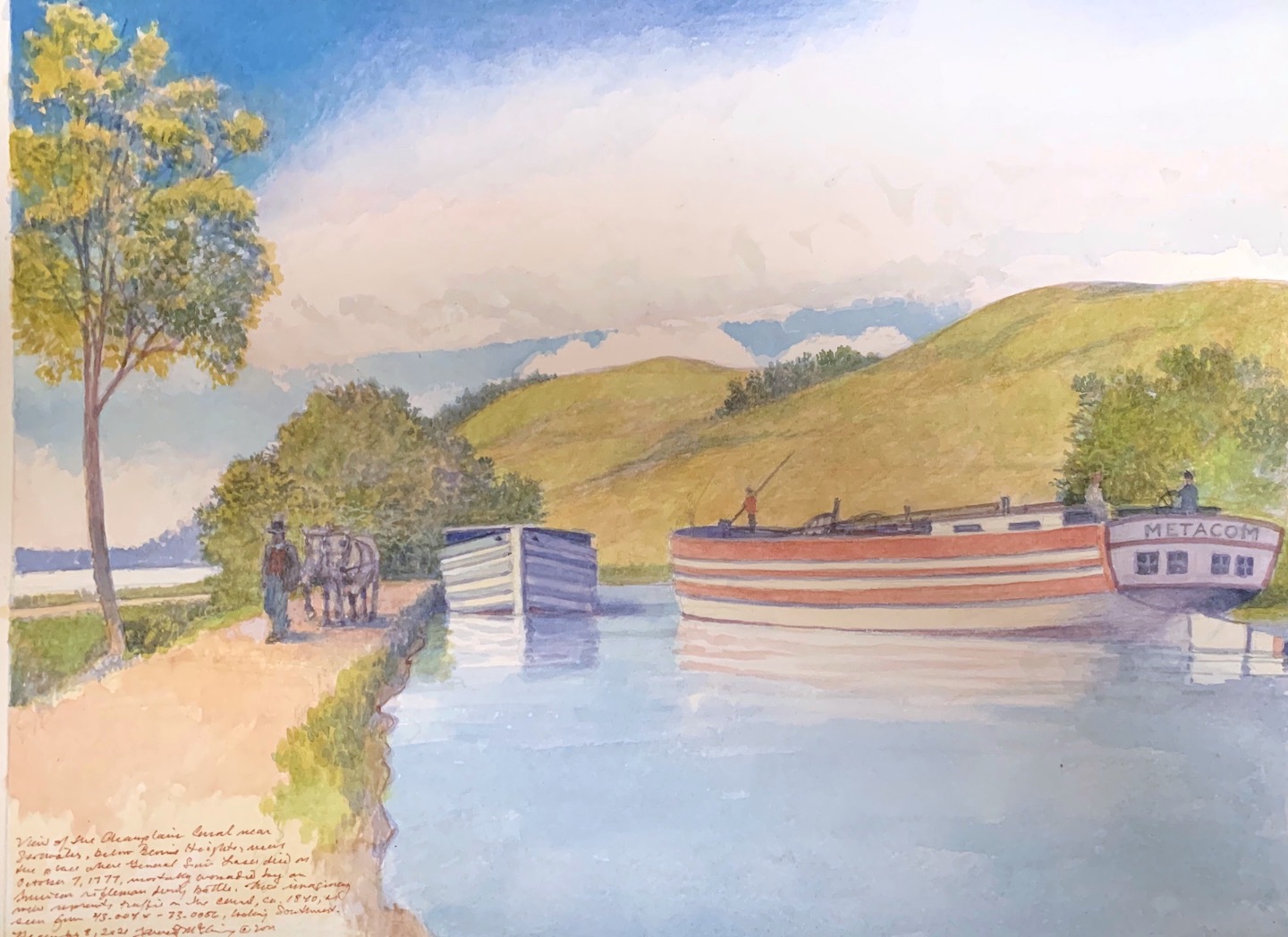
Champlain Canal below Bemis Heights, Saratoga National Historical Park. Watercolor on Lana watercolor paper. 12 x 16 inches. 2021.
This painting, which will be reproduced on interpretive signage created by the Erie Canal National Heritage Corridor, represents a slight departure in that it imagines a specific location as it may have looked circa 1840. Maps of the period revealed that the terrain depicted was nearly treeless. A few arboreal touches were included to help visitors transition from today’s semi-wooded setting to its nineteenth century appearance.

On September 10, 1823, the sixty-mile Champlain Canal finally opened to traffic, linking the Hudson River at Fort Edward with Lake Champlain at Whitehall, formerly known as Skenesboro. Built in stages starting in 1817, the canal increased the volume of goods and raw materials that moved from the navigable tidal estuary that ascended the Hudson from New York harbor to north of Cohoes. Unlike the Erie Canal, which would open two years later, the Champlain Canal was built to accommodate schooner-rigged canal boats. Spars and masts were laid lengthwise on deck. Sails and rigging were stashed in a forward compartment, where the hired man also slept. Masts would be stepped at Whitehall, secured by stout deck-mounted tabernacles. Spars and rigging were designed for quick assembly. Descending Lake Champlain under sail, steering and stability was assisted by a large centerboard that could be lowered in deep waters.  Centerboards are common features in today’s recreational sailboats. As an historical aside, the concept was first put to use in gunboats being assembled for the royal navy by John Schanck (1746-1823), for use against the American rebels that controlled Lake Champlain. Several men-or-war were taken apart on the Saint Lawrence River and reassembled at Saint John’s on the Richelieu River. With them Schank’s  centerboard gunboats would defeat Benedict Arnold’s mosquito fleet at the Battle of Valcour Island on October 11, 1776.
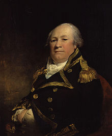

Admiral John Schank (1746-1823) Inventor of the centerboard

The rudders of Lake Champlain sailing canal-boats were equipped with a similar innovation in the form of an extension that could be flipped aft to double its length. This enhanced steering the vessel at slow speed while passing the canal, with no more than a foot or two of leeway. Running along the length of the hull above the waterline were longitudinal rub-rails; thick wooden bumpers to absorb the shock of occasional collisions with banks and bulkheads.
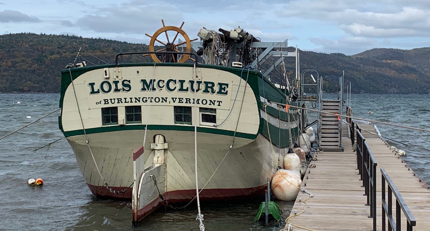

Sailing canal-boat Lois McClure, Lake Champlain Maritime Museum, Vergennes, Vermont

I had made an appointment with Lake Champlain Maritime Museum collections manager Patricia Reid to look at some of the visual documents in the museum collection related to sail-powered canal boats. Arriving at the museum near Vergennes at 10:35 on the morning of October 27, I was greeted by schooner management and volunteer coordinator Elisa Nelson, who brought me into a meeting room with books set out on a large refectory table. After perusing the volumes, accompanied by a lively and informative conversation, Elisa and I went outdoors to take a look at the museum’s working replica of an 1862 series sailing canal boat, the Lois McClure, named for one of the donors who underwrote its construction.
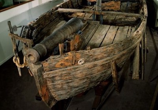

Gunboat Philadelphia. (1776) Smithsonian Museum of American History. Washington DC. Below: Replica of the gunboat Philadelphia awaiting repairs at Lake Champlain Maritime Museum.
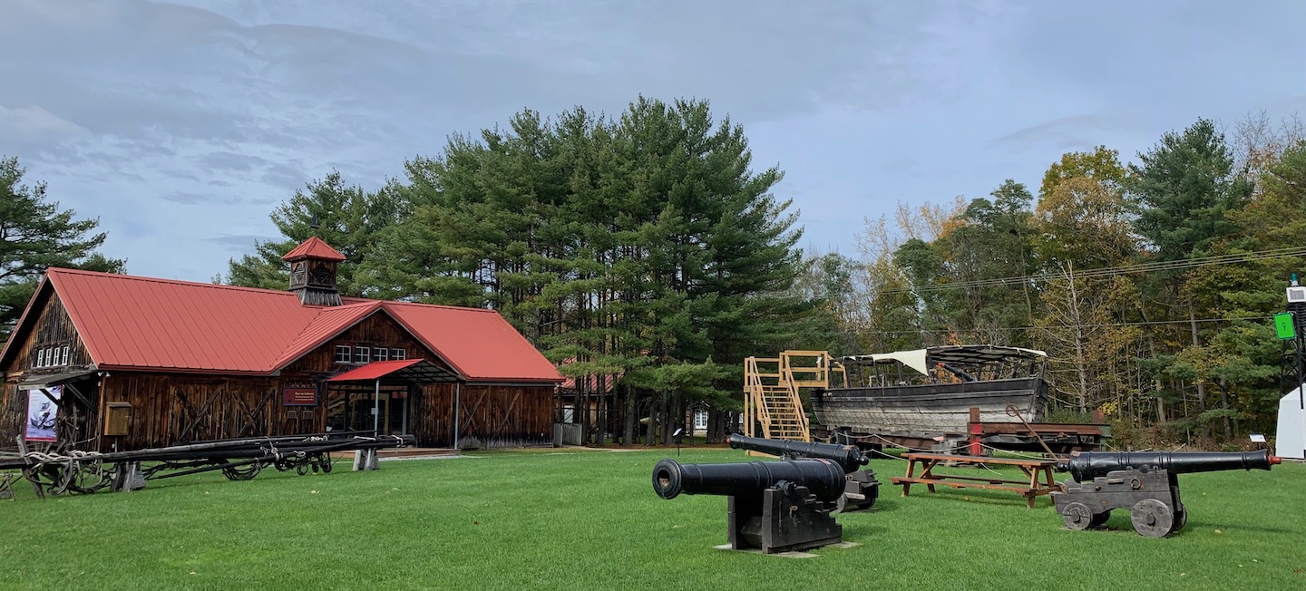
The day was windy as we walked across the campus, past boat shed and workshops. We paused to inspect the museum’s replica of the gunboat Philadelphia. The original is in the Smithsonian National Museum of American History. After years in the water, the full-scale reproduction was looking more and more like its predecessor. Copper sheeting had been attached to the bottom of the wooden hull to hinder its deterioration. Nelson related how when the original Philadelphia was being fitted out for active service, the shipwrights discovered that in their haste, they had made provisions for a bow gun in the stern. To correct their blunder, a notch had to be chopped out of the stem post to accommodate the cannon tube. The replica copied this exactly.
“These boats were never built to last,” Nelson commented. “They were built for the battle.”
Diving into the woods, we followed a steep gravel paved roadway descending to the shoreline of North Harbor. Jutting out into the water, a pier led to a long floating dock, which rocked on the waves. Moored along the south side of the dock was the Lois McClure. Stout tee bar racks supported the masts and spars.
“Those supports are not historically accurate.” Elisa explained. “When the boat was coming the canal, all that would have been just lying on the deck, with the sails and rigging stowed in the forward compartment, which would also have been where the hired man slept.”
Having closed for the season, in preparation for winter the museum crew had started dismantling bits and pieces, including twenty feet of hand rail that ran up the middle of the dock. Whitecaps appeared atop choppy, two to three foot waves. Across the lake, a sheer escarpment rising more than a hundred feet added to this sublime, unruly and dangerous expression of nature. Nelson nixed the idea of making a dash for the stairway that would have put us on the deck. “I always rope off those steps,” she explained. “You see any ropes? This crazy wind has blown them off. It’s too bad we can’t go aboard, but it’s just not safe.”
Before winter sets in, the schooner will be towed to Basin Harbor, the next anchorage to the south. There it will spend the winter out of the water, before undergoing maintenance and repairs before returning to the museum dock.


Arthur B. Cohn 
Lake Champlain Sailing Canal Boats.
Lake Champlain Maritime Museum. Basin Harbor, VT. 2003

Back in the office, I purchased a membership, and a copy of the book Lake Champlain’s Sailing Canal Boats: An Illustrated Journey from Burlington Bay to the Hudson River – Building the Canal Schooner Lois McClure by former executive director Arthur B. Cohn, and others. Thanking my hosts for an informative visit, I made my way to the parking area. Climbing into my car, I backed up slowly as another vehicle pulled in beside me. Strapped to the top was a large kayak. Unlike the ubiquitous tutti-frutti synthetic variety seen zipping around the Green Mountains and Adirondacks, this one appeared to be made of natural materials, painted in modest earth tones. The driver noted my interest and nodded. I nodded back and continued my journey.
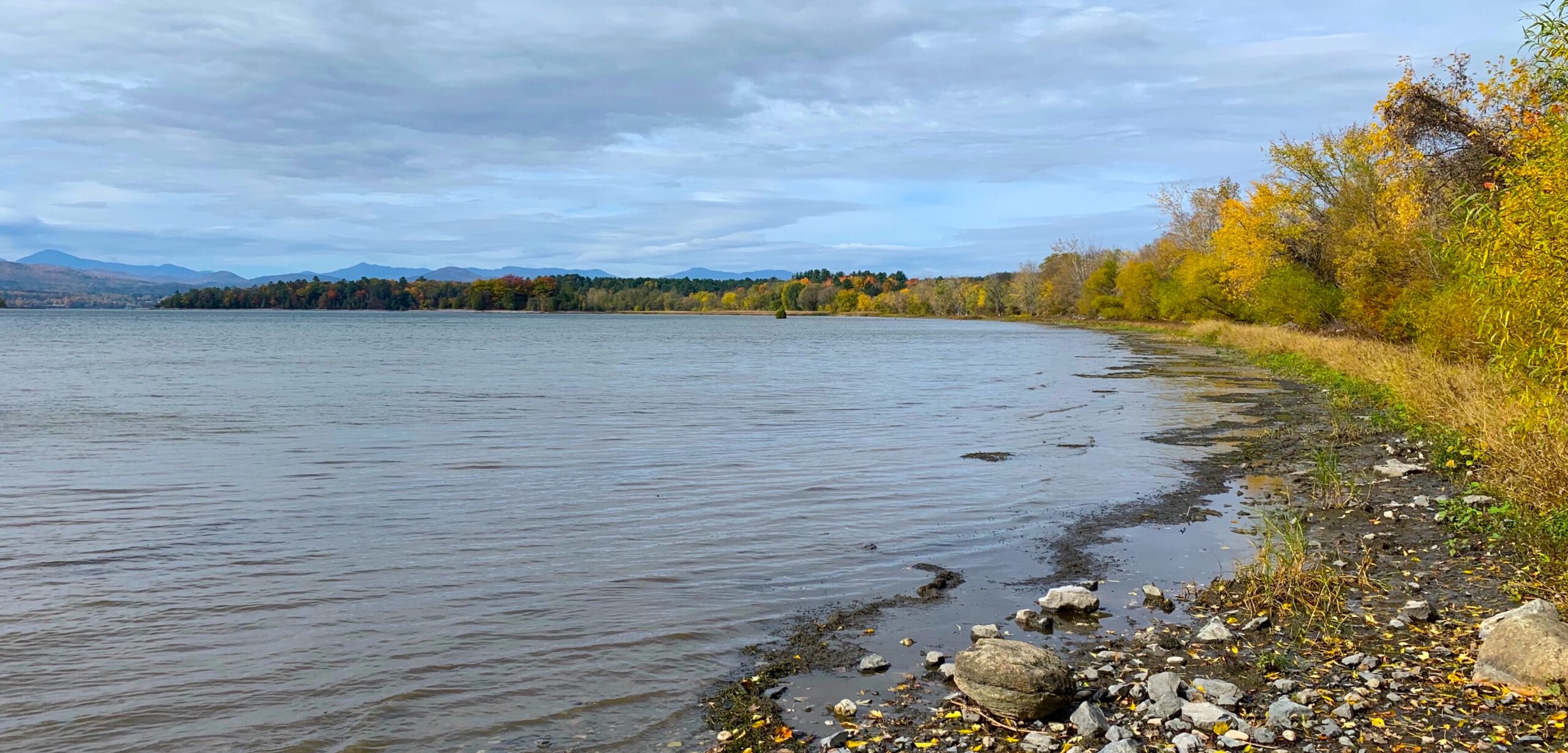

Button Bay, formerly Buttonmould Bay. In June 1777,  elements of General John Burgoyne’s army camped along these shores during its progress up the lake toward Ticonderoga.

Heading back to Crown Point, I was curious to visit the little bay where the British navy caught up to Benedict Arnold on October 13, 1776. The gunboat Philadelphia, reproduced at Lake Champlain Maritime Museum, had already been lost when the British fleet caught up the remnants of the leaky, battered rebel fleet just south of Split Rock. The fight that ensued cost more American lives. Lieutenant Thomas Rogers was blown to smithereens when a Swedish-made cannon exploded on the gunboat New York. Facing certain defeat, Arnold ran his remaining boats ashore, put them to the torch and beat a hasty overland skedaddle to Crown Point.
Today the road to Arnold Bay runs along a narrow gravel-paved course through the wooded margins of the lake. To the left on the descent is a massive concrete building that houses the water treatment facility for the town of Panton, Vermont. Parking on the little point on the northern corner of the circular bay, I found a bronze and stone Sons of the American Revolution marker identifying the site as where Arnold had come ashore on October 13. Reaching into the bay were two piers. Small single class racing boats were secured to the more distant pier, managed by the sailing program at Middlebury College. Riding at anchor in the middle of the bay was a solitary cruising sloop of thirty feet or more. Its tender was stashed onshore, just below the water treatment plant. To the north, the shoreline rose vertically in one of the ubiquitous fossil-reef limestone layer-cakes that rim the lakeshore.
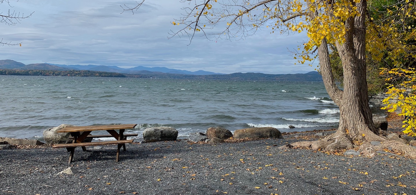

Arnold Bay, Panton, Vermont. Looking west toward the Adirondacks.

Taking note of my surroundings a veteran subcompact import rolled to a stop, ten feet from my Subaru. From it emerged the same  cheerful hirsute fellow, with whom I had exchanged nods in the parking lot at the maritime museum. Strapped to the roof was the same kayak. Its owner was Ron Rost, a longtime member of the dance department staff at Middlebury College. Replying to my query about the kayak he replied,
“This was handmade by one of the guys up in the boat shop at Champlain Maritime Museum. Because of its size, it’s stable enough for the lake. It’s roomier inside that you might think.”
Rost explained how after graduating from college in 1979, he had come to the Champlain Valley to work on a Delaware Bay oysterman. Having grown up in the Delaware Valley, I was familiar with these boats with their beamy hulls, shallow drafts and raking masts. They were a common sight also in Chesapeake Bay, where they were known regionally as skipjacks. The schooner whose crew Rost had joined traveled up and down the lake, stopping at different ports of call to take on visitors for tours and day cruises.It struck me as odd that someone would think it was a good idea to bring a craft designed for coasting over shoals to a deep and often turbulent body of water with its own regional history of nautical architecture. The bicentennial years of the late seventies had seen their parades of tall ships. Suddenly every urban waterfront in America needed tourist-friendly seaport zones with their own tall ships. It seemed to me that a Delmarva Skipjack on Lake Champlain was like a benign invasive species, unlike the Zebra Mussels and Asian Watermilfoil that had made their way into its waters. I kept these thoughts to myself.
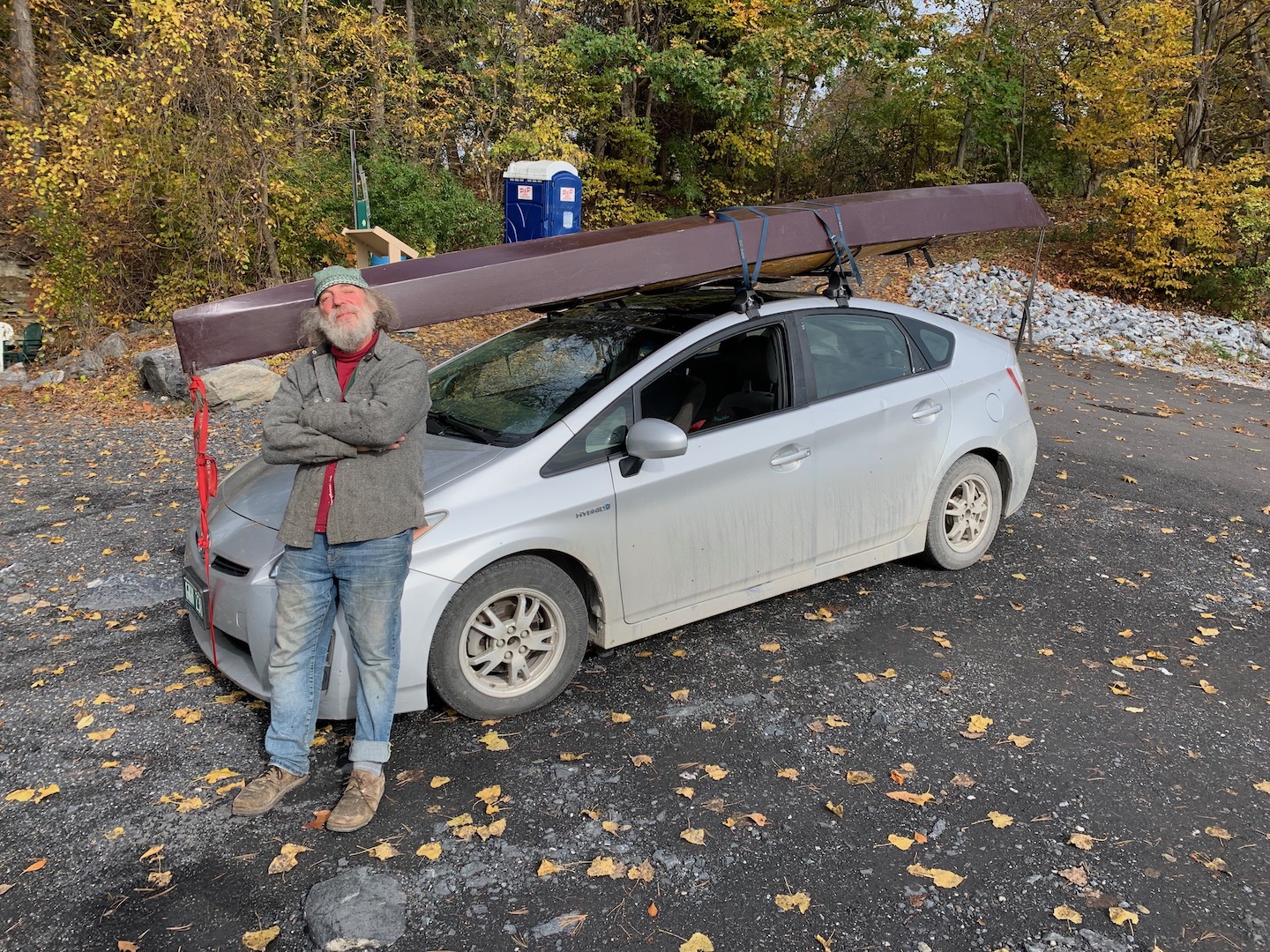
Rost explained that when I had seen him at the museum, he was paying a visit to friends on the boat shop. He was now in search of a likely place to launch his kayak and planned to travel from bay to bay in search of calmer waters. We spoke about the battle at Valcour, and the action that took place just offshore. Directing me to a few other bays and landings he though worth exploring, he noted that  the tranquility of Arnold’s Bay looked like an inflatable kiddie pool, compared to the churning cauldron stretching back to Westport on the Adirondack Coast. As Rost cogitated on the merits and perils of putting in, I bade him farewell and continued on to Crown Point. Crossing the narrows from Chimney Point into New York State, the king’s colors danced above the massive fort in a fierce west wind.

James Lancel McElhinney (c) 2021

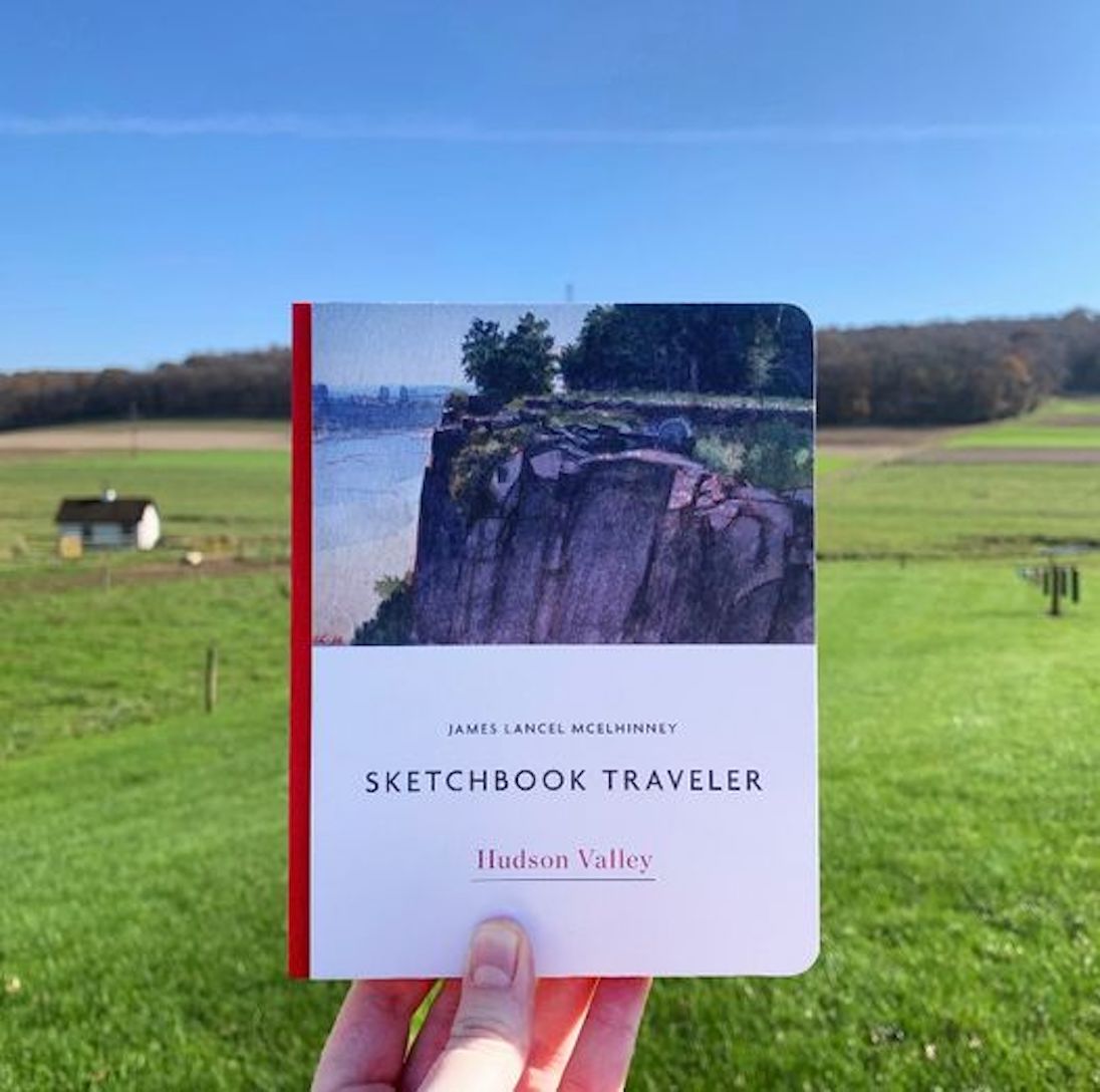
Now available to own: Sketchbook Traveler: Hudson Valley
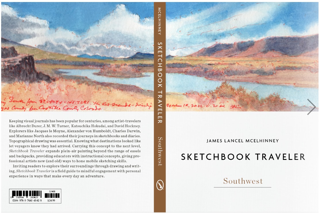
Coming Soon: Spring 2022: Sketchbook Traveler: Southwest
Explore my Quaranteam Dispatches, from April 1-June 8, 2020
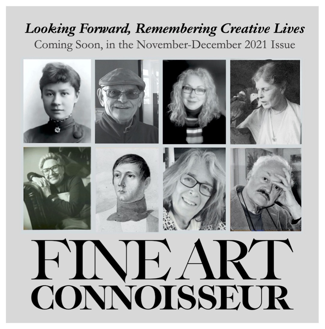
Remembering Creative Lives: Legacy Planning for Artists

Read the Full Article from Fine Art Connoisseur magazine (scroll down)

“For the first time in history, a considerable number of visual artists have amassed vast fortunes. Lavishly endowed eponymous artist-estate foundations herald a new species of philanthropy: many possess sufficient funding to maintain a permanent staff to pursue their missions in support of education, research, and helping artists in need. In some cases, these foundations establish museums and research centers or collaborate with existing institutions. Among the leaders in this sector are Robert Motherwell’s Dedalus Foundation, the Joan Mitchell Foundation, Robert Mapplethorpe Foundation, and Andy Warhol Foundation for the Visual Arts.
Such ambitious goals are beyond the means of many notable artists, even those of considerable fame. So what options are available to them? What must the heirs of noteworthy and moderately successful artists do to prevent works that once won laurels from being flogged for pennies or carted off to landfills?
…Augustus Kollner (1812–1906) was born in Stuttgart, Germany. Immigrating to the United States in 1839, he settled in Philadelphia, a hub of print publishing. Working as an illustrator and engraver, Kollner gained recognition for his city views and landscapes. He outlived his career, however, and died forgotten at 94. In life Kollner had organized his oeuvre into an orderly collection. yet his daughter let the junk man have it all for two dollars. Recognizing the quality of what he had just purchased, the canny scrap dealer preserved the artworks, which over time made their way into private and public collections. Later, philanthropist Joseph M. Fox donated his collection of Kollner’s graphic works to the Free Library of Philadelphia. While much of this artist’s visual output is preserved, most of his correspondence and records has been lost.
Famed as a teacher, Ashcan School painter John French Sloan (1871–1951) pioneered a gritty brand of realism that presaged WPA-era regionalism. Widowed in 1943, Sloan married his former protégé and extramarital lover Helen Farr (1911–2005) two years later. When Sloan passed away, Helen devoted herself to preserving his legacy. A decade later, she reached an agreement with the Delaware Art Museum, which received thousands of works representing each phase of Sloan’s career. A century after the Ashcan painters fell from favor, Sloan’s reputation endures.”

–excerpt from “Looking Forward. Remembering Creative Lives” in the November-December 2021 issue of Fine Art Connoisseur magazine. Scroll down to a link & download a PDF of the article

Beginning in 2006, for more than ten years I collected oral history interviews for the Smithsonian Archives of American Art and other organizations.These conversations made me keenly aware of how many practicing artists, especially those working in higher education, misunderstood the nature of the art market, and their roles in it.
The event that got me involved in legacy planning was the death of my grad school mentor Bernard Chaet (1924-2012). Following his retirement from Yale he devoted himself to painting with astounding vigor. His prolific output was exhibited widely to growing acclaim. Pressing on as his health declined, he continued to produce new work until he was no longer able. When he passed away in the fall of 2012, his widow and daughter were faced with the daunting task of organizing countless postcards, letters, drawings, watercolors, prints and paintings. Bernie threw nothing away. Nor did he make plans for what was to be done with all that material. Putting his estate in touch with the Archives of American Art provided guidance in organizing Bernie’s papers, which I delivered in person to the Victor Building in Washington DC. Since then I have provided professional consulting, research and appraisal services to a number of artists’ estates.
The more involved with this work I became, the more aware I became of others engaged in similar work, including a number of artists stealing a march on time. Nobody wants to confront their own mortality, nor consign a productive lifetime to oblivion. My hope is that by unpacking a number of case studies, this article will motivate artists to play a proactive role in estate planning, by embracing the task as part of their creative practice

DOWNLOADABLE PDF. LINK:  LOOKING FORWARD, REMEMBERING CREATIVE LIVES.  Fine Art Connoisseur magazine. Streamline Publishing

SUBSCRIBE:  FINE ART CONNOISSEUR 

THE AUTHOR: James Lancel McElhinney is owner of Needlewatcher Arts Advisory (Needlewatcher LLC) Enquiries: PO Box 233, Essex, New York. 12936-0233.

ap********@ne***********.com


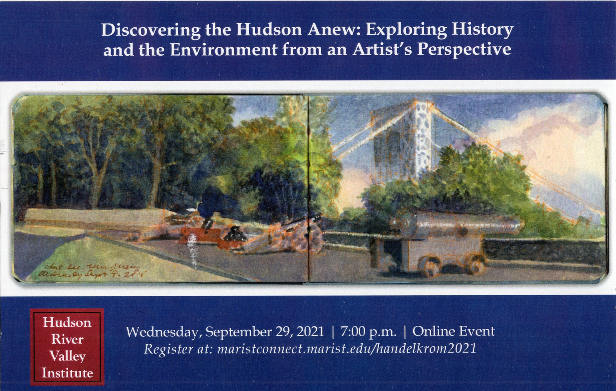
SKETCHBOOK TRAVELER: Dispatch #110. Discovering the Hudson Anew: Lecture and Transcript

Last spring, the Hudson River Valley Review published my article Explorers, Naturalists and Military Precursors of the Hudson River School. This was deeply gratifying. For many years my teaching had been devoted to promoting drawing as form of literacy, beyond that of poetic endeavors. Like putting words together, drawing gives us a way to transform personal experience into knowledge and ideas. Intensifying our encounters with nature in this way can foster social responsibility and ecological civics. This may smack of Yankee utilitarianism, which as a descendant of literate Congregationalist yeoman farmers, Minutemen, Quaker whale-ship captains, and progressive educators, would be part of my nature. The art-historical narrative has also changed. Titanic cults of individualism and selfhood have today given way to explorations of social justice, human identity, and environmental priorities.
Everyone can learn to draw, just as they can learn to write. This is nothing new. Rembrandt Peale argued that writing is a form of drawing, and drawing is a just mode of writing. Horace Mann described drawing as an essential industrial skill. He also called it a moral force. These voices advocated for a system of universal education, in which drawing was a core subject. This was not to promote self-expression, but to develop a virtuous citizenry that valued knowledge, practiced democracy, and contributed to society.
Being bold enough to go out into the world, to lay down marks, pictures and words promises rich rewards.  Anyone can describe anything, once they know it. Drawing sharpens our focus, and deepens our experience, to teach us what we behold. It seems that the best way to demonstrate how this can works is by setting an example.

WATCH THE VIDEO

DOWNLOAD THE TRANSCRIPT

Download (PDF, 281KB)

PDF

Now available to own: Sketchbook Traveler: Hudson Valley

Explore my Quaranteam Dispatches, from April 1-June 8, 2020

Be the first to receive these blogposts


up*****@mc***********.com


“>


SKETCHBOOK TRAVELER: Dispatch #109: Valcour Island from Au Sable Point.

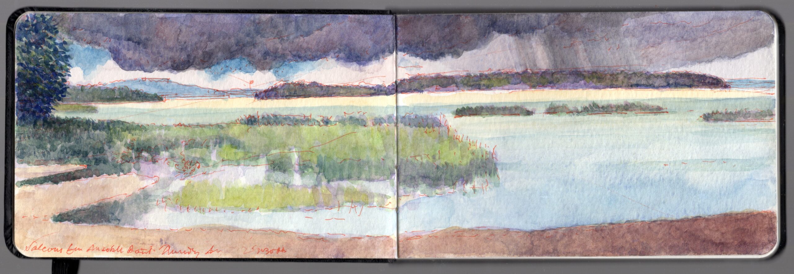
Valcour Island from Au Sable Point. 355 degrees North from 44.5727 x -79.4323. Watercolor and mixed media on paper. 3.5 x 10.5 inches. The body of water dead ahead was the scene of a naval battle fought on October 11, 1776 between a British fleet commanded by Sir Guy Carleton and an assortment of smaller vessels and gunboats led by Benedict Arnold.

The shoreline of Lake Champlain is girded with various types of marine-fossil limestone. Further inland, this shifts to carboniferous rock from which iron was extracted further south at Moriah and at other locations along the Boquet and Au Sable Rivers.


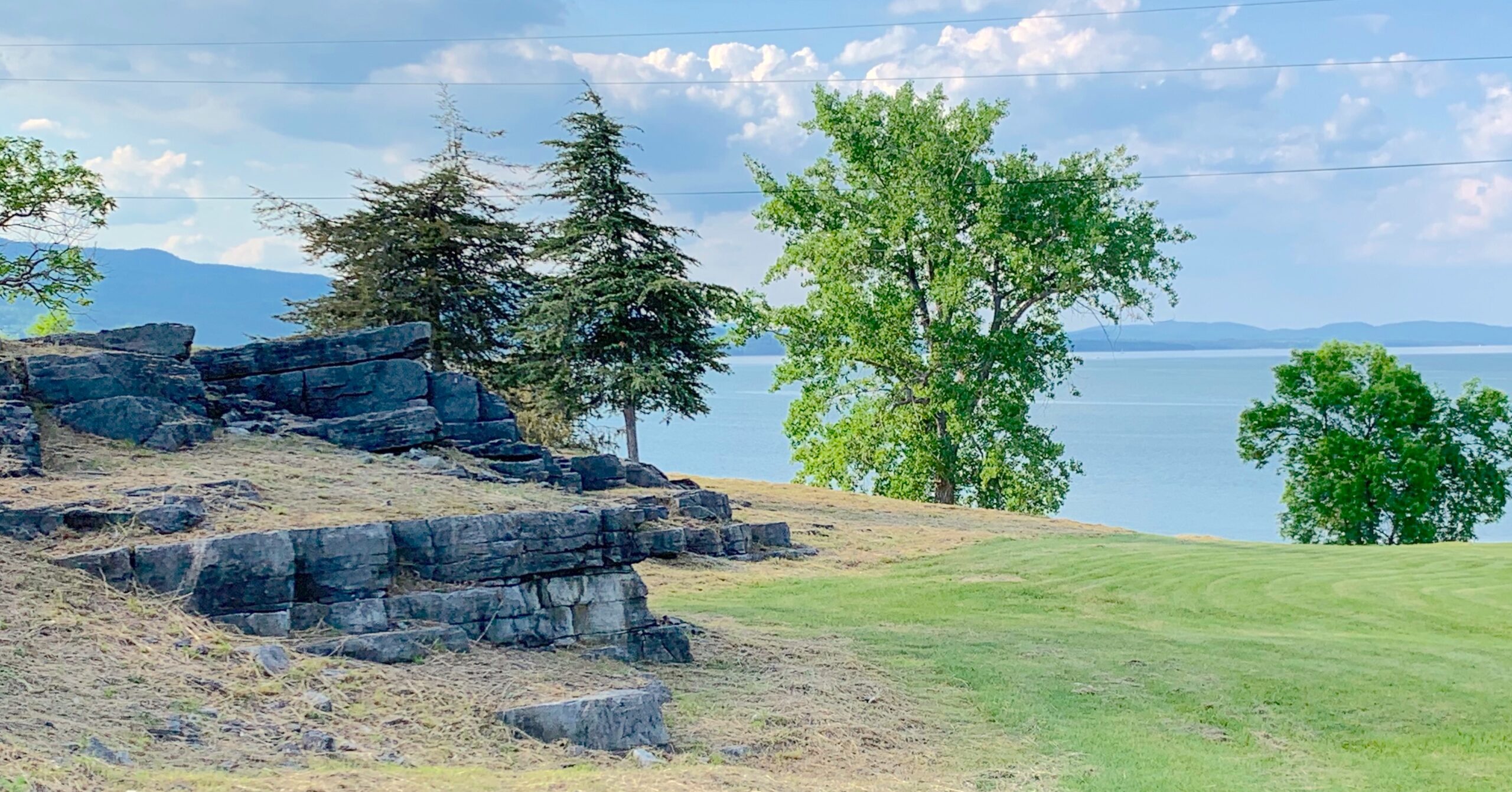
Limestone outcroppings at Crown Point, New York

Both of these formations stretch southward into the Alleghenies, from which coal and iron is mined in Pennsylvania, West Virginia and Kentucky. Bearing a striking resemblance to outcroppings incorporated into His Majesty’s Fort at Crown Point, portions of Civil War-era Fort Negley in Nashville, Tennessee are in fact distant traces of the same fossil-reef.

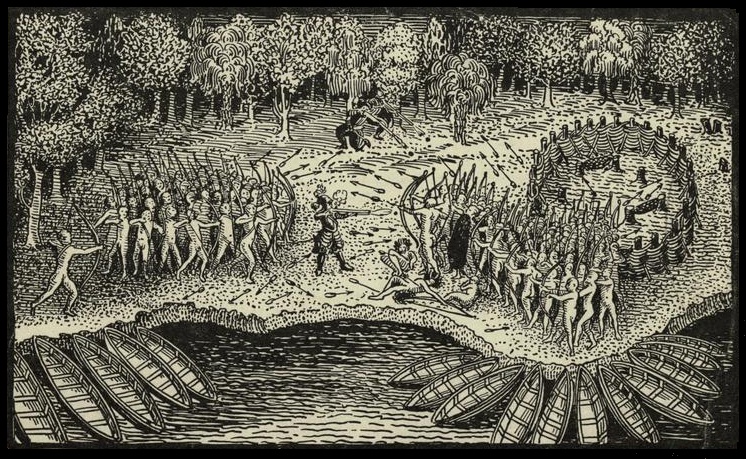
More than 120 miles from its headwaters, the lower stretches of Lake Champlain reach their greatest width. Its waters are broken up by a number of islands forming a kind of delta in reverse. The outflow of the inland sea empties into the Richelieu River, which flows another eighty miles north-northeast, to its confluence with the Saint Lawrence. This system of lakes and rivers, which included Lake George and the Hudson Valley was, prior to the invention of mechanized transportation, one of the most strategic thoroughfares in North America. Indigenous Haudenosaunee, Abenaki, Mahican and Lenape had for centuries vied in bloody conflict to control these waterways. European colonials quickly saw it importance. In the summer of 1609 Samuel de Champlain and a handful of other Frenchmen accompanied a party of several hundred Abenaki, Montagnais and Wyandot warriors up the Richelieu River into the inland sea. Near the head of Lake Champlain they encountered a Haudenosaunee war-party. As the foes squared off against one another, Champlain stepped forward, lowered an arquebus loaded with buckshot and fired, killing with one shot three Iroquois war-chiefs. Terrified by this event, the Haudenosaunee scattered.


Champlain firing on the Haudeonsaunee war-party. July 29, 1609

French intervention in the region culminated with the construction of two fortresses; one at Pointe de Chevelure (Scalp Point), the peninsula where the lower portion of the lake widens significantly. The other was constructed on the rocky heights above the site of Champlain’s demonstration of firepower, at the mouth of river La Chute. Descending more than two hundred feet over the course of three miles, the outflow from Lake George was a major portage, or carrying-place linking the Saint Lawrence watershed with the Hudson Valley.

Both fortresses fell to the British in 1759, as did Quebec, the capital of New France. Sixteen years later, an American force led by Ethan Allen and Benedict Arnold captured Ticonderoga and Crown Point, giving them control of the lakes and the backdoor to Canada. After capturing Montreal, the Americans failed to take Quebec, which was reinforced in the spring of 1776 with fresh troops from Britain and Germany. American forces defending Montreal and the Richelieu Valley were forced to retreat. Royal Governor Sir Guy Carleton poured over maps with General John Burgoyne, planning the recapture of the Champlain Valley before pressing south to take Albany.

South of the border, an arms race was underway. The quarrelsome, jealous and litigious Benedict Arnold was put in charge of shipyards at Skenesboro (today’s Whitehall, New York), building row galleys, gundalows and gunboats to augment ships captured at Crown Point during the previous year. British warships in the Saint Lawrence were dismantled, then transported in pieces up the Richelieu River to Saint-Jean, where they were reassembled, rigged and armed. The plan was to regain control of the lake and capture Crown Point and Ticonderoga. Both fortresses had been weakened by the removal of cannon (mostly from Crown Point), which were transported overland to Boston during the winter of 1775-1776. With the Gibraltar of the north once again in British hands, the capture of Albany would drive a wedge between New England and the middle-Atlantic colonies, forcing Washington’s rebels to sue for peace.


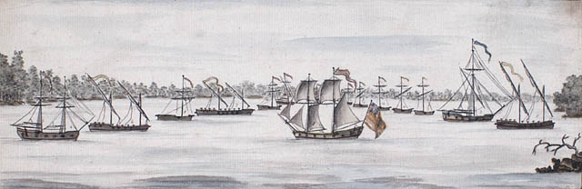
Benedict Arnold’s fleet in a watercolor ca. 1776 by Charles Randle. Left to right: Royal Savage, Revenge, Lee, Trumble, Washington, Congress, Philadelphia, New York, Jersey, Connecticut, Providence, New Haven, Spitfire, Boston & Liberty.

In late summer, Arnold’s fleet was ready. Sailing north, the force creeped down the Richelieu looking for any sign of the enemy. Receiving intelligence from his spies that British warship were preparing to depart, Arnold withdrew south to Isle la Motte, then Cumberland Bay, on whose waters in 1814 the U.S. Navy bested delivered the British a crushing defeat. Carleton’s squadron sailed into Lake Champlain on October 9. Arnold moved his force into position across the southern mouth of Valcour Bay. The eponymous island’s footprint provided cover, concealing Arnold’s deployments from the southbound British vessels. Around noon on October 11, advance elements of Carleton’s force cleared the southern tip of Valcour Island. Arnold’s ships opened fire. Outgunned and outnumbered, Arnold’s men fought into the evening.


Battle of Valcour Island. Watercolor by Henry Gilder, ca 1776.

By sundown, both combatants were running low on shot and gunpowder. Sometime after nightfall, Arnold’s surviving vessels raised anchor. Hugging the shoreline they slipped silently past the British fleet. Rounding Au Sable Point they proceeded south to Corlaer Bay. On Schuyler Island Arnold’s command regrouped, repairing whatever damage they could, scuttling two boats deemed beyond repair. At sunrise on October 12, the British were stunned to find open water where the American fleet rode at anchor the night before. Getting underway, Carleton doggedly pursued Arnold up the lake. Weather confounded both commanders. Arnold’s fleet disintegrated as Carleton picked them off one-by-one. One of Arnold’s subordinates ran his boat ashore and led his crew on foot to Ticonderoga. Arnold himself was pinned down in a small bay on the Vermont shore, but escaped to shore; hiking overland to the ferry that carried him to Crown Point. Abandoning that post, barracks and warehouses were put to the torch. What remained of Arnold’s forced rendezvoused at Fort Ticonderoga, digging in with the garrison to receive the full fury of British arms. As the British landed at Crown Point, the first snow was falling. With limited rations and materiel, and winter approaching, with his force more than a hundred miles from its nearest base of supply, Sir Guy Carleton postponed the invasion and withdrew down the lake. Arnold’s Fabian punch-and-run tactics had bought precious time for the American cause. Something else had been achieved. The newborn United States Navy had received its baptism of fire.


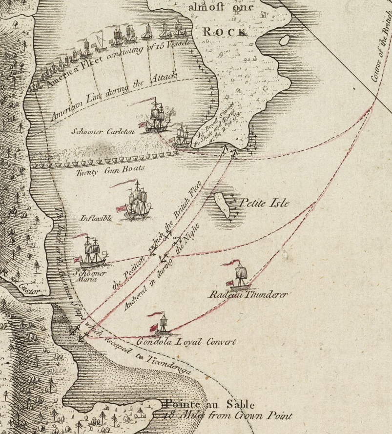
Chart of the Battle at Valcour Bay. October 11, 1776. Au Sable Poiint is visible neat the bottom of the drawing.

Valcour Island is uninhabited, except for an historic lighthouse on its western shore. Like much of the region Valcour Island is composed of marine fossil-reef limestone, in places rising twenty feet or more above the waterline. A peculiar feature of Lake Champlain is a mirage-like optical illusion that exaggerates the elevation of rocky cliffs girding its islands. Au Sable Point is formed by the sandy delta of the eponymous river. The south fork rises above Keene Valley, flowing through the town of Jay, once home to American painter and illustrator Rockwell Kent. The northern fork rises near North Elba, near the farmstead of Abolitionist John Brown, flowing eastward through Wilmington Notch at the foot of Whiteface Mountain. Both arms of the Au Sable River converge at Point of Rocks (today’s Au Sable Forks), flowing past Keeseville—where Louis Agassiz was given a hero’s welcome in 1858, by a crowd that paid no attention to his dour companion, celebrated author Ralph Waldo Emerson.


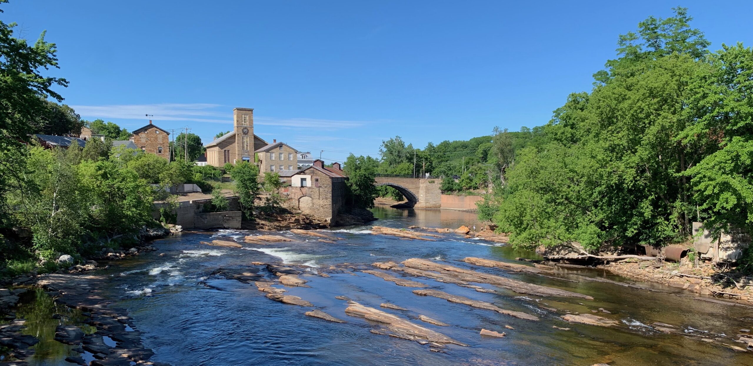
Keeseville, New York. Once a manufacturing hub producing nails and farming implements, it was also the gateway to the High Peaks of the Adirondacks. Agassiz, Emerson, James Russell Lowell and other Saturday Club lumniaries passed this way en route to “Camp Maple” on Follensbee Pond in 1858, at the behest of artist and writer William JAMES Stillman.

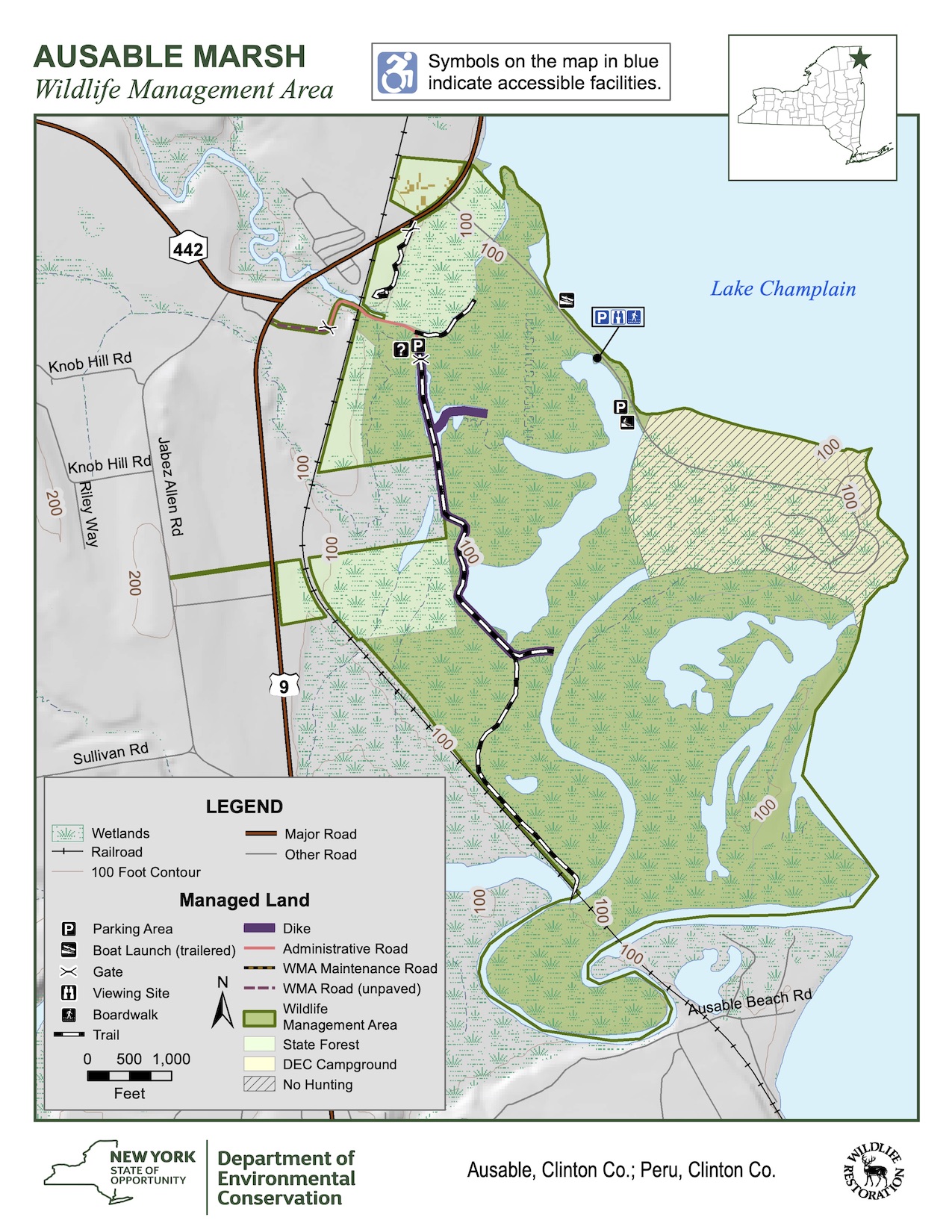
Bending northward the Au Sable crashes over Rainbow Falls, carving a deep chasm through half a billion years of the ubiquitous regional limestone, before looping east to pour its waters into Lake Champlain, a hundred yards behind my point of view in this sketch. The area is protected by the State of New York, maintained as a public beach and campground at the northern end of the point, and as a wildlife management area encompassing the delta wetlands to its south.

Map of Au Sable Marsh Wildlife Management Area,. thge red dot marks my POV. The arrow  indicates my line of sight. Valcour Island is off the map to the north

Now available to own: Sketchbook Traveler: Hudson Valley

Explore my Quaranteam Dispatches, from April 1-June 8, 2020

SKETCHBOOK TRAVELER: Dispatch #108. Claude’s Comeback


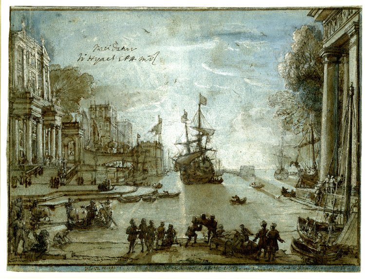
Page from Claude Lorrain’s Liber Veritatis. ca 1630-1682. Collection British Museum

Claude Gellée, dit “Le Lorrain” (1600 to 1682) lived and worked in Rome. Having once developed a successful practice, Claude began to keep records of his sales in pictorial form. This was done partly to establish some means of authentication, and to protect his reputation from forgeries and imitators. Referring to this project as Liber Veritatis, his “book of truth” functioned as a living catalogue-raisonné. Apart from drawings of completed paintings, the book included a complete list of Claude’s works detailing when they were made and to whom they were sold. Following his death in 1682, the book passed to his illegitimate daughter Agnese. When she passed away in 1716, Claude’s nephew took possession of it. Many of Claude’s customers were British. Sometime in the 1720s the book was acquired by William Cavendish, second Duke of Devonshire. It remained in the family until 1957, when the Liber Veritatis was received by the British government, as an in-kind payment in lieu of unpaid taxes. It now resides in the British Museum.


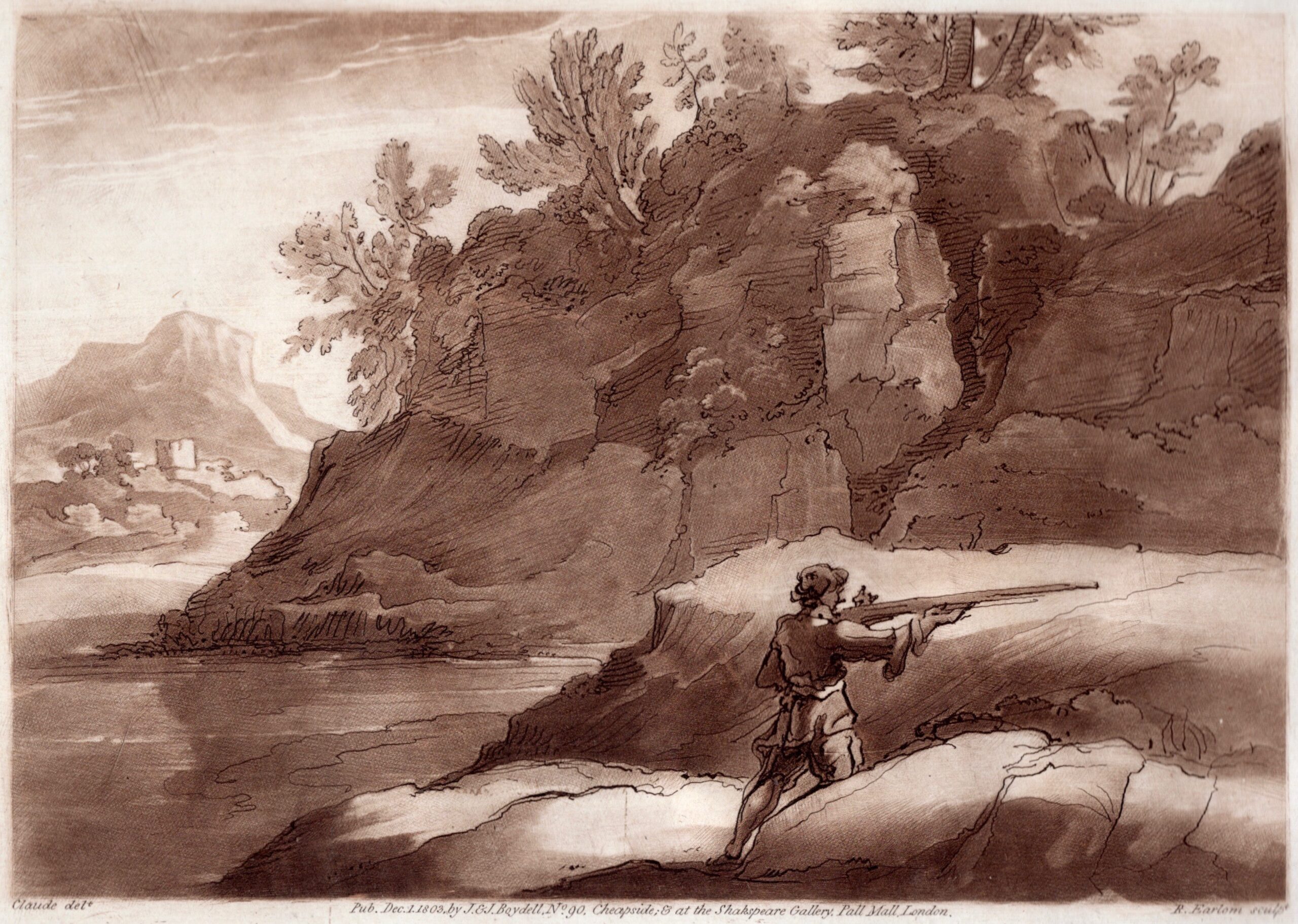
Plate from Claude Lorrain’s Liber Veritatis. Engraved by Richard Earlon. Publishing by John Boydell. Published December 1, 1803. Private Collection

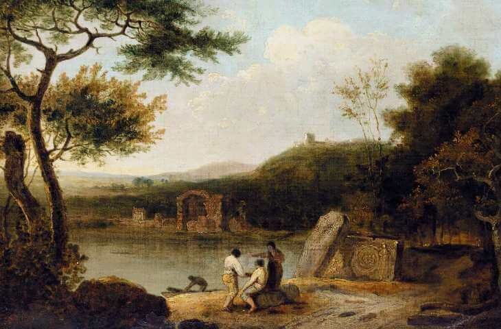
Readers today may be unaware that public art museums as we know them today did not exist in the eighteenth century. The only way for artists and art-lovers to gain access to masterworks would be to find them in churches or government buildings, or to gain access to the private homes of wealthy elites. Claude’s work had a profound effect on younger British artists like Richard Wilson (1714-1782), who had been lucky enough to encounter Claude’s paintings abroad, and in the private collections of aristocratic patrons. Like his contemporary Claude-Joseph Vernet (1714-1789),


Richard Wilson. Lake Avernus. On on Canvas. 1765

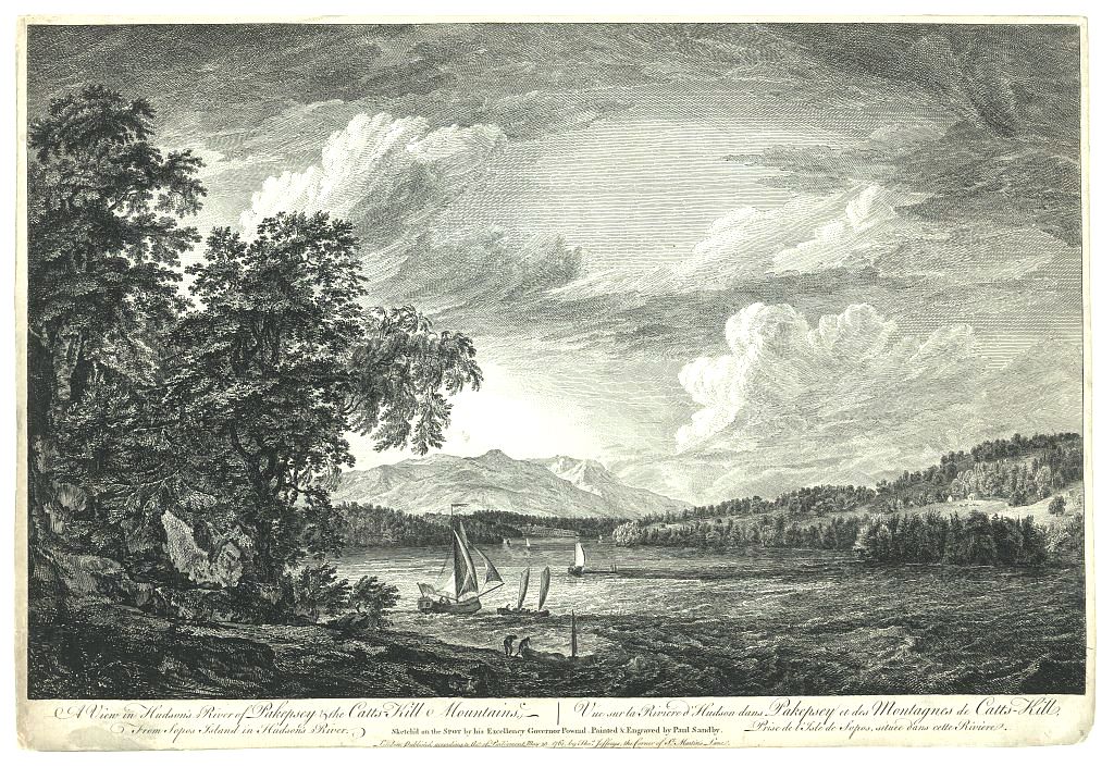
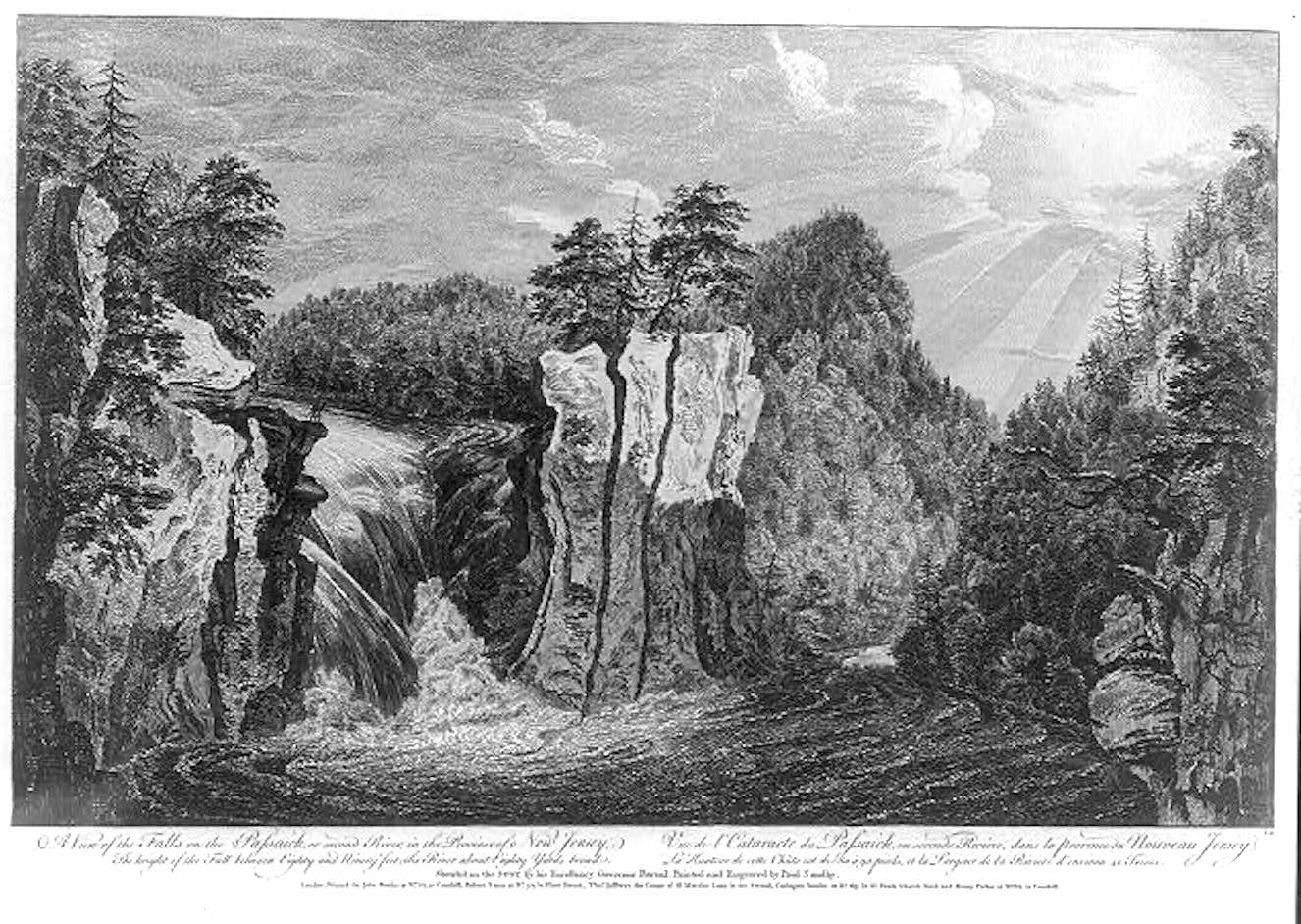
Wilson absorbed Claudian concepts while studying landscape-painting in Italy, where they found patrons among privileged travelers embarked on The Grand Tour. By the mid-eighteenth century, scenic vistas of faraway places were much in demand, as were paintings of the parks and great houses owned by wealth patrons. Print publishing made it possible to purchase works of art at affordable prices. A growing middle-class clamored for scenic engravings. Following the cessation of hostilities during the French and Indian War (1754-1763), British military officers Captain Hervey Smyth, Elias Durnford, Lieutenant Archibald Campbell and Massachusetts Royal Governor Thomas Pownall (1722-1805) traveled through the British possessions of North America, from Canada to the Caribbean, sketching picturesque views “on the spot” that were elaborated by professional artists like Paul Sandby (1731-1809), engraved by William Eliot, Paul Benazech and others, and published to great acclaim in 1768 by John Bowles and a consortium of printing-industry entrepreneurs.


A view in Hudson’s River of Pakepsey & the Catts-Kill Mountains, from Sopos Island in Hudson’s River Vue sur la Riviere d’Hudson dans Pakepsey et des Montagnes de Catts-Kill, prise de l’Isle de Sopos, situee dans cette riviere. sketch’d on the spot by his excellency, Governor Pownal; painted & engraved by Paul Sandby. 1761

Scenographia Americana was nothing less than a flag-waving celebration of Britain’s triumph over the French, declaring the insular kingdom’s new status as an imperial power. In the wake of its success, with a boom in art-publishing underway, the young fifth Duke of Devonshire (1748-1811) allowed the drawings from Claude Lorrain’s Liber Veritatis to be engraved by Richard Earlom and published in serial form by John Boydell. When Earlom’s prints first appeared on the market in 1774, their effect was to electrify and reinvigorate the practice of landscape painting. The task of reproducing Claude’s Book of Truth was completed by 1778. Over the decades that followed, a number of new editions were released, exerting a considerable influence on the practice of landscape-painting that only waned with the advent of photography and the rise of Impressionism.

From a modernist perspective, one might argue that Claude’s Liber Veritatis first proposed the notion that pictorial design was as much the subject of any painting as whatever else it portrayed. The early works of Kandinsky and Mondrian demonstrate how the genesis of abstract art is rooted in the landscape tradition.
Were we to consider the possibility that Scenographia Americana and the topographical tradition helped Claude make a comeback, we would broaden the narrative to include explorers, naturalists, military topographers and printmakers, standing shoulder-to-shoulder with poetic visionaries.


A view of the falls on the Passaick, or second river, in the province of New Jersey Vue de l’cataracte du Passaick, ou seconde riviere, dans la province du Nouveau Jersey / / sketch’d on the spot by his excellency, Governor Pownal ; painted & engraved by Paul Sandby. The height of the fall between eighty and ninety feet; the river about eighty yards broad = La hauteur de cette chŭte est de 80 à 90 pieds, et la largeur de la riviere d’environ 40 toises.1761

Now available to own: Sketchbook Traveler: Hudson Valley

Explore my Quaranteam Dispatches, from April 1-June 8, 2020

SKETCHBOOK TRAVELER: Dispatch #107. Cape Elizabeth, Maine


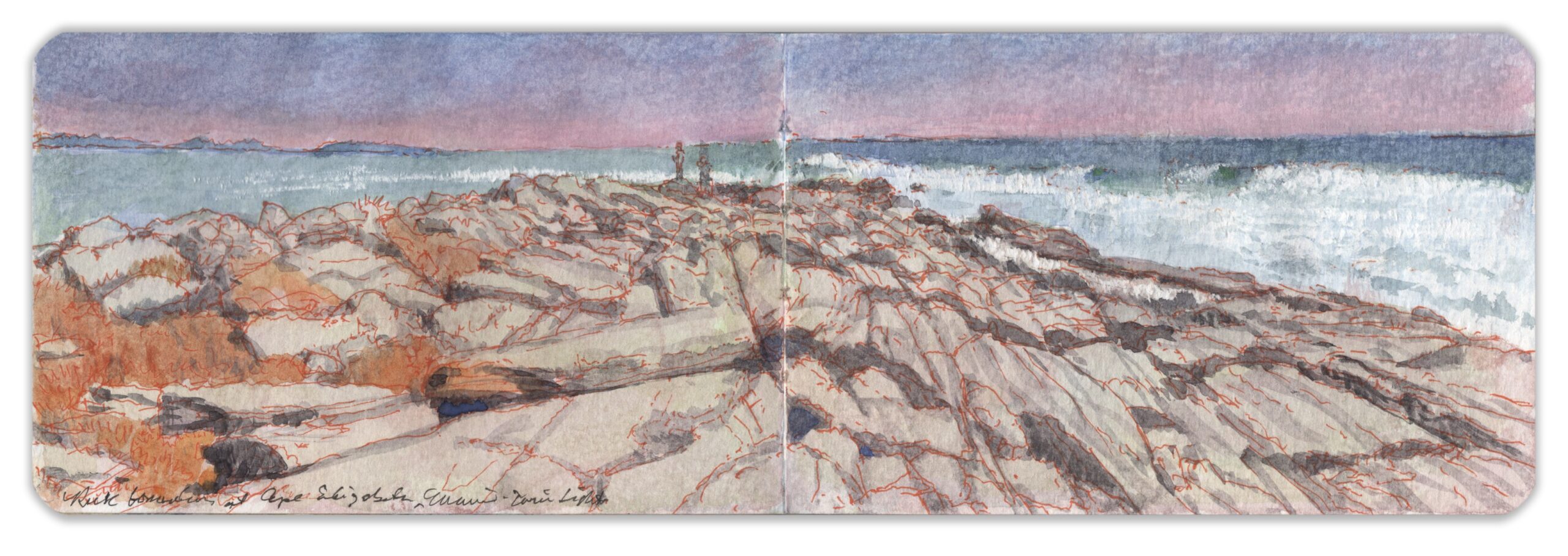
Rock Formations at Dyer’s Point. Cape Elizabeth, Maine. Northeast from 44.5648 x 70.1978. March 20, 2018. Watercolor and pen on Moleskine watercolor journal. 3.5 x 10.5 inches.

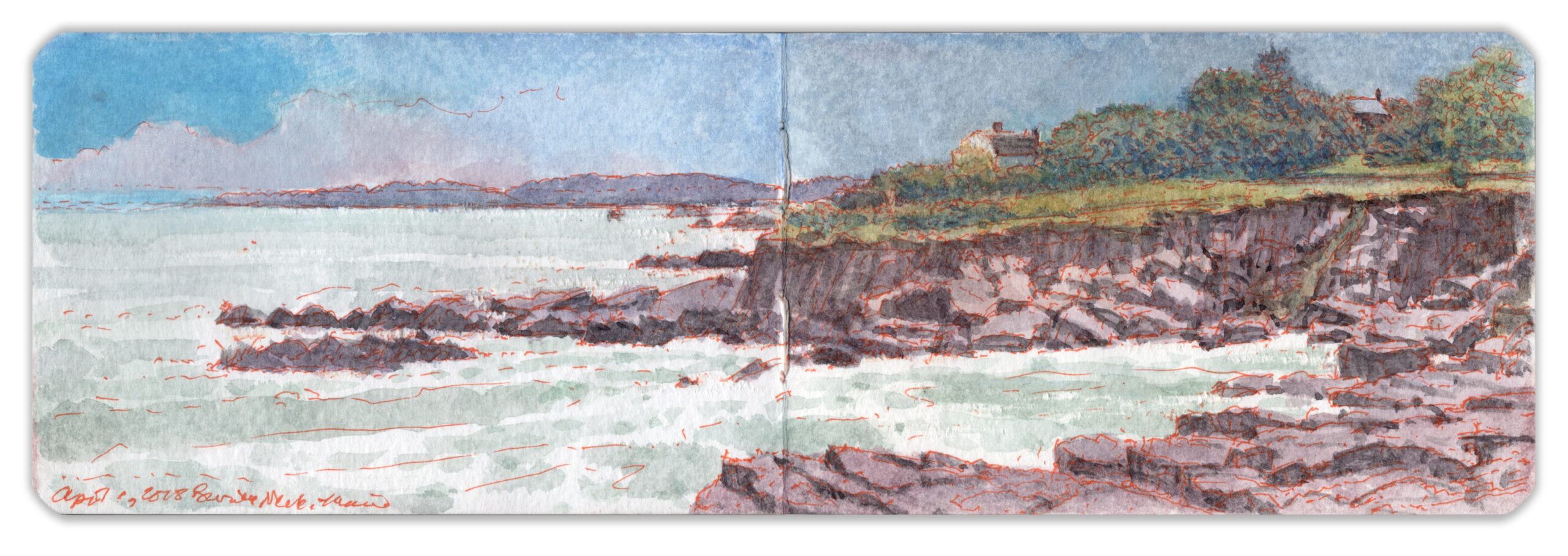
Southeast of Portland, projecting into the Gulf of Maine, Cape Elizabeth divides Saco Bay to the south from Casco Bay to the north. Like other headlands and promontories girding the shores of northern New England, it has rocky formations that provide a time capsule of geological history shaped by sedimentation, plate tectonics, and volcanism. Visible today are fragments of the micro-continent of Avalonia, scattered along the Atlantic rim into Canada, Iceland, Cornwall, and Gibraltar. Exposed to intense heat and crushed between colliding land masses, sedimentary bedrock was folded and compressed into stratified formations resembling petrified wood. As it cooled, the rock became brittle. Fractured by pressure exerted by the continuing motion of continental plates, plumes of magma arose through the fissures, forming basaltic dykes similar to those found at Cathedral Rocks on Cape Ann, the Jersey Palisades, and the Spanish Peaks area of southern Colorado. Scoured by glaciation and eroded by the constant pounding by the sea, the rocky shoreline resonated with the romantic trope of the power of nature, inspiring awe and terror, embodied by the poetic Sublime. Built in 1828, a pair of masonry lighthouses alerted mariners to submerged ledges, which, combined with ten-foot tides, remain a constant threat to shipping. The original lights were replaced by cast-iron towers in 1874, at a time when the Maine coast was being developed as America’s vacation land. The ubiquitous Shingle Style seasonal homes were popularized by architect and erstwhile landscape painter John Calvin Stevens, who worked on the renovation of Winslow Homer’s home and studio at Prouts Neck.

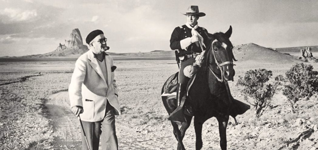
During his New York City years, Winslow Homer would hide out in his studio with a sign on the door that read, “Mr. Homer is not at home.” Following a summer on Ten Pound Island and a two-year retreat in Cullercoats on the Northumbrian coast, Homer returned to the United States. During a visit to the Maine coast, he decided to establish a permanent residence and studio at Prouts Neck, renovating a carriage house on property owned by his brother. He moved the building closer to the shoreline and provided the modest structure with a wraparound porch for painting in all seasons. Prouts Neck is connected to the mainland by a bottleneck rimmed with sandy beaches; its geology is the same as that of Cape Elizabeth—folded and fissured Silurian bedrock crisscrossed by basaltic upflows. Revealed by ten-foot tides, crevasses draped with marine flora form tidal pools teeming with life. In violent weather, rough seas crash against the shore, launching great plumes of spray that fall like rain on glistening rocks. This tiny headland became Homer’s muse for the rest of his days. His studio has been preserved and is maintained by the Portland Museum of Art. A son of Irish immigrants later recalled watching Homer sitting out on the rocks, at work on a canvas. Working at the Gem Theater on nearby Peak’s Island, the teenage Sean Martin Aloysius Feeney fell in love with the movies. Hollywood later lionized him as the iconic film-director John Ford.


John Ford (left) with John Wayne during the filming of “Fort Apache” at Monument Valley in 1948

Now available to own: Sketchbook Traveler: Hudson Valley

Explore my Quaranteam Dispatches, from April 1-June 8, 2020

SKETCHBOOK TRAVELER: Dispatch #106: Prouts Neck, Maine

This is a preview of Sketchbook Traveler: New England.(Volume Three) Schiffer Publishing. Release date: Fall 2022

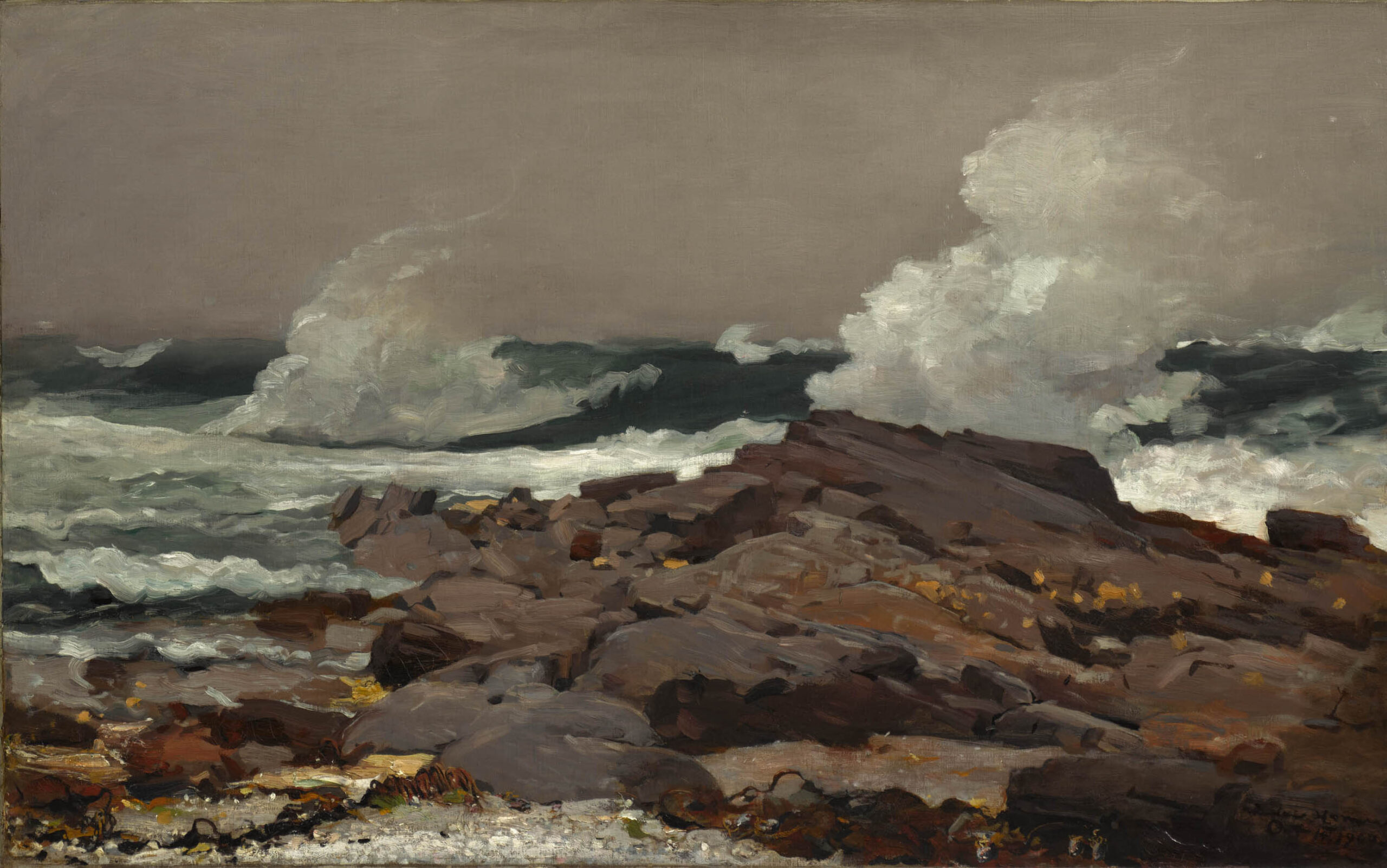
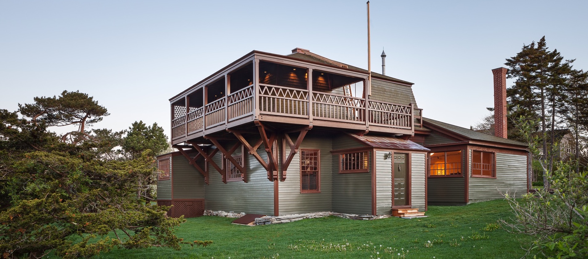
During his New York City years, Winslow Homer would hide out in his studio with a sign on the door that read, “Mr. Homer is not at home.” Following a summer on Ten Pound Island and a two-year retreat in Cullercoats on the Northumbrian coast, Homer returned to the United States. During a visit to the Maine coast, he decided to establish a permanent residence and studio at Prouts Neck, renovating a carriage house on property owned by his brother. He moved the building closer to the shoreline and provided the modest structure with a wraparound porch for painting in all seasons. Prouts Neck is connected to the mainland by a bottleneck rimmed with sandy beaches; its geology is the same as that of Cape Elizabeth—folded and fissured Silurian bedrock crisscrossed by basaltic upflows. Revealed by ten-foot tides, crevasses draped with marine flora form tidal pools teeming with life. In violent weather, rough seas crash against the shore, launching great plumes of spray that fall like rain on glistening rocks.

Winslow Homer (American; 1836–1910); Eastern Point; 1900. Oil on canvas; 30 1/4 x 48 1/2 in. (76.8 x 123.2 cm). Sterling and Francine Clark Art Institute; Williamstown; Massachusetts; 1955.6

This tiny headland had been developed as an affluent enclave by Homer’s brother. It was to become his muse for the rest of his days. Cultivating an image as a hermit, Homer remained very much in touch with the art-world; even lecturing art-dealers on market trends. Fitting to his reputation as a maritime painter, his drink of choice seems to have been rum. Once a visitor asked how so many empty bottles had gotten into the studio, Homer’s wry reply was that he had no idea. He never bought an empty bottle in his life. A child of Irish immigrants later recalled watching Homer sitting out on the rocks, at work on a canvas. Working at the Gem Theater on nearby Peak’s Island, the teenage Sean Martin Aloysius Feeney fell in love with the movies. Hollywood later lionized him as John Ford.
Homer’s studio has been preserved. It is maintained and interpreted for visitors by the Portland Museum of Art.


Homer’s Studio, Prout’s Neck. Courtesy Portland Museum of Art.

Now available to own: Sketchbook Traveler: Hudson Valley

Explore my Quaranteam Dispatches, from April 1-June 8, 2020

© James Lancel McElhinney 2021.
(All images reproduced under Fair Use for critical and educational purposes)

SKETCHBOOK TRAVELER: DIspatch #106. Sprague River from Morse Mountain

This is a preview of (Volume Three) Sketchbook Traveler: New England. Schiffer Publishing. Publication date: Fall 2022


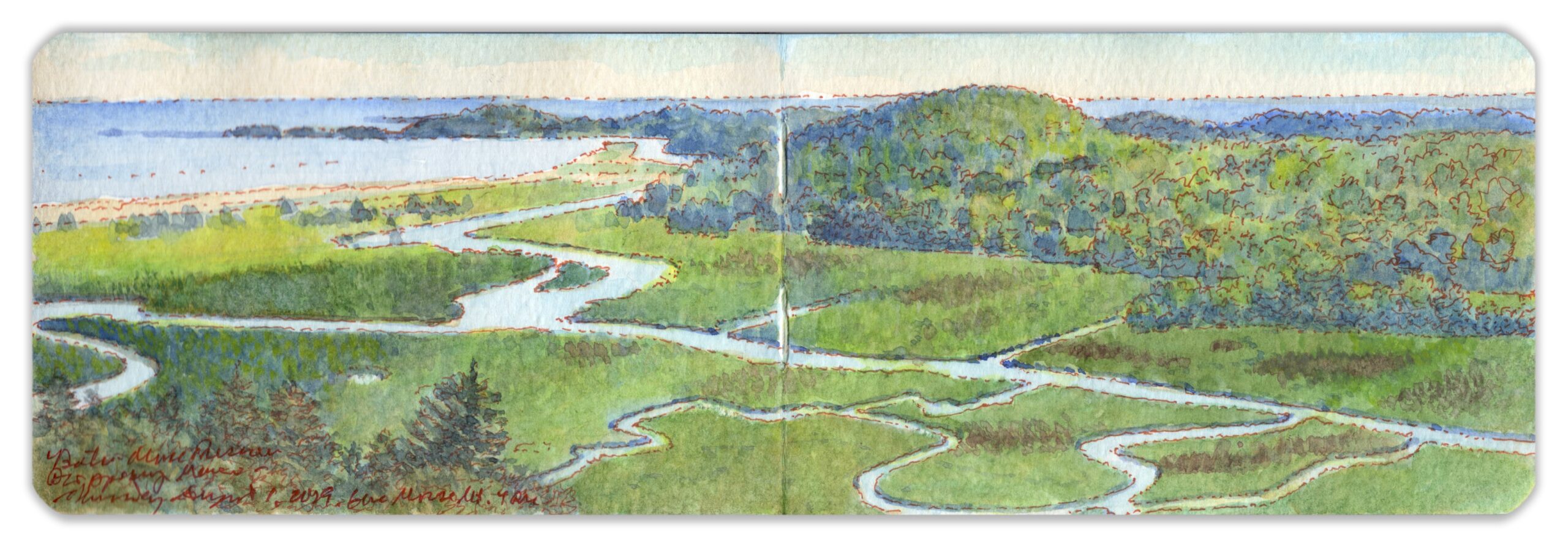
Sprague River from Morse Mountain, Phippsburg, Maine. August 1, 2019. Looking south from 43.7376 x -69.8260.

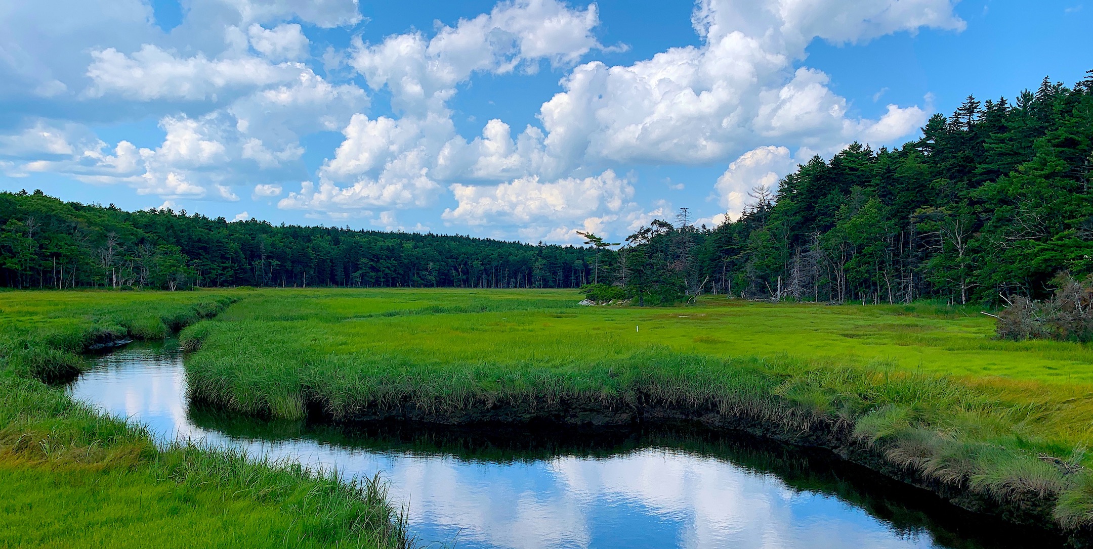
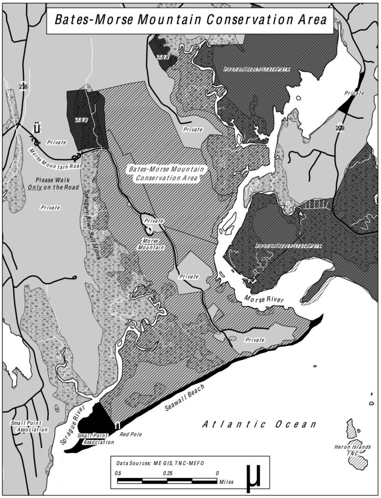
Looking at a map of the Maine coast north of Portland, one finds fewer coves and headlands. Crumpled upward by tectonic plates and sculpted by glaciation, a labyrinth of islands among narrow fingers of land reaches southward into the Gulf of Maine. Early settlements sprang up along this fringe in the shelter of intervening waterways. Prior to automobiles and the two-lane blacktop, getting from place to place in the region was accomplished by water. Travel time by land between some of these villages could exceed three or four times that of going by water at the same speed. Scouting motifs with a roadmap on the passenger seat, I have firsthand experience with a maxim of humorist Marshall Dodge, “You can’t get there from here.” It must have been equally vexing to early explorers, sailing up what seemed like a river only to find a rocky cul-de-sac. Divided by long ridges interspersed by marshes, the land on either side of the Kennebec River rises from the coast into rolling terrain once blanketed by forests. Located south of Phippsburg, the Bates-Morse Mountain Conservation Area was established by a local family and today is managed through a partnership between its nonprofit corporation, the Nature Conservancy, and Bates College, which uses the site as an outdoor classroom and summer residency. Viewed from the western slope of Morse Mountain, the marshy Sprague River meanders beside Small Point. Serpentine loops meander through verdant wetlands spill into a channel behind an alluvial sandbar known as Seawall Beach before mingling its waters with the sea.


Looking upstream on the Sprague River from the causeway, Morse Mountain Road. Photo by the author. August 1, 2019

Map of Bates-Morse Mountain Conservation Area. Courtesy Bates College, Auburn, Maine.


Along Morse Mountain Road just south of the causeway. August 1, 2019

Now available to own: Sketchbook Traveler: Hudson Valley

Explore my Quaranteam Dispatches, from April 1-June 8, 2020

© James Lancel McElhinney 2021.
(All images reproduced under Fair Use for critical and educational purposes)

SKETCHBOOK TRAVELER: Dispatch # 105. The Vicissitudes of (Optical) Verisimilitude


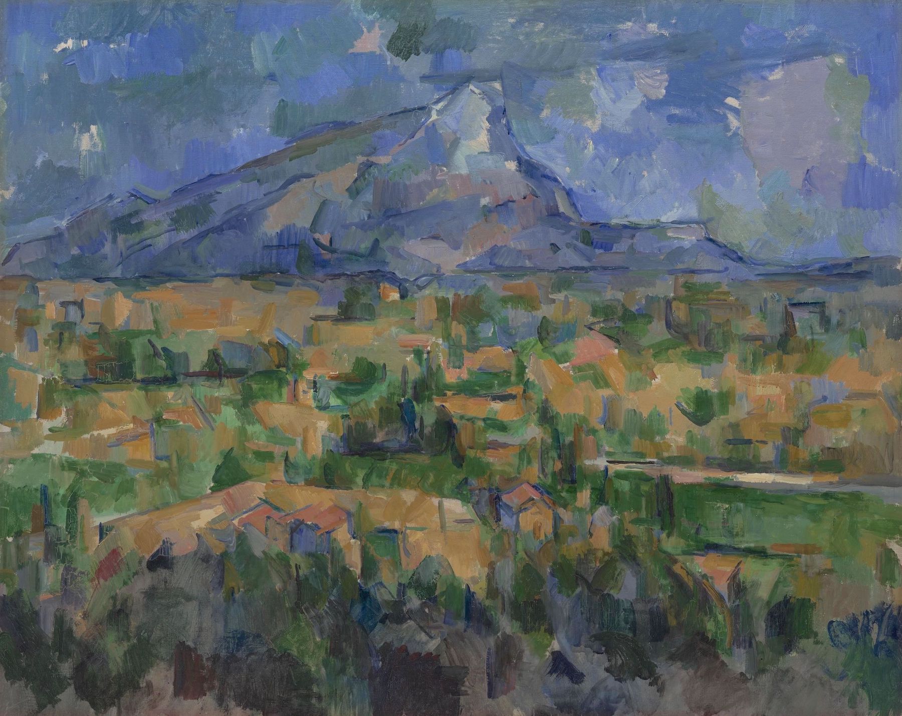
Paul Cézanne. Mont Sainte-Victoire. 1902-1904. Collection Philadelphia Museum of Art. An old friend since childhood, this painting was always at the top of my list of works to visit. Between the PMA and the Barnes Collection, Philadelphia is blessed with a greater concentration of works by Cézanne than anywhere else on earth.

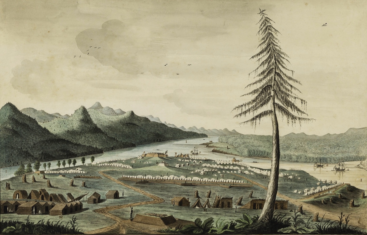
In 1759, Captain Thomas Davies of the Royal Artillery made a drawing, ”…on the spot” of the encampment of Lord Jeffrey Amherst’s army from a position a few hundred yards southeast of His Majesty’s Fort at Crown Point. From what I could reckon by looking at maps of the period, today’s main parking-area just north of the fort had been covered by workshops and warehouses. General Amherst and his staff would have been lodged beside the little cove just beyond the foot of today’s Champlain Bridge. A picnic area and events-pavilion now stand on the site of an earthen French redoubt. Wooster’s Third Connecticut provincial regiment, including my ancestor, would have been encamped just to south behind a line of outworks along a natural uplift of the fossil-reef limestone that undergirds the peninsula. Rangers and indigenous forces were quartered in huts and wigwams further to the rear, near the site of the present-day park-ranger station and maintenance shed.


Thomas Davies. 1737-1812. View of Amherst’s army at Crown Point, 1759. Courtesy Wintherthur Museum, Delaware.

Embellished with picturesque touches, Davies’s finished watercolor is far from naïve in its rendering of the site. Twenty-first-century viewers might mistake topographical accuracy for a lack of optical verisimilitude. Davies was keenly aware that whatever artistic aims his painting might achieve, his primary goal was creating a chorographic vista one could read like a map. Eight years later professional watercolorist Paul Sandby took up a position to oversee the drawing curriculum at the Royal Military Academy in Woolwich. It was believed that artistic training would make keener observers of future military officers, enhancing the value as military intelligence whatever drawings they might make “on the spot”. It also gave them the ability to editorialize, to downplay or call attention to features and landmarks which might be regarded as advantageous. A hallmark of expeditionary art is the distortion of scale to render more legible certain elements of terrain. I noted this on many occasions when my travels gave me the opportunity to compare an optical experience of terrain with historic depictions more focused on conveying specific data.


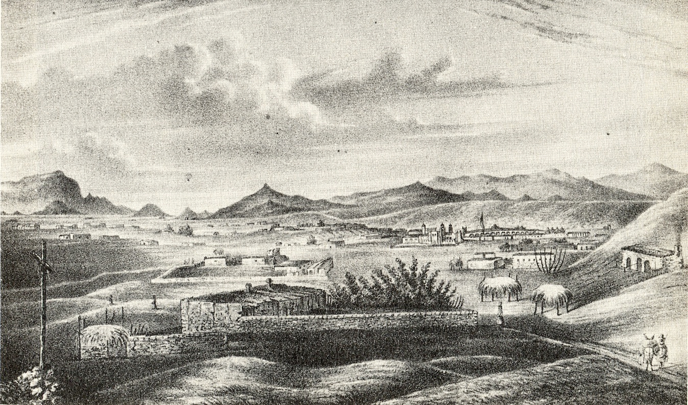
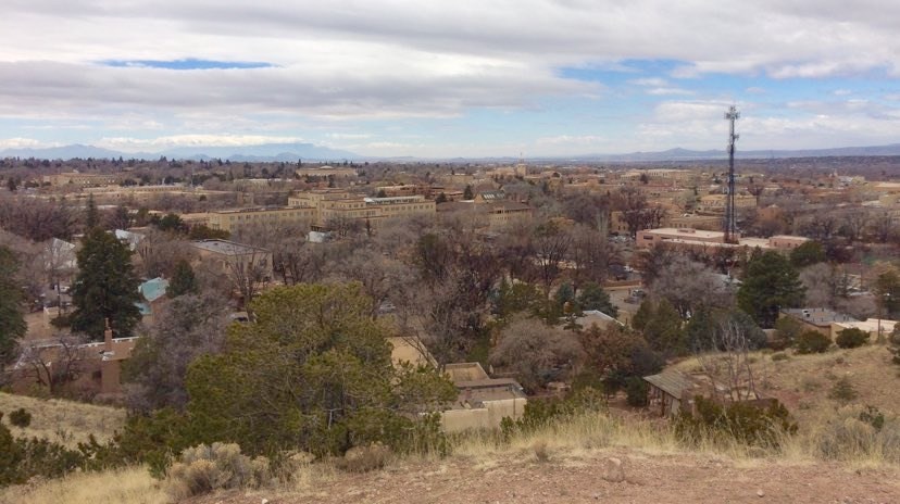
Richard Hovenden Kern’s 1849 view from Fort Marcy is a case in point. Looking south from a hillock along the northern margins of downtown Santa Fe, one’s gaze may seize first on the jagged Placer mountains, then the fall of the massive upthrusting Sandias. Panning right, we find the pinched summit of La Tetilla hill. Further on we find the Jemez range and Valles Caldera, looming up behind Ortiz Mountain and Montoso Peak. Viewed altogether in a single photographic exposure, these features become nothing more than illegible specks on the horizon.
By compressing the distance between these landmarks, while enlarging them and minimizing the foreground, Kern has chosen to privilege data over optics. His drawing provides a pictorial guide to prominent landmarks in ways that no still snapshot ever could.


Santa Fe from Fort Marcy. March 4, 2019. Photograph by the author.

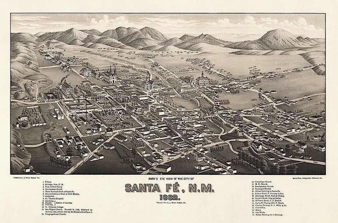
Conditioned by photography, later vistas from the same point-of-view embrace optical verisimilitude at the expense of useful data. Kern’s approach is reprised thirty-three years later in an aerial fly-overview of Santa Fe, one of the countless townscape panoramas produced in vast quantities during the denouement of the golden age of popular lithography.


Looking east. Richard Kern’s point of view would have been from atop one of the hills visible along he left edge of this image, just beyond Bishop’s Lodge Road. More than three decades had passed since Kern visited the former Spanish possession, acquired from Mexico in 1848. The street grid has expanded. The downtown area between Rio Santa Fe and the row of low hills to the north filling up with new construction. Thirty years later Santa Fe had become a magnet for tourists, artists and writers. 19th-century Victorian and Spanish Revival architecture disappeared under the adobe façades of the Pueblo Revival style, expressing a strong regional flavor retained by the city today.


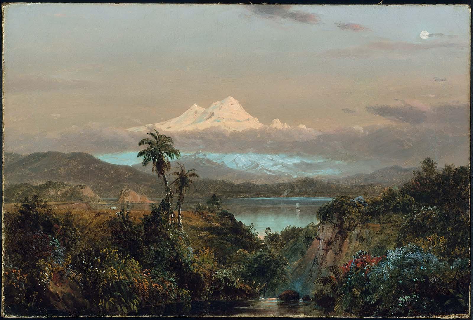
Frederic E Church. Cayambe. 1858. Museum of Fine Arts, Boston.

To the photo-conditioned eye, Kern’s drawing may seem naïve, but we find similar distortions in the works of professional artists like Frederic Edwin Church, Albert Bierstadt and John Frederic Kensett. For the Ecuadorian volcano Cayambe to be visible from Otavallo, looming over Lago San Pablo as it does in Church’s painting, the mountain would have to dwarf Everest. Similarly, Albert Bierstadt frames a fictitious alpine peak in a nebulous porthole, hovering above the summit of Mount Rosalie (present-day Mount Evans, Colorado).


Albert Bierstadt. A Storm in the Rockies (Mt. Rosalie) 1866. Brooklyn Museum


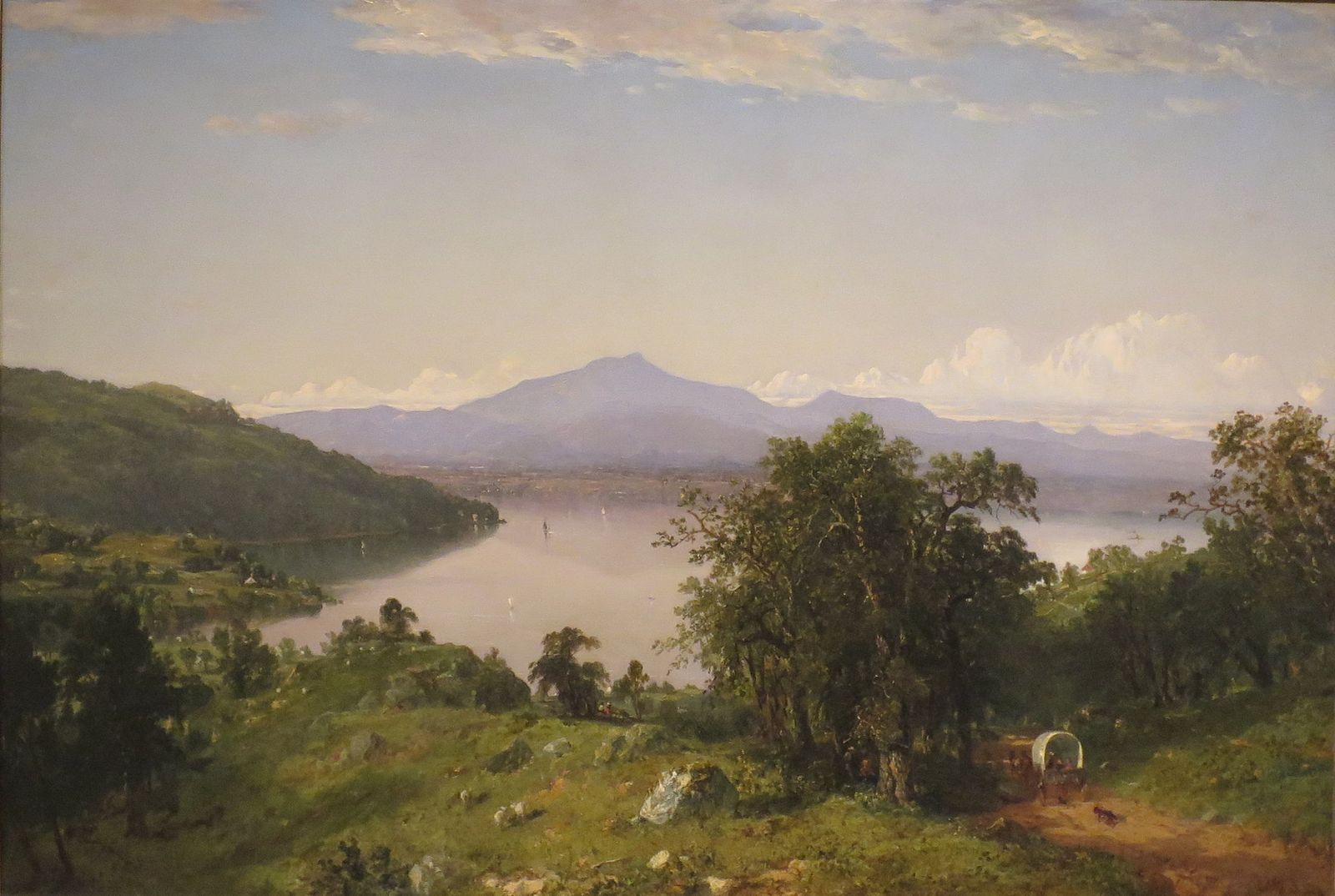
John Frederick Kensett. Camel’s Hump. 1852. Hugh Museum. Atlanta


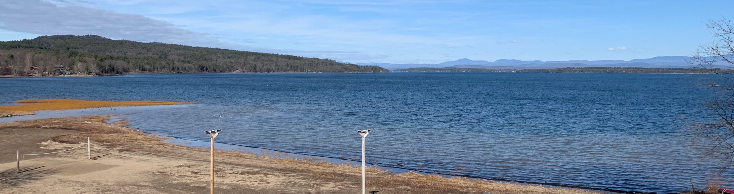
A recent photograph of Kensett’s perspective. 2021

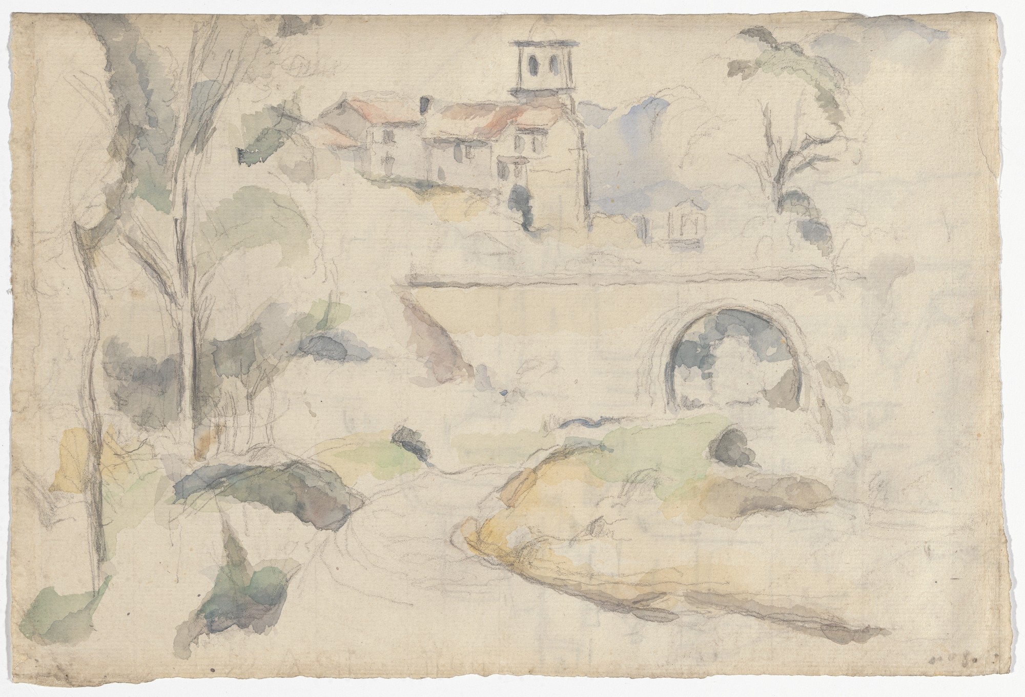
Kensett’s view of Camel Hump Mountain in Vermont, as seen from Westport, New York is another foray into hyperbole. These artists followed the maxim that mere imitation can never attain the lofty realm of art, at the same time relying on the fact that their viewers were unlikely to question the data their pictures delivered. Later artists like Paul Cézanne employed a comparable intensity of empiricism. Eschewing traditional descriptive conventions, he developed idiosyncratic visual effects which superficial readings might confuse with style. Many of his watercolors read like maps of scientific knowledge; fragments of hard-won certainty, scattered across fields of unknowing, and yet legible as complete ideas.


Paul Cézanne. Bridge at Gardanne. 1885-1886. Lillie P. Bliss Collection. MoMA

As tastes and methods changed, the goal of painting what is there was, and is less important than portraying the experience of discovering, exploring, and then seeing it. Few landscape painters understand this because most are trained in a bubble, a hall of mirrors in which a painting is a painting is a painting. “Landscapes,” as J.B. Jackson put it, “do not occur in nature but are created when people adapt terrain to their use.” The landscape is thus not composed of the physical features we behold, but how we come to know them. In other words, as far as a painting might be concerned, it is the landscape. Topographical artists were well aware of this, which is why they say no need to compromise valuable data for the sake of optical verisimilitude. Neither did Cézanne. The man who died of a chill, after being drenched by a downpour in the parched land of Provence, would have laughed at the formalist fairy-tale that he turned away from nature to set the corner-stone of modern art. On the contrary, he gave us new ways to look at nature, making his contributions more relevant today than ever before.

Now available to own: Sketchbook Traveler: Hudson Valley

Explore my Quaranteam Dispatches, from April 1-June 8, 2020

(c) 2021 by James Lancel McElhinney.
(All images reproduced under fair use for critical and educational purposes)

SKETCHBOOK TRAVELER: Dispatch # 104. Mount Equinox, Vermont

(The following is an excerpt from Sketchbook Traveler: New England (volume three) from Schiffer Publishing. Scheduled for publication in the fall of 2022.

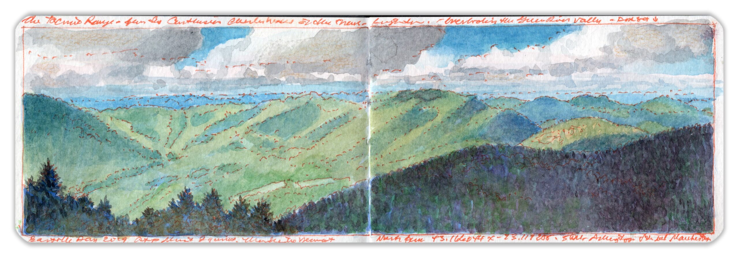
Looking north from the summit of Mount Equinox (43.1660414 x -73.1117056). Bastille Day, 2019

Rising five hundred feet higher than Mount Greylock fifty miles to the south, Equinox Mountain, at just under four thousand feet, is the highest peak in the Taconic range that marks the western boundary of New England. Gaining two thousand feet in elevation above the Batten Kill River just south of the upscale resort town and outlet mecca of Manchester, Vermont, the summit is a popular destination for motorists and hikers. The historic Equinox Golf Resort & Spa stands at its foot. The only Carthusian monastery in the country resides at its summit. Open to the public, the Charterhouse of the Transfiguration contains exhibits, chapels, restrooms, and open-air observation decks. Surrounding vistas reveal serried highlands stepping off to the west into the Hudson Valley.


Location: The summit of Mount Equinox. Skyline Drive. North side of Highway 7A, 4.3 miles south of Manchester, Vermont

Marching eastward, longitudinal mountain ridge divided by the Connecticut River arrive at Mount Monadnock ninety miles away before reaching northward into the White Mountains of New Hampshire. Summit vistas disclose the topographical history of New England. Most of its mountain ranges are aligned on a north-south axis, like the deserts of northern Nevada and western Utah without the intervening basins.
The depth of, and distance between heights and valleys is a corrugation of such regularity that it puts me in mind of a plowed field, or a theater curtain laid flat. Added to massive tectonic forces that formed the Appalachians, collision with the micro-continent of Avalonia brought to bear further compression in the process of mountain building in New England. Fifty thousand years ago, advancing ice sheets two miles thick smoothed jagged peaks into the rounded forms we behold today.

Now available to own: Sketchbook Traveler: Hudson Valley

Explore my Quaranteam Dispatches, from April 1-June 8, 2020