Category Archives: Dispatches

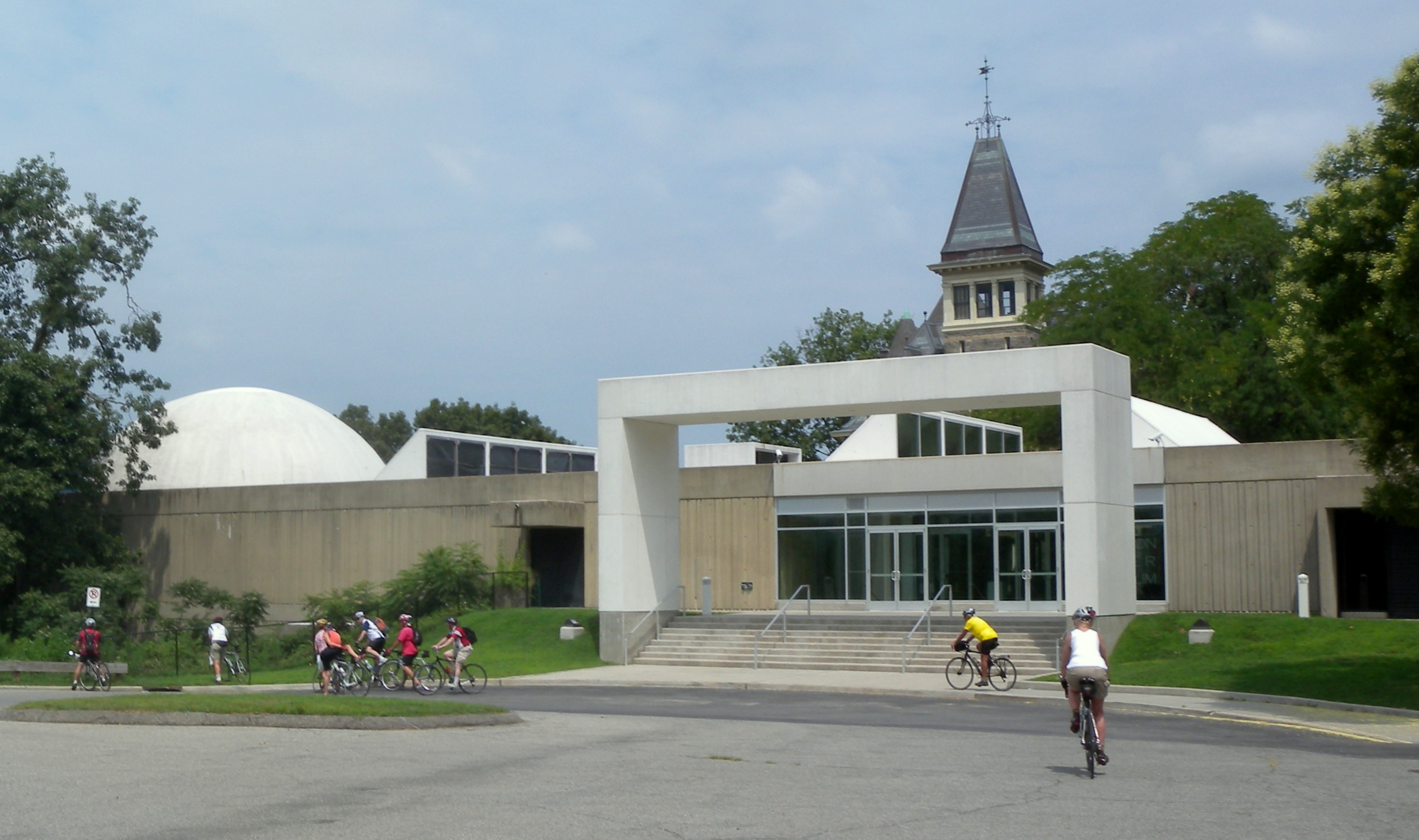
Talk delivered at the Hudson River Museum, Tuesday June 18

On Tuesday, June 18 I was given the privilege of speaking to the docents and staff of the Hudson River Museum, to unpack key factors in the genesis of American landscape painting, apart from the familiar narrative about constructing a national image. First, its relationship to the importance of drawing and penmanship in the crusade for universal education. Second, as a tool for developing new economies in the wilderness. Third, how it reflects the artists’ commitment to public access and fourth, their concerns about environmental degradation.
After the talk, one of the docents mentioned how Lewis and Clark were charged by Thomas Jefferson with collecting botanical and mineral specimens to discover all that they might, about the unexplored regions they were about to traverse. I reminded her that while all of that was true, at the end of the day the expedition was all about beaver-pelts. The primary mission of the Corps of Discovery (as a military force) was to steal a march on the British Northwest Trading Company, by establishing diplomatic and trade agreements with indigenous nations between Saint Louis and the Pacific Northwest. Economic priorities such as these are today of slight concern, except as historic trivia. What has endured is an epic tale about the brave pursuit of knowledge.
Perhaps the salient point was to insist on the primacy of personal engagement, over self-expression, or aesthetic refinement. Artists like Thomas Cole, Frederic Church and Albert Bierstadt endured the hardships of travel and exposure to the elements to experience and record the power of nature. J.W.M. Turner famously had himself lashed to the mast of a ship so that the could experience firsthand a tempest at sea.
These artists demonstrate by their example what might be learned by anyone who scales a snowy peak, treks across burning deserts, goes on sylvan rambles, or sits in one’s garden. When drawing and writing become part of these activities, one improves the likelihood that their experience will be more profound; transformed into the kind of knowledge that gives birth to ideas. The transcript is below, along with a PDF of the PowerPoint slideshow. (all images reproduced under fair use for critical and educational purposes).

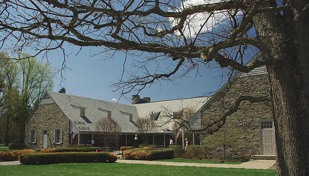
(A similar talk was delivered to a meeting of the Hudson Valley Greenway Community Council, at the FDR Presidential Library in Hyde Park, New York on June 12, 2019)

Inventing the American Landscape: Art & Nature in the Hudson River Valley, by James Lancel McElhinney © 2019

A talk delivered to the docents, and members of the staff of the Hudson River Museum, Yonkers, New York
June 18, 2019. 11:30 A.M.

“Let me open my comments by expressing my sincere thanks to Masha Turchinsky, Saralinda Lichtblau, Laura Vookles and Bridget McCormick for this opportunity to address you all today. I want to talk to you about two big, intertwined ideas. First, that American landscape art – manifested through drawing, painting and prints — was born in the Hudson Valley. Second, that from the beginning the artist’s appreciation of scenery went hand in hand with the mission of public access and the values of environmental responsibility. George Perkins Marsh, an early voice in the American conservation movement observed that,

“Vision is a faculty, seeing is an art”

Few today know that one of the great American drawing academies was founded at West Point. When Sylvanus Thayer became superintendent in 1818, he specified two hours of drawing a day, for all second and third-year cadets. Apart from knowing how to produce mechanical drawings and maps, military officers were expected to know how to think visually—not just to produce chorographic views of new territories, but also to be able to discern anomalies and changes in the terrain, which could inform their decisions under fire. Thayer’s drawing-master was French miniaturist Thomas Gimbrede, who noted that,

“Drawing is all curved lines and straight lines. Anyone can draw a curved line. Anyone can draw a straight line. Therefore, anyone can draw”

These were heady times in American schoolrooms. Reformers like Rembrandt Peale, Hector Humphreys, Horace Mann and others promoted universal education, including drawing and penmanship. A working-person might know how to read a book, but not their master’s longhand. Teaching cursive handwriting to all was another way to level the playing-field. Rembrandt Peale observed that drawing and writing were reciprocal skills.

“Writing is nothing more than drawing the forms of letters. Drawing is nothing else than writing the forms of things”.

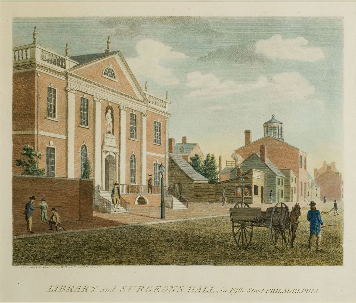
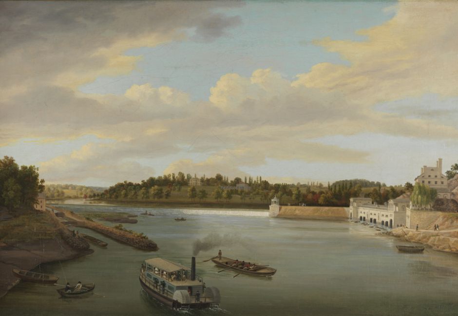
Horace Mann called drawing a moral force.As the Young Republic began to form its identity, public demand for scenic vistas fueled a publishing boom—at first in Philadelphia, then soon after in New York. Artists like William and Thomas and William Birch, Charles Willson Peale, Thomas Doughty and others specialized in river views—at first along the Schuylkill and Delaware, and later the Hudson Valley.
Within a couple of decades, the great North River had become a magnet for landscape artists.
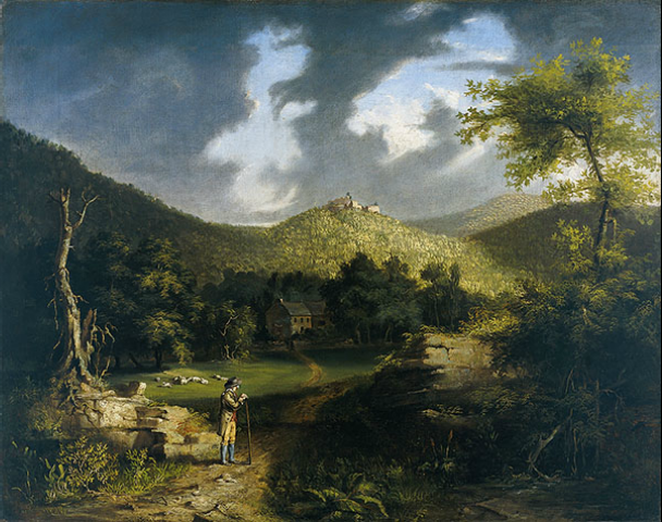
A young Briton who had emigrated to Ohio, before moving to New York produced this painting of Fort Putnam in 1826, giving birth to what is known today at the Hudson River School. His name was Thomas Cole.
Five years earlier, Irish painter William Guy Wall and author John Agg had traveled from what was then believed to be the source of the Hudson River in the Adirondacks to New York Harbor.
Over the next four years, Wall and printmaker John Hill produced a remarkable series of hand-colored etchings, which were published with travel-narratives by Agg.
The Hudson River Portfolio is divided between canonical picturesque views and natural wonders, including a preponderance of waterfalls. I wondered why. And then it occurred to me that people looking at these images in 1820 might have seen more than just thrilling scenery.
Some would have recognized these falls as untapped hydropower, perfectly suited to manufacturing.
While it is only a theory, it is possible that some of Wall’s backers were looking to promote commercial development in the upper Hudson Valley. Tourism would not develop in these regions for another couple of decades, after canals and railroads had penetrated the wilderness.
Years later, two thousand miles to the west, upon meeting a group of prospectors entering the Boulder Valley in central Colorado, an Arapahoe chief named Niwot is quoted as saying,

“People seeing the beauty of this valley will want to stay, and their staying will be the undoing of the beauty.”

Indeed, the steamboats and railroads that delivered travelers to upriver resorts, Lakes George and Champlain, to Adirondack camps and the White Mountains an American Grand Tour, dependent upon the same industrial economy that poisoned wild rivers and filled the air with soot from coal-burning vehicles, factories and cities. In his painting of the Lackawanna Valley, George Inness shows us the fate of the forest—a field of stumps. The trees have been recycled as fence-rails and railroad ties. Distant Steamtown, with its fuming chimneys and brick-bound dystopia recalls the question posed by William Blake,

“And was Jerusalem builded here
among these dark Satanic Mills?”

In his epic poem The Lament of the Forest, painter Thomas Cole described the rape of the land, stripped of its beauty by human greed. Here are a few lines, which presage Richard Powers’s Pulitzer-Prize winning novel The Overstory.

‘Echo, whose voice had answered to the call

Of thunder or of winds, or to the cry

Of cataracts — sound of sylvan habitants

Or song of birds — uttered responses sharp

And dissonant; the axe unresting smote

Our reverend ranks, and crashing branches lashed

The ground, and mighty trunks, the pride of years,

Rolled on the groaning earth with all their umbrage’

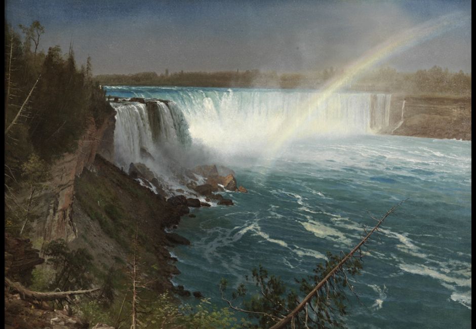
By the time Cole’s student Frederic Church painted Niagara, the falls had already become a well-established tourist destination. Artists like Albert Bierstadt and Thomas Moran, who had accompanied railroad and mineral surveys of the American West helped sell the idea of national parks to Congress. Cole’s lament and George Perkins Marsh’s dire predictions helped shape the thinking of subsequent activists like John Muir, John Burroughs and Rachel Carson.
If we are to preserve nature’s treasures, we must continue to develop new ways to bring human beings into deeper contact with nature, without consuming it—except as personal experience, while leaving no trace. One need not be an artist in order to benefit from writing, drawing, and journal-keeping. These are proven methods for transforming experience into knowledge. Pulling into a highway scenic overlook to snap a few pictures avoids any significant engagement with nature, which can be its own best advocate, if only people will take time to interact with it. Clean rivers, heritage itineraries, historic sites, improved hiking and rail-trails, and open spaces, let citizens reacquaint themselves with nature.
The more profound their experience, the more likely they will be to discover how deeply they care about these resources, and perhaps take steps to protect them. Over the years, many artists have taken up the cause. Explorers and artists were always pathfinders. In many ways, they were the first tourists. They showed the world what America looked like.
Following their example—perhaps at an easel, or with sketchbook in hand—we can deepen our experience of nature, enriching our encounters with all of its wonders.
With the rise of social media, and a new revolution in printed matter underway, there are countless opportunities for nature conservancies and preservationists to partner with the arts. Environmental humanities programs at University of Pennsylvania, Colby College, and elsewhere are rapidly discovering that the arts—not just as individual expression, but more as personal engagement—can provide common ground between science, history, and the societies they serve. This was true in the nineteenth century. It is still true today.
The American landscape was invented in the Hudson Valley—a vision being reborn today. Foregrounding the arts in new initiatives like the Empire State Trail not only honors that legacy. It will assure their success.
Thank you.”

Downloadable PDF of the talk:

Download (PDF, 227KB)

Downloadable PDF of the PowerPoint:

Download (PDF, 9.53MB)

Links to some of the organizations in attendance:

Boscobel House and Gardens

Gomez Mill House

Greater Hudson Heritage Network

Greenway Conservancy for the Hudson River Valley, Inc.

Greenway Heritage Conservancy HRV, Inc.

Maurice D. Hinchey Hudson River Valley National Heritage Area
Hudson Watershed Alliance

John Burroughs Association

Empire State Trail

FASNY Museum of Firefighting

Fisher Center, Bard College

Palisades Interstate Park Conservancy

Saugerties Lighthouse

Thomas Cole National Historic Site

From the Schuylkill to the Hudson: Landscapes of the Early American Republic, opening June 28 at PAFA.

I am very excited about this exhibition curated by Anna Marley for several reasons, the first of which is that the Hudson River School did not spring up out of nowhere. Something had motivated Thomas Cole and others to venture upriver to mine the terrain for pictorial treasure. Cole was no Natty Bumppo, hacking his way through virgin forest to get to million-dollar vistas. The places he visited in 1825 were accessible by steamboat and stage coach. In other words, he was a tourist.


View of Fort Putnam. Thomas Cole. 1826.

Born in England, he moved with his family from Lancashire to Steubenville, Ohio. Prior to his arrival in Manhattan, he had spent time in Pittsburgh and Philadelphia, where he exhibited at PAFA. As the place where the Declaration of Independence had been signed, Philadelphia attracted a steady flow of tourists, hungry for prints of sites like Independence Hall and Fairmount Water Works. The year before Cole’s birth, another Briton named William Birch had self-published a series of engravings; views of the city.

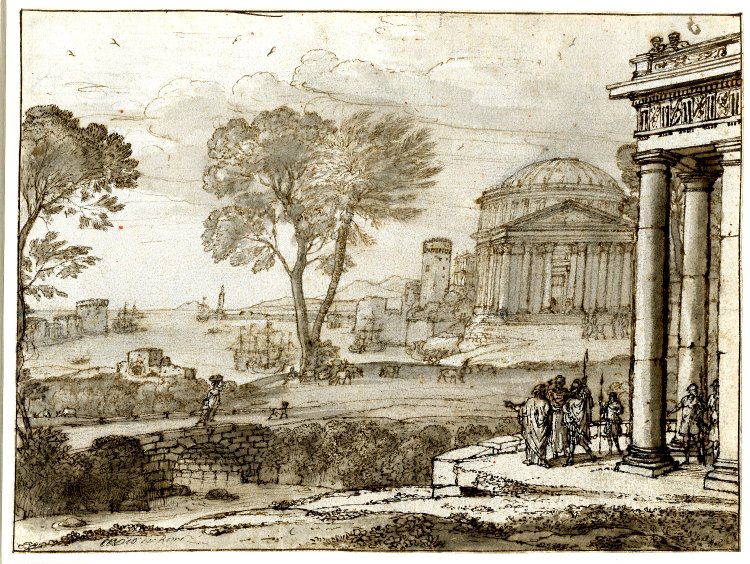
By the time Cole got there, Philadelphia had become the epicenter of a revolution in publishing. A number of European and British artists tried their hand at earning a living by making portraits of the land. The first coherent attempt to portray the Hudson Valley was William Guy Wall’s suite of twenty-four hand-colored aquatints, published between 1821-1825 in sets of six (a magical number in the multiples market). My feeling is that Wall’s patrons must have backed the project in part to promote hydro-power industry and tourism in the upper Hudson Valley. The final six were never published, perhaps because the opening of the Erie Canal had caused investors to look west, instead of north. And then Cole came onto the stage. I for one (perhaps because of my Philadelphia roots) never bought the standard Hudson River School creation-myth. Since the seventeenth century, landscape painting and print publishing were closely intertwined. Turner published his “Liber Studiorum” (Book of the Studio), inspired in part by Claude Lorrain’s Liber Veritatis (Book of Truth), which in effect served to copyright these artist’ compositions.

It is no coincidence that Hudson River School artists like Asher B. Durand and John Frederick Kensett began their careers as engravers. It is high time for a prequel to the legend taught by received wisdom, mostly because it’s a better story.

https://www.pafa.org/exhibitions/schuylkill-hudson-early-american-landscapes


Niagara. Albert Bierstadt

View from Fort Montgomery. David Johnson. In fact, Fort Montgomery is on the riverbank at the lower left-hand side of the image. Fort Clinton was on the adjoining bluff across the creek to its right. Fort Clinton is today the western terminus of Bear Mountain Bridge. The body of water beside it is Hessian Lake. I have come across numerous misidentified landscape paintings. The actual prospect for this picture is from a ridge on the West Point Military Reservation, today off limits to the public.

For more information, follow this LINK

Talks delivered at FDR Presidential Library & Museum on June 12, 2019

On June 12, 2019 I had the privilege of delivering a PowerPoint talk to a meeting of the boards of Hudson Valley Greenway Communities Council, Greenway Conservancy for the Hudson River Valley, Inc. Greenway Heritage Conservancy and the Maurice D. Hinchey Hudson Valley National Heritage Area, at the Franklin Delano Roosevelt Presidential Library & Museum in Hyde Park, New York. The subject of the talk was “Inventing the American Landscape: Art & Nature in the Hudson Valley”. Many thanks to Barnabas McHenry and Kevin Burke for honoring me with the invitation to speak.
The other speaker, Jean MacKay of the Erie Canal National Heritage Corridor, spoke about the new Canalway Challenge initiative.

Inventing the American Landscape: Art & Nature in the Hudson River Valley, by James Lancel McElhinney © 2019

A talk delivered to a meeting of the:

Hudson Valley Greenway Conservancy
Greenway Conservancy for the Hudson River Valley, Inc.
Greenway Heritage Conservancy HRV, Inc.
Maurice D. Hinchey Hudson Valley River Valley National Heritage Area at:

Henry A. Wallace Center at the FDR Library Museum
June 12, 2019. 10:00 A.M.

“Let me open by expressing my sincere thanks to Barnabas McHenry and Kevin Burke for inviting me to address this august gathering. Today I want to talk to you about two big, intertwined ideas. First, that American landscape art – manifested through drawing, painting and prints — was born in the Hudson Valley. Second, that from the beginning the artist’s appreciation of scenery went hand in hand with the mission of public access and the values of environmental responsibility. George Perkins Marsh, an early voice in the American conservation movement observed that,

“Vision is a faculty, seeing is an art”

Few today know that one of the great American drawing academies was founded at West Point. When Sylvanus Thayer became superintendent in 1818, he specified two hours of drawing a day, for all second and third-year cadets. Apart from knowing how to produce mechanical drawings and maps, military officers were expected to know how to think visually—not just to produce chorographic views of new territories, but also to be able to discern anomalies and changes in the terrain, which could inform their decisions under fire. Thayer’s drawing-master was French miniaturist Thomas Gimbrede, who noted that,

“Drawing is all curved lines and straight lines. Anyone can draw a curved line. Anyone can draw a straight line. Therefore, anyone can draw”

These were heady times in American schoolrooms. Reformers like Rembrandt Peale, Hector Humphreys, Horace Mann and others promoted universal education, including drawing and penmanship. A working-person might know how to read a book, but not their master’s longhand. Teaching cursive handwriting to all was another way to level the playing-field. Rembrandt Peale observed that drawing and writing were reciprocal skills.

“Writing is nothing more than drawing the forms of letters. Drawing is nothing else than writing the forms of things”.

Horace Mann called drawing a moral force.As the Young Republic began to form its identity, public demand for scenic vistas fueled a publishing boom—at first in Philadelphia, then soon after in New York. Artists like William and Thomas and William Birch, Charles Willson Peale, Thomas Doughty and others specialized in river views—at first along the Schuylkill and Delaware, and later the Hudson Valley.
Within a couple of decades, the great North River had become a magnet for landscape artists.
A young Briton who had emigrated to Ohio, before moving to New York produced this painting of Fort Putnam in 1826, giving birth to what is known today at the Hudson River School. His name was Thomas Cole.
Five years earlier, Irish painter William Guy Wall and author John Agg had traveled from what was then believed to be the source of the Hudson River in the Adirondacks to New York Harbor.
Over the next four years, Wall and printmaker John Hill produced a remarkable series of hand-colored etchings, which were published with travel-narratives by Agg.
The Hudson River Portfolio is divided between canonical picturesque views and natural wonders, including a preponderance of waterfalls. I wondered why. And then it occurred to me that people looking at these images in 1820 might have seen more than just thrilling scenery.
Some would have recognized these falls as untapped hydropower, perfectly suited to manufacturing.
While it is only a theory, it is possible that some of Wall’s backers were looking to promote commercial development in the upper Hudson Valley. Tourism would not develop in these regions for another couple of decades, after canals and railroads had penetrated the wilderness.
Years later, two thousand miles to the west, upon meeting a group of prospectors entering the Boulder Valley in central Colorado, an Arapahoe chief named Niwot is quoted as saying,

“People seeing the beauty of this valley will want to stay, and their staying will be the undoing of the beauty.”

Indeed, the steamboats and railroads that delivered travelers to upriver resorts, Lakes George and Champlain, to Adirondack camps and the White Mountains an American Grand Tour, dependent upon the same industrial economy that poisoned wild rivers and filled the air with soot from coal-burning vehicles, factories and cities. In his painting of the Lackawanna Valley, George Inness shows us the fate of the forest—a field of stumps. The trees have been recycled as fence-rails and railroad ties. Distant Steamtown, with its fuming chimneys and brick-bound dystopia recalls the question posed by William Blake,

“And was Jerusalem builded here
among these dark Satanic Mills?”

In his epic poem The Lament of the Forest, painter Thomas Cole described the rape of the land, stripped of its beauty by human greed. Here are a few lines, which presage Richard Powers’s Pulitzer-Prize winning novel The Overstory.

‘Echo, whose voice had answered to the call

Of thunder or of winds, or to the cry

Of cataracts — sound of sylvan habitants

Or song of birds — uttered responses sharp

And dissonant; the axe unresting smote

Our reverend ranks, and crashing branches lashed

The ground, and mighty trunks, the pride of years,

Rolled on the groaning earth with all their umbrage’

By the time Cole’s student Frederic Church painted Niagara, the falls had already become a well-established tourist destination. Artists like Albert Bierstadt and Thomas Moran, who had accompanied railroad and mineral surveys of the American West helped sell the idea of national parks to Congress. Cole’s lament and George Perkins Marsh’s dire predictions helped shape the thinking of subsequent activists like John Muir, John Burroughs and Rachel Carson.
If we are to preserve nature’s treasures, we must continue to develop new ways to bring human beings into deeper contact with nature, without consuming it—except as personal experience, while leaving no trace. One need not be an artist in order to benefit from writing, drawing, and journal-keeping. These are proven methods for transforming experience into knowledge. Pulling into a highway scenic overlook to snap a few pictures avoids any significant engagement with nature, which can be its own best advocate, if only people will take time to interact with it. Clean rivers, heritage itineraries, historic sites, improved hiking and rail-trails, and open spaces, let citizens reacquaint themselves with nature.
The more profound their experience, the more likely they will be to discover how deeply they care about these resources, and perhaps take steps to protect them. Over the years, many artists have taken up the cause. Explorers and artists were always pathfinders. In many ways, they were the first tourists. They showed the world what America looked like.
Following their example—perhaps at an easel, or with sketchbook in hand—we can deepen our experience of nature, enriching our encounters with all of its wonders.
With the rise of social media, and a new revolution in printed matter underway, there are countless opportunities for nature conservancies and preservationists to partner with the arts. Environmental humanities programs at University of Pennsylvania, Colby College, and elsewhere are rapidly discovering that the arts—not just as individual expression, but more as personal engagement—can provide common ground between science, history, and the societies they serve. This was true in the nineteenth century. It is still true today.
The American landscape was invented in the Hudson Valley—a vision being reborn today. Foregrounding the arts in new initiatives like the Empire State Trail not only honors that legacy. It will assure their success.
Thank you.”

Downloadable PDF of the talk:

Download (PDF, 97KB)

Downloadable PDF of the PowerPoint:

Download (PDF, 9.53MB)

Links to some of the organizations in attendance:

Boscobel House and Gardens

Gomez Mill House

Greater Hudson Heritage Network

Greenway Conservancy for the Hudson River Valley, Inc.

Greenway Heritage Conservancy HRV, Inc.

Maurice D. Hinchey Hudson River Valley National Heritage Area
Hudson Watershed Alliance

John Burroughs Association

Empire State Trail

FASNY Museum of Firefighting

Fisher Center, Bard College

Palisades Interstate Park Conservancy

Saugerties Lighthouse

Thomas Cole National Historic Site

UPDATE: GRAND RIVER SKETCHBOOK: May 8, 2019


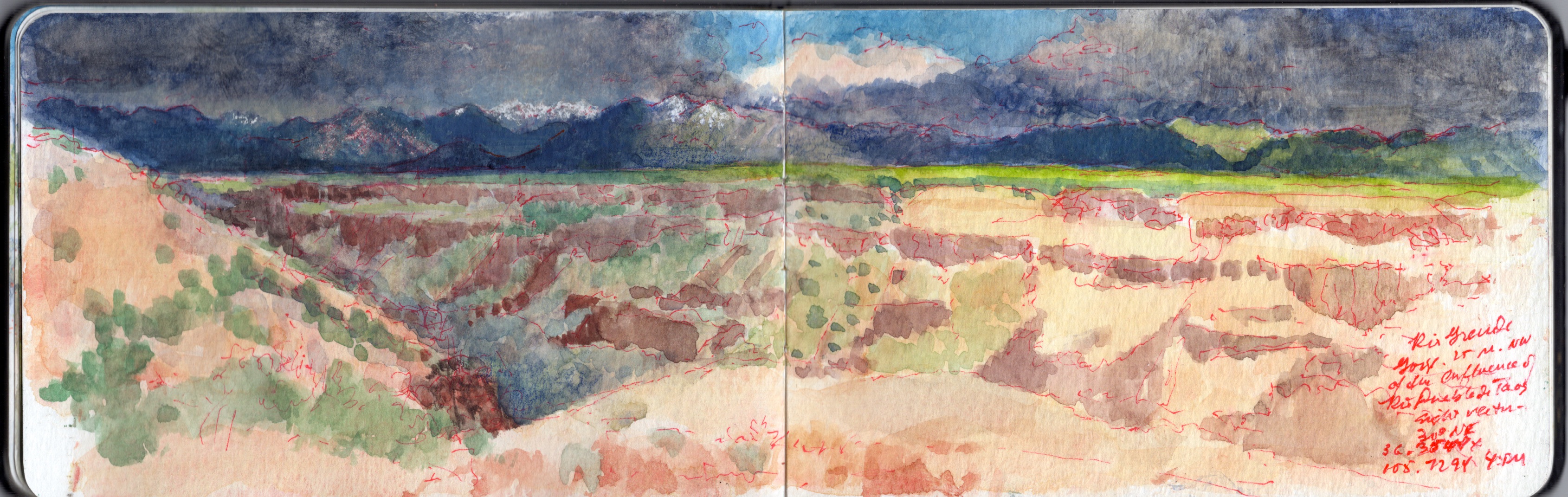
May 8, 2019. Near the Trail-head above Taos Junction Bridge. 30 degrees NE.36.3544 x 105.7294. 2-4pm

May 8, 2019. Wake early, make journal entries, posting them on social media. Simple breakfast. Work in the studio. Decide to try to produce a concertina book. Call Artisan, ordering cut foam-core to serve as (2 each) supports of the books (10 x 48”), and large works on paper (22 x 30”). Set out to work at White Rock Canyon, but dark clouds over the Jemez Caldera cause me to rethink my plan. Instead I drive pas Black Mesa, taking photos for reference. From there I follow the river to Ohkay Owingeh (San Juan Pueblo), crisscrossing the river. Chary of setting up in Indian land, I follow the Chama River for a distance before heading toward Ojo Caliente.
The area is agricultural. The village appears to survive off the revenue from guests staying at the eponymous spa and resort, surrounded by a modest number of satellite B&Bs and restaurants. I do not tarry A long mesa rises more than a thousand feet to my right (east). Continuing north on US285 toward Antonito, the land rises gradually, until the roadbed is level with the plain atop the mesa. I turn right onto NM567, passing a number of US Forest Service roads. I pull into one reddish dirt road, check my location and take a few photos looking south, toward the mouth of Rio Grande Gorge. Mental note. Rent a 4WD off-road vehicle. Ten miles to Canada de Embudo. Check the map later. Returning to NM567, I guide my Subaru eastward. The road seems to have been laid down onto the terrain with a straight-edge, running from west to east.
The land falls away to the south. Red soil gives way to sharp gravel and dark rocks. All is covered by the familiar scattering of sage and pinyon, a bushy sea of celadon and jade. Gullies widen into arroyos, revealing rocky layers like icing on a cake, breaking through the soil.
Suddenly, the drawing-board that plotted my course sends the two-lane blacktop into a ninety-degree turn to the left. Black and yellow zebra signs proclaim the event. I pause, look at the map. Country Road C-115 carries on to the north, toward US64 and the gorge high bridge.
State road 567 turns right, to the southeast, winding its way down to Taos Junction Bridge.
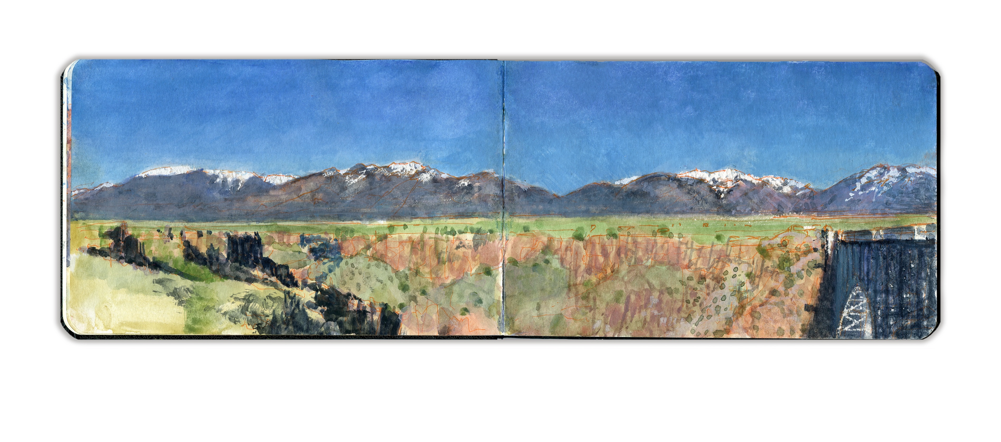
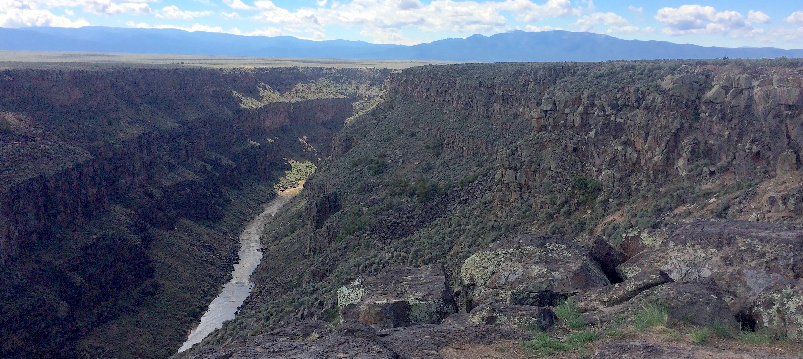
I follow the road, as it slowly descends along a gentle grade. Ahead can be seen the rocky walls of the Rio Grande Gorge. A few hundred yards to the left I see a group of parked cars, most with rooftop carriers. Just before the main road plunges down a series of OMG switchbacks, I turn left onto a dirt road, which leads to one of the western rim trailheads. I park alongside an SUV and walk toward the rim. Following a brief reconnaissance, I set up to paint. Selecting a sight-vector of 30 degrees northeast, I open the book and get to work. Measuring distances, gauging relative spatial depth, and mapping different features and landmarks, I find myself drawn to the simplicity of the composition—a dark leftward arrow, underlining the upper band of snow-capped mountains. Below the horizontal, abstract patterns of rock-layers and vegetation remind me why this very terrain had so enchanted Stuart Davis, Marsden Hartley and Georgia O’Keeffe. A thunderclap sounds behind me. Towering off to the west, black clouds seem to stride on graphite slabs—diaphanous curtains of promiscuous downpours. Scattered drops strike the dusty soil, like the shotgun pellets and .22 bullet-holes that pepper an interpretive sign at the parking-area. The storm moves eastward, four or five miles to the north. Native artists set up in the parking-lot next to the bridge on US64 must be scrambling to cover their tables, or put away their wares before the deluge arrives. Suddenly, bright sunshine warms my back. Shadows darken. Edges sharpen. The northern stretch of the canyon is thrown into darkness. Across the chasm, the vertiginous layer-cake effect of volcanic rock and alluvial sediment pales in the sunlight. Umbrageous clouds shroud the mountains beyond. Too much to absorb in one sitting, or to commit to paper with pigment, water and weasel hair.
One speaks of the Sublime, but talk is cheap. One cannot comprehend it, without knowing fear and awe. Speaking at a conference in New York in the nineties, I shared that going into the wild, I sometimes wore a revolver on my hip—as an argument against feral dogs, rabid mammals and venomous snakes. Sitting in the audience, another presenter—the late Martha Mayer Erlebacher—raised her hand and commented. “I love it. Art as a life or death experience!”

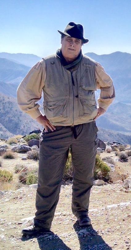
Note to self. Good field kit for wild places. Orvis bush shirt, Outback Trading Co. or Filson crushable waxed cotton round-hat. Drake neck-scarf/cravat. Duluth Trading company travel-vest. Nylon cargo pants. Filson belt. Woolen socks (all seasons). Danner hiking boots, Wolverine oiled leather 1000-Mile boots, or knee-length Chippewa snake-boots (for protection against briars and venomous reptiles). Handmade belt-knife. Compass. Brass-tipped Yew walking-stick with wrought-iron rams-head Branscombe Forge, Devon. Kaweco brass pencil (port-crayon) and fountain pen. Sakura Micron colored pens, Watercolor travel-kit (Schmincke or Sennelier, enameled steel, with integral water-flask. Safety razor. Moleskine watercolor journal. Pocket notebook. Maps. Mobile phone. A quart of drinking water. Sunglasses. Sunscreen. Insect repellent. Travel protocols. When venturing out alone, know where you are heading. Let someone else know. Keep a log.

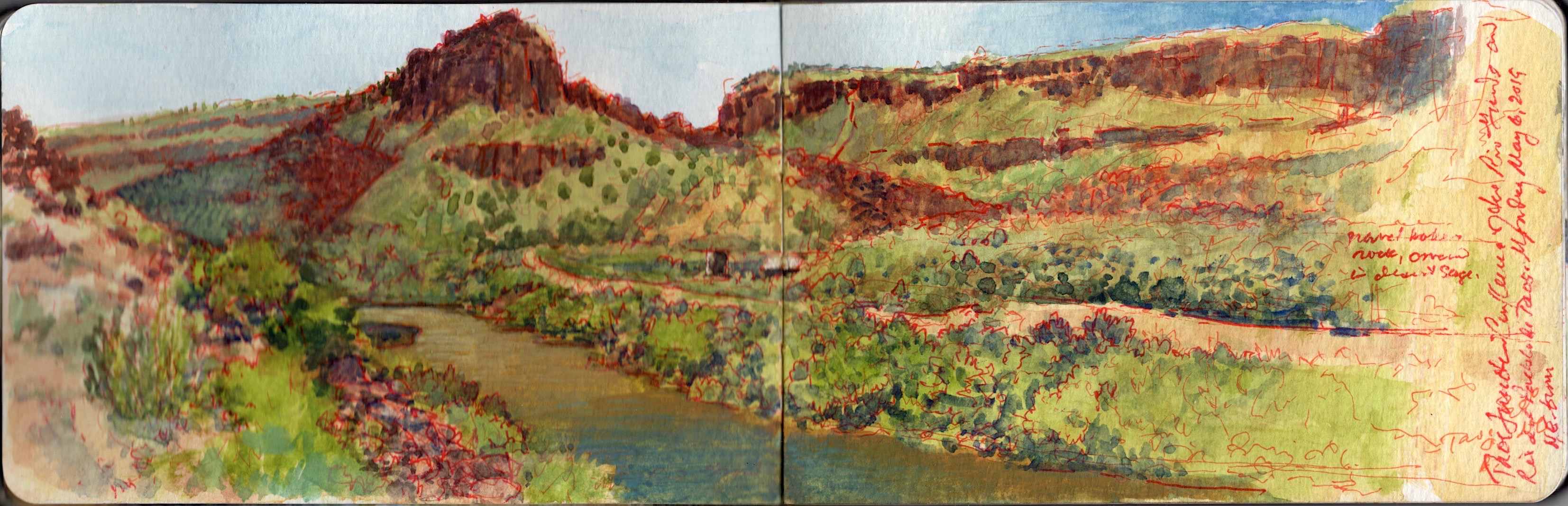
May 6, 2019. 59 degrees ENE. 36.3354 x 105.7346. Taos Junction Bridge is a Pratt riveted through-truss span 150 yards below the confluence of the Rio Grande del Norte and Rio Pueblo de Taos, flowing through a gorge seen to the right in this image. The confluence is undramatic, as Rio Taos joins the great river, sheltered by riverbanks covered with pinyon and sage. This might be considered the mouth of the Rio Grande Gorge, even though the river has another twenty-one miles to go before debouching onto a wider to flood-plain at Velarde. A dirt road on the left bank of the river winds its way up Taos gorge to blacktop on the plain above. From the western bridge-head, another unpaved road sans guard-rails climbs through a series of OMG switchbacks to become County Road C-115, meeting US64 just west of the high bridge crossing the Rio Grande. Near the confluence is a series of campgrounds, small buildings; restrooms and state utility sheds. Less than a mile downriver, Orilla Verde recreation area offers a wider menu of amenities. Just below the bridge, is aa parking area and boat ramp. A car carrying two kayaks rolled into the dusty patch of bare soil. Within minutes, they were on the river and away. As record snowpack in Colorado last winter melt, the river rises. In a week or two, or maybe tomorrow, it might be licking the girders under the roadbed. A woman walked onto the bridge, turned toward the confluence and took a few pictures. Two men, who seemed to be intimate friends, walked behind me with a dog on a leash, turning onto the trail that skirts the right bank of the river. One of the gents wore a porkpie hat and plaid shirt of the lumbersexual hipster. The other, taller fellow was the affectless beau-ideal of sartorial practicality; ball-cap, light jacket and jeans. Banging on about finance and investment, they followed the dog out of earshot, into the rock-fall and pinyon. Driving back to Pilar and NM68, I returned to the audiobook version of Richard Powers’s The Overstory. Suddenly, the radio squawked three times, followed by a flash-flood warning. By then I was back on the main road, traveling south toward Española.


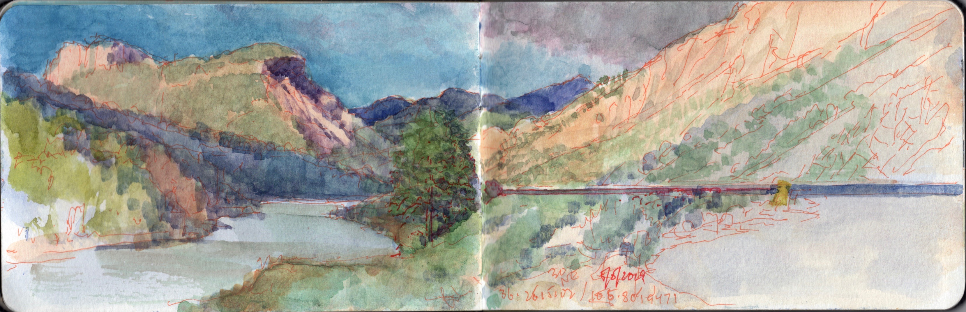
May 6, 2019. Upriver from Embudo Station. 36.2402 x 105.8366. 46 degrees NW. 2436-2450NM-68, Taos.
Heading southwest on state highway 68, one passes a series of roadside pull-offs frequented by anglers and shutterbugs. On the outbound drive, I had made a note of the steep inclined mountain between Pilar and Embudo, framed between two sloping hills. A few miles downstream is a pair of volcanic plugs, between which Rio Embudo flows through a wooded gap, into the Rio Grande. The place-name in Spanish means “bottleneck”. Nearby on March 30, 1854, a young, bigoted lieutenant rashly led two companies of the First Regiment, U.S. Dragoons into an ambush. Jicarilla Apache and Ute warriors engaged the dragoons in a pitched, four-hour battle, forcing the soldiers to withdraw to Rancho de Taos. Considerable losses were suffered on both sides.
Native victory was short-lived. Eight days later, with Kit Carson serving as guide, a detachment of the 2nd U.S, Dragoons under Lieutenant Philip St. George Cooke fell upon the war-party at Ojo Caliente. Many who survived the attack perished from exposure. In a note of irony, as the battle raged, Carson had been on a mission to offer the native combatants rations and humanitarian aid. The present-day village was established in 1881, as a watering station for the Chili Line of the Denver and Rio Grande Western Railroad. Seven years later the hamlet was selected by explorer John Wesley Powell as a stream-gauging station for the U.S. Geological Survey. Embudo Historic District was added to the National Register of Historic Places in 1979, the year of my first visit to New Mexico.


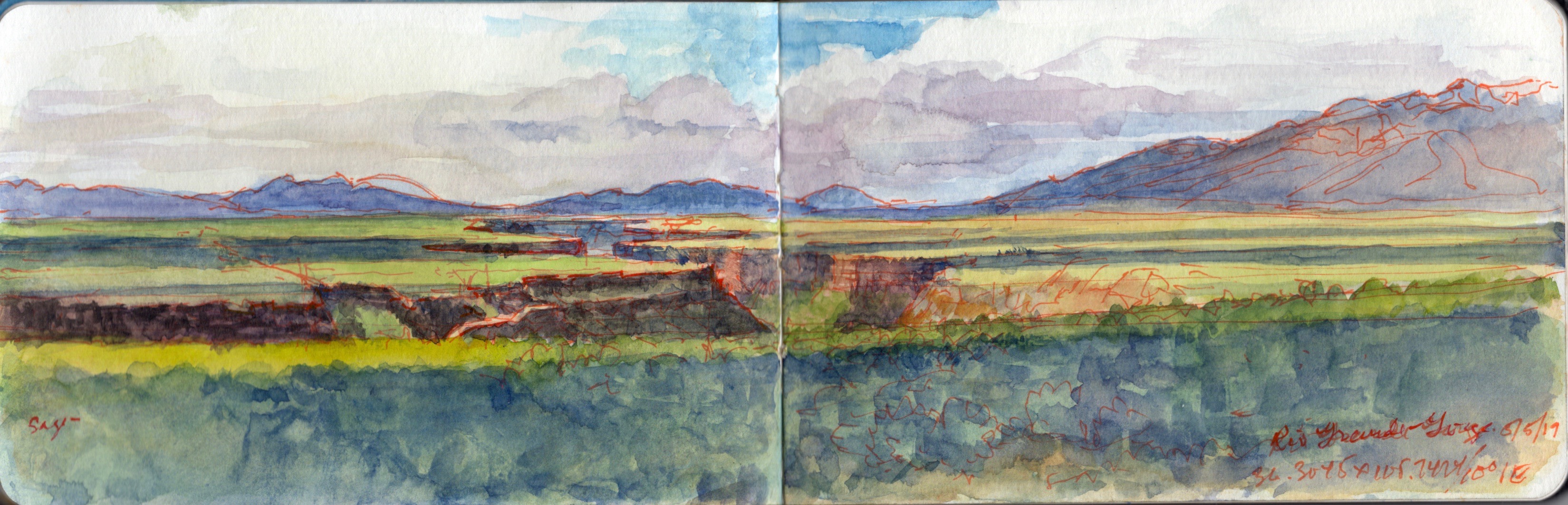
Roadside vista. Rio Grande Gorge from NM68. 10.0000 degrees NE. from 36.4105 x 105.2424. May 5, 2019.

Two hikers climb over the wire fence hundred behind me (south). Motorists pull over and snap photos. Almost every one of them hold their phone or camera, arms fully extended above their heads, as if they could peer into the nearly thousand-foot ditch two miles away. Speeding past, drivers honk and wave at me.

Taos Valley is actually the southernmost extremity of the San Luis basin, the northern end of the Rio Grande Rift. The two distant peaks are volcanic domes. Ute Mountain lies dead ahead, with Antonio Peak to the left. Alluvial sediment, laid down over volcanic ash and lava flows, is crossed by the river through a deep gorge. While the waters are navigable, they tend to be treacherous at this time of year. Record snowpack this past winter promise dramatic floodwaters later this spring. The plain is covered in Desert Sage (Salvi dorrii) and Pinyon Pine (Pinus monophylla). Taos Pueblo is at the foot of the mountains to the far right. Across the river, County Road C-8-115 descends to Taos Junction Bridge, just below the confluence of Rio Pueblo de Taos. The road continues south through Orilla Verde and Pilar, terminating at NM68


Roadside Vista. Below Pilar, Route NM68. 30 degrees NE from 36.2515102 x 105.801947.May 5, 2019

Named for the columnar mountain that rises above it, Nuestra Senora de Pilar stands on the historic site of an Apache village burned by Diego de Vargas during the Reconquista of 1684. The riverbank settlement is contained within the Spanish land-grant of Cieneguilla, awarded to twenty-five families in 1795. Taos County Road C-115 runs through the village, then upriver through Orilla Verde to Taos Junction Bridge. Clinging to the vertiginous walls of the gorge, the road climbs to the rim via a series of hair-raising switchbacks. Turning northward, it crosses the plain, intersecting US64 just west of the Rio Grande Gorge Bridge. Pilar today is home to the Rio Grande Gorge visitor center, café, river-guide and rafting-tour company.

UPDATE ON RIO GRANDE PROJECT

FOR GENERAL RELEASE: April 2, 2019

Click here for Downloadable PDF

GRAND RIVER SKETCHBOOK: Visions and Voices
by James Lancel McElhinney ©2019


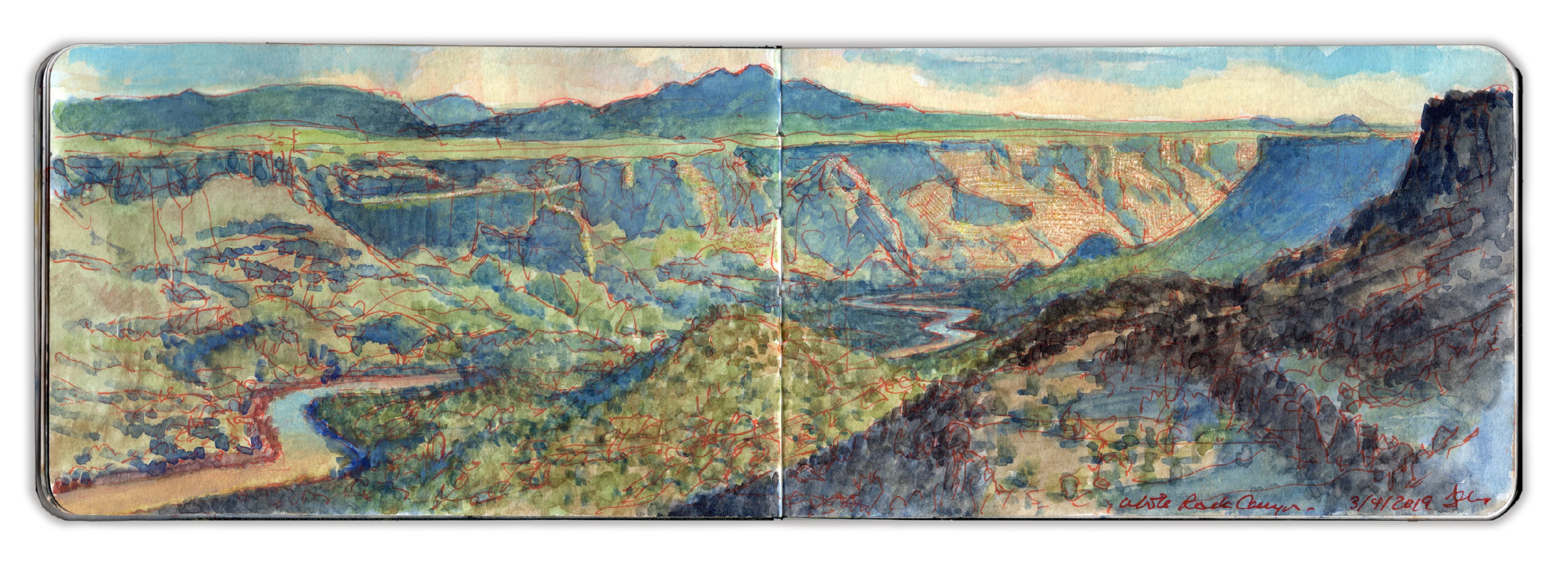
The Rio Grande passing through White Rock Canyon, Los Alamos County, New Mexico. SSE from 35.8215-106.1845. March 9, 2019. 3:30 pm

In 2009, James Lancel McElhinney revived an historic form of expeditionary drawing, painting and writing in travel journals, focused on waterways, rivers, and coastlines, promoting environmental sustainability through a deeper personal engagement with nature.

In 2015 McElhinney formed Needlewatcher Editions, a new publishing company specializing in fine-press art-books. Read the feature article by Peter Trippi in Fine Art Connoisseur magazine. In 2017, Needlewatcher Editions produced its first book: Hudson Highlands. North River Suite Volume One, which was acquired by a number of notable museums and rare book libraries across the United States.

A new project O.T.W. On the Water: The Schuylkill River, was published on October 26, 2018. It too has been well-received. It is now the focus of a new multimedia installation organized by McElhinney, now on view through September 2019, at Independence Seaport Museum in Philadelphia.
Assembled around McElhinney’s Schuylkill River Sketchbook, and a limited edition of archival pigment prints drawn from its pages, the installation brings together a group of living and historic artists engaging the river, including a series of podcast interviews.


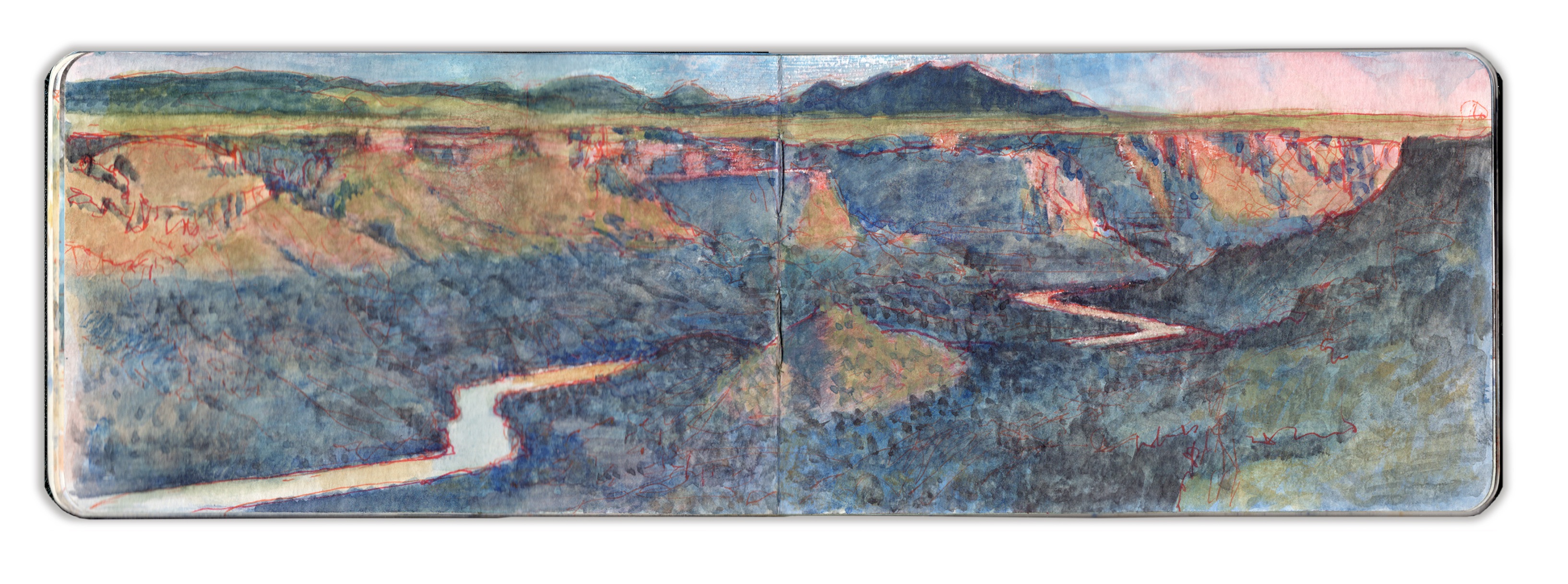
Late Light. The Rio Grande Passing Through White Rock Canyon. SSE from 36.8261 -106.1802. March 7, 2019. 5:30 pm

McElhinney now turns his attention to the Rio Grande, following the historic waterway across New Mexico. Works from his Grand River Sketchbook project will be on view at Gerald Peters Gallery in Santa Fe, from June 20, to August 4, 2019.

Recently McElhinney has been working in New Mexico, to explore the Rio Grande Rift, collecting images and stories, with the goal of contributing to a growing number of conversations around one of America’s greatest waterways. A suite of paintings and color intaglio prints are now underway. A new limited edition of archival pigment prints drawn from the pages of McElhinney’s painting journals is planned.


Looking East from the Western Rim of Rio Grande Gorge. 36.4765 -106.7353. Journal-painting. 3.5 x 10 inches

McElhinney is also currently in the process of creating a series of pocket field-guides to mindful travel through drawing and writing for Schiffer Publishing, the first three of which will focus on The American Southwest, Hudson Valley, and the New England Coast.


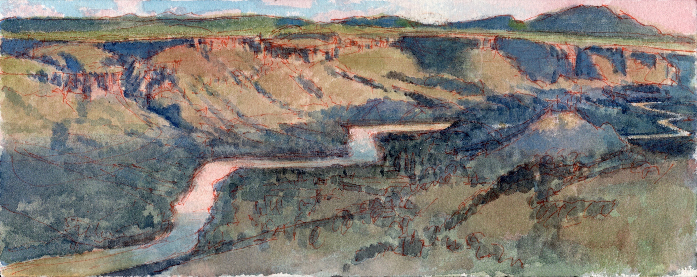
Looking SSE from SSE from 36.8261 -106.1802. March 11, 2019. 5:00 pm. Watercolor and pen on Arches block paper. 3.9 x 9.8 inches.


James Lancel McElhinney in the Field


Rio Grande Gorge. Photograph by the author.

James Lancel McElhinney is an author, visual artist, oral historian, independent scholar and publisher. He is also the owner of Needlewatcher LLC, a bonded New York State Limited Liability Company specializing in artist estates, art appraisal, art publishing, education and cultural affairs. He who passed the USPAP (Uniform Standards and Practices for Appraisal Professionals) exam, and is an Associate member of the Appraisers Association of America. He holds an MFA in painting from Yale, a BFA from the Tyler School of Art, and attended the Skowhegan School of Painting and Sculpture. He is the author of numerous essays, articles and several trade books on art. McElhinney has conducted numerous oral history interviews for organizations such as the Archives of American Art, Columbia Center for Oral History, Coleción Patricia Phelps de Cisneros, Frick Center for the History of Collecting, University of Charleston, and the Vermont Studio Center. McElhinney is listed on the Master Artist Advisory Council of The Arthur Miller Foundation. He is the recipient of several fellowships and grants, including a 2017 Pollock Krasner Foundation grant, and a prior Visual Artist fellowship from National Endowment for the Arts. His work has been the subject of nearly fifty solo exhibition and numerous group shows. McElhinney’s work can be found in numerous private collections, and:
Albany Institute of History and Art, Albany, New York
Asheville Art Museum, Asheville NC
Avery Fine Art and Architecture Library Columbia University, New York, NY
Boscobel House and Gardens, Garrison, New York
Chrysler Museum, Norfolk VA
Denver Art Museum, Denver CO
University of Denver Library. Special Collections, Denver CO
Free Library of Philadelphia Print and Picture Collection, Philadelphia PA
Hudson River Museum, Yonkers New York
Huntington Library and Museum, San Marino, CA
Independence Seaport Museum, Philadelphia PA
Newberry Library. Chicago, Illinois
New York Public Library. Wallach Collection of Art, Prints and Photographs, New York, NY
Pennsylvania Academy of the Fine Arts. Special Collections and Archives, Philadelphia PA
Temple University, Samuel L. Paley Special Collections Research Center, Philadelphia PA
West Point Museum, United States Military Academy. Highland Falls, NY
Yale Beinecke Rare Book and Manuscript Library. New Haven CT

For information regarding this project, to contact the artist, or to schedule a workshop or speaking engagement, please email

ed******@ne***********.com


Downloadable PDF:

Download (PDF, 813KB)

Needlewatcher Editions. PO Box 142, West Haverstraw, New York 10993-0142.

A Quick Guide to Schuylkill River Netcasts

O.T.W. On the Water: Schuylkill River:

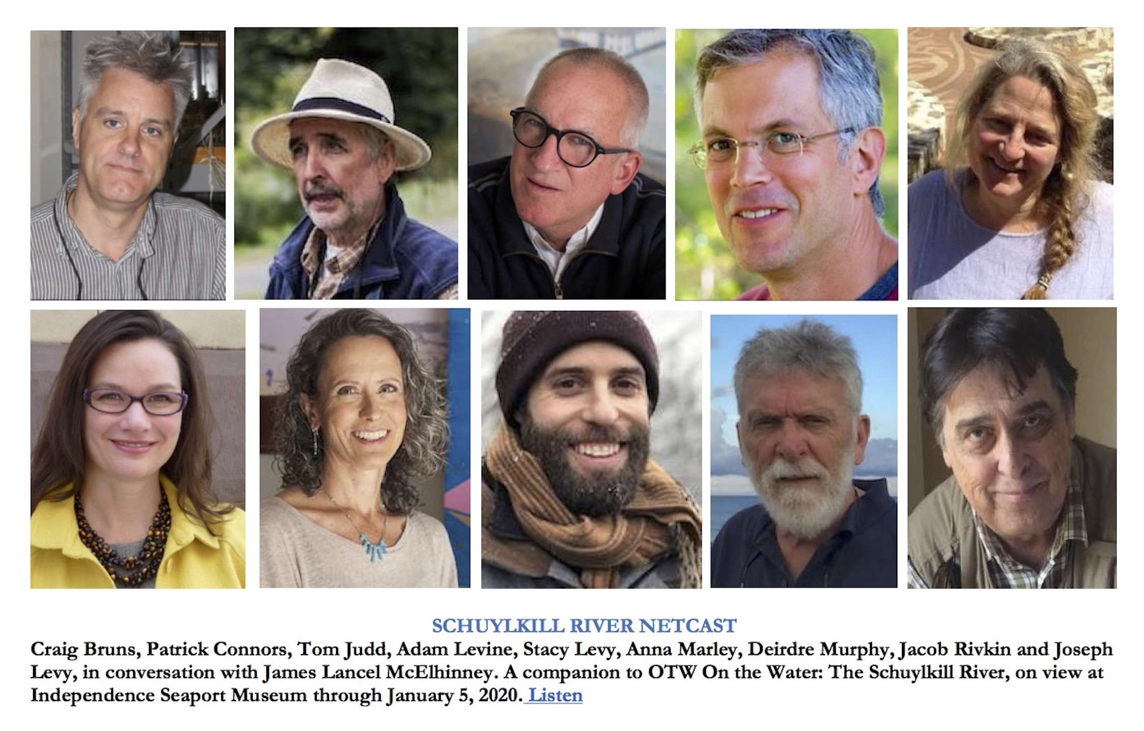
Conversations with:

Craig Bruns: Part One

Craig Bruns. Part Two

Patrick Connors

Tom Judd

Dr. Anna O. Marley

Adam Levine

Stacy Levy

Deirdre Murphy

Jacob Rivkin

Joseph Sweeney

Earlier Conversations with:
Elise Engler
Don Stinson
Ronnie Landfield
Robert C. Morgan

Oral History and Podcast Interviews: 2006-2019

On the Water: Schuylkill River Netcast: A Conversation with Jacob Rivkin

On the Water: Schuylkill River Netcast: A Conversation with Stacy Levy

PAINTING JOURNAL ANIMATION: O.T.W. On the Water: The Schuylkill River

On view now at Independence Seaport Museum in Philadelphia: O.T.W. On the Water: The Schuylkill River, an installation by James Lancel McElhinney, a complement to the River Alive! experience. The installation includes works by Patrick Connors, Tom Judd, Daniel Kennedy, Stacy Levy, Edmund Darch Lewis, Johann Georg Martini, Deirdre Murphy, Granville Perkins, Jacob Rivkin, Joseph Sweeney and Graham White.
location:
Community Gallery. Independence Seaport Museum. 211 South Columbus Boulevard. Philadelphia PA 19106

On the Water: Schuylkill River Netcast: A Conversation with Tom Judd