Category Archives: Dispatches

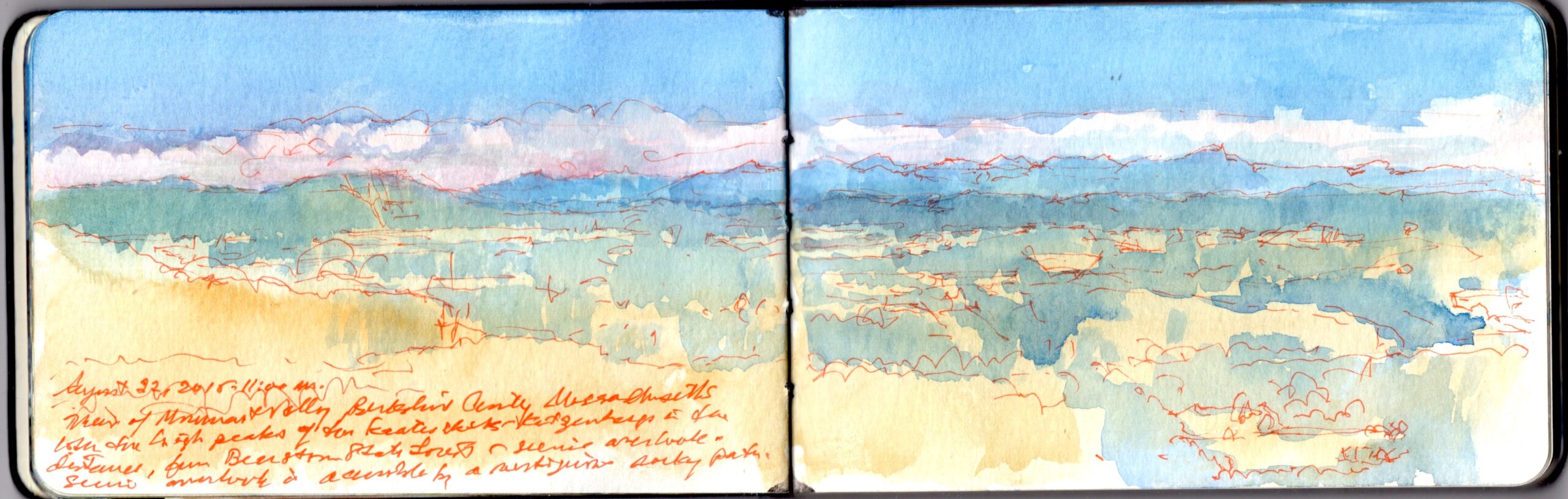
SKETCHBOOK TRAVELER. Dispatch #90. Monument Mountain. Housatonic Valley

“August 22, 2015. 11:00 AM. View of Monument Valley, Berkshire County, Massachusetts. Both the high peaks of the Kaaterskill-Katzenbergs (are visible). in the distance from Beartown State Forest—scenic overlook—scenic overlook is accessible by a vertiginous rocky path”–Journal entry inscribed on the lower left

Rising above the Housatonic River at less than half the elevation of Mount Greylock, Monument Mountain (1,642 feet above sea-level) is also entangled in the history of American letters.
A frequent visitor to the mountain was Great Barrington poet William Cullen Bryant, who wrote,

“It is a fearful thing
To stand upon the beetling verge, and see
Where storm and lightning, from that huge gray wall,
Have tumbled down vast blocks, and at the base
Dashed them in fragments, and to lay thine ear
Over the dizzy depth, and hear the sound
Of winds, that struggle with the woods below,
Come up like ocean murmurs. But the scene
Is lovely round; a beautiful river there
Wanders amid the fresh and fertile meads,
The paradise he made unto himself,
Mining the soil for ages. On each side
The fields swell upward to the hills; beyond,
Above the hills, in the blue distance, rise
The mighty columns with which earth props heaven.”

W.C. Bryant. Monument Mountain (excerpt) 1815.

Bryant was not the only luminary who drew inspiration from its scenic views of the Housatonic Valley. On August 5, 1850 Nathaniel Hawthorne and Herman Melville hiked to the summit with Oliver Wendell Holmes and Stockbridge lawyer David Dudley, Jr. According to legend, a bottle of champagne was uncorked and Bryant’s poem was read aloud. By whom I cannot say.
Caught in a sudden deluge, the party found shelter in a cave. Following their meeting under these extraordinary circumstances, Hawthorne and Melville embarked on a brief but stimulating correspondence that helped shape the literary trajectories of both authors. Melville dedicated his novel Moby Dick to Hawthorne, whom he regarded as a something of a mentor.
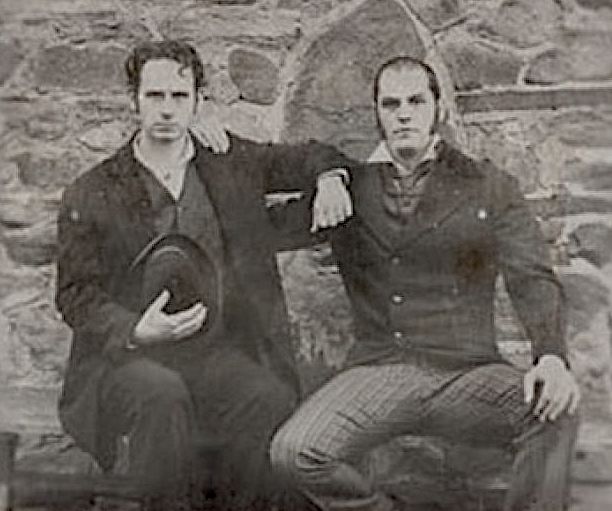

Herman Melville and Nathaniel Hawthorne, ca 1850-1852

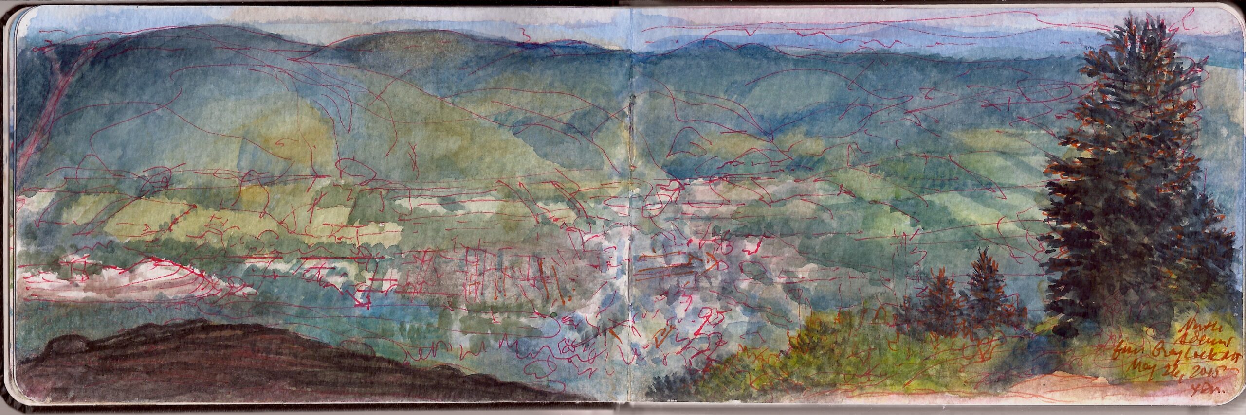
Monument Mountain appears in the distance to the left in this view of the Housatonic (Monument) Valley, with the northern Catskills serrating the western skyline. The goal of a   journal-painting is never to produce a finished product, but to employ the practice of painting as an act reconnaissance; a mode of learning what is beheld, in ways that transform experience into knowledge and ideas. Somewhere between picturing something and truly knowing it is where art abides.

Now available to own: Sketchbook Traveler: Hudson Valley
Explore my Quaranteam Dispatches, from April 1-June 8, 2020
SKETCHBOOK TRAVELER: Dispatch #89. Mount Greylock

“But since the majestic mountain, Greylock—my own more immediate sovereign lord and king—hath now, for innumerable ages, been the one grand dedicatee of the earliest rays of all the Berkshire mornings, I know not how his Imperial Purple Majesty (royal-born: Porphyrogenitus) will receive the dedication of my own poor solitary ray.”

–Herman Melville. Pierre, or The Ambiguities. 1852

Looking up from his Pittsfield desk in the dead of winter, Melville beheld the snowy summit of Mount Greylock at a distance of twenty miles. To the writer’s imagination, the long mountain looming above rolling hills resembled the scarred back of a great white whale. Herman Melville (1819-1891) devoted an entire chapter of Moby Dick to the color white, which resonates today, as people of color become targets of bigotry. Having recently re-read Moby Dick, I had forgotten how much of it meanders through a pre-Joycean stream of consciousness; digressions ranging from whaleboat mechanics to a field-guide to hunting, killing, butchering and rendering the wild leviathan into spermaceti and ambergris. Pale illumination and seductive scents were fruits of bloody slaughter. Racially speaking, the whaleship Pequod was a world turned upside down. Seldom present, under the spell of a mysterious Mohammedan, the monomaniacal captain seemed mindful of his moral conundrum, yet incapable of conquering his addiction to the chase. Apart from Starbuck and Stubb, the stars of the ship’s company were the harpooneers. These were people of color; a Pacific Islander, an African, and a Gay Head Wampanoag. Ordinary Americans today may not imagine such diversity truly existed at that time. Yet a century or more before the novel is set, every seafaring tongue from around the globe was spoken on the waterfronts of New Bedford and Nantucket, where in 1716, the Quaker Meeting declared that slavery was “not agreeable to Truth.”

At 3,491 feet above sea-level, the summit of Mount Greylock is the highest point of elevation in Massachusetts. Traversing the Hoosic floodplain at the foot of its northern slopes, the Mohawk Trail was established as an overland east-west trading-route between the Connecticut River and the Hudson Valley. Its remoteness made for excellent hunting-grounds. Bloody clashes between competing native communities intensified with the arrival of Europeans. By the time Melville chronicled the pursuit of Leviathan, many Berkshire County forests had been cleared for farmland. Rivers harnessed for water-powered mills were straddled by towns populated by workers, merchants and service professionals. Logging, quarries and limekilns whittled away whatever wild tracts remained. Denuded of woodlands for lumber and paper-mills, Greylock suffered landslides and wildfires.

Concerned citizens purchased land for a park in 1885. Twelve years later Massachusetts set into motion a process that would protect the mountain within its first state forest preserve. Nathaniel Hawthorne hiked its slopes. The mountain became an object of pilgramge for literary lights of the day such as William Cullen Bryant. Henry David Thoreau spent a night on the mountain in the summer of 1844. When he awoke, a thick fog covered the summit.

“As the light increased I discovered around me an ocean of mist, which by chance reached up to exactly the base of the tower, and shut out every vestige of the earth, while I was left floating on this fragment of the wreck of the world, on my carved plank in cloudland; a situation which required no aid from the imagination to render it impressive.”

–Henry David Thoreau. A Week on the Concord and Merrimack Rivers. 1849

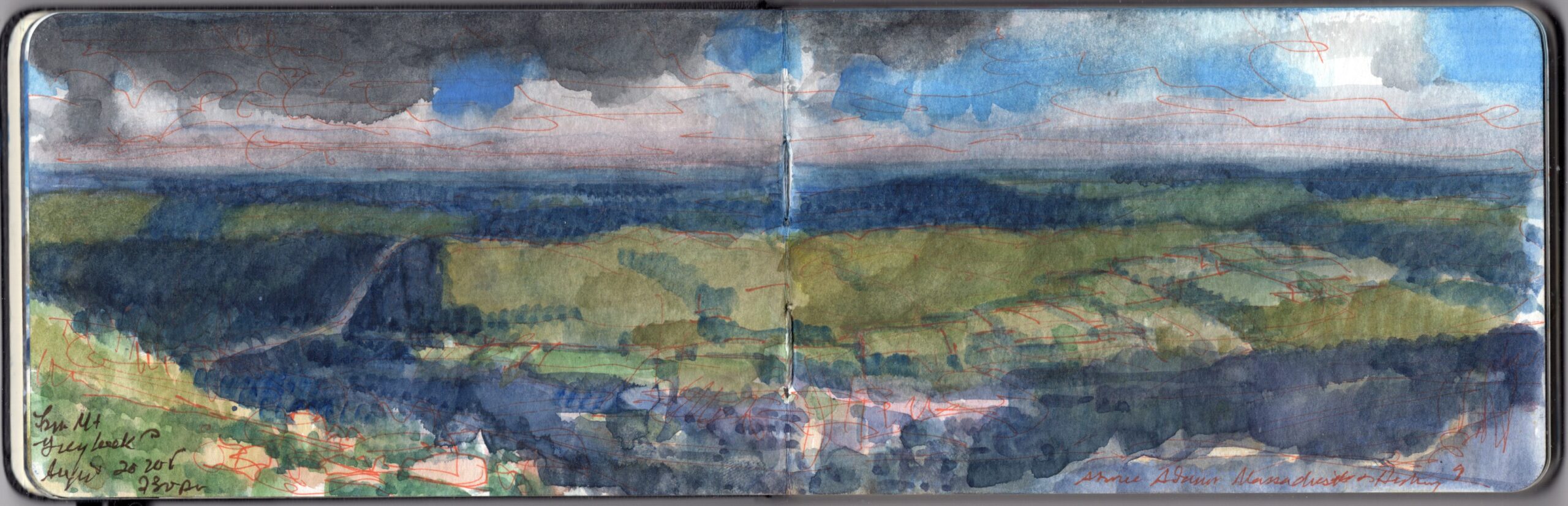
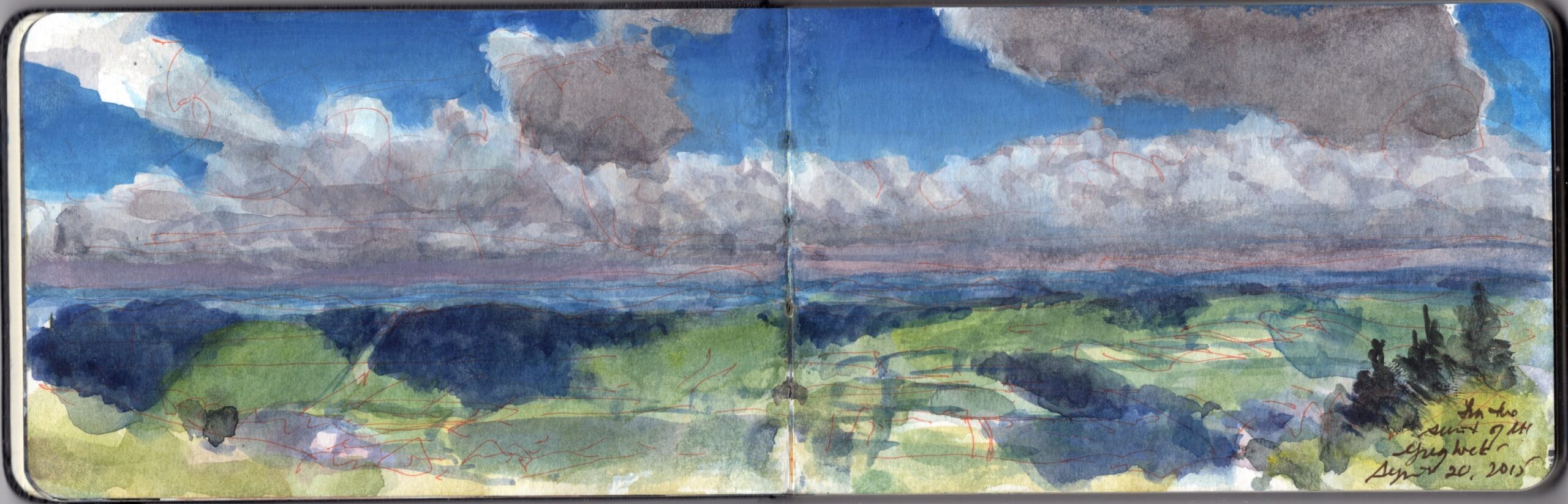
On one occasion I  found the summit of Mount Greylock blanketed with cool, damp clouds. Gazing across the Hoosic Valley, I saw a bright pathc of light strike the distant ridge, and then another, and another. Moments later I was warmed by bright sunlight, as dark clouds scattered beneath a glorious blue sky.

Large sheets of rock lie exposed at the summit. The bell-shaped Veterans Memorial Tower marks the highest point of elevation in Massachusetts. Its beacon marks the location at night. The northern end of the mountain faces Williamstown, North Adams, and the Mohawk Trail—Route 2, which runs between Troy, New York and Boston. Below to the east. the Hoosic River flows northward, entering the Hudson River near Stillwater. Mill-towns like Adams Massachusetts, the birthplace of women’s rights activist Susan B. Anthony; centers of light industry flourished during the nineteenth-century. A century later it had fallen into decline and economic hardship. Today the Hoosic Valley is enjoying a revival. Berkshire County has become a popular destination for weekenders from New York and Boston, as well as a magnet for cultural tourism, with numerous museums and performing arts centers.

Below: James McElhinney at Mount Greylock.

Now available to own: Sketchbook Traveler: Hudson Valley

Explore my Quaranteam Dispatches, from April 1-June 8, 2020
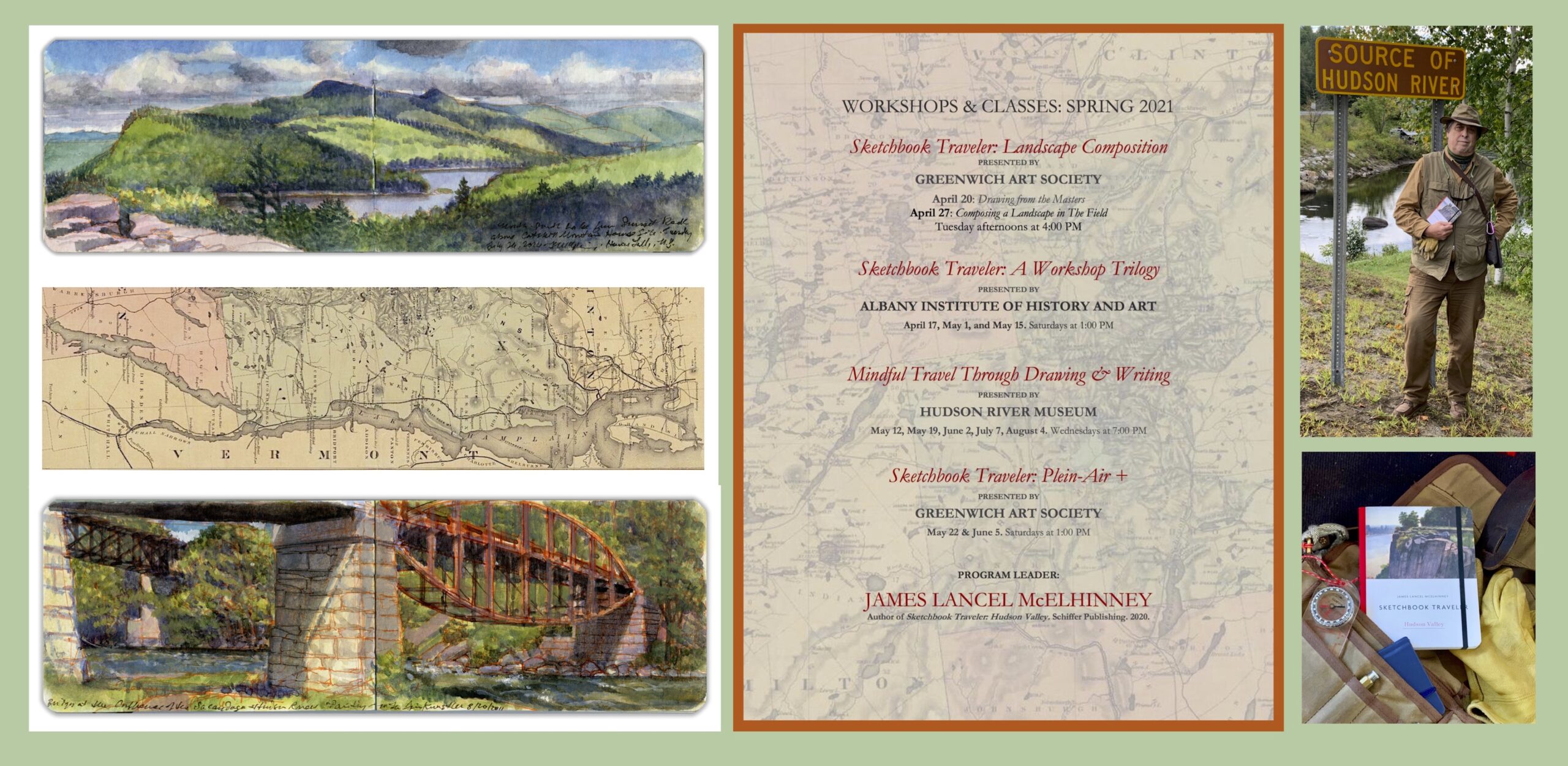
2021 SPRING SCHEDULE: WORKSHOPS AND CLASSES.

Updated Schedule of Workshops and Classes for spring, 2021. Venues include Albany Institute of History and Art, Greenwich Art Society, and Hudson River Museum.

Schedule: PDF: SCHEDULE Workshop Schedule Spring 2021

Poster: PDF: POSTER_WORKSHOPS AND CLASSES_S2021_FEB14_21

For all other enquiries, or to be placed on a list to be notified of futute workshops, classes and events, please send an email to:

wo*******@ne***********.com


SKETCHBOOK TRAVELER. Dispatch #88. Tse’Bii”Ndzisgaii: Monument Valley. Navaho Nation


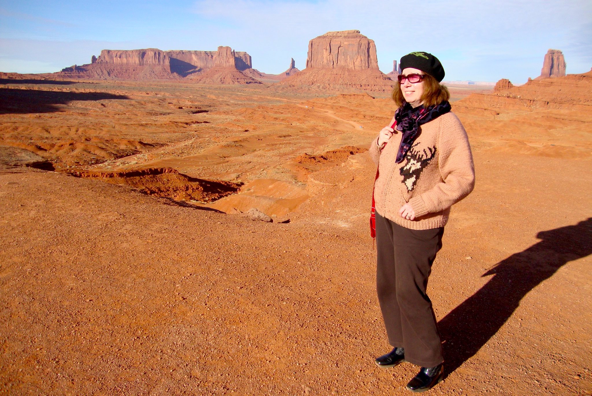
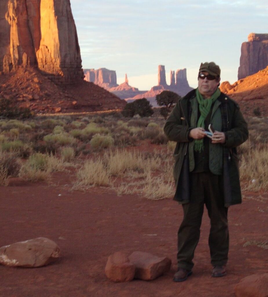
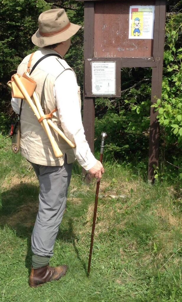
Boots-on-the-ground cultural historian Kathie Manthorne, at John Ford’s Point. Monument Valley. Navaho Nation.

Rising early, we headed out of Durango on Highway 160. In the darkness, starlight glowed softly on patches of snow in the wooded hills to the south. A cluster of peaks to the north broke the horizon with a ghostly geometry. For a thousand years this had been a hotly contested borderland between the domains of the Ute and Dine. Later a remote corner of New Spain, it had been known for centuries past to only a handful of European trappers, traders and prospectors. Past Mancos the land opened up. Tablelands to the south are scored with more than a dozen long canyons, draining south into the Rio Manco, which drains into the San Juan River near Four Corners. Mesa Verde National Park preserves the remains of ancient dwellings, inhabited by a community of Native Americans. Romanticized as a lost race known as Anasazi, these people are accepted by modern-day Puebloans as their ancestors. Past Cortez the land dropped away to the south as darkness surrendered to the half-light heralding dawn. In the distance, the rosy first light of day painted the crown of Ship Rock, a towering geological formation rising up along the Rio San Juan. Below Towaoc the highway turns to the southwest, past Four Corners. To our amazement, the little park was open, despite heavy accumulations of snow. Vendors were setting up for the day. I bought a piece of fry-bread for the road, which we devoured on the way to Tec Nos Pos (T’iisnazbas, or “Cottonwoods in a circle”) a tiny settlement around a trading-post. To the south arose a landmark elevation noted on the map as Pastoral Peak. We were in the Navaho Nation. Heading west, the road crossed a series of frozen creeks and dry washes. Between low table-lands to the north and south we crossed terrain that would seem familiar to fans of western movies and Road Runner cartoons. Reaching Kayenta, known locally as “K-town” we grabbed a quick breakfast before heading north on Highway 163. One could easily see why the irascible John Ford would go for Harry Goulding’s pitch to use this section of the Colorado Plateau as a filming location. Apart from the gobsmacking scenery, Goulding’s trading-post offered all the amenities required by director, cast and crew; far from meddlesome Hollywood executives and investors.


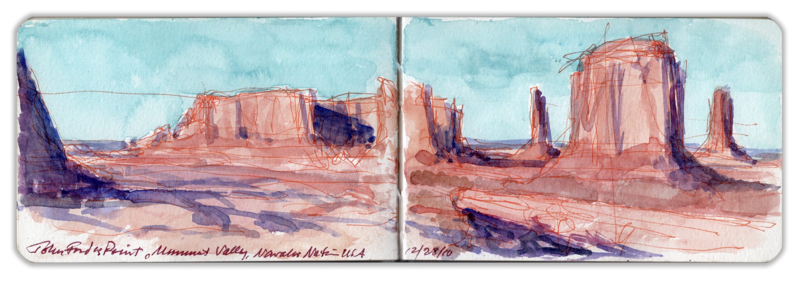
John Ford’s Point, Monument Valley

Checking into Goulding’s Lodge just before nine o’clock, we dumped our bags. Our room was located at the far end of a modern addition on the same level as the restaurant. The celebrity rooms had all been taken, as had most of the accommodation at The View, a newly-built resort and hotel inside the tribal park. We hired a local guide—a diffident fellow, mid-sixties, wearing weathered denim and a fur-felt cowboy hat. Driving a high-clearance white Jeep with giant tires and roll-bar, we passed The View. Our guide explained that a couple of Anglos had raised the capital. Married to local girls, they got a pass on tribal zoning restrictions. I never fact-checked his story. It was a reminder that while tourism dollars were welcome, outsiders were another matter. A popular destination within the park is a narrow rocky outcropping known as John Ford Point—named for the director of classic westerns like Stagecoach, and The Searchers. Visitors park in a pull-off, then walk down a short trail. Reaching the feature, one runs a gauntlet of local artisans peddling native jewelry and other keepsakes. For a fee one can get onto a horse, which is walked out onto the rocky diving-board. Pictures are taken, just like in the movies. I shot a photo of Kathie, sin caballo. Amidst the ruckus I produced a hasty sketch, elaborating it later back in our hotel-room. Before dawn I discovered our car covered in snow, which continued to fall.


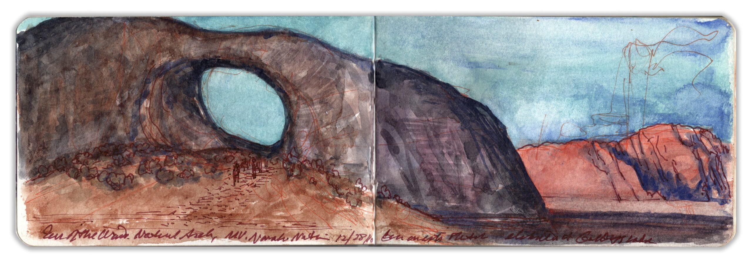
Ear of the Wind. Monument Valley

Like many geological features within Monument Valley Tribal Park, Ear of the Wind seems to have been concocted by the same kind of marketing magic that transformed Marion Morrison into John Wayne. The large circular aperture in a large outcropping of de Chelly sandstone was formed by the process of chemical exfoliation. Entering the rock, water dissolves the small particles that act as a binder. Loosening larger grains in the sandstone accelerates the natural process of erosion. Moisture gathered in rocky niches, which are enlarged by persistent winds that carry away the exfoliated particles. In igneous dikes and other geological formations with high aspect ratios, openings can appear which in time become stone arches. Ear of the Wind is accessible only to visitors accompanied by a licensed Navaho guide. Parking the Jeep, our guide led us to the edge of a conical mine-tailing of gravel and rocky debris—remnants of the sandstone mass formerly occupying that space where now abides a gaping pothole arch. Its height I estimated to be three or four stories above the valley floor. We decided to linger a while for lunch, which gave me some time to map out a composition and lay down some color-notes. Never very talkative, our guide was more like an off-road car service driver. He next delivered us to the Eye of the Sun—another pothole aperture atop a petrified bandshell, which in the failing light was evocative of the installation-art of James Terrell


At Monument Valley. Tuesday December 28, 2010.

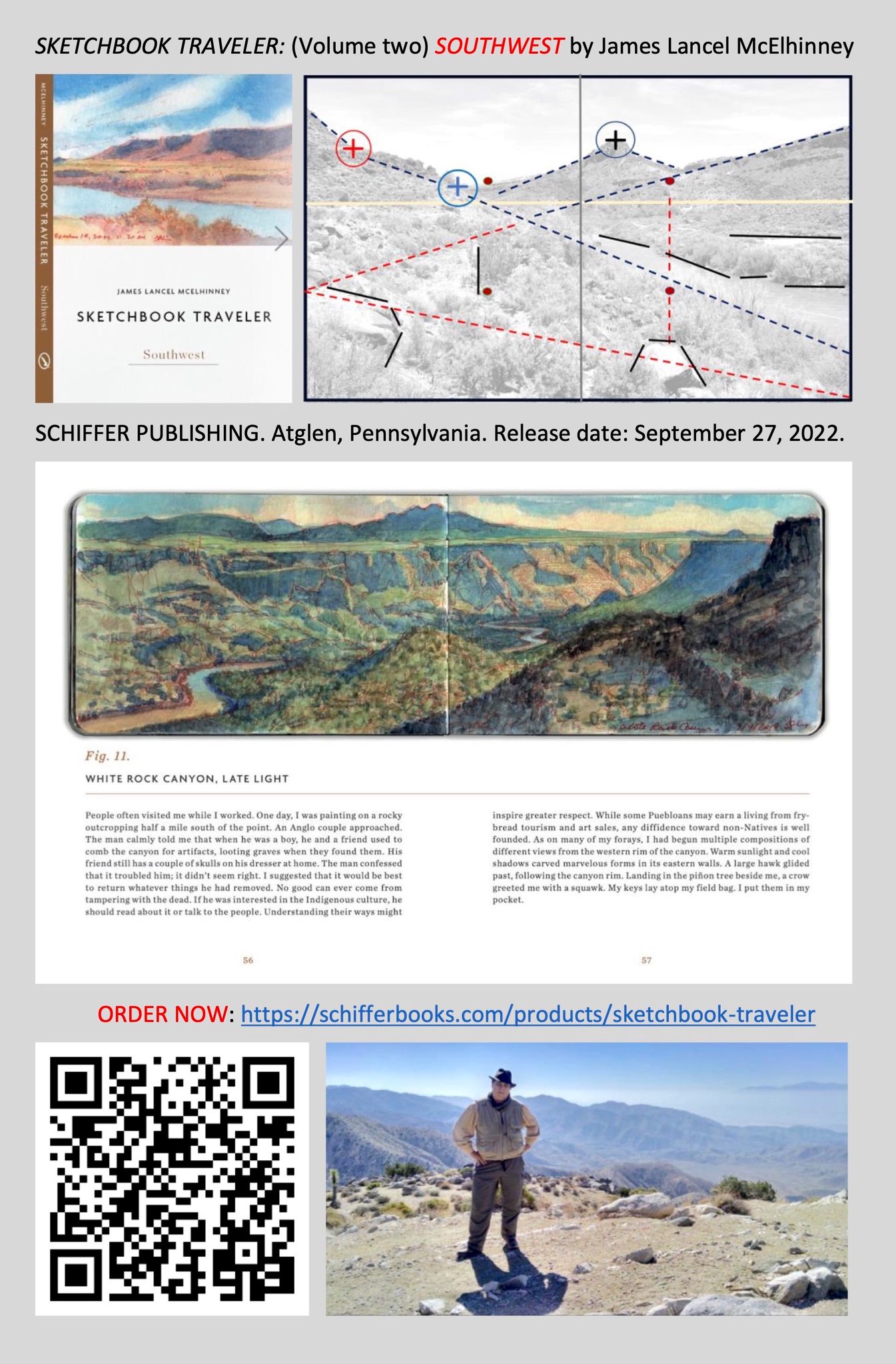
Now available: SKETCHBOOK TRAVELER; SOUTHWEST. Schiffer Publishing, Atglen PA

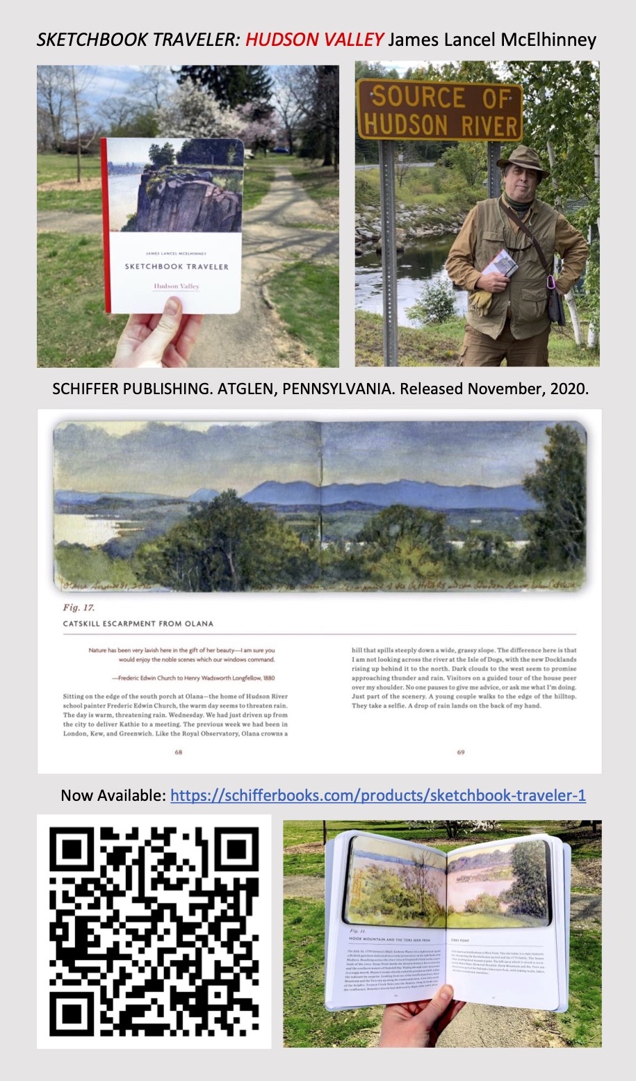
Now available to own: Sketchbook Traveler: Hudson Valley

Explore my Quaranteam Dispatches, from April 1-June 8, 2020

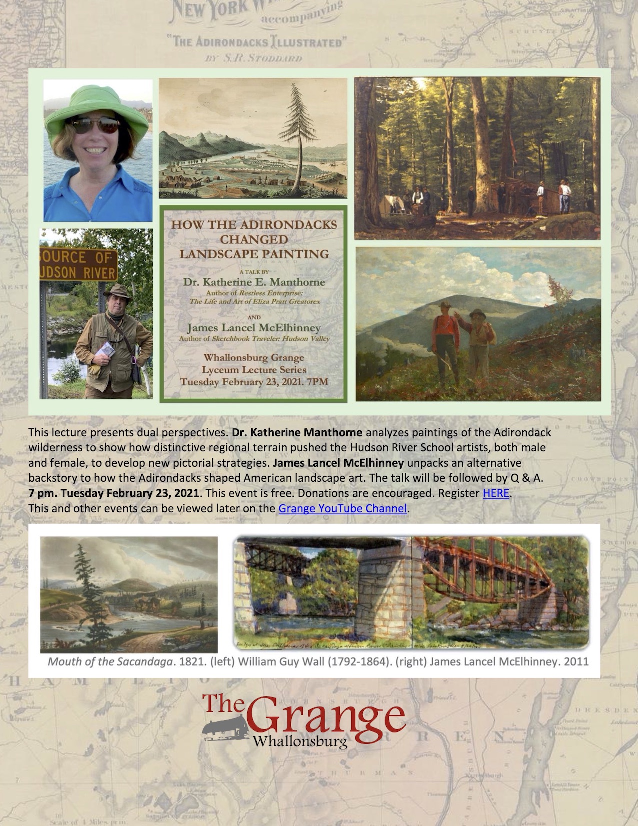
Tandem Talk: Kathie Manthorne & James McElhinney. Tuesday February 23, 2021 @ 7pm.

FREE. Online.
How the Adirodnacks Changed Landspace Painting.
The talk is free and open to all. Donations are encouraged
Register HERE


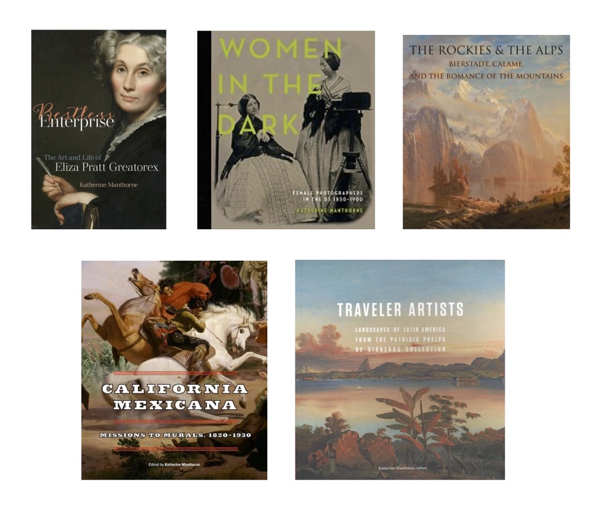
BOOKS BY KATHERINE MANTHORNE

BOOKS BY JAMES LANCEL McELHINNEY

Some titles by Manthorne & McElhinney are also available locally, on ther Adirondack Coast of Lake Champlain at Kit & Syl Studio. 1598 Route 22. Whallonsburg. Essex, New York. 12936. (518)412-4026.

he***@ki*************.com


. Facebook.

DOWNLOAD PDF:

Download (PDF, 583KB)

SKETCHBOOK TRAVELER: Dispatch # 87. Hidden Valley, Joshua Tree National Park. February 20-21, 2012.

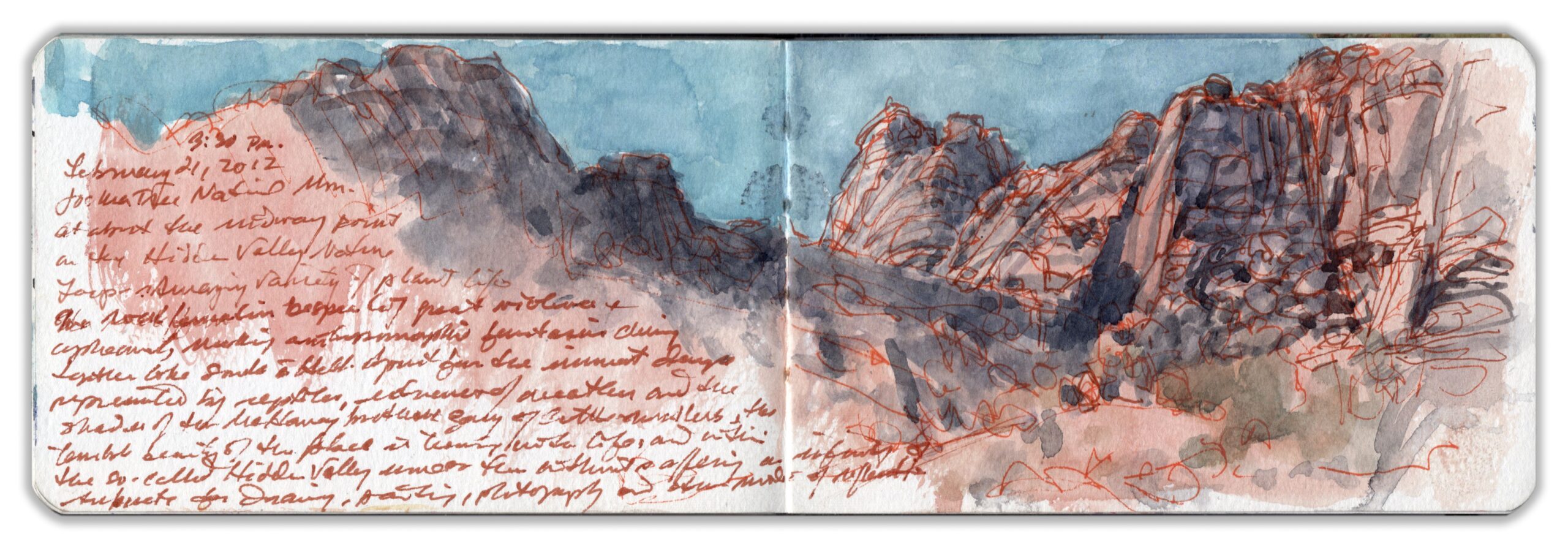
Drawing and writing are two sides of the same coin. Both are sensory-cognitive practices. One makes visible the spoken word, while the other transcribes visual sensation into written form. One finds in East Asian painting an almost effortless rapport between calligraphy and picture making, perhaps due in part to a writing system that has preserved some of its pictorial attributes. Instead of worrying about whether or not a drawing needs to confine itself to making pictures, remember the words of Rembrandt Peale: “Drawing is little else than writing the forms of objects.” Expeditionary journal keeping is less about producing works of art than engaging an experience, digesting data, and compressing the file. The practice itself is the art. Always in the back of my mind is the fact that Leonardo’s greatest contribution is not the Mona Lisa but his sketchbooks. Written on the left side of this page spread is the following text:

“3:30 P.M. February 21, 2012. Joshua Tree National Mon. at about the midpoint of the Hidden Valley Nature Loop—Amazing variety of plant-life. The rock formations bespeak of past violence + upheaval, making anthropomorphic fantasies clinging together like souls in Hell. Apart from the imminent danger represented by reptiles, inclement weather, and the shades of McHaney Brothers gang of cattle-rustlers, the terrible beauty of this place is teeming with life, and within the so-called Hidden Valley—some of them without (outside of Hidden Valley), offering an infinity of subjects for drawing, painting, photography, and other modes of reflection.”

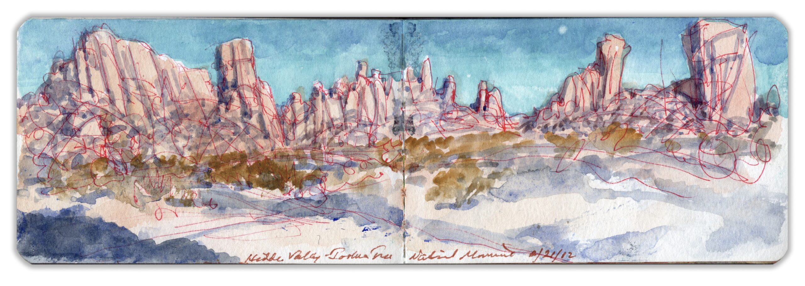
Private efforts to preserve its unique setting and to protect a fragile ecosystem from real-estate development resulted in 825,000 acres being set aside as Joshua Tree National Monument in 1936. Forty years later, Congress protected 420,000 acres as wilderness. In 1994 Joshua Tree was promoted to park status. Naming the geological attractions in Joshua Tree National Park, like the buttes and arches in Monument Valley, was a way to bestow identity to recognizable features of terrain in ways that reflect a human desire for the picturesque. Skull Rock, Hall of Horrors, and Jumbo Rocks conjure up thrilling images of matinee adventures. Sculpted by tectonic activity and subsequent erosion, fantastical geological formations within the park have long served as a backdrop for television, cinema, and advertising photo shoots. Among these features is a semi-enclosed inselberg dubbed Hidden Valley. An easy mile-long loop trail and legendary escalades make Hidden Valley a magnet for rock-climbing enthusiasts.
One remembers Chief Niwot’s curse: beautiful places will attract so many people that their beauty will be lost. Sitting on a rock to produce this drawing, I was passed by dozens of hikers and a fair number of dogs. Many appeared to be late for an appointment with the next destination on their bucket-list, hastily consuming the experience rather than taking time to absorb it. The purpose of hikes is not to get to the finish line but to invite new experience. The words of John Burroughs came to mind:

“If you want to learn something new, take the path you took yesterday.”

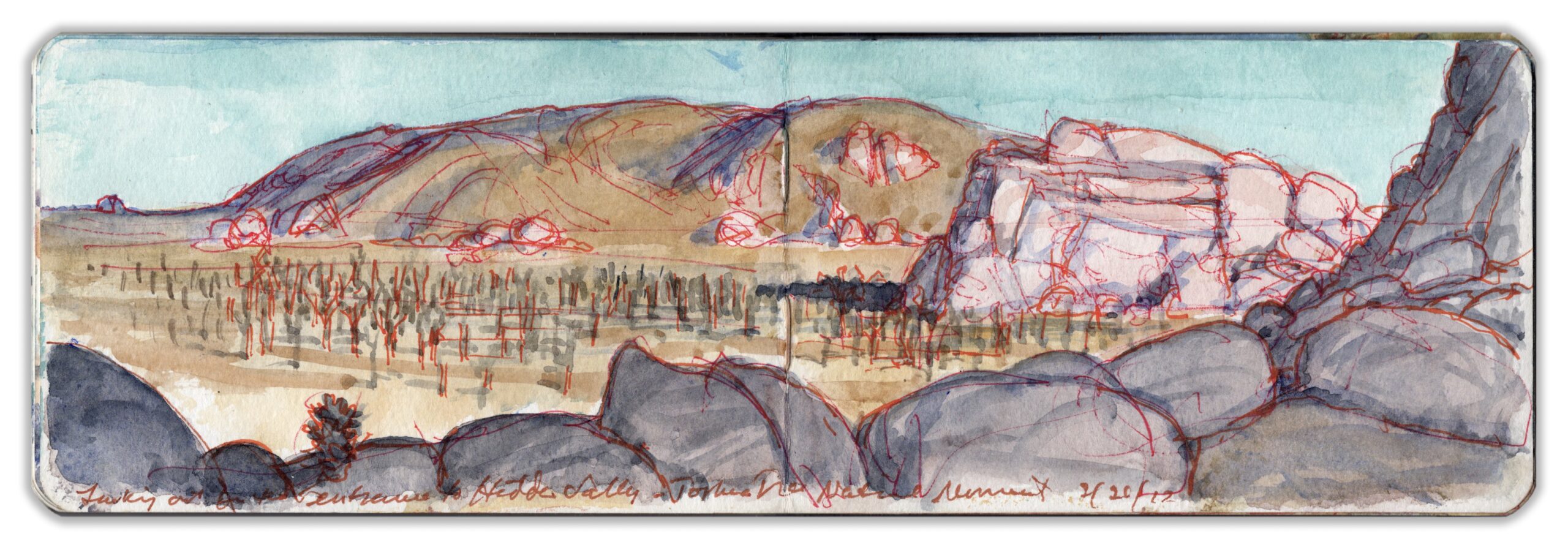
Ascending (not descending) to the entrance of Hidden Valley, one beholds a sweeping vista stretching eastward across Lost Horse Valley toward Pinto Basin, past Ryan Mountain. Rising 1,000 feet above the pediment, the summit, at 5,465 feet, is one of the highest points accessible to hikers within the park. The large, rocky outcropping to the right is classified an “inselberg,” or island mount, because it rises from the desert floor like an island from the sea. Known as “pediment,” the flat expanses between scattered elevations and outcroppings appear flat but are in fact slightly inclined. As wind, rain, and chemical erosion gnaw away at its slopes, the mountain retreats. The descending ground level forms a plain, exposing large gneiss formations to spheroid weathering. Entering through fissures created by immense pressure underground, water and chemicals cause erosion together with windblown grit that sculpts the rock into organic forms. Scattered across the expanse between my perch and Ryan Mountain is an orderly grove of Joshua Trees, Yucca brevifolia. In arranging this composition, it was important for me to capture geological variations—mountain, inselberg, pediment, and foliage. The image is framed with a shadowed foreground—a Claudian repoussoir substituting the rock wall to the right for an arboreal anchor. It was designed with a leftward diagonal sweep into the distance. Emerging from the close, almost intimate confines of the Hidden Valley Loop, I was delighted to be greeted by this panorama. Preserving that feeling is what I sought to convey.

Now available to own: Sketchbook Traveler: Hudson Valley

Explore my Quaranteam Dispatches, from April 1-June 8, 2020
SKETCHBOOK TRAVELER: Dispatch #86. Hall of Horrors


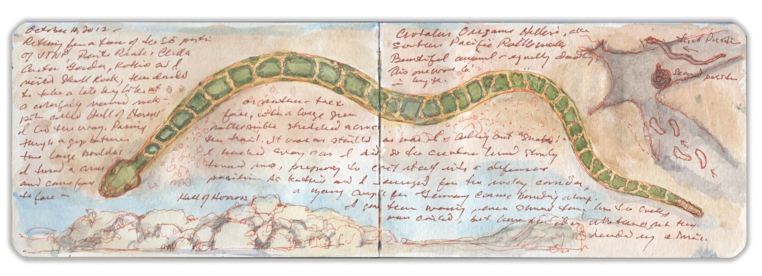
Crotalus oreganus helleri. Joshua Tree National Monument. October 11, 2017

Heading south into the park from the town of Twenty-Nine Palms, one passes striking rock-formations with colorful names like Skull Rock and Hall of Horrors, where I had a run-in with a deadly Southern Pacific rattlesnake. Like its cousin the Mojave Sidewinder, it has distinctive green-and-buff coloration. Taking note of one another, we parted without incident. As Kathie and I withdrew from the site, we warned a group of youths in light raiment wearing flip-flops and suntan lotion not to proceed. Scornful of the danger and sage advice from their elders, they forged ahead. When we got finally got a cellphone signal, we called the visitor center to note our concern. A ranger back at the visitor center brought out a loose-leaf binder. “We have seven venomous species in the park. The one you saw is one of the deadliest, with three kinds of poison; a hemotoxin, neurotoxin and powerful flesh-rotting digestive enzymes. Probably he was looking to score another meal before going into hibernation.” I ask if many visitors get bitten each year. Relatively few, he tells me. Those who do usually provoked the creature, or threatened it in some way. People lose dogs by letting them run off the leash in warmer seasons when snakes are active. The nearest hospital is in Yucca Valley, forty-five-minutes from where we encountered the rattler. Cellphone reception exists only within a few miles of Twentynine Palms. In such an environment, being mindfulness can save lives.

Journal entry:
“October 11, 2017. Returning from a tour of the SE portion of JTNP, Pinto Peak + Cholla Cactus Garden, Kathie and I visited Skull Rock, then decided to take a late-day look at a colorfully-named rock-pile called hall of Horrors. I led the way. Passing between two boulders, I turned a corner and came face-to-face, or rather foot-to-face with a large green rattlesnake stretched across the trail. It was as startled as was I. Calling out “snake” I backed away. As I did, the creature turned slowly toward me, preparing to coil itself into a defensive position. As Kathie and I emerged from the rocky corridor, a young couple from Germany came bounding along. I gave them warning, even showed them how the snake was coiled, but haven’t (an) idea whether or not they heeded my advice. Crotalus Oreganus helleri, aka Southern Pacific Rattlesnake. Beautiful animal—equally deadly. This one was six feet in length.”

Now available to own: Sketchbook Traveler: Hudson Valley

Explore my Quaranteam Dispatches, from April 1-June 8, 2020
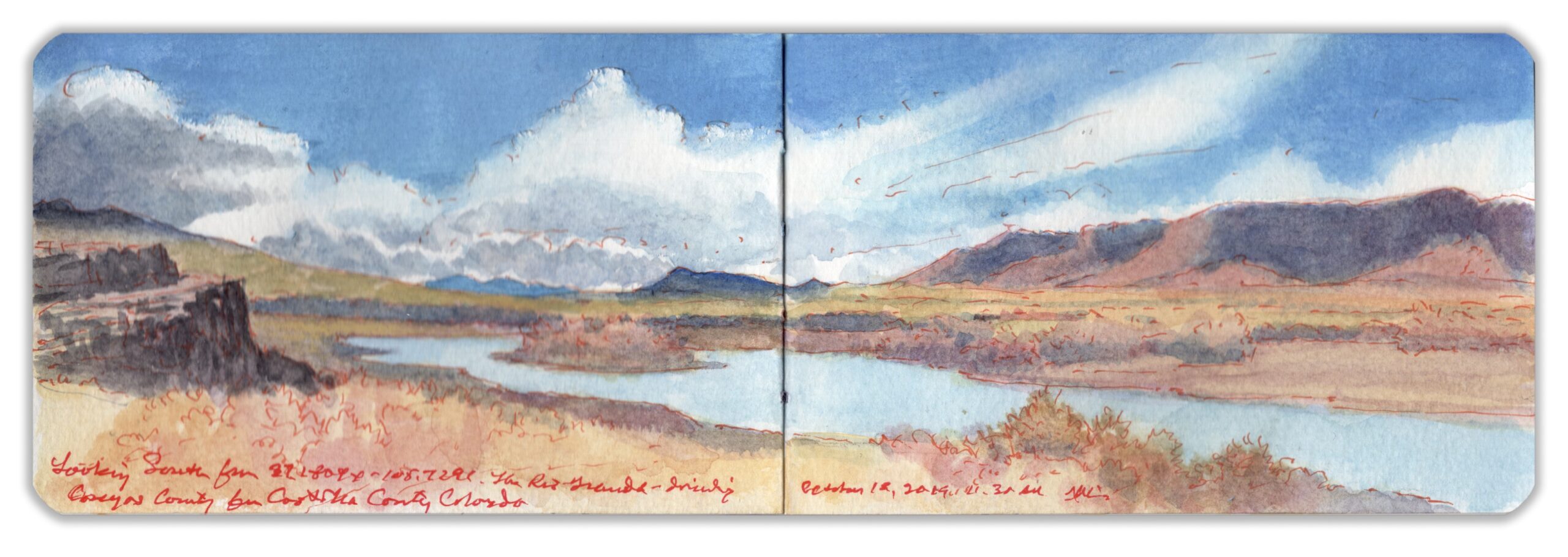
SKETCHBOOK TRAVELER. Dispatch # 85. The Rio Grande: Looking South from Colorado Highway 142.

“It was at the same time one of the most sublime and beautiful inland prospects every presented to the eyes of man…”
–Zebulon Pike. 1807

Dividing Conejos County to the west from Costilla County to the east the Rio Grande traverses the southern margins of the San Luis Basin, then descends between ever steeper and higher banks that downstream widen up to a quarter-mile, reaching depths of more than eight hundred feet. Rising in the San Juan mountains west of Creede the river flows east past Alamosa, turning south past the mouth of Rio Conejos (Rabbit River) to meet another tributary—Rio Costilla (Rib River) just across the New Mexico Border. After studying maps over breakfast at the Windsor Hotel in Del Norte, I follow the Rio Grande past Monte Vista to Alamosa, where I turn south onto Highway 285—the road to Santa Fe. Passing the village of La Jara—named for Cistaceae, a species of desert-flower commonly known as rockrose. Turning east onto Highway 142 at Romeo, past Manassa the road traverses the Conejos River a few miles below its confluence with the Rio Grande. Undulating grasslands spread out to the north, across the San Luis Valley. Further to the south, high-desert sage and pinyon cling to rocky soil. Parking my rental car on the east bank of the Rio Grande in Costilla County, I walk back across the bridge in search of a compelling visual narrative. Big Year birders from Montreal arrive, in search of a migratory rarity spotted in the area. Both upstream and down, the waterway is flanked by modest outcroppings worn by erosion. Green tendrils swayed beneath the clear water. I was surprised to learn that the elevation was eight thousand feet—

This text is an excerpt from SKETCHBOOK TRAVELER SOUTHWEST,  Now available worldwide.

Watch the recorded book-launch: CLICK on the image below

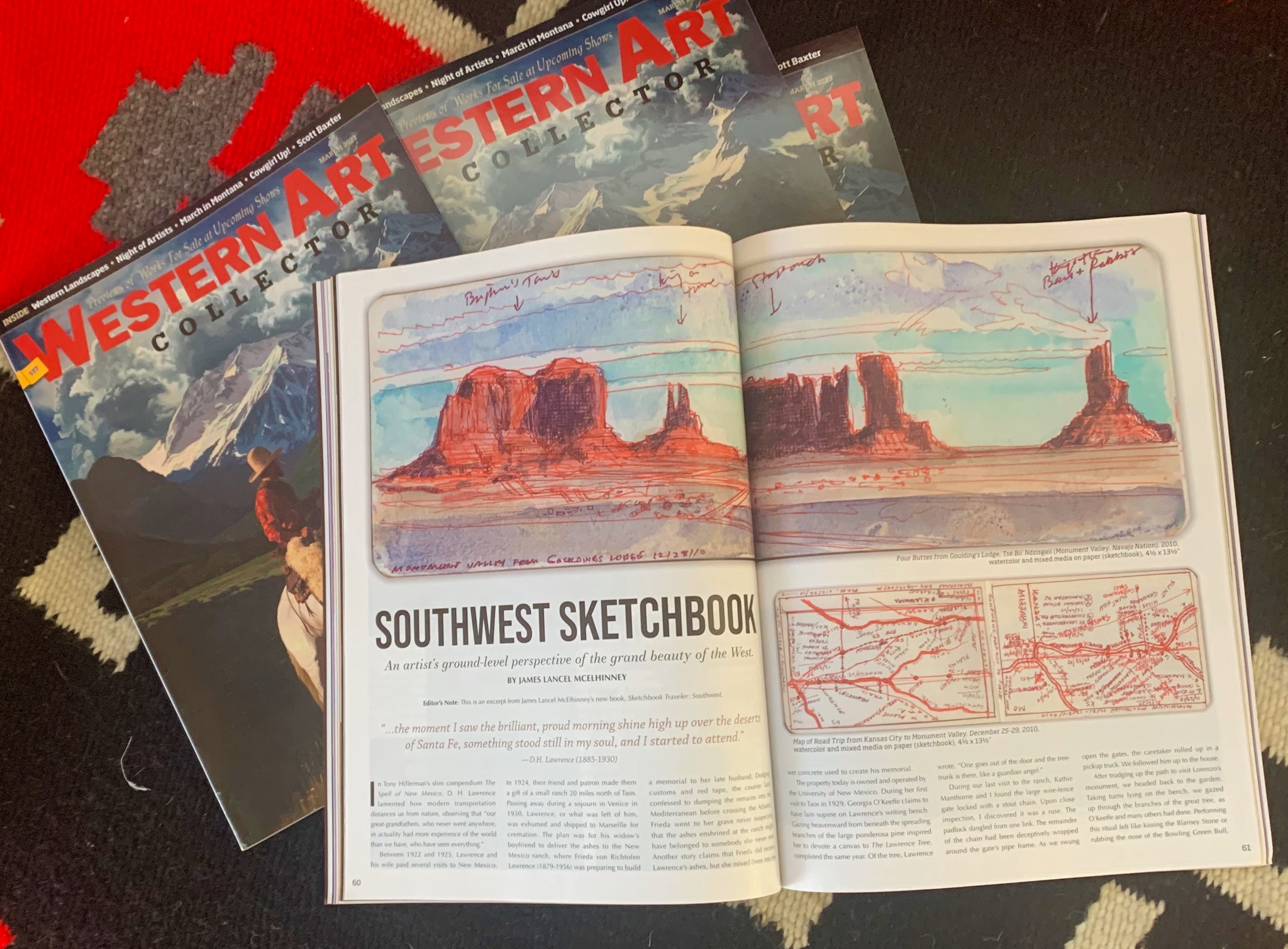
SKETCHBOOK TRAVELER SOUTHWEST is featured in the March 2023 issue of Western Art Collector magazine:

Now available to own: Sketchbook Traveler: Hudson Valley

Explore my Quaranteam Dispatches, from April 1-June 8, 2020
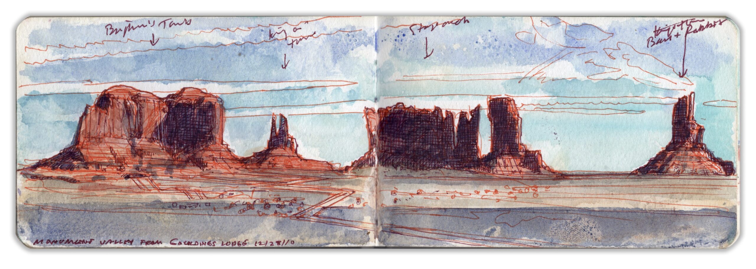
SKETCHBOOK TRAVELER: THE SOUTHWEST: Dispatch # 84. Four Buttes from Goulding’s Lodge. Tsé Biiʼ Ndzisgaii (Monument Valley, Navajo Nation) December 28, 2010.

Saturday December 25, 2010. Walking up to the car rental desk at Kansas City airport, I laid the contract on the counter. The attendant asked for our flight number. Looking it up, he calmly informed us that due to a blizzard on the east coast, nothing was flying in or out of any of the New York City airports. I asked if he could find out how long this would continue. Placing another call, he informed us that it would be five or six days before we could get seats on another flight. No guarantee, but maybe next Thursday or Friday. He also informed us that a massive winter storm was brewing on the Pacific coast. There had been snowfall in Los Angeles for the first time in many years. Kathie looked at me and asked, “How far is it from here to Monument Valley?” Trying to compose a quick, coherent answer, I calculated the distance, potential delays, and the challenges of returning in time to catch our return flight, then gave her my answer. “Let’s go”.
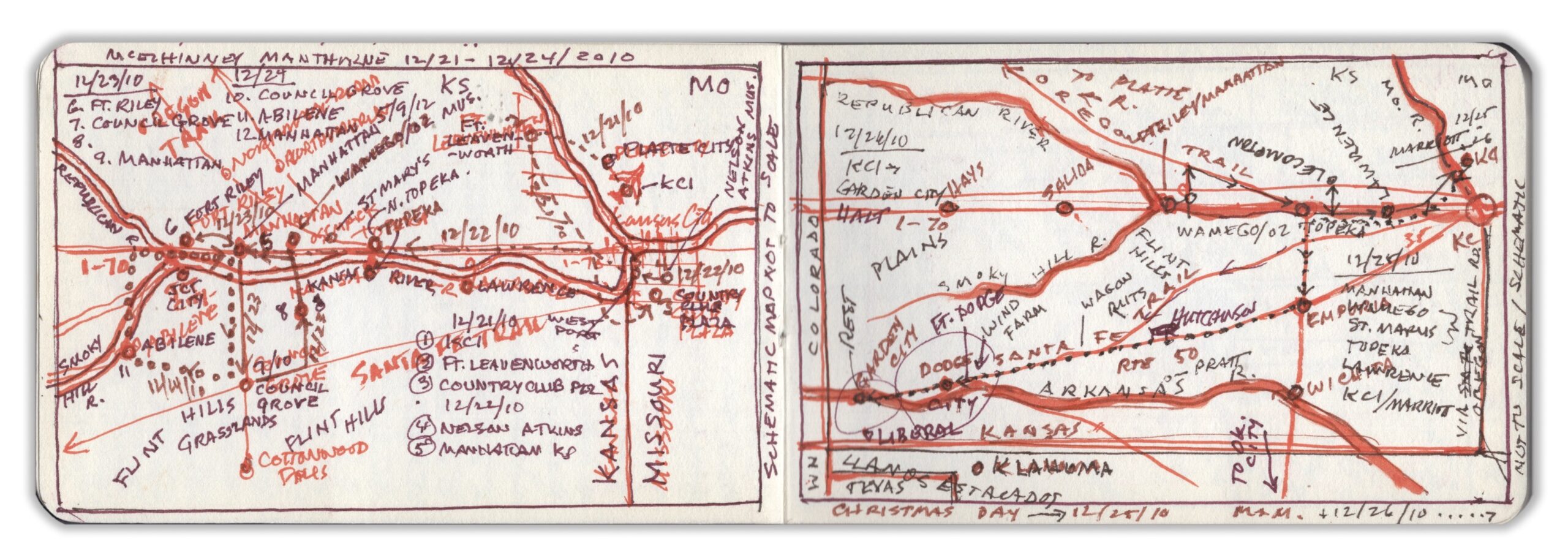
Crossing the Missouri River back into Kansas, we picked up the Santa Fe Trail, shadowing US Route 50 beyond Emporia. Along the roadside, wagon-ruts could still be seen, carved into the rolling prairie. Following a late lunch in Dodge City, we spent the night in Garden City. After breakfast we crossed into Colorado, calling at the ruins of the WW2-era Amache Japanese-American internment camp before pausing in La Junta for lunch, and a visit to Bent’s Old Fort National Historic Site. Passing Spanish Peaks and La Veta Pass, we pressed on across the San Luis Valley. As we retired for the night at a hotel in Durango, we learned that Wolf Creek Pass, which we had traversed just hours before was again buried in snow.
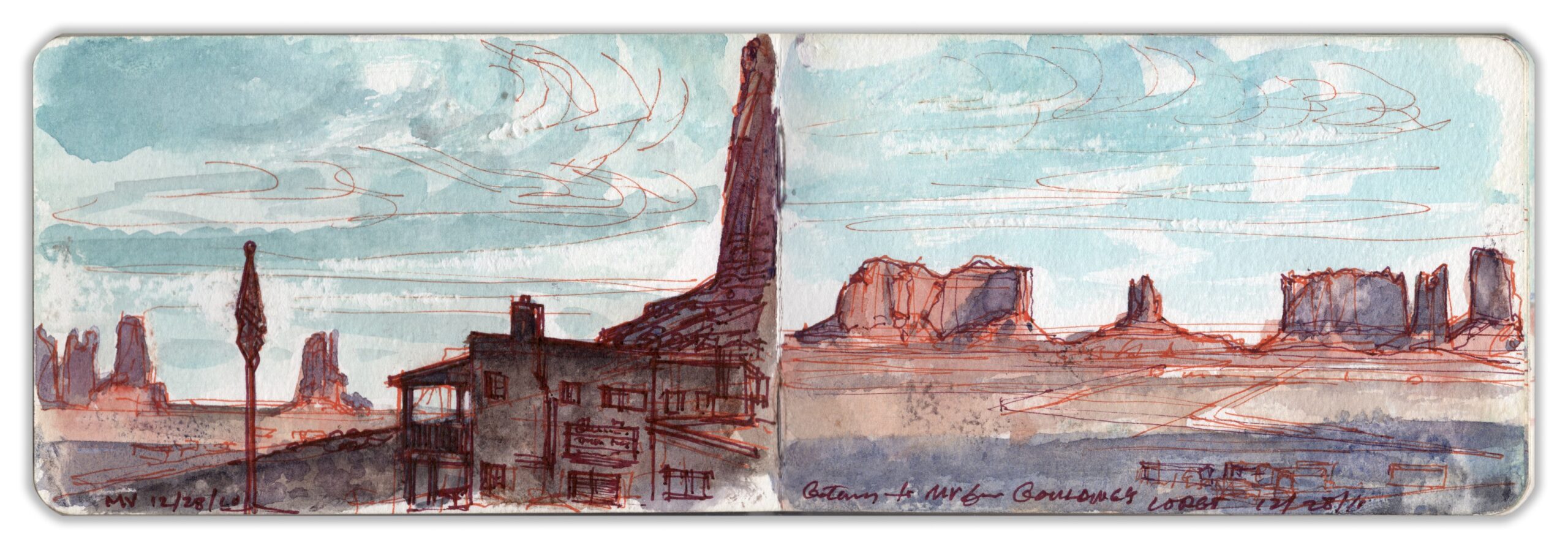
Rising before dawn we descended past Mesa Verde in our approach to the Four Corners area. A rosy point of light to the south, the pinnacle of Ship Rock soared above the vast grey expanse below. Famished, we stopped for breakfast at Kayenta–known locally as “K-town”. Two elderly Navaho men sat by the window, enjoying their breakfast. Apart from them, we were the only customers. Switching back and forth between English and Dine, a radio announcer unpacked the weather report and tribal news. Our server was polite but diffident. Locals had long ago gotten used to belagana (Americanos) passing through en route to Monument Valley.Half an hour after paying our check we arrived Goulding’s Lodge, the guest-ranch and hotel used by John Ford as his base-camp in filming many of his westerns. Famous for its spectacular chessboard of tall sandstone buttes, it became synonymous with the cinematic west. Left to right: Brigham’s Tomb, King-in-his-Throne, Stagecoach, and Bear-and-Rabbit. Needless to say, the Diné have other names for these formations. This page-spread was delineated upon our arrival.
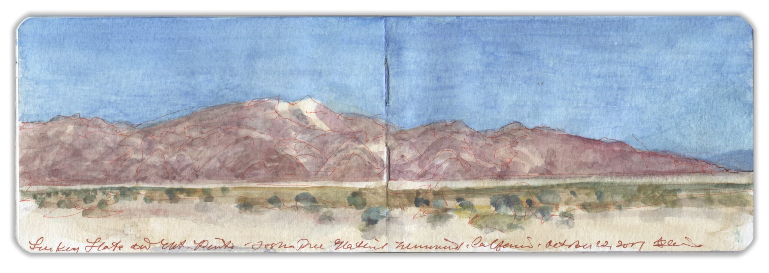
SKETCHBOOK TRAVELER: Dispatch # 83. Pinto Peak. Joshua Tree National Park. October 12, 2017.


Turkey Flats and Pinto Peak. Joshua Tree National Monument. California. October 12, 2017. Watercolor on paper. 3.5 x 10.5 inches (Moleskine watercolor journal)

Joshua Tree National Monument sits atop a plateau where the Mojave Desert to the north meets the Sonoran Desert to the Southeast. The park is named after a distinctive species known officially as Yucca Brevifolia, to the Spanish as Izote de desierto, before receiving its popular name Joshua Tree from a band of Mormon settlers. Otherworldly rock formations created by volcanism and erosion, cyclopean boulders and outcroppings sculpted by erosion provide a perfect backdrop for Westerns, science-fiction movies and automobile commercials.


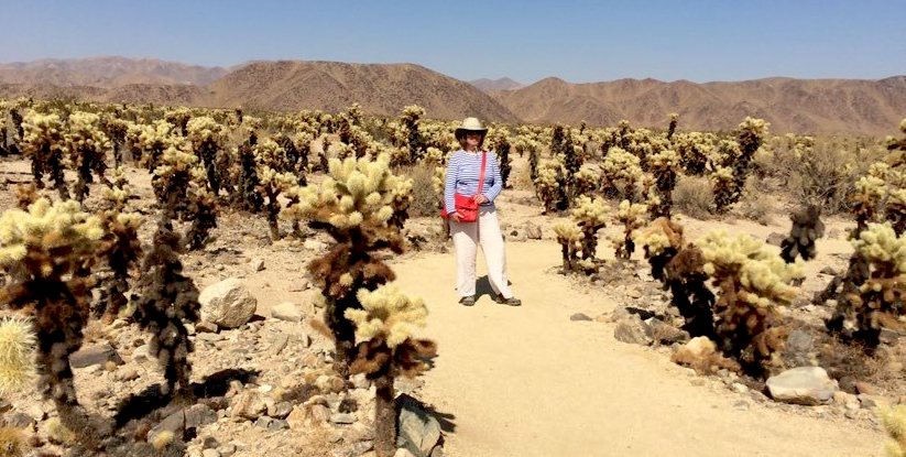
Kathie Manthorne among the “jumping” Cholla. October 12, 2017

Traveling southeast on the park road, one finds less abundant plant-life before entering a scorched wasteland at the foot of the Hexie Mountains. En-route to the Cottonwood Visitor Center is a large patch of fuzzy Cholla cactus. Cylindropuntia fulgia is dreaded for its flesh-stinging nettles that are said to leap at passers-by. The trail is well-marked, with frequent cautions against touching the plants. A small group of insouciant pretty young Asian women in party-dresses and high-heels run among the cacti snapping selfies and othersies. As they gambol among the Cholla, a massive SUV arrives. Out of the vehicle steps a very large man in an evening-gown, having a Priscilla Queen of the Desert moment. Three male handlers and female photographer follow him through the Cholla-garden as he strikes poses. His long diaphanous yellow scarf floats on light breezes, its selvedge licking the nettles. Further along Pinto Basin Road a parking-area faces a desolate plain known as Turkey Flats. To the southeast, Pinto Mountain rises to an elevation of nearly five thousand feet.

Now available to own: Sketchbook Traveler: Hudson Valley

Explore my Quaranteam Dispatches, from April 1-June 8, 2020