Category Archives: Dispatches

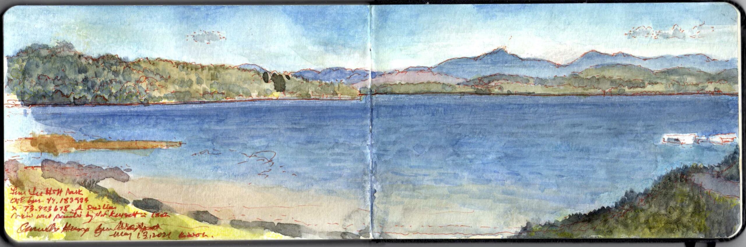
SKETCHBOOK TRAVELER: Dispatch #100. Camel’s Hump Mountain from Westport, New York


Camel’s Hump Mountain, Vermont, from Lee Park Hill. Westport, NY. May 12, 2021

 Traveling south with an Abenaki war-party, Samuel de Champlain’s canoe traversed a large body of water known to his bellicose companions as Pitawbagok, or “the water between the lands.” Their Mohawk enemies to the south called it Kaniatarakwà: ronte, or “the bulging lake.” Noting a peak rising to the east, the explorer named it Leon Couchant, or “resting lion.” The Abenaki called it Moziozagan, or “moose shoulder,” which in English morphed into “Camel’s Hump,” in honor of a beast whose natural habitat was thousands of miles away. Disparity in elevation between its summit and the land from which it rises allows the peak to be recognizable at a great distance; a landmark for travelers since a time immemorial. The geological term for its unusual shape is roche moutonée, an allusion to mutton-fat as an adhesive used by wearers of powdered wigs. During the last Ice Age, ten thousand feet of ice passed over the massive rock. Immense pressure smoothed its upstream face, carving away the downstream side to leave a steeper slope in its wake. All of New England’s mountain-ranges were subjected to this process, including those of coastal Maine. Mapping the orientation of these asymmetrical formations allow us to reconstruct different flow-patterns within the Laurentide ice-sheet. Camel Hump has become an iconic symbol of the Green Mountains. Celebrated by Hudson River School painters, stunning vistas reward a relatively easy three-hour hike to the summit.


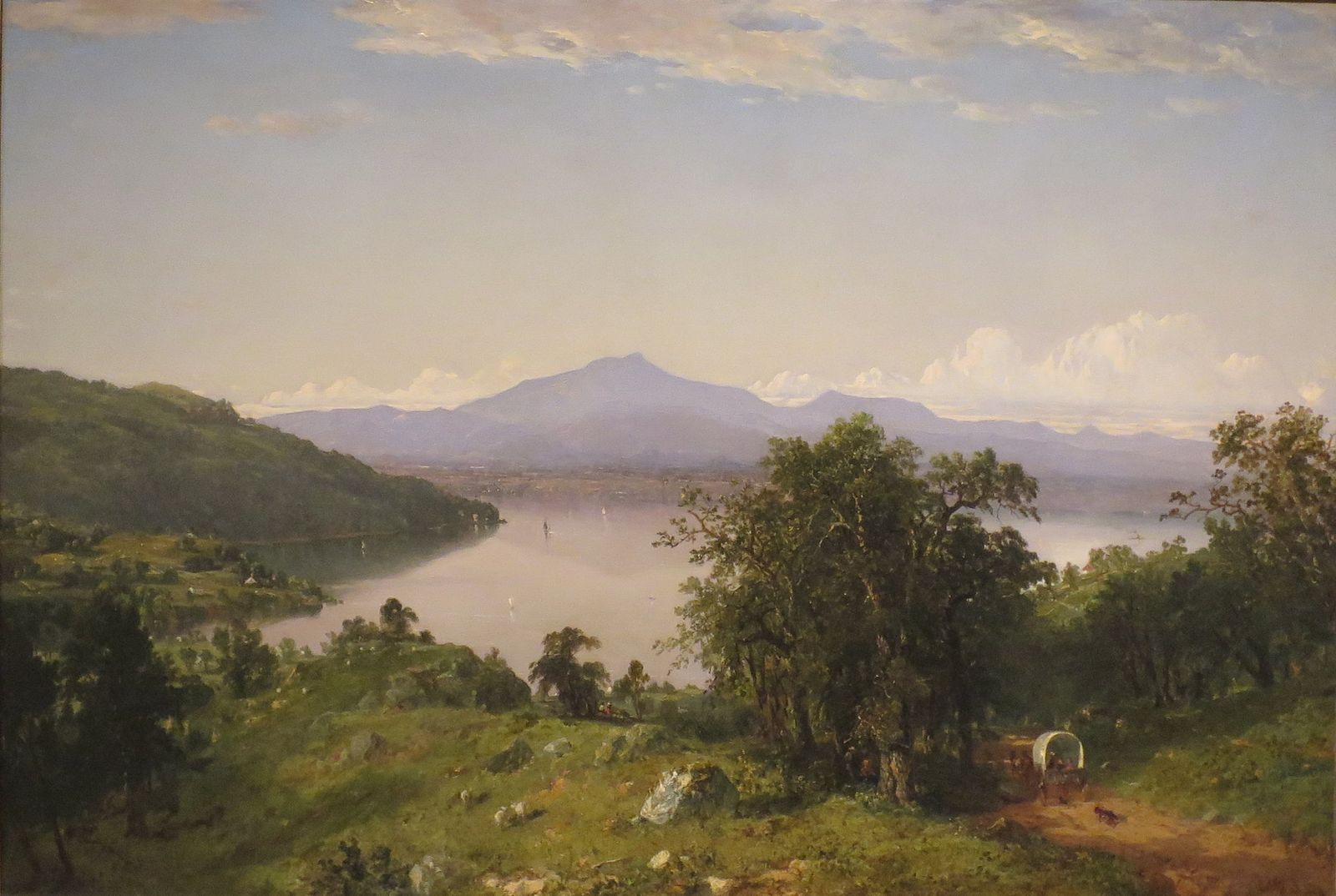
John Frederick Kensett. Camel’s Hump from the Western Shor of Lake Champlain. 1852. High Museum of Art, Atlanta. GA (reproduced under Fair Use, etc.)

My view of the mountain was taken from a hilly corner of Lee Park in Westport, New York.   A similar prospect was adopted by John Frederick Kensett in 1852. One can see that he took tremendous liberties in portraying the vista in scale, greatly exaggerating the size of the distant peak.  Cherishing verisimilitude, contemporary realists frequently embrace a benighted understanding of historical artworks as reporting visual data with accuracy. In fact the opposite is true. The job of art was to improve on nature. Failing to do so was dismissed as mere imitation. Kensett’s point of view would have been within a few hundred yards of my position.


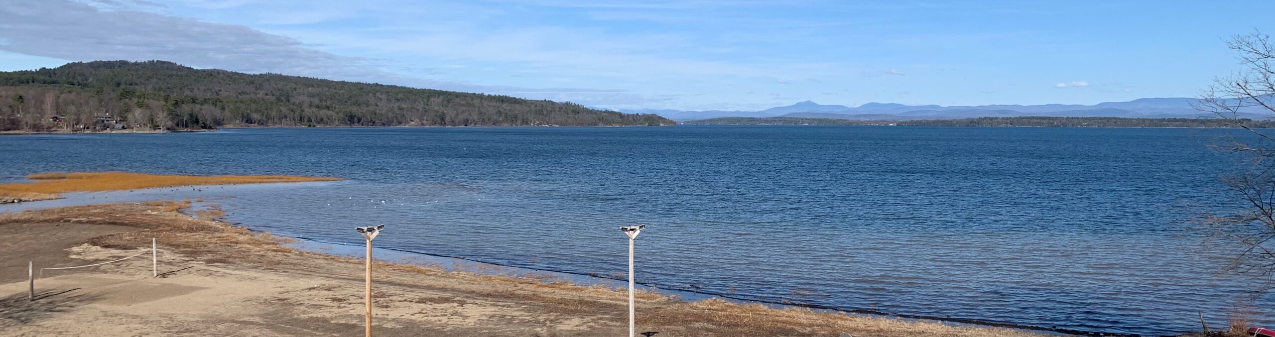
View of Camel’s Hump and Lake Champlain. NW from Lee Park Hill (44.1839 x -73.3447). March 27, 2021. 4:31 PM,

The panoramic photograph above hardly resembles my memory of the scene. Nor would it have given much satisfaction to Kensett. Equipped with a better camera and more judicious lens options, a far more satisfactory result might have been achieved. Regardless of technology, still photography faces an uphill struggle to attain the complexity of human experience. Cinema stands a better chance. Here’s why.
Looking at individual features of terrain, we adjust our vision, zooming in and out, scanning the vista to collect bits of information to be filed away on the hard-drive. Drawing on these memories to reconstruct the scene, the relative size of one thing or another becomes less important than experiential conditions such as space, light, distance and proximity. Thus Kensett’s painting is a faithful reprise of the experience of looking at Camel’s Hump from Westport, unfettered by facts and data. One of the key differences between painting and photography is how either process is shaped by memory. The camera does not see things as we see them. It may take dozens of exposures to capture something that resonates with the photographer’s experience. In drawing and painting, even if we think that we are working from observation, in fact we are always working from memory. One looks at the subject, then turns to the page to make a mark. One looks at the mark, and then studies the subject. Casting our gaze back to the page we remember the subject. Looking back at the subject we remember the page. Because drawing from observation is working from memory, the challenge is not just to report the facts we behold, but to portray our memory of them.


View last week’s Virtual Workshop (May 12, 2021), presented by the HUDSON RIVER MUSEUM. LINK

This week’s workshops:

Hudson River Museum. Wednesday, May 19 @ 1:30 PM, EDT. REGISTER
Greenwich Art Society. Saturday May 22 @ 1PM, EDT. REGISTER

To receive updates and free study guides from the members-only Sketchbook Traveler Resources page, please send us an

wo*******@ne***********.com


“>EMAIL
, subject-line “members”


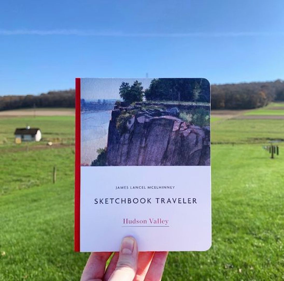
Now available to own: Sketchbook Traveler: Hudson Valley (Photo by the author)

Explore my Quaranteam Dispatches, from April 1-June 8, 2020

SKETCHBOOK TRAVELER: Dispatch #99. Thacher Island Lights: Cape Ann, Massachusetts


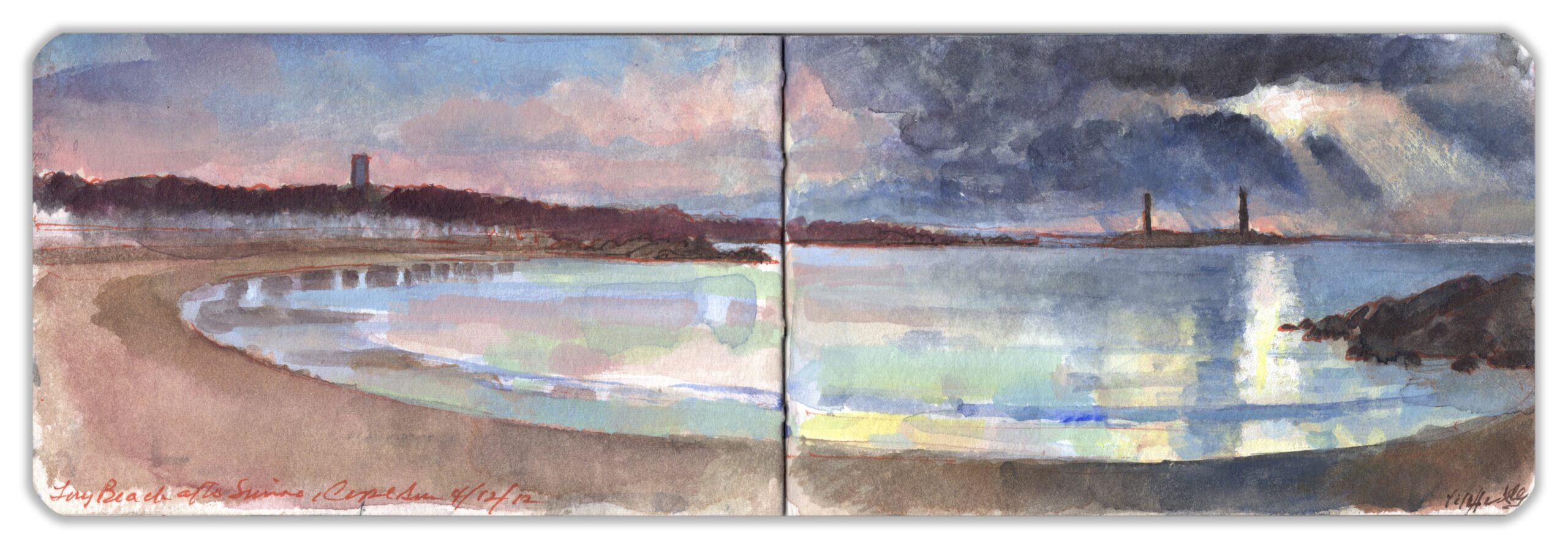
Cape Ann: Thatcher Island Lights from Long Beach. Thursday April 12, 2012

Few subjects invite more derision from self-identified serious painters than lighthouses and fishing-shacks, both of which Cape Ann has in abundance. Great artists like Edward Hopper, Winslow Homer and Fitz Henry Lane were undaunted by these pastiches, perhaps because they found more personal ways to confront them. During a visit to Cape Ann in the spring of 2012, we decided to seek accommodations along its Atlantic coast. Long Beach is a fishhook-shaped strip of sandy shoreline perhaps two miles in length, behind which stands in two ranks a row of seasonal homes. We stayed in the motel tucked in a cover at the southern end of the beach, in a modest room with a kitchen. Starting at the parking-area, a pedestrian walkway stretched northward between the beach and the houses, most of which would be vacant until Memorial Day. At the far end of the strand a stream flowed across the beach, dumping its waters into the ocean. Blowing in from the sea, a cold wind greeted our return to the warm room where we prepared our supper. Daybreak revealed beneath dark clouds the low profile of Thatcher’s Island with its twin lighthouses, silhouetted against a rosy horizon.


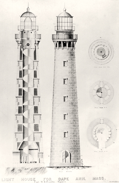
New design for the Thacher Island light-towers. Drawing by Captain William Buel Franklin (1823-1903). A graduate of West Point, Franklin became a member of the elite Corps of Topographical Engineers. He took part in the survey of the Great Lakes and saw action during the Mexican War. In 1857 he was put in charge of lighthouse construction along the New England coast. In 1859 he was made engineer for construction of the U.S. Capitol dome. During the Civil War he achieved the rank of Major General.

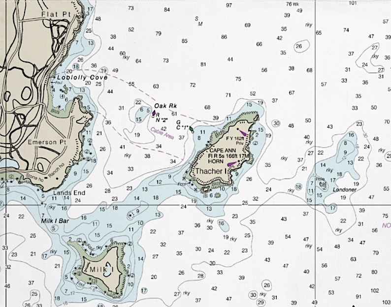
Violent storms off the coast of Cape Ann frequently drove ships onto Londoner Ledge, which in 1635 took twenty-one lives aboard the unlucky Watch and Wait. Only two survived. Anthony and Elizabeth Thacher found refuge on a nearby island, which the colonial government awarded them as recompense for their losses. Bequeathed to their descendants, the island was purchased by the colony for the purpose of setting up a pair of lighthouses. As an aid to navigation the towers were built along a north-south axis. The beacons first were lit in 1771. Four years later a detachment of minutemen shut them down. Following the cessation of hostilities the Commonwealth of Massachusetts ceded Thacher’s Island to the federal government. Lighthouse operations resumed in 1793. In 1861, a new pair of towers took their place. As the sun rose behind them one cold April morning, they seemed to signal both hope and danger.


Nautical chart showing Emerson Point, Oak Rock, Thacher’s Island, Londoner Ledge and Milk Island; treacherous waters in fog or bad weather. With tides at time in excess of nine feet, miscalculating the combined effect of currents, winds and tides expose mariners to calamity, in the form of rocky ledges lurking beneath the waves.

Now available to own: Sketchbook Traveler: Hudson Valley

Explore my Quaranteam Dispatches, from April 1-June 8, 2020

SKETCHBOOK TRAVELER: Dispatch #98. Derby’s Wharf, Salem Massachusetts.


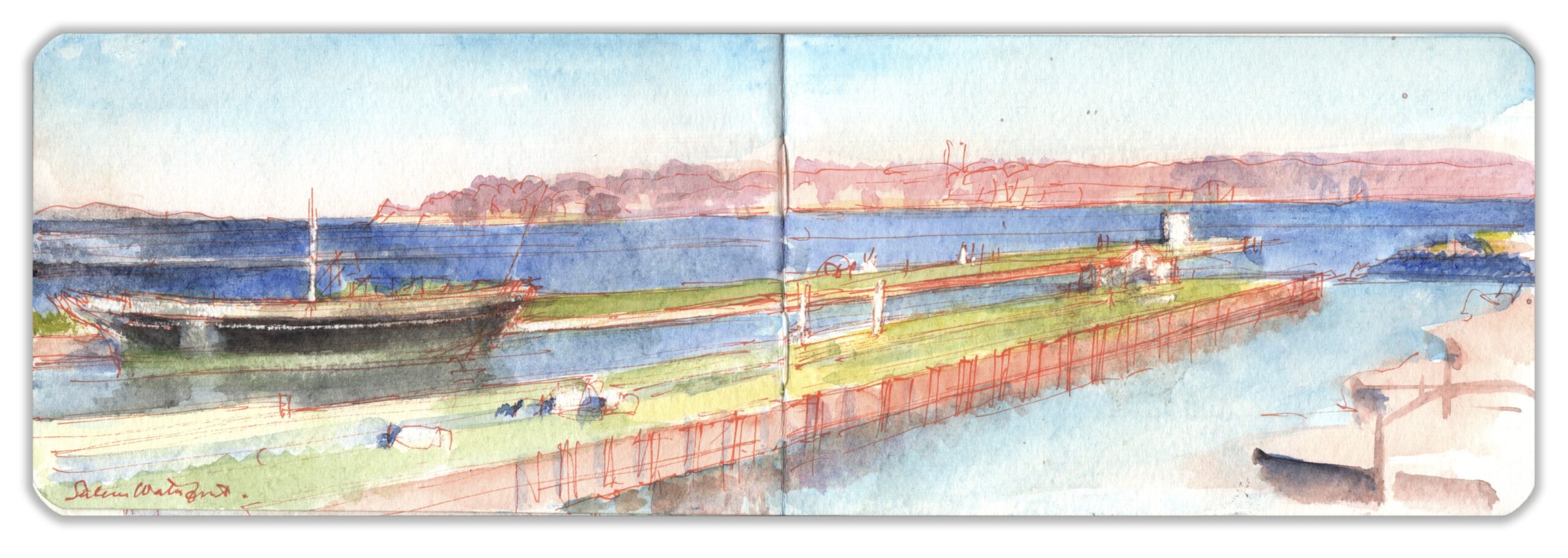
Salem Harbor. Derby’s Wharf

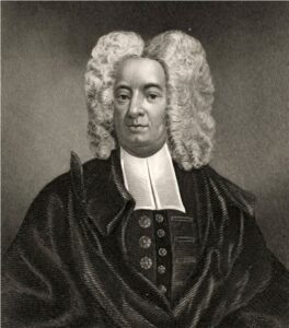
Puritan clergyman Cotton Mather regarded the wild spaces of New England as the domain of Satan, and his fellow Puritans as agents of Divine Will, winning for Christendom dominion over a spiritual desert inhabited by savage heathens. As the promoter of an early Smallpox vaccine, Mather was deeply interested in science and learning. At the same time, he praised the Salem witch-trials that took the lives of nineteen men and women. His moral struggle between faith, science and superstition would be reconciled by a later generation during The Enlightenment.


Cotton Mather (1663-1728)

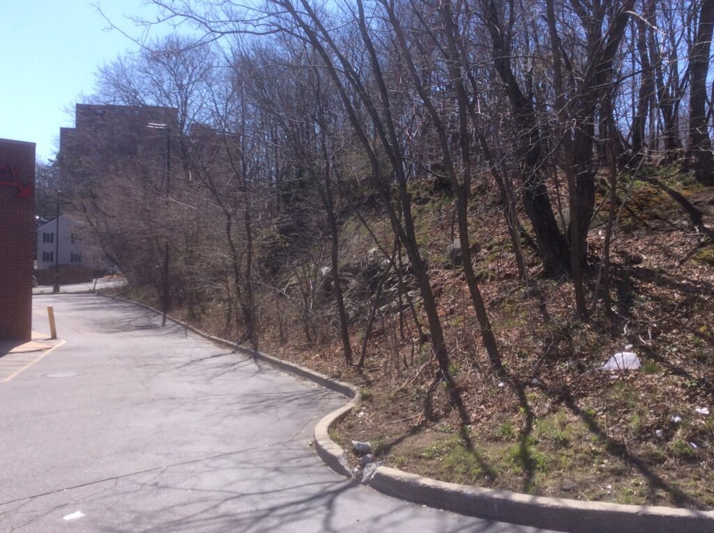
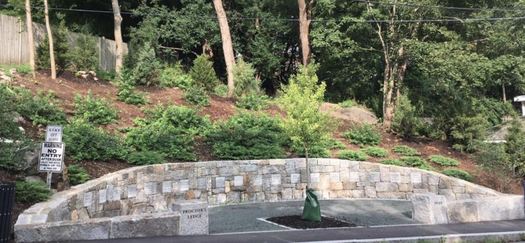
Haunted by the events of 1692-1693, witnesses to the mass-hysteria found way to deflect their shame and outrage. Salem Village changed its name to Danvers in 1752. In recent times Salem has profited from Wiccan tourism and a lively Halloween industry. Astride a crescent moon, a life-sized bronze statue of Bewitched actress Elizabeth Montgomery was installed along a pedestrian walkway. Visitors to Gallows Hill would pass by unknowing the rocky wooded rise where the executions actually took place. Curious to visit the site, it was troubling to find Proctor’s Ledge wedged in behind the drive-through lane of a Walgreen’s drugstore. Here the gallows once stood, not on the hill behind it. One year and two months after this photograph was taken, a memorial to the victims was dedicated near the eastern end of the ledge along modern-day Pope Street, amid fissures in the rock where the corpses had been dumped.


Looking east from Proctor Street toward Pope Street. Walgreens on the left.
Proctor’s Ridge on the right. 4:30 pm. April 15, 2016


Proctors Ledge Memorial. Dedicated June 19, 2017.

Salem struggled through the eighteenth century. Its fishery suffered during the French and Indian War and during the American War of Independence, when privateering helped to develop a maritime economy that would later evolve into profitable merchant fleets.


Map of Salem 1820

Situated at the base of a forked spit of land dividing Massachusetts Bay from the Danvers River, a tidal estuary formed by a confluence of creeks that drain the surrounding low-lying hills, Salem profited from trade in molasses, rum and slaves. Following the American war of independence, Salem established shipping routes to the far east.
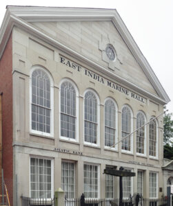
Embarking for the Orient, merchantmen rounded Cape Horn before sailing to the Pacific Northwest and Alaska. Otter-pelts and other exotic furs prized by Chinese buyers were traded for silks, tea, and porcelains. During the Napoleonic Wars, Salem ships called at Nagasaki, as proxies for the Dutch East India Company. By the early nineteenth century Salem had grown to become the sixth largest city in the new republic, and the wealthiest. A consortium of sea-captains and ship owners in 1799 established the East India Marine Society to preserve in a museum natural and cultural curiosities collected on their voyages.


East Asia Marine Society Hall precursor to the Peabody-Essex Museum, Salem, Mass.

Like Peale’s Columbianum in Philadelphia, Salem’s museum fostered a linkage between science and art to advance higher learning. Silks, spices and Chinese export porcelain flooded into New England’s prime entrepôt of Asian luxury goods. Yankee seafarers, exotic foreigners and the occasional elephant trod Salem’s bustling docklands. Fidelia Bridges and Nathaniel Hawthorne grew up here. Stripped of its masts and rigging, the Friendship awaits a refit. Resounding with hushed memories, Derby’s wharf reaches into the harbor, a barren elegy to former glory.


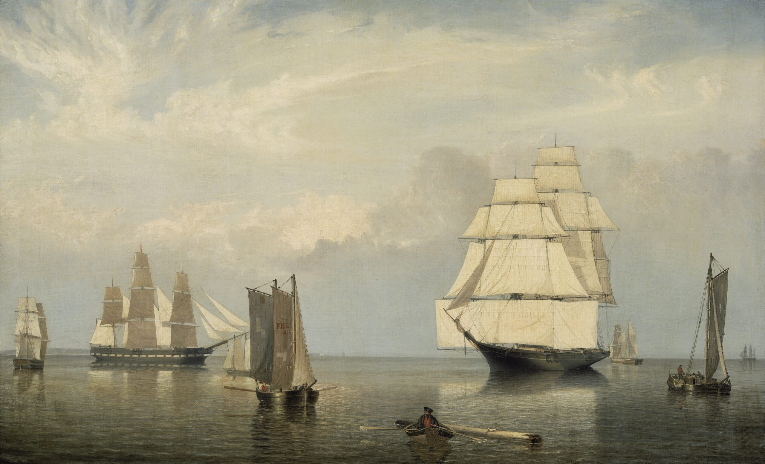
Salem Harbor. Fitz Henry Lane. 1852


Now available to own: Sketchbook Traveler: Hudson Valley

Explore my Quaranteam Dispatches, from April 1-June 8, 2020

SKETCHBOOK TRAVELER: Dispatch #97. Cathedral Rocks, The Atlantic Coast of Cape Ann


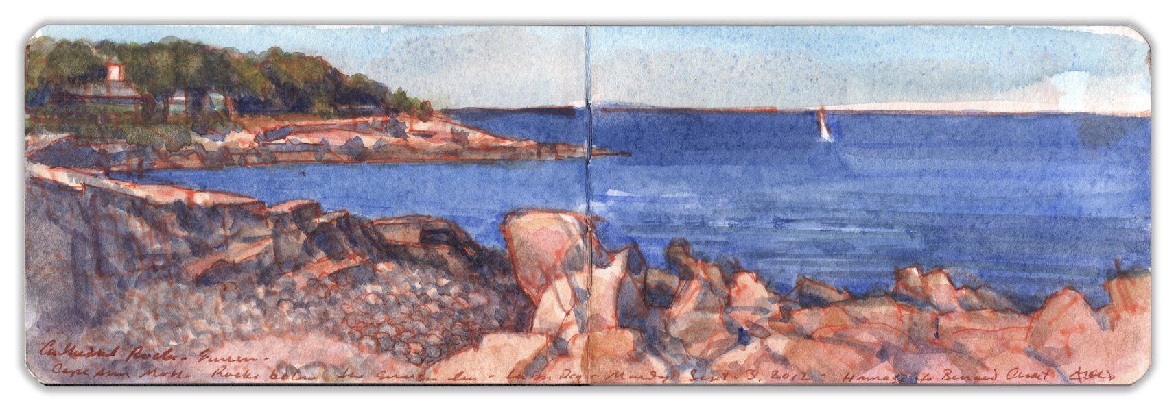
Cathedral Rocks below Emerson Inn. Labor Day. Monday September 3, 2012. Homage to Bernard Chaet

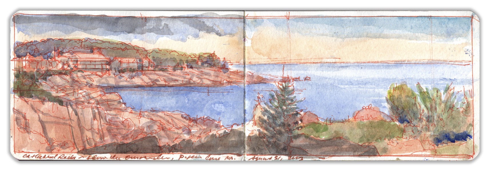
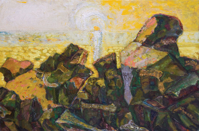
At Joshua Tree National Park, rocky outcroppings were formed as a byproduct of plate tectonics and shaped by erosion. The fractured granite headland known as Cape Ann was generated in much the same way, with a few noticeable differences owing to climate. While the southern Mojave formations were sculpted by wind and chemical erosion, the granite shoreline at Cape Ann is also subject to extreme fluctuations in temperature. Water seeps into tiny crevices during the warmer seasons. As the mercury slips below freezing, trapped water expands, widens the fissures and eventually shatters the rock. This proceeds at a slower pace in substrates covered by sand, soil and vegetation. Just north of Pigeon Cove, just south of Hoop Pole Bay is a wide crescent of shoreline littered with boulders, a popular and potentially dangerous scuba-diving attraction. Traversing this natural rip-rap is a wall of granite. Jutting into the waters of Sandy Bay, Cathedral Rocks have resisted the wrecking-ball, but must one day succumb to tempests and breakers. All along the New England coast, tidal pools teem with life, from sea-urchins and starfish to mollusks and crustaceans; a smorgasbord for terns and gulls. Loons and diving Cormorants fish the waters just offshore. Like an earworm that just will not get out of your head, it is impossible to confront a vista such as this without Cézanne looking over your shoulder. Not that it looks anything like Provence, but Cezanne might have been enthralled by its geology. During our last visit to Bernard Chaet’s summer home a year or two before, he had aged noticeably. Departing for lunch at The Lobster Pool near the northern tip of Cape Ann, he passed me the keys to his minivan. I was stunned. Bernie had long cultivated a special relationship with motoring, manifested in a demonstrative approach to highway safety. As I sat drawing, on a low escarpment behind the Emerson Inn, Bernie was on my mind. Mindful that he was failing, not knowing that soon he would be gone, I dedicated this painting to him; a prayer for the dying, a way to say thanks and farewell.


Cathedral Rocks below the Emerson Inn. Pigeon Cove, MA. August 31, 2013.

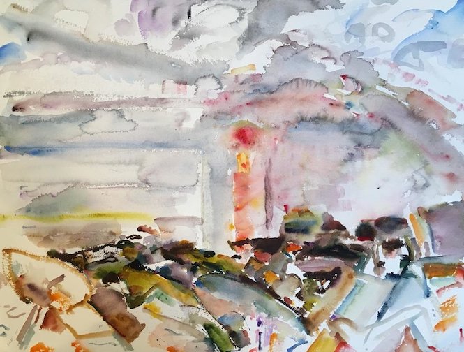
Having visited Cape Ann once or twice as a teenager I was curious to see it anew, through the eyes of a freshly minted graduate of the Yale School of Art. Bernard Chaet had been a mentor and advocate during my two years in the program. Working as his teaching assistant in an undergraduate drawing class launched me into a career in higher education. His way of leading students to knowledge, and motivating them with curiosity continues to influence my approach to teaching, including the creation of the book you are reading. In the summer of 1976, a few months after graduation, my then partner and I traveled to Manchester-by-the-Sea to have lunch with friends of her family. Following a splendid repast surrounded, by works by the American Impressionists, we drove north on Route 128 to Cape Ann. The Chaets summered in a charming cottage on Granite Street, aka Highway 127; the two-lane highway that leads through Rockport around the tip of Cape Ann to Lanesboro. It was the first of many visits. In the decades that followed, Bernie was drawn to the rocky shoreline, the sea, and the sunrise, which became his muse. Chaet’s lifelong passion for Jazz undergirded his drawing and painting compositions; manifested in rhythmic juxtapositions and pictorial patterns. In his final works, brushes loaded with color jammed with Django, Bird, Dizzy and Miles; the earth, the sea and the air.


Bernard Chaet. Untitled. Watercolor on paper. 22 x 30 inches. Courtesy Alpha Gallery, Boston,

Now available to own: Sketchbook Traveler: Hudson Valley

Explore my Quaranteam Dispatches, from April 1-June 8, 2020

SKETCHBOOK TRAVELER: Dispatch #96. Popham Point from Drummond Point, Mouth of the Kennebec River. August 2, 2019


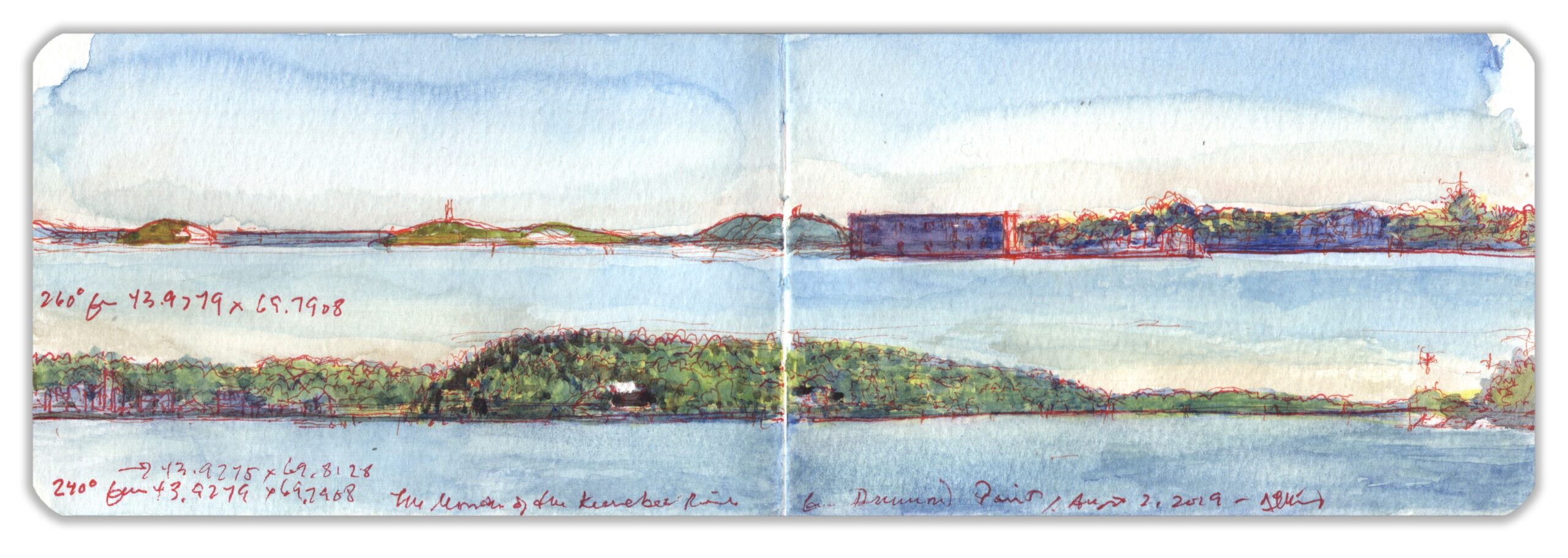
260 degrees from 43.9279 x -69.7908 (top) sight vector 240 degrees (below)

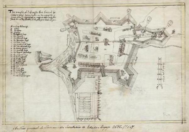
Rising from the outflow of Moosehead Lake, the Kennebec River travels more than one hundred and fifty miles before passing through a bottleneck of sandy tidal flats to enter the Gulf of Maine. Located at the southern end of the narrows is a small peninsula bounded to the east by the sea, and by Atkins Bay to the west. Below the tip of Sabino Head is a flat, slightly elevated piece of ground upon which in 1607 an English colony was founded by the Virginia Company.


Map of St.George’s Fort, Phippsburg. Maine 1607. Courtesy Maine Historical Society

Like Jamestown, which was settled the same year, the site was fortified against the elements and hostile acts by the French, Spanish and indigenous Abenaki, who were less than welcoming. Finding itself rudderless following the death of its governor Sir George Popham, the colony was abandoned in 1608. Due to its strategic location at the mouth of the Kennebec River, defensive positions at Popham Point were improved during every national conflict, up to and including the Second World War. Most notable among these is a two-tiered casemated Third-System forty-two-gun coastal fortification. Using local granite, construction began in 1861. Building ceased on the unfinished structure in 1869. Looking south across the mouth of the Kennebec from Drummond Point I embraced the format of a double panorama; left side on top, right side below. The blocky profile of Fort Popham appears at top right, while the Popham Colony site begins just beyond it to the right, continuing on the left side of the lower vista.


View of the gorge (rear wall facing the land) of Fort Popham. April 12, 2016. 6:10 pm


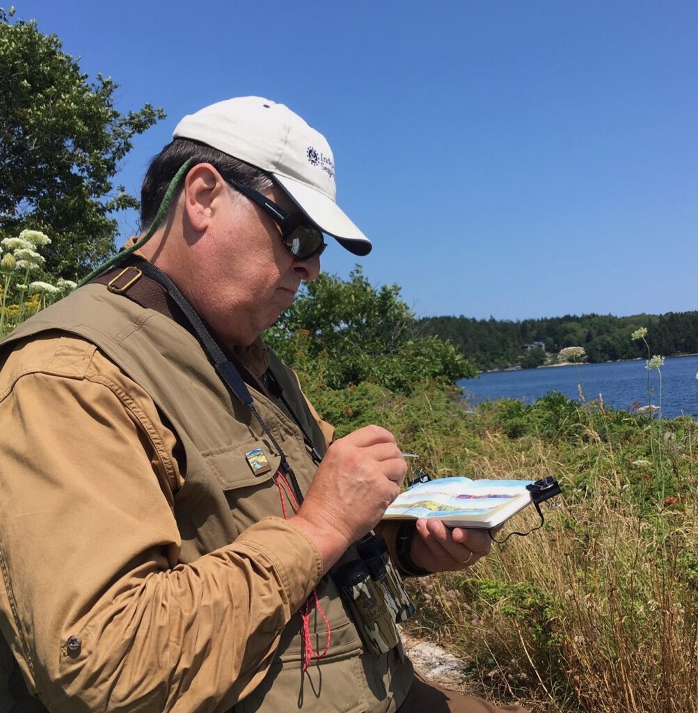
Working on the painting @ Drummond Point.
August 2, 2019. 4pm

a href=”https://www.schifferbooks.com/sketchbook-traveler-hudson-valley-6989.html”>Now available to own: Sketchbook Traveler: Hudson Valley

Explore my Quaranteam Dispatches, from April 1-June 8, 2020

SKETCHBOOK TRAVELER: Dispatch #95: The Essex River, Massachusetts


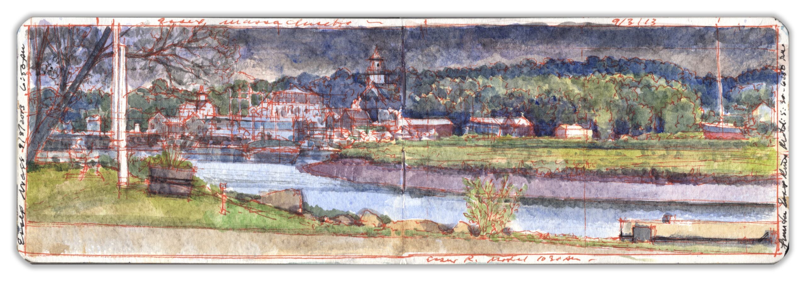
Essex River. Labor Day 2013. Watercolor and colored pens on paper (Moleskine Watercolor Journal)
The composition was laid out at 10:30 and elaborated later in the day before 6:30 pm.

The territory between Cape Ann and the Merrimack River were known in the local Algonkian dialect as Wonnesquamsauke; land of pleasant waters. Anglicized as Agwam, the indigenous Asquam tribe was ravaged by European diseases following contact with British settlers in 1634. All within forty years had either succumbed, migrated north, or were assimilated. Divided by the Annisquam River, town of Gloucester extends west of Cape Ann to another estuary. Traversing a maze of tidal swamps, dozens of creeks, runs and rivulets converge with the outflow of Chebacco Lake between a cluster of wooded low-lying hills. Here a settlement district was established under the administration of the town of Ipswich, which forbade any man to raise a town hall without permission. Citing gender as a loophole, the women of Chebacco village took up men’s tools, defied the law, and won autonomy for their community. Five years later, Chebacco was recognized as an independent parish. Owing to a series of wars with France and Britain, the district suffered many hardships. Reorganized in 1819 as the township of Essex, shipbuilding flourished at the head of the Essex River, supplying schooners and other sailing vessels for nearby fisheries and coastal transportation. The twentieth century saw the industry decline, and ultimately disappear. In 1916, local shopkeepers Bessie and Chubby Woodman shucked some clams and fried them. Their invention made culinary history, by purposing lowly bivalves to glories beyond chowder, while planting a seed that would resurrect Essex as a tourist attraction. With its restaurants, antique shops, shipbuilding museum, and few overnight accommodations, the historic village seems more like a day trip from Boston’s northern suburbs than a destination for vacationers.


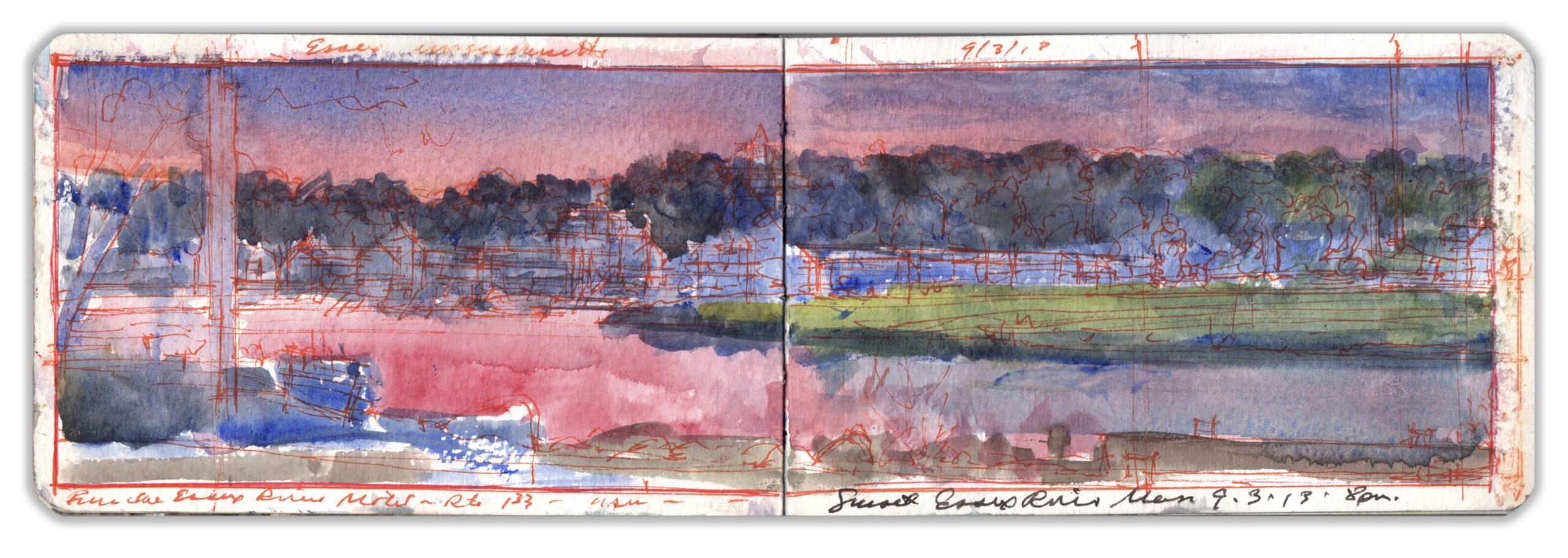
Essex River. 8:00 pm, Labor Day 2013. Watercolor and colored pens on paper (Moleskine Watercolor Journal)

The Essex River Motel, now Shea’s Colonial Inn and Motel, is one of few overnight accommodations in Essex, and the last ground-level motor-inn to survive in the Cape Ann Region. Sheltered by an overhanging roof, guest-rooms look out across a grassy bank toward the river. Highway 133 follows the historic overland route linking Gloucester to Ipswich, with Newburyport beyond. Seen from the common porch, Essex River flows toward us past a hairpin meander a few hundred yards to the northeast. The wooded village rises on a low hill beyond. Lying off to the right, fragrant salt-marshes flank the stream on its course to Essex Bay. Hastened by the failing light, I repeated the composition of another painting made earlier in the day. Rather than allow the image to fill the page-spread, I had in both instances delineated the framed within the page. Having jotted notes onto other paintings, I weighed the merits of establishing a narrow space around the image to receive marginalia.


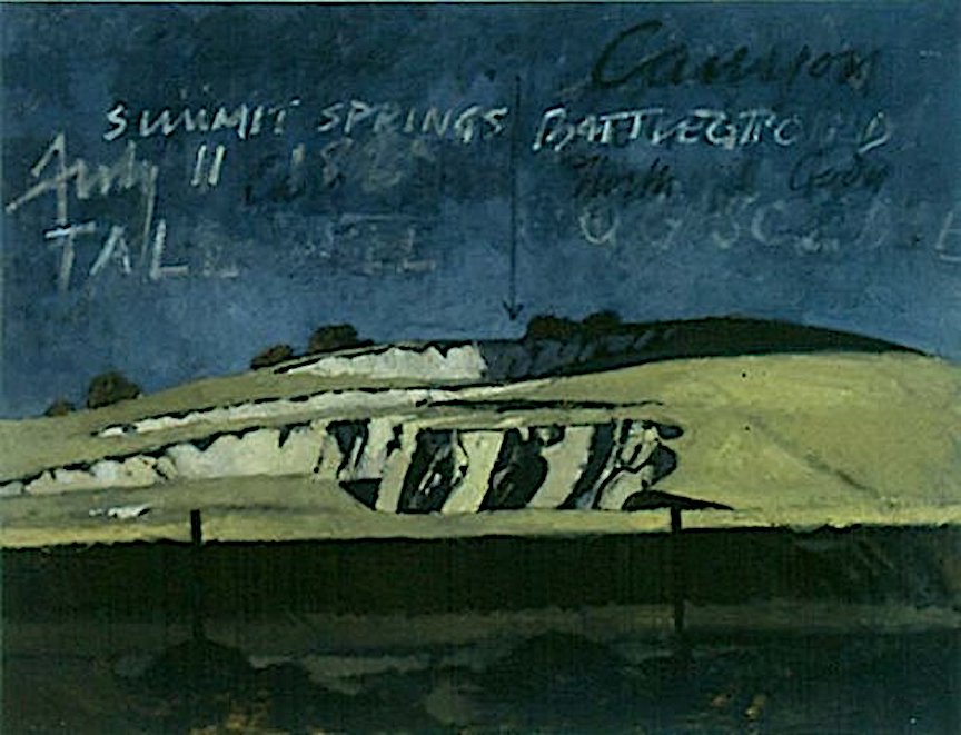
Summit Springs Battlefield, Oil n canvas. 50 x 66 inches. 2000

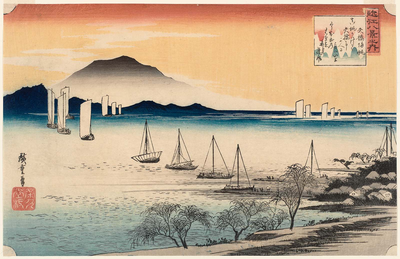
My recent paintings of the American West were exhibited in 2001 at the Donegal County Council gallery in Letterkenny. Reproduced on the postcard announcing the show was a painting of Summit Springs, an Indian Wars battlefield on the high plains of northeastern Colorado. Ghostly words written in the sky paid homage to Cheyenne-Arapaho artist Edgar Heap of Birds, and to those members of his community who fell in the battle. When he received the card Bernie Chaet shot back a hand-written note that said in large block letters, “These are paintings, not posters!” Given that the painting is question was nearly six feet wide, perhaps he had a point. Something about the light that evening reminded me of prints by Ando Hiroshige (1797-1858), nearly all of which include calligraphic elements. Painting in books also provided a less formal approach than what Bernie had in mind.


Ando Hiroshige. (1797-1858) Yabase no Kihan. Color woodblock print on paper. 1834 (from the suite Eight Views of Omi)

Now available to own: Sketchbook Traveler: Hudson Valley

Explore my Quaranteam Dispatches, from April 1-June 8, 2020

SKETCHBOOK TRAVELER: Dispatch #94. Cape Ann: Offshore Squall. September 1, 2013


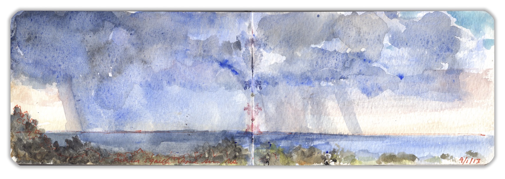
Cape Ann: Offshore Squall. September 1, 2013. Journal Painting. 3.5 x 10.5 inches. Watercolor on paper

Projecting eastward into the Atlantic Ocean, Cape Ann represents a landmass smaller than Cape Cod, that one hundred miles to the south encircles the southern waters of Massachusetts Bay. To the North is the Gulf of Maine, stretching three hundred miles eastward to the Bay of Fundy and Nova Scotia. Here the warm waters Gulf Stream mingle with the Labrador Current flowing south from the arctic region. Proper hurricanes seldom make landfall this far north. However, the offspring of tropical depressions can make for powerful storms that batter southern New England. Cape Ann and the Maine coast are more prone to Nor’easters. Positioned at a pivotal coastal location in relation to these weather-patterns, picturesque cloud-formations and light effects in the region have for centuries attracted artists to Cape Ann as much as its rocky coastline. This summer squall was painted from the seaward lawn at the Emerson Inn, near Cathedral Rocks in the Pigeon Cove section of Rockport.

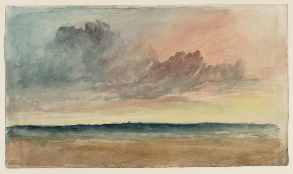
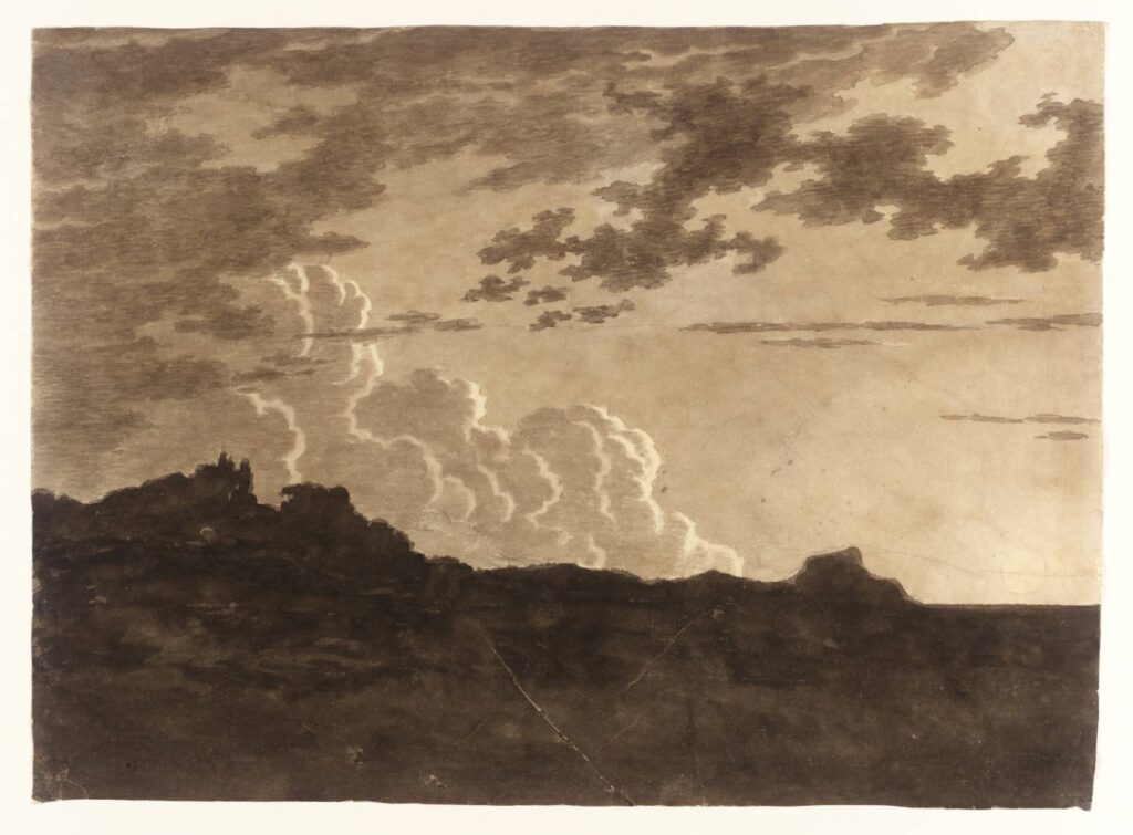
Clouds ?over the Sea at Sunset c.1823-6 Joseph Mallord William Turner 1775-1851 Accepted by the nation as part of the Turner Bequest 1856 http://www.tate.org.uk/art/work/D36213
The Cloud circa 1770 Alexander Cozens 1717-1786 Purchased for the Tate Gallery by the Art Fund, as part of the Oppé Collection 1996 http://www.tate.org.uk/art/work/T08057

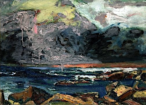
Drawing on my recollections of cloud studies by Alexander Cozens, John Constable, J.M.W. Turner, I was reminded also of the late Bernard Chaet. His summer home was less than a mile from where I sat. Rising before dawn he would set up his painting equipment among the rocks, look out to sea and greet the sunrise. In one of his works dark clouds tower above sparkling seas. As we looked at the painting together. I turned to speak. Burning in his eyes, a fierce light defied the enveloping darkness that soon would overtake him.


Bernard Chaet. 4PM. Oil on Canvas. 2002. Courtesy Lew Allen Gallery, Santa Fe, New Mexico

Now available to own: Sketchbook Traveler: Hudson Valley

Explore my Quaranteam Dispatches, from April 1-June 8, 2020

SKETCHBOOK TRAVELER: Dispatch #93: Cape Ann. Motif Number One


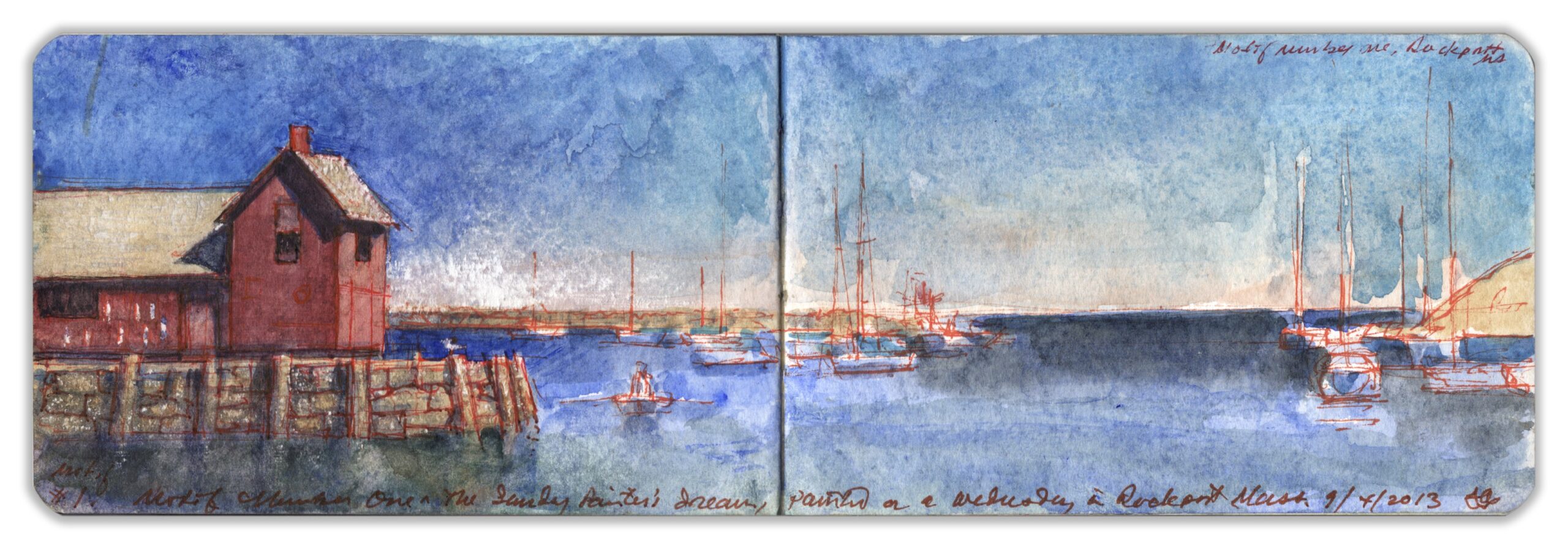
Motif Number One; A Sunday Painter’s Dream, painted on a Wednesday in Rockport Mass. 9/4/2013

The fishing-shack is to New England what the log cabin was to the colonial frontier; symbols of enterprise and perseverance confronting the unruly forces of nature. Established in 1840, the village and harbor of Rockport exported granite for the construction industry, all along the eastern seaboard. A fishery had existed in the area since colonial times, as an outpost of the larger port of Gloucester on the southern shore of Cape Ann. The fame of Fitz-Henry Lane attracted many artists to the rocky peninsula, some of whom formed an art-colony in and around Rockport.


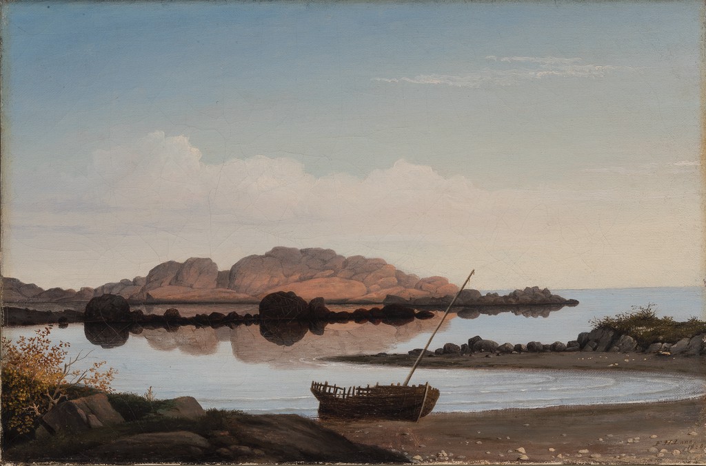
Fitz Henry Lane (1804-1865) Brace’s Rock, Brace’s Cove. Collection of the Terra Foundation.

Among these were Ninon Lacey and Bernard Chaet, who kept a seasonal home north of the village at Pigeon Cove. During the summertime, painters set up their easels next to Bearskin Neck, a rocky spit of land attracting crowds of visitors with cedar-shake gift-shops and seafood restaurants. The focus of their attention is a granite pier known as Bradley’s Wharf, upon which stands red fishing-shack known as Motif #1. First built in 1840, the building was blown apart by a blizzard in 1978. By summertime, a replica had taken its place.
Chaet passed away in 2012. Returning to Cape Ann over Labor Day weekend in 2013, Kathie and I recalled during our final visit with him a few years prior. Ninon had told us that when Bernie drove past the artists clustered around Motif #1, he would shout at them,

“More blue! It needs more blue!”

After lunch, we strolled down to the harbor. “There it is.” Kathie said. “I dare you to paint it.” Taking out my sketchbook and an enameled steel bijou-box of watercolor, I began to measure out the scene. Looking beyond the cliché, I saw in a fishing-shack atop an orderly heap of cut granite a physical metaphor for the entire region. Representing not just an iconic subject for Sunday painters, Motif #1 is a monument to the two industries that sustained the town, prior to the rise of tourism. Pains have been taken by Rockport to keep the wharf free of overhead wires, commercial signage, or anything else that might intrude upon the picturesque subject.


Bernard Chaet.Sunrise. Undated. Cape Ann Museum, Gloucester. MA

Now available to own: Sketchbook Traveler: Hudson Valley

Explore my Quaranteam Dispatches, from April 1-June 8, 2020

SKETCHBOOK TRAVELER: Dispatch #92. Origin Myths, Genesis Facts


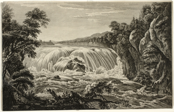
Thomas Pownall, Paul Sandby and William Elliott. View of the Great Cohoes Falls on the Mohawk River. 1760. Bookplate engraving after the original print. Collection of the Albany Institute of History and Art.

Topographical landscape painting was already an established genre that dovetailed naturally with the art of map-making and scientific illustration. Specializing in watercolor with a background in mapmaking, Paul Sandby (1731–1809) gained acclaim as a landscape painter. He was the ideal candidate to oversee the drawing program at the Royal Military Academy at Woolwich, where it was believed that by learning how to make art, military officers would become keener observers. Sandby began teaching at Woolwich in 1768. Scenographia Americana was published that year in a series of twenty-eight prints of North American landscapes drawn from observation by British military officers, including former Massachusetts governor Thomas Pownall. A view of the Great Falls at Cohoes on the Mohawk River was based on a drawing by Pownall, elaborated by Sandby in 1760 for the engraver William Elliott (1727-1766). An accomplished draughtsman, Pownall also served as Royal Governor of South Carolina, and as Lieutenant-Governor of New Jersey.
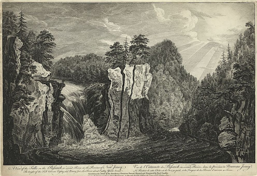
Pownall & Sandby. A View of the Falls of the Passaic River in New Jersey. Scenographia Americana.1768

Engravings of views drawn by Pownall and other British military officers were published in London in 1768 as Scenographia Americana, six years before the first plates of Claude Lorrain’s Liber Veritatis (Book of Truth) were published by John Boydell, as mezzotint  engravings by Richard Earlom.  Pownall traveled extensively throughout British North America, making drawings, keeping a journal and later collaborating with cartographer Lewis Evans to produce the book, A Topographical Description of Such Parts of North America as are Contained in the Map of the Middle British Colonies, &c. in North America. Published at London by John Almon in 1776.
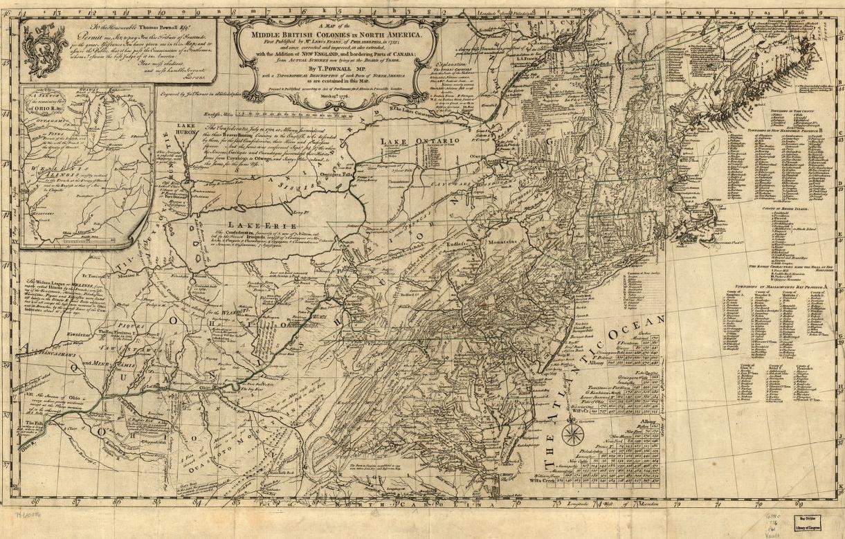

Lewis Evans. Map of the Middle British Colonies in North America. 1755-1776

“When I was afterward in a Situation to direct the Inquiries of others, I formed a set of instructions for directing the Observations and Remarks of such as were sent out to reconnoitre; and the Returns I received gave very sufficient information as far as it could go. If the Plan, which I proposed and began, has been observed through the (French and Indian) War, namely that of obliging every Scout to keep a Journal with Topographical Remarks; and upon the Returns of these, of copying into a Book (under a general Head, each within their respective District) all these Informations so returned; a very ample store of Topographical Knowledge of the country might have been collected and classed, which is now dispersed and lost. I can speak from experience of the Use of this; I experienced it is my own Province; such classed and posted Accounts would have proved a good Check of the Unfaithfulness of many an artificial journal cooked up by Scouting Parties; moreover the Habit of keeping such Journals, and making such Remarks, would have trained many a good Regimental Officer to become a real General. Without this Knowledge and practical Readiness in applying it, no Officer ought to be trusted with the command of a Body of Men.”

–Thomas Pownall

Paul Sandby is considered the father of watercolor landscape painting. In 1768 Sandby accepted a position at the Royal Military Academy at Woolwich to teach drawing to cadets. It was (correctly) believed that instruction in the art of drawing would sharpen the observational skills of future artillery and engineer officers. Pownall’s comments echo this sentiment. This belief, and this pedagogy it demanded, would later be adopted into the curriculum at the United States Military Academy at West Point.

One might presume that because Claude Lorrain (1600-1692) predated Sandby and the others by more than a century, his work exerted a direct influence on their development. Given that no museums yet existed, the only direct access painters might have had to Claude’s work would have been via private collections. Claude’s Liber Veritatis—a kind of catalogue-raisonné of original compositions created by the artist, was known only to those in Georgian England with whom its owner, the Duke of Devonshire, chose to share it. One of these was John Boydell, who engaged printmaker Richard Earlom to reproduce all two hundred of Claude’s drawings in etching and mezzotint for their publication between 1774 and 1777. It is tempting to ponder the notion that the success of Scenographia Americana, published six years prior, helped convince the duke to share Claude’s Liber Veritatis with the world.
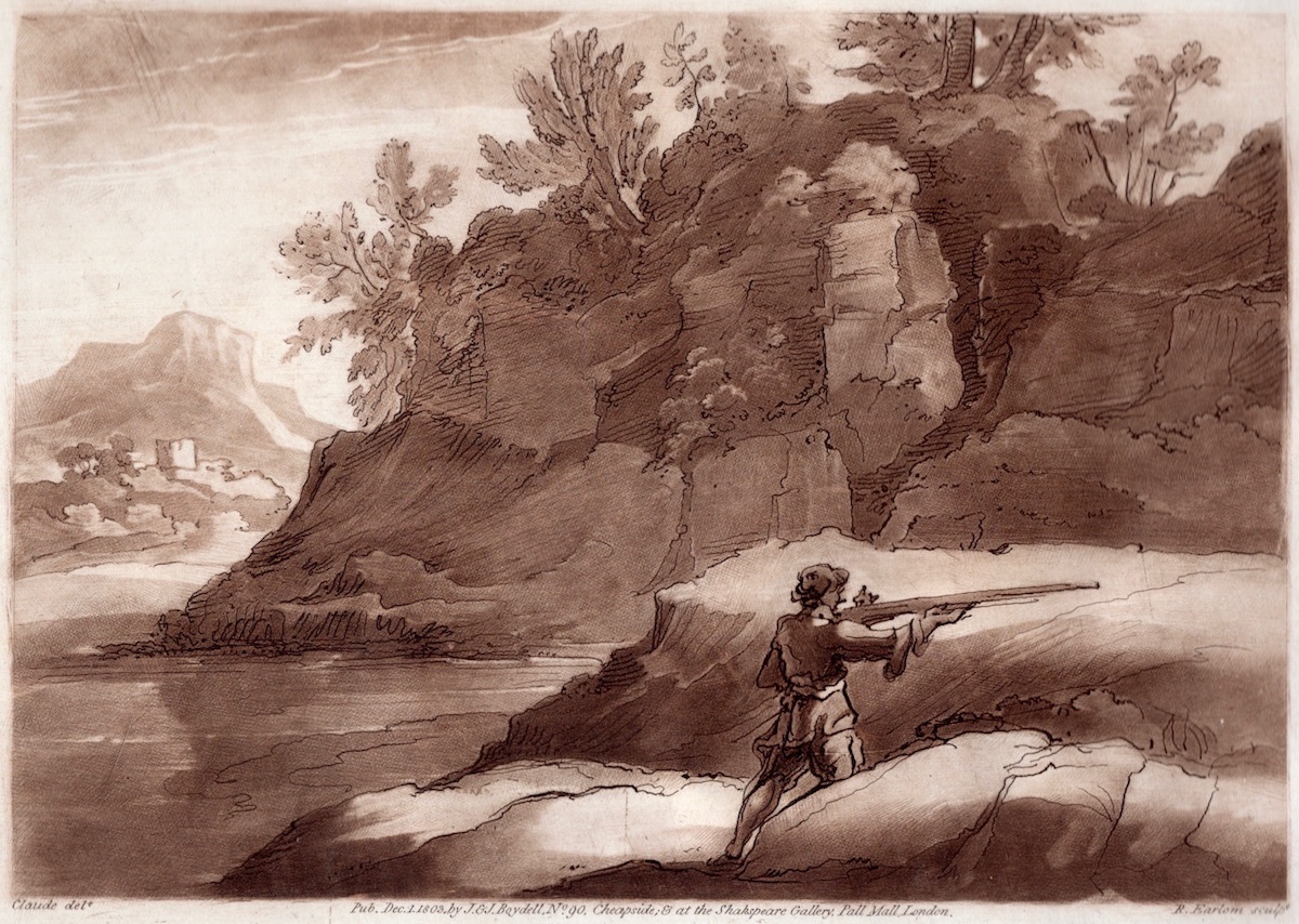

Claude Lorrain (1600-1682). A plate from the Liber Veritatis, engraved by Richard Earlom. From a later edition published in 1803 by John Boydell.  Claude’s success as a landscape painter inspired legions of mediocre imitators. In order to protect his intellectual property, Claude documented his original compositions as ink drawings, sometimes with color accents. This he did from ca. 1635 until his death, referring to his catalogue of images as The Book of Truth or in Latin, Liber Veritatis.
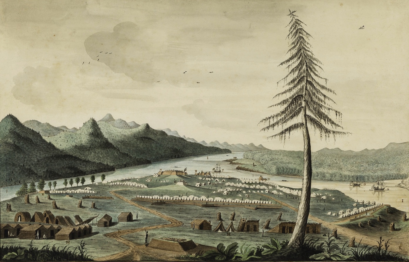

Thomas Davies. A South View of the New Fortress at Crown Point with the Camp commanded by Major General Jeffrey Amherst in the year 1759. Watercolor on paper. Collection Winterthur Museum, Delaware

Filtered through the landscape paintings of Richard Wilson (1713–1782), Paul Sandby, and his brother, Thomas Sandby (1728–1798), Claudian influence can be seen in the early works of British artillery officer Thomas Davies (1737–1812). His 1760 watercolor of the British forts and encampment at Crown Point, New York, aestheticizes what could have been little more than a diagram.
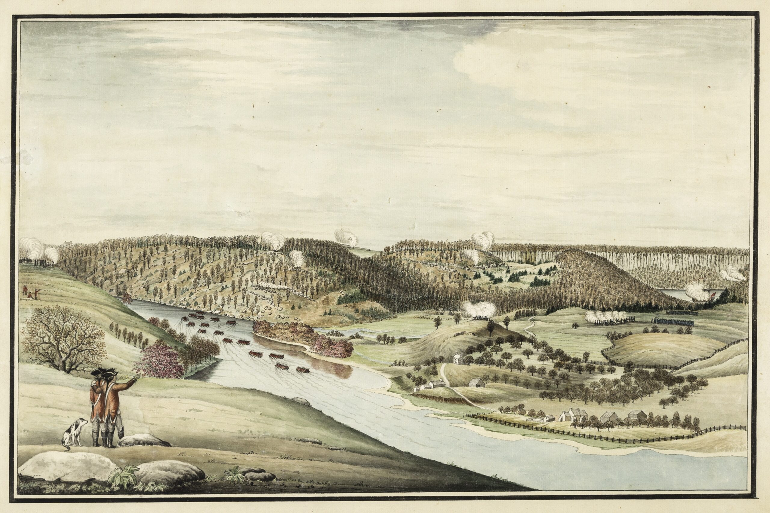

Thomas Davies. The Attack of Fort Washington . November 16, 1776. Watercolor on paper. Collections Winterthur Museum,  Delaware.

Davies’s view of the November 16, 1776, attack on Fort Washington in northern Manhattan expresses both topographical specificity and artistic élan. Davies is credited with being the first European to draw Niagara Falls from direct observation.
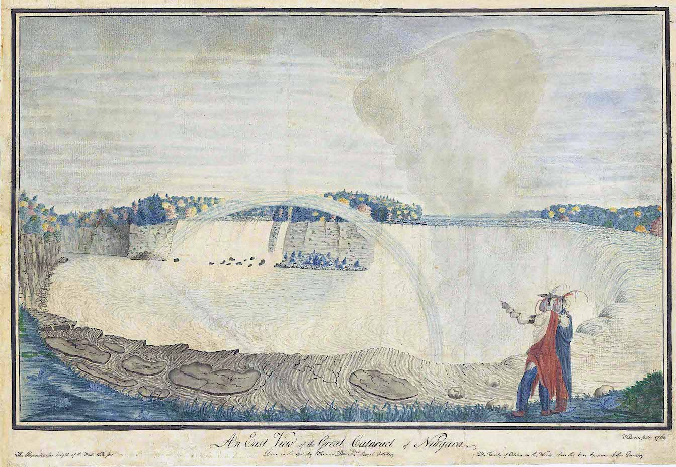

Thomas Davies. Niagara Falls. Watercolor on Paper. Collection National Gallery of Canada, Ottawa.

The visual language developed by the British military for topographical rendering provided some of the undergirding upon which the civilian artists J. R. Cozens, Thomas Girtin, and J. M. W. Turner built more poetic, creative visions of nature. The landed gentry eagerly decorated their dwellings with views of their rural estates, along with portraits of their horses, hounds, and wives. Like Charles Willson Peale (1741–1827) and his brother James (1749–1831), the Scotsman Archibald Robertson (1765–1835) and his younger brother, Alexander (1772¬–1841), trained under Benjamin West and Sir Joshua Reynolds at the Royal Academy in London. Moving to New York in 1792, the brothers established the Columbian Academy on William Street in lower Manhattan. Touring the Hudson Valley in 1796, Alexander Robertson collected picturesque views along the river that were influenced by the British topographical tradition embodied by Richard Wilson, Thomas Gainsborough, and Cozens.
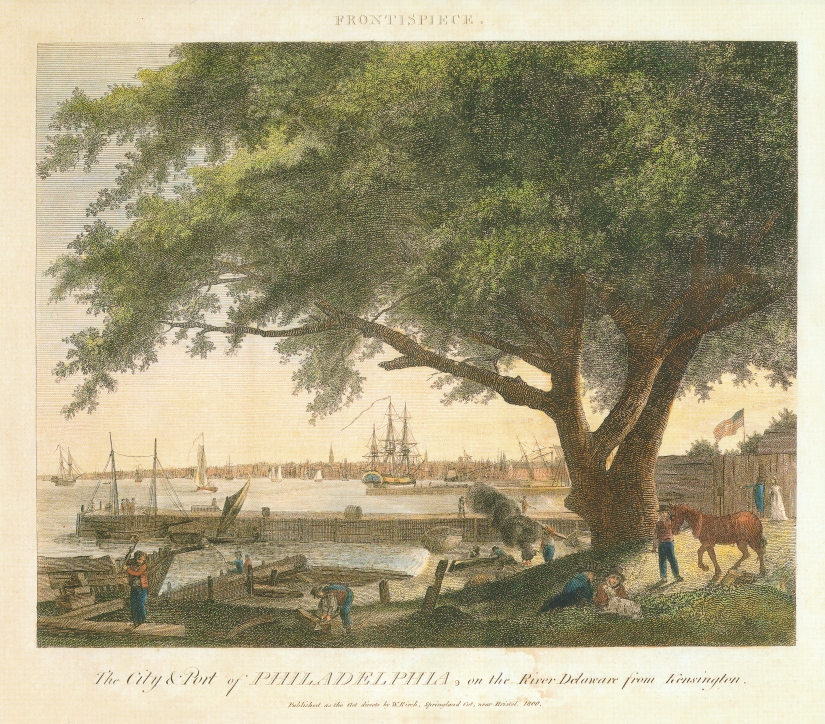

William Russell Birch and Thomas Birch. The City and Port of Philadelphia from Kensington. 1800

During the first decades of the nineteenth century, Philadelphia became the publishing capitol of the nation. Four years after Robertson’s Hudson Valley sojourn, the English-born artist William Russell Birch (1755–1834) engraved and published views of Philadelphia in multiple editions, the first of which appeared in 1800. A booming print culture soon flooded the American public with picturesque views of scenic attractions, from Virginia’s Natural Bridge and Lake Champlain to the falls at Cohoes, New York, and the Fairmount Water Works in Philadelphia. In the catalogue for her 2019 exhibition From the Schuylkill to the Hudson: Landscape in the Early Republic. Anna Marley writes, “Centrally located between the mighty Delaware and the picturesque Schuylkill . . . Philadelphia was defined and limited by those powerful borders. Images of these rivers not only embodied the ideals of the new American nation-state, but also led to the creation of the Hudson River School.”
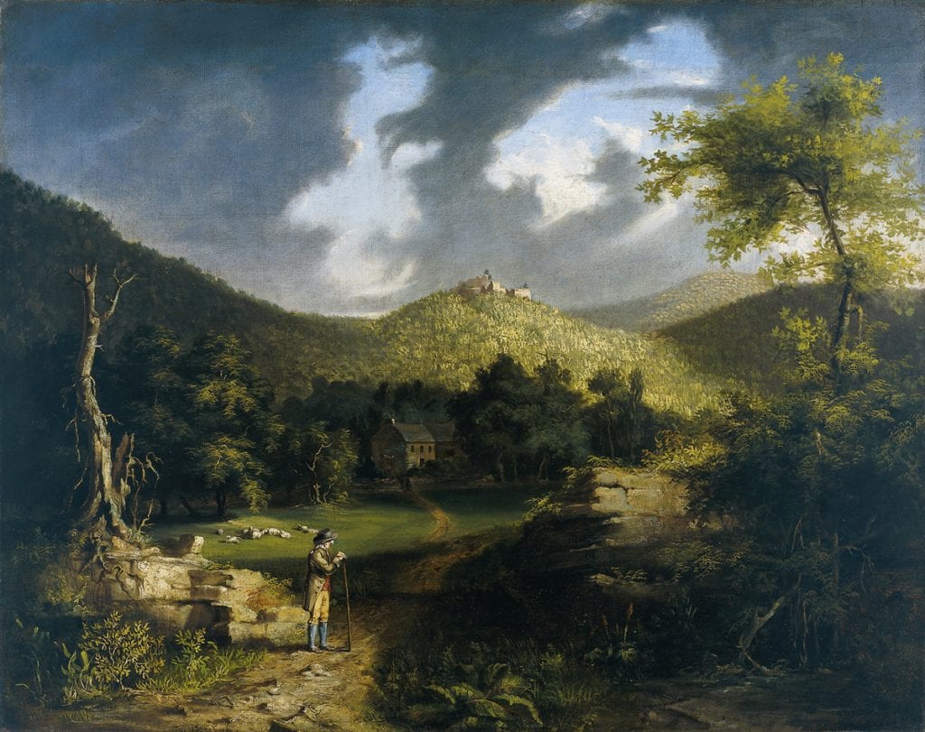

Thomas Cole. View of Fort Putnam. Oil on Canvas. 1825. Collection Philadelphia Museum of Art.

The actual start-date for American landscape painting predates Thomas Cole by more than a century. Meeting a practical need for chorographic imagery to accompany topographical maps and nautical charts, scenographic drawings and paintings assisted in the visual recognition of landfalls, harbors and terrain, in much the same way as Jane’s silhouettes later identified warships and aircraft. Military topographical landscape sketches were elaborated for the print market by professional artists like Paul Sandby, who in turn delivered drawing instruction to future military officers. Proficiency in drawing enhanced reconnaissance skills, and thus the process of intelligence-gathering. Following the French and Indian War, popular demand for North American scenery increased. Images produced for military and scientific use were repurposed as etching and engravings, to be consumed by veterans of the Grand Tour, landowners and drawing-room pathfinders.
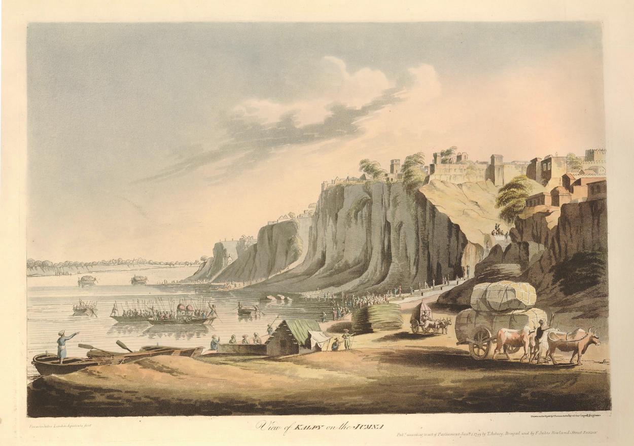

After Thomas Anburey (1759-1840). View of Kalpy on the Jumna. Francis Jukes. London, 1799. Collection of the British Museum.
(Thomas Anburey served as a lieutenant in the 47th (Lancashire) Regiment of Foot, during Burgoyne’s campaign of 1777. Taken prisoner at Saratoga, Anburey traveled to Cambridge Massachusetts, then to Charlottesville Virginia before returning to England in 1781. In 1789 he published as a series of letters an entertaining book Travels Through the Interior of North America, 1777-1781. Anburey’s keen observations and clever narrative has been called into question.)

Into this publishing boom enters Claude Lorrain’s Liber Veritatis in 1774, ninety-two years after the artist’s death, and one year after the Boston Tea-Party. Its publication exerted a major influence on both poetic artists and military topographers alike, by further defining their aesthetic goals. In the years following American independence, homegrown talent was joined by new arrivals, clamoring to celebrate the natural wonders of the new republic. The burgeoning print-culture became a melting-pot for professional artists, naturalists and geographers, having already put the American landscape on the map, many years before Thomas Cole made his first voyage up the Hudson River. As before, armchair wanderlust fueled popular demand for etchings and engravings of faraway places; visual travelogues described in a graphic language developed by mapmakers and military topographers. The American landscape-painting tradition was born not on an easel, but in sketchbooks carried in the field by explorers, naturalists and soldiers.

Download the essay Explorers, Naturalists and Military Precursors to the Hudson River School. in HUDSON RIVER VALLEY REVIEW. Volume 37, Number 2. Spring 2021

Download (PDF, 15.8MB)


Now available to own: Sketchbook Traveler: Hudson Valley
Explore my Quaranteam Dispatches, from April 1-June 8, 2020
SKETCHBOOK TRAVELER. Dispatch #91. Stage Rocks, Gloucester Harbor


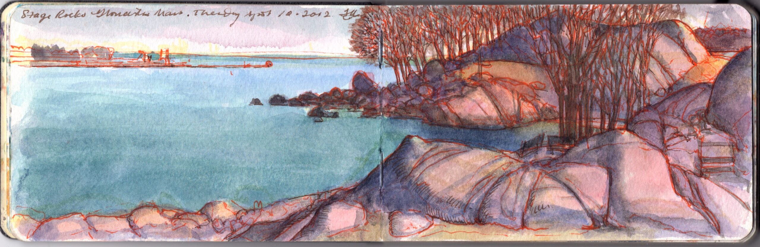
Stage Rocks, Gloucester Harbor. Massachusetts. Thursday April 12, 2012

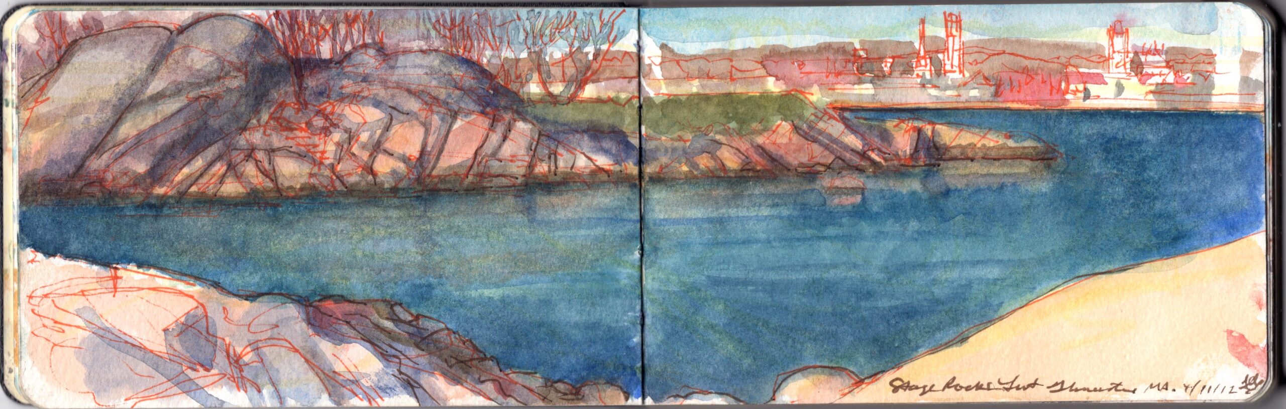
Separated from the mainland by a tidal estuary, the Annisquam River, Cape Ann had long been a summertime home to the Pawtucket tribe, who along the shoreline southwest of modern-day Gloucester had built stages for drying and salting codfish. Standing beside this pre-colonial fish-packing operation stands a cluster of enormous rocks. Half a billion years ago the subduction of tectonic plates released plumes of magma. Rising to the surface, these cooled into granite, forming the bedrock of a micro-climate known to geologists as Avalonia. Scouring by glaciation from the late Cenozoic through the Paleolithic exposed dramatic granite formations at Stage Rocks, Dogtown and Cape Ann’s Atlantic shoreline. The resemblance of Stage Rocks to stony outcroppings at Joshua Tree can be attributed to their creation by similar geological processes.


Stage Rock, Gloucester Harbor. Massachusetts. Wednesday April 11, 2012

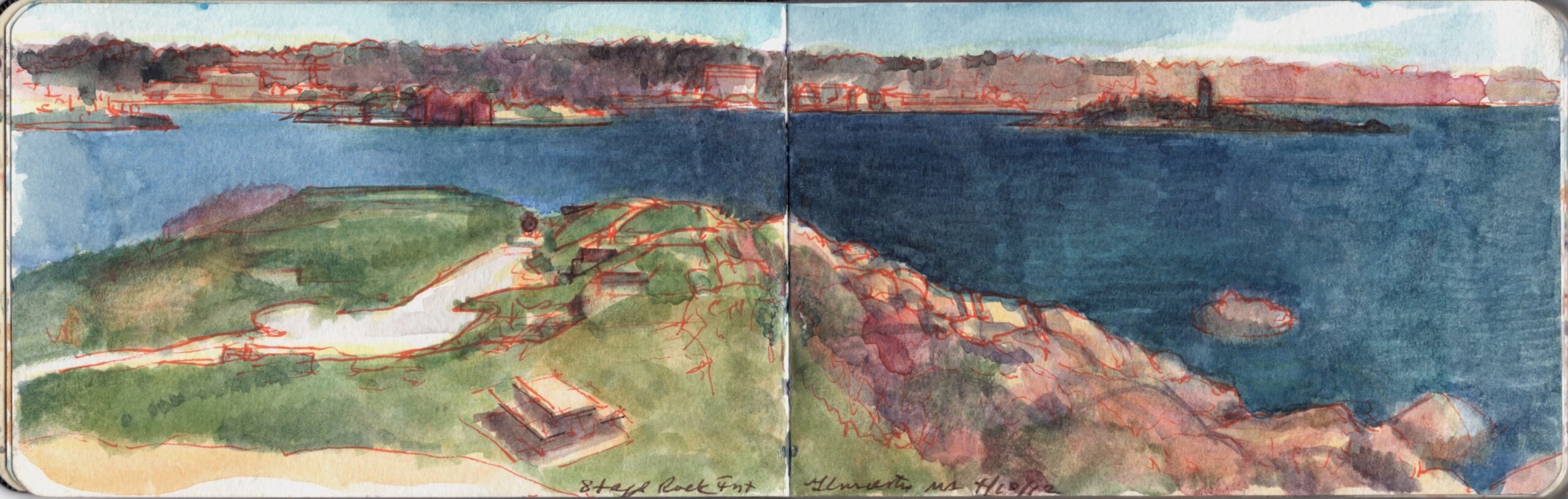
Expanding British colonial operations to the northern end of Massachusetts Bay, settlers from Plymouth arrived in 1623. Finding tillable soil inadequate to support much agriculture, they focused their efforts on harvesting the abundant Cod. At first working side-by-side with the newcomers, hostilities between the English and other tribes drove the Pawtucket into exile, or enslavement by British masters. Stage Head projects into the harbor like a natural fortress. During the Pequot War (1636-1638), the position was fortified to guard the harbor, and dispute attacks from the mainland. Updated over the years the fort remained in service until 1898. The Civil War battery was reconstructed in 1930 and is now preserved within a city park that includes ball fields and bathing areas.


Stage Fort. Gloucester Harbor.  Massachusetts. Tuesday, April 10, 2012


Now available to own: Sketchbook Traveler: Hudson Valley

Explore my Quaranteam Dispatches, from April 1-June 8, 2020